Aberpennar Gorllewin

Community in Glamorgan

Wales

Aberpennar Gorllewin

Penrhiw Cradoc Rifle Butts Presumably a WWII practice range.
Penrhiw Cradoc Rifle Butts Credit: Alan Hughes

Aberpennar Gorllewin is a community located in the county borough of Rhondda Cynon Taf, in the historic county of Glamorgan, Wales. It is situated in the Cynon Valley, between the towns of Abercynon and Mountain Ash.

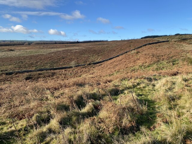
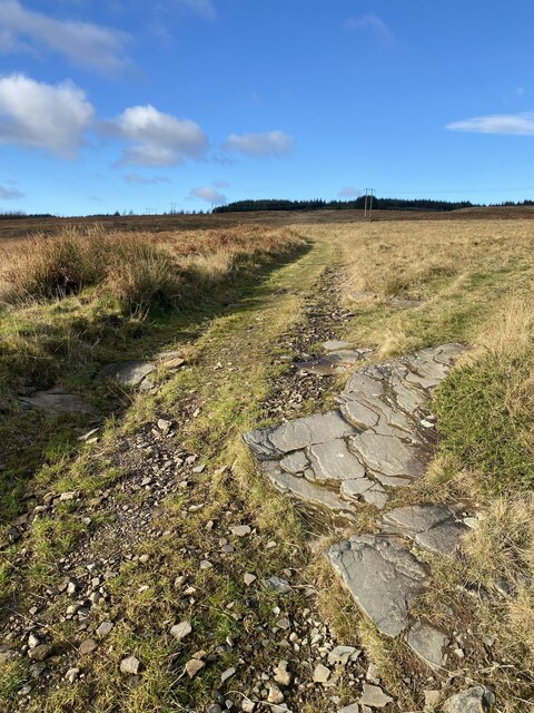
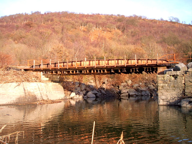
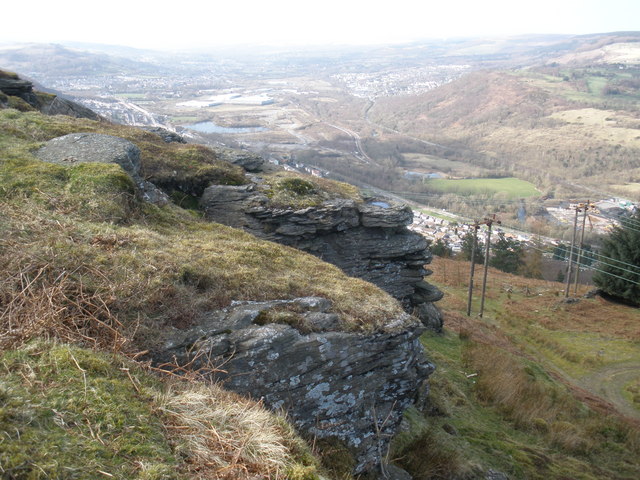
The community is known for its beautiful natural surroundings, with the River Cynon flowing through it and the nearby Brecon Beacons National Park offering stunning landscapes for outdoor activities. Aberpennar Gorllewin is also home to a number of parks and green spaces, providing residents with ample opportunities for leisure and recreation.

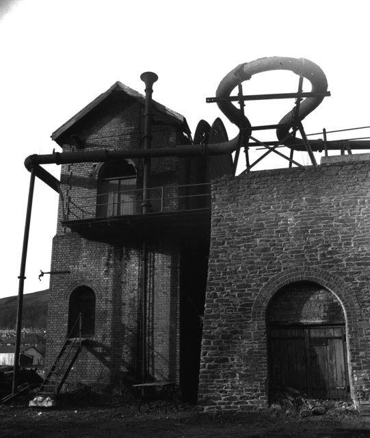
The community has a rich industrial heritage, with coal mining being a significant part of its past. However, in recent years, the economy has diversified, and there are now a variety of industries and businesses operating in the area.

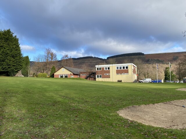
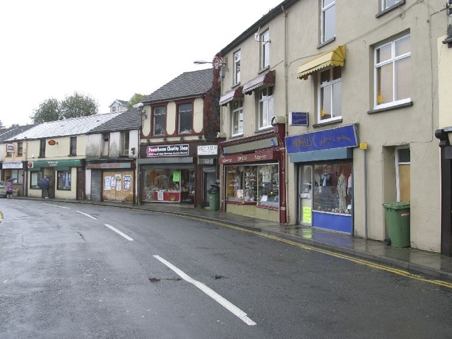
Aberpennar Gorllewin has a close-knit community, with a range of amenities and services to cater to the needs of its residents. There are several schools, healthcare facilities, and shopping centers in the area, ensuring that locals have access to essential services.

Transportation is also well-served in Aberpennar Gorllewin, with regular bus services connecting the community to neighboring towns and cities. The nearby train station in Abercynon provides further transport links, making it easy for residents to commute to work or explore other areas of Wales.

Overall, Aberpennar Gorllewin is a vibrant community with a mix of natural beauty, industrial history, and modern amenities, making it an attractive place to live, work, and visit.

If you have any feedback on the listing, please let us know in the comments section below.

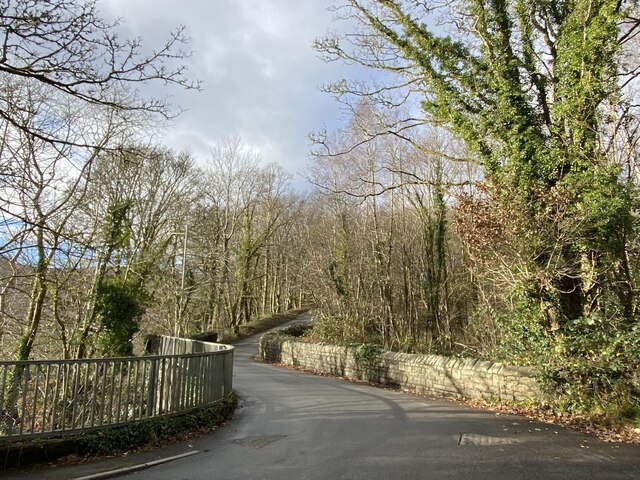
Aberpennar Gorllewin Images

Images are sourced within 2km of 51.6785/-3.392268 or Grid Reference ST0398. Thanks to Geograph Open Source API. All images are credited.

Penrhiw Cradoc Rifle Butts Presumably a WWII practice range.
Penrhiw Cradoc Rifle Butts
Presumably a WWII practice range.
Snaking wall Stone wall snaking across early winter landscape above Mountain Ash.
Snaking wall
Stone wall snaking across early winter landscape above Mountain Ash.
Moorland track
Moorland track
Mountain Ash War Memorial
Gorsedd Circle, Mountain Ash The National Eisteddfod was held in Mountain Ash in 1905.
Gorsedd Circle, Mountain Ash
The National Eisteddfod was held in Mountain Ash in 1905.
Ordnance Survey Rivet This OS rivet can be found on the concrete base of the railings NE side of the road. It marks a point 212.674m above mean sea level.
Ordnance Survey Rivet
This OS rivet can be found on the concrete base of the railings NE side of the road. It marks a point 212.674m above mean sea level.
Mountain Ash Golf Club
Road bridge over disused railway The line used to run due north serving colliery and quarry workings near Gelliddu.
Road bridge over disused railway
The line used to run due north serving colliery and quarry workings near Gelliddu.
Disused mineral line bridge Abercwmboi This bridge is built of the scrap of other railway bridges and is now disused
Disused mineral line bridge Abercwmboi
This bridge is built of the scrap of other railway bridges and is now disused
Strand Street, Newtown, Mountain Ash This is a photo taken of Strand Street after the coal tip was taking away that was behind the houses on the left hand side, the photo was taken from Perthcelyn.
Strand Street, Newtown, Mountain Ash
This is a photo taken of Strand Street after the coal tip was taking away that was behind the houses on the left hand side, the photo was taken from Perthcelyn.
Oxford Street, Mountain Ash
Fields and Walls
Fields and Walls
Abandoned Quarry
Abandoned Quarry
Rock Overhang One of several outcrops of rock in this part of the forest
Rock Overhang
One of several outcrops of rock in this part of the forest
Forest Road
Forest Road
Waddle Fan, Deep Duffryn Colliery, formerly Nixon's Navigation Colliery. Circa 1880 steam driven Waddle fan for ventilating the pit. Standby until 1967. The 40' fan has been cut-up but the driving steam engine is at Big Pit Mining Museum.

Colin Bowden writes as follows - The fan engine was installed at Nixon's Navigation Colliery (North Pit), but the two shafts of this were taken over and used for pumping and ventilation by Deep Duffryn Colliery, for which the Waddle fan was used as a standby ventilator  until 1967, when it was condemned. I don't know when the change occurred - it seems that Nixon's Navigation was never operated by the NCB, so it was presumably before nationalisation. 

This site has also been called Abergorki colliery by various authors.
Waddle Fan, Deep Duffryn Colliery, formerly Nixon's Navigation Colliery.
Circa 1880 steam driven Waddle fan for ventilating the pit. Standby until 1967. The 40' fan has been cut-up but the driving steam engine is at Big Pit Mining Museum. Colin Bowden writes as follows - The fan engine was installed at Nixon's Navigation Colliery (North Pit), but the two shafts of this were taken over and used for pumping and ventilation by Deep Duffryn Colliery, for which the Waddle fan was used as a standby ventilator until 1967, when it was condemned. I don't know when the change occurred - it seems that Nixon's Navigation was never operated by the NCB, so it was presumably before nationalisation. This site has also been called Abergorki colliery by various authors.
Mountain Ash Workingmens Hall and Institute Mountain Ash Workingmens Hall and Institute, High Street, Mountain Ash.
Mountain Ash Workingmens Hall and Institute
Mountain Ash Workingmens Hall and Institute, High Street, Mountain Ash.
Mountain Ash RFC Clubhouse
Show me another place!

Aberpennar Gorllewin is located at Grid Ref: ST0398 (Lat: 51.6785, Lng: -3.392268)

Unitary Authority: Rhondda Cynon Taf

Police Authority: South Wales

Also known as: Mountain Ash West

What 3 Words

///clouding.pounds.others. Near Mountain Ash, Rhondda Cynon Taf

Related Wikis

South Wales

South Wales (Welsh: De Cymru) is a loosely defined region of Wales bordered by England to the east and mid Wales to the north. Generally considered to...

Bethlehem Chapel, Mountain Ash

Bethlehem, Mountain Ash was a Calvinistic Methodist chapel in Pryce Street, Mountain Ash, Glamorgan, Wales. Services at Bethlehem were conducted in the...

Fernhill railway station

Fernhill railway station is a railway station serving the village of Fernhill in the Cynon Valley, Wales. It is located on the Aberdare branch of the...

Darranlas

Darranlas is a large village in Mountain Ash, Rhondda Cynon Taf in South Wales. == History == The houses in the area are around 100–130 years old. Before...

Mountain Ash, Rhondda Cynon Taf

Mountain Ash (Welsh: Aberpennar) is a town and former community in the Cynon Valley, within the County Borough of Rhondda Cynon Taf, Wales, with a population...
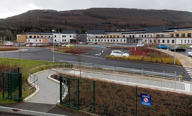
Ysbyty Cwm Cynon

Ysbyty Cwm Cynon (English: Cynon Valley Hospital) is a health facility on New Road, Mountain Ash, Rhondda Cynon Taf, Wales. It is managed by the Cwm Taf...

Glenboi

Glenboi is a village located one mile north of the town of Mountain Ash in the county borough of Rhondda Cynon Taf, Wales. It is linked to Mountain Ash...

Rhos Baptist Chapel, Mountain Ash

Rhos, Mountain Ash was a Baptist chapel in Mountain Ash, Glamorgan, Wales. Services at Rhos were conducted in the Welsh language. == Early history == There...

Related Videos

Cribarth...The sleeping Giant..Walking in South Wales.

A walk from Abercraf in the Swansea valley.

SOMEWHERE IN SOUTH WALES

Summer time is holiday time for everyone! So this summer holiday, we decided to visit South Wales and here are some videos of ...

Nearby Amenities

Located within 500m of 51.6785,-3.392268
Power: tower
Lat/Long: 51.6827339/-3.3899152
Power: pole
Lat/Long: 51.6786594/-3.387909
Power: pole
Lat/Long: 51.6804772/-3.3971465
Power: pole
Lat/Long: 51.6803341/-3.3960709
Power: pole
Lat/Long: 51.6799051/-3.3946118
Power: pole
Lat/Long: 51.6795092/-3.3932707
Power: pole
Lat/Long: 51.6804896/-3.3959582
Power: pole
Lat/Long: 51.6794011/-3.3922327
Power: pole
Lat/Long: 51.6794244/-3.3901486
Power: pole
Lat/Long: 51.6792847/-3.392517
Power: pole
Lat/Long: 51.6792814/-3.391369
Power: pole
Lat/Long: 51.6792731/-3.3902237
Power: pole
Lat/Long: 51.6785646/-3.3880645
Power: pole
Lat/Long: 51.6773355/-3.3865947
The data included in this document is from www.openstreetmap.org. The data is made available under ODbL.

Have you been to Aberpennar Gorllewin?

Leave your review of Aberpennar Gorllewin below (or comments, questions and feedback).