Bridge End

Settlement in Worcestershire Malvern Hills

England

Bridge End

Entrance off Moorend Road Entrance to what appears to be a recently built house on Moorend Road near Eldersfield.
Entrance off Moorend Road Credit: Philip Halling

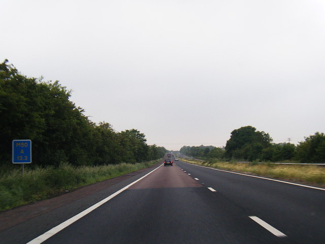
Bridge End is a small village located in the county of Worcestershire, England. Situated on the banks of the River Avon, it is known for its picturesque setting and charming rural atmosphere. The village is located approximately 4 miles south-east of the town of Evesham, making it easily accessible for both residents and visitors.

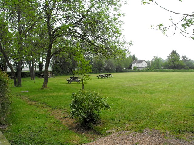
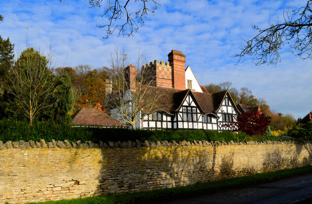
Bridge End is primarily a residential area, with a mix of traditional cottages and more modern housing developments. The village is characterized by its quiet streets and well-maintained gardens, creating a peaceful and friendly environment for its residents. Many of the properties in Bridge End enjoy scenic views of the river and surrounding countryside.

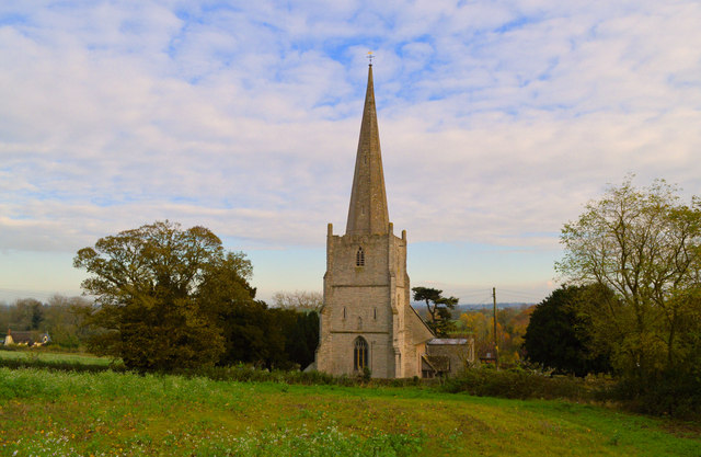
Although small in size, Bridge End boasts a strong sense of community. The village has a local pub, The Bridge Inn, which serves as a popular gathering spot for locals and visitors alike. The pub offers a wide selection of beverages, including traditional ales, and often hosts live music events and pub quizzes.

Nature lovers will appreciate the abundance of outdoor activities available in and around Bridge End. The River Avon provides opportunities for fishing and boating, while the nearby countryside offers scenic walks and cycling routes. The village is also conveniently located near the Cotswolds, an Area of Outstanding Natural Beauty, providing further opportunities for exploration and outdoor pursuits.

Overall, Bridge End offers a tranquil and friendly living environment, with its stunning riverside location and strong community spirit.

If you have any feedback on the listing, please let us know in the comments section below.

Bridge End Images

Images are sourced within 2km of 51.983472/-2.2867423 or Grid Reference SO8031. Thanks to Geograph Open Source API. All images are credited.

Entrance off Moorend Road Entrance to what appears to be a recently built house on Moorend Road near Eldersfield.
Entrance off Moorend Road
Entrance to what appears to be a recently built house on Moorend Road near Eldersfield.
St. John the Baptist's church, Eldersfield Viewed from the laburnum-clad lychgate.
The gridline intersects the east wall of the chancel.
St. John the Baptist's church, Eldersfield
Viewed from the laburnum-clad lychgate. The gridline intersects the east wall of the chancel.
Picnic and camping field beside Gadfield Elm Chapel The chapel <a title="https://www.geograph.org.uk/photo/3613" href="https://www.geograph.org.uk/photo/3613">Link</a> was built in 1836 by the United Brethren, a small break-off group from the Primitive Methodists. They had purchased the land for £25.
Picnic and camping field beside Gadfield Elm Chapel
The chapel Link was built in 1836 by the United Brethren, a small break-off group from the Primitive Methodists. They had purchased the land for £25.
M50 westbound near Grafton Farm
Fisher's Place, Pendock Built in 1909-10 for C.O. Fisher - 'a Baronial Arts and Crafts confection' says Alan Brooks in the relevant Pevsner. Now subdivided and sprouting fences and garden buildings, Fisher's Place was a boarding school for many years.
Fisher's Place, Pendock
Built in 1909-10 for C.O. Fisher - 'a Baronial Arts and Crafts confection' says Alan Brooks in the relevant Pevsner. Now subdivided and sprouting fences and garden buildings, Fisher's Place was a boarding school for many years.
Fisher's Place Built in 1909-10 for C.O. Fisher - 'a Baronial Arts and Crafts confection' says Alan Brooks in the relevant Pevsner. Now subdivided and sprouting fences and garden buildings, Fisher's Place was a boarding school for many years.
Fisher's Place
Built in 1909-10 for C.O. Fisher - 'a Baronial Arts and Crafts confection' says Alan Brooks in the relevant Pevsner. Now subdivided and sprouting fences and garden buildings, Fisher's Place was a boarding school for many years.
St John the Baptist, Eldersfield
Eldersfield Court Seen from the churchyard
Eldersfield Court
Seen from the churchyard
St John the Baptist, Eldersfield Unless I am mistaken, there is a slight suggestion of Chesterfield in that spire.
St John the Baptist, Eldersfield
Unless I am mistaken, there is a slight suggestion of Chesterfield in that spire.
Remains of late Norman doorway, Eldersfield A Late Norman doorway of some quality on the South side of the nave, protected by a porch of 1925 by Healing and Overbury. The stonework of the Victorian replacement dates from the restoration of the nave by F.S. Waller in 1876.
Remains of late Norman doorway, Eldersfield
A Late Norman doorway of some quality on the South side of the nave, protected by a porch of 1925 by Healing and Overbury. The stonework of the Victorian replacement dates from the restoration of the nave by F.S. Waller in 1876.
Ordnance Survey Cut Mark This OS cut mark can be found on the south angle of St John the Baptist's Church. It marks a point 24.485m above mean sea level.
Ordnance Survey Cut Mark
This OS cut mark can be found on the south angle of St John the Baptist's Church. It marks a point 24.485m above mean sea level.
M50 heading west At marker 13.3
M50 heading west
At marker 13.3
Grassland; South Worcestershire View to New Barn Cottages from Dobshill Lane.
Grassland; South Worcestershire
View to New Barn Cottages from Dobshill Lane.
Gated track and footpath Leading to Pillows Green.
Gated track and footpath
Leading to Pillows Green.
Old orchard at The Hawthorns Possibly old perry pear trees judging by the shape.
Old orchard at The Hawthorns
Possibly old perry pear trees judging by the shape.
Show me another place!

Bridge End is located at Grid Ref: SO8031 (Lat: 51.983472, Lng: -2.2867423)

Administrative County: Worcestershire

District: Malvern Hills

Police Authority: West Mercia

What 3 Words

///arose.lends.reset. Near Corse, Gloucestershire

Nearby Locations

Eldersfield Bridge End

Related Wikis

Eldersfield

Eldersfield is a village and civil parish in the Malvern Hills district of Worcestershire, England. It had a population of 584 in 2021.It stands exactly...

Gadfield Elm Chapel

The Gadfield Elm Chapel near the village of Pendock in Worcestershire, England, is the oldest extant chapel of the Church of Jesus Christ of Latter-day...

Pendock

Pendock is a village and civil parish in the Malvern Hills district in the county of Worcestershire, England, situated about halfway between the towns...

RAF Berrow

Royal Air Force Berrow or more simply RAF Berrow is a former Royal Air Force Satellite Landing Ground located near Berrow, Worcestershire, England. �...

Related Videos

NIKKITA - Postcard Lover

Listen here: https://song.link/Nikkitamusic Follow NIKKITA: Facebook: https://www.facebook.com/nikkitamusic Instagram: ...

K A T I E + G A R E T H | Birtsmorton Court |Teaser Flashback Wedding Video

K A T I E + G A R E T H | Wedding Flashback Teaser Video Trying to squeeze as much as I can into this little flashback has been ...

STAUNTON OFF PISTE TRAILS ARE RUNNING SO GOOOOOOD !

so after last weeks hair-raising experience down Barry sidings we decided to try something not so steep & narly , Staunton has ...

Worcestershire Wedding Videographer | Multi Media Market Wedding Videography | Birtsmorton Court

I've filmed many Wedding Videos across Worcester and the West Midlands. Birtsmorton Court is an amazing wedding venue.

Nearby Amenities

Located within 500m of 51.983472,-2.2867423
Bridge End
Naptan AtcoCode: 2000G017400
Naptan Bearing: SE
Naptan BusStopType: CUS
Naptan CommonName: Bridge End
Naptan Indicator: adj
Naptan NaptanCode: wocdjmdp
Naptan Street: Lime Street
Naptan Verified: no
Source: naptan_import
Lat/Long: 51.9834144/-2.2870438
Bridge End
Place: hamlet
Lat/Long: 51.9832777/-2.2840483
Archaeological Site: tumulus
Historic: archaeological_site
Source: OS 1:25k
Lat/Long: 51.9869418/-2.2855057
Archaeological Site: tumulus
Historic: archaeological_site
Source: OS 1:25k
Lat/Long: 51.986552/-2.2855915
Advertising: board
Lat/Long: 51.9835352/-2.2867643
Public Bookcase
Booth: K6
Colour: red
Disused Amenity: telephone
Man Made: telephone_box
Public Bookcase Type: phone_box
Lat/Long: 51.9836319/-2.2866678
Post Box
Post Box Type: lamp
Lat/Long: 51.9836104/-2.2866879
Power: pole
Lat/Long: 51.9813637/-2.2929525
Eldersfield
Power: pole
Transformer: distribution
Voltage Primary: 11000
Lat/Long: 51.9818587/-2.2923271
Power: pole
Lat/Long: 51.9818942/-2.2933383
Power: pole
Lat/Long: 51.982593/-2.2938198
Location Transition: yes
Power: pole
Lat/Long: 51.9842524/-2.2924237
Power: pole
Lat/Long: 51.9843309/-2.2911121
Power: pole
Lat/Long: 51.9844168/-2.2898059
Marsh Court
Power: pole
Transformer: distribution
Voltage Primary: 11000
Lat/Long: 51.987661/-2.2873758
Power: pole
Lat/Long: 51.986831/-2.2877164
Power: pole
Lat/Long: 51.9858993/-2.2880892
Power: pole
Lat/Long: 51.9849305/-2.2884808
Power: pole
Lat/Long: 51.9841128/-2.2888121
Power: pole
Lat/Long: 51.9838923/-2.2880825
Bridge End Sewage
Power: pole
Transformer: distribution
Voltage Primary: 11000
Lat/Long: 51.9842004/-2.2857906
Power: pole
Lat/Long: 51.9840245/-2.2864142
Bridge End
Power: pole
Transformer: distribution
Voltage Primary: 11000
Lat/Long: 51.9835776/-2.2870358
Power: pole
Lat/Long: 51.9837304/-2.2875461
Power: pole
Lat/Long: 51.9824555/-2.2861782
Power: pole
Lat/Long: 51.9829135/-2.2872537
Power: pole
Lat/Long: 51.9820181/-2.2850691
Power: pole
Lat/Long: 51.9815638/-2.2839734
Power: pole
Lat/Long: 51.9811195/-2.2829434
Power: pole
Lat/Long: 51.9810377/-2.2822702
Power: pole
Lat/Long: 51.9829048/-2.2798971
Power: pole
Lat/Long: 51.9827302/-2.2800406
Power: pole
Lat/Long: 51.9818496/-2.2807521
Power: pole
Lat/Long: 51.9808758/-2.2812335
The data included in this document is from www.openstreetmap.org. The data is made available under ODbL.

Have you been to Bridge End?

Leave your review of Bridge End below (or comments, questions and feedback).