Cwm
Community in Flintshire
Wales
Cwm

Cwm is a small community located in the county of Flintshire, in North Wales, United Kingdom. Situated in the northern part of the country, Cwm is surrounded by beautiful landscapes and is known for its rural charm.
With a population of approximately 2,000 residents, Cwm offers a quiet and peaceful atmosphere. The community is predominantly residential, with a mix of traditional houses and newer developments. The architecture reflects the area's history and character, with some buildings dating back to the 18th century.
Cwm is blessed with natural beauty, as it is nestled between the Clwydian Range and the Dee Estuary. This provides ample opportunities for outdoor activities and scenic walks. The nearby Moel Famau, the highest hill within the Clwydian Range, offers breathtaking views of the surrounding countryside.
Despite its small size, Cwm benefits from a few local amenities. There is a primary school, a community center, and a village hall, which serves as a social hub for residents. The community also has a post office, a convenience store, and a few local businesses, providing essential services to its residents.
Cwm has a strong sense of community, with various events and activities organized throughout the year. These include summer fairs, Christmas markets, and sports events, fostering a sense of camaraderie among the residents.
Overall, Cwm, Flintshire, is a picturesque and welcoming community, offering a peaceful and idyllic lifestyle in the heart of the North Wales countryside.
If you have any feedback on the listing, please let us know in the comments section below.
Cwm Images
Images are sourced within 2km of 53.282544/-3.393859 or Grid Reference SJ0777. Thanks to Geograph Open Source API. All images are credited.


Cwm is located at Grid Ref: SJ0777 (Lat: 53.282544, Lng: -3.393859)
Unitary Authority: Denbighshire
Police Authority: North Wales
What 3 Words
///bagpipes.clots.folds. Near Cwm, Denbighshire
Nearby Locations
Related Wikis
Mynydd y Cwm
Mynydd y Cwm is a hill in the Clwydian Range in Denbighshire, North Wales. It reaches a height of 304.8 metres (1,000 feet). It has recently been promoted...
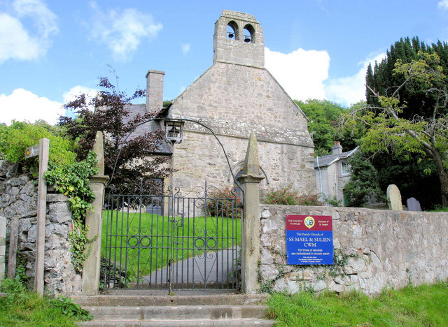
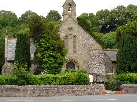
Cwm, Denbighshire
Cwm is a village and community in Denbighshire, below the hill Mynydd y Cwm. The church in Cwm is dedicated to two 6th-century saints, St Mael and St Sulien...

Moel Hiraddug
Moel Hiraddug, also known as Y Foel, is a hill fort and hill in the Clwydian Range of north-east Wales. The northern part of the hill has been eaten away...
Rhuallt
Rhuallt is a village in Denbighshire, Wales. The village is situated approximately 5 mi (8.0 km) south of Prestatyn and 2 mi (3.2 km) east of St Asaph...
Dyserth
Dyserth (Welsh: Diserth) is a village, community and electoral ward in Denbighshire, Wales. Its population at the 2011 United Kingdom census was 2,269...
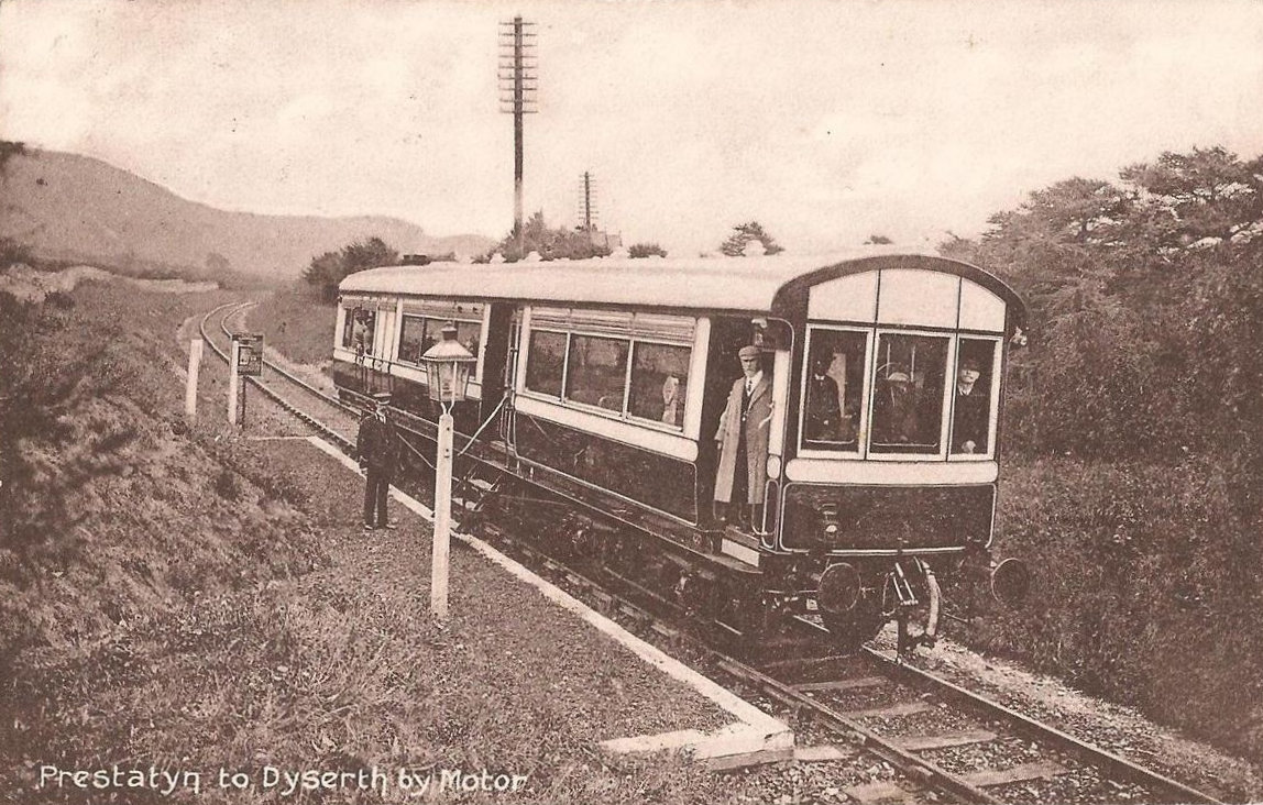
Dyserth railway station
Dyserth railway station served the village of Dyserth, Flintshire (now Denbighshire), Wales. It was the southern terminus of the 2 miles 70 chains (4.6...

Maes Hiraddug
Maes Hiraddug is a Site of Special Scientific Interest in the preserved county of Clwyd, north Wales. It is species-rich neutral grassland which includes...
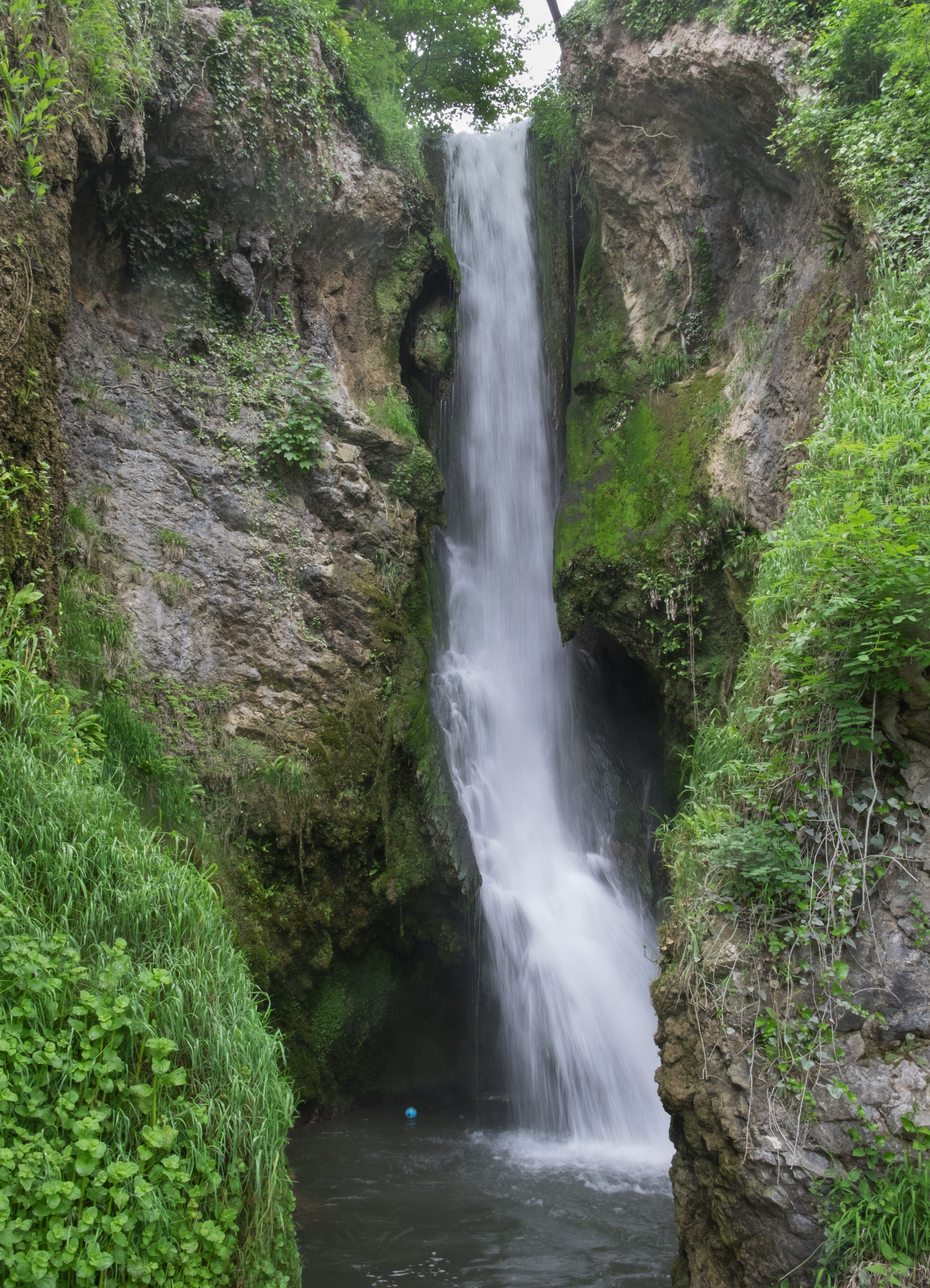
Dyserth Waterfall
Dyserth Waterfall is a waterfall in Dyserth, North Wales. The River Ffyddion, a tributary of the River Clwyd, falls down a 70-foot ledge creating the waterfall...
Nearby Amenities
Located within 500m of 53.282544,-3.393859Have you been to Cwm?
Leave your review of Cwm below (or comments, questions and feedback).