Clynnog
Community in Caernarfonshire
Wales
Clynnog

Clynnog is a community located in the historical county of Caernarfonshire, Wales. It is situated on the northern coast of the Llŷn Peninsula, overlooking the Irish Sea. The community covers an area of approximately 6 square miles and is home to a population of around 1,200 residents.
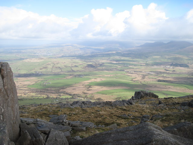
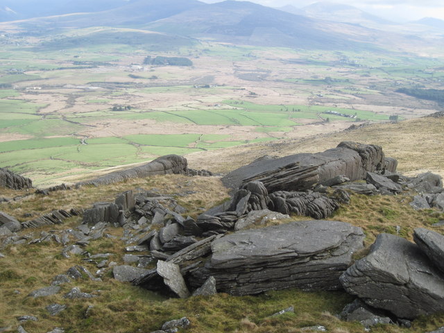
The village of Clynnog itself is nestled between the mountains and the sea, offering breathtaking views of the surrounding landscape. It is known for its rich history, with evidence of human habitation dating back to the Neolithic period. One of the notable landmarks in the area is Clynnog Fawr, a Grade I listed medieval church that has been a place of worship for over a millennium. The church is renowned for its impressive 15th-century rood screen and intricately carved oak ceiling.
Clynnog is also famous for its connection to the legendary Welsh king, Maelgwn Gwynedd. According to folklore, the king's court was located in Clynnog, and the village is said to have been an important cultural and religious center during his reign in the 6th century.
Today, Clynnog is a peaceful and charming community, offering a range of amenities for its residents and visitors. It has a primary school, a pub, and several local businesses. The surrounding countryside provides ample opportunities for outdoor activities such as hiking, fishing, and birdwatching. The village also attracts tourists who are drawn to its historical significance and picturesque scenery.
If you have any feedback on the listing, please let us know in the comments section below.
Clynnog Images
Images are sourced within 2km of 53.015476/-4.330001 or Grid Reference SH4349. Thanks to Geograph Open Source API. All images are credited.


![Road alongside a landfill site, Llwyngwnadl The landfill site is behind the trees on the left [west].](https://s2.geograph.org.uk/geophotos/04/26/12/4261222_daad88d0.jpg)

Clynnog is located at Grid Ref: SH4349 (Lat: 53.015476, Lng: -4.330001)
Unitary Authority: Gwynedd
Police Authority: North Wales
What 3 Words
///open.hound.something. Near Penygroes, Gwynedd
Nearby Locations
Related Wikis

Bwlch Mawr
Bwlch Mawr is a hill near the northeastern corner of the Llŷn Peninsula in the community of Clynnog in the county of Gwynedd in North Wales. Its name is...

Clynnog Fawr
Clynnog Fawr, often simply called "Clynnog", is a village and community on the north coast of Llŷn Peninsula in Gwynedd, north-west Wales. It is in the...

Aberdesach
Aberdesach is a small village in a primarily Welsh speaking area of Gwynedd. It is in the historic county of Caernarfonshire. The village is situated approximately...
Nantlle Valley
The Nantlle Valley (Welsh: Dyffryn Nantlle, IPA: [ˈdəfrɨn ˈnantɬɛ]) is an area in Gwynedd, North Wales, characterised by its numerous small settlements...
Nearby Amenities
Located within 500m of 53.015476,-4.330001Have you been to Clynnog?
Leave your review of Clynnog below (or comments, questions and feedback).