Carreghofa

Community in Montgomeryshire

Wales

Carreghofa

Shropshire Union Canal (Montgomery Branch) at the Vyrnwy Aqueduct
Shropshire Union Canal (Montgomery Branch) at the Vyrnwy Aqueduct Credit: Colin Park

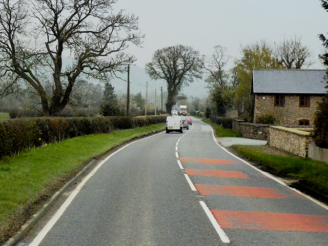
Carreghofa is a small community located in Montgomeryshire, a historic county in Wales, United Kingdom. Situated in the stunning countryside of Powys, this rural area offers breathtaking landscapes and a peaceful environment.

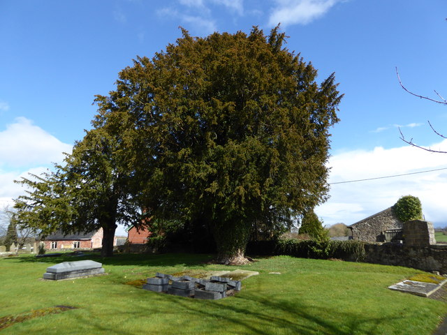
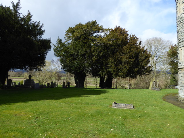
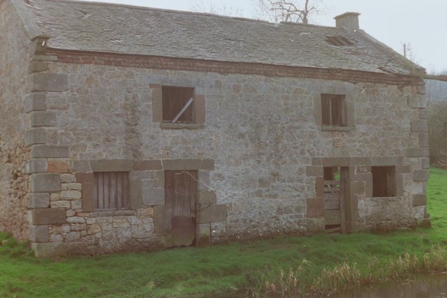
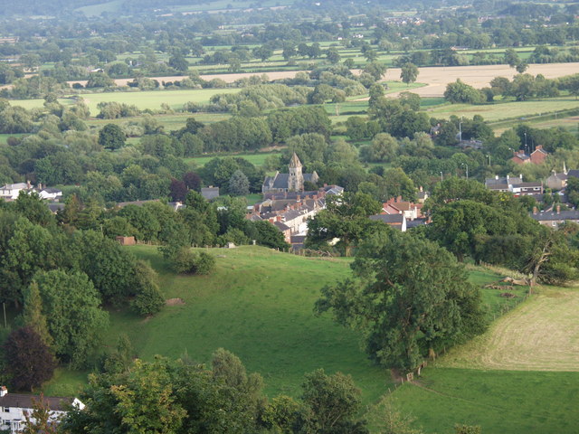
The community is centered around the village of Carreghofa, which is nestled in the picturesque Tanat Valley. Surrounded by rolling hills and lush green fields, it provides a tranquil setting for residents and visitors alike. The village is home to a close-knit community, with a population of approximately 500 people.

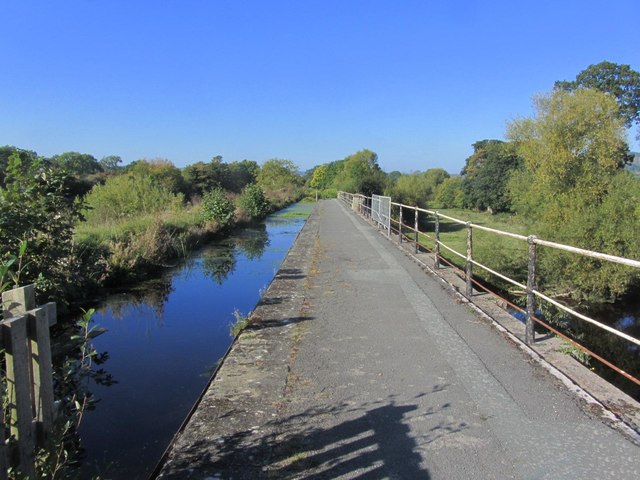
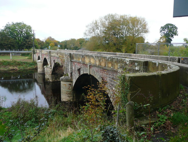
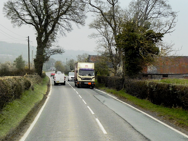
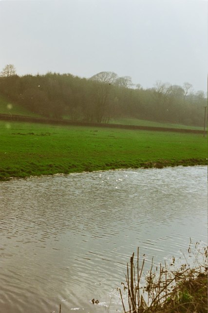
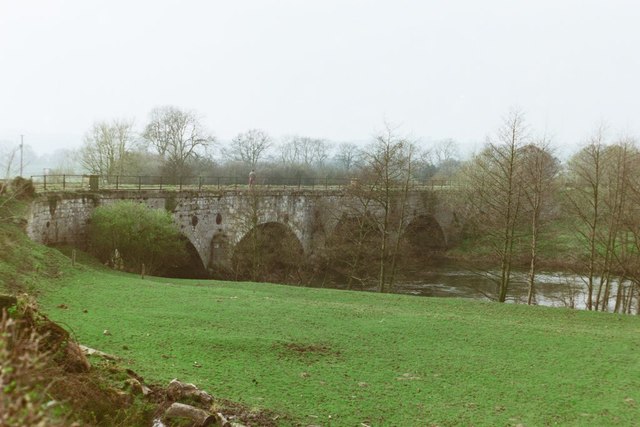
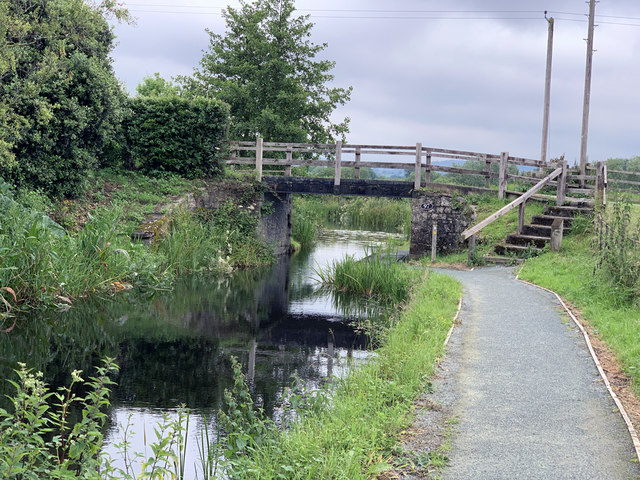
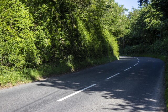
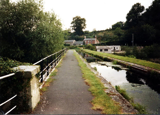
Carreghofa is renowned for its stunning natural beauty, with the River Tanat flowing through the heart of the community. The river is a popular spot for fishing enthusiasts, who come to enjoy the abundance of trout and grayling. The picturesque countryside also offers numerous walking and hiking trails, providing opportunities for outdoor activities and exploration.

Despite its rural setting, Carreghofa is conveniently located close to the town of Oswestry, which provides residents with access to a range of amenities and services. The community has a strong sense of community spirit and hosts various events and activities throughout the year, including local festivals and community gatherings.

Carreghofa is an idyllic community that offers a peaceful and scenic retreat for those seeking a slower pace of life. With its stunning natural surroundings and close-knit community, it is a hidden gem in the heart of Montgomeryshire.

If you have any feedback on the listing, please let us know in the comments section below.

Carreghofa Images

Images are sourced within 2km of 52.779958/-3.10322 or Grid Reference SJ2520. Thanks to Geograph Open Source API. All images are credited.

Shropshire Union Canal (Montgomery Branch) at the Vyrnwy Aqueduct
New Bridge over the River Vyrnwy This carries the B4398, which goes to the A483 at Llanymynech.
New Bridge over the River Vyrnwy
This carries the B4398, which goes to the A483 at Llanymynech.
Ordnance Survey Cut Mark This OS cut mark can be found on the south face of St Tysilio's Church. It marks a point 70.9570m above mean sea level.
Ordnance Survey Cut Mark
This OS cut mark can be found on the south face of St Tysilio's Church. It marks a point 70.9570m above mean sea level.
A483 at Llandysilio The A483 is a major north-south trunk road in Wales, running for 149 miles between Chester and Junction 42 of the M4 motorway just east of Swansea.
<span class="nowrap"><a title="http://www.sabre-roads.org.uk/wiki/index.php?title=A483" rel="nofollow ugc noopener" href="http://www.sabre-roads.org.uk/wiki/index.php?title=A483">Link</a><img style="margin-left:2px;" alt="External link" title="External link - shift click to open in new window" src="https://s1.geograph.org.uk/img/external.png" width="10" height="10"/></span>  SABRE
<span class="nowrap"><a title="https://en.wikipedia.org/wiki/A483_road" rel="nofollow ugc noopener" href="https://en.wikipedia.org/wiki/A483_road">Link</a><img style="margin-left:2px;" alt="External link" title="External link - shift click to open in new window" src="https://s1.geograph.org.uk/img/external.png" width="10" height="10"/></span>  Wikipedia
A483 at Llandysilio
The A483 is a major north-south trunk road in Wales, running for 149 miles between Chester and Junction 42 of the M4 motorway just east of Swansea. LinkExternal link SABRE LinkExternal link Wikipedia
The Street (A483) at Rhandregynwen The A483 is a major north-south trunk road in Wales, running for 149 miles between Chester and Junction 42 of the M4 motorway just east of Swansea.
<span class="nowrap"><a title="http://www.sabre-roads.org.uk/wiki/index.php?title=A483" rel="nofollow ugc noopener" href="http://www.sabre-roads.org.uk/wiki/index.php?title=A483">Link</a><img style="margin-left:2px;" alt="External link" title="External link - shift click to open in new window" src="https://s1.geograph.org.uk/img/external.png" width="10" height="10"/></span>  SABRE
<span class="nowrap"><a title="https://en.wikipedia.org/wiki/A483_road" rel="nofollow ugc noopener" href="https://en.wikipedia.org/wiki/A483_road">Link</a><img style="margin-left:2px;" alt="External link" title="External link - shift click to open in new window" src="https://s1.geograph.org.uk/img/external.png" width="10" height="10"/></span>  Wikipedia
The Street (A483) at Rhandregynwen
The A483 is a major north-south trunk road in Wales, running for 149 miles between Chester and Junction 42 of the M4 motorway just east of Swansea. LinkExternal link SABRE LinkExternal link Wikipedia
Large yew in Llandysilio churchyard
Old yew trees, Llandysilio
Montgomery Canal near Pentreheylin Hall, 1988
The Old Salt Warehouse, Pentreheylin, 1988 A look at Google Street View in 2018 shows that the building has since been restored into a private house. Not only was the building made habitable again, but the crane at the right-hand side of the building was also restored.
The Old Salt Warehouse, Pentreheylin, 1988
A look at Google Street View in 2018 shows that the building has since been restored into a private house. Not only was the building made habitable again, but the crane at the right-hand side of the building was also restored.
Vyrnwy Aqueduct, 1988
Canal milemarker by the Montgomery Canal, Vyrnwy Viaduct Replica Milemarker by the Montgomery Canal, in parish of Carreghofa (Powys District), near the  Vyrnwy Aqueduct.

Inscription reads:
: NEWTOWN / 23 / MILES : : MONTGOMERY / CANAL : : WELSH / FRANKTON / 12 MILES :
Sponsor:-
: MWRT / 1984 :
(Montgomery Waterway Restoration Trust)

Milestone Society National ID: MGY-12R
Canal milemarker by the Montgomery Canal, Vyrnwy Viaduct
Replica Milemarker by the Montgomery Canal, in parish of Carreghofa (Powys District), near the Vyrnwy Aqueduct. Inscription reads: : NEWTOWN / 23 / MILES : : MONTGOMERY / CANAL : : WELSH / FRANKTON / 12 MILES : Sponsor:- : MWRT / 1984 : (Montgomery Waterway Restoration Trust) Milestone Society National ID: MGY-12R
Canal bridge at Pentreheylin Carrying a minor road over the Montgomery Canal. The towpath here is used by Offa's Dyke Path.
Canal bridge at Pentreheylin
Carrying a minor road over the Montgomery Canal. The towpath here is used by Offa's Dyke Path.
Road B4393 Woodland next to B4393
Road B4393
Woodland next to B4393
Road works on the A483 This will be the beginning of the Four Crosses by-pass, the building of which is progressing well.
Road works on the A483
This will be the beginning of the Four Crosses by-pass, the building of which is progressing well.
Rhandregynwen Farm
Rhandregynwen Farm
Vyrnwy road bridge Bridge over the River Vyrnwy near Four Crosses
Vyrnwy road bridge
Bridge over the River Vyrnwy near Four Crosses
A483 at Rhandregynwen
Pont Ddwr / Aqueduct Llwybr Clawdd Offa yn croesi pont ddwr y gamlas a rychwanta Afon Efyrnwy.

The Offa's Dyke Path following the canal over the aqueduct which spans the Vyrnwy River < Efyrnwy.
Pont Ddwr / Aqueduct
Llwybr Clawdd Offa yn croesi pont ddwr y gamlas a rychwanta Afon Efyrnwy. The Offa's Dyke Path following the canal over the aqueduct which spans the Vyrnwy River < Efyrnwy.
Show me another place!

Carreghofa is located at Grid Ref: SJ2520 (Lat: 52.779958, Lng: -3.10322)

Unitary Authority: Powys

Police Authority: Dyfed Powys

Also known as: Carreghwfa

What 3 Words

///pouch.canoe.sadly. Near Pant, Shropshire

Related Wikis

Carreghofa Halt railway station

Carreghofa Halt railway station is a disused station in Carreghofa, Powys, Wales. The station opened in 1938 and closed in 1965. == References == ��2...

Carreghofa

Carreghofa (Welsh: Carreghwfa) is a community in Montgomeryshire, Powys, Wales, and is 89.6 miles (144.2 km) from Cardiff and 153.6 miles (247.2 km) from...

Llanymynech

Llanymynech is a village and former civil parish straddling the border between Montgomeryshire/Powys, Wales, and Shropshire, England, about 9 miles (14...
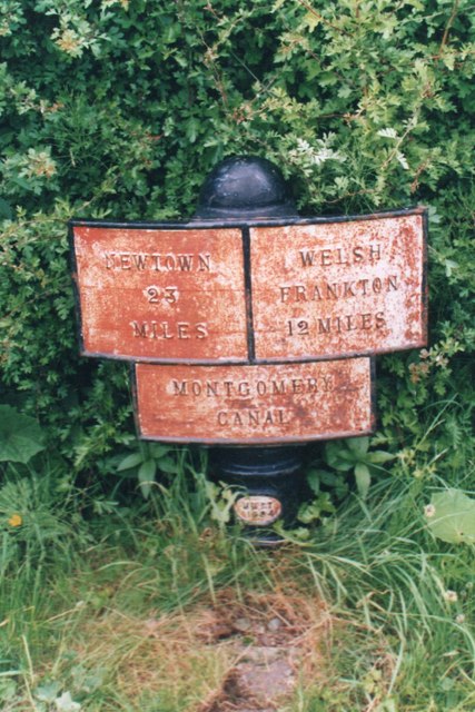
Afon Tanat

Afon Tanat is a river in northern Powys, Wales. Its source is close to the Cyrniau Nod mountain, to the north of Lake Vyrnwy. The river flows in a generally...

Nearby Amenities

Located within 500m of 52.779958,-3.10322
Direction: both
Traffic Calming: cushion
Lat/Long: 52.7787597/-3.0982811
Barrier: stile
Foot: yes
Lat/Long: 52.782677/-3.1010653
Priority: forward
Traffic Calming: choked_cushion
Lat/Long: 52.7790366/-3.0968135
Traffic Calming: choker
Lat/Long: 52.7785927/-3.0990468
Bus Stop
Bus: yes
Naptan AtcoCode: 3500B431801
Naptan NaptanCode: shrdajdj
Public Transport: platform
Lat/Long: 52.7777296/-3.1020015
Bus Stop
Bus: yes
Public Transport: platform
Lat/Long: 52.7776774/-3.1019758
Barrier: stile
Bicycle: no
Foot: yes
Horse: no
Motor Vehicle: no
Lat/Long: 52.7801806/-3.1039317
Barrier: stile
Bicycle: no
Foot: yes
Horse: no
Motor Vehicle: no
Lat/Long: 52.780243/-3.1038326
Barrier: stile
Lat/Long: 52.7798081/-3.1036521
Carreghofa
Abandoned Railway: halt
Railway: site
Wikidata: Q28971151
Wikipedia: en:Carreghofa Halt railway station
Lat/Long: 52.7784767/-3.0987614
Llanfyllin Branch Junction
Railway: junction
Lat/Long: 52.7788985/-3.0999899
Carreghofa
Place: village
Source: NLS-OS-1st_Series
Lat/Long: 52.7804255/-3.0968807
Direction: 165
Generator Method: photovoltaic
Generator Output Electricity: yes
Generator Solar Modules: 12
Generator Source: solar
Generator Type: solar_photovoltaic_panel
Location: roof
Power: generator
Lat/Long: 52.7800245/-3.1010547
Direction: 190
Generator Method: photovoltaic
Generator Output Electricity: yes
Generator Solar Modules: 16
Generator Source: solar
Generator Type: solar_photovoltaic_panel
Location: roof
Power: generator
Lat/Long: 52.780065/-3.0981392
Direction: SSW
Generator Method: photovoltaic
Generator Output Electricity: yes
Generator Solar Modules: 4
Generator Source: solar
Generator Type: solar_photovoltaic_panel
Location: roof
Power: generator
Lat/Long: 52.7792084/-3.0981995
Direction: SSW
Generator Method: photovoltaic
Generator Output Electricity: yes
Generator Solar Modules: 12
Generator Source: solar
Generator Type: solar_photovoltaic_panel
Location: roof
Power: generator
Lat/Long: 52.7792571/-3.0983752
Give Way
Direction: backward
Lat/Long: 52.7790556/-3.0967046
Direction: both
Traffic Calming: cushion
Lat/Long: 52.7788394/-3.0977902
The data included in this document is from www.openstreetmap.org. The data is made available under ODbL.

Have you been to Carreghofa?

Leave your review of Carreghofa below (or comments, questions and feedback).