Cadfarch

Community in Merionethshire

Wales

Cadfarch

River Dovey near Derwenlas
River Dovey near Derwenlas Credit: Chris Morgan

Cadfarch is a small community located in the county of Merionethshire, Wales. It is situated in the northern part of the country, near the coast of Cardigan Bay. The community covers an area of approximately 15 square miles and has a population of around 300 people.

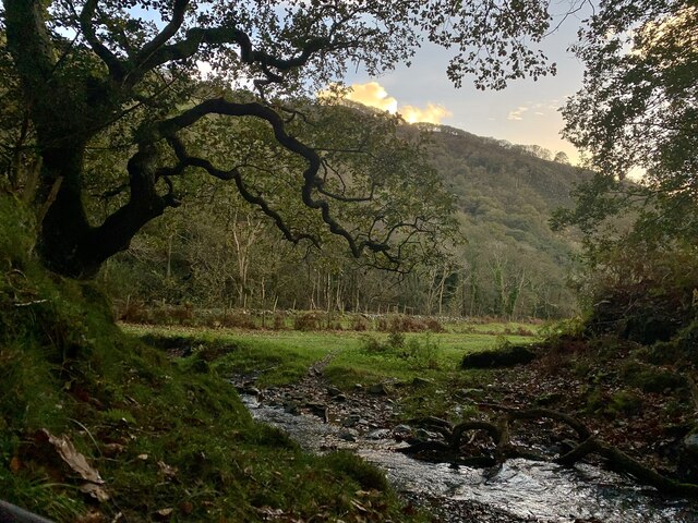
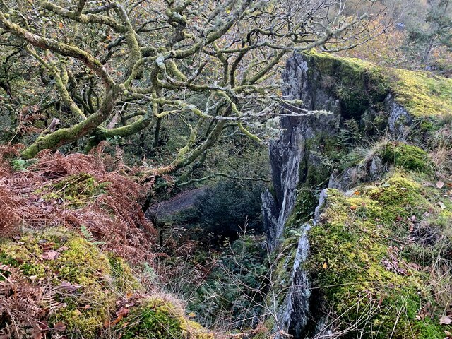
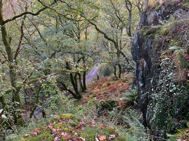
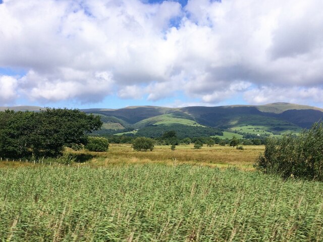
The landscape of Cadfarch is characterized by rolling hills, lush green fields, and picturesque countryside. It is a predominantly rural area, with farming being the main occupation of the local residents. The community is known for its sheep farming, and the surrounding fields are often dotted with grazing livestock.

Cadfarch is a close-knit community where people take pride in their Welsh heritage and traditions. The Welsh language is still spoken by many residents, and traditional cultural events and festivals are celebrated throughout the year.

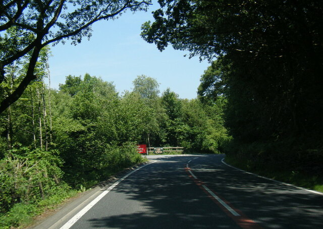
In terms of amenities, Cadfarch has a small primary school that serves the local children. There is also a village hall that hosts various community activities and events. However, for more extensive services and facilities, residents often travel to nearby towns such as Barmouth or Dolgellau.

The area surrounding Cadfarch offers plenty of opportunities for outdoor activities and exploration. The nearby coastline provides beautiful sandy beaches and scenic coastal walks, while the nearby mountains and national parks offer hiking and biking trails for nature enthusiasts.

Overall, Cadfarch is a charming and peaceful community that offers a rural lifestyle with stunning natural beauty. It is a place where residents can enjoy the tranquility of the countryside while being close to the amenities offered by larger towns in the area.

If you have any feedback on the listing, please let us know in the comments section below.
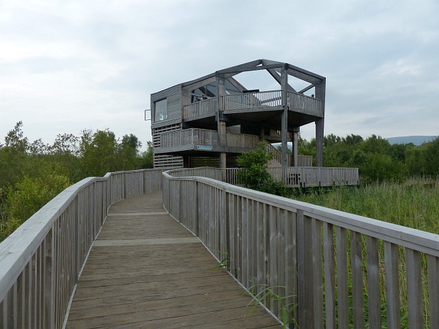
Cadfarch Images

Images are sourced within 2km of 52.576363/-3.891655 or Grid Reference SN7199. Thanks to Geograph Open Source API. All images are credited.

River Dovey near Derwenlas
Hen dderwen, Cwm Llyfnant A tiny tributary rushes down from the hills to join the Afon Llyfnant, overlooked by a glorious old oak tree.
Hen dderwen, Cwm Llyfnant
A tiny tributary rushes down from the hills to join the Afon Llyfnant, overlooked by a glorious old oak tree.
Clogwyn Cwm Llyfnant A massive rock above the Llyfnant makes for unexpectedly dramatic cliffs in the wooded valley.
Clogwyn Cwm Llyfnant
A massive rock above the Llyfnant makes for unexpectedly dramatic cliffs in the wooded valley.
Coedwig Cwm Llyfnant Looking down towards the largely unused lane through the wooded Cwm Llyfnant from the top of the massive rock above it.
Coedwig Cwm Llyfnant
Looking down towards the largely unused lane through the wooded Cwm Llyfnant from the top of the massive rock above it.
Old milestone by Hen Gapel, Derwenlas This classic old Welsh slate milestone stands in front of Hen Gapel, Derwenlas alongside the A487. The top is damaged and it appears to have two lots of inscriptions both apparently indicating 2 miles to Machynlleth. The milestone isn't marked on any maps I've seen, but does appear to be equidistant between milestones 'Mach 1', which is now in a cut off section of the A487 (if the MS exists), and 'Mach 3' further west, which may have been lost to an RTC, where there is a hole in the hedge. 
For a wider view of this milestone see <a href="https://www.geograph.org.uk/photo/7519195">SN7299 : Derwenlas by the A487, and a milestone</a>

Inscription reads:-
         2 M
MA(CH)
2 M.

Surveyed

Milestone Society National ID: MOT_AYMC15
Old milestone by Hen Gapel, Derwenlas
This classic old Welsh slate milestone stands in front of Hen Gapel, Derwenlas alongside the A487. The top is damaged and it appears to have two lots of inscriptions both apparently indicating 2 miles to Machynlleth. The milestone isn't marked on any maps I've seen, but does appear to be equidistant between milestones 'Mach 1', which is now in a cut off section of the A487 (if the MS exists), and 'Mach 3' further west, which may have been lost to an RTC, where there is a hole in the hedge. For a wider view of this milestone see SN7299 : Derwenlas by the A487, and a milestone Inscription reads:- 2 M MA(CH) 2 M. Surveyed Milestone Society National ID: MOT_AYMC15
Derwenlas by the A487, and a milestone Looking west along the A487 in Derwenlas. On the right there is a slate milestone in front of Hen Gapel <a href="https://www.geograph.org.uk/photo/7519171">SN7299 : Old milestone by Hen Gapel, Derwenlas</a>
Derwenlas by the A487, and a milestone
Looking west along the A487 in Derwenlas. On the right there is a slate milestone in front of Hen Gapel SN7299 : Old milestone by Hen Gapel, Derwenlas
A487 near Cors Dyfi Nature Reserve
A487 roadworks near Morben
A487 at Bryn Siriol
A487 at Bryn Siriol
A487 near Derwenlas
A487 near Derwenlas
From a Macchynlleth-Aberystwyth train, bend in the River Dovey
From a Machynlleth-Aberystwyth train, alongside the river Dovey
From a Machynlleth-Aberystwyth train, reed beds by the Dovey
Inside the observatory, Cors Dyfi Nature Reserve Viewing the ospreys. <a title="https://www.geograph.org.uk/photo/4619714" href="https://www.geograph.org.uk/photo/4619714">Link</a>
Inside the observatory, Cors Dyfi Nature Reserve
Viewing the ospreys. Link
Observatory, Cors Dyfi Nature Reserve Situated at the Cors Dyfi Nature Reserve in Wales and managed by the Montgomeryshire Wildlife Trust.
In 2011, the first three chicks hatched and were featured on the BBC Springwatch program.
A 360 degrees observatory was opened in 2014 giving extensive views of the reserve from a height of 10 metres.
In August 2015 the project won the environmental category of the National Lottery Awards and the funding received is to be used to install electricity in the 360 Observatory and build a wheelchair lift.
Observatory, Cors Dyfi Nature Reserve
Situated at the Cors Dyfi Nature Reserve in Wales and managed by the Montgomeryshire Wildlife Trust. In 2011, the first three chicks hatched and were featured on the BBC Springwatch program. A 360 degrees observatory was opened in 2014 giving extensive views of the reserve from a height of 10 metres. In August 2015 the project won the environmental category of the National Lottery Awards and the funding received is to be used to install electricity in the 360 Observatory and build a wheelchair lift.
BBC film crew, Cors Dyfi Nature Reserve With  BBC presenter Michaela Strachan on the day that the winning of a National Lottery Award was announced.
BBC film crew, Cors Dyfi Nature Reserve
With BBC presenter Michaela Strachan on the day that the winning of a National Lottery Award was announced.
Common Lizard, Cors Dyfi Nature Reserve Beside the path that leads to the observatory. <a title="https://www.geograph.org.uk/photo/4619759" href="https://www.geograph.org.uk/photo/4619759">Link</a>
Common Lizard, Cors Dyfi Nature Reserve
Beside the path that leads to the observatory. Link
Bird hide, Cors Dyfi Nature Reserve Near to the entrance of the reserve.
Bird hide, Cors Dyfi Nature Reserve
Near to the entrance of the reserve.
Show me another place!

Cadfarch is located at Grid Ref: SN7199 (Lat: 52.576363, Lng: -3.891655)

Unitary Authority: Powys

Police Authority: Dyfed Powys

What 3 Words

///fades.joys.disputes. Near Machynlleth, Powys

Nearby Locations

Cadfarch Llugwy

Related Wikis

Derwenlas

Derwenlas is a hamlet in northern Powys, Wales. It is part of the community of Cadfarch. Part of the historic county of Montgomeryshire (Sir Drefaldwyn...

Morben

Morben is a hamlet in northern Powys, Wales. Part of the historic county of Montgomeryshire (Sir Drefaldwyn) from 1536 to 1974, it lies on the Afon Dyfi...

Llugwy Hall

Llugwy is the name of an old property near Pennal, a village on the A493 road in southern Gwynedd, Wales, on the north bank of the Afon Dyfi/River Dovey...

Machynlleth transmitting station

The Machynlleth transmitting station is a broadcasting and telecommunications facility located on a hill about 2.5 kilometres (1.6 mi) west of the town...

Nearby Amenities

Located within 500m of 52.576363,-3.891655
Source: npe
Lat/Long: 52.5782079/-3.8969379
Source: npe
Lat/Long: 52.5769431/-3.8920992
Created By: POI Editor
Source: npe
Lat/Long: 52.5783265/-3.8881765
Pub
Black Lion Inn
Wikidata: Q29506360
Lat/Long: 52.5743305/-3.8893591
Power: pole
Source: bing
Lat/Long: 52.5804329/-3.8928213
Power: pole
Source: bing
Lat/Long: 52.579587/-3.8949295
Power: pole
Source: bing
Lat/Long: 52.5791925/-3.8959112
Power: pole
Source: bing
Lat/Long: 52.5787329/-3.8970404
Power: pole
Source: bing
Lat/Long: 52.5782782/-3.8981454
Power: pole
Source: bing
Lat/Long: 52.5800205/-3.8938432
Derwenlas
Place: hamlet
Source: NPE
Wikidata: Q5263318
Lat/Long: 52.5755028/-3.8855993
Railway: level_crossing
Lat/Long: 52.5766088/-3.8850754
Railway: level_crossing
Lat/Long: 52.5762862/-3.8883458
The data included in this document is from www.openstreetmap.org. The data is made available under ODbL.

Have you been to Cadfarch?

Leave your review of Cadfarch below (or comments, questions and feedback).