Aberhonddu

Community in Brecknockshire

Wales

Aberhonddu

Road to Lower Pontgwilym Farm near Brecon Viewed from the B4520.
Road to Lower Pontgwilym Farm near Brecon Credit: Jaggery

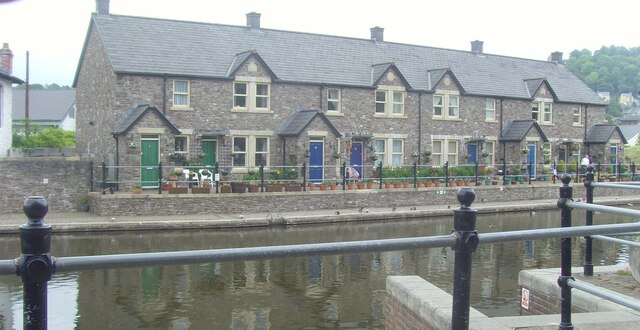
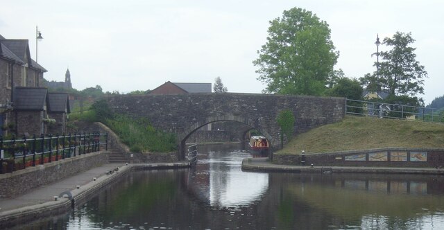
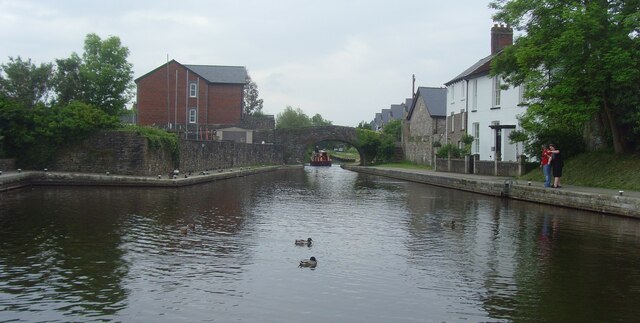
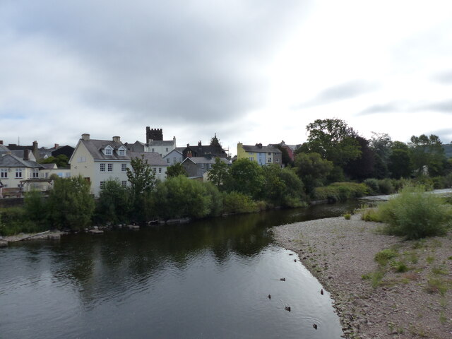
Aberhonddu is a charming community located in the county of Brecknockshire, Wales. Situated at the confluence of the rivers Usk and Honddu, it is nestled within the scenic and picturesque Brecon Beacons National Park. The community is named after the Honddu river, which flows through its heart, and is commonly referred to as Brecon in English.

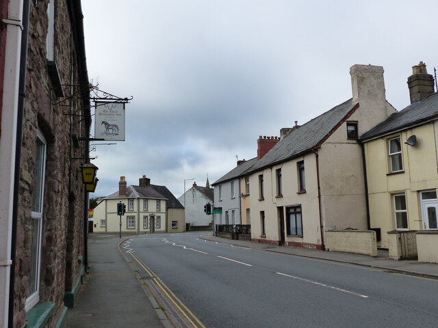
With a population of around 8,250 residents, Aberhonddu offers a mix of both historical and natural attractions. The town itself is steeped in history, evident in its well-preserved architecture, including the iconic Brecon Cathedral, dating back to the 11th century. The town center boasts a vibrant market square, lined with shops, cafes, and traditional pubs, providing a pleasant atmosphere for residents and visitors alike.

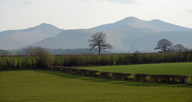
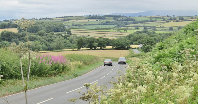
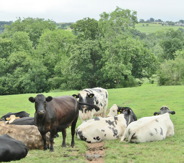
Nature enthusiasts are drawn to Aberhonddu for its proximity to the Brecon Beacons National Park. The park offers a wealth of outdoor activities, including hiking, cycling, and horseback riding, allowing visitors to explore the stunning landscapes, rolling hills, and cascading waterfalls that define the area. Pen y Fan, the highest peak in southern Britain, is a popular destination for hikers and offers breathtaking panoramic views.

The community also hosts several annual events, such as the renowned Brecon Jazz Festival, which attracts music enthusiasts from around the world. Aberhonddu is also home to a number of schools, providing education opportunities for residents of all ages.

Overall, Aberhonddu is a captivating community that seamlessly blends history, natural beauty, and a thriving cultural scene, making it an attractive destination for both residents and tourists.

If you have any feedback on the listing, please let us know in the comments section below.
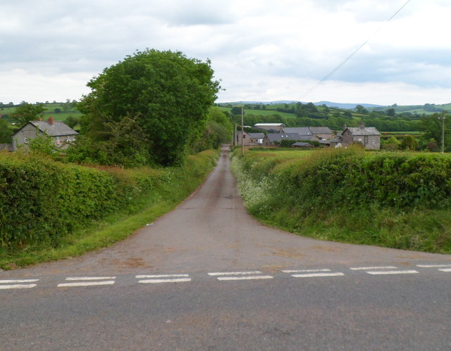
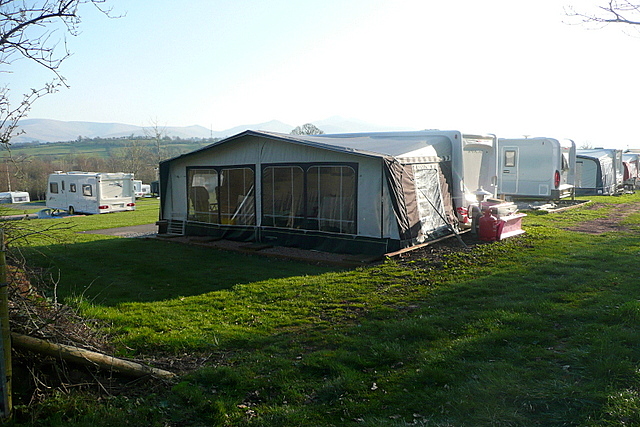
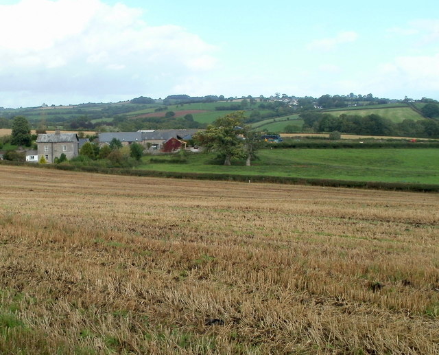
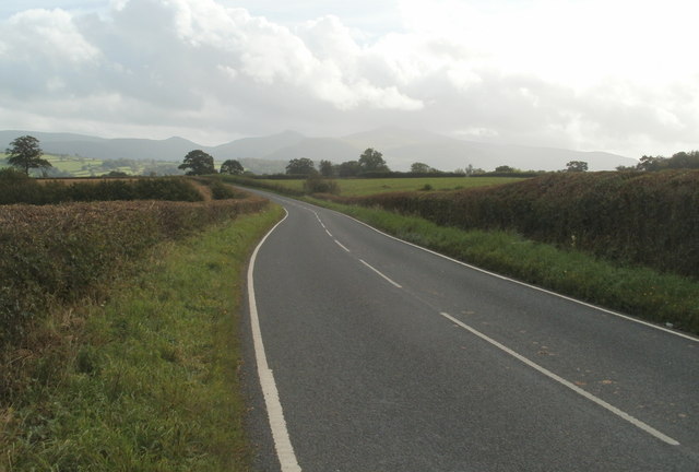
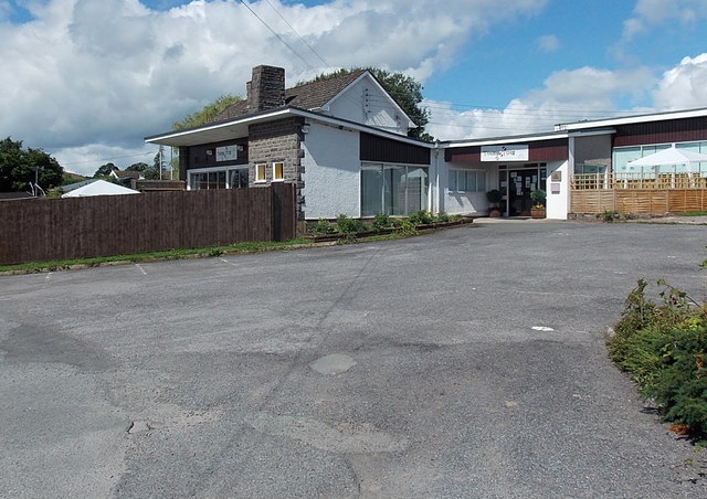
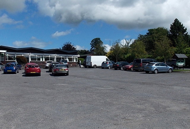
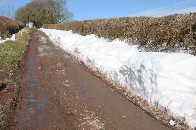
Aberhonddu Images

Images are sourced within 2km of 51.947585/-3.385657 or Grid Reference SO0428. Thanks to Geograph Open Source API. All images are credited.

Road to Lower Pontgwilym Farm near Brecon Viewed from the B4520.
Road to Lower Pontgwilym Farm near Brecon
Viewed from the B4520.
Bishop's Meadow camping park Even in March there are plenty of pitches in use.  Mind you, that's not a bad view to wake  up to is it?
Bishop's Meadow camping park
Even in March there are plenty of pitches in use. Mind you, that's not a bad view to wake up to is it?
Lower Pontgwilym Farm north of Brecon Viewed from the B4520.
Lower Pontgwilym Farm north of Brecon
Viewed from the B4520.
B4520 heads south towards Brecon The northern boundary of Brecon <a title="https://www.geograph.org.uk/photo/3403408" href="https://www.geograph.org.uk/photo/3403408">Link</a> is about 600 metres ahead.
B4520 heads south towards Brecon
The northern boundary of Brecon Link is about 600 metres ahead.
Teeny Tots day nursery near Brecon Located in Bishops Meadow, Hay Road (the B4602).
Teeny Tots day nursery near Brecon
Located in Bishops Meadow, Hay Road (the B4602).
Entrance to Bishop's Meadow Caravan and Camping Park near Brecon The entrance is from the B4602 Hay Road near Brecon. The reception office is in view.
The caravan and camping site is located to the north (behind) and east of the office.
Entrance to Bishop's Meadow Caravan and Camping Park near Brecon
The entrance is from the B4602 Hay Road near Brecon. The reception office is in view. The caravan and camping site is located to the north (behind) and east of the office.
Fields near to Lower Pontgwilym Lower Pontgwilym is a farm north of Brecon; the view over fields is to the main peaks of the Brecon Beacons, Pen-y-Fan and Corn Du to the right.
Fields near to Lower Pontgwilym
Lower Pontgwilym is a farm north of Brecon; the view over fields is to the main peaks of the Brecon Beacons, Pen-y-Fan and Corn Du to the right.
Drifted snow beside a lane This lane is a bridleway just to the north of Brecon.  Last week's heavy snowfall is still very evident here with snow lying where it was blown and drifted.
Drifted snow beside a lane
This lane is a bridleway just to the north of Brecon. Last week's heavy snowfall is still very evident here with snow lying where it was blown and drifted.
Stagecoach Depot, Bishop's Meadow near Brecon Not in use on a Sunday morning, four Stagecoach buses are parked at the western edge of the depot on the north side of the B4602.
Stagecoach Depot, Bishop's Meadow near Brecon
Not in use on a Sunday morning, four Stagecoach buses are parked at the western edge of the depot on the north side of the B4602.
TrawsCymru bus in the Stagecoach Depot, Bishop's Meadow near Brecon At a scheduled stop on TrawsCymru bus route T4 from Cardiff to Newtown (Powys)
TrawsCymru bus in the Stagecoach Depot, Bishop's Meadow near Brecon
At a scheduled stop on TrawsCymru bus route T4 from Cardiff to Newtown (Powys)
Brecon Road B4520 below Pen-y-Crug, a fort-topped hill.
Brecon Road
B4520 below Pen-y-Crug, a fort-topped hill.
Brecon - Pastoral Landscape Cows grazing in the Honddu Valley north of Brecon.
Brecon - Pastoral Landscape
Cows grazing in the Honddu Valley north of Brecon.
Brecon Brecon canal houses, along the canal
Brecon
Brecon canal houses, along the canal
Brecon Brecon canal
Brecon
Brecon canal
Orchard Street, looking west
Brecon Town Brecon Town Canal
Brecon Town
Brecon Town Canal
The river Usk at Brecon, looking east from Bridge Street
Gate into the cathedral grounds
Show me another place!

Aberhonddu is located at Grid Ref: SO0428 (Lat: 51.947585, Lng: -3.385657)

Unitary Authority: Powys

Police Authority: Dyfed Powys

Also known as: Brecon

What 3 Words

///gathers.viewer.amps. Near Brecon, Powys

Related Wikis

Brecon Free Street railway station

Brecon Free Street railway station served Brecon, in the historic Welsh county of Brecknockshire, now Powys. The Brecon and Merthyr Railway obtained an...

Brecon War Memorial Hospital

Brecon War Memorial Hospital (Welsh: Ysbyty Coffa Rhyfel Brycheiniog) is a health facility in Cerrigcochion Road, Brecon, Powys, Wales. It is managed by...

Plough Lane Chapel, Brecon

Plough Lane Chapel or Plough United Reformed Church is a historic building in Brecon, Wales. The chapel's foundation dates to the 17th century and the...

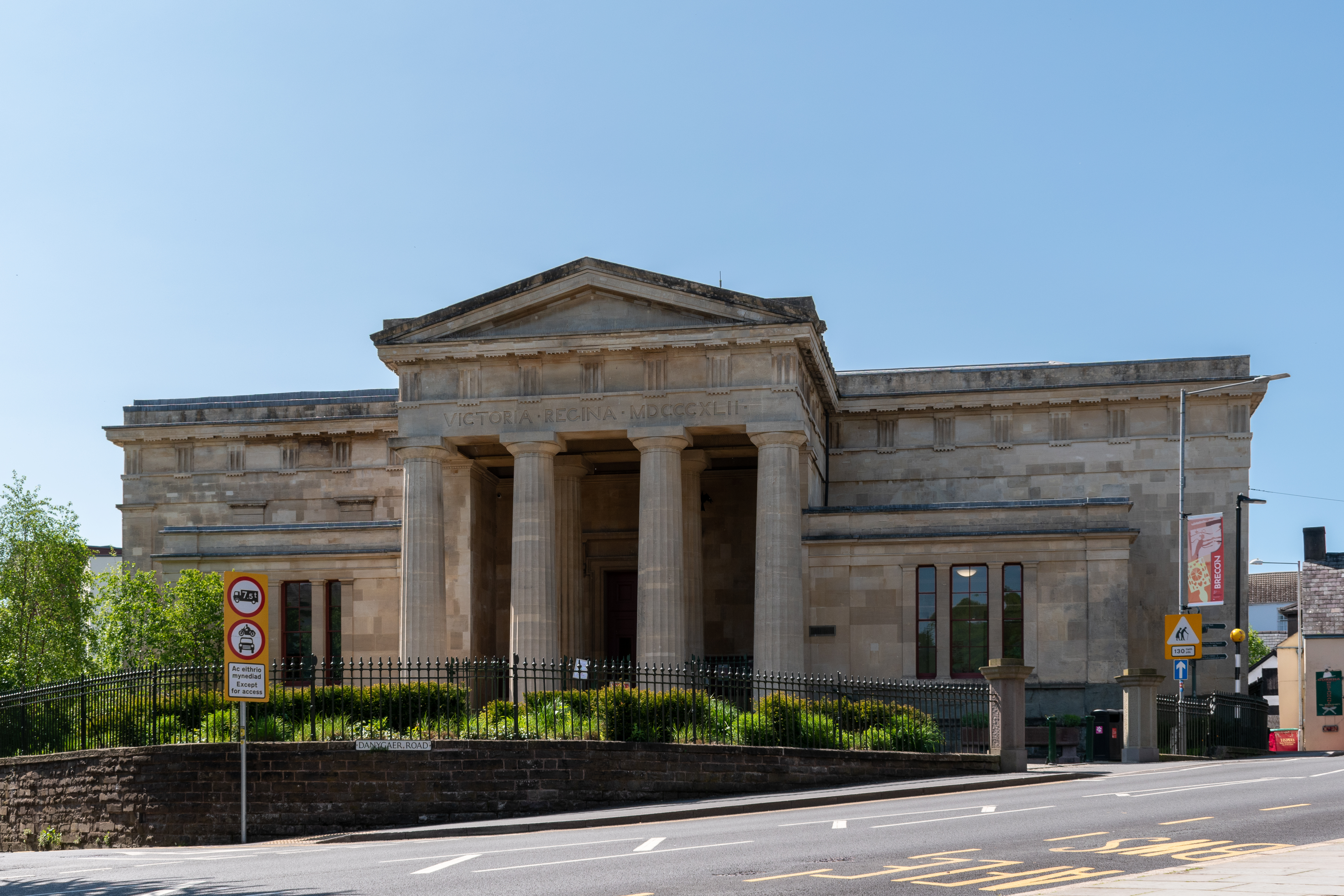
Y Gaer (cultural hub)

Y Gaer (English: The Fortress) is a municipal structure in Glamorgan Street, Brecon, Powys, Wales. The complex, which includes a museum, an art gallery...

Conway Street drill hall, Brecon

The Conway Street drill hall is a former military installation in Brecon, Wales. == History == The building was designed as the headquarters of the 1st...

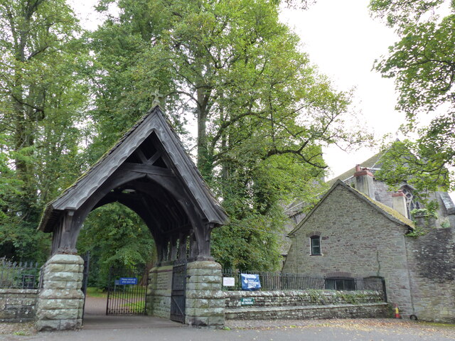
St Mary's Church, Brecon

St Mary's Church is a parish church in Brecon, Powys, Mid Wales. It is a Grade II* listed building in Powys. The structure was originally a chapel of ease...

Brecon Guildhall

Brecon Guildhall (Welsh: Neuadd y Dref Aberhonddu), is a municipal building in the High Street, Brecon, Powys, Wales. The structure, which is the meeting...

Regimental Museum of The Royal Welsh

The Regimental Museum of The Royal Welsh, formerly the South Wales Borderers Museum is located at Brecon in Wales. The museum's collection is made up of...

Nearby Amenities

Located within 500m of 51.947585,-3.385657
Brecon
Is In: Powys,Wales,UK
Is In Country: United Kingdom
Is In Country Code: GB
Name Br: Aberhonddu
Name Cy: Aberhonddu
Place: town
Population: 8250
Population Date: 2011-03-27
Postal Code: LD3
Source Name Br: ofis publik ar brezhoneg
Source Population: https://www.nomisweb.co.uk
Wikidata: Q904472
Wikipedia: en:Brecon
Lat/Long: 51.9472048/-3.391696
Mini Roundabout
Direction: clockwise
Lat/Long: 51.9449119/-3.3858465
Crossing
Crossing: uncontrolled
Crossing Ref: zebra
Lat/Long: 51.9486182/-3.3889213
Traffic Signals
Button Operated: yes
Crossing: traffic_signals
Crossing Ref: pelican
Tactile Paving: yes
Traffic Signals Sound: no
Traffic Signals Vibration: yes
Lat/Long: 51.9470989/-3.3867278
Mini Roundabout
Direction: clockwise
Lat/Long: 51.9460787/-3.3850722
Traffic Signals
Button Operated: yes
Crossing: traffic_signals
Crossing Ref: pelican
Tactile Paving: yes
Traffic Signals Sound: no
Traffic Signals Vibration: yes
Lat/Long: 51.9491188/-3.3913221
Mini Roundabout
Direction: clockwise
Lat/Long: 51.9474471/-3.3875288
Mini Roundabout
Direction: clockwise
Lat/Long: 51.9445431/-3.3890173
Parking
Created By: Potlatch 0.10f
Lat/Long: 51.9447127/-3.3897085
Parking
Access: yes
Created By: Potlatch 0.10f
Fee: yes
Parking: surface
Lat/Long: 51.9459825/-3.3902492
Parking
Created By: Potlatch 0.10f
Lat/Long: 51.9490721/-3.3921546
Brecon Free Street
Historic Railway: station
Name Cy: Aberhonddu
Railway: site
Wikidata: Q29379125
Wikipedia: en:Brecon Free Street railway station
Lat/Long: 51.9462653/-3.3843818
Post Box
Post Box Type: pillar
Royal Cypher: GR
Royal Cypher Wikidata: Q33102273
Lat/Long: 51.9469169/-3.3912129
Telephone
Booth: K6
Covered: booth
Listed Status: Grade II
Operator: BT
Operator Wikidata: Q593786
Phone: +44 1874 625535
Lat/Long: 51.946885/-3.3910759
Telephone
Booth: K6
Covered: booth
Listed Status: Grade II
Operator: BT
Operator Wikidata: Q593786
Phone: +44 1874 625570
Lat/Long: 51.9468515/-3.3909022
Man Made: tower
Source: approx
Lat/Long: 51.9470545/-3.3909106
Barrier: bollard
Lat/Long: 51.9471341/-3.3910127
Crossing
Crossing: zebra
Tactile Paving: yes
Lat/Long: 51.9463732/-3.389261
Barrier: bollard
Bicycle: yes
Bollard: removable
Foot: yes
Lat/Long: 51.9471653/-3.3901093
Barrier: bollard
Lat/Long: 51.9476902/-3.3917261
Crossing
Check Date Crossing: 2023-07-07
Crossing: zebra
Tactile Paving: yes
Lat/Long: 51.9480504/-3.3887545
Crossing
Check Date Crossing: 2023-07-07
Crossing: zebra
Tactile Paving: yes
Lat/Long: 51.9477081/-3.3882084
Fire Station
Brecon Fire Station
Lat/Long: 51.9466496/-3.3848461
Recycling
Lat/Long: 51.944718/-3.3897987
Cafe
the waterfront pop-up Café
Addr Housename: Theatr Brycheiniog
Addr Postcode: LD3 7EW
Addr Street: Canal Wharf
Phone: +44 1874 611622
Website: https://www.theatrbrycheiniog.co.uk/
Wheelchair: yes
Lat/Long: 51.9440368/-3.3882377
Disused Amenity: pub
Old Name: The Bulls Head
Wheelchair: no
Wikidata: Q29486107
Lat/Long: 51.9502626/-3.3909677
Taxi
Lat/Long: 51.9469997/-3.3900951
Restaurant
Zeera
Lat/Long: 51.9488363/-3.3915168
Turning Circle
Lat/Long: 51.9459384/-3.3807531
Turning Circle
Lat/Long: 51.9474905/-3.3822663
Turning Circle
Lat/Long: 51.9459361/-3.3795101
Turning Circle
Lat/Long: 51.9498547/-3.3851619
Turning Circle
Turning Circle: y-head
Lat/Long: 51.9498107/-3.3881343
Turning Circle
Lat/Long: 51.9498756/-3.3890656
Turning Circle
Lat/Long: 51.9492829/-3.3860783
Give Way
Direction: backward
Lat/Long: 51.9480214/-3.3878024
Crossing
Crossing: marked
Crossing Markings: yes
Tactile Paving: yes
Lat/Long: 51.9473516/-3.3875014
Turning Circle
Lat/Long: 51.9474448/-3.3867616
Entrance: main
Lat/Long: 51.9490055/-3.384829
Post Box
Operator: Royal Mail
Operator Wikidata: Q638098
Post Box Type: pillar
Ref: LD3 311D
Royal Cypher: VR
Royal Cypher Wikidata: Q33102356
Lat/Long: 51.9493399/-3.3911663
Shop: greengrocer
Lat/Long: 51.9484969/-3.392176
P F Sweeney
Addr Housenumber: 9-12
Addr Postcode: LD3 9DA
Addr Street: Market Arcade
Shop: butcher
Lat/Long: 51.9485004/-3.3920138
Marketplace
Brecon Market
Lat/Long: 51.9484208/-3.3925837
MacDonalds
Shop: seafood
Lat/Long: 51.9483779/-3.3921868
Defibrillator
Defibrillator Location: outside public toilets, Lion Yard, Brecon - by car park
Emergency: defibrillator
Indoor: no
Lat/Long: 51.9479684/-3.3895076
Post Office
Brecon Post Office
Addr City: Brecon
Addr Country: GB
Addr Postcode: LD3 7HY
Addr Street: Lion Street
Opening Hours: Mo-Sa 08:30-17:30
Operator: Co-op
Ref Pol Id: 14221
Website: https://www.postoffice.co.uk/
Lat/Long: 51.9483736/-3.3906714
Parking
Lat/Long: 51.9452754/-3.3908967
Duke of Wellington statue
Artwork Type: statue
Historic: memorial
Memorial: statue
Source: gps
Tourism: artwork
Wikidata: Q28087861
Lat/Long: 51.9468725/-3.3900653
Niloc Semaj
Description: Niloc Semaj, 1703-1784, time traveller, lived here 2041-2046
Historic: memorial
Openplaques Id: 39656
Lat/Long: 51.9435946/-3.3859965
Bus Stop
Brecon Interchange
Bench: yes
Bin: yes
Bus: yes
Lit: yes
Local Ref: 1
Public Transport: platform
Shelter: yes
Tactile Paving: no
Lat/Long: 51.9468051/-3.3864651
Bus Stop
Brecon Interchange
Bench: yes
Bin: yes
Bus: yes
Local Ref: 3
Public Transport: platform
Shelter: yes
Lat/Long: 51.9467154/-3.3862529
Bus Stop
Brecon Interchange
Bench: yes
Bus: yes
Local Ref: 6
Public Transport: platform
Shelter: yes
Lat/Long: 51.9465804/-3.3859364
Bus Stop
Brecon Interchange
Bench: yes
Bin: no
Bus: yes
Local Ref: 2
Public Transport: platform
Shelter: yes
Lat/Long: 51.9467577/-3.3863497
Bus Stop
Brecon Interchange
Bench: yes
Bus: yes
Local Ref: 4
Public Transport: platform
Shelter: yes
Lat/Long: 51.9466691/-3.3861558
Bus Stop
Brecon Interchange
Bench: yes
Bus: yes
Local Ref: 5
Public Transport: platform
Shelter: yes
Lat/Long: 51.946621/-3.3860413
Bus Stop
Brecon, Bulwark
Bench: yes
Bin: yes
Bus: yes
Lit: no
Public Transport: platform
Shelter: yes
Tactile Paving: no
Lat/Long: 51.946778/-3.3897572
Bus Stop
Bus: yes
Public Transport: platform
Lat/Long: 51.9462738/-3.388864
Crossing
Crossing: zebra
Tactile Paving: yes
Lat/Long: 51.9464089/-3.3892136
Bench
Lat/Long: 51.9462193/-3.3890384
Post Box
Post Box Type: wall
Royal Cypher: VR
Royal Cypher Wikidata: Q33102356
Lat/Long: 51.9462242/-3.3883946
Telephone
Booth: K6
Covered: booth
Listed Status: Grade II
Operator: BT
Operator Wikidata: Q593786
Phone: +44 1874 625575
Lat/Long: 51.9468582/-3.3909323
Telephone
Booth: K6
Covered: booth
Listed Status: Grade II
Operator: BT
Operator Wikidata: Q593786
Phone: +44 1874 625530
Lat/Long: 51.946889/-3.3910966
Post Box
Post Box Type: pillar
Royal Cypher: VR
Royal Cypher Wikidata: Q33102356
Lat/Long: 51.9476954/-3.3913795
Historic: memorial
Memorial: war_memorial
Lat/Long: 51.9471623/-3.3905898
Restaurant
The Proper Pizza Company Ltd.
Addr Street: Lion Yard
Opening Hours: We-Sa 16:00-21:00
Phone: +44 1874 620036
Website: https://www.facebook.com/properpizzas
Lat/Long: 51.9477548/-3.3896463
Atm
ATM Santander bank
Cash In: yes
Check Date: 2023-07-04
Lat/Long: 51.9480428/-3.3915198
Atm
ATM NatWest bank
Check Date: 2023-07-04
Lat/Long: 51.9484143/-3.3916331
Atm
ATM Lloyds bank
Lat/Long: 51.9476843/-3.3914108
Atm
ATM HSBC
Lat/Long: 51.9474581/-3.3905468
Atm
Check Date: 2023-07-04
Description: inside Morrisons supermarket
Lat/Long: 51.9475689/-3.3881375
Post Box
Post Box Type: pillar
Royal Cypher: VR
Royal Cypher Wikidata: Q33102356
Lat/Long: 51.9446118/-3.3851298
Atm
Description: inside Co-op
Lat/Long: 51.9483969/-3.390648
Parking
Operator: Powys County Council
Parking: surface
Surface: asphalt
Lat/Long: 51.9494486/-3.3922929
The Gaming Hub
Opening Hours: Mo-Sa 09:00-17:00
Operator: Now Closed Down
Shop: computer
Lat/Long: 51.9488405/-3.3913312
Freestyle
Opening Hours: Mo-Sa 09:00-17:00
Shop: copyshop
Lat/Long: 51.948693/-3.3913994
Beacon Independent Financial Advice
Office: financial_advisor
Opening Hours: Mo-Sa 09:00-17:00
Lat/Long: 51.9486545/-3.3914127
Barnum's
Opening Hours: Mo-Sa 09:00-17:00
Shop: laundry
Lat/Long: 51.9486206/-3.3914304
Traffic Calming: yes
Lat/Long: 51.945028/-3.3861645
Fast Food
Bo Country
Cuisine: chinese
Lat/Long: 51.944154/-3.384558
Brecon Motors MG
Shop: car
Lat/Long: 51.9450917/-3.3884448
Cafe
Rich Way Cafe
Opening Hours: Mo-Su 09:00-16:00
Lat/Long: 51.9448967/-3.3887386
Aradise
Shop: beauty
Lat/Long: 51.944971/-3.3886423
Car Rental
Brecon Car Rental
Lat/Long: 51.9451802/-3.3883152
Addr Housenumber: 64
Lat/Long: 51.9446831/-3.3857592
Barrier: lift_gate
Source: Maxar-Premium
Lat/Long: 51.9441728/-3.3838928
Addr Housenumber: 72
Lat/Long: 51.9444979/-3.3853622
Barrier: bollard
Lat/Long: 51.9439273/-3.3862441
Barrier: bollard
Lat/Long: 51.9437463/-3.386346
Traffic Calming: yes
Lat/Long: 51.9447298/-3.3855141
Addr Housename: Maesllan
Lat/Long: 51.9434214/-3.3829831
Addr Housename: Lindens
Lat/Long: 51.9434992/-3.3831709
Addr Housenumber: 14
Lat/Long: 51.9449078/-3.3855874
Addr Housenumber: 1
Lat/Long: 51.9444581/-3.3845467
Addr Housename: Linwood
Lat/Long: 51.9434611/-3.383077
Telephone
Booth: K6
Covered: booth
Listed Status: Grade II
Operator: BT
Operator Wikidata: Q593786
Phone: +44 1874 624663
Lat/Long: 51.944802/-3.3855418
Dixies Corner
Phone: +441874938150
Shop: clothes
Lat/Long: 51.9459627/-3.3887041
Reflections
Female Signed: no
Male Signed: no
Shop: hairdresser
Lat/Long: 51.9459825/-3.3887471
King Morter Proud & Co.
Office: accountant
Lat/Long: 51.94607/-3.3884468
Addr Housenumber: 21
Lat/Long: 51.9452616/-3.3864243
Addr Housenumber: 15
Lat/Long: 51.9450699/-3.3859871
The Brecon Parcel Shop
Office: courier
Lat/Long: 51.9464572/-3.3899342
Sunshine Nail Bar
Shop: beauty
Lat/Long: 51.9474687/-3.3919229
Atm
ATM HSBC
Lat/Long: 51.9474952/-3.3904946
Fast Food
Greggs
Brand: Greggs
Brand Wikidata: Q3403981
Brand Wikipedia: en:Greggs
Contact Website: https://www.greggs.co.uk/shop-finder?shop-code=1101
Cuisine: sandwich;bakery
Takeaway: yes
Lat/Long: 51.9476572/-3.3904664
Bench
Lat/Long: 51.9476382/-3.3913797
Barrier: bollard
Bollard: fixed
Lat/Long: 51.9480539/-3.3915797
Welsh Gift Shop
Shop: gift
Lat/Long: 51.947244/-3.390402
Key Vapours
Shop: e-cigarette
Lat/Long: 51.94721/-3.3903296
Brecon Barbers
Shop: hairdresser
Lat/Long: 51.9466818/-3.3894914
Crossing
Crossing: marked
Crossing Markings: yes
Tactile Paving: yes
Lat/Long: 51.9474952/-3.3874013
Addr Housenumber: 12
Lat/Long: 51.9461859/-3.3877144
LDC
Phone: +44 1874 622707
Shop: hardware
Lat/Long: 51.9467174/-3.3895478
Addr Housenumber: 38
Lat/Long: 51.9467347/-3.3874034
Addr Housenumber: 35
Lat/Long: 51.94689/-3.3868785
Addr Housenumber: 47
Lat/Long: 51.9463545/-3.3878914
Roy Hatton Car Sales
Phone: +44 1874 622 200
Shop: car
Lat/Long: 51.9467579/-3.3870144
Bank
NatWest
Brand: NatWest
Brand Wikidata: Q2740021
Brand Wikipedia: en:NatWest
Website: https://www.natwest.com/search-results/locator/branch.html?sortcode=518127&name=Brecon
Lat/Long: 51.9483996/-3.3917459
Tenovus
Shop: charity
Lat/Long: 51.9484991/-3.3916376
Entrance: main
Lat/Long: 51.9487064/-3.3910915
Centre of Attention
Shop: gift
Lat/Long: 51.9477333/-3.3906059
Head Candi
Shop: hairdresser
Lat/Long: 51.9476978/-3.3905362
Visit Brecon
Information: office
Tourism: information
Lat/Long: 51.9478052/-3.3895625
BCA
Lat/Long: 51.9477796/-3.3896026
Fast Food
Subway
Brand: Subway
Brand Wikidata: Q244457
Brand Wikipedia: en:Subway (restaurant)
Contact Website: https://restaurants.subway.com/united-kingdom/wa/brecon/co-op-lion-street
Cuisine: sandwich
Note: Inside Co-op
Takeaway: yes
Lat/Long: 51.9483566/-3.3906904
Cafe
The Dutchess
Lat/Long: 51.9482062/-3.3899152
Barrier: bollard
Lat/Long: 51.9483896/-3.3901981
Brecon Computers
Shop: computer
Lat/Long: 51.947463/-3.3899742
Altered Image
Phone: +44 1874 611520
Shop: hairdresser
Lat/Long: 51.9470307/-3.3911946
Beacons Laundry
Shop: laundry
Lat/Long: 51.9470505/-3.3912683
9 Worlds Tattoo
Shop: tattoo
Lat/Long: 51.94711/-3.3915742
Serenity
Shop: gift
Lat/Long: 51.9470712/-3.3914079
Bank
Leeds Building Society
Brand: Leeds Building Society
Brand Wikidata: Q6515848
Brand Wikipedia: en:Leeds Building Society
Lat/Long: 51.9466041/-3.389883
Setfords
Office: lawyer
Lat/Long: 51.9465802/-3.3897878
Barrier: bollard
Lat/Long: 51.9468019/-3.39049
Operator: Canal & River Trust
Seamark Type: mooring
Lat/Long: 51.9441647/-3.3882658
Operator: Canal & River Trust
Seamark Type: mooring
Lat/Long: 51.9443084/-3.3880781
Operator: Canal & River Trust
Seamark Type: mooring
Lat/Long: 51.9439622/-3.387032
Abandoned Operator: Ordnance Survey of Great Britain
Ele: 136.0841
Man Made: survey_point
Ref: 1100
Lat/Long: 51.9469511/-3.387236
Barrier: stile
Lat/Long: 51.9476578/-3.382288
Pub
The Wellington Hotel
Addr City: Brecon
Addr Housenumber: 10
Addr Postcode: LD3 7AD
Addr Street: Bulwark
Brand: Marston's
Brand Wikidata: Q6773982
Brewery: Brains;Buckley's;Guinness;Amstel;Carling;Peroni;San_Miguel;Aspall;Strongbow
Email: Wellington.Brecon@marstons.co.uk
Name Cy: Y Gwesty'r Wellington
Opening Hours: Mo-Su 11:00-23:00
Opening Hours Covid19: Mo-Su 09:00-23:30
Operator: Marstons
Outdoor Seating: no
Phone: +44 1874 625 225
Smoking: no
Source: Maxar-Premium
Tourism: hotel
Website: https://www.wellingtonpubbreconpowys.co.uk/
Wikidata: Q29485931
Lat/Long: 51.9467192/-3.3902109
Direction: 185
Generator Method: photovoltaic
Generator Output Electricity: yes
Generator Solar Modules: 16
Generator Source: solar
Generator Type: solar_photovoltaic_panel
Location: roof
Power: generator
Lat/Long: 51.9462923/-3.3917714
Direction: 235
Generator Method: photovoltaic
Generator Output Electricity: yes
Generator Solar Modules: 6
Generator Source: solar
Generator Type: solar_photovoltaic_panel
Location: roof
Power: generator
Lat/Long: 51.9510495/-3.3896678
Direction: 195
Generator Method: photovoltaic
Generator Output Electricity: yes
Generator Solar Modules: 16
Generator Source: solar
Generator Type: solar_photovoltaic_panel
Location: roof
Power: generator
Lat/Long: 51.9491612/-3.3907299
Direction: SW
Generator Method: photovoltaic
Generator Output Electricity: yes
Generator Solar Modules: 16
Generator Source: solar
Generator Type: solar_photovoltaic_panel
Location: roof
Power: generator
Lat/Long: 51.9467829/-3.382684
Direction: 145
Generator Method: photovoltaic
Generator Output Electricity: yes
Generator Solar Modules: 12
Generator Source: solar
Generator Type: solar_photovoltaic_panel
Location: roof
Power: generator
Lat/Long: 51.9512606/-3.3881449
Direction: SW
Generator Method: photovoltaic
Generator Output Electricity: yes
Generator Solar Modules: 16
Generator Source: solar
Generator Type: solar_photovoltaic_panel
Location: roof
Power: generator
Lat/Long: 51.9452734/-3.3819598
Telephone
Booth: K6
Covered: booth
Listed Status: Grade II
Operator: BT
Operator Wikidata: Q593786
Lat/Long: 51.9464115/-3.3895405
Brecon Mount Street
Historic Railway: station
Railway: site
Lat/Long: 51.9473579/-3.3868485
Direction: 215
Generator Method: photovoltaic
Generator Output Electricity: yes
Generator Solar Modules: 10
Generator Source: solar
Generator Type: solar_photovoltaic_panel
Location: roof
Power: generator
Lat/Long: 51.9455126/-3.3864389
Direction: 170
Generator Method: photovoltaic
Generator Output Electricity: yes
Generator Solar Modules: 22
Generator Source: solar
Generator Type: solar_photovoltaic_panel
Location: roof
Power: generator
Lat/Long: 51.9440512/-3.3901049
Direction: 165
Generator Method: photovoltaic
Generator Output Electricity: yes
Generator Solar Modules: 6
Generator Source: solar
Generator Type: solar_photovoltaic_panel
Location: roof
Power: generator
Lat/Long: 51.9454233/-3.3906469
Direction: 195
Generator Method: photovoltaic
Generator Output Electricity: yes
Generator Solar Modules: 8
Generator Source: solar
Generator Type: solar_photovoltaic_panel
Location: roof
Power: generator
Lat/Long: 51.9468672/-3.391695
Direction: 175
Generator Method: photovoltaic
Generator Output Electricity: yes
Generator Solar Modules: 8
Generator Source: solar
Generator Type: solar_photovoltaic_panel
Location: roof
Power: generator
Lat/Long: 51.9468992/-3.3916994
Direction: 125
Generator Method: photovoltaic
Generator Output Electricity: yes
Generator Solar Modules: 12
Generator Source: solar
Generator Type: solar_photovoltaic_panel
Location: roof
Note: older form factor (~ 80 cm)
Power: generator
Lat/Long: 51.9519399/-3.3871439
Direction: 305
Generator Method: photovoltaic
Generator Output Electricity: yes
Generator Solar Modules: 12
Generator Source: solar
Generator Type: solar_photovoltaic_panel
Location: roof
Note: older form factor (~ 80 cm)
Power: generator
Lat/Long: 51.9519519/-3.3871741
Direction: SW
Generator Method: photovoltaic
Generator Output Electricity: yes
Generator Solar Modules: 12
Generator Source: solar
Generator Type: solar_photovoltaic_panel
Location: roof
Power: generator
Lat/Long: 51.9490466/-3.3883107
Direction: 195
Generator Method: photovoltaic
Generator Output Electricity: yes
Generator Solar Modules: 8
Generator Source: solar
Generator Type: solar_photovoltaic_panel
Location: roof
Power: generator
Lat/Long: 51.9491239/-3.3907527
Entrance: yes
Lat/Long: 51.9476714/-3.3845294
Addr City: Brecon
Addr Housenumber: 26
Addr Postcode: LD3 7BY
Addr Street: Camden Crescent
Lat/Long: 51.9470578/-3.3830473
Addr City: Brecon
Addr Housenumber: 28
Addr Postcode: LD3 7BY
Addr Street: Camden Crescent
Lat/Long: 51.9469609/-3.3828478
Addr City: Brecon
Addr Housenumber: 19
Addr Postcode: LD3 7BY
Addr Street: Camden Crescent
Lat/Long: 51.9477297/-3.3838174
Addr City: Brecon
Addr Housenumber: 13
Addr Postcode: LD3 7PG
Addr Street: School Gardens
Lat/Long: 51.9498137/-3.3848016
Entrance: yes
Lat/Long: 51.9468547/-3.3855366
Entrance: yes
Lat/Long: 51.9469474/-3.3859647
Noexit: yes
Lat/Long: 51.9459893/-3.3840031
Addr City: Brecon
Addr Housenumber: 47
Addr Postcode: LD3 7BN
Addr Street: Free Street
Lat/Long: 51.9463439/-3.3878299
Addr City: Brecon
Addr Housenumber: 46
Addr Postcode: LD3 7BN
Addr Street: Free Street
Lat/Long: 51.9463671/-3.3877803
Addr City: Brecon
Addr Housenumber: 45
Addr Postcode: LD3 7BN
Addr Street: Free Street
Lat/Long: 51.9464055/-3.3877217
Entrance: yes
Lat/Long: 51.9454956/-3.3864277
Entrance: yes
Lat/Long: 51.9453886/-3.38674
Entrance: yes
Lat/Long: 51.9456069/-3.3865935
Entrance: yes
Lat/Long: 51.9454821/-3.3869419
Telephone
Booth: K6
Covered: booth
Listed Status: Grade II
Operator: BT
Operator Wikidata: Q593786
Phone: +44 1874 624690
Lat/Long: 51.9495561/-3.3911165
Give Way
Direction: backward
Lat/Long: 51.950356/-3.3907943
Crossing
Crossing: marked
Crossing Island: no
Crossing Markings: yes
Lat/Long: 51.9502539/-3.3908118
The data included in this document is from www.openstreetmap.org. The data is made available under ODbL.

Have you been to Aberhonddu?

Leave your review of Aberhonddu below (or comments, questions and feedback).