Beechwood

Community in Monmouthshire

Wales

Beechwood

Work progressing on the eastward extension of Malpas to Caerleon cycleway and footpath The work is taking place beyond the eastern end <a title="https://www.geograph.org.uk/photo/1755714" href="https://www.geograph.org.uk/photo/1755714">Link</a> of the route from Malpas.
Work progressing on the eastward extension of Malpas to Caerleon cycleway and footpath Credit: Jaggery

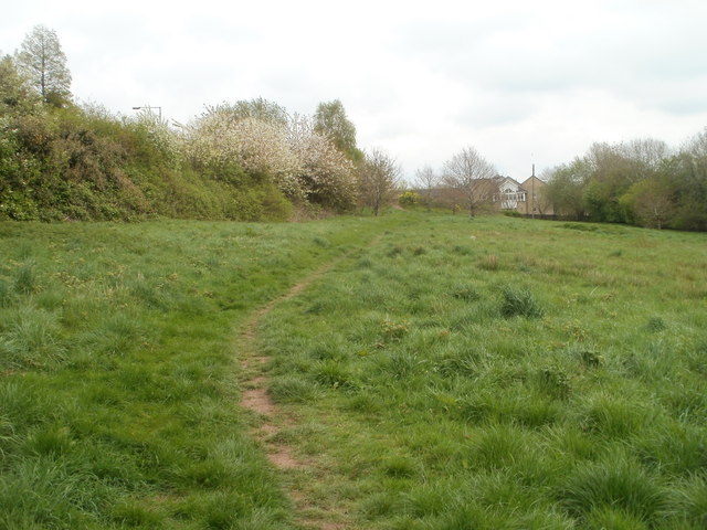
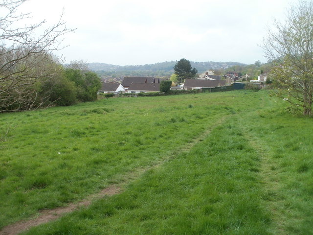
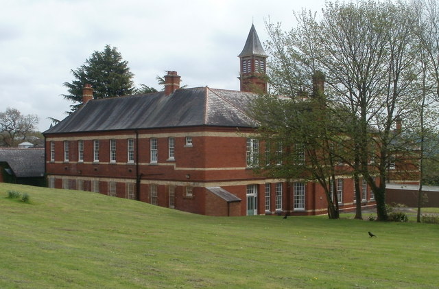
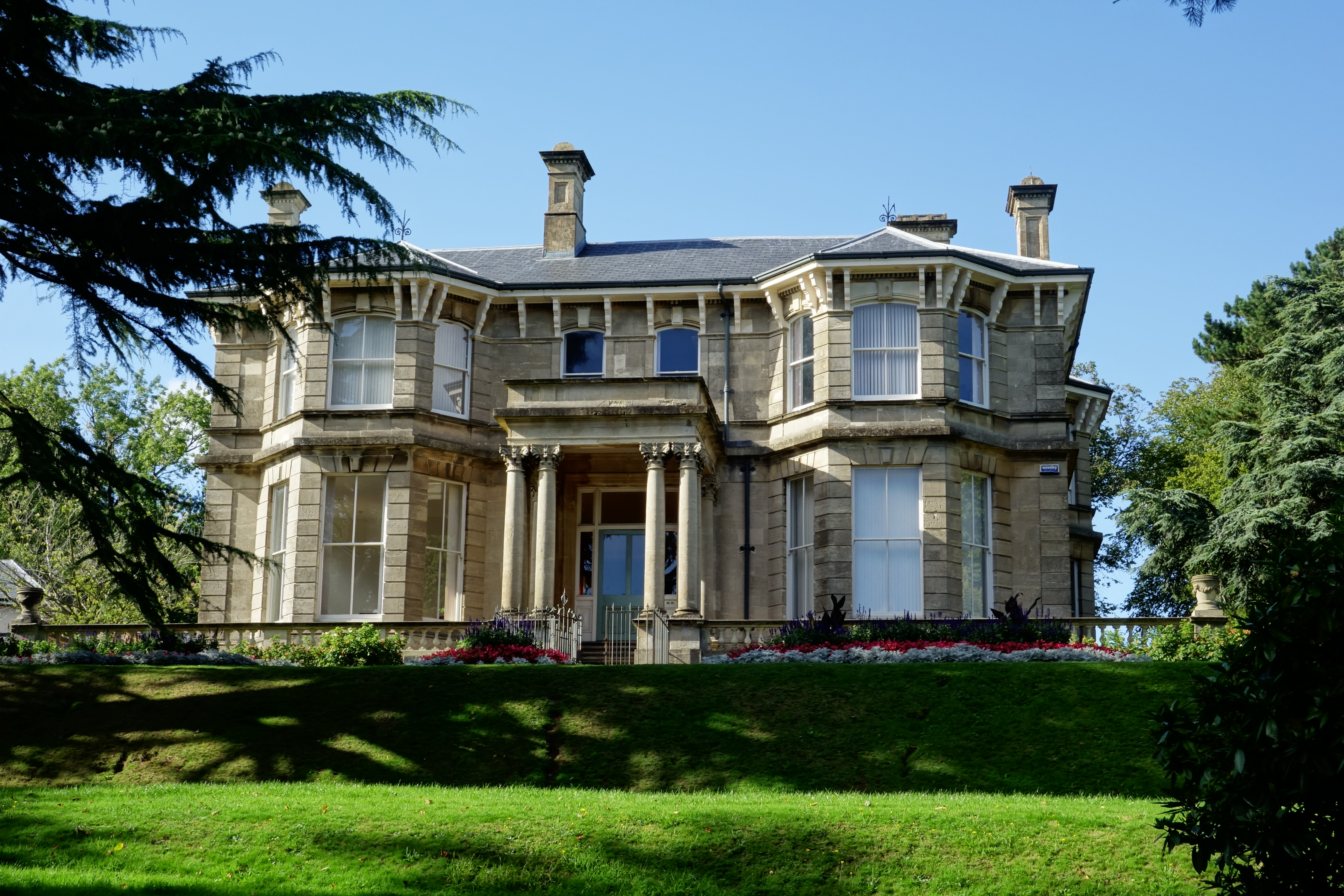
Beechwood is a community located in the county of Monmouthshire, Wales. Situated on the eastern outskirts of the city of Newport, Beechwood is a predominantly residential area known for its tranquil atmosphere and picturesque surroundings. The community is nestled between the beautiful Beechwood Park and the vast expanse of Monmouthshire countryside, offering residents stunning views and ample opportunities for outdoor activities.

Beechwood is well-connected to the rest of Monmouthshire and beyond. It benefits from excellent transport links, with convenient access to the M4 motorway and regular bus services connecting it to Newport city center and neighboring towns. Additionally, Newport train station is just a short distance away, providing further connectivity to major cities across the UK.

In terms of amenities, Beechwood has a range of facilities to cater to the needs of its residents. The community is home to a number of local shops, cafes, and restaurants, ensuring that residents have access to everyday essentials and a variety of dining options. For those seeking recreational activities, Beechwood Park offers a peaceful retreat with its well-maintained green spaces, walking trails, and play areas for children.

Beechwood is also known for its strong sense of community. The residents actively participate in various local events and initiatives, fostering a friendly and welcoming atmosphere. The community has a primary school, providing education for young children, and there are also several churches, reinforcing the area's diverse cultural and religious heritage.

Overall, Beechwood offers a peaceful and well-connected living environment with its stunning natural surroundings, convenient amenities, and strong community spirit.

If you have any feedback on the listing, please let us know in the comments section below.

Beechwood Images

Images are sourced within 2km of 51.595206/-2.968527 or Grid Reference ST3388. Thanks to Geograph Open Source API. All images are credited.

Work progressing on the eastward extension of Malpas to Caerleon cycleway and footpath The work is taking place beyond the eastern end <a title="https://www.geograph.org.uk/photo/1755714" href="https://www.geograph.org.uk/photo/1755714">Link</a> of the route from Malpas.
Work progressing on the eastward extension of Malpas to Caerleon cycleway and footpath
The work is taking place beyond the eastern end Link of the route from Malpas.
Edge of the reeds, Malpas to Caerleon cycleway On the Caerleon side of the cycleway and footpath from Malpas, there is a sharp dividing line between a 200-metre long area of reeds, and a grassy area.
Edge of the reeds, Malpas to Caerleon cycleway
On the Caerleon side of the cycleway and footpath from Malpas, there is a sharp dividing line between a 200-metre long area of reeds, and a grassy area.
Caerleon : Track from Home Farm Green to Eleanor Hodson House A track crosses a 120-metre long field.
Caerleon : Track from Home Farm Green to Eleanor Hodson House
A track crosses a 120-metre long field.
Track to Home Farm Green, Caerleon Viewed from the edge of Eleanor Hodson House. A track crosses a 120-metre long field towards houses in Home Farm Green.
Track to Home Farm Green, Caerleon
Viewed from the edge of Eleanor Hodson House. A track crosses a 120-metre long field towards houses in Home Farm Green.
Eleanor Hodson Care Home, Caerleon Privately-owned care home for 32 residents, located on the south side of Lodge Road, near the western edge of Caerleon.
Eleanor Hodson Care Home, Caerleon
Privately-owned care home for 32 residents, located on the south side of Lodge Road, near the western edge of Caerleon.
Western side of St Cadoc's Hospital, Caerleon Viewed from near the Lodge Road end of entrance 4.
The hospital opened in 1906 as the Newport Borough Asylum, built to accommodate up to 350 patients. Extensive outbuildings were later added. 
Now designated a mental health hospital, its resident patients are few. Various mental health day services are provided.
Western side of St Cadoc's Hospital, Caerleon
Viewed from near the Lodge Road end of entrance 4. The hospital opened in 1906 as the Newport Borough Asylum, built to accommodate up to 350 patients. Extensive outbuildings were later added. Now designated a mental health hospital, its resident patients are few. Various mental health day services are provided.
St Cadoc's Hospital building, Caerleon A building on the western side of the hospital <a title="https://www.geograph.org.uk/photo/2357098" href="https://www.geograph.org.uk/photo/2357098">Link</a> viewed from the edge of entrance 4.
St Cadoc's Hospital building, Caerleon
A building on the western side of the hospital Link viewed from the edge of entrance 4.
South side of St Cadoc's Hospital, Caerleon The hospital opened in 1906 as the Newport Borough Asylum, built to accommodate up to 350 patients. Extensive outbuildings were later added. Now designated a mental health hospital, its resident patients are few. Various mental health day services are provided.
South side of St Cadoc's Hospital, Caerleon
The hospital opened in 1906 as the Newport Borough Asylum, built to accommodate up to 350 patients. Extensive outbuildings were later added. Now designated a mental health hospital, its resident patients are few. Various mental health day services are provided.
Footbridge over the railway, St Cadoc's Hospital, Caerleon A footbridge at the southern edge of the hospital <a title="https://www.geograph.org.uk/photo/2357119" href="https://www.geograph.org.uk/photo/2357119">Link</a> crosses the Welsh Marches railway lines.
Footbridge over the railway, St Cadoc's Hospital, Caerleon
A footbridge at the southern edge of the hospital Link crosses the Welsh Marches railway lines.
Llwyn Onn, St Cadoc's Hospital, Caerleon Child and Family Psychology Department building located in the SE corner of the grounds of St Cadoc's Hospital. <a title="https://www.geograph.org.uk/photo/2357119" href="https://www.geograph.org.uk/photo/2357119">Link</a>
Llwyn Onn, St Cadoc's Hospital, Caerleon
Child and Family Psychology Department building located in the SE corner of the grounds of St Cadoc's Hospital. Link
M4 east of Brynglas tunnel
Looking from Pillmawr Road towards four Usk bridges, Newport Viewed from near a sharp bend on Pillmawr Road. The bridges <a title="https://www.geograph.org.uk/photo/1968953" href="https://www.geograph.org.uk/photo/1968953">Link</a> in the distance carry the M4 motorway and the A4042 connecting road across the River Usk.
Looking from Pillmawr Road towards four Usk bridges, Newport
Viewed from near a sharp bend on Pillmawr Road. The bridges Link in the distance carry the M4 motorway and the A4042 connecting road across the River Usk.
Eastern extension of National Cycle Network 88, Caerleon Viewed from the edge of Home Farm Crescent, Caerleon. Ahead is a new section of National Cycle Network Route 88. Opened in June 2011, the cycle route and footpath run parallel with railway lines for most of the way to Caerleon Comprehensive School. The extension is part of a £50 million UK-wide project by environment charity Sustrans, funded by the Big Lottery Fund.
Eastern extension of National Cycle Network 88, Caerleon
Viewed from the edge of Home Farm Crescent, Caerleon. Ahead is a new section of National Cycle Network Route 88. Opened in June 2011, the cycle route and footpath run parallel with railway lines for most of the way to Caerleon Comprehensive School. The extension is part of a £50 million UK-wide project by environment charity Sustrans, funded by the Big Lottery Fund.
National Cycle Network Route 88, Caerleon The view east from the Home Farm Crescent entrance barrier. <a title="https://www.geograph.org.uk/photo/2494687" href="https://www.geograph.org.uk/photo/2494687">Link</a>
National Cycle Network Route 88, Caerleon
The view east from the Home Farm Crescent entrance barrier. Link
A track through woods, Caerleon Viewed from National Cycle Network Route 88. <a title="https://www.geograph.org.uk/photo/2494691" href="https://www.geograph.org.uk/photo/2494691">Link</a>
A track through woods, Caerleon
Viewed from National Cycle Network Route 88. Link
National Cycle Network Route 88 approaches Home Farm Crescent, Caerleon This section of the footpath and cycle route, <a title="https://www.geograph.org.uk/photo/2494687" href="https://www.geograph.org.uk/photo/2494687">Link</a> from Caerleon Comprehensive School, opened in June 2011.
National Cycle Network Route 88 approaches Home Farm Crescent, Caerleon
This section of the footpath and cycle route, Link from Caerleon Comprehensive School, opened in June 2011.
Fences, National Cycle Network route 88, Caerleon A view ENE along the section of the route opened in June 2011. The black fence on the left is newly installed. On the right, mostly obscured by vegetation, a smaller grey fence separates the footpath and cycle route from railway lines. <a title="https://www.geograph.org.uk/photo/2494738" href="https://www.geograph.org.uk/photo/2494738">Link</a>
Fences, National Cycle Network route 88, Caerleon
A view ENE along the section of the route opened in June 2011. The black fence on the left is newly installed. On the right, mostly obscured by vegetation, a smaller grey fence separates the footpath and cycle route from railway lines. Link
Railway lines, Caerleon The double-track Welsh Marches Line viewed from National Cycle Network route 88.
Railway lines, Caerleon
The double-track Welsh Marches Line viewed from National Cycle Network route 88.
Show me another place!

Beechwood is located at Grid Ref: ST3388 (Lat: 51.595206, Lng: -2.968527)

Unitary Authority: Newport

Police Authority: Gwent

What 3 Words

///ocean.cube.curving. Near Caerleon, Newport

Nearby Locations

Alway Beechwood Beechwood

Related Wikis

Beechwood Park, Newport

Beechwood Park is a thirty-acre public park situated in the eastern Beechwood area of the city of Newport, South Wales. The park is listed on the Cadw/ICOMOS...

Beechwood, Newport

Beechwood is a community (civil parish) and coterminous electoral ward (division) of the city of Newport. The community is bounded by the River Usk to...

St John's Church, Maindee

The Church of St John is a Victorian Church in Wales parish church in Maindee, Newport, Wales. == History == The church was built between 1859 and 1860...

Victoria, Newport

Victoria is both a community (civil parish) and an electoral ward (division) of the city of Newport. The ward is bounded by the River Usk to the west and...

Nearby Amenities

Located within 500m of 51.595206,-2.968527
Mini Roundabout
Direction: clockwise
Lat/Long: 51.5945615/-2.9680973
Turning Circle
Lat/Long: 51.5928452/-2.9683364
Turning Circle
Lat/Long: 51.5934264/-2.970073
Beechwood
Is In City: Newport
Name Cy: Coed Ffawydd
Place: suburb
Lat/Long: 51.5926555/-2.9642537
Summerhill
Is In City: Newport
Name Cy: Bryn yr Haf
Place: suburb
Wikidata: Q107032945
Lat/Long: 51.5955423/-2.9752045
Barrier: bollard
Lat/Long: 51.5959602/-2.9751554
Turning Circle
Lat/Long: 51.5956006/-2.9644544
Noexit: yes
Lat/Long: 51.5964587/-2.9680231
Noexit: yes
Lat/Long: 51.5965004/-2.9689816
Turning Circle
Lat/Long: 51.5938661/-2.9708377
Post Box
Operator: Royal Mail
Post Box Type: wall
Lat/Long: 51.594625/-2.9739098
Bench
Lat/Long: 51.5945752/-2.9683377
Post Box
Operator: Royal Mail
Post Box Type: pillar
Lat/Long: 51.5945993/-2.9683055
Barrier: kissing_gate
Lat/Long: 51.5954762/-2.9615323
Bench
Lat/Long: 51.5907339/-2.9690961
Barrier: bollard
Lat/Long: 51.5926688/-2.9658678
Toilets
Access: yes
Male: yes
Toilets Disposal: flush
Lat/Long: 51.5927152/-2.9650928
Cafe
The Cafe at Beechwood
Addr City: Newport
Addr Housename: Beechwood Park
Addr Postcode: NP19 8AJ
Addr Street: Christchurch Road
Addr Unit: Stable 7
Cuisine: coffee;brunch;british;breakfast
Email: hello@thecafeatbeechwood.co.uk
Opening Hours: Mo-Su 09:00-16:00
Outdoor Seating: yes
Phone: +44 1633 290 973
Website: https://www.thecafeatbeechwood.co.uk/
Lat/Long: 51.5926907/-2.9651537
Bench
Lat/Long: 51.591545/-2.9651694
Lifestyle Express
Addr City: Newport
Addr Housenumber: 70
Addr Postcode: NP19 7QX
Addr Street: Heather Road
Brand: Lifestyle Express
Brand Wikidata: Q61994869
Opening Hours: Mo-Sa 09:00-21:00; Su 10:00-16:00
Shop: convenience
Lat/Long: 51.5979812/-2.9709012
Addr City: Newport
Addr Housenumber: 90
Addr Postcode: NP19 7QX
Addr Street: Heather Road
Disused Amenity: fast_food
Not Addr Postcode: NP19 9QX
Source Addr Postcode: code-point_open
Lat/Long: 51.5977934/-2.9705957
Bus Stop
Bus: yes
Naptan AtcoCode: 5310AWB31030
Naptan NaptanCode: nwpgadj
Public Transport: platform
Lat/Long: 51.5981373/-2.9708497
Beechwood Stores
Addr City: Newport
Addr Housenumber: 88BC
Addr Postcode: NP19 7SJ
Addr Street: Christchurch Road
Brand: Premier
Brand Wikidata: Q7240340
Brand Wikipedia: en:Premier Stores
Opening Hours: Mo-Sa 07:30-20:30; Su 08:00-20:30
Phone: +44 1633 730 689
Shop: convenience
Website: https://www.premier-stores.co.uk/our-stores/beechwood-stores
Lat/Long: 51.5944061/-2.9726419
Smooth Moves
Addr City: Newport
Addr Housename: Beechwood House
Addr Postcode: NP19 8AJ
Addr Street: Christchurch Road
Email: web@smoothmoveagents.co.uk
Office: estate_agent
Opening Hours: Mo-Fr 09:00-17:00
Phone: +44 1633 401 070
Website: https://www.smoothmoveagents.co.uk/
Lat/Long: 51.5926837/-2.9647341
Bus Stop
Christchurch Road
Bus: yes
Naptan AtcoCode: 5310AWB30708
Naptan NaptanCode: nwpgawd
Public Transport: platform
Shelter: no
Lat/Long: 51.5945831/-2.9734343
Bus Stop
Christchurch Road
Bus: yes
Naptan AtcoCode: 5310AWB30709
Naptan NaptanCode: nwpgawg
Public Transport: platform
Shelter: yes
Lat/Long: 51.5944752/-2.9731905
Bench
Lat/Long: 51.5954577/-2.9754813
Bench
Lat/Long: 51.595611/-2.9753901
Direction: 185
Generator Method: photovoltaic
Generator Output Electricity: yes
Generator Solar Modules: 12
Generator Source: solar
Generator Type: solar_photovoltaic_panel
Location: roof
Power: generator
Lat/Long: 51.594624/-2.9731059
Direction: 185
Generator Method: photovoltaic
Generator Output Electricity: yes
Generator Solar Modules: 12
Generator Source: solar
Generator Type: solar_photovoltaic_panel
Location: roof
Power: generator
Lat/Long: 51.594648/-2.973419
Bench
Lat/Long: 51.5932718/-2.9640921
Bench
Lat/Long: 51.5932293/-2.9641665
Bus Stop
Hove Avenue
Bus: yes
Public Transport: platform
Shelter: yes
Lat/Long: 51.5941894/-2.9658675
Bus Stop
Hove Avenue
Bus: yes
Naptan AtcoCode: 5310AWB30712
Naptan NaptanCode: nwpdjag
Public Transport: platform
Shelter: no
Lat/Long: 51.594524/-2.9645551
Bench
Lat/Long: 51.5924548/-2.9654463
Direction: 215
Generator Method: photovoltaic
Generator Output Electricity: yes
Generator Solar Modules: 4
Generator Source: solar
Generator Type: solar_photovoltaic_panel
Location: roof
Power: generator
Lat/Long: 51.5948272/-2.9681023
Direction: SSW
Generator Method: photovoltaic
Generator Output Electricity: yes
Generator Solar Modules: 8
Generator Source: solar
Generator Type: solar_photovoltaic_panel
Location: roof
Power: generator
Lat/Long: 51.5929322/-2.9744612
Direction: ESE
Generator Method: photovoltaic
Generator Output Electricity: yes
Generator Solar Modules: 12
Generator Source: solar
Generator Type: solar_photovoltaic_panel
Location: roof
Power: generator
Lat/Long: 51.5929056/-2.9745966
Direction: 190
Generator Method: photovoltaic
Generator Output Electricity: yes
Generator Solar Modules: 14
Generator Source: solar
Generator Type: solar_photovoltaic_panel
Location: roof
Power: generator
Lat/Long: 51.5943002/-2.9735734
Direction: 215
Generator Method: photovoltaic
Generator Output Electricity: yes
Generator Solar Modules: 16
Generator Source: solar
Generator Type: solar_photovoltaic_panel
Location: roof
Power: generator
Lat/Long: 51.5931147/-2.9718138
Direction: 175
Generator Method: photovoltaic
Generator Output Electricity: yes
Generator Solar Modules: 18
Generator Source: solar
Generator Type: solar_photovoltaic_panel
Location: roof
Power: generator
Lat/Long: 51.5935796/-2.966955
Direction: SSE
Generator Method: photovoltaic
Generator Output Electricity: yes
Generator Solar Modules: 4
Generator Source: solar
Generator Type: solar_photovoltaic_panel
Location: roof
Power: generator
Lat/Long: 51.5915058/-2.9681835
Direction: SSE
Generator Method: photovoltaic
Generator Output Electricity: yes
Generator Solar Modules: 13
Generator Source: solar
Generator Type: solar_photovoltaic_panel
Location: roof
Power: generator
Lat/Long: 51.5915283/-2.9682465
Direction: SW
Generator Method: photovoltaic
Generator Output Electricity: yes
Generator Solar Modules: 8
Generator Source: solar
Generator Type: solar_photovoltaic_panel
Location: roof
Power: generator
Lat/Long: 51.594601/-2.9713619
Direction: SE
Generator Method: photovoltaic
Generator Output Electricity: yes
Generator Solar Modules: 4
Generator Source: solar
Generator Type: solar_photovoltaic_panel
Location: roof
Power: generator
Lat/Long: 51.5946027/-2.9712908
Direction: 215
Generator Method: photovoltaic
Generator Output Electricity: yes
Generator Solar Modules: 7
Generator Source: solar
Generator Type: solar_photovoltaic_panel
Location: roof
Power: generator
Lat/Long: 51.5944985/-2.9711674
Direction: 125
Generator Method: photovoltaic
Generator Output Electricity: yes
Generator Solar Modules: 7
Generator Source: solar
Generator Type: solar_photovoltaic_panel
Location: roof
Power: generator
Lat/Long: 51.5945019/-2.9710923
Direction: 195
Generator Method: photovoltaic
Generator Output Electricity: yes
Generator Solar Modules: 5
Generator Source: solar
Generator Type: solar_photovoltaic_panel
Location: roof
Power: generator
Lat/Long: 51.5949521/-2.9723042
Direction: 105
Generator Method: photovoltaic
Generator Output Electricity: yes
Generator Solar Modules: 4
Generator Source: solar
Generator Type: solar_photovoltaic_panel
Location: roof
Power: generator
Lat/Long: 51.5949684/-2.972239
Direction: 215
Generator Method: photovoltaic
Generator Output Electricity: yes
Generator Solar Modules: 14
Generator Source: solar
Generator Type: solar_photovoltaic_panel
Location: roof
Power: generator
Lat/Long: 51.5962047/-2.967411
Direction: SSW
Generator Method: photovoltaic
Generator Output Electricity: yes
Generator Solar Modules: 12
Generator Source: solar
Generator Type: solar_photovoltaic_panel
Location: roof
Power: generator
Lat/Long: 51.5962047/-2.9700986
Direction: SSW
Generator Method: photovoltaic
Generator Output Electricity: yes
Generator Solar Modules: 13
Generator Source: solar
Generator Type: solar_photovoltaic_panel
Location: roof
Power: generator
Lat/Long: 51.5957965/-2.9696265
Direction: SSW
Generator Method: photovoltaic
Generator Output Electricity: yes
Generator Solar Modules: 15
Generator Source: solar
Generator Type: solar_photovoltaic_panel
Location: roof
Power: generator
Lat/Long: 51.5971311/-2.9702407
Direction: SSW
Generator Method: photovoltaic
Generator Output Electricity: yes
Generator Solar Modules: 16
Generator Source: solar
Generator Type: solar_photovoltaic_panel
Location: roof
Power: generator
Lat/Long: 51.5990938/-2.9695675
Direction: SSW
Generator Method: photovoltaic
Generator Output Electricity: yes
Generator Solar Modules: 16
Generator Source: solar
Generator Type: solar_photovoltaic_panel
Location: roof
Power: generator
Lat/Long: 51.5990138/-2.9693931
Direction: 235
Generator Method: photovoltaic
Generator Output Electricity: yes
Generator Solar Modules: 16
Generator Source: solar
Generator Type: solar_photovoltaic_panel
Location: roof
Power: generator
Lat/Long: 51.5983774/-2.9691437
Direction: sW
Generator Method: photovoltaic
Generator Output Electricity: yes
Generator Solar Modules: 16
Generator Source: solar
Generator Type: solar_photovoltaic_panel
Location: roof
Power: generator
Lat/Long: 51.5978259/-2.9680306
Direction: 165
Generator Method: photovoltaic
Generator Output Electricity: yes
Generator Solar Modules: 12
Generator Source: solar
Generator Type: solar_photovoltaic_panel
Location: roof
Power: generator
Lat/Long: 51.5953941/-2.9642607
Direction: NNE
Generator Method: photovoltaic
Generator Output Electricity: yes
Generator Solar Modules: 6
Generator Source: solar
Generator Type: solar_photovoltaic_panel
Location: roof
Power: generator
Lat/Long: 51.598015/-2.9643439
Direction: SSW
Generator Method: photovoltaic
Generator Output Electricity: yes
Generator Solar Modules: 10
Generator Source: solar
Generator Type: solar_photovoltaic_panel
Location: roof
Power: generator
Lat/Long: 51.5979883/-2.9643653
Drinking Water
Access: yes
Bottle: yes
Covered: no
Fee: no
Indoor: no
Level: 0
Lit: yes
Operator: Newport City Council
Wheelchair: yes
Lat/Long: 51.5925264/-2.9657002
Toilets
Access: yes
Female: yes
Toilets Disposal: flush
Lat/Long: 51.5927262/-2.965037
Bench
Lat/Long: 51.5925443/-2.9658462
Meekos Fitness
Addr City: Newport
Addr Housename: Beechwood Park
Addr Postcode: NP19 8AJ
Addr Street: Christchurch Road
Addr Unit: Stable 1
Email: meekosfitness@gmail.com
Opening Hours: Mo 06:15-20:15; Tu 06:00-19:35; We 06:00-20:00; Th 06:00-20:35; Fr 06:00-19:00; Sa 08:30-21:30; Su 09:30-10:30
Phone: +44 7808 810 498
Shop: yes
Website: https://www.meekosfitness.com/
Lat/Long: 51.5925806/-2.9657017
Unique Embroidery Designs
Addr City: Newport
Addr Housename: Beechwood Park
Addr Postcode: NP19 8AJ
Addr Street: Christchurch Road
Addr Unit: Stable 3
Contact Facebook: https://www.facebook.com/people/Unique-embroidery-designs/100040295777182/
Opening Hours: Mo off; Tu-Su 10:00-16:00
Shop: household
Lat/Long: 51.592616/-2.9655255
Speed Camera
Average speed camera (SPECS)
Maxspeed: 50 mph
Lat/Long: 51.5963854/-2.9643986
The data included in this document is from www.openstreetmap.org. The data is made available under ODbL.

Have you been to Beechwood?

Leave your review of Beechwood below (or comments, questions and feedback).