Allt-yr-ynn

Community in Monmouthshire

Wales

Allt-yr-ynn

Ordnance Survey Cut Mark This OS cut mark can be found on the wall of No3 Wells Close. It marks a point 27.760m above mean sea level.
Ordnance Survey Cut Mark Credit: Adrian Dust

Allt-yr-ynn is a small community located in Monmouthshire, Wales. Situated in the southeastern part of the county, it is surrounded by beautiful countryside and offers a peaceful and picturesque setting.

The community is primarily residential in nature, with a population of approximately 500 people. The landscape is characterized by rolling hills, lush green fields, and charming country lanes. The area is known for its tranquility and natural beauty, making it an attractive destination for those seeking a quiet and idyllic lifestyle.

Although small in size, Allt-yr-ynn is equipped with essential amenities to meet the needs of its residents. There is a local village hall that serves as a community hub, hosting various events and gatherings throughout the year. Additionally, there are a few small businesses, including a convenience store and a pub, providing essential services and a place for locals to socialize.

The community is also well-connected to the surrounding areas. The nearby town of Abergavenny is just a short drive away, offering a wider range of amenities such as supermarkets, shops, and leisure facilities. There are also excellent transport links, with regular bus services connecting Allt-yr-ynn to neighboring towns and cities.

Overall, Allt-yr-ynn is a charming community with a strong sense of community spirit and a close-knit population. Its natural beauty and peaceful atmosphere make it an ideal place for those seeking a slower pace of life in a rural setting.

If you have any feedback on the listing, please let us know in the comments section below.
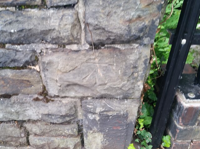
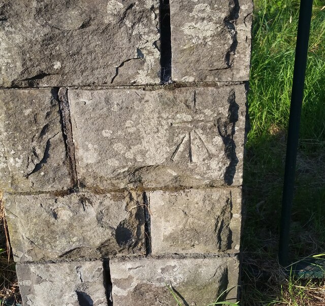
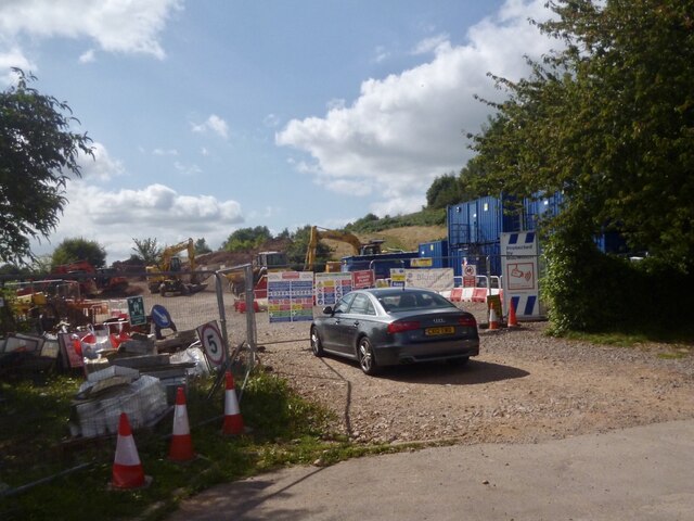
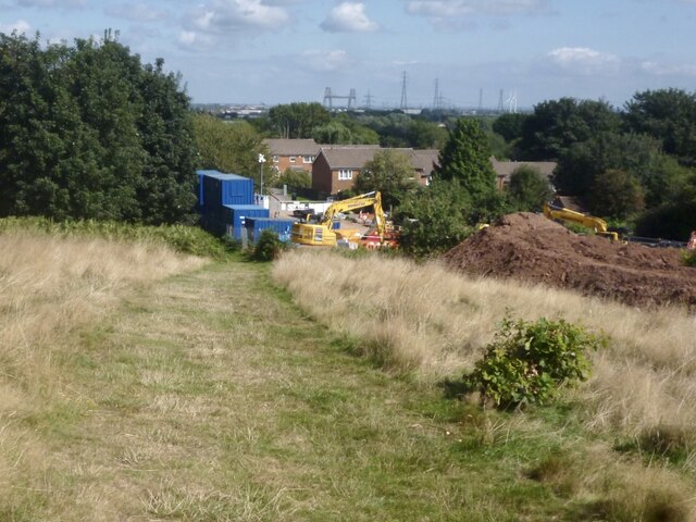
Allt-yr-ynn Images

Images are sourced within 2km of 51.588461/-3.017563 or Grid Reference ST2988. Thanks to Geograph Open Source API. All images are credited.

Ordnance Survey Cut Mark This OS cut mark can be found on the wall of No3 Wells Close. It marks a point 27.760m above mean sea level.
Ordnance Survey Cut Mark
This OS cut mark can be found on the wall of No3 Wells Close. It marks a point 27.760m above mean sea level.
Ordnance Survey Cut Mark This OS cut mark can be found on the west angle of the Gaer Park Club. It marks a point 69.614m above mean sea level.
Ordnance Survey Cut Mark
This OS cut mark can be found on the west angle of the Gaer Park Club. It marks a point 69.614m above mean sea level.
Ordnance Survey Cut Mark This OS cut mark can be found on No10 Highfield Road. It marks a point 65.432m above mean sea level.
Ordnance Survey Cut Mark
This OS cut mark can be found on No10 Highfield Road. It marks a point 65.432m above mean sea level.
Ordnance Survey Cut Mark This OS cut mark can be found on the cemetery wall on Bassaleg Road. It marks a point 64.470m above mean sea level.
Ordnance Survey Cut Mark
This OS cut mark can be found on the cemetery wall on Bassaleg Road. It marks a point 64.470m above mean sea level.
Ordnance Survey Cut Mark This OS cut mark can be found on No83 Bassaleg Road. It marks a point 73.460m above mean sea level.
Ordnance Survey Cut Mark
This OS cut mark can be found on No83 Bassaleg Road. It marks a point 73.460m above mean sea level.
Ordnance Survey Cut Mark This OS cut mark can be found on wall post at the cemetery entrance on Bassaleg Road. It marks a point 78.002m above mean sea level.
Ordnance Survey Cut Mark
This OS cut mark can be found on wall post at the cemetery entrance on Bassaleg Road. It marks a point 78.002m above mean sea level.
Ordnance Survey Cut Mark This OS cut mark can be found on the cemetery wall on Bassaleg Road. It marks a point 79.733m above mean sea level.
Ordnance Survey Cut Mark
This OS cut mark can be found on the cemetery wall on Bassaleg Road. It marks a point 79.733m above mean sea level.
Ordnance Survey Cut Mark This OS cut mark can be found on No76 Stelvio Park Drive. It marks a point 69.630m above mean sea level.
Ordnance Survey Cut Mark
This OS cut mark can be found on No76 Stelvio Park Drive. It marks a point 69.630m above mean sea level.
Ordnance Survey Cut Mark This OS cut mark can be found on the SW parapet of the railway bridge. It marks a point 24.467m above mean sea level.
Ordnance Survey Cut Mark
This OS cut mark can be found on the SW parapet of the railway bridge. It marks a point 24.467m above mean sea level.
Ordnance Survey Rivet This OS rivet can be found on the Motorway Bridge. It marks a point 64.115m above mean sea level.
Ordnance Survey Rivet
This OS rivet can be found on the Motorway Bridge. It marks a point 64.115m above mean sea level.
Ordnance Survey Cut Mark This OS cut mark can be found on the post at the entrance of Coed Melyn Park. It marks a point 70.434m above mean sea level.
Ordnance Survey Cut Mark
This OS cut mark can be found on the post at the entrance of Coed Melyn Park. It marks a point 70.434m above mean sea level.
Ordnance Survey Cut Mark This OS cut mark can be found on the wall of Clewer Court, Oakfield Road. It marks a point 63.108m above mean sea level.
Ordnance Survey Cut Mark
This OS cut mark can be found on the wall of Clewer Court, Oakfield Road. It marks a point 63.108m above mean sea level.
Ordnance Survey Cut Mark This OS cut mark can be found on No2 Upton Road. It marks a point 75.242m above mean sea level.
Ordnance Survey Cut Mark
This OS cut mark can be found on No2 Upton Road. It marks a point 75.242m above mean sea level.
Ordnance Survey Cut Mark This OS cut mark can be found on the cemetery gatepost SW side of Risca Road. It marks a point 76.615m above mean sea level.
Ordnance Survey Cut Mark
This OS cut mark can be found on the cemetery gatepost SW side of Risca Road. It marks a point 76.615m above mean sea level.
Ordnance Survey Cut Mark This OS cut mark can be found on the wall of No18 Woodville Road. It marks a point 75.926m above mean sea level.
Ordnance Survey Cut Mark
This OS cut mark can be found on the wall of No18 Woodville Road. It marks a point 75.926m above mean sea level.
Ordnance Survey Cut Mark This OS cut mark can be found on the wall of No6 Woodville Road. It marks a point 81.064m above mean sea level.
Ordnance Survey Cut Mark
This OS cut mark can be found on the wall of No6 Woodville Road. It marks a point 81.064m above mean sea level.
Works site, Gaer Fort, Newport For the construction for an Active Travel route around the south-western boundary of Gaer Fort.
The existing footpath is being turned into a cycle route. 
Active travel is about getting from A to B by walking or cycling.
Viewed from Wells Close where there was a kissing gate entrance to Gaer Fort.
Works site, Gaer Fort, Newport
For the construction for an Active Travel route around the south-western boundary of Gaer Fort. The existing footpath is being turned into a cycle route. Active travel is about getting from A to B by walking or cycling. Viewed from Wells Close where there was a kissing gate entrance to Gaer Fort.
Works site on the Gaer Fort, Newport Site for the construction of an Active Travel route around the south-western boundary of Gaer Fort.
The existing footpath is being turned into a cycle route.
Active travel is about getting from A to B by walking or cycling.
This is the area where the works are situated <a title="https://www.geograph.org.uk/photo/3556734" href="https://www.geograph.org.uk/photo/3556734">Link</a> .
Works site on the Gaer Fort, Newport
Site for the construction of an Active Travel route around the south-western boundary of Gaer Fort. The existing footpath is being turned into a cycle route. Active travel is about getting from A to B by walking or cycling. This is the area where the works are situated Link .
Show me another place!

Allt-yr-ynn is located at Grid Ref: ST2988 (Lat: 51.588461, Lng: -3.017563)

Unitary Authority: Newport

Police Authority: Gwent

Also known as: Allt-yr-Yn

What 3 Words

///blast.soda.elite. Near Newport

Related Wikis

Ridgeway, Newport

Ridgeway is an area in Newport, Wales, in the electoral ward and community of Allt-yr-yn. It is well known for its ridge which overlooks Rogerstone and...

Allt-yr-yn

Allt-yr-yn (Welsh: Allt-yr-ynn) is a suburb of the city of Newport, south-east Wales. == Name == Pronounced by English-speaking locals as "Olt-er-reen...

St Woolos Cemetery

St Woolos Cemetery (officially named Newport and St Woolos new Cemetery) is the main cemetery in the city of Newport, Wales situated one mile to the west...

Newport Civic Centre

Newport Civic Centre (Welsh: Canolfan Ddinesig Casnewydd) is a municipal building in Godfrey Road in Newport, South Wales. The civic centre, which is the...

Nearby Amenities

Located within 500m of 51.588461,-3.017563
Turning Circle
Lat/Long: 51.5865437/-3.0207681
Created By: GPSBabel-1.3.6
Lat/Long: 51.587696/-3.023455
Created By: GPSBabel-1.3.6
Lat/Long: 51.587855/-3.023685
Created By: GPSBabel-1.3.6
Lat/Long: 51.587794/-3.023629
Created By: GPSBabel-1.3.6
Lat/Long: 51.587806/-3.023655
Created By: GPSBabel-1.3.6
Lat/Long: 51.587875/-3.023705
Created By: GPSBabel-1.3.6
Lat/Long: 51.587714/-3.023494
Created By: GPSBabel-1.3.6
Lat/Long: 51.587724/-3.023515
Created By: GPSBabel-1.3.6
Lat/Long: 51.587784/-3.023601
Created By: GPSBabel-1.3.6
Lat/Long: 51.58777/-3.023577
Noexit: yes
Lat/Long: 51.5849585/-3.0141063
Created By: GPSBabel-1.3.6
Lat/Long: 51.591923/-3.013238
Created By: GPSBabel-1.3.6
Lat/Long: 51.591532/-3.014168
Created By: GPSBabel-1.3.6
Lat/Long: 51.59158/-3.01404
Created By: GPSBabel-1.3.6
Lat/Long: 51.591409/-3.014325
Created By: GPSBabel-1.3.6
Lat/Long: 51.59147/-3.014258
Created By: GPSBabel-1.3.6
Lat/Long: 51.592001/-3.013146
Turning Circle
Lat/Long: 51.5893109/-3.0148099
Ridgeway
Is In City: Newport
Place: suburb
Population: 1513
Wikidata: Q24182412
Wikipedia: en:Ridgeway, Newport
Lat/Long: 51.5879651/-3.0213042
Tourism: viewpoint
Lat/Long: 51.5884867/-3.0218798
Tourism: viewpoint
Lat/Long: 51.5882467/-3.0216051
Noexit: yes
Lat/Long: 51.58491/-3.013813
Pub
Ridgeway Inn
Addr City: Newport
Addr Postcode: NP20 5AJ
Addr Street: Ridgeway Avenue
Opening Hours: Mo off; Tu 16:00-18:00; We-Su 11:00-18:00
Opening Hours Covid19: Mo Off; Tu 16:00-18:00; We-Su 11:00-18:00
Phone: +44 1633 251 489
Website: https://attheridgeway.com
Wikidata: Q80583056
Lat/Long: 51.5866084/-3.0170478
Noexit: yes
Lat/Long: 51.5852463/-3.0130154
Man Made: mast
Tower Construction: lattice_steel
Tower Type: communication
Lat/Long: 51.5892418/-3.0206171
Bus Stop
Coed Melyn Park (opposite)
Bench: yes
Bin: yes
Bus: yes
Lit: yes
Naptan AtcoCode: 5310AWB30337
Naptan NaptanCode: nwpajpd
Network: Newport Bus
Operator: Newport Bus
Public Transport: platform
Route Ref: 1;JF3;R1;SJ8;YGI1;YGI2
Shelter: yes
Lat/Long: 51.584794/-3.0179789
Pub
Stow Park Lawn Tennis Club
Access: customers
Addr City: Newport
Addr Postcode: NP20 4JB
Addr Street: Woodville Road
Email: spltc.communications@gmail.com
Name Cy: Clwb Tenis Lawnt Parc Stow
Operator: Stow Park Lawn Tennis Club
Phone: +44 1633 262 370
Sport: tennis
Website: https://clubspark.lta.org.uk/StowParkLTC/
Lat/Long: 51.5849955/-3.0174087
Londis
Addr City: Newport
Addr Housenumber: 78
Addr Postcode: NP20 5BL
Addr Street: Fields Park Road
Brand: Londis
Brand Wikidata: Q21008564
Brand Wikipedia: en:Londis (United Kingdom)
Opening Hours: Mo-Fr 05:30-21:00; Sa 06:00-21:00; Su 06:30-21:00
Shop: convenience
Website: https://www.londis.co.uk/our-stores/ba-ba-news
Lat/Long: 51.586242/-3.0169867
Communication Mobile Phone: yes
Man Made: mast
Tower Construction: monopole
Tower Type: communication
Lat/Long: 51.5885438/-3.0214197
Barrier: bollard
Lat/Long: 51.5896435/-3.0117569
Direction: 185
Generator Method: photovoltaic
Generator Output Electricity: yes
Generator Solar Modules: 20
Generator Source: solar
Generator Type: solar_photovoltaic_panel
Location: roof
Power: generator
Lat/Long: 51.5893847/-3.0164594
Direction: SSE
Generator Method: photovoltaic
Generator Output Electricity: yes
Generator Solar Modules: 20
Generator Source: solar
Generator Type: solar_photovoltaic_panel
Location: roof
Power: generator
Lat/Long: 51.5892077/-3.017314
Direction: SSE
Generator Method: photovoltaic
Generator Output Electricity: yes
Generator Solar Modules: 20
Generator Source: solar
Generator Type: solar_photovoltaic_panel
Location: roof
Power: generator
Lat/Long: 51.5891164/-3.0174891
Direction: SSE
Generator Method: photovoltaic
Generator Output Electricity: yes
Generator Solar Modules: 20
Generator Source: solar
Generator Type: solar_photovoltaic_panel
Location: roof
Power: generator
Lat/Long: 51.5890917/-3.0176152
Direction: SSE
Generator Method: photovoltaic
Generator Output Electricity: yes
Generator Solar Modules: 20
Generator Source: solar
Generator Type: solar_photovoltaic_panel
Location: roof
Power: generator
Lat/Long: 51.5893702/-3.0176566
Direction: SSE
Generator Method: photovoltaic
Generator Output Electricity: yes
Generator Solar Modules: 20
Generator Source: solar
Generator Type: solar_photovoltaic_panel
Location: roof
Power: generator
Lat/Long: 51.589335/-3.0178237
Direction: SSE
Generator Method: photovoltaic
Generator Output Electricity: yes
Generator Solar Modules: 20
Generator Source: solar
Generator Type: solar_photovoltaic_panel
Location: roof
Power: generator
Lat/Long: 51.5893093/-3.0179585
Direction: SSE
Generator Method: photovoltaic
Generator Output Electricity: yes
Generator Solar Modules: 20
Generator Source: solar
Generator Type: solar_photovoltaic_panel
Location: roof
Power: generator
Lat/Long: 51.5883953/-3.0179865
Direction: SSE
Generator Method: photovoltaic
Generator Output Electricity: yes
Generator Solar Modules: 20
Generator Source: solar
Generator Type: solar_photovoltaic_panel
Location: roof
Power: generator
Lat/Long: 51.5884447/-3.0178394
Direction: SSE
Generator Method: photovoltaic
Generator Output Electricity: yes
Generator Solar Modules: 20
Generator Source: solar
Generator Type: solar_photovoltaic_panel
Location: roof
Power: generator
Lat/Long: 51.588507/-3.0174891
Direction: SSE
Generator Method: photovoltaic
Generator Output Electricity: yes
Generator Solar Modules: 20
Generator Source: solar
Generator Type: solar_photovoltaic_panel
Location: roof
Power: generator
Lat/Long: 51.5885883/-3.0171786
Direction: SSE
Generator Method: photovoltaic
Generator Output Electricity: yes
Generator Solar Modules: 20
Generator Source: solar
Generator Type: solar_photovoltaic_panel
Location: roof
Power: generator
Lat/Long: 51.5887566/-3.0165855
Direction: SSE
Generator Method: photovoltaic
Generator Output Electricity: yes
Generator Solar Modules: 9
Generator Source: solar
Generator Type: solar_photovoltaic_panel
Location: roof
Power: generator
Lat/Long: 51.5876743/-3.0207021
Direction: SSW
Generator Method: photovoltaic
Generator Output Electricity: yes
Generator Solar Modules: 20
Generator Source: solar
Generator Type: solar_photovoltaic_panel
Location: roof
Power: generator
Lat/Long: 51.5872681/-3.0175522
Direction: SSW
Generator Method: photovoltaic
Generator Output Electricity: yes
Generator Solar Modules: 20
Generator Source: solar
Generator Type: solar_photovoltaic_panel
Location: roof
Power: generator
Lat/Long: 51.5873218/-3.0176946
Direction: 175
Generator Method: photovoltaic
Generator Output Electricity: yes
Generator Solar Modules: 20
Generator Source: solar
Generator Type: solar_photovoltaic_panel
Location: roof
Power: generator
Lat/Long: 51.5871332/-3.0173397
Direction: SSE
Generator Method: photovoltaic
Generator Output Electricity: yes
Generator Solar Modules: 16
Generator Source: solar
Generator Type: solar_photovoltaic_panel
Location: roof
Power: generator
Lat/Long: 51.5873798/-3.0171412
Direction: SE
Generator Method: photovoltaic
Generator Output Electricity: yes
Generator Solar Modules: 20
Generator Source: solar
Generator Type: solar_photovoltaic_panel
Location: roof
Power: generator
Lat/Long: 51.5876134/-3.0169824
Direction: 195
Generator Method: photovoltaic
Generator Output Electricity: yes
Generator Solar Modules: 20
Generator Source: solar
Generator Type: solar_photovoltaic_panel
Location: roof
Power: generator
Lat/Long: 51.587493/-3.016352
Direction: 195
Generator Method: photovoltaic
Generator Output Electricity: yes
Generator Solar Modules: 20
Generator Source: solar
Generator Type: solar_photovoltaic_panel
Location: roof
Power: generator
Lat/Long: 51.5874697/-3.0161932
Direction: 190
Generator Method: photovoltaic
Generator Output Electricity: yes
Generator Solar Modules: 20
Generator Source: solar
Generator Type: solar_photovoltaic_panel
Location: roof
Power: generator
Lat/Long: 51.5878803/-3.0164804
Direction: SSE
Generator Method: photovoltaic
Generator Output Electricity: yes
Generator Solar Modules: 20
Generator Source: solar
Generator Type: solar_photovoltaic_panel
Location: roof
Power: generator
Lat/Long: 51.5876714/-3.0175522
Direction: SSE
Generator Method: photovoltaic
Generator Output Electricity: yes
Generator Solar Modules: 20
Generator Source: solar
Generator Type: solar_photovoltaic_panel
Location: roof
Power: generator
Lat/Long: 51.5876409/-3.0177133
Direction: SSE
Generator Method: photovoltaic
Generator Output Electricity: yes
Generator Solar Modules: 20
Generator Source: solar
Generator Type: solar_photovoltaic_panel
Location: roof
Power: generator
Lat/Long: 51.5878427/-3.0177955
Direction: SSE
Generator Method: photovoltaic
Generator Output Electricity: yes
Generator Solar Modules: 20
Generator Source: solar
Generator Type: solar_photovoltaic_panel
Location: roof
Power: generator
Lat/Long: 51.5878832/-3.0176175
Direction: SSW
Generator Method: photovoltaic
Generator Output Electricity: yes
Generator Solar Modules: 20
Generator Source: solar
Generator Type: solar_photovoltaic_panel
Location: roof
Power: generator
Lat/Long: 51.5880689/-3.0180425
Direction: 140
Generator Method: photovoltaic
Generator Output Electricity: yes
Generator Solar Modules: 8
Generator Source: solar
Generator Type: solar_photovoltaic_panel
Power: generator
Lat/Long: 51.58861/-3.0161185
Direction: SSE
Generator Method: photovoltaic
Generator Output Electricity: yes
Generator Solar Modules: 16
Generator Source: solar
Generator Type: solar_photovoltaic_panel
Location: roof
Power: generator
Lat/Long: 51.587858/-3.0122602
Direction: SE
Generator Method: photovoltaic
Generator Output Electricity: yes
Generator Solar Modules: 7
Generator Source: solar
Generator Type: solar_photovoltaic_panel
Location: roof
Power: generator
Lat/Long: 51.5871898/-3.0145991
Direction: S
Generator Method: photovoltaic
Generator Output Electricity: yes
Generator Solar Modules: 8
Generator Source: solar
Generator Type: solar_photovoltaic_panel
Location: roof
Power: generator
Lat/Long: 51.5898101/-3.0128855
Direction: W
Generator Method: photovoltaic
Generator Output Electricity: yes
Generator Solar Modules: 7
Generator Source: solar
Generator Type: solar_photovoltaic_panel
Location: roof
Power: generator
Lat/Long: 51.5875497/-3.0155271
Direction: S
Generator Method: photovoltaic
Generator Output Electricity: yes
Generator Solar Modules: 9
Generator Source: solar
Generator Type: solar_photovoltaic_panel
Location: roof
Power: generator
Lat/Long: 51.5875231/-3.0154547
Direction: 125
Generator Method: photovoltaic
Generator Output Electricity: yes
Generator Solar Modules: 8
Generator Source: solar
Generator Type: solar_photovoltaic_panel
Location: roof
Power: generator
Lat/Long: 51.5860615/-3.0236422
Direction: 125
Generator Method: photovoltaic
Generator Output Electricity: yes
Generator Solar Modules: 8
Generator Source: solar
Generator Type: solar_photovoltaic_panel
Location: roof
Power: generator
Lat/Long: 51.5861307/-3.0235778
Direction: 140
Generator Method: photovoltaic
Generator Output Electricity: yes
Generator Solar Modules: 6
Generator Source: solar
Generator Type: solar_photovoltaic_panel
Location: roof
Power: generator
Lat/Long: 51.5886429/-3.0160528
Direction: S
Generator Method: photovoltaic
Generator Output Electricity: yes
Generator Solar Modules: 4
Generator Source: solar
Generator Type: solar_photovoltaic_panel
Location: roof
Power: generator
Lat/Long: 51.5898128/-3.0129723
Direction: SW
Generator Method: photovoltaic
Generator Output Electricity: yes
Generator Solar Modules: 4
Generator Source: solar
Generator Type: solar_photovoltaic_panel
Location: roof
Power: generator
Lat/Long: 51.5848099/-3.0162138
Direction: SW
Generator Method: photovoltaic
Generator Output Electricity: yes
Generator Solar Modules: 4
Generator Source: solar
Generator Type: solar_photovoltaic_panel
Location: roof
Power: generator
Lat/Long: 51.5848349/-3.0162513
Bus Stop
Edward VII Crescent (SW-bound)
Bench: no
Bin: no
Bus: yes
Lit: yes
Network: Newport Bus
Operator: Newport Bus
Public Transport: platform
Shelter: no
Tactile Paving: no
Lat/Long: 51.5867481/-3.0115967
Bus Stop
Edward VII Crescent (NE-bound)
Bench: no
Bin: no
Bus: yes
Lit: yes
Network: Newport Bus
Operator: Newport Bus
Public Transport: platform
Shelter: no
Tactile Paving: no
Lat/Long: 51.5868994/-3.0114396
Bus Stop
Woodville Road (W-bound)
Bench: no
Bin: no
Bus: yes
Lit: yes
Naptan AtcoCode: 5310AWB30388
Naptan NaptanCode: nwpajma
Network: Newport Bus
Operator: Newport Bus
Public Transport: platform
Shelter: no
Tactile Paving: no
Lat/Long: 51.5862456/-3.0149042
Bus Stop
Woodville Road (E-bound)
Bench: no
Bin: no
Bus: yes
Lit: yes
Naptan AtcoCode: 5310AWB30387
Naptan NaptanCode: nwpajgw
Network: Newport Bus
Operator: Newport Bus
Public Transport: platform
Shelter: no
Tactile Paving: no
Lat/Long: 51.5863375/-3.014439
Bus Stop
Ridgeway Inn
Bus: yes
Network: Newport Bus
Operator: Newport Bus
Public Transport: platform
Lat/Long: 51.586417/-3.0172474
Bus Stop
Ridgeway Walk
Bench: no
Bin: yes
Bus: yes
Lit: yes
Network: Newport Bus
Operator: Newport Bus
Public Transport: platform
Shelter: no
Tactile Paving: no
Lat/Long: 51.5871061/-3.0171858
Bus Stop
Ridgeway Rise (S-bound)
Bus: yes
Network: Newport Bus
Operator: Newport Bus
Public Transport: platform
Lat/Long: 51.587623/-3.0167205
Bus Stop
Ridgeway Rise (N-bound)
Bus: yes
Network: Newport Bus
Operator: Newport Bus
Public Transport: platform
Lat/Long: 51.5880116/-3.0167513
Bus Stop
Ridgeway Close (E-bound)
Bus: yes
Naptan AtcoCode: 5310AWB30381
Naptan NaptanCode: nwpdtgm
Network: Newport Bus
Operator: Newport Bus
Public Transport: platform
Lat/Long: 51.588651/-3.017765
Bus Stop
Ridgeway Close (W-bound)
Bus: yes
Naptan AtcoCode: 5310AWA17119
Naptan NaptanCode: nwpgdgw
Network: Newport Bus
Operator: Newport Bus
Public Transport: platform
Lat/Long: 51.5884997/-3.0181532
Bus Stop
Ridgeway Grove (NE-bound)
Bus: yes
Network: Newport Bus
Operator: Newport Bus
Public Transport: platform
Lat/Long: 51.5874335/-3.021185
Bus Stop
Ridgeway Grove (SW-bound)
Bus: yes
Network: Newport Bus
Operator: Newport Bus
Public Transport: platform
Lat/Long: 51.5873856/-3.0209847
Bus Stop
Ash Tree View
Bus: yes
Network: Newport Bus
Operator: Newport Bus
Public Transport: platform
Lat/Long: 51.5907216/-3.0134206
Cafe
The Cafe at Ridgeway
Addr City: Newport
Addr Postcode: NP20 5DE
Addr Street: Allt-yr-yn Avenue
Cuisine: cake;brunch;sandwich;british
Opening Hours: Mo-Sa 08:00-19:00; Su 09:00-19:00
Outdoor Seating: yes
Phone: +44 1633 265 279
Website: https://www.instagram.com/thecafeatridgeway/
Lat/Long: 51.589262/-3.0201678
Addr City: Newport
Addr Housenumber: 5
Addr Street: Preston Avenue
Lat/Long: 51.5843496/-3.0167437
Addr City: Newport
Addr Housenumber: 8
Addr Street: Clewer Court
Lat/Long: 51.585059/-3.0129818
Addr City: Newport
Addr Housenumber: 3
Addr Street: Preston Avenue
Lat/Long: 51.5843081/-3.0167945
Addr City: Newport
Addr Housenumber: 2a
Addr Street: Preston Avenue
Lat/Long: 51.5844553/-3.0160012
Waste Basket
Lat/Long: 51.5850494/-3.0191284
Addr City: Newport
Addr Housenumber: 11
Addr Street: Clewer Court
Lat/Long: 51.5851139/-3.0130364
FeetWell
Addr City: Newport
Addr Housenumber: 124
Addr Street: Ridgeway Drive
Healthcare: podiatrist
Phone: +441633264418
Website: https://www.feetwell.co.uk
Lat/Long: 51.585421/-3.0196628
Addr City: Newport
Addr Housenumber: 4
Addr Street: Preston Avenue
Lat/Long: 51.584495/-3.0159314
Bench
Lat/Long: 51.5850462/-3.0192483
Waste Basket
Lat/Long: 51.5845151/-3.0177183
Ridgeway Chiropractic Clinic
Addr City: Newport
Addr Housenumber: 1a
Addr Street: Ridgeway Drive
Healthcare: alternative
Healthcare Speciality: chiropractic
Website: https://www.ridgewaychiropracticclinic.co.uk
Lat/Long: 51.585311/-3.0189123
Addr City: Newport
Addr Housenumber: 1
Addr Street: Clewer Court
Lat/Long: 51.5849214/-3.0131075
Addr City: Newport
Addr Housenumber: 2
Addr Street: Preston Avenue
Lat/Long: 51.5844341/-3.0160379
Bus Stop
Bench: no
Bin: no
Bus: yes
Lit: yes
Network: Newport Bus
Public Transport: platform
Shelter: no
Tactile Paving: yes
Lat/Long: 51.5841677/-3.0170301
Addr City: Newport
Addr Housenumber: 92
Addr Street: Risca Road
Lat/Long: 51.584213/-3.0162617
Waste Basket
Lat/Long: 51.5848523/-3.0180352
Bus Stop
Bench: yes
Bin: yes
Bus: yes
Lit: yes
Public Transport: platform
Shelter: yes
Tactile Paving: yes
Lat/Long: 51.5880774/-3.0165805
Ridgeway Barbers
Shop: hairdresser
Lat/Long: 51.5863725/-3.0172721
Information: board
Tourism: information
Lat/Long: 51.5878524/-3.0168356
Defibrillator
Emergency: defibrillator
Lat/Long: 51.5878252/-3.0169494
Community Centre
Ridgeway Community Centre
Lat/Long: 51.5878348/-3.0169876
Bus Stop
Bench: no
Bin: no
Bus: yes
Lit: yes
Public Transport: platform
Shelter: no
Tactile Paving: yes
Lat/Long: 51.588342/-3.0167443
Waste Basket
Lat/Long: 51.5862938/-3.0167943
Bus Stop
Bench: yes
Bin: yes
Bus: yes
Lit: yes
Public Transport: platform
Shelter: yes
Tactile Paving: yes
Lat/Long: 51.5864812/-3.0171207
Classy Kutz
Shop: hairdresser
Lat/Long: 51.5862922/-3.0170916
Post Box
Access: yes
Collection Times: Mo-Fr 09:00; Sa 07:00
Operator: Royal Mail
Operator Wikidata: Q638098
Royal Cypher: GR
Lat/Long: 51.5862289/-3.0134217
Recycling
Recycling Clothes: yes
Recycling Type: container
Lat/Long: 51.5868006/-3.0172211
The data included in this document is from www.openstreetmap.org. The data is made available under ODbL.

Have you been to Allt-yr-ynn?

Leave your review of Allt-yr-ynn below (or comments, questions and feedback).