An Cadha Ruadh

Settlement in Inverness-shire

Scotland

An Cadha Ruadh

Loch Caroy Today, there is just the slightest dusting of snow on the distant Cuillin Hills.
Loch Caroy Credit: Richard Dorrell

An Cadha Ruadh, also known as Achnasheen, is a small village located in Inverness-shire, Scotland. Situated in the picturesque Scottish Highlands, it is surrounded by stunning natural beauty, making it an ideal destination for outdoor enthusiasts and nature lovers.

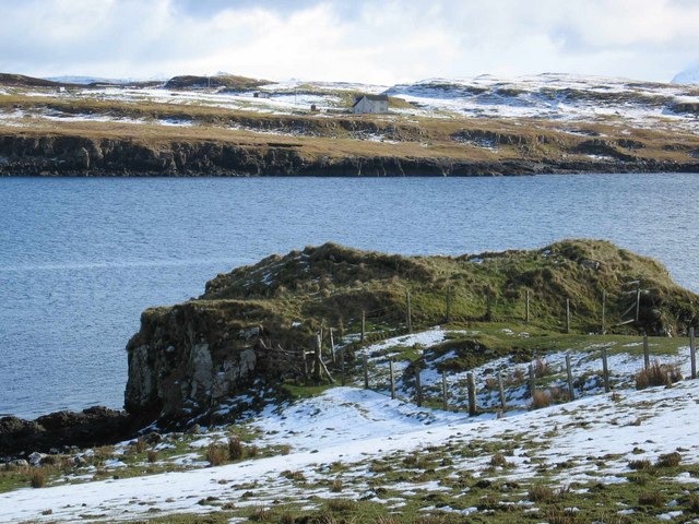
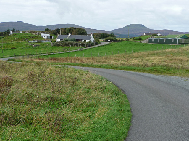
The village is nestled in a valley, surrounded by majestic mountains and rolling hills. It is located along the A832 road, which connects the nearby towns of Dingwall and Gairloch. Achnasheen is approximately 30 miles west of Inverness, the capital of the Highlands.

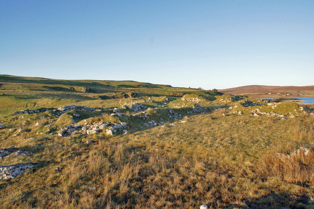
The area is known for its abundance of hiking and walking trails, offering opportunities to explore the rugged landscapes and enjoy breathtaking views. Beinn Eighe, one of Scotland's most iconic mountains, is located nearby and attracts climbers and hikers from around the world.

Achnasheen has a small but welcoming community, with a handful of shops, cafes, and accommodations for visitors. The village is also home to a historic railway station, which was originally built in the 19th century and now serves as a stop on the scenic Kyle Line.

For those interested in history and culture, nearby attractions include the Eilean Donan Castle, the Loch Maree Islands, and the Beinn Eighe National Nature Reserve. Wildlife enthusiasts may also have the chance to spot red deer, golden eagles, and other native species in the surrounding countryside.

In summary, An Cadha Ruadh, Inverness-shire, is a charming village surrounded by stunning natural landscapes, offering a range of outdoor activities and attractions for visitors to enjoy.

If you have any feedback on the listing, please let us know in the comments section below.

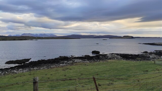
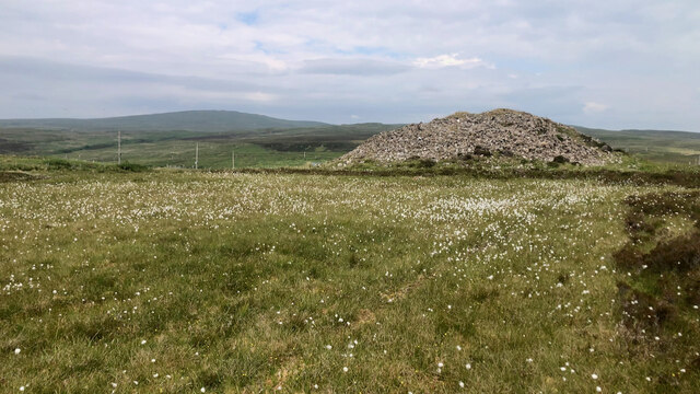
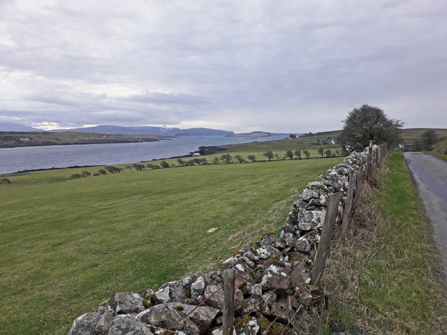
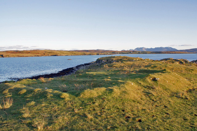
An Cadha Ruadh Images

Images are sourced within 2km of 57.399918/-6.4864928 or Grid Reference NG3043. Thanks to Geograph Open Source API. All images are credited.

Loch Caroy Today, there is just the slightest dusting of snow on the distant Cuillin Hills.
Loch Caroy
Today, there is just the slightest dusting of snow on the distant Cuillin Hills.
A charming white house in windswept moorland overlooking Loch Caroy
Another final battle between the Macdonalds and MacLeods The A863 road to Dunvegan, where it crosses the head of Loch Caroy, is quite speedy and most drivers accelerate to maintain their momentum as they ascend the Harlosh Peninsula. Drivers, therefore, will overlook the two significant stone mounds on the left, situated above the brown moorland. According to tradition, this magnificent location was the site of the final clash between the rival Macdonald and MacLeod clans — not another one. The battle took place in the mist, dyeing the heather a deeper shade of purple with the blood of the clansmen. After the day ended, the bodies of the slain chiefs and warriors were laid to rest here, with the enormous cairns erected as memorials above them. At the turn of the 20th century, the chief of MacLeod attempted to excavate one of the mounds, but the laborious nature of the task, combined with the community’s opposition to disturbing the deceased, led to the abandonment of the project. Additionally, the workers may have feared encountering the powerful ghost known as the “barrow-dweller,” who had often frightened and engaged in single combat with those who robbed ancient Viking graves.

Such is the local legend, but according to modern interpretation, these mounds are chambered cairns from the Neolithic era, predating any recorded clan conflicts. It appears that several smaller cairns can be found scattered across the moor.

For sources see my blog post <span class="nowrap"><a title="http://www.fhithich.uk/?p=32314" rel="nofollow ugc noopener" href="http://www.fhithich.uk/?p=32314">Link</a><img style="margin-left:2px;" alt="External link" title="External link - shift click to open in new window" src="https://s1.geograph.org.uk/img/external.png" width="10" height="10"/></span>
Another final battle between the Macdonalds and MacLeods
The A863 road to Dunvegan, where it crosses the head of Loch Caroy, is quite speedy and most drivers accelerate to maintain their momentum as they ascend the Harlosh Peninsula. Drivers, therefore, will overlook the two significant stone mounds on the left, situated above the brown moorland. According to tradition, this magnificent location was the site of the final clash between the rival Macdonald and MacLeod clans — not another one. The battle took place in the mist, dyeing the heather a deeper shade of purple with the blood of the clansmen. After the day ended, the bodies of the slain chiefs and warriors were laid to rest here, with the enormous cairns erected as memorials above them. At the turn of the 20th century, the chief of MacLeod attempted to excavate one of the mounds, but the laborious nature of the task, combined with the community’s opposition to disturbing the deceased, led to the abandonment of the project. Additionally, the workers may have feared encountering the powerful ghost known as the “barrow-dweller,” who had often frightened and engaged in single combat with those who robbed ancient Viking graves. Such is the local legend, but according to modern interpretation, these mounds are chambered cairns from the Neolithic era, predating any recorded clan conflicts. It appears that several smaller cairns can be found scattered across the moor. For sources see my blog post LinkExternal link
Sheep resting above Crossnish Point A nearby sign warns to 'beware of the bull', but the only livestock here today are these placid-looking sheep. The water is Lach Caroy. The distant Cuillin hills are almost completely obscured by smoke rising from the annual muir burn, when dead grasses and heather are burned off to encourage fresh new growth.
Sheep resting above Crossnish Point
A nearby sign warns to 'beware of the bull', but the only livestock here today are these placid-looking sheep. The water is Lach Caroy. The distant Cuillin hills are almost completely obscured by smoke rising from the annual muir burn, when dead grasses and heather are burned off to encourage fresh new growth.
Long-gone buildings Lumps in the grass are all that now remain of what were once at least two buildings and a wall. Much of the Harlosh peninsula is still valuable grazing land, and still in use as such, though not as many people are working the land today as was the case in the past. There are ruins everywhere, some dating back many hundreds of years.
Long-gone buildings
Lumps in the grass are all that now remain of what were once at least two buildings and a wall. Much of the Harlosh peninsula is still valuable grazing land, and still in use as such, though not as many people are working the land today as was the case in the past. There are ruins everywhere, some dating back many hundreds of years.
Road towards Harlosh This seldom-used road runs through grazing land, and follows the western shore of Loch Caroy.
Road towards Harlosh
This seldom-used road runs through grazing land, and follows the western shore of Loch Caroy.
Feorlig Farm The farmhouse (largely hidden by the trees on the left) was built about eight years ago after the former house, on the same site, was destroyed by fire.
Feorlig Farm
The farmhouse (largely hidden by the trees on the left) was built about eight years ago after the former house, on the same site, was destroyed by fire.
Grazing land at Feorlig There is good grazing land on the western side of Loch Caroy. Today, it is almost entirely sheep which are grazed here, though there have also been a number of cattle here in the recent past.
Grazing land at Feorlig
There is good grazing land on the western side of Loch Caroy. Today, it is almost entirely sheep which are grazed here, though there have also been a number of cattle here in the recent past.
A863 near Upper Feorlig
Grazing land above Loch Caroy The east-facing pastures above Loch Caroy drain well and provide excellent grazing, mostly for sheep, though a few cattle stay here too.
Grazing land above Loch Caroy
The east-facing pastures above Loch Caroy drain well and provide excellent grazing, mostly for sheep, though a few cattle stay here too.
Glen Heysdal Looking north from the single track dead-end road to Upper Feorlig.
Ben Aketil windfarm on the horizon.
Glen Heysdal
Looking north from the single track dead-end road to Upper Feorlig. Ben Aketil windfarm on the horizon.
Moorland track Feolaig to Bhatan, a short hop over the peninsula. Very rough moorland on both sides.
Moorland track
Feolaig to Bhatan, a short hop over the peninsula. Very rough moorland on both sides.
Moorland track, Vatten
A long straight, Altavaid Newly surfaced road, much appreciated.
A long straight, Altavaid
Newly surfaced road, much appreciated.
Moorland, Altavaid
Moorland, Altavaid
Building remains, Crossnish Point Unusually, the Highland Historic Environment Record has no entry for the ruins at Crossnish Point, and yet there are remains of at least eight buildings here, probably dating from two different periods.
This image shows what appear to be the older remains, as very few of the stones which once formed the walls are now visible. There were three structures in this group, all approximately the same size, and about the right shape and size to have been dwellings.
Building remains, Crossnish Point
Unusually, the Highland Historic Environment Record has no entry for the ruins at Crossnish Point, and yet there are remains of at least eight buildings here, probably dating from two different periods. This image shows what appear to be the older remains, as very few of the stones which once formed the walls are now visible. There were three structures in this group, all approximately the same size, and about the right shape and size to have been dwellings.
Ruins at Crossnish Point Unusually, the Highland Historic Environment Record has no entry for the ruins at Crossnish Point, and yet there are remains of at least eight buildings here, probably dating from two different periods.
This image attempts to show part of three rectangular building footprints - all about the same size, and the right shape and size to have been dwellings - though they are unusually close to each other. There are two smaller squarer footprints in the group. 
Same ruins, different angle: <a href="https://www.geograph.org.uk/photo/6315906">NG2941 : Ruins at Crossnish Point</a>.
Ruins at Crossnish Point
Unusually, the Highland Historic Environment Record has no entry for the ruins at Crossnish Point, and yet there are remains of at least eight buildings here, probably dating from two different periods. This image attempts to show part of three rectangular building footprints - all about the same size, and the right shape and size to have been dwellings - though they are unusually close to each other. There are two smaller squarer footprints in the group. Same ruins, different angle: NG2941 : Ruins at Crossnish Point.
Ruins at Crossnish Point Unusually, the Highland Historic Environment Record has no entry for the ruins at Crossnish Point, and yet there are remains of at least eight buildings here, probably dating from two different periods.
This image looks west over footprints of part of the group of five structures, three of which are the right shape and size to have been dwellings.
Same ruins, different angle: <a href="https://www.geograph.org.uk/photo/6315905">NG2941 : Ruins at Crossnish Point</a>.
Ruins at Crossnish Point
Unusually, the Highland Historic Environment Record has no entry for the ruins at Crossnish Point, and yet there are remains of at least eight buildings here, probably dating from two different periods. This image looks west over footprints of part of the group of five structures, three of which are the right shape and size to have been dwellings. Same ruins, different angle: NG2941 : Ruins at Crossnish Point.
Show me another place!

An Cadha Ruadh is located at Grid Ref: NG3043 (Lat: 57.399918, Lng: -6.4864928)

Unitary Authority: Highland

Police Authority: Highlands and Islands

Also known as: Caroy

What 3 Words

///cabbages.weeps.format. Near Dunvegan, Highland

Related Wikis

Feorlig

Feorlig (Scottish Gaelic: Feòirlig) is a small crofting settlement on the northwest shore of Loch Caroy near Dunvegan on the Isle of Skye in the Highlands...

Vatten, Skye

Vatten is a hamlet 3 miles (4.8 km) south east of Dunvegan, on the eastern shore of Loch Vatten, on the Isle of Skye, in the council area of Highland,...

Harlosh

Harlosh (Scottish Gaelic: Heàrrlois) is a settlement on the island of Skye off the west coast of Scotland. The settlement is on a peninsula of the same...

Ose, Skye

Ose (Scottish Gaelic: Òs) is a small coastal settlement of Loch Bracadale, in the Scottish Highland area. It lies on the west coast of the Isle of Skye...

Nearby Amenities

Located within 500m of 57.399918,-6.4864928
Source: PGS
Lat/Long: 57.3982229/-6.4942113
Source: PGS
Lat/Long: 57.3985573/-6.4939648
Source: PGS
Lat/Long: 57.3997273/-6.4938541
Source: PGS
Lat/Long: 57.4003555/-6.4937602
Source: PGS
Lat/Long: 57.4009095/-6.4939281
Source: PGS
Lat/Long: 57.40383/-6.4891583
Source: PGS
Lat/Long: 57.4034861/-6.4885476
Source: PGS
Lat/Long: 57.4030255/-6.4883201
Source: PGS
Lat/Long: 57.4018227/-6.4886034
Created By: dmgroom_coastlines
Source: PGS
Lat/Long: 57.40145/-6.48833
Created By: dmgroom_coastlines
Source: PGS
Lat/Long: 57.40094/-6.48837
Created By: dmgroom_coastlines
Source: PGS
Lat/Long: 57.39991/-6.48796
Source: PGS
Lat/Long: 57.3996158/-6.487979
Source: PGS
Lat/Long: 57.3993689/-6.4877419
Created By: dmgroom_coastlines
Source: PGS
Lat/Long: 57.39912/-6.48754
Created By: dmgroom_coastlines
Source: PGS
Lat/Long: 57.39862/-6.48758
Created By: dmgroom_coastlines
Source: PGS
Lat/Long: 57.3981/-6.48761
Source: PGS
Lat/Long: 57.3977111/-6.4874876
Source: PGS
Lat/Long: 57.3973544/-6.4870563
Source: PGS
Lat/Long: 57.3971058/-6.4868589
Source: PGS
Lat/Long: 57.3969994/-6.4865681
Source: PGS
Lat/Long: 57.3969665/-6.4862463
Source: PGS
Lat/Long: 57.3968543/-6.4852731
Source: PGS
Lat/Long: 57.396774/-6.4840372
Source: PGS
Lat/Long: 57.3965/-6.4833398
Source: PGS
Lat/Long: 57.3959363/-6.4829976
Parking
Parking: lane
Source: survey
Lat/Long: 57.4033279/-6.4877651
Parking
Source: survey
Lat/Long: 57.4040482/-6.4878078
Post Box
Post Box Type: lamp
Ref: IV56 87
Royal Cypher: scottish_crown
Source: survey
Lat/Long: 57.3975377/-6.4812159
Power: pole
Lat/Long: 57.3999565/-6.4845246
Power: pole
Lat/Long: 57.400445/-6.4847606
Power: pole
Lat/Long: 57.400864/-6.4850557
Power: pole
Lat/Long: 57.4015389/-6.4854312
Power: pole
Lat/Long: 57.4021964/-6.4858174
Power: pole
Lat/Long: 57.4027642/-6.486142
Power: pole
Lat/Long: 57.4033697/-6.4864853
Power: pole
Lat/Long: 57.4039693/-6.4868259
Power: pole
Lat/Long: 57.3997102/-6.4836404
Power: pole
Lat/Long: 57.3993924/-6.4826943
Power: pole
Lat/Long: 57.3991679/-6.4819757
Power: pole
Lat/Long: 57.3988512/-6.4810034
Power: pole
Lat/Long: 57.3985031/-6.4799386
The data included in this document is from www.openstreetmap.org. The data is made available under ODbL.

Have you been to An Cadha Ruadh?

Leave your review of An Cadha Ruadh below (or comments, questions and feedback).