Camastianavaig

Settlement in Inverness-shire

Scotland

Camastianavaig

Eastern flank of Ben Tianavaig Looking north from just below the summit. 
The cruise ship Silver Whisper is anchored outside Portree harbour.
Eastern flank of Ben Tianavaig Credit: Ian Taylor

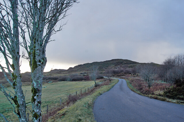
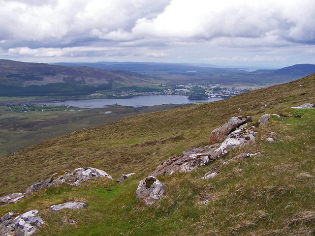
Camastianavaig is a small village located in the Inverness-shire region of Scotland. Situated on the eastern coast of the Isle of Skye, this picturesque settlement is known for its stunning natural beauty and tranquil surroundings.

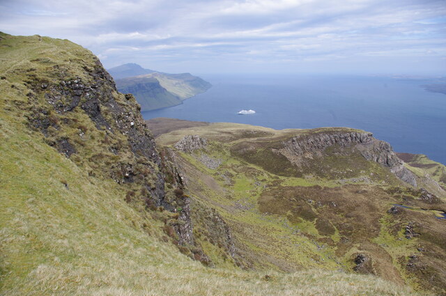
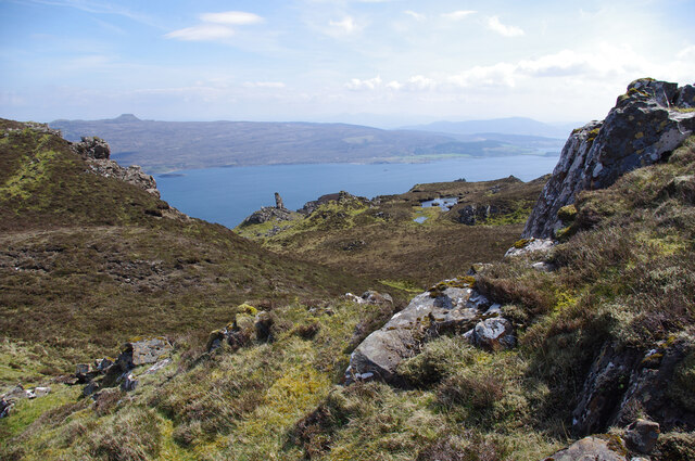
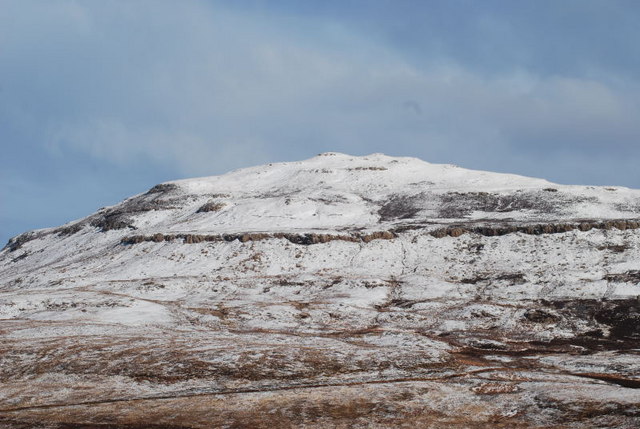
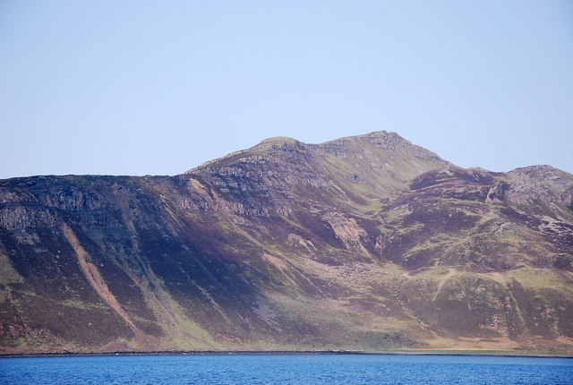
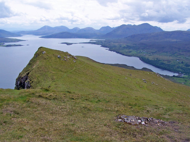
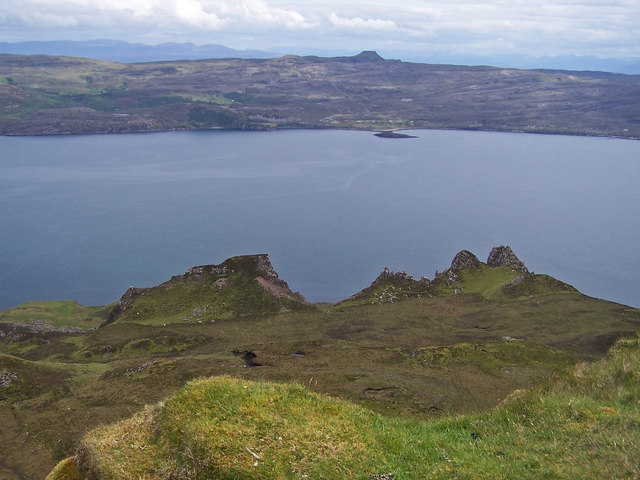
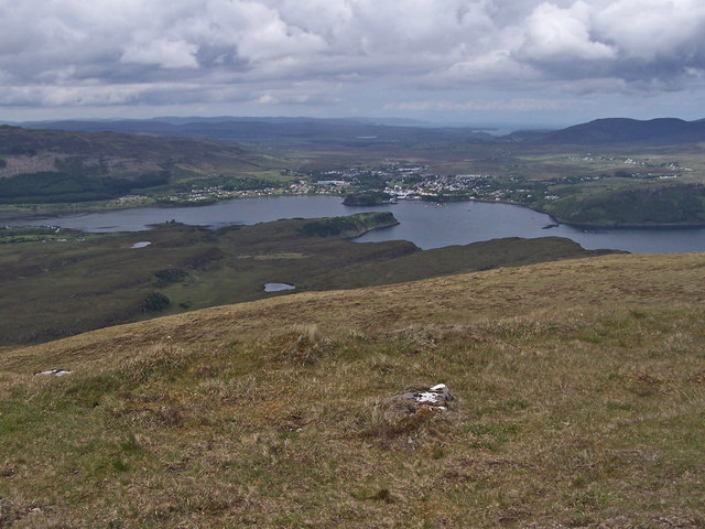
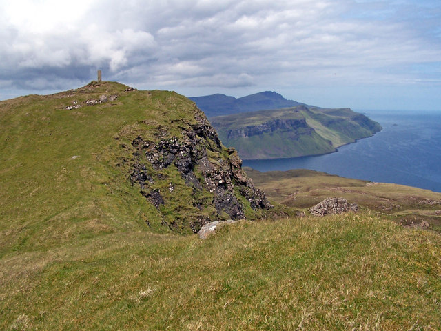
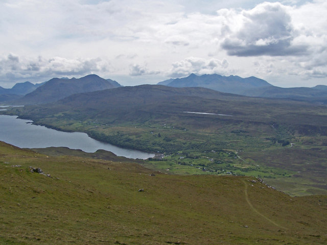
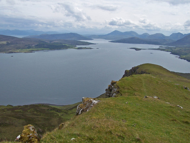
The village is nestled between the rolling hills of the Trotternish Peninsula and the crystal-clear waters of the Sound of Raasay. Its unique location offers breathtaking views of the surrounding landscapes, including the majestic Cuillin Mountains and the peaceful Loch Eyre.

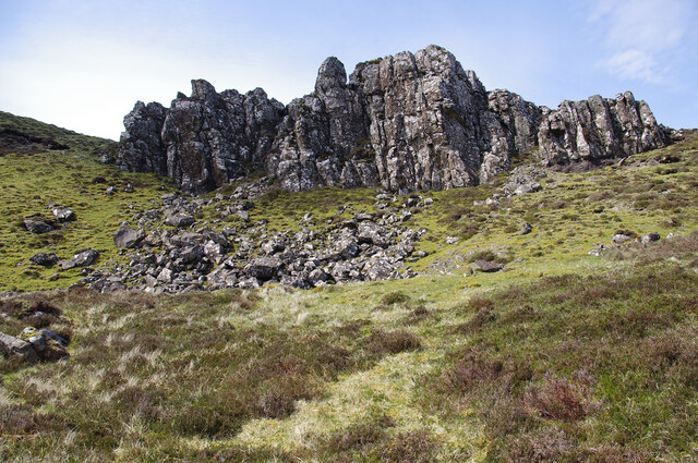
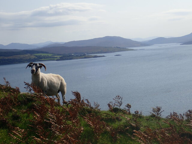
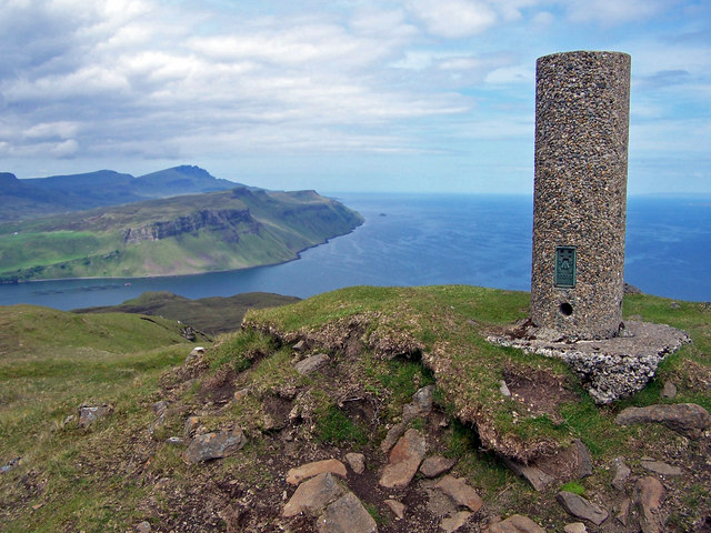
Camastianavaig is a popular destination for nature lovers and outdoor enthusiasts. The area boasts numerous walking trails and hiking routes, allowing visitors to explore the rugged coastline and discover hidden gems such as the enchanting Fairy Glen and the dramatic cliffs of the Quiraing.

The village itself is small and quaint, with a handful of traditional stone cottages and a charming local pub. The community is close-knit and welcoming, making it an ideal place for those seeking a peaceful retreat away from the hustle and bustle of city life.

In terms of amenities, Camastianavaig is relatively limited, with no major shops or supermarkets. However, nearby towns such as Portree offer a wider range of services and facilities, including grocery stores, restaurants, and accommodation options.

Overall, Camastianavaig is a haven for nature enthusiasts, offering stunning vistas, peaceful surroundings, and a chance to immerse oneself in the beauty of the Scottish Highlands.

If you have any feedback on the listing, please let us know in the comments section below.

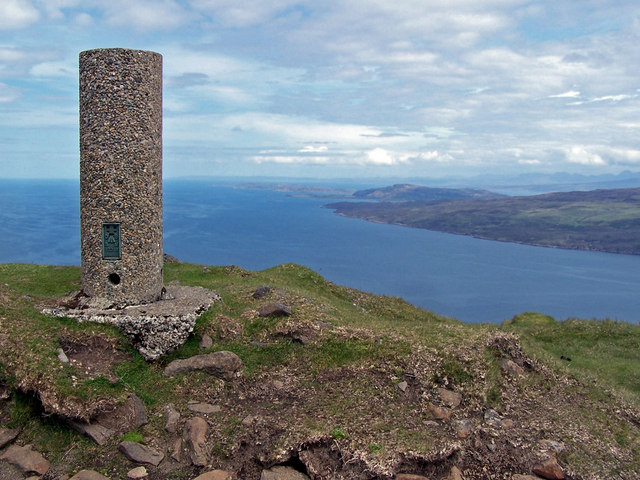
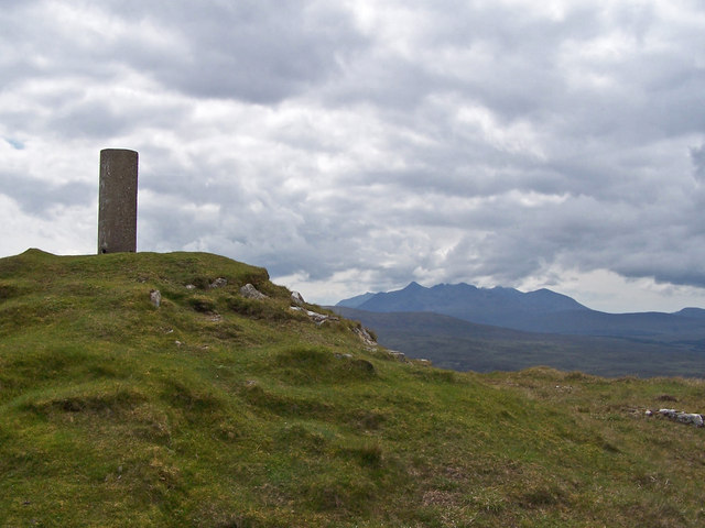
Camastianavaig Images

Images are sourced within 2km of 57.377637/-6.149407 or Grid Reference NG5039. Thanks to Geograph Open Source API. All images are credited.

Eastern flank of Ben Tianavaig Looking north from just below the summit. 
The cruise ship Silver Whisper is anchored outside Portree harbour.
Eastern flank of Ben Tianavaig
Looking north from just below the summit. The cruise ship Silver Whisper is anchored outside Portree harbour.
Eastern flank of Ben Tianavaig Looking south from NE of the summit. 
Raasay is in the background, across the Sound of Raasay, with Dun Caan on the left.
Eastern flank of Ben Tianavaig
Looking south from NE of the summit. Raasay is in the background, across the Sound of Raasay, with Dun Caan on the left.
Crag, Ben Tianavaig NE of the summit.
Crag, Ben Tianavaig
NE of the summit.
Southern end of Ben Tianavaig ridge The steep ground gives an excellent view over Tianavaig Bay to the red hills.
Southern end of Ben Tianavaig ridge
The steep ground gives an excellent view over Tianavaig Bay to the red hills.
Back from Ben Tianavaig summit
Bends in the Braes road Here, looking south towards the end of a craggy outcrop which rises above the road for the next mile or so.
Bends in the Braes road
Here, looking south towards the end of a craggy outcrop which rises above the road for the next mile or so.
Ben Tianavaig Dressed in its winter coat!
Ben Tianavaig
Dressed in its winter coat!
An Ceann Dubh On Ben Tianavaig's south ridge is a band of high black east facing cliffs, which are better appreciated at a distance
An Ceann Dubh
On Ben Tianavaig's south ridge is a band of high black east facing cliffs, which are better appreciated at a distance
Summit of Ben Tianavaig Looking north past the trig point. The highest point in the background is The Storr.
Summit of Ben Tianavaig
Looking north past the trig point. The highest point in the background is The Storr.
Summit of Ben Tianavaig Looking north east past the summit trig point with the north of the island of Raasay on the right.
Summit of Ben Tianavaig
Looking north east past the summit trig point with the north of the island of Raasay on the right.
South from Ben Tianavaig This view is taken from the summit looking south down the ridge of the hill, which is the most commonly used route to the top.
South from Ben Tianavaig
This view is taken from the summit looking south down the ridge of the hill, which is the most commonly used route to the top.
From Ben Tianavaig towards Raasay A view east from the summit of the hill, looking over the impressive landslip blocks and pinnacles on the east side of the hill. The water is the Narrows of Raasay. Beyond is the island of Raasay, topped by the flat topped Dun Caan, with summit in <a href="https://www.geograph.org.uk/gridref/NG5739">NG5739</a>.
From Ben Tianavaig towards Raasay
A view east from the summit of the hill, looking over the impressive landslip blocks and pinnacles on the east side of the hill. The water is the Narrows of Raasay. Beyond is the island of Raasay, topped by the flat topped Dun Caan, with summit in NG5739.
From Ben Tianavaig to Portree A view from the summit of Ben Tianavaig towards Portree.
From Ben Tianavaig to Portree
A view from the summit of Ben Tianavaig towards Portree.
Summit of Ben Tianavaig A grass clad summit, topped with a 'Vanessa' trig point. Views in all directions are spectacular. Here, the black Cuillin lie on the horizon.
Summit of Ben Tianavaig
A grass clad summit, topped with a 'Vanessa' trig point. Views in all directions are spectacular. Here, the black Cuillin lie on the horizon.
Summit of Ben Tianavaig The summit is topped with a 'Vanessa' style trig point. This view is looking north.
Summit of Ben Tianavaig
The summit is topped with a 'Vanessa' style trig point. This view is looking north.
Looking down Ben Tianavaig The upper part of the hill is covered in short grass, and a complete lack of burns or boggy areas make the going easy (if a bit steep in places)! At the foot of the hill is the township of Camastianavaig. The Cuillin Hills line up along the horizon, Red to the left, Black to the right.
Looking down Ben Tianavaig
The upper part of the hill is covered in short grass, and a complete lack of burns or boggy areas make the going easy (if a bit steep in places)! At the foot of the hill is the township of Camastianavaig. The Cuillin Hills line up along the horizon, Red to the left, Black to the right.
Over the edge of Ben Tianavaig The hill has a very steep western face and a rather more gently sloping eastern side. The most popular route to the summit is up the edge of the grassy ridge seen here. The water below is the Narrows of Raasay, with the island of Raasay to the left.
Over the edge of Ben Tianavaig
The hill has a very steep western face and a rather more gently sloping eastern side. The most popular route to the summit is up the edge of the grassy ridge seen here. The water below is the Narrows of Raasay, with the island of Raasay to the left.
Towards Portree from Ben Tianavaig Ben Tianavaig is much photographed by visitors to Portree. Here is a shot the other way round. The upper part of the hill is covered with short grass, making for easy walking.
Towards Portree from Ben Tianavaig
Ben Tianavaig is much photographed by visitors to Portree. Here is a shot the other way round. The upper part of the hill is covered with short grass, making for easy walking.
Show me another place!

Camastianavaig is located at Grid Ref: NG5039 (Lat: 57.377637, Lng: -6.149407)

Unitary Authority: Highland

Police Authority: Highlands and Islands

Also known as: Camas Tianabhaig

What 3 Words

///dynamic.hiking.couriers. Near Portree, Highland

Related Wikis

Camastianavaig

Camustianavaig (also English spelling: Camustinivaig) is a crofting township on the island of Skye in Scotland. It is located on the shores of the Sound...

Ben Tianavaig

Ben Tianavaig is a hill located on the Isle of Skye, near Portree . It is very prominent from Portree dominating the view from the harbour. It is a Marilyn...

Ollach

Ollach (in Scottish Gaelic, An t-Olach) is a remote settlement, made up of Lower Ollach and Upper Ollach, lying on B883 road, south of Portree, Isle of...
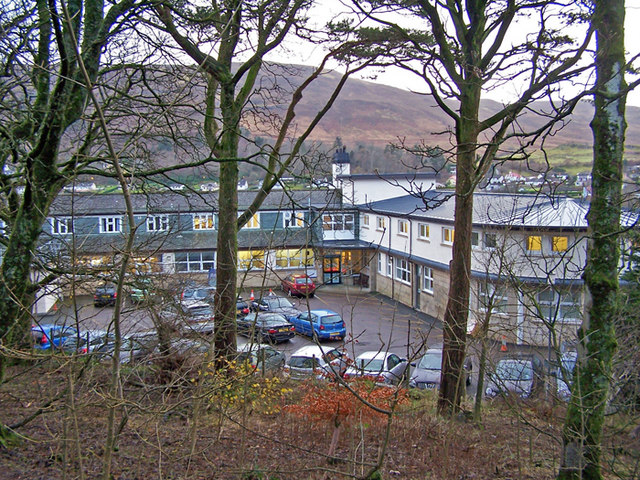
Portree Hospital

The Portree Hospital is a health facility in Fancyhill, Portree on the Isle of Skye. It is managed by NHS Highland. == History == The facility, which was...

Nearby Amenities

Located within 500m of 57.377637,-6.149407
Barrier: cattle_grid
Source: survey
Lat/Long: 57.3759723/-6.1523118
Camustianavaig
Alt Name: Camastianavaig;Camustinivaig
Name Gd: Camas Dìonabhaig
Place: village
Wikidata: Q2372721
Wikipedia: en:Camastianavaig
Lat/Long: 57.3743217/-6.1486111
Place: farm
Lat/Long: 57.3765765/-6.1480486
Power: pole
Lat/Long: 57.3742647/-6.1457224
Power: pole
Lat/Long: 57.3746022/-6.1464546
Power: pole
Lat/Long: 57.3736918/-6.149526
Power: pole
Lat/Long: 57.3745621/-6.1501868
Power: pole
Lat/Long: 57.3752841/-6.1507269
Power: pole
Lat/Long: 57.375405/-6.152462
Power: pole
Lat/Long: 57.3753705/-6.153935
Power: pole
Lat/Long: 57.3753359/-6.1556614
The data included in this document is from www.openstreetmap.org. The data is made available under ODbL.

Have you been to Camastianavaig?

Leave your review of Camastianavaig below (or comments, questions and feedback).