An Cladach

Settlement in Argyllshire

Scotland

An Cladach

Keppochan Trigpoint TP4169 - Keppochan

<span class="nowrap"><a title="https://trigpointing.uk/trig/4169" rel="nofollow ugc noopener" href="https://trigpointing.uk/trig/4169">Link</a><img style="margin-left:2px;" alt="External link" title="External link - shift click to open in new window" src="https://s1.geograph.org.uk/img/external.png" width="10" height="10"/></span>
Keppochan Trigpoint Credit: Brian Deegan

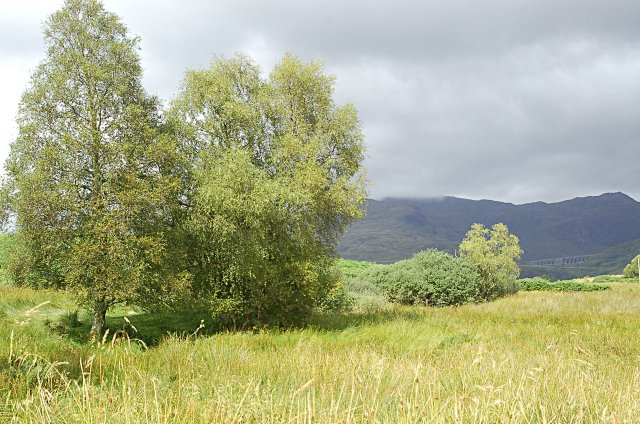
An Cladach is a picturesque coastal village located in Argyllshire, Scotland. Situated on the west coast of Scotland, it is nestled between the charming seaside towns of Oban and Fort William. The village is known for its stunning natural beauty, with breathtaking views of the surrounding mountains and the tranquil waters of Loch Linnhe.

The main attraction of An Cladach is its pristine sandy beach, which stretches for miles along the coastline. This idyllic beach offers visitors the perfect spot to relax, sunbathe, and enjoy a leisurely stroll along the shore. The crystal-clear waters of the loch are also ideal for swimming and various water sports activities.

The village itself is small but charming, with a close-knit community that warmly welcomes visitors. There are a few local shops and cafes, where visitors can indulge in delicious seafood dishes and traditional Scottish cuisine. The area is also home to some quaint guesthouses and holiday cottages, providing accommodation options for those looking to immerse themselves in the peaceful surroundings.

An Cladach is a haven for nature lovers, with ample opportunities for hiking, cycling, and wildlife spotting. The nearby Glen Coe, known for its dramatic landscapes and stunning hiking trails, is a popular day trip destination. Additionally, the village is a great base for exploring the nearby islands, such as Mull and Skye.

Overall, An Cladach offers a serene and unspoiled Scottish coastal experience, with its natural beauty and warm community making it a must-visit destination for those seeking tranquility and breathtaking scenery.

If you have any feedback on the listing, please let us know in the comments section below.
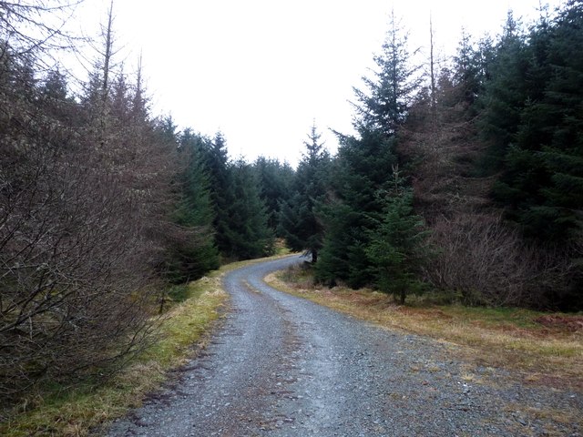
An Cladach Images

Images are sourced within 2km of 56.350623/-5.081819 or Grid Reference NN0921. Thanks to Geograph Open Source API. All images are credited.

Keppochan Trigpoint TP4169 - Keppochan

<span class="nowrap"><a title="https://trigpointing.uk/trig/4169" rel="nofollow ugc noopener" href="https://trigpointing.uk/trig/4169">Link</a><img style="margin-left:2px;" alt="External link" title="External link - shift click to open in new window" src="https://s1.geograph.org.uk/img/external.png" width="10" height="10"/></span>
Keppochan Trigpoint
TP4169 - Keppochan LinkExternal link
Typical forestry road near Claddich
Two great pines dominate the bottom of the road A sharp bend on the minor road near Keppochan.
Two great pines dominate the bottom of the road
A sharp bend on the minor road near Keppochan.
Cladich turning from A819 north
Bend towards Cladich Bridge A819 north
Bend towards Cladich Bridge
A819 north
B840 junction with A819 At Cladich
B840 junction with A819
At Cladich
B840 junction with A819
A819 near Cladich
A819 near Cladich
Wooded valley near Cladich
Lay-by on the A819 from Dalmally to Inveraray
A819 descending near Cladich
B840 near Cladich
B840 near Cladich
B840 and bridge over Archan River
An Old Road Sign Near Cladich Common sense information from a bygone era!
An Old Road Sign Near Cladich
Common sense information from a bygone era!
From the A810 near Cladich A little snow on the tops of the Cruachan range in the distance.
From the A810 near Cladich
A little snow on the tops of the Cruachan range in the distance.
A819, Bridge over Cladich River The A819 runs for approximately 14½ miles forming a connection between the A83 and A85 trunk roads. The road is still largely as it was constructed during the 1930s, partly following the course of an old military road, and as such it is lined with mile stones.
A819, Bridge over Cladich River
The A819 runs for approximately 14½ miles forming a connection between the A83 and A85 trunk roads. The road is still largely as it was constructed during the 1930s, partly following the course of an old military road, and as such it is lined with mile stones.
A819 near Cladich The A819 runs for approximately 14½ miles forming a connection between the A83 and A85 trunk roads. The road is still largely as it was constructed during the 1930s, partly following the course of an old military road, and as such it is lined with mile stones.
A819 near Cladich
The A819 runs for approximately 14½ miles forming a connection between the A83 and A85 trunk roads. The road is still largely as it was constructed during the 1930s, partly following the course of an old military road, and as such it is lined with mile stones.
Layby on the A819 near Cladich The A819 runs for approximately 14½ miles forming a connection between the A83 and A85 trunk roads. The road is still largely as it was constructed during the 1930s, partly following the course of an old military road, and as such it is lined with mile stones.
Layby on the A819 near Cladich
The A819 runs for approximately 14½ miles forming a connection between the A83 and A85 trunk roads. The road is still largely as it was constructed during the 1930s, partly following the course of an old military road, and as such it is lined with mile stones.
Show me another place!

An Cladach is located at Grid Ref: NN0921 (Lat: 56.350623, Lng: -5.081819)

Unitary Authority: Argyll and Bute

Police Authority: Argyll and West Dunbartonshire

Also known as: Cladich

What 3 Words

///overheard.dives.contacts. Near Inveraray, Argyll & Bute

Nearby Locations

Cladich An Cladach

Related Wikis

Cladich

Cladich (Scottish Gaelic: An Cladach) is a scattered settlement in Argyll, Scotland. Cladich lies on the B840 road just to the west of its junction with...

Chapel of St Fyndoca

The Chapel of St Fyndoca (alternate: Fyndoc, or Findoc) is located on the island of Inishail in Loch Awe, Argyll and Bute, Scotland. It was the parish...

Inishail

Inishail (alternate Inchald) is an island and former parish, in Loch Awe, Scotland. == Geography == The island lies at the north end of the loch in the...

Ardanaiseig

Ardanaiseig (Scottish Gaelic: Àird an Aiseig) is a settlement on Loch Awe, Argyll and Bute, Scotland. Loch Awe is one of Scotland's longest freshwater...

Nearby Amenities

Located within 500m of 56.350623,-5.081819
Power: pole
Source: OS7
Lat/Long: 56.3519941/-5.0795441
Telephone
Defibrillator
Booth: K6
Covered: booth
Defibrillator Location: inside old red phone box in Cladich
Emergency: defibrillator
Man Made: telephone_box
Lat/Long: 56.3527864/-5.0819762
Post Box
Post Box Type: lamp
Ref: PA33 57
Royal Cypher: scottish_crown
Lat/Long: 56.3527626/-5.0820191
Bus Stop
Cladich, At Road End On A819
Lat/Long: 56.3546053/-5.0783229
Bus Stop
Cladich, Opp Road End On A819
Lat/Long: 56.3544211/-5.0777006
Power: pole
Lat/Long: 56.3513819/-5.0765929
Power: pole
Lat/Long: 56.3516925/-5.0780922
Power: pole
Lat/Long: 56.3519957/-5.0743827
Power: pole
Lat/Long: 56.3511114/-5.075292
Power: pole
Lat/Long: 56.350395/-5.0760779
Power: pole
Lat/Long: 56.3494215/-5.0770596
Power: pole
Lat/Long: 56.3481909/-5.0779715
Cladich
Place: hamlet
Wikidata: Q5124925
Wikipedia: en:Cladich
Lat/Long: 56.3520789/-5.0818956
The data included in this document is from www.openstreetmap.org. The data is made available under ODbL.

Have you been to An Cladach?

Leave your review of An Cladach below (or comments, questions and feedback).