An Càrn Bàn

Settlement in Argyllshire

Scotland

An Càrn Bàn

Low-lying land with regenerating woodland beside Crinan Canal The rough moorland lies between the canal and the route of the A816 which has the Badden Burn alongside it, presumably with its course somewhat realigned. Near to the camera and mainly out of view to the right, there's regenerating woodland.
Low-lying land with regenerating woodland beside Crinan Canal Credit: Trevor Littlewood

An Càrn Bàn is a small village located in Argyllshire, Scotland. Situated in the stunning scenery of the Scottish Highlands, this picturesque village is known for its natural beauty and tranquil atmosphere. With a population of around 300, An Càrn Bàn offers a peaceful retreat away from the hustle and bustle of city life.

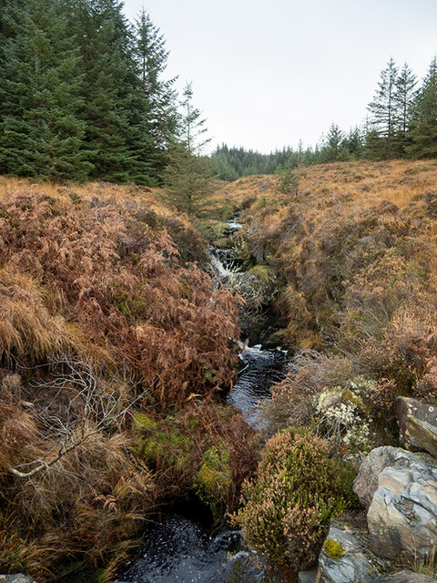
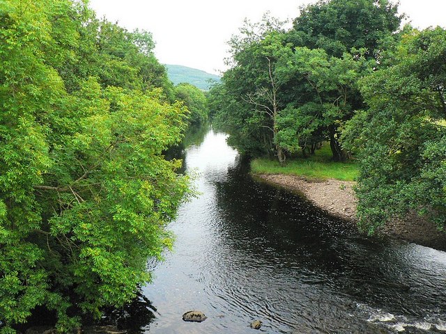
Surrounded by rolling hills and lush greenery, the village is renowned for its stunning landscape. The nearby Loch Linnhe adds to the charm of the area, providing opportunities for fishing and boating. The village is also a popular destination for hikers, with several scenic trails leading to breathtaking viewpoints and cascading waterfalls.

Despite its small size, An Càrn Bàn has a close-knit community that takes pride in preserving its rich cultural heritage. The village is home to several historic buildings, including a charming 19th-century church and a traditional Scottish pub that serves local cuisine and brews.

Visitors to An Càrn Bàn can enjoy a range of outdoor activities, such as hiking, biking, and birdwatching. The area is also known for its abundant wildlife, including red deer, otters, and various bird species. For those seeking a more relaxed experience, the village offers cozy accommodations and stunning views of the surrounding mountains.

In conclusion, An Càrn Bàn is a serene village nestled in the beautiful landscape of Argyllshire. With its natural beauty, friendly community, and range of outdoor activities, it is a perfect destination for nature lovers and those seeking a peaceful retreat in the Scottish Highlands.

If you have any feedback on the listing, please let us know in the comments section below.

An Càrn Bàn Images

Images are sourced within 2km of 56.060318/-5.48582 or Grid Reference NR8390. Thanks to Geograph Open Source API. All images are credited.

Low-lying land with regenerating woodland beside Crinan Canal The rough moorland lies between the canal and the route of the A816 which has the Badden Burn alongside it, presumably with its course somewhat realigned. Near to the camera and mainly out of view to the right, there's regenerating woodland.
Low-lying land with regenerating woodland beside Crinan Canal
The rough moorland lies between the canal and the route of the A816 which has the Badden Burn alongside it, presumably with its course somewhat realigned. Near to the camera and mainly out of view to the right, there's regenerating woodland.
Quarry in Knapdale Forest
Forest road in Knapdale Forest
Felling in Knapdale Forest Looking out towards Moine Mhor and Loch Crinan.
Felling in Knapdale Forest
Looking out towards Moine Mhor and Loch Crinan.
Burn in Knapdale Forest Looking upstream.
Burn in Knapdale Forest
Looking upstream.
Autumnal larches in Knapdale Forest
Burn in Knapdale Forest Looking downstream.
Burn in Knapdale Forest
Looking downstream.
Stacked logs These seem to be old, and may have been abandoned.
Stacked logs
These seem to be old, and may have been abandoned.
End of the logging road In Knapdale Forest.
End of the logging road
In Knapdale Forest.
Three phases of forestry in Knapdale Forest Clear fell, recent planting and mature trees can be seen.
Three phases of forestry in Knapdale Forest
Clear fell, recent planting and mature trees can be seen.
Forest roads in Knapdale Forest The sharp hairpin to the left necessitates a turning loop for log lorries.
Forest roads in Knapdale Forest
The sharp hairpin to the left necessitates a turning loop for log lorries.
Daill Loch West In low water conditions.
Daill Loch West
In low water conditions.
Crinan Canal above Dunardry Locks For small enough ships, the Crinan Canal cuts out the long (and potentially rough and exposed) journey round Kintyre. Boats as big as a Clyde Puffer have made it through (though not when heavily loaded), but mostly it is used by small yachts and cruisers. Compared with the open sea, you stand less chance of getting lost (or wrecked) in poor visibility (cloudbase was getting close to sea level on the evening this photo was taken) and there are none of the strong tides that characterise the Sound of Jura to the west.
Crinan Canal above Dunardry Locks
For small enough ships, the Crinan Canal cuts out the long (and potentially rough and exposed) journey round Kintyre. Boats as big as a Clyde Puffer have made it through (though not when heavily loaded), but mostly it is used by small yachts and cruisers. Compared with the open sea, you stand less chance of getting lost (or wrecked) in poor visibility (cloudbase was getting close to sea level on the evening this photo was taken) and there are none of the strong tides that characterise the Sound of Jura to the west.
House at Cairnbaan by Lock 6 Adorned by a prolifically blooming climbing rose, this is one of several attractive houses along the north bank of the Crinan Canal at Cairnbaan. It sits directly next to lock number six (the numbering runs from the Ardrishaig end, and lock eight is the highest lock on the eastern side of the watershed). The narrow road with passing places serves only properties north of the canal - the main road (a little wider) lies on the south bank.
House at Cairnbaan by Lock 6
Adorned by a prolifically blooming climbing rose, this is one of several attractive houses along the north bank of the Crinan Canal at Cairnbaan. It sits directly next to lock number six (the numbering runs from the Ardrishaig end, and lock eight is the highest lock on the eastern side of the watershed). The narrow road with passing places serves only properties north of the canal - the main road (a little wider) lies on the south bank.
Sign on the Dalriada Heritage Trail The footpath leading from the west side of Loch a'Bharain by the Crinan Canal is signed as part of the Dalriada Heritage Trail, with the destination of Dunadd. For part of the way it uses a forest track, but quickly ducks off into the trees again at this junction. Although it crosses quite a lot of boggy ground, one can keep dryshod owing to a lot of work having been done to add boardwalks over the wettest (and most fragile) soils. The signage is also useful as the views remain pretty restricted within the forest and otherwise you get little feel for what direction you are headed or whether still on the right route.
Sign on the Dalriada Heritage Trail
The footpath leading from the west side of Loch a'Bharain by the Crinan Canal is signed as part of the Dalriada Heritage Trail, with the destination of Dunadd. For part of the way it uses a forest track, but quickly ducks off into the trees again at this junction. Although it crosses quite a lot of boggy ground, one can keep dryshod owing to a lot of work having been done to add boardwalks over the wettest (and most fragile) soils. The signage is also useful as the views remain pretty restricted within the forest and otherwise you get little feel for what direction you are headed or whether still on the right route.
Show me another place!

An Càrn Bàn is located at Grid Ref: NR8390 (Lat: 56.060318, Lng: -5.48582)

Unitary Authority: Argyll and Bute

Police Authority: Argyll and West Dunbartonshire

Also known as: Cairnbaan

What 3 Words

///crop.discussed.wiser. Near Lochgilphead, Argyll & Bute

Nearby Locations

Cairnbaan An Càrn Bàn

Related Wikis

Cairnbaan

Cairnbaan (Scottish Gaelic: An Càrn Bàn) is a village situated on the Crinan Canal, in Argyll and Bute, western Scotland. Cairnbaan is about halfway between...
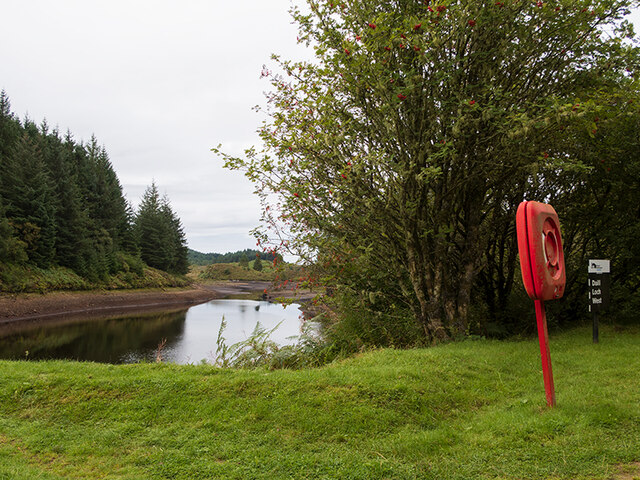
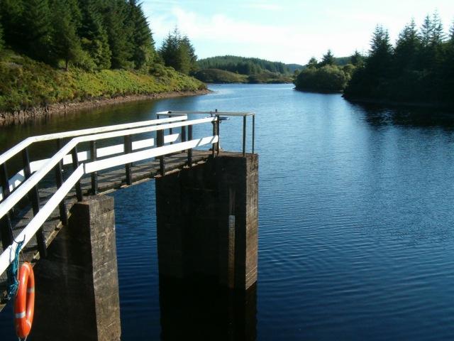
Loch A' Bharain

Loch A' Bharain (the Baron's Loch) is an impounding reservoir in Scotland. Loch A' Bharain directly sits on the north bank of the Crinan Canal beside lock...
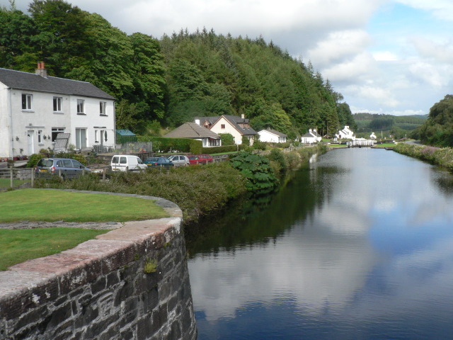
Crinan Canal

The Crinan Canal between Crinan and Ardrishaig in Argyll and Bute in the west of Scotland is operated by Scottish Canals. The canal, which opened in 1801...

Daill Loch

Daill Loch is an impounding reservoir located 5 kilometres (3.1 mi) west north west of Lochgilphead and 1.5 kilometres (0.93 mi) south of the Crinan Canal...
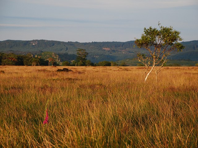
Moine Mhòr

Moine Mhòr ("Great Moss" in Scottish Gaelic) encompasses a large area of raised bog in the Kilmartin Glen area of Argyll and Bute, Scotland. As well as...
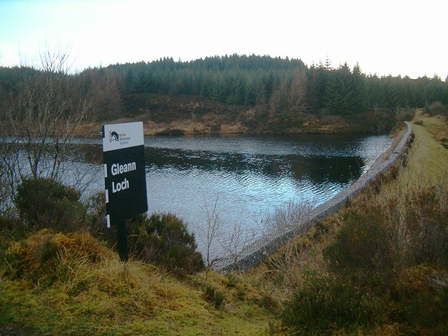
Gleann Loch

The loch runs south west to north east and is an impounding reservoir located to the west of Lochgilphead, Scotland. It is one of a number of lochs supplying...

River Add

The River Add (Scottish Gaelic: Abhainn Àd) is a river which runs through Argyll and Bute on the West of Scotland. Historically, it was known as the river...
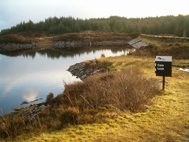
Cam Loch

Cam Loch (the Crooked Loch) is one of a number of water supply sources for the Crinan Canal. The impounding reservoir lies to the south of the canal and...

Nearby Amenities

Located within 500m of 56.060318,-5.48582
Waterway: lock_gate
Lat/Long: 56.0606418/-5.4787329
Seamark Type: gate
Waterway: lock_gate
Lat/Long: 56.0605029/-5.4824094
Waterway: lock_gate
Lat/Long: 56.0606346/-5.4791844
Waterway: lock_gate
Lat/Long: 56.0605114/-5.48194
Fixme: track continues southeast (visible on Bing, unsurveyed)
Lat/Long: 56.0638881/-5.4905891
Bus Stop
Cairnbaan, B841
Naptan AtcoCode: 60707302
Naptan NaptanCode: 54734968
Lat/Long: 56.0603004/-5.4821057
Bus Stop
Cairnbaan, B841
Bus: yes
Naptan AtcoCode: 60709302
Naptan NaptanCode: 54723529
Public Transport: platform
Shelter: yes
Lat/Long: 56.0604085/-5.4822418
Power: pole
Lat/Long: 56.0626967/-5.4820183
Power: pole
Lat/Long: 56.0626239/-5.4832613
Power: pole
Lat/Long: 56.0641842/-5.4880223
Power: pole
Lat/Long: 56.062569/-5.4822276
Power: pole
Lat/Long: 56.0625659/-5.4833297
Power: pole
Lat/Long: 56.0639048/-5.4875082
Post Box
Lat/Long: 56.0602113/-5.4856846
Power: pole
Lat/Long: 56.0585605/-5.4857627
Power: pole
Lat/Long: 56.0587297/-5.4870908
Power: pole
Lat/Long: 56.0588306/-5.4849656
Power: pole
Lat/Long: 56.059179/-5.4839037
Power: pole
Lat/Long: 56.0594591/-5.4830098
Power: pole
Lat/Long: 56.0597079/-5.4822458
Power: pole
Lat/Long: 56.0599027/-5.4815811
Power: pole
Lat/Long: 56.0601658/-5.4807102
Material: wood
Power: pole
Lat/Long: 56.0602169/-5.4794547
Power: pole
Lat/Long: 56.0602425/-5.4781941
Crossing
Crossing: unmarked
Crossing Island: no
Lat/Long: 56.0602499/-5.485738
Life Ring
Emergency: life_ring
Lat/Long: 56.0604548/-5.4821662
Telephone
Defibrillator
Booth: K6
Covered: booth
Defibrillator Location: inside red phone box by Lock 8 of Crinan Canal, Cairnbaan
Emergency: defibrillator
Man Made: telephone_box
Ref GB The Circuit: 0D458A92-5C4A-46CD-BBDB-AD5500D2A576
Lat/Long: 56.0607079/-5.4825444
The data included in this document is from www.openstreetmap.org. The data is made available under ODbL.

Have you been to An Càrn Bàn?

Leave your review of An Càrn Bàn below (or comments, questions and feedback).