Clarbeston

Settlement in Pembrokeshire

Wales

Clarbeston

Farm entrance Leading to Spring Hill and Summers Hill.
Farm entrance Credit: Alan Hughes

Clarbeston is a small village located in the county of Pembrokeshire, Wales. Situated in the southwestern part of the country, it is surrounded by picturesque countryside and offers a tranquil and rural setting.

The village is home to a population of around 500 people and has a rich history that dates back many centuries. It was once an important agricultural center and evidence of this can still be seen in the surrounding farmland and fields. Today, Clarbeston retains its rural charm and is largely residential, with a few small businesses serving the local community.

Despite its small size, Clarbeston benefits from good transport links. The village is served by a train station, which provides regular services to nearby towns and cities. It is also conveniently located near major road networks, making it easily accessible by car.

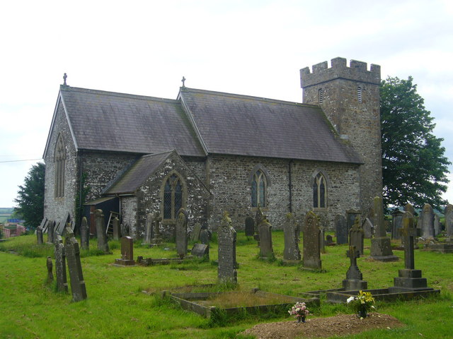
Clarbeston boasts a strong sense of community, with various events and activities taking place throughout the year. The village has a primary school, a community hall, and a church, which all contribute to the social fabric of the area.

For those seeking outdoor pursuits, Clarbeston is surrounded by stunning natural beauty. The Pembrokeshire Coast National Park is just a short distance away, offering picturesque landscapes, walking trails, and opportunities for wildlife spotting.

In conclusion, Clarbeston is a charming and peaceful village in Pembrokeshire, Wales. With its rural setting, strong sense of community, and proximity to nature, it is an ideal place for those seeking a tranquil and idyllic lifestyle.

If you have any feedback on the listing, please let us know in the comments section below.

Clarbeston Images

Images are sourced within 2km of 51.855541/-4.836595 or Grid Reference SN0421. Thanks to Geograph Open Source API. All images are credited.

Farm entrance Leading to Spring Hill and Summers Hill.
Farm entrance
Leading to Spring Hill and Summers Hill.
Field gateway Footpath to New Mill.
Field gateway
Footpath to New Mill.
St Martin’s Church, Clarbeston
Old bridge over stream Near Deep Ford.
Old bridge over stream
Near Deep Ford.
Railway Cottage Fine-looking house alongside the railway line at Deepford Lane. But beware of the yappy dogs!
Railway Cottage
Fine-looking house alongside the railway line at Deepford Lane. But beware of the yappy dogs!
Railway bridge at Deepford Lane
Ordnance Survey Cut Mark This OS cut mark can be found on the SW face of St Martin's Church. It marks a point 69.531m above mean sea level.
Ordnance Survey Cut Mark
This OS cut mark can be found on the SW face of St Martin's Church. It marks a point 69.531m above mean sea level.
Ordnance Survey Cut Mark This OS cut mark can be found on the SW face of Carmel Chapel. It marks a point 72.396m above mean sea level.
Ordnance Survey Cut Mark
This OS cut mark can be found on the SW face of Carmel Chapel. It marks a point 72.396m above mean sea level.
Boundary Stone This BS can be found on the north side of the road on Pont
Boundary Stone
This BS can be found on the north side of the road on Pont
View over Deepford Brook valley, Clarbeston Little is now visible of the track that gave access to the dozen or so smallholdings that used to exist on the enclosed Clarbeston moor. At the bottom is Deepford Brook, the southern boundary of Clarbeston.
View over Deepford Brook valley, Clarbeston
Little is now visible of the track that gave access to the dozen or so smallholdings that used to exist on the enclosed Clarbeston moor. At the bottom is Deepford Brook, the southern boundary of Clarbeston.
Parish Church, Clarbeston Dedicated to St Martin of Tours. The name Clarbeston can be explained in an early (1230) reference to it: "ecclesia Sti. Martini de villa Clarenbaldi"; Clarenbald was a Flemish name, and the dedication to the military saint indicates that he was more a fighter than a farmer. The Welsh name of the parish, Treglarbes, is simply a translation of the English. Clarbeston is south of the Landsker, which here follows the Afon Syfni.
Parish Church, Clarbeston
Dedicated to St Martin of Tours. The name Clarbeston can be explained in an early (1230) reference to it: "ecclesia Sti. Martini de villa Clarenbaldi"; Clarenbald was a Flemish name, and the dedication to the military saint indicates that he was more a fighter than a farmer. The Welsh name of the parish, Treglarbes, is simply a translation of the English. Clarbeston is south of the Landsker, which here follows the Afon Syfni.
Porch: Clarbeston parish church The base of the tower is fenced off due to falling masonry, and this temporary structure protects those using the only door. The church was re-built on the ancient site in 1841, and is now not in good shape.
Porch: Clarbeston parish church
The base of the tower is fenced off due to falling masonry, and this temporary structure protects those using the only door. The church was re-built on the ancient site in 1841, and is now not in good shape.
Carmel Particular Baptist chapel, Clarbeston The original chapel on this site was built in 1804, but this building was completed in 1874.
Carmel Particular Baptist chapel, Clarbeston
The original chapel on this site was built in 1804, but this building was completed in 1874.
The Green, Clarbeston Clarbeston used to have an open village green, ringed by cottages. To the left is Clarbeston farm house, and to the right is the smithy.
The Green, Clarbeston
Clarbeston used to have an open village green, ringed by cottages. To the left is Clarbeston farm house, and to the right is the smithy.
Meadow in the Syfni valley, Clarbeston Syfni is the local pronunciation of the river name, and is the spelling in some, but not all, OS maps. More literary variants are Syfynwy, Syfynfi, Syfnau. The name is derived from the same Celtic name (Sumina) as the Somme in France. The river for some distance marks the traditional Landsker or language boundary, English on this side and Welsh on the other. It also marked the boundary in the Hundred of Dungleddy between the Marcher barons' land to the south and west and the bishop's lands to the north and east.
Meadow in the Syfni valley, Clarbeston
Syfni is the local pronunciation of the river name, and is the spelling in some, but not all, OS maps. More literary variants are Syfynwy, Syfynfi, Syfnau. The name is derived from the same Celtic name (Sumina) as the Somme in France. The river for some distance marks the traditional Landsker or language boundary, English on this side and Welsh on the other. It also marked the boundary in the Hundred of Dungleddy between the Marcher barons' land to the south and west and the bishop's lands to the north and east.
Stepaside Bridge, Clarbeston The bridge crosses the Afon Syfni, and gets its name from what used to be a pub on the far side. Syfni is the local pronunciation of the river name, and is the spelling in some, but not all, OS maps. More literary variants are Syfynwy, Syfynfi, Syfnau. The name is derived from the same Celtic name (Sumina) as the Somme in France. The river for some distance marks the traditional Landsker or language boundary, English on this side and Welsh on the other. It also marked the boundary in the Hundred of Dungleddy between the Marcher barons' land to the south and west and the bishop's lands to the north and east.
Stepaside Bridge, Clarbeston
The bridge crosses the Afon Syfni, and gets its name from what used to be a pub on the far side. Syfni is the local pronunciation of the river name, and is the spelling in some, but not all, OS maps. More literary variants are Syfynwy, Syfynfi, Syfnau. The name is derived from the same Celtic name (Sumina) as the Somme in France. The river for some distance marks the traditional Landsker or language boundary, English on this side and Welsh on the other. It also marked the boundary in the Hundred of Dungleddy between the Marcher barons' land to the south and west and the bishop's lands to the north and east.
Road junction by Knock Farm The entrance to Knock Farm can be seen from the road junction near Clarbeston Road.
Road junction by Knock Farm
The entrance to Knock Farm can be seen from the road junction near Clarbeston Road.
Bridge near Rhydd-y-brown Bridge over a stream near Rhydd-y-brown to the north of Bletherston.
Bridge near Rhydd-y-brown
Bridge over a stream near Rhydd-y-brown to the north of Bletherston.
Show me another place!

Clarbeston is located at Grid Ref: SN0421 (Lat: 51.855541, Lng: -4.836595)

Unitary Authority: Pembrokeshire

Police Authority: Dyfed Powys

Also known as: Treglarbes

What 3 Words

///angry.type.relegate. Near Wiston, Pembrokeshire

Nearby Locations

Treglarbes Clarbeston

Related Wikis

Clarbeston

Clarbeston (Welsh: Treglarbes) is a village and parish in Pembrokeshire, Wales, 11 km (6.8 mi) east of Haverfordwest. The parish, together with Wiston...

Pembrokeshire

Pembrokeshire ( PEM-bruuk-sheer, -⁠shər; Welsh: Sir Benfro [siːr ˈbɛnvrɔ]) is a county in the south-west of Wales. It is bordered by Carmarthenshire to...

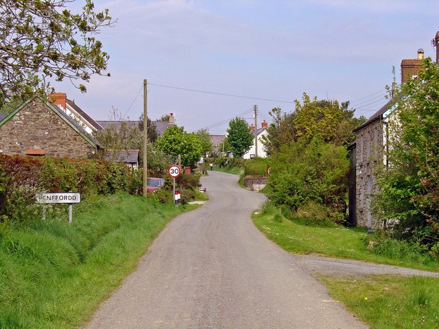
Penffordd, Pembrokeshire

Penffordd or Pen-ffordd is a small village in the community of New Moat, Pembrokeshire, Wales, in the parish of Bletherston. It lies approximately 10.8...
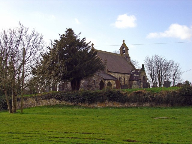
Walton East

Walton East (Welsh: Waltwn) is a small rural village and parish established around a church at least as early as Norman times. It is 2 miles (3.2 km) southwest...

Nearby Amenities

Located within 500m of 51.855541,-4.836595
Clarbeston
Name Cy: Clarbeston
Name En: Clarbeston
Place: hamlet
Wikidata: Q5126095
Lat/Long: 51.855637/-4.8364793
Give Way
Direction: forward
Lat/Long: 51.8562595/-4.8352442
Give Way
Direction: backward
Lat/Long: 51.8555759/-4.8364838
The data included in this document is from www.openstreetmap.org. The data is made available under ODbL.

Have you been to Clarbeston?

Leave your review of Clarbeston below (or comments, questions and feedback).