Great Chesterford

Settlement in Essex Uttlesford

England

Great Chesterford

Little Chesterford church
Little Chesterford church Credit: mym

Great Chesterford is a village located in the Uttlesford district of Essex, England. Situated approximately 45 miles north of London, it lies adjacent to the River Cam and is surrounded by picturesque countryside. The village has a population of around 1,500 people.

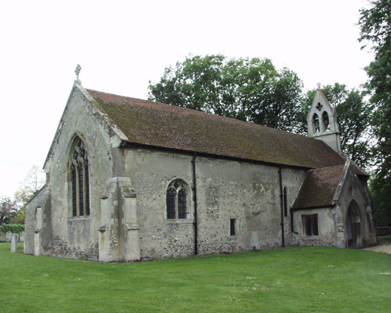
Great Chesterford dates back to Roman times and has a rich history, evident in its charming architecture and landmarks. The St. Mary and St. Nicholas Church, a Grade I listed building, is a notable feature with its striking tower and medieval origins. The village also boasts several well-preserved timber-framed houses, showcasing its historical character.

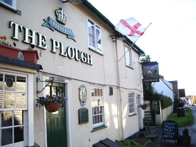
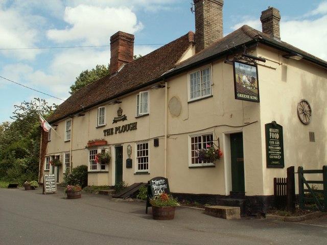
Despite its small size, Great Chesterford offers a range of amenities to its residents. There is a primary school, a village hall, and a local pub, providing a sense of community and social gathering spaces. Additionally, the village is home to a cricket club, offering recreational activities for sports enthusiasts.

Transportation in Great Chesterford is convenient, with a train station linking the village to London Liverpool Street and Cambridge. The nearby M11 motorway provides easy access to major cities and airports.

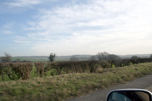
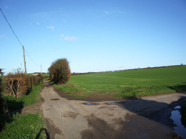
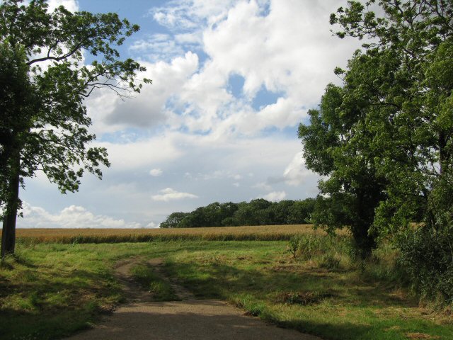
The village's proximity to Cambridge and London makes it an attractive location for commuters, while its rural setting appeals to those seeking a tranquil lifestyle. The surrounding countryside offers opportunities for outdoor activities, such as walking and cycling, with several nature reserves nearby.

Overall, Great Chesterford is a charming and historical village that combines the best of rural living with convenient access to urban centers.

If you have any feedback on the listing, please let us know in the comments section below.

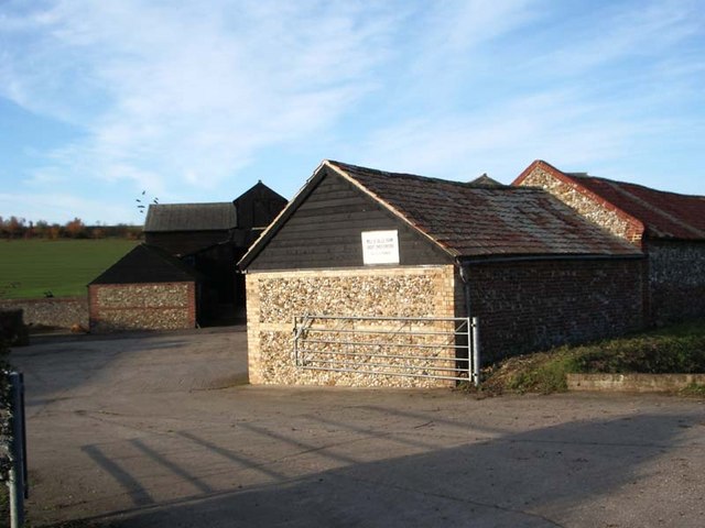
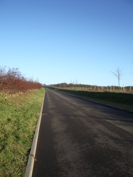
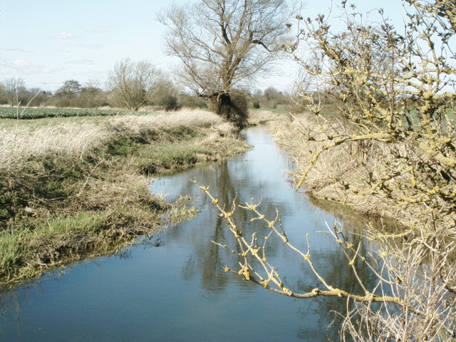
Great Chesterford Images

Images are sourced within 2km of 52.064299/0.19724254 or Grid Reference TL5042. Thanks to Geograph Open Source API. All images are credited.

Little Chesterford church
Great Chesterford Church Some of my antecedents are buried in the family plot to the left of this picture
Great Chesterford Church
Some of my antecedents are buried in the family plot to the left of this picture
The Green, Great Chesterford, Essex
Fields at Great Chesterford
Hills near Little Chesterford
Junction of Cow Lane and Little Cow Lane
The Plough at Great Chesterford
Dells Farm, Great Chesterford
Stump Cross Roundabout
New House on Park Road
New Road to Chesterford Research Park
Severe Storms On The Motorways Today's strong winds (Thursday 18 January 2007) have caused this lorry to overturn on the M11 in Essex. Within 50 metres behind this lorry is yet another overturned see <a title="https://www.geograph.org.uk/photo/314970" href="https://www.geograph.org.uk/photo/314970">Link</a>
Severe Storms On The Motorways
Today's strong winds (Thursday 18 January 2007) have caused this lorry to overturn on the M11 in Essex. Within 50 metres behind this lorry is yet another overturned see Link
Severe Storms On The Motorways Today's strong winds (Thursday 18 January 2007) have caused this lorry to overturn on the M11 in Essex. Within 50 metres in front of this lorry is yet another overturned you can just make out the other lorry in my car's mirror. Other lorry see <a title="https://www.geograph.org.uk/photo/314960" href="https://www.geograph.org.uk/photo/314960">Link</a>
Severe Storms On The Motorways
Today's strong winds (Thursday 18 January 2007) have caused this lorry to overturn on the M11 in Essex. Within 50 metres in front of this lorry is yet another overturned you can just make out the other lorry in my car's mirror. Other lorry see Link
The River Cam (or Granta) The River Cam (or Granta) near Little Chesterford, Essex
The River Cam (or Granta)
The River Cam (or Granta) near Little Chesterford, Essex
'The Plough' inn This has been an inn at Great Chesterford since the 18th century.
'The Plough' inn
This has been an inn at Great Chesterford since the 18th century.
Back to grass roots? View through a gap in the hedgerow adjacent to the access road to the Chesterford Research Park (private).
Back to grass roots?
View through a gap in the hedgerow adjacent to the access road to the Chesterford Research Park (private).
Great Chesterford station The station was built in 1845 by the Eastern Counties Railway, and is still in mainline passenger service.  A branch line was opened by the Newmarket & Chesterford Railway in 1848, and closed in 1851.  The buildings on No.2 (Cambridge) platform have been demolished, along with the signal box at the north end of the London platform, but the station building itself survives, it is currently used as offices.  A new ticket office has recently been opened.  

The picture was taken from the footbridge, looking southwards towards London.
Great Chesterford station
The station was built in 1845 by the Eastern Counties Railway, and is still in mainline passenger service. A branch line was opened by the Newmarket & Chesterford Railway in 1848, and closed in 1851. The buildings on No.2 (Cambridge) platform have been demolished, along with the signal box at the north end of the London platform, but the station building itself survives, it is currently used as offices. A new ticket office has recently been opened. The picture was taken from the footbridge, looking southwards towards London.
Old Milepost Old milepost near to Little Chesterford, Essex on what was the old A.11. For close up view see <a title="https://www.geograph.org.uk/photo/1276325" href="https://www.geograph.org.uk/photo/1276325">Link</a> for info on the post see <span class="nowrap"><a title="http://milestones.megalithia.com/sites/tl513418.htm" rel="nofollow ugc noopener" href="http://milestones.megalithia.com/sites/tl513418.htm">Link</a><img style="margin-left:2px;" alt="External link" title="External link - shift click to open in new window" src="https://s1.geograph.org.uk/img/external.png" width="10" height="10"/></span> do look at their home page.
Old Milepost
Old milepost near to Little Chesterford, Essex on what was the old A.11. For close up view see Link for info on the post see LinkExternal link do look at their home page.
Show me another place!

Great Chesterford is located at Grid Ref: TL5042 (Lat: 52.064299, Lng: 0.19724254)

Administrative County: Essex

District: Uttlesford

Police Authority: Essex

What 3 Words

///logo.solicitor.winner. Near Great Chesterford, Essex

Related Wikis

Great Chesterford

Great Chesterford is a village and civil parish in the Uttlesford district of Essex, England. The village is 13 miles (20 km) north from Bishop's Stortford...

Great Chesterford railway station

Great Chesterford railway station is on the West Anglia Main Line serving the village of Great Chesterford in Essex, England. It is 45 miles 56 chains...

Little Chesterford

Little Chesterford is a small village and civil parish in Uttlesford, Essex, in the East of England. Close to the Cambridgeshire border, it is built principally...

St Mary Magdalene Church, Ickleton

St Mary Magdalene Church is the Church of England parish church in the village of Ickleton in Cambridgeshire. The church is a Grade I listed building....

Nearby Amenities

Located within 500m of 52.064299,0.19724254
Great Chesterford
Place: village
Wikidata: Q1020030
Lat/Long: 52.0651937/0.1991121
Source: npe
Lat/Long: 52.0631332/0.1909619
Source: npe
Lat/Long: 52.0619099/0.1926381
Source: npe
Lat/Long: 52.0616155/0.1938008
Source: npe
Lat/Long: 52.0616955/0.1944069
Source: npe
Waterway: weir
Lat/Long: 52.0616515/0.1940763
Source: npe
Lat/Long: 52.0615097/0.1960386
Source: npe
Lat/Long: 52.0621677/0.19768
Source: npe
Lat/Long: 52.0614317/0.1986401
Recycling
Lat/Long: 52.0673317/0.1933599
Crossing
Lat/Long: 52.0629361/0.199549
Traffic Calming: table
Lat/Long: 52.0663547/0.2034224
Barrier: bollard
Lat/Long: 52.0657345/0.2020721
Turning Circle
Lat/Long: 52.0646673/0.1952996
Barrier: bollard
Material: concrete
Motor Vehicle: no
Lat/Long: 52.0661747/0.1995847
Barrier: chain
Lat/Long: 52.0624614/0.1974543
Post Box
Collection Times: Mo-Fr 09:00; Sa 07:00
Operator: Royal Mail
Operator Wikidata: Q638098
Post Box Type: lamp
Ref: CB10 107
Royal Cypher: EIIR
Royal Cypher Wikidata: Q33102113
Source: survey
Lat/Long: 52.0671099/0.2018717
Post Box
Collection Times: Mo-Fr 09:00; Sa 07:00
Operator: Royal Mail
Operator Wikidata: Q638098
Post Box Type: lamp
Ref: CB10 57
Royal Cypher: EIIR
Royal Cypher Wikidata: Q33102113
Source: survey
Lat/Long: 52.0638421/0.2023535
Bus Stop
Station Turn
Bus: yes
Naptan AtcoCode: 150018007004
Naptan Bearing: SE
Naptan CommonName: Station Turn
Naptan Crossing: Newmarket Road
Naptan Indicator: E-bound
Naptan Landmark: Station Turn
Naptan NaptanCode: esxdaptg
Naptan Street: Ickleton Road
Naptan Verified: no
Public Transport: platform
Source: naptan_import
Lat/Long: 52.0621731/0.1913278
Bus Stop
Station Turn
Bus: yes
Naptan AtcoCode: 1500IM1744
Naptan Bearing: NW
Naptan CommonName: Station Turn
Naptan Crossing: Newmarket Road
Naptan Indicator: W-bound
Naptan Landmark: Station Turn
Naptan NaptanCode: esxdaptj
Naptan Street: Ickleton Road
Naptan Verified: no
Public Transport: platform
Source: naptan_import
Lat/Long: 52.0621754/0.1910341
Bus Stop
St. John's Cross
Bus: yes
Naptan AtcoCode: 1500IM1958
Naptan Bearing: E
Naptan BusStopType: CUS
Naptan CommonName: St. John's Cross
Naptan Crossing: Carmel Street
Naptan Indicator: o/s
Naptan Landmark: St. John's Cross
Naptan NaptanCode: esxadmtj
Naptan Street: South Street
Naptan Verified: no
Public Transport: platform
Source: naptan_import
Lat/Long: 52.0628729/0.1994523
Bus Stop
St. John's Cross
Bus: yes
Naptan AtcoCode: 1500IM1958AA
Naptan Bearing: W
Naptan BusStopType: CUS
Naptan CommonName: St. John's Cross
Naptan Crossing: Carmel Street
Naptan Indicator: Opp
Naptan Landmark: St. John's Cross
Naptan NaptanCode: esxgpjgt
Naptan Street: South Street
Naptan Verified: no
Public Transport: platform
Source: naptan_import
Lat/Long: 52.0627758/0.1993897
Traffic Calming: island
Lat/Long: 52.0644853/0.1947802
Give Way
Direction: backward
Lat/Long: 52.0620165/0.1917356
Post Box
Collection Times: Mo-Fr 16:30; Sa 12:00
Operator: Royal Mail
Operator Wikidata: Q638098
Post Box Type: wall
Ref: CB10 56
Royal Cypher: EIIR
Royal Cypher Wikidata: Q33102113
Source: survey
Lat/Long: 52.0640241/0.1968966
Post Box
Collection Times: Mo-Fr 09:00; Sa 07:00
Operator: Royal Mail
Operator Wikidata: Q638098
Post Box Design: type_k
Post Box Type: pillar
Ref: CB10 55
Royal Cypher: EIIR
Royal Cypher Wikidata: Q33102113
Source: survey
Lat/Long: 52.0620705/0.1912569
Crossing
Crossing: unmarked
Crossing Markings: no
Cyclestreets Id: 103593
Traffic Calming: island
Lat/Long: 52.0600628/0.1959526
Give Way
Direction: forward
Lat/Long: 52.062335/0.1907936
Crossing
Crossing: unmarked
Crossing Island: yes
Crossing Markings: no
Tactile Paving: yes
Lat/Long: 52.0620214/0.1916585
Telephone
Booth: K6
Covered: booth
Man Made: telephone_box
Operator: Great Chesterford Parish Council
Tourism: museum
Lat/Long: 52.0626342/0.1974557
Bench
Lat/Long: 52.0622894/0.197792
Bench
Lat/Long: 52.0624045/0.1979248
Bench
Lat/Long: 52.0625354/0.1978278
Bench
Lat/Long: 52.062234/0.1979208
Bench
Lat/Long: 52.0637428/0.1974235
Man Made: village_sign
Lat/Long: 52.062847/0.1969403
Crossing
Lat/Long: 52.0671319/0.2022019
Crossing
Crossing: unmarked
Crossing Markings: no
Lat/Long: 52.0615156/0.1923685
Crossing
Lat/Long: 52.062743/0.1998083
Crossing
Lat/Long: 52.0601727/0.1955582
Crossing
Crossing: unmarked
Crossing Island: yes
Crossing Markings: no
Tactile Paving: yes
Lat/Long: 52.0614611/0.1926443
Traffic Calming: table
Lat/Long: 52.0630101/0.2031671
Traffic Calming: table
Lat/Long: 52.0631382/0.2035977
Traffic Calming: table
Lat/Long: 52.064868/0.2017892
Crossing
Lat/Long: 52.0656576/0.2008273
Barrier: height_restrictor
Lat/Long: 52.0671416/0.1932924
Great Chesterford
Traffic Sign: city_limit
Lat/Long: 52.0677154/0.1925491
Waste Basket
Waste: dog_excrement
Lat/Long: 52.0626412/0.197515
Waste Basket
Lat/Long: 52.062586/0.197922
Waste Basket
Lat/Long: 52.0622715/0.1976937
Bench
Lat/Long: 52.0618901/0.1983989
Waste Basket
Lat/Long: 52.0618211/0.1984911
Waste Basket
Waste: dog_excrement
Lat/Long: 52.0622647/0.1980865
Waste Basket
Waste: dog_excrement
Lat/Long: 52.0638572/0.1970145
Advertising: board
Lat/Long: 52.0638365/0.1970136
Bench
Lat/Long: 52.0673979/0.1946137
Bench
Lat/Long: 52.066879/0.1958421
Bench
Lat/Long: 52.0664475/0.1940088
Waste Basket
Waste: dog_excrement
Lat/Long: 52.0663358/0.1941651
Waste Basket
Waste: dog_excrement
Lat/Long: 52.0665896/0.1976566
Waste Basket
Waste: dog_excrement
Lat/Long: 52.066599/0.1971162
Bench
Lat/Long: 52.0674015/0.1946702
Barrier: bollard
Material: wood
Motor Vehicle: no
Lat/Long: 52.0651859/0.202334
Crossing
Crossing: unmarked
Crossing Island: yes
Crossing Markings: no
Tactile Paving: yes
Lat/Long: 52.06286/0.1927746
Crossing
Crossing: unmarked
Crossing Island: yes
Crossing Markings: no
Tactile Paving: yes
Lat/Long: 52.0615231/0.1926856
Traffic Calming: island
Lat/Long: 52.0676993/0.1925544
Crossing
Lat/Long: 52.0608134/0.1944849
Traffic Calming: table
Lat/Long: 52.0625042/0.2037207
Traffic Calming: table
Lat/Long: 52.0645167/0.201732
Give Way
Direction: backward
Lat/Long: 52.0635791/0.1941327
Give Way
Direction: backward
Lat/Long: 52.0662616/0.1936769
Barrier: cycle_barrier
Lat/Long: 52.0638745/0.2019973
Power: pole
Lat/Long: 52.0664182/0.1937229
Power: pole
Lat/Long: 52.0667444/0.1932814
Power: pole
Lat/Long: 52.0671492/0.1929662
Power: pole
Lat/Long: 52.0675004/0.192764
Power: pole
Lat/Long: 52.0677177/0.1931608
Power: pole
Lat/Long: 52.0681533/0.1943501
Power: pole
Lat/Long: 52.0685245/0.1953699
Power: pole
Lat/Long: 52.0653455/0.1913025
Power: pole
Lat/Long: 52.0640109/0.1930824
Power: pole
Lat/Long: 52.0633539/0.1922966
Power: pole
Lat/Long: 52.0626707/0.1915248
Power: pole
Lat/Long: 52.0646195/0.1922562
Power: pole
Lat/Long: 52.0617539/0.2023575
Crossing
Lat/Long: 52.0641864/0.1947162
Crossing
Lat/Long: 52.0630107/0.193438
Crossing
Lat/Long: 52.063562/0.1941883
Crossing
Lat/Long: 52.063937/0.1970383
Crossing
Lat/Long: 52.0626611/0.1973827
Crossing
Lat/Long: 52.0626943/0.1983169
Crossing
Lat/Long: 52.0627029/0.1985824
Crossing
Lat/Long: 52.0627952/0.1989488
Crossing
Lat/Long: 52.0644213/0.1973127
Crossing
Lat/Long: 52.0641723/0.1979509
Crossing
Lat/Long: 52.0658423/0.1989448
Crossing
Lat/Long: 52.0661249/0.1985416
Crossing
Lat/Long: 52.0663949/0.1982506
Traffic Calming: table
Lat/Long: 52.0647381/0.2012245
Crossing
Lat/Long: 52.0640044/0.2001597
Crossing
Lat/Long: 52.0642713/0.2006674
Crossing
Lat/Long: 52.0647077/0.201576
Crossing
Lat/Long: 52.0645263/0.2008391
Traffic Calming: table
Lat/Long: 52.0648982/0.2003229
Crossing
Lat/Long: 52.0666694/0.2028578
Crossing
Lat/Long: 52.0662681/0.2001839
Barrier: cycle_barrier
Lat/Long: 52.0637884/0.1987093
Grit Bin
Lat/Long: 52.0663596/0.1938437
Grit Bin
Lat/Long: 52.0644125/0.1972455
Grit Bin
Lat/Long: 52.0621298/0.1916688
Grit Bin
Lat/Long: 52.0636337/0.1942308
Bench
Lat/Long: 52.0658893/0.1990047
Waste Basket
Lat/Long: 52.0659012/0.1989726
Grit Bin
Lat/Long: 52.0663325/0.1982896
The data included in this document is from www.openstreetmap.org. The data is made available under ODbL.

Have you been to Great Chesterford?

Leave your review of Great Chesterford below (or comments, questions and feedback).