Yondover

Settlement in Dorset

England

Yondover

Uploders: Crown Inn and cottage By the T-junction in the centre of the village; see also <a href="https://www.geograph.org.uk/photo/7360457">SY5093 : Bungalow, Uploders</a>. Fairly obvious where I am headed.
Uploders: Crown Inn and cottage Credit: Derek Harper

Yondover, located in Dorset, England, is a picturesque and tranquil village nestled in the heart of the county. With a population of around 400 residents, Yondover is known for its stunning natural beauty, charming cottages, and rich history.

Situated amidst rolling hills and lush green landscapes, Yondover offers breathtaking views of the surrounding countryside. The village is surrounded by miles of scenic walking trails, making it an ideal destination for outdoor enthusiasts and nature lovers. The nearby River Yeo adds to the village's charm, providing a serene setting for fishing and boating activities.

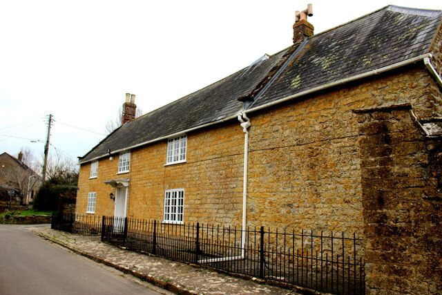
Yondover boasts a well-preserved architectural heritage, with many of its buildings dating back to the 18th and 19th centuries. The village's historic church, St. Mary's, is a prominent landmark, known for its beautiful stained glass windows and intricate stonework.

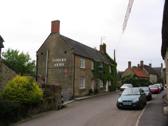
The community spirit is strong in Yondover, with various local events and festivities held throughout the year. The village pub, The Yondover Arms, is a popular gathering spot for locals and visitors alike, offering a warm and friendly atmosphere along with traditional British cuisine.

Yondover's location provides easy access to nearby attractions, such as the historic town of Sherborne with its stunning abbey and castle, and the Jurassic Coast, a UNESCO World Heritage Site renowned for its fossil-rich cliffs and idyllic beaches.

In summary, Yondover, Dorset, offers a peaceful and idyllic setting, combining natural beauty, rich history, and a close-knit community, making it an enchanting place to visit or call home.

If you have any feedback on the listing, please let us know in the comments section below.
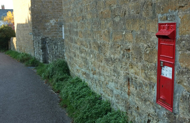
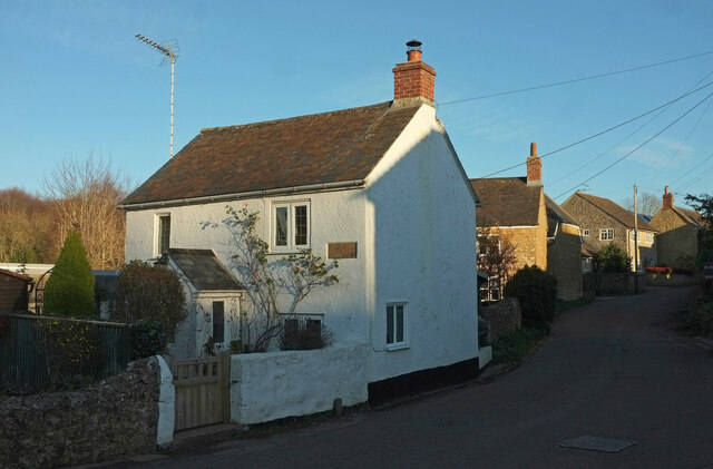
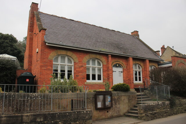
Yondover Images

Images are sourced within 2km of 50.742116/-2.7121406 or Grid Reference SY4993. Thanks to Geograph Open Source API. All images are credited.

Uploders: Crown Inn and cottage By the T-junction in the centre of the village; see also <a href="https://www.geograph.org.uk/photo/7360457">SY5093 : Bungalow, Uploders</a>. Fairly obvious where I am headed.
Uploders: Crown Inn and cottage
By the T-junction in the centre of the village; see also SY5093 : Bungalow, Uploders. Fairly obvious where I am headed.
Bungalow, Uploders An intriguing little timber-framed bungalow at the junction where <a href="https://www.geograph.org.uk/photo/7360445">SY5093 : Uploders: Crown Inn and cottage</a> was taken. NCN2 turns left at the signpost.
Bungalow, Uploders
An intriguing little timber-framed bungalow at the junction where SY5093 : Uploders: Crown Inn and cottage was taken. NCN2 turns left at the signpost.
Postbox, Uploders Victorian postbox DT6 9 is shown at <a title="https://www.geograph.org.uk/search.php?i=171075133" href="https://www.geograph.org.uk/search.php?i=171075133">Link</a> .
Postbox, Uploders
Victorian postbox DT6 9 is shown at Link .
Halfway Copse Seen from the road at the western edge of Uploders. The copse overlooks the meeting of the Asker valley (foreground, with trees along the course of the river) with the Mappercombe valley.
Halfway Copse
Seen from the road at the western edge of Uploders. The copse overlooks the meeting of the Asker valley (foreground, with trees along the course of the river) with the Mappercombe valley.
Village street, Uploders From the junction with Home farm Close. The nearest house, a holiday cottage, is named "Knight's Pightle".
Village street, Uploders
From the junction with Home farm Close. The nearest house, a holiday cottage, is named "Knight's Pightle".
Lee Lane This is the northern end of Lee Lane just before it reaches Stepps Farm which is in the next grid square SY4894
Lee Lane
This is the northern end of Lee Lane just before it reaches Stepps Farm which is in the next grid square SY4894
Normans Meat Processing Plant This is the rear of the building seen from the footpath that runs from Bothenhampton to Mangerton Lane.
Normans Meat Processing Plant
This is the rear of the building seen from the footpath that runs from Bothenhampton to Mangerton Lane.
Fishing Lakes in the Mangerton Valley These small fishing lakes are just to the west of the Oldhouse Farm buildings next to the Mangerton River which is marked by the line of trees and bushes on  the opposite side of the lake.
Fishing Lakes in the Mangerton Valley
These small fishing lakes are just to the west of the Oldhouse Farm buildings next to the Mangerton River which is marked by the line of trees and bushes on the opposite side of the lake.
Normans Meat Processing Plant This abattoir and meat processing plant is located just north of Bradpole on the road to Mangerton.
Normans Meat Processing Plant
This abattoir and meat processing plant is located just north of Bradpole on the road to Mangerton.
Terrace of Houses in Bradpole These very recently built cottages are on Higher St on the western edge of the grid square. The photographer can be seen in the mirror with Higher St running up behind him where it intersects with Townsend Way and Mangerton Lane. The footpath sign points to the path that leads from these cottages up to Townsend Way.
Terrace of Houses in Bradpole
These very recently built cottages are on Higher St on the western edge of the grid square. The photographer can be seen in the mirror with Higher St running up behind him where it intersects with Townsend Way and Mangerton Lane. The footpath sign points to the path that leads from these cottages up to Townsend Way.
Bradpole Village Hall Also known as the Forster Memorial Institute this red brick building with Hamstone detailing round the windows is located on Higher St.
Bradpole Village Hall
Also known as the Forster Memorial Institute this red brick building with Hamstone detailing round the windows is located on Higher St.
Forster Memorial Institute, Bradpole This building on the north side of Higher Street now fulfils the function of Bradpole Village Hall. It was built in 1890 and was restored in 1970. It was built by public subscription in memory of William Forster MP who came from Bradpole.
Forster Memorial Institute, Bradpole
This building on the north side of Higher Street now fulfils the function of Bradpole Village Hall. It was built in 1890 and was restored in 1970. It was built by public subscription in memory of William Forster MP who came from Bradpole.
Graves in Bradpole These tombstones are in Bradpole village church yard. The corner of the church can just be seen on the extreme right.
Graves in Bradpole
These tombstones are in Bradpole village church yard. The corner of the church can just be seen on the extreme right.
Middle Street Bradpole Looking down Middle Street from the parish churchyard. Village Road runs across the lower part of the image. Above the raised footpath on the left can be seen the square plates on the ends of the rods used recently to stabilise the soil on the steep bank.
Middle Street Bradpole
Looking down Middle Street from the parish churchyard. Village Road runs across the lower part of the image. Above the raised footpath on the left can be seen the square plates on the ends of the rods used recently to stabilise the soil on the steep bank.
Home Farm Bradpole Home Farm is situated on Caley Way close to the junction with Forsters Lane. The farmhouse is built of inferior oolite on a plinth of Forest Marble. See also <a href="https://www.geograph.org.uk/photo/7061215">SY4894 : Home Farm Bradpole (Detail)</a>
Home Farm Bradpole
Home Farm is situated on Caley Way close to the junction with Forsters Lane. The farmhouse is built of inferior oolite on a plinth of Forest Marble. See also SY4894 : Home Farm Bradpole (Detail)
Home Farm Bradpole (Detail) This shows the stone construction of the farm house located on Caley Way. It is Inferior Oolite on a plinth of Forest Marble. The inferior oolite may have come from quarries at Allington and the Forest Marble is almost certainly Bothenhampton stone (or Baunton Stone as it was known as locally) from the quarries at Bothenhampton. The forest marble was used on the lower courses because of its low permeability to water. See also <a href="https://www.geograph.org.uk/photo/7061204">SY4894 : Home Farm Bradpole</a>
Home Farm Bradpole (Detail)
This shows the stone construction of the farm house located on Caley Way. It is Inferior Oolite on a plinth of Forest Marble. The inferior oolite may have come from quarries at Allington and the Forest Marble is almost certainly Bothenhampton stone (or Baunton Stone as it was known as locally) from the quarries at Bothenhampton. The forest marble was used on the lower courses because of its low permeability to water. See also SY4894 : Home Farm Bradpole
Holy Trinity Church, Bradpole, Dorset
Show me another place!

Yondover is located at Grid Ref: SY4993 (Lat: 50.742116, Lng: -2.7121406)

Unitary Authority: Dorset

Police Authority: Dorset

What 3 Words

///certified.rooster.beak. Near Bridport, Dorset

Related Wikis

Loders

Loders is a village and civil parish in the English county of Dorset. It lies 2 miles (3.2 km) north-east of the town of Bridport. It is a linear village...

Loders and Bothenhampton Liberty

Loders and Bothenhampton Liberty was a liberty in the county of Dorset, England, containing the following parishes: Bothenhampton Loders == See also... ==

Uploders

Uploders is a small village in Dorset, England. It consists mainly of houses, and has a pub, the Crown, a Grade II listed Methodist chapel and a playing...

Alan Rice-Oxley

Lieutenant Alan Rice-Oxley (1 July 1896 – 21 July 1961) was a British pilot during World War I. He became a flying ace in 1918, credited with six aerial...

Nearby Amenities

Located within 500m of 50.742116,-2.7121406
Post Box
Post Box Type: lamp
Ref: DT6 116
Ref GB Uprn: 10015338868
Lat/Long: 50.7422016/-2.7119277
Power: pole
Source: bing
Lat/Long: 50.7435953/-2.7138081
Power: pole
Source: bing
Transformer: distribution
Lat/Long: 50.7431896/-2.7124724
Power: pole
Source: bing
Lat/Long: 50.7432946/-2.7133507
Power: pole
Source: bing
Transformer: distribution
Lat/Long: 50.7430581/-2.7111863
Power: pole
Source: bing
Lat/Long: 50.742986/-2.7070288
Power: pole
Source: bing
Lat/Long: 50.7428689/-2.7081696
Power: pole
Source: bing
Lat/Long: 50.7429414/-2.7092751
Power: pole
Source: bing
Lat/Long: 50.743014/-2.7106994
Telephone
Booth: K6
Colour: red
Covered: booth
Listed Status: Grade II
Lat/Long: 50.7452722/-2.7167767
Information: guidepost
Tourism: information
Lat/Long: 50.7452823/-2.7166256
Advertising: board
Lat/Long: 50.7453033/-2.7166498
Natural: spring
Lat/Long: 50.7430822/-2.7153922
Natural: spring
Lat/Long: 50.7429705/-2.7146729
Yondover
Place: village
Lat/Long: 50.7419949/-2.713865
The data included in this document is from www.openstreetmap.org. The data is made available under ODbL.

Have you been to Yondover?

Leave your review of Yondover below (or comments, questions and feedback).