Breich

Settlement in Midlothian

Scotland

Breich

A706 passes under high tension cables
A706 passes under high tension cables Credit: Stuart Logan

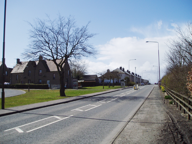
Breich is a small village located in the council area of Midlothian, Scotland. Situated approximately 25 miles southwest of Edinburgh, it falls within the historic county of West Lothian. Breich is surrounded by picturesque countryside, offering residents and visitors a peaceful and rural setting.

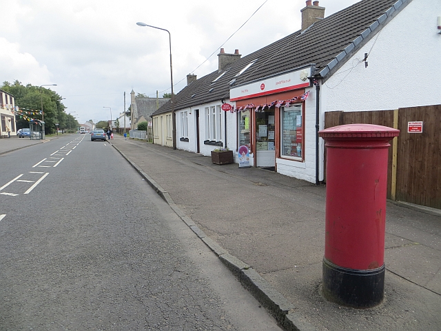
The village has a relatively small population and is primarily residential, with a few local amenities to cater to the needs of the community. These include a local shop, a post office, and a pub, providing essential services to the residents.

Breich is well-connected in terms of transportation, with a railway station that provides easy access to surrounding areas. This is particularly convenient for commuters who work in nearby towns or cities. The village is also well-served by road links, with the A71 passing through, connecting Breich to Edinburgh and other major towns in the region.

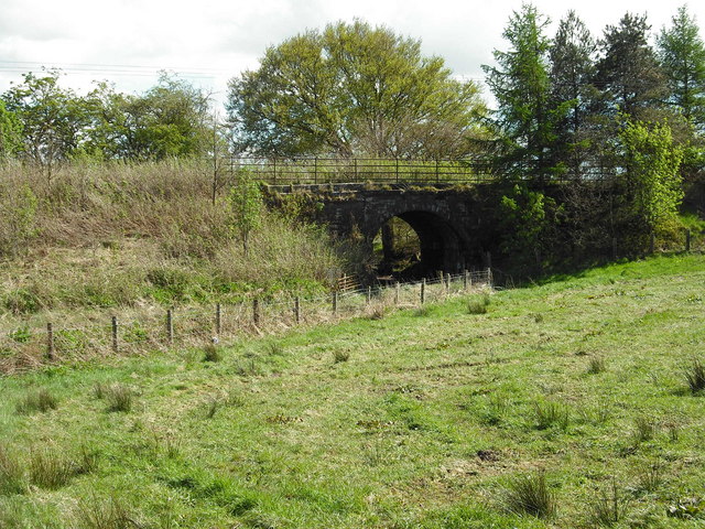
The surrounding area offers plenty of opportunities for outdoor activities and exploration. The Pentland Hills Regional Park is within reach, providing beautiful walking and cycling trails, and stunning views of the surrounding landscape. Additionally, the nearby Almondell and Calderwood Country Park offers further recreational opportunities, with its woodlands, riverside walks, and wildlife.

Overall, Breich is a peaceful and rural village that offers a tranquil and picturesque setting for its residents. With its convenient transportation links and beautiful surrounding countryside, it provides a quiet retreat while still being within reach of larger towns and cities.

If you have any feedback on the listing, please let us know in the comments section below.

Breich Images

Images are sourced within 2km of 55.828749/-3.656732 or Grid Reference NS9660. Thanks to Geograph Open Source API. All images are credited.

A706 passes under high tension cables
Top Blinky car park, Woodmuir Forest
Clear-fell, Woodmuir Forest
The A704 heading through Woodmuir Plantation Between West Calder and Forth.
The A704 heading through Woodmuir Plantation
Between West Calder and Forth.
Woodmuir Plantation The current generation of trees have come on a bit since 2008. <a href="https://www.geograph.org.uk/photo/930776">NS9659 : Clear fell at Woodmuir Plantation</a>
Woodmuir Plantation
The current generation of trees have come on a bit since 2008. NS9659 : Clear fell at Woodmuir Plantation
Forestry Road Barrier Near the start of a forest track that leads to Hendry's Corse plus plenty of parking off the A704.
Forestry Road Barrier
Near the start of a forest track that leads to Hendry's Corse plus plenty of parking off the A704.
Rashiehill Muir Looking south along the A706, with some of the Tormywheel Wind Farm turbines.
Rashiehill Muir
Looking south along the A706, with some of the Tormywheel Wind Farm turbines.
Rashiehill Muir and Forestry Rough pasture by the A706.
Rashiehill Muir and Forestry
Rough pasture by the A706.
Blood Red Water of Woodmuir Burn Not being much of an expert on anything have no idea why the water is so red, but the colour remains pretty much the same for a good few hundred yards further upstream. Nor do I read that much but made me think of historical novels in which they say the river ran red with blood due to the battle being so deadly!
Blood Red Water of Woodmuir Burn
Not being much of an expert on anything have no idea why the water is so red, but the colour remains pretty much the same for a good few hundred yards further upstream. Nor do I read that much but made me think of historical novels in which they say the river ran red with blood due to the battle being so deadly!
Open Ground below Power Lines in Woodmuir Forest Always good to see big electricity lines crossing forests as at least you get some idea what the area would have looked like before the trees got planted - in this case neverending mossy boggy ground...  These lines are 400,000 volts - have noticed now having walked under a few that they aren't all the same voltage as I had always assumed.
Open Ground below Power Lines in Woodmuir Forest
Always good to see big electricity lines crossing forests as at least you get some idea what the area would have looked like before the trees got planted - in this case neverending mossy boggy ground... These lines are 400,000 volts - have noticed now having walked under a few that they aren't all the same voltage as I had always assumed.
Intriguing Stone Post at Edge of Burn Row Ruins Probably a gate post, but odd in that it has deep holes on two sides. At the NorthEastern edge of the ruin. Not much left of what, from old maps, looks like a row of four terraced houses. On the large scale 1893 surveyed map a small square is attached to the row at this end, probably for livestock. Looks like stopped being occupied from around 1900.
Intriguing Stone Post at Edge of Burn Row Ruins
Probably a gate post, but odd in that it has deep holes on two sides. At the NorthEastern edge of the ruin. Not much left of what, from old maps, looks like a row of four terraced houses. On the large scale 1893 surveyed map a small square is attached to the row at this end, probably for livestock. Looks like stopped being occupied from around 1900.
Quarry Pond near Woodmuir Burn Steep-sided pond now surrounded by dense conifer forest, but originally the site of extensive quarry workings. The path that leads here through the woods was originally a railway line serving the quarry. Strictly speaking the section of the burn close by is actually called Paddy's River - an unusual name for a small burn -  which is meant to flow into the original Woodmuir Burn, shortly after it (Woodmuir Burn)  issues from the ground, having been diverted underground due to the quarry works, but there was no on the ground evidence of this to back up the map.
Quarry Pond near Woodmuir Burn
Steep-sided pond now surrounded by dense conifer forest, but originally the site of extensive quarry workings. The path that leads here through the woods was originally a railway line serving the quarry. Strictly speaking the section of the burn close by is actually called Paddy's River - an unusual name for a small burn - which is meant to flow into the original Woodmuir Burn, shortly after it (Woodmuir Burn) issues from the ground, having been diverted underground due to the quarry works, but there was no on the ground evidence of this to back up the map.
Unmapped Burn in Woodmuir Plantation This small burn doesn't appear on even the largest scale mapping and flows into the pond just North of the picture location , or, more correctly, the marshland surrounding the pond. Before the trees were planted this area was all marshland dotted with old mine workings, as the blood red burn water shows - have only ever come across water this colour when mines or quarries were once nearby.
A path runs roughly NorthEast from the track that stops a short distance West of the pond to the dead-end bigger track to the NorthEast of it, passing right by the round sheepfold marked on the map. This path crosses the burn at the picture location.
Unmapped Burn in Woodmuir Plantation
This small burn doesn't appear on even the largest scale mapping and flows into the pond just North of the picture location , or, more correctly, the marshland surrounding the pond. Before the trees were planted this area was all marshland dotted with old mine workings, as the blood red burn water shows - have only ever come across water this colour when mines or quarries were once nearby. A path runs roughly NorthEast from the track that stops a short distance West of the pond to the dead-end bigger track to the NorthEast of it, passing right by the round sheepfold marked on the map. This path crosses the burn at the picture location.
Pond just South of A704 in Woodmuir Plantation This pond is relatively new as doesn't appear on the 1:2500 1950s OS map. There were old mines in the area and the pond is probably on the site of an old, though far smaller, coal pit. Without looking at more recent maps it is impossible to know if it is here as the result of drainage works when the forest was first planted, or as a result of very recent mining activity. There was an open-cast coal mine operating around here from 2012-2016, and part of the deal for them being allowed to mine was a requirement that they replanted fast growing Sitka Spruce once the mining finished.
Pond just South of A704 in Woodmuir Plantation
This pond is relatively new as doesn't appear on the 1:2500 1950s OS map. There were old mines in the area and the pond is probably on the site of an old, though far smaller, coal pit. Without looking at more recent maps it is impossible to know if it is here as the result of drainage works when the forest was first planted, or as a result of very recent mining activity. There was an open-cast coal mine operating around here from 2012-2016, and part of the deal for them being allowed to mine was a requirement that they replanted fast growing Sitka Spruce once the mining finished.
Electricity Transmission Lines Cutting through Woodmuir Plantation
Electricity Transmission Lines
Cutting through Woodmuir Plantation
Moorland beside A706 With pylons heading west
Moorland beside A706
With pylons heading west
Breich Braes Switchback on A706 heading down to Breich crossroads
Breich Braes
Switchback on A706 heading down to Breich crossroads
Show me another place!

Breich is located at Grid Ref: NS9660 (Lat: 55.828749, Lng: -3.656732)

Unitary Authority: West Lothian

Police Authority: The Lothians and Scottish Borders

What 3 Words

///sprouts.convinces.vast. Near Stoneyburn, West Lothian

Nearby Locations

Breich Woodmuir

Related Wikis

Breich

Breich is a small village lying in the western part of West Lothian, Scotland. It lies on the A71, the Edinburgh to Ayrshire road, which also goes to...

Breich railway station

Breich railway station is a rural railway station serving the village of Breich in West Lothian, Scotland. It is located on the Shotts Line, 21 miles...

Longridge railway station (Scotland)

Longridge railway station was the original terminus of the Wilsontown, Morningside and Coltness Railway (WM&CR) that served the nearby village of Longridge...

Bents railway station

Bents railway station served the village of Bents, West Lothian, Scotland, from 1865 to 1955 on the Longridge and Bathgate Extension Railway. == History... ==

Longridge, West Lothian

Longridge is a village in West Lothian, Scotland. In 2001 the population was 650, with 92.77% of those born in Scotland and 4.31% born in England. Since...

Stoneyburn

Stoneyburn is a village in West Lothian, Scotland. Nearby towns include Bathgate, Whitburn, Addiewell and Blackburn. == Geography == Stoneyburn is situated...

Crofthead railway station

Crofthead railway station or Fauldhouse and Crofthead was a station on the Wilsontown, Morningside and Coltness Railway (WM&CR) that served the area of...

Foulshiels railway station

Foulshiels railway station served the town of Bathgate, West Lothian, Scotland, from 1850 to 1852 on the Longridge and Bathgate Extension Railway. ��2...

Nearby Amenities

Located within 500m of 55.828749,-3.656732
Breich
Place: village
Source: OS_OpenData_StreetView
Wikidata: Q4960409
Wikipedia: en:Breich
Lat/Long: 55.8290673/-3.6570885
Addr City: Briech
Addr Housenumber: 1
Addr Postcode: EH55 8JR
Addr Street: Rashiehill Crescent
Lat/Long: 55.8295249/-3.6562557
Addr City: Briech
Addr Housenumber: 10
Addr Postcode: EH55 8JR
Addr Street: Rashiehill Crescent
Lat/Long: 55.8296445/-3.6554872
Addr City: Briech
Addr Housenumber: 11
Addr Postcode: EH55 8JR
Addr Street: Rashiehill Crescent
Lat/Long: 55.8297148/-3.6552423
Addr City: Briech
Addr Housenumber: 12
Addr Postcode: EH55 8JR
Addr Street: Rashiehill Crescent
Lat/Long: 55.8296917/-3.6552284
Addr City: Briech
Addr Housenumber: 13
Addr Postcode: EH55 8JR
Addr Street: Rashiehill Crescent
Lat/Long: 55.8297477/-3.6551155
Addr City: Briech
Addr Housenumber: 14
Addr Postcode: EH55 8JR
Addr Street: Rashiehill Crescent
Lat/Long: 55.8297214/-3.6550997
Addr City: Briech
Addr Housenumber: 15
Addr Postcode: EH55 8JR
Addr Street: Rashiehill Crescent
Lat/Long: 55.8297917/-3.6548547
Addr City: Briech
Addr Housenumber: 16
Addr Postcode: EH55 8JR
Addr Street: Rashiehill Crescent
Lat/Long: 55.8297686/-3.6548409
Addr City: Briech
Addr Housenumber: 17
Addr Postcode: EH55 8JR
Addr Street: Rashiehill Crescent
Lat/Long: 55.8298225/-3.6547226
Addr City: Briech
Addr Housenumber: 18
Addr Postcode: EH55 8JR
Addr Street: Rashiehill Crescent
Lat/Long: 55.8297963/-3.6547068
Addr City: Briech
Addr Housenumber: 19
Addr Postcode: EH55 8JR
Addr Street: Rashiehill Crescent
Lat/Long: 55.8298665/-3.6544619
Addr City: Briech
Addr Housenumber: 2
Addr Postcode: EH55 8JR
Addr Street: Rashiehill Crescent
Lat/Long: 55.8294986/-3.6562399
Addr City: Briech
Addr Housenumber: 20
Addr Postcode: EH55 8JR
Addr Street: Rashiehill Crescent
Lat/Long: 55.8298435/-3.654448
Addr City: Briech
Addr Housenumber: 21
Addr Postcode: EH55 8JR
Addr Street: Rashiehill Crescent
Lat/Long: 55.8298994/-3.6543404
Addr City: Briech
Addr Housenumber: 22
Addr Postcode: EH55 8JR
Addr Street: Rashiehill Crescent
Lat/Long: 55.8298732/-3.6543246
Addr City: Briech
Addr Housenumber: 23
Addr Postcode: EH55 8JR
Addr Street: Rashiehill Crescent
Lat/Long: 55.8299434/-3.6540797
Addr City: Briech
Addr Housenumber: 24
Addr Postcode: EH55 8JR
Addr Street: Rashiehill Crescent
Lat/Long: 55.8299204/-3.6540659
Addr City: Briech
Addr Housenumber: 3
Addr Postcode: EH55 8JR
Addr Street: Rashiehill Crescent
Lat/Long: 55.8295689/-3.655995
Addr City: Briech
Addr Housenumber: 4
Addr Postcode: EH55 8JR
Addr Street: Rashiehill Crescent
Lat/Long: 55.8295458/-3.6559811
Addr City: Briech
Addr Housenumber: 5
Addr Postcode: EH55 8JR
Addr Street: Rashiehill Crescent
Lat/Long: 55.8295969/-3.6558958
Addr City: Briech
Addr Housenumber: 6
Addr Postcode: EH55 8JR
Addr Street: Rashiehill Crescent
Lat/Long: 55.8295707/-3.65588
Addr City: Briech
Addr Housenumber: 7
Addr Postcode: EH55 8JR
Addr Street: Rashiehill Crescent
Lat/Long: 55.8296409/-3.6556351
Addr City: Briech
Addr Housenumber: 8
Addr Postcode: EH55 8JR
Addr Street: Rashiehill Crescent
Lat/Long: 55.8296179/-3.6556212
Addr City: Briech
Addr Housenumber: 9
Addr Postcode: EH55 8JR
Addr Street: Rashiehill Crescent
Lat/Long: 55.8296708/-3.655503
Post Box
Collection Times: Mo-Fr 16:00; Sa 11:00
Operator: Royal Mail
Operator Wikidata: Q638098
Post Box Type: lamp
Ref: EH55 43
Royal Cypher: scottish_crown
Lat/Long: 55.8295986/-3.6564295
Bicycle Parking
Woodmuir Primary School Cycle Parking
Bicycle Parking: stands
Capacity: 16
Covered: no
Lat/Long: 55.8292691/-3.651352
Woodmuir Farm
Place: hamlet
Lat/Long: 55.8257991/-3.6524895
Bench
Lat/Long: 55.8290884/-3.652233
Bench
Lat/Long: 55.8291095/-3.6522705
Bench
Lat/Long: 55.8291118/-3.6521955
Bench
Lat/Long: 55.8291298/-3.6522261
Entrance: main
Lat/Long: 55.8292062/-3.6512693
Communication Microwave: yes
Communication Mobile Phone: yes
Man Made: mast
Material: metal
Tower Construction: lattice
Tower Type: communication
Lat/Long: 55.8302473/-3.6577405
Power: pole
Lat/Long: 55.8273174/-3.6635611
Power: pole
Lat/Long: 55.8275146/-3.6623522
Power: pole
Lat/Long: 55.8277142/-3.6610887
Power: pole
Lat/Long: 55.8278949/-3.6598209
Power: pole
Lat/Long: 55.832729/-3.660048
Power: pole
Lat/Long: 55.8262109/-3.650418
Power: pole
Lat/Long: 55.8260663/-3.6512012
Power: pole
Lat/Long: 55.8258366/-3.6517499
Power: pole
Lat/Long: 55.8256393/-3.6522429
Power: pole
Lat/Long: 55.8265144/-3.6520579
Power: pole
Lat/Long: 55.8270753/-3.6531217
Railway: signal
Railway Signal Direction: forward
Railway Signal Main: GB-NR:main
Railway Signal Main Form: light
Ref: EJW741
Lat/Long: 55.8316672/-3.6513058
Railway: signal
Railway Signal Direction: forward
Railway Signal Main: GB-NR:main
Railway Signal Main Form: light
Ref: EJW740
Lat/Long: 55.8286094/-3.6631381
The data included in this document is from www.openstreetmap.org. The data is made available under ODbL.

Have you been to Breich?

Leave your review of Breich below (or comments, questions and feedback).