Wykeham

Settlement in Lincolnshire South Holland

England

Wykeham

Cross Gate meets the A151 There used to be an inn at this crossroads according to the 1940s map. Now there is Gate Farm to the left and Sycamore Farm to the right. The road straight ahead is Swindler's Drove. See <a href="https://www.geograph.org.uk/gridref/TF2723">TF2723</a>
Cross Gate meets the A151 Credit: Kate Jewell

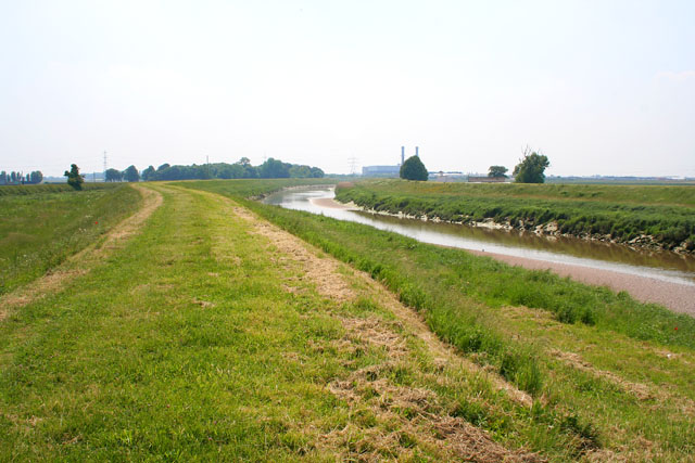
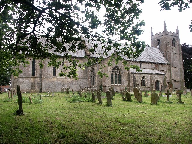
Wykeham is a small village located in the county of Lincolnshire, England. Situated near the market town of Market Rasen, Wykeham is surrounded by picturesque countryside and rolling hills. The village is known for its quaint charm and peaceful atmosphere, making it a popular destination for those seeking a quiet retreat.

Wykeham is home to a mix of traditional stone cottages and newer housing developments, providing a variety of housing options for residents. The village also boasts a village hall, local pub, and a primary school, making it a convenient and family-friendly place to live.

In terms of amenities, Wykeham offers limited shopping options, with residents often traveling to nearby towns for larger supermarkets and retail stores. However, the village is well-connected by road, with easy access to the A46 and A631, making it easy to reach larger towns and cities such as Lincoln and Grimsby.

Overall, Wykeham is a charming village with a strong sense of community and a peaceful rural setting, making it an ideal place for those looking to escape the hustle and bustle of city life.

If you have any feedback on the listing, please let us know in the comments section below.

Wykeham Images

Images are sourced within 2km of 52.820499/-0.1101 or Grid Reference TF2726. Thanks to Geograph Open Source API. All images are credited.

Cross Gate meets the A151 There used to be an inn at this crossroads according to the 1940s map. Now there is Gate Farm to the left and Sycamore Farm to the right. The road straight ahead is Swindler's Drove. See <a href="https://www.geograph.org.uk/gridref/TF2723">TF2723</a>
Cross Gate meets the A151
There used to be an inn at this crossroads according to the 1940s map. Now there is Gate Farm to the left and Sycamore Farm to the right. The road straight ahead is Swindler's Drove. See TF2723
Countryside near Spalding Looking from Cross Gate towards High Road, the A151, just to the north east of Spalding.
Countryside near Spalding
Looking from Cross Gate towards High Road, the A151, just to the north east of Spalding.
Farmland near Spalding Looking towards the flood defence bank on the River Welland. The industrial building on the horizon is on the opposite bank of the river in <a href="https://www.geograph.org.uk/gridref/TF2625">TF2625</a>.
Farmland near Spalding
Looking towards the flood defence bank on the River Welland. The industrial building on the horizon is on the opposite bank of the river in TF2625.
Wykeham Lane near Spalding Looking northwards towards Wykeham from the junction with Rood's Lane. This is typical of many of the cross country Fenland roads once you get off the main routes.
Wykeham Lane near Spalding
Looking northwards towards Wykeham from the junction with Rood's Lane. This is typical of many of the cross country Fenland roads once you get off the main routes.
Stumps Lane, pylons and new power station The industrial plant is in <a href="https://www.geograph.org.uk/gridref/TF2625">TF2625</a> across the River Welland. The flood bank can just be made out in front of the building.
Stumps Lane, pylons and new power station
The industrial plant is in TF2625 across the River Welland. The flood bank can just be made out in front of the building.
Fenland countryside Typical scenery: large flat field crossed by pylons alleviated by shelter belt tree planting. It's the same until you get to the sea!
Fenland countryside
Typical scenery: large flat field crossed by pylons alleviated by shelter belt tree planting. It's the same until you get to the sea!
River Welland at low tide The Welland is tidal up to Fulney Lock in Spalding, approximately 20 km (12.5 miles) from the sea. "Beaches" of sand are exposed at low tide. View point from the eastern flood defence bank. (See <a href="https://www.geograph.org.uk/photo/28250">TF2523 : The River Welland</a> for a view of the river above the lock.)
River Welland at low tide
The Welland is tidal up to Fulney Lock in Spalding, approximately 20 km (12.5 miles) from the sea. "Beaches" of sand are exposed at low tide. View point from the eastern flood defence bank. (See TF2523 : The River Welland for a view of the river above the lock.)
Next stop: the Wash The tidal River Welland from the massive flood bank on the eastern side.
Next stop: the Wash
The tidal River Welland from the massive flood bank on the eastern side.
Fenland countryside Endless cabbages! Taken looking east from Marsh Road.
Fenland countryside
Endless cabbages! Taken looking east from Marsh Road.
Farmland near Spalding Barn surrounded by potatoes.
Farmland near Spalding
Barn surrounded by potatoes.
Fly tipping by the River Welland flood bank
Fly tipping
by the River Welland flood bank
Wykeham Chapel Standing alone just south of Spalding Marsh, this was built in 1311 by Prior Clement Hatfield to be the private chapel of his country residence. The line of the rectangular moat survives, part of it still filled with water. Clement of Hatfield was Lord Prior of the Benedictine Priory in Spalding from 1292 to 1318. The ruin is tucked away behind Wykeham Farm. View from the field to the east of Marsh Road.
Wykeham Chapel
Standing alone just south of Spalding Marsh, this was built in 1311 by Prior Clement Hatfield to be the private chapel of his country residence. The line of the rectangular moat survives, part of it still filled with water. Clement of Hatfield was Lord Prior of the Benedictine Priory in Spalding from 1292 to 1318. The ruin is tucked away behind Wykeham Farm. View from the field to the east of Marsh Road.
The Chase, Wykeham near Spalding This lane is tree lined, an unusual sight in this part of Lincolnshire.
The Chase, Wykeham near Spalding
This lane is tree lined, an unusual sight in this part of Lincolnshire.
Marsh Road near Spalding Marsh House Farm to the right and Sunnyfield Nursery behind the trees straight ahead. The River Welland is just out of shot on the left.
Marsh Road near Spalding
Marsh House Farm to the right and Sunnyfield Nursery behind the trees straight ahead. The River Welland is just out of shot on the left.
Farmland near Spalding The trailers are covered wagons used during crop picking. They are dotted about all over the Fenland fields.
Farmland near Spalding
The trailers are covered wagons used during crop picking. They are dotted about all over the Fenland fields.
Shepherd's Farm on Stone Gate, near Weston
Farmland near Spalding Brassicas growing at Shepherd's Farm
Farmland near Spalding
Brassicas growing at Shepherd's Farm
Any one for chips? Potatoes at Shepherd's Farm
Any one for chips?
Potatoes at Shepherd's Farm
Show me another place!

Wykeham is located at Grid Ref: TF2726 (Lat: 52.820499, Lng: -0.1101)

Division: Parts of Holland

Administrative County: Lincolnshire

District: South Holland

Police Authority: Lincolnshire

What 3 Words

///faster.blemishes.series. Near Pinchbeck, Lincolnshire

Nearby Locations

Wykeham

Related Wikis

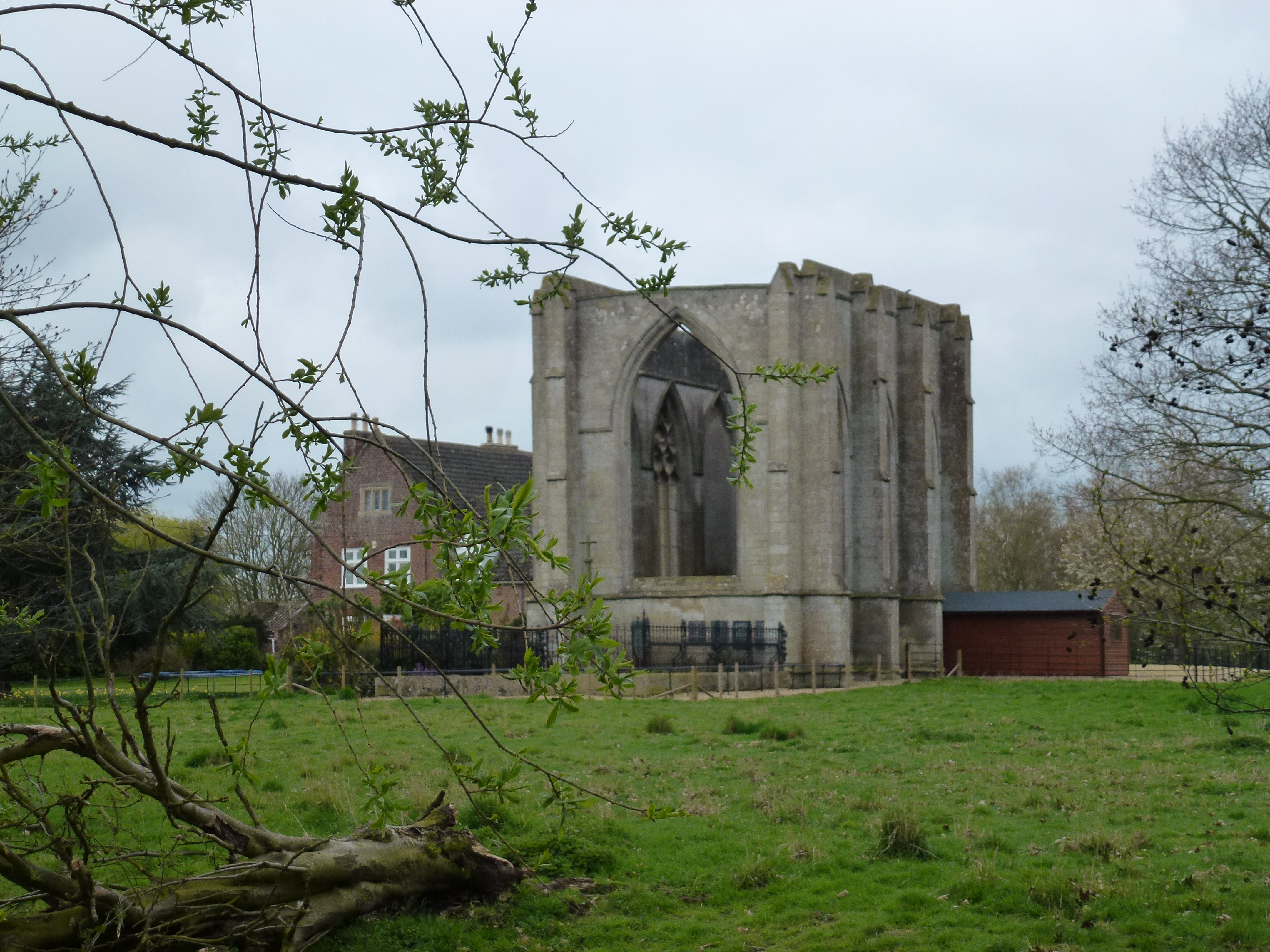
Wykeham, Weston, Lincolnshire

Wykeham /ˈwɪk.əm/ is a deserted medieval village in the civil parish of Weston in the South Holland district of Lincolnshire, England. Wykeham is the...
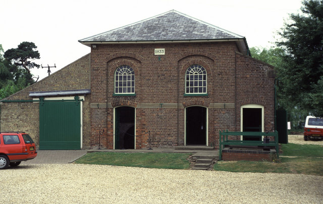
Pinchbeck Engine

The Pinchbeck Engine is a drainage engine, a rotative beam engine built in 1833 to drain Pinchbeck Marsh, to the north of Spalding, Lincolnshire, in England...

Spalding Power Station

Spalding Power Station is a 860 MW gas-fired power station one mile north of Spalding on West Marsh Road close to the River Welland. The current site provides...

Weston, Lincolnshire

Weston is a village and civil parish in the South Holland district of Lincolnshire, England. It is situated approximately 2 miles (3 km) north-east from...

Nearby Amenities

Located within 500m of 52.820499,-0.1101
Spalding Marsh
Place: locality
Source: Bing
Lat/Long: 52.8220355/-0.1086824
Wykeham Farm
Place: farm
Source: Bing
Lat/Long: 52.8194459/-0.1072178
Wykeham
Place: isolated_dwelling
Source: Bing
Lat/Long: 52.8191946/-0.1096407
The data included in this document is from www.openstreetmap.org. The data is made available under ODbL.

Have you been to Wykeham?

Leave your review of Wykeham below (or comments, questions and feedback).