Wrekenton

Settlement in Durham

England

Wrekenton

Angel Of The North, Gateshead With Me for Scale :) I am 6ft 3. I had to sprint up the hill as only had 10 seconds. 

The steel sculpture is 20 metres (66 ft) tall, with wings measuring 54 metres (177 ft) across. Sculpted by Antony Gormley and was installed on 15 February 1998

<span class="nowrap"><a title="https://en.wikipedia.org/wiki/Angel_of_the_North" rel="nofollow ugc noopener" href="https://en.wikipedia.org/wiki/Angel_of_the_North">Link</a><img style="margin-left:2px;" alt="External link" title="External link - shift click to open in new window" src="https://s1.geograph.org.uk/img/external.png" width="10" height="10"/></span>
Angel Of The North, Gateshead Credit: Brian Deegan

Wrekenton is a small village located in the county of Durham, in the northeast of England. Situated about 3 miles south of Gateshead and 6 miles southwest of Newcastle upon Tyne, Wrekenton is part of the Metropolitan Borough of Gateshead.

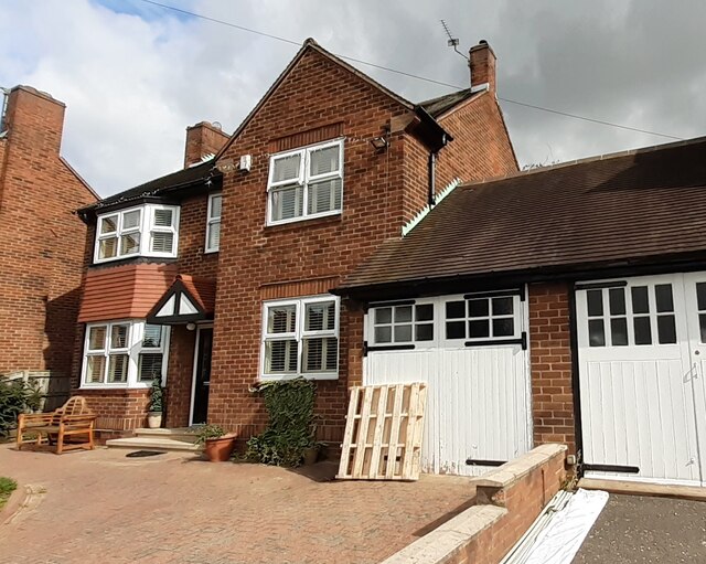
Historically, Wrekenton was an agricultural community, with farming being the primary occupation of its residents. However, over the years, the village has seen significant development and has become more residential. The housing in Wrekenton consists of a mix of traditional Victorian and Edwardian houses, as well as more modern properties.

Despite its growth, Wrekenton has managed to retain its village charm and sense of community. The village center features a few local shops, including a convenience store, a post office, and a pharmacy, catering to the needs of the residents. Additionally, there are a couple of pubs in the area, providing a social hub for locals to gather.

Wrekenton benefits from its proximity to larger towns and cities, allowing residents to easily access a wider range of amenities and employment opportunities. The village is well-connected by road, with the A1(M) and A167 nearby, providing convenient access to Newcastle, Durham, and surrounding areas.

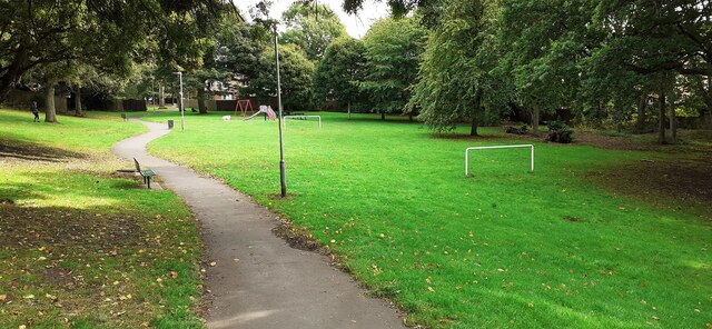
Surrounded by picturesque countryside, Wrekenton offers its residents a peaceful environment with various green spaces. The village is home to several parks and recreational areas, providing opportunities for outdoor activities and leisure pursuits.

In summary, Wrekenton is a small, residential village in Durham that balances the tranquility of rural living with the convenience of nearby urban centers.

If you have any feedback on the listing, please let us know in the comments section below.
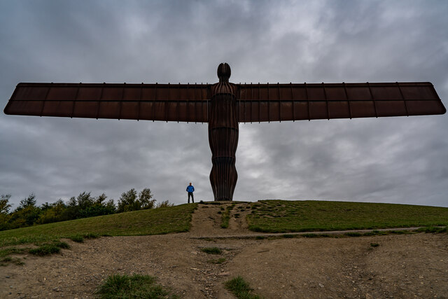
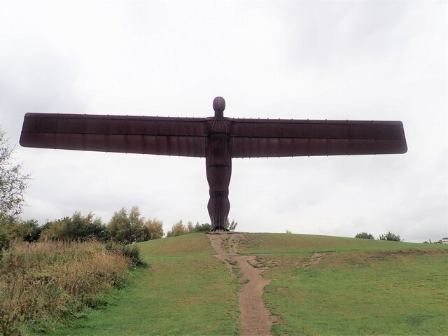
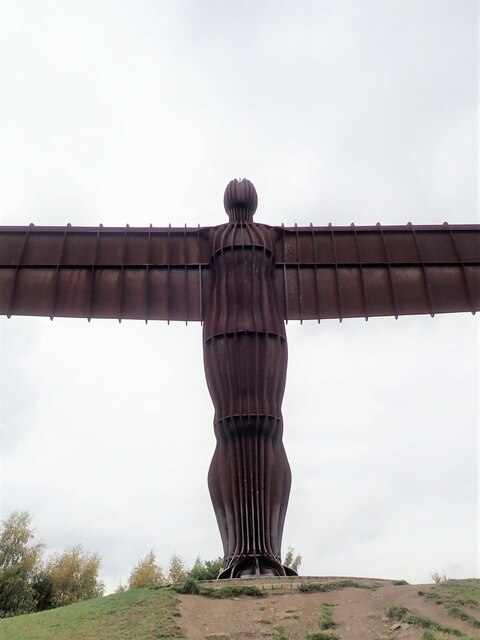
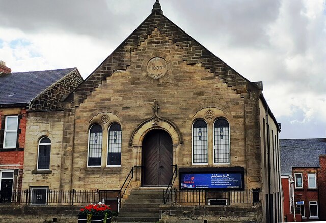
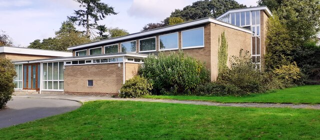
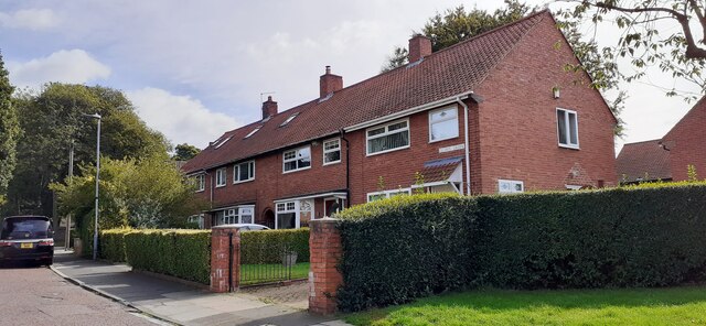
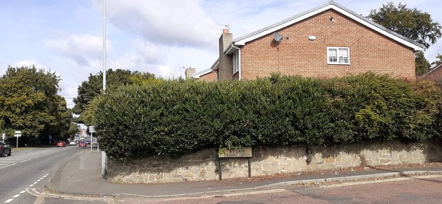
Wrekenton Images

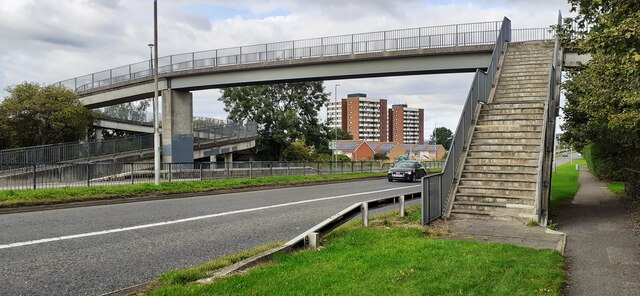
Images are sourced within 2km of 54.926249/-1.5700259 or Grid Reference NZ2759. Thanks to Geograph Open Source API. All images are credited.

Angel Of The North, Gateshead With Me for Scale :) I am 6ft 3. I had to sprint up the hill as only had 10 seconds. 

The steel sculpture is 20 metres (66 ft) tall, with wings measuring 54 metres (177 ft) across. Sculpted by Antony Gormley and was installed on 15 February 1998

<span class="nowrap"><a title="https://en.wikipedia.org/wiki/Angel_of_the_North" rel="nofollow ugc noopener" href="https://en.wikipedia.org/wiki/Angel_of_the_North">Link</a><img style="margin-left:2px;" alt="External link" title="External link - shift click to open in new window" src="https://s1.geograph.org.uk/img/external.png" width="10" height="10"/></span>
Angel Of The North, Gateshead
With Me for Scale :) I am 6ft 3. I had to sprint up the hill as only had 10 seconds. The steel sculpture is 20 metres (66 ft) tall, with wings measuring 54 metres (177 ft) across. Sculpted by Antony Gormley and was installed on 15 February 1998 LinkExternal link
The Angel of the North, Gateshead
The Angel of the North A contemporary sculpture by Antony Gormley, it is believed to be the largest sculpture of an angel in the world. Despite considerable opposition during its design and construction phases, it is now widely recognised as an iconic example of public art and as a symbol of Gateshead. It can withstand wind speeds over 100 mph.
The Angel of the North
A contemporary sculpture by Antony Gormley, it is believed to be the largest sculpture of an angel in the world. Despite considerable opposition during its design and construction phases, it is now widely recognised as an iconic example of public art and as a symbol of Gateshead. It can withstand wind speeds over 100 mph.
Prayers and wishes Just south of the Angel of the North, people have left tributes and mementos of lost loved ones hanging on the trees and bushes.
Prayers and wishes
Just south of the Angel of the North, people have left tributes and mementos of lost loved ones hanging on the trees and bushes.
Up close to the Angel of the North Missing half its wingspan of 175 ft when so close
Up close to the Angel of the North
Missing half its wingspan of 175 ft when so close
Information Board - Angel of the North An information board relating the birth of the concept, its construction and various facts.
Information Board - Angel of the North
An information board relating the birth of the concept, its construction and various facts.
Angel of the North A contemporary sculpture by Antony Gormley, it is believed to be the largest sculpture of an angel in the world. Despite considerable opposition during its design and construction phases, it is now widely recognised as an iconic example of public art and as a symbol of Gateshead. It can withstand wind speeds over 100 mph.
Angel of the North
A contemporary sculpture by Antony Gormley, it is believed to be the largest sculpture of an angel in the world. Despite considerable opposition during its design and construction phases, it is now widely recognised as an iconic example of public art and as a symbol of Gateshead. It can withstand wind speeds over 100 mph.
Angel of the North In silhouette
Angel of the North
In silhouette
The Coach House on west side of Durham Road
Chowdene Church, #660 Durham Road
St Ninian's Church on NW side of Ivy Lane
Nos 1-4 Cedars Green
Junction of Ivy Lane and Durham Road Ordnance Survey documents describe a benchmark levelled at 88.800m above Newlyn Datum on a wall at this location
Junction of Ivy Lane and Durham Road
Ordnance Survey documents describe a benchmark levelled at 88.800m above Newlyn Datum on a wall at this location
#771 Durham Road Ordnance Survey documents indicate that a benchmark was levelled at 76.023m above Newlyn Datum on the far corner of the house
#771 Durham Road
Ordnance Survey documents indicate that a benchmark was levelled at 76.023m above Newlyn Datum on the far corner of the house
Play area and goalposts in Calderwood Park
Esso filling station on east side of A167
Betty Pit electricity substation on east side of A167
Footbridge over Durham Road (A167)
Show me another place!

Wrekenton is located at Grid Ref: NZ2759 (Lat: 54.926249, Lng: -1.5700259)

Unitary Authority: Gateshead

Police Authority: Northumbria

What 3 Words

///atom.league.person. Near Lamesley, Tyne & Wear

Nearby Locations

Wrekenton Black Hill

Related Wikis

Wrekenton

Wrekenton is a residential area in Gateshead, located around 3.5 miles (5.6 km) from Newcastle upon Tyne, 11 miles (18 km) from Sunderland, and 14 miles...

Sheriff Hill Colliery

Sheriff Hill Colliery or Ellison Main Colliery was a coal mine at Gateshead Fell in County Durham, England. The colliery had two shafts and provided...

Cardinal Hume Catholic School

Cardinal Hume Catholic School is a coeducational secondary school and sixth form located in the Beacon Lough area of Gateshead, Tyne and Wear, England...
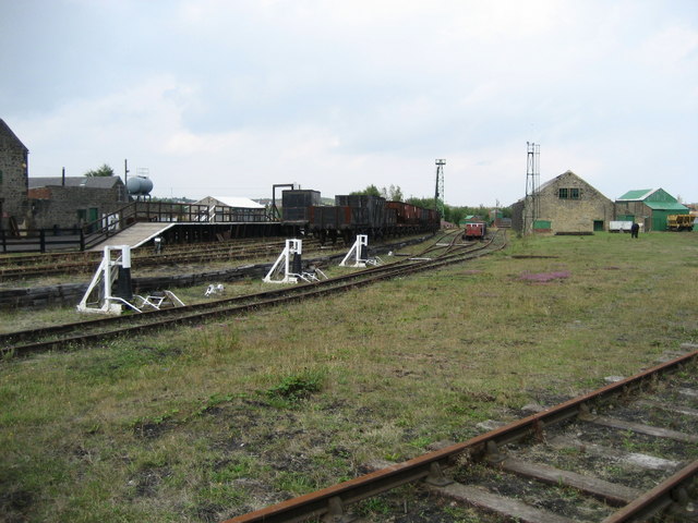
Bowes Railway

The Bowes Railway, built by George Stephenson in 1826, is the world's only operational preserved standard gauge cable railway system. It was built to transport...
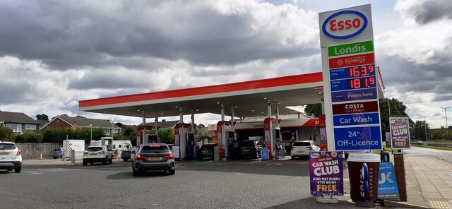
Nearby Amenities

Located within 500m of 54.926249,-1.5700259
Mini Roundabout
Direction: clockwise
Lat/Long: 54.9242444/-1.5754006
Mini Roundabout
Direction: clockwise
Lat/Long: 54.9244372/-1.576861
Traffic Signals
Crossing: traffic_signals
Traffic Signals Direction: both
Lat/Long: 54.92558/-1.5750744
Wrekenton
Is In: Gateshead, England, UK
Old Name: Wreckington
Place: suburb
Wikidata: Q8037721
Lat/Long: 54.9253141/-1.5745803
Bus Stop
ST. OSWALD'S RC. PRIMARY SCHOOL
Local Ref: E
Naptan AtcoCode: 410000000108
Naptan Bearing: E
Naptan CommonName: ST. OSWALD'S RC. PRIMARY SCHOOL
Naptan Indicator: E
Naptan Landmark: ST. OSWALD'S RC. PRIMARY SCHOOL
Naptan NaptanCode: twrgtwmw
Naptan PlusbusZoneRef: NWCSTLE
Naptan Street: EASINGTON AVENUE
Naptan Verified: no
Source: naptan_import
Lat/Long: 54.9270232/-1.5732039
Bus Stop
WREKENTON A
Local Ref: S
Naptan AtcoCode: 410000022003
Naptan Bearing: S
Naptan CommonName: WREKENTON A
Naptan Indicator: S
Naptan Landmark: OPPOSITE THE CO-OP STORE
Naptan NaptanCode: twrdpjpm
Naptan PlusbusZoneRef: NWCSTLE
Naptan Street: HIGH STREET
Naptan Verified: no
Source: naptan_import
Wheelchair: yes
Lat/Long: 54.925286/-1.5749855
Bus Stop
Springwell Road
Bench: yes
Bus: yes
Departures Board: timetable
Lit: yes
Local Ref: SW
Naptan AtcoCode: 410000022005
Naptan Bearing: SW
Naptan CommonName: SPRINGWELL ROAD-SPRINGWELL TERRACE-N/B
Naptan Indicator: SW
Naptan Landmark: OPPOSITE SPRINGWELL TERRACE
Naptan NaptanCode: twrdpjpw
Naptan PlusbusZoneRef: NWCSTLE
Naptan Street: SPRINGWELL ROAD
Naptan Verified: no
Public Transport: platform
Shelter: yes
Source: naptan_import
Lat/Long: 54.9278824/-1.5638853
Bus Stop
Springwell Road
Bench: yes
Bin: yes
Bus: yes
Departures Board: timetable
Local Ref: SW
Naptan AtcoCode: 410000022026
Naptan Bearing: SW
Naptan CommonName: SPRINGWELL ROAD-SPRINGWELL TERRACE-S/B
Naptan Indicator: SW
Naptan Landmark: OUTSIDE SPRINGWELL TERRACE
Naptan NaptanCode: twrdpmat
Naptan PlusbusZoneRef: NWCSTLE
Naptan Street: SPRINGWELL ROAD
Naptan Verified: no
Public Transport: platform
Shelter: yes
Source: naptan_import
Lat/Long: 54.9276747/-1.5632905
Bus Stop
SPRINGWELL ROAD-FELLDYKE SCHOOL-S/B
Bench: yes
Bin: no
Bus: yes
Local Ref: SW
Naptan AtcoCode: 410000022027
Naptan Bearing: SW
Naptan CommonName: SPRINGWELL ROAD-FELLDYKE SCHOOL-S/B
Naptan Indicator: SW
Naptan Landmark: OUTSIDE FELL DYKE PRIMARY SCHOOL
Naptan NaptanCode: twrdpmaw
Naptan PlusbusZoneRef: NWCSTLE
Naptan Street: SPRINGWELL ROAD
Naptan Verified: no
Public Transport: platform
Shelter: yes
Source: naptan_import
Lat/Long: 54.9271987/-1.566929
Bus Stop
WREKENTON B
Bench: yes
Bus: yes
Departures Board: timetable
Local Ref: N
Naptan AtcoCode: 410000022028
Naptan Bearing: N
Naptan CommonName: WREKENTON B
Naptan Indicator: N
Naptan Landmark: OUTSIDE THE CO-OP STORE
Naptan NaptanCode: twrdpmda
Naptan PlusbusZoneRef: NWCSTLE
Naptan Street: HIGH STREET
Naptan Verified: no
Public Transport: platform
Ref: B
Shelter: yes
Source: naptan_import
Wheelchair: yes
Lat/Long: 54.9252686/-1.5751417
Bus Stop
WREKENTON
Local Ref: S
Naptan AtcoCode: 410000022080
Naptan Bearing: S
Naptan CommonName: WREKENTON
Naptan Indicator: S
Naptan Landmark: OUTSIDE NO.11 WREKENTON ROW
Naptan NaptanCode: twrdptda
Naptan PlusbusZoneRef: NWCSTLE
Naptan Street: WREKENTON ROW
Naptan Verified: no
Source: naptan_import
Lat/Long: 54.9242787/-1.5747465
Bus Stop
Wrekenton
Bus: yes
Departures Board: timetable
Local Ref: N
Naptan AtcoCode: 410000022090
Naptan Bearing: N
Naptan CommonName: WREKENTON
Naptan Indicator: N
Naptan Landmark: OPPOSITE NO.12 WREKENTON ROW
Naptan NaptanCode: twrdptgm
Naptan PlusbusZoneRef: NWCSTLE
Naptan Street: WREKENTON ROW
Naptan Verified: no
Public Transport: platform
Source: naptan_import
Wheelchair: yes
Lat/Long: 54.9239432/-1.5748292
Bus Stop
SPRINGWELL ESTATE
Local Ref: W
Naptan AtcoCode: 410000022141
Naptan Bearing: W
Naptan CommonName: SPRINGWELL ESTATE
Naptan Indicator: W
Naptan Landmark: EAST OF THE WREKENDIKE PUBLIC HOUSE
Naptan NaptanCode: twrdpwgd
Naptan PlusbusZoneRef: NWCSTLE
Naptan Street: LANCHESTER AVENUE
Naptan Verified: no
Source: naptan_import
Lat/Long: 54.9291136/-1.5646144
Bus Stop
Lanchester Avenue
Bench: yes
Bus: yes
Departures Board: timetable
Local Ref: S
Naptan AtcoCode: 410000022143
Naptan Bearing: S
Naptan CommonName: LANCHESTER AVENUE-SPRINGWELL ROAD-S/B
Naptan Indicator: S
Naptan Landmark: 30M NORTH OF SPRINGWELL ROAD
Naptan NaptanCode: twrdpwgj
Naptan PlusbusZoneRef: NWCSTLE
Naptan Street: LANCHESTER AVENUE
Naptan Verified: no
Public Transport: platform
Shelter: yes
Source: naptan_import
Lat/Long: 54.9272707/-1.5675146
Bus Stop
LANCHESTER AVENUE-SPRINGWELL ROAD-N/B
Local Ref: N
Naptan AtcoCode: 410000022144
Naptan Bearing: N
Naptan CommonName: LANCHESTER AVENUE-SPRINGWELL ROAD-N/B
Naptan Indicator: N
Naptan Landmark: NORTH OF FELL DYKE SCHOOL OUTSIDE WHITBURN GDNS
Naptan NaptanCode: twrdpwgm
Naptan PlusbusZoneRef: NWCSTLE
Naptan Street: LANCHESTER AVENUE
Naptan Verified: no
Source: naptan_import
Lat/Long: 54.9274445/-1.5678314
Bus Stop
LANCHESTER AVENUE-CLEADON GARDENS-E/B
Local Ref: E
Naptan AtcoCode: 410000022145
Naptan Bearing: E
Naptan CommonName: LANCHESTER AVENUE-CLEADON GARDENS-E/B
Naptan Indicator: E
Naptan Landmark: OPPOSITE THE WREKENDIKE PUBLIC HOUSE
Naptan NaptanCode: twrdpwgp
Naptan PlusbusZoneRef: NWCSTLE
Naptan Street: LANCHESTER AVENUE
Naptan Verified: no
Source: naptan_import
Lat/Long: 54.9289476/-1.5659427
Bus Stop
SPRINGWELL ROAD-SOCIAL CLUB
Bench: yes
Bus: yes
Check Date Shelter: 2022-03-09
Departures Board: timetable
Local Ref: SW
Naptan AtcoCode: 410000022201
Naptan Bearing: SW
Naptan CommonName: SPRINGWELL ROAD-SOCIAL CLUB
Naptan Indicator: SW
Naptan Landmark: OPPOSITE THE HEALTH CENTRE
Naptan NaptanCode: twrdtajg
Naptan PlusbusZoneRef: NWCSTLE
Naptan Street: SPRINWELL ROAD
Naptan Verified: no
Passenger Information Display: no
Public Transport: platform
Shelter: yes
Source: naptan_import
Lat/Long: 54.9259984/-1.5705776
Bus Stop
SPRINGWELL ROAD-HEALTH CENTRE
Local Ref: NE
Naptan AtcoCode: 410000022202
Naptan Bearing: NE
Naptan CommonName: SPRINGWELL ROAD-HEALTH CENTRE
Naptan Indicator: NE
Naptan Landmark: OUTSIDE HEALTH CENTRE
Naptan NaptanCode: twrdtajm
Naptan PlusbusZoneRef: NWCSTLE
Naptan Street: SPRINGWELL ROAD
Naptan Verified: no
Source: naptan_import
Lat/Long: 54.926142/-1.5705137
Bus Stop
WREKENTON
Local Ref: W
Naptan AtcoCode: 410000022205
Naptan Bearing: W
Naptan CommonName: WREKENTON
Naptan Indicator: W
Naptan Landmark: OUTSIDE WREKENTON CLUB
Naptan NaptanCode: twrdtajw
Naptan PlusbusZoneRef: NWCSTLE
Naptan Street: SPRINGWELL ROAD
Naptan Verified: no
Source: naptan_import
Lat/Long: 54.925499/-1.5742031
Railway: switch
Lat/Long: 54.9232741/-1.5674051
Barrier: bollard
Motor Vehicle: no
Lat/Long: 54.9285751/-1.5724928
Turning Circle
Lat/Long: 54.9289979/-1.5760232
Turning Circle
Lat/Long: 54.9293583/-1.575152
Turning Circle
Lat/Long: 54.9297047/-1.5741307
Turning Circle
Lat/Long: 54.9300753/-1.5732903
Turning Circle
Noexit: yes
Lat/Long: 54.9296302/-1.5688209
Turning Circle
Lat/Long: 54.9237468/-1.5731467
Barrier: bollard
Motor Vehicle: no
Lat/Long: 54.9285289/-1.5724546
Stormont Main Colliery
Historic: mine
Mineral: coal
Source: OS 1:25k
Lat/Long: 54.9265367/-1.5747778
Bryson's Animal Refuge
Animal: shelter
Cat: yes
Dog: yes
Horse: yes
Lat/Long: 54.9227804/-1.5688304
Entrance: yes
Lat/Long: 54.9223388/-1.5697458
Fixme: barrier / crossing type?
Railway: crossing
Lat/Long: 54.9234489/-1.5676014
Railway: crossing
Lat/Long: 54.9234536/-1.5675534
Railway: switch
Lat/Long: 54.9240694/-1.5684125
Spar
Addr City: Gateshead
Addr Housenumber: 161-163
Addr Postcode: NE9 7JR
Addr Street: High Street
Addr Suburb: Wrekenton
Brand: Spar
Brand Wikidata: Q610492
Fhrs Id: 950831
Shop: convenience
Source Addr: FHRS Open Data
Wheelchair: limited
Lat/Long: 54.9252628/-1.5748512
Addr Housenumber: 2
Addr Postcode: NE9 7BL
Addr Street: Linden Way
Lat/Long: 54.9225066/-1.5733981
Addr Housenumber: 1
Addr Postcode: NE9 7BL
Addr Street: Linden Way
Lat/Long: 54.9224696/-1.5734946
Addr Housenumber: 10
Addr Postcode: NE9 7BL
Addr Street: Linden Way
Lat/Long: 54.9228089/-1.5724808
Addr Housenumber: 3
Addr Postcode: NE9 7BL
Addr Street: Linden Way
Lat/Long: 54.9225467/-1.5732264
Addr Housenumber: 4
Addr Postcode: NE9 7BL
Addr Street: Linden Way
Lat/Long: 54.9225775/-1.5731352
Addr Housenumber: 5
Addr Postcode: NE9 7BL
Addr Street: Linden Way
Lat/Long: 54.9226206/-1.5729528
Addr Housenumber: 6
Addr Postcode: NE9 7BL
Addr Street: Linden Way
Lat/Long: 54.9226516/-1.572867
Addr Housenumber: 7
Addr Postcode: NE9 7BL
Addr Street: Linden Way
Lat/Long: 54.9227164/-1.5727222
Addr Housenumber: 8
Addr Postcode: NE9 7BL
Addr Street: Linden Way
Lat/Long: 54.9227503/-1.5726149
Addr Housenumber: 9
Addr Postcode: NE9 7BL
Addr Street: Linden Way
Lat/Long: 54.9227779/-1.5725559
Addr Housenumber: 11
Addr Postcode: NE9 7BL
Addr Street: Linden Way
Lat/Long: 54.9225622/-1.5718102
Addr Housenumber: 12
Addr Postcode: NE9 7BL
Addr Street: Linden Way
Lat/Long: 54.9224973/-1.5717029
Addr Housenumber: 13
Addr Postcode: NE9 7BL
Addr Street: Linden Way
Lat/Long: 54.9224172/-1.5716064
Addr Housenumber: 14
Addr Postcode: NE9 7BL
Addr Street: Linden Way
Lat/Long: 54.922368/-1.5715527
Addr Housenumber: 15
Addr Postcode: NE9 7BL
Addr Street: Linden Way
Lat/Long: 54.9224788/-1.5712845
Addr Housenumber: 16
Addr Postcode: NE9 7BL
Addr Street: Linden Way
Lat/Long: 54.9225128/-1.5711987
Addr Housenumber: 17
Addr Postcode: NE9 7BL
Addr Street: Linden Way
Lat/Long: 54.9225282/-1.5708714
Addr Housenumber: 18
Addr Postcode: NE9 7BL
Addr Street: Linden Way
Lat/Long: 54.9224667/-1.5707427
Addr Housenumber: 19
Addr Postcode: NE9 7BL
Addr Street: Linden Way
Lat/Long: 54.9224573/-1.5706139
Addr Housenumber: 20
Addr Postcode: NE9 7BL
Addr Street: Linden Way
Lat/Long: 54.9224328/-1.5704637
Addr Housenumber: 23
Addr Postcode: NE9 7BL
Addr Street: Linden Way
Lat/Long: 54.922112/-1.5705442
Addr Housenumber: 24
Addr Postcode: NE9 7BL
Addr Street: Linden Way
Lat/Long: 54.9221769/-1.5706408
Addr Housenumber: 25
Addr Postcode: NE9 7BL
Addr Street: Linden Way
Lat/Long: 54.922263/-1.5707641
Addr Housenumber: 26
Addr Postcode: NE9 7BL
Addr Street: Linden Way
Lat/Long: 54.9221769/-1.5713006
Addr Housenumber: 21
Addr Postcode: NE9 7BL
Addr Street: Linden Way
Lat/Long: 54.9224172/-1.5703618
Addr Housenumber: 27
Addr Postcode: NE9 7BL
Addr Street: Linden Way
Lat/Long: 54.9221214/-1.5712201
Addr Housenumber: 28
Addr Postcode: NE9 7BL
Addr Street: Linden Way
Lat/Long: 54.9220505/-1.5711128
Addr Housenumber: 29
Addr Postcode: NE9 7BL
Addr Street: Linden Way
Lat/Long: 54.9219981/-1.571027
Addr Housenumber: 30
Addr Postcode: NE9 7BL
Addr Street: Linden Way
Lat/Long: 54.9219364/-1.5709251
Addr Housenumber: 16
Addr Street: Hazelwood Close
Lat/Long: 54.922741/-1.5711718
Addr Housenumber: 14
Addr Street: Hazelwood Close
Lat/Long: 54.922815/-1.571263
Addr Housenumber: 8
Addr Street: Hazelwood Close
Lat/Long: 54.9228736/-1.5715903
Addr Housenumber: 4
Addr Street: Hazelwood Close
Lat/Long: 54.9227564/-1.5718156
Addr Housenumber: 2
Addr Street: Hazelwood Close
Lat/Long: 54.9227193/-1.571896
Addr Housenumber: 6
Addr Street: Hazelwood Close
Lat/Long: 54.9228397/-1.5716654
Addr Housenumber: 10
Addr Street: Hazelwood Close
Lat/Long: 54.922932/-1.5714508
Addr Housenumber: 12
Addr Street: Hazelwood Close
Lat/Long: 54.9229692/-1.5713596
Addr Housenumber: 1
Addr Street: Hazelwood Close
Lat/Long: 54.9228736/-1.5723574
Addr Housenumber: 9
Addr Street: Hazelwood Close
Lat/Long: 54.9230892/-1.5718692
Addr Housenumber: 11
Addr Street: Hazelwood Close
Lat/Long: 54.9231201/-1.5717834
Addr Housenumber: 5
Addr Street: Hazelwood Close
Lat/Long: 54.9229753/-1.5721374
Addr Housenumber: 7
Addr Street: Hazelwood Close
Lat/Long: 54.9230245/-1.5720194
Addr Housenumber: 3
Addr Street: Hazelwood Close
Lat/Long: 54.9229043/-1.5722554
Post Box
Collection Times: Mo-Fr 17:00; Sa 12:00
Drive Through: no
Operator: Royal Mail
Operator Wikidata: Q638098
Post Box Type: pillar
Ref: NE9 20
Royal Cypher: GVIR
Royal Cypher Wikidata: Q33102169
Lat/Long: 54.9250172/-1.574905
Pharmacy
Lloyds Pharmacy
Addr City: Gateshead
Addr Housenumber: 1
Addr Postcode: NE9 7JN
Addr Street: Springwell Road
Addr Suburb: Wrekenton
Brand: Lloyds Pharmacy
Brand Wikidata: Q6662870
Brand Wikipedia: en:LloydsPharmacy
Dispensing: yes
Fhrs Id: 843317
Healthcare: pharmacy
Source Addr: FHRS Open Data
Wheelchair: yes
Lat/Long: 54.9257085/-1.5746964
Bench
Backrest: yes
Lat/Long: 54.9279736/-1.5637388
Atm
Drive Through: no
Operator: CashZone
Wheelchair: yes
Lat/Long: 54.9254246/-1.575206
Kellys Hair & Beauty
Addr Street: Wrekenton Row
Phone: +44 191 4400 608
Shop: hairdresser
Wheelchair: yes
Lat/Long: 54.9237843/-1.5745632
M J Phoenix & Son
Addr Street: Wrekenton Row
Office: yes
Lat/Long: 54.9236967/-1.5748843
Crossing
Crossing: zebra
Lat/Long: 54.9249749/-1.5750684
Ultra Tan
Addr Street: Wrekenton Row
Phone: +44 191 482 2537
Shop: beauty
Wheelchair: yes
Lat/Long: 54.9242302/-1.5746007
Crossing
Crossing: zebra
Crossing Island: no
Tactile Paving: yes
Lat/Long: 54.9244785/-1.575055
Fast Food
Fish & Chips
Cuisine: fish_and_chips
Drive Through: no
Wheelchair: yes
Lat/Long: 54.9243146/-1.5746432
Fast Food
Marshall Express Sandwiches
Addr Street: Wrekenton Row
Drive Through: no
Wheelchair: yes
Lat/Long: 54.9243675/-1.5746414
Poundzone
Shop: variety_store
Wheelchair: yes
Lat/Long: 54.9245231/-1.5746586
Post Office
Wrekenton Post Office
Addr City: Gateshead
Addr Country: GB
Addr Housenumber: 9
Addr Postcode: NE9 7JD
Addr Street: Wrekenton Row
Opening Hours: Mo-Sa 09:00-17:30
Ref Pol Id: 124939
Wheelchair: yes
Lat/Long: 54.9244491/-1.5746452
Pharmacy
Order My Tablets
Website: www.ordermytablets.com
Wheelchair: yes
Lat/Long: 54.9246187/-1.5746854
Ladbrokes
Brand: Ladbrokes
Brand Wikidata: Q1799875
Shop: bookmaker
Lat/Long: 54.9247087/-1.5746488
Pub
The Clock
Wheelchair: yes
Lat/Long: 54.9247704/-1.5744597
Bench
Backrest: yes
Lat/Long: 54.9246679/-1.5750298
Bench
Backrest: yes
Lat/Long: 54.924613/-1.5750278
Bench
Backrest: yes
Lat/Long: 54.9245756/-1.5750237
Waste Basket
Lat/Long: 54.9246573/-1.5749831
Pub
The Royal Oak
Addr City: Gateshead
Addr Housenumber: 177
Addr Postcode: NE9 7JR
Addr Street: High Street
Addr Suburb: Wrekenton
Fhrs Id: 843272
Source Addr: FHRS Open Data
Wheelchair: limited
Lat/Long: 54.9249097/-1.5748367
Sabs Barbers
Addr Street: High Street
Shop: hairdresser
Wheelchair: limited
Lat/Long: 54.9250304/-1.5748156
Bodylux Hair & Beauty
Addr Street: High Street
Shop: hairdresser
Wheelchair: limited
Lat/Long: 54.9250641/-1.5748116
Phoenix Vaping
Addr Street: High Street
Shop: e-cigarette
Lat/Long: 54.9251024/-1.5748089
Fast Food
Greggs
Addr City: Gateshead
Addr Housenumber: 167
Addr Postcode: NE9 7JR
Addr Street: High Street
Addr Suburb: Wrekenton
Brand: Greggs
Brand Wikidata: Q3403981
Brand Wikipedia: en:Greggs
Cuisine: sandwich;bakery
Fhrs Id: 339212
Source Addr: FHRS Open Data
Takeaway: yes
Wheelchair: yes
Lat/Long: 54.9251375/-1.5748069
Betfred
Brand: Betfred
Brand Wikidata: Q4897425
Shop: bookmaker
Lat/Long: 54.9253721/-1.5748181
This & That
Shop: variety_store
Wheelchair: limited
Lat/Long: 54.9254507/-1.5747993
Fast Food
Regency Pizza
Addr Street: Springwell Road
Phone: +44 191 482 6060
Wheelchair: yes
Lat/Long: 54.9254576/-1.5746196
Doctors
Wreckenton Health Centre
Addr City: Wreckenton
Addr Postcode: NE9 7AD
Addr Street: Springwell Road
Fixme: merge with a building
Phone: +44 191 487 6129
Website: https://www.wrekentonmedicalgroup.nhs.uk/
Lat/Long: 54.9263169/-1.570417
Cafe
Angel Fish Bar
Addr Street: Springwell Road
Wheelchair: limited
Lat/Long: 54.9257081/-1.5745413
Waste Basket
Lat/Long: 54.9256532/-1.5746106
John Willetts Fireplace & Stove Centre
Addr City: Gateshead
Addr Street: Old Durham Road
Shop: fireplace
Lat/Long: 54.9258772/-1.574814
Bench
Backrest: no
Lat/Long: 54.9262894/-1.5749002
Bench
Backrest: no
Lat/Long: 54.9263037/-1.574787
Bench
Backrest: no
Lat/Long: 54.9263169/-1.5746967
Bicycle Parking
Bicycle Parking: stands
Covered: no
Lat/Long: 54.9263311/-1.5745958
Fast Food
Wrekenton Chop Suey House
Addr City: Gateshead
Addr Housenumber: 87
Addr Postcode: NE9 7JR
Addr Street: High Street
Addr Suburb: Wrekenton
Cuisine: chinese
Drive Through: no
Fhrs Id: 339209
Phone: +44 191 4879247
Source Addr: FHRS Open Data
Takeaway: only
Wheelchair: limited
Lat/Long: 54.9267665/-1.5751256
Fast Food
Hotway
Addr City: Gateshead
Addr Housenumber: 85
Addr Postcode: NE9 7JR
Addr Street: High Street
Addr Suburb: Wrekenton
Cuisine: indian
Delivery: yes
Drive Through: no
Fhrs Id: 339208
Phone: +44 191 487 1940
Source Addr: FHRS Open Data
Takeaway: only
Wheelchair: limited
Lat/Long: 54.9268042/-1.5751516
Fast Food
Dial A Pizza
Addr City: Gateshead
Addr Housenumber: 83
Addr Postcode: NE9 7JR
Addr Street: High Street
Addr Suburb: Wrekenton
Delivery: yes
Drive Through: no
Fhrs Id: 339207
Phone: +44 191 482 4600
Source Addr: FHRS Open Data
Takeaway: only
Wheelchair: limited
Lat/Long: 54.926862/-1.5751748
The Head Gardener
Addr City: Gateshead
Addr Housenumber: 81
Addr Postcode: NE9 7JR
Addr Street: High Street
Addr Suburb: Wrekenton
Phone: +44 191 491 0515
Shop: hairdresser
Wheelchair: limited
Lat/Long: 54.9269237/-1.5752053
Childcare
Addr City: Gateshead
Addr Street: Old Durham Road
Lat/Long: 54.927612/-1.574621
Post Box
Drive Through: no
Operator: Royal Mail
Operator Wikidata: Q638098
Post Box Type: pillar
Ref: NE9 17
Royal Cypher: GVIR
Royal Cypher Wikidata: Q33102169
Lat/Long: 54.9276131/-1.5660466
Barrier: bollard
Motor Vehicle: no
Lat/Long: 54.9272922/-1.562874
Fast Food
Chutney Balti House
Addr City: Gateshead
Addr Street: High Street
Cuisine: indian
Drive Through: no
Phone: +44 191 487 1727;+44 191 487 4145
Takeaway: only
Wheelchair: yes
Lat/Long: 54.9250661/-1.5752758
Gateshead Carpet Centre
Addr City: Gateshead
Addr Street: High Street
Shop: carpet
Lat/Long: 54.9249293/-1.5752828
St Vincents
Addr City: Gateshead
Addr Street: High Street
Shop: yes
Lat/Long: 54.924732/-1.5752828
Post Box
Ref: NE9 120
Lat/Long: 54.9281207/-1.5765613
Barrier: bollard
Motor Vehicle: no
Lat/Long: 54.9283117/-1.5735786
Munch Box
Addr City: Gateshead
Addr Housenumber: 133
Addr Postcode: NE9 7JR
Addr Street: High Street
Addr Suburb: Wrekenton
Fhrs Id: 991386
Shop: deli
Source Addr: FHRS Open Data
Wheelchair: limited
Lat/Long: 54.9260373/-1.5749099
Street Lamp
Lat/Long: 54.9277072/-1.5626718
Pharmacy
Whitworth Pharmacy
Dispensing: yes
Drive Through: no
Healthcare: pharmacy
Lat/Long: 54.9262336/-1.5705492
Camera Mount: pole
Camera Type: panning
Man Made: surveillance
Surveillance Type: camera
Lat/Long: 54.9247095/-1.5750979
Bicycle Parking
Access: yes
Bicycle Parking: stands
Capacity: 4
Covered: no
Fee: no
Lat/Long: 54.9250196/-1.5749474
Traffic Calming: hump
Lat/Long: 54.9278426/-1.5656715
Addr City: Gateshead
Addr Postcode: NE9 7AB
Addr Street: Springwell Road
Addr Suburb: Wrekenton
Disused Amenity: pub
Fhrs Id: 339473
Outdoor Seating: yes
Was Name: Springwell Inn
Lat/Long: 54.9272318/-1.5630052
Springwell Stores
Addr City: Gateshead
Addr Housenumber: 25-27
Addr Postcode: NE9 7AY
Addr Street: Springwell Terrace
Addr Suburb: Wrekenton
Fhrs Id: 339474
Shop: convenience
Lat/Long: 54.9276628/-1.564637
Wrekenton Auto Supplies
Shop: car_parts
Lat/Long: 54.9276961/-1.5643709
Generator Method: photovoltaic
Generator Output Electricity: yes
Generator Source: solar
Generator Type: solar_photovoltaic_panel
Location: roof
Power: generator
Lat/Long: 54.922238/-1.5708757
Generator Method: photovoltaic
Generator Output Electricity: yes
Generator Source: solar
Generator Type: solar_photovoltaic_panel
Location: roof
Power: generator
Lat/Long: 54.9231748/-1.5717045
Generator Method: photovoltaic
Generator Output Electricity: yes
Generator Source: solar
Generator Type: solar_photovoltaic_panel
Location: roof
Power: generator
Lat/Long: 54.9232677/-1.5714432
Generator Method: photovoltaic
Generator Output Electricity: yes
Generator Source: solar
Generator Type: solar_photovoltaic_panel
Location: roof
Power: generator
Lat/Long: 54.9239357/-1.5715532
Generator Method: photovoltaic
Generator Output Electricity: yes
Generator Source: solar
Generator Type: solar_photovoltaic_panel
Location: roof
Power: generator
Lat/Long: 54.9243744/-1.5737404
Generator Method: photovoltaic
Generator Output Electricity: yes
Generator Source: solar
Generator Type: solar_photovoltaic_panel
Location: roof
Power: generator
Lat/Long: 54.9243961/-1.5727121
Generator Method: photovoltaic
Generator Output Electricity: yes
Generator Source: solar
Generator Type: solar_photovoltaic_panel
Location: roof
Power: generator
Lat/Long: 54.924408/-1.5724095
Generator Method: photovoltaic
Generator Output Electricity: yes
Generator Source: solar
Generator Type: solar_photovoltaic_panel
Location: roof
Power: generator
Lat/Long: 54.9244633/-1.5720725
Generator Method: photovoltaic
Generator Output Electricity: yes
Generator Source: solar
Generator Type: solar_photovoltaic_panel
Location: roof
Power: generator
Lat/Long: 54.9247855/-1.573902
Generator Method: photovoltaic
Generator Output Electricity: yes
Generator Source: solar
Generator Type: solar_photovoltaic_panel
Location: roof
Power: generator
Lat/Long: 54.9246945/-1.5740533
Generator Method: photovoltaic
Generator Output Electricity: yes
Generator Source: solar
Generator Type: solar_photovoltaic_panel
Location: roof
Power: generator
Lat/Long: 54.9247558/-1.574129
Generator Method: photovoltaic
Generator Output Electricity: yes
Generator Source: solar
Generator Type: solar_photovoltaic_panel
Location: roof
Power: generator
Lat/Long: 54.9248131/-1.5741668
Generator Method: photovoltaic
Generator Output Electricity: yes
Generator Source: solar
Generator Type: solar_photovoltaic_panel
Location: roof
Power: generator
Lat/Long: 54.9263664/-1.5703874
Generator Method: photovoltaic
Generator Output Electricity: yes
Generator Source: solar
Generator Type: solar_photovoltaic_panel
Location: roof
Power: generator
Lat/Long: 54.926149/-1.5683068
Generator Method: photovoltaic
Generator Output Electricity: yes
Generator Source: solar
Generator Type: solar_photovoltaic_panel
Location: roof
Power: generator
Lat/Long: 54.9258743/-1.5717527
Generator Method: photovoltaic
Generator Output Electricity: yes
Generator Source: solar
Generator Type: solar_photovoltaic_panel
Location: roof
Power: generator
Lat/Long: 54.9268631/-1.5644504
Generator Method: photovoltaic
Generator Output Electricity: yes
Generator Source: solar
Generator Type: solar_photovoltaic_panel
Location: roof
Power: generator
Lat/Long: 54.9296139/-1.565521
Generator Method: photovoltaic
Generator Output Electricity: yes
Generator Source: solar
Generator Type: solar_photovoltaic_panel
Location: roof
Power: generator
Lat/Long: 54.9295852/-1.565618
Generator Method: photovoltaic
Generator Output Electricity: yes
Generator Source: solar
Generator Type: solar_photovoltaic_panel
Location: roof
Power: generator
Lat/Long: 54.9276701/-1.5698459
Generator Method: photovoltaic
Generator Output Electricity: yes
Generator Source: solar
Generator Type: solar_photovoltaic_panel
Location: roof
Power: generator
Lat/Long: 54.9288947/-1.5723056
Generator Method: photovoltaic
Generator Output Electricity: yes
Generator Source: solar
Generator Type: solar_photovoltaic_panel
Location: roof
Power: generator
Lat/Long: 54.9277169/-1.5741551
Generator Method: photovoltaic
Generator Output Electricity: yes
Generator Source: solar
Generator Type: solar_photovoltaic_panel
Location: roof
Power: generator
Lat/Long: 54.9277618/-1.5741332
Generator Method: photovoltaic
Generator Output Electricity: yes
Generator Source: solar
Generator Type: solar_photovoltaic_panel
Location: roof
Power: generator
Lat/Long: 54.9292543/-1.5740112
Generator Method: photovoltaic
Generator Output Electricity: yes
Generator Source: solar
Generator Type: solar_photovoltaic_panel
Location: roof
Power: generator
Lat/Long: 54.9294251/-1.5719864
Generator Method: photovoltaic
Generator Output Electricity: yes
Generator Source: solar
Generator Type: solar_photovoltaic_panel
Location: roof
Power: generator
Lat/Long: 54.9292669/-1.5729284
Cycleway: asl
Direction: forward
Lat/Long: 54.925795/-1.5751131
Punkture
Shop: tattoo
Lat/Long: 54.9281915/-1.5767145
Wrekenton Eye Centre
Shop: optician
Lat/Long: 54.9253317/-1.5748646
Traffic Calming: cushion
Lat/Long: 54.9269792/-1.5677584
Barrier: chain
Locked: yes
Lat/Long: 54.9236831/-1.5659971
Waste Basket
Lat/Long: 54.927983/-1.5636815
Addr Housenumber: 29
Lat/Long: 54.9255465/-1.5733894
Addr Housenumber: 31
Lat/Long: 54.9255389/-1.5732909
The data included in this document is from www.openstreetmap.org. The data is made available under ODbL.

Have you been to Wrekenton?

Leave your review of Wrekenton below (or comments, questions and feedback).