Wrangle

Settlement in Lincolnshire Boston

England

Wrangle

Minor Road and Ditch to East of Old Leake
Minor Road and Ditch to East of Old Leake Credit: Ian Paterson

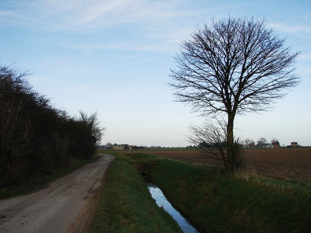
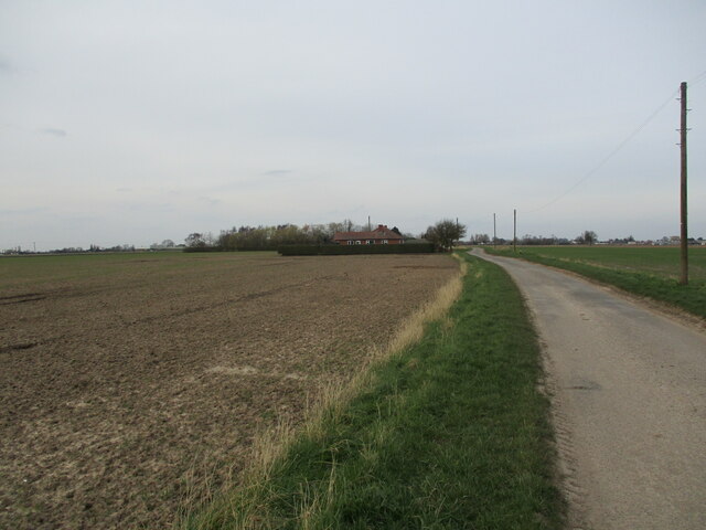
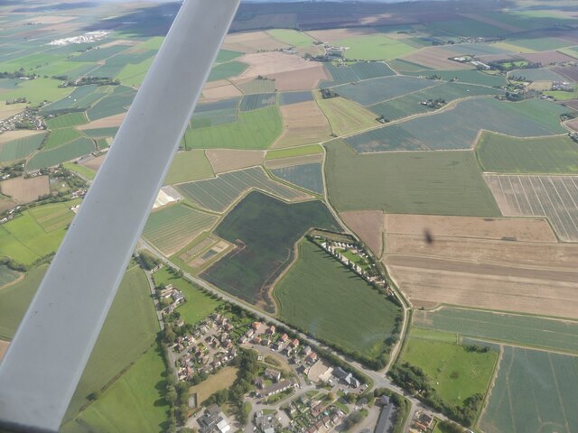
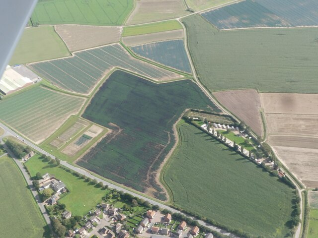
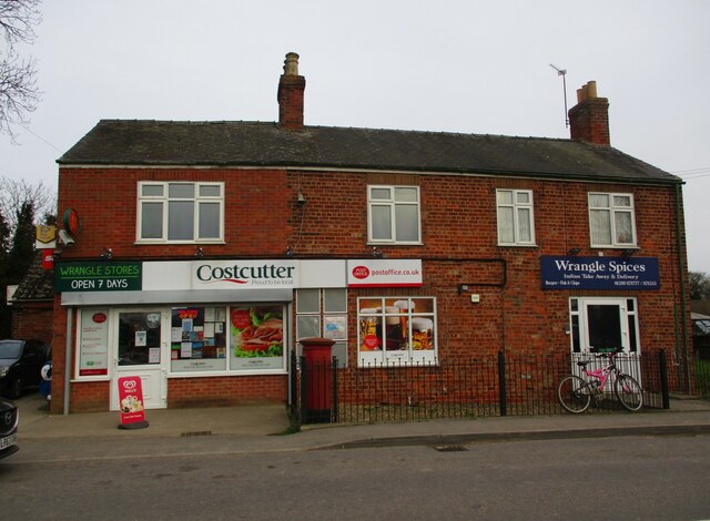
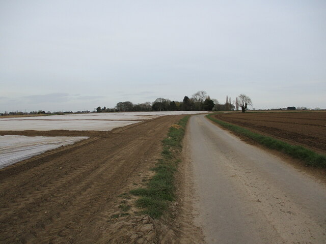
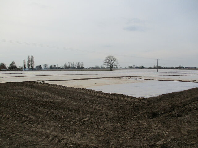
Wrangle is a small village located in the county of Lincolnshire, England. It is situated approximately 8 miles east of the town of Boston and has a population of around 1,000 residents. The village is known for its picturesque countryside and charming rural atmosphere.

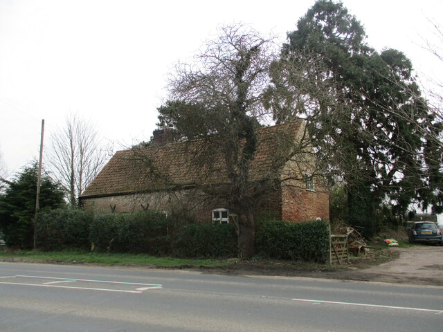
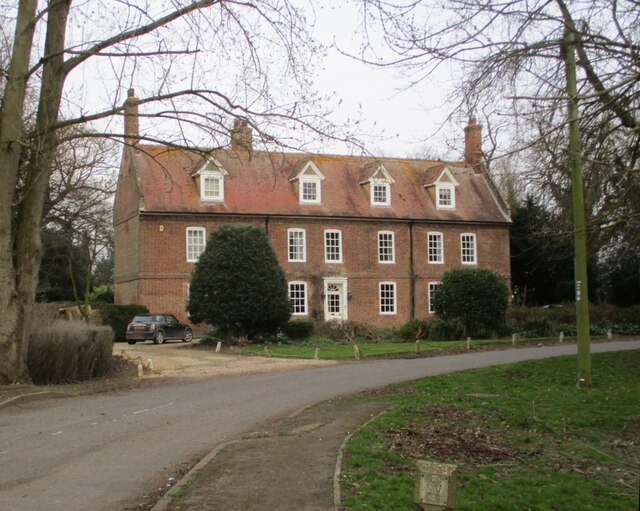
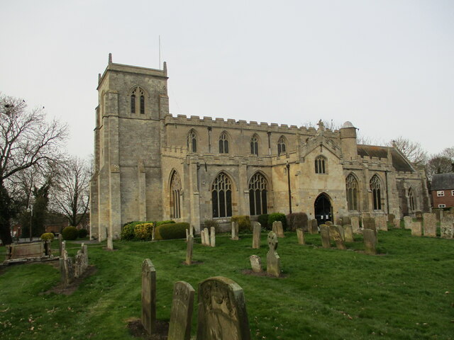
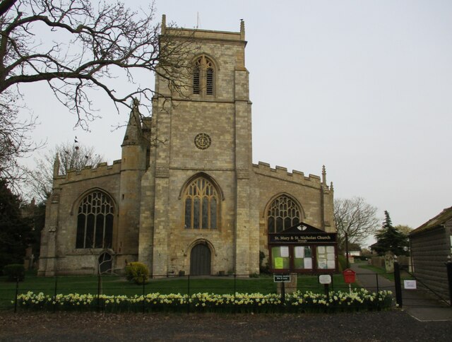
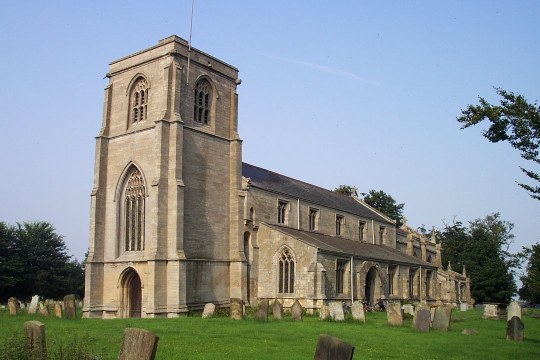
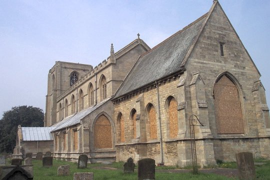
One of the notable landmarks in Wrangle is the St. Mary and St. Nicholas Church, which dates back to the 13th century. This historic church is renowned for its beautiful stained glass windows and impressive architectural design. Additionally, the village is also home to several traditional thatched cottages, adding to its quaint and timeless appeal.

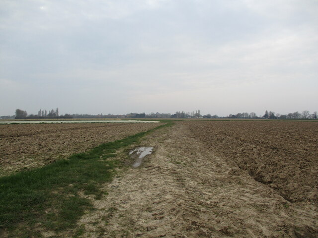
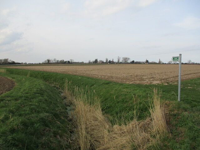
Agriculture plays a significant role in Wrangle's economy, with farming being a key industry in the area. The village is surrounded by fertile farmland, which is used for growing crops such as potatoes, wheat, and vegetables. Livestock farming, particularly cattle and sheep rearing, is also prevalent in the region.

Wrangle offers a range of amenities and services to its residents, including a primary school, a village hall, and a local pub. The village hosts various community events throughout the year, such as the Wrangle Show, which showcases local produce, crafts, and entertainment.

The village has good transport links, with regular bus services connecting it to nearby towns and cities. The coastal town of Skegness is approximately 14 miles away, providing residents with access to sandy beaches and tourist attractions.

Overall, Wrangle is a charming and close-knit village, offering a peaceful and idyllic setting for its residents and visitors alike.

If you have any feedback on the listing, please let us know in the comments section below.
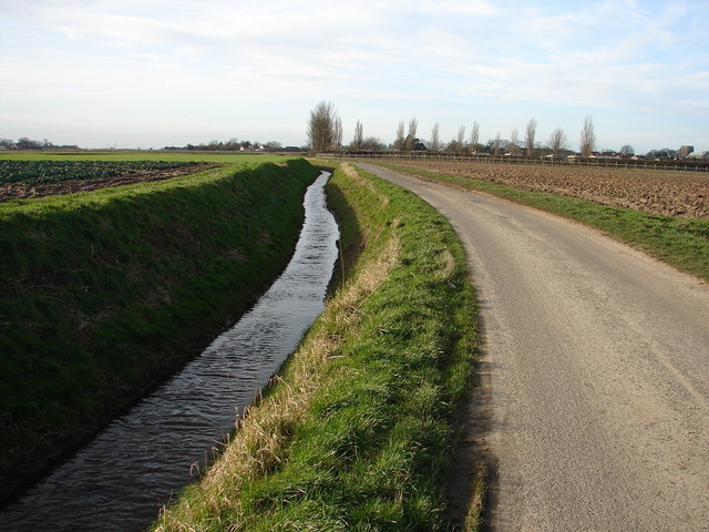
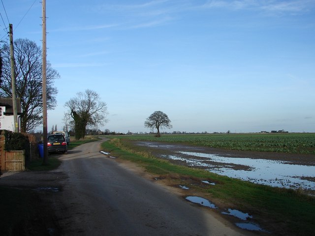
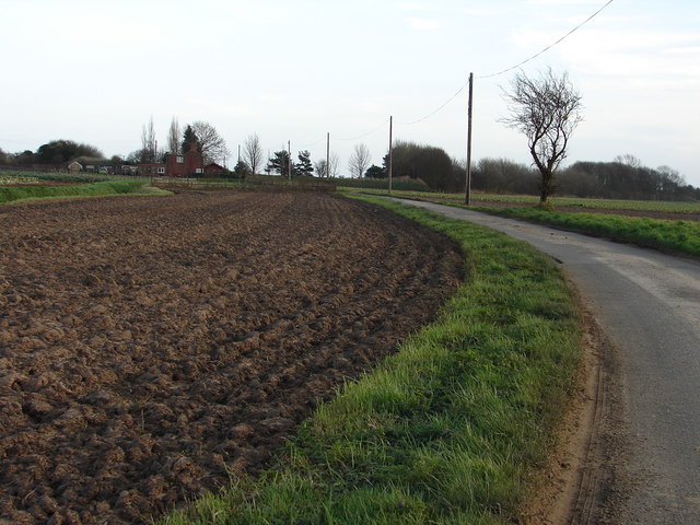
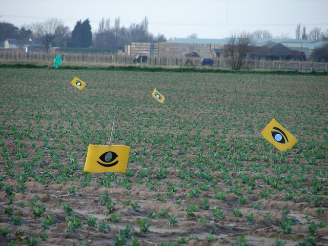
Wrangle Images

Images are sourced within 2km of 53.038284/0.121742 or Grid Reference TF4251. Thanks to Geograph Open Source API. All images are credited.

Minor Road and Ditch to East of Old Leake
Road and Field Near Greystones The wet patch was previously a drainage ditch which had been filled in.  Had the drain not been filled in, there would be no wet patch.
Road and Field Near Greystones
The wet patch was previously a drainage ditch which had been filled in. Had the drain not been filled in, there would be no wet patch.
Sea Lane Heading Eastwards
Eye Eye These pigeon scarers have an unnerving effect.  Look at the three to the left and imagine a skinless face peering at you from the fields with its little mouth and lemon-squeezy nose!
Eye Eye
These pigeon scarers have an unnerving effect. Look at the three to the left and imagine a skinless face peering at you from the fields with its little mouth and lemon-squeezy nose!
Market Lane
Market Lane
Prepared field and Market Lane
Church End Cottage, Old Leake Seventeenth century cottage <span class="nowrap"><a title="https://historicengland.org.uk/listing/the-list/list-entry/1308389?section=official-list-entry" rel="nofollow ugc noopener" href="https://historicengland.org.uk/listing/the-list/list-entry/1308389?section=official-list-entry">Link</a><img style="margin-left:2px;" alt="External link" title="External link - shift click to open in new window" src="https://s1.geograph.org.uk/img/external.png" width="10" height="10"/></span>
Church End Cottage, Old Leake
Seventeenth century cottage LinkExternal link
Farm track to Shaw Lane
Old Leake: aerial 2023 (1)
Old Leake: aerial 2023 (2)
A long shot Another view of Wrangle Mill from Sea Lane. Different month. Different point of view.  <a href="https://www.geograph.org.uk/photo/3784918">TF4351 : Wrangle Mill viewed from Sea Lane</a>
A long shot
Another view of Wrangle Mill from Sea Lane. Different month. Different point of view. TF4351 : Wrangle Mill viewed from Sea Lane
Footpath to Hall End, Wrangle
The Old Vicarage, Wrangle Dated 1704-7 <span class="nowrap"><a title="https://historicengland.org.uk/listing/the-list/list-entry/1307201?section=official-list-entry" rel="nofollow ugc noopener" href="https://historicengland.org.uk/listing/the-list/list-entry/1307201?section=official-list-entry">Link</a><img style="margin-left:2px;" alt="External link" title="External link - shift click to open in new window" src="https://s1.geograph.org.uk/img/external.png" width="10" height="10"/></span>
The Old Vicarage, Wrangle
Dated 1704-7 LinkExternal link
Wrangle Stores and Wrangle Spices
Hall End Road The plastic on the field covers a delicate crop, probably early potatoes.
Hall End Road
The plastic on the field covers a delicate crop, probably early potatoes.
Plastic covered fields The plastic is covering a delicate crop, probably early potatoes.
Plastic covered fields
The plastic is covering a delicate crop, probably early potatoes.
Church of Sr. Mary and St, Nicholas, Wrangle Much of the church dates from the mid fourteenth century <span class="nowrap"><a title="https://historicengland.org.uk/listing/the-list/list-entry/1308367?section=official-list-entry" rel="nofollow ugc noopener" href="https://historicengland.org.uk/listing/the-list/list-entry/1308367?section=official-list-entry">Link</a><img style="margin-left:2px;" alt="External link" title="External link - shift click to open in new window" src="https://s1.geograph.org.uk/img/external.png" width="10" height="10"/></span>
Church of Sr. Mary and St, Nicholas, Wrangle
Much of the church dates from the mid fourteenth century LinkExternal link
Church of Sr. Mary and St, Nicholas, Wrangle, from the west A predominantly mid fourteenth century church <span class="nowrap"><a title="https://historicengland.org.uk/listing/the-list/list-entry/1308367?section=official-list-entry" rel="nofollow ugc noopener" href="https://historicengland.org.uk/listing/the-list/list-entry/1308367?section=official-list-entry">Link</a><img style="margin-left:2px;" alt="External link" title="External link - shift click to open in new window" src="https://s1.geograph.org.uk/img/external.png" width="10" height="10"/></span>
Church of Sr. Mary and St, Nicholas, Wrangle, from the west
A predominantly mid fourteenth century church LinkExternal link
Show me another place!

Wrangle is located at Grid Ref: TF4251 (Lat: 53.038284, Lng: 0.121742)

Division: Parts of Holland

Administrative County: Lincolnshire

District: Boston

Police Authority: Lincolnshire

What 3 Words

///appealing.twig.incursion. Near Old Leake, Lincolnshire

Related Wikis

Wrangle, Lincolnshire

Wrangle is a village in the Boston Borough of Lincolnshire, England. It is situated approximately 9 miles (14 km) north-east from the town of Boston. The...

Old Leake

Old Leake is a village and civil parish in Lincolnshire, England. The population of the civil parish at the 2011 census was 2,022.Old Leake is situated...

Giles Academy

The Giles Academy (formerly the Giles School) is a mixed secondary school located in Old Leake in the English county of Lincolnshire. == History == Giles...

Leverton, Lincolnshire

Leverton is a village and civil parish in the Boston district of Lincolnshire, England, about 6 mi (10 km) east-north-east of Boston, on the A52 road....

Old Leake railway station

Old Leake was a railway station on the East Lincolnshire Railway which served the village of Old Leake in Lincolnshire between 1848 and 1964. It originally...

Benington Sea End

Benington Sea End is a hamlet in the Benington civil parish of the Borough of Boston in Lincolnshire, England. It is 5 miles (8 km) east-northeast from...

Skirbeck Wapentake

Skirbeck Wapentake was an administrative unit in the Parts of Holland Lincolnshire, England from the early eleventh century at the latest, until the wapentakes...

Benington, Lincolnshire

Benington is a village and civil parish in the Borough of Boston in Lincolnshire, England, and approximately 4 miles (6 km) east of Boston, and on the...

Nearby Amenities

Located within 500m of 53.038284,0.121742
Wrangle
Is In: Lincolnshire, England, UK
Place: village
Source: Bing
Lat/Long: 53.0378725/0.1247633
Bus Stop
Post Office
Naptan AtcoCode: 270000010405
Naptan Bearing: S
Naptan CommonName: Post Office
Naptan Indicator: o/s
Naptan Landmark: Post Office
Naptan NaptanCode: linjmpgp
Naptan Street: Church End
Naptan Verified: no
Source: naptan_import
Lat/Long: 53.0380486/0.1217885
Bus Stop
Angel Inn
Naptan AtcoCode: 270000014157
Naptan Bearing: SE
Naptan CommonName: Angel Inn
Naptan Indicator: opp
Naptan Landmark: Angel Inn
Naptan NaptanCode: linjpdam
Naptan Street: Church End
Naptan Verified: no
Source: naptan_import
Lat/Long: 53.0365472/0.1227887
Bus Stop
Angel Inn
Naptan AtcoCode: 2700LWAI0837
Naptan Bearing: NW
Naptan CommonName: Angel Inn
Naptan Indicator: adj
Naptan Landmark: Angel Inn
Naptan NaptanCode: linagmgm
Naptan Street: Church End
Naptan Verified: no
Source: naptan_import
Lat/Long: 53.036385/0.1228106
Bus Stop
Post Office
Naptan AtcoCode: 2700LWLV6135
Naptan Bearing: N
Naptan CommonName: Post Office
Naptan Indicator: opp
Naptan Landmark: Post Office
Naptan NaptanCode: lingampg
Naptan Street: Church End
Naptan Verified: no
Source: naptan_import
Lat/Long: 53.0380618/0.1215505
Post Box
Collection Times: Mo-Fr 16:30; Sa 11:00
Operator: Royal Mail
Post Box Type: pillar
Ref: PE22 147
Lat/Long: 53.0379771/0.1217629
Gowt Bank Farm
Place: farm
Source: Bing
Lat/Long: 53.0383439/0.1192459
Joy Hill
Place: locality
Source: Bing
Lat/Long: 53.0344999/0.1209814
Sea Dyke Farm
Place: farm
Source: Bing
Lat/Long: 53.0412375/0.1185791
Historic: memorial
Source: Bing
Lat/Long: 53.0363485/0.1230542
Pub
The Angel Inn
Addr City: Boston
Addr Country: GB
Addr Postcode: PE22 9EW
Addr Street: Church End
Addr Suburb: Wrangle
Fhrs Authority: Boston
Fhrs Id: 1080023
Fhrs Local Authority Id: 39641
Source: Bing
Lat/Long: 53.0364323/0.1224794
Power: pole
Lat/Long: 53.0406169/0.1172443
Power: pole
Lat/Long: 53.0407242/0.1196659
Power: pole
Lat/Long: 53.0407742/0.120105
Power: pole
Lat/Long: 53.0407773/0.1199179
Power: pole
Lat/Long: 53.0408257/0.1192554
Power: pole
Lat/Long: 53.0408429/0.1196685
Power: pole
Lat/Long: 53.0408882/0.1198738
Power: pole
Lat/Long: 53.0409101/0.120092
Power: pole
Lat/Long: 53.0416754/0.1192321
Recycling
Recycling Type: centre
Lat/Long: 53.0387561/0.1252682
Social Facility
The Minstrels
Addr City: Boston
Addr Country: GB
Addr Postcode: PE22 9AJ
Addr Street: Main Road
Addr Suburb: Wrangle
Fhrs Authority: Boston
Fhrs Id: 231689
Fhrs Local Authority Id: 1088
Social Facility: assisted_living
Social Facility For: senior
Lat/Long: 53.039423/0.126037
Fast Food
Wrangle Spice Takeaway
Addr City: Boston
Addr Country: GB
Addr Postcode: PE22 9EH
Addr Street: Church End
Addr Suburb: Wrangle
Cuisine: indian
Fhrs Authority: Boston
Fhrs Id: 232086
Fhrs Local Authority Id: 8123
Takeaway: yes
Lat/Long: 53.037965/0.1218903
Post Office & General Store
Addr City: Boston
Addr Country: GB
Addr Postcode: PE22 9EH
Addr Street: Church End
Addr Suburb: Wrangle
Fhrs Authority: Boston
Fhrs Id: 231442
Fhrs Local Authority Id: 1085
Shop: convenience
Lat/Long: 53.0380263/0.1219064
Generator Method: photovoltaic
Generator Output Electricity: yes
Generator Source: solar
Generator Type: solar_photovoltaic_panel
Location: roof
Power: generator
Lat/Long: 53.0390573/0.1289162
The data included in this document is from www.openstreetmap.org. The data is made available under ODbL.

Have you been to Wrangle?

Leave your review of Wrangle below (or comments, questions and feedback).