Wormley

Settlement in Hertfordshire Broxbourne

England

Wormley

Houses on Perrysfield Road, Turnford The birch tree has suffered a recent accident, it was perfect a few years earlier.
Houses on Perrysfield Road, Turnford Credit: David Howard

Wormley is a small village located in the county of Hertfordshire, England. Situated in the district of Broxbourne, it is approximately 20 miles north of central London. With a population of around 5,000 residents, Wormley enjoys a peaceful and rural setting, surrounded by picturesque countryside.

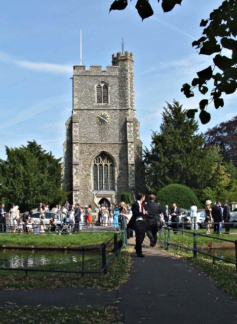
The village is known for its charming character and historic buildings. One notable structure is St. Laurence Church, a Grade II listed building dating back to the 12th century, which serves as a focal point for the community. The village also boasts a range of attractive residential properties, including traditional cottages and modern houses.

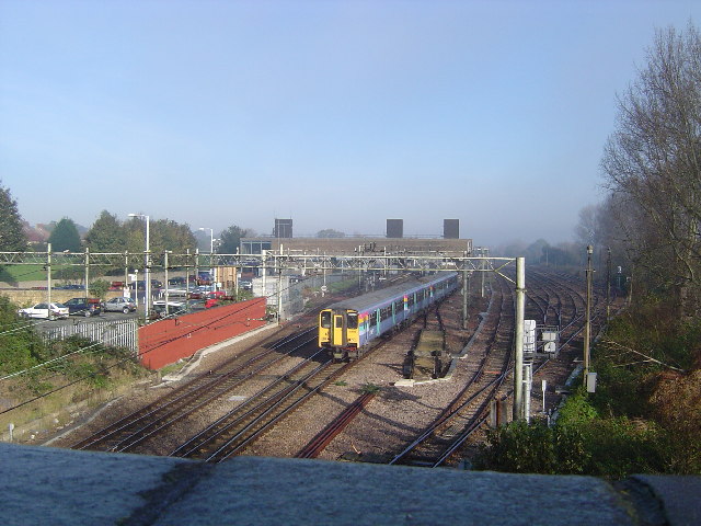
Wormley benefits from excellent transport links, making it an ideal location for commuters. The nearby A10 road provides easy access to London and other major towns in the region. Additionally, the village has its own railway station, offering regular services to London Liverpool Street and Cambridge.

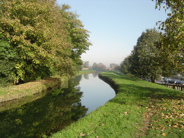
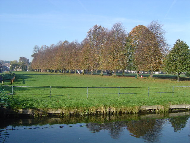
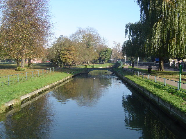
For recreational activities, residents and visitors can explore the beautiful countryside surrounding Wormley, with numerous walking and cycling trails to enjoy. The nearby Lee Valley Regional Park offers a wide range of outdoor activities, including fishing, birdwatching, and boating.

In terms of amenities, Wormley has a selection of local shops, including a convenience store, a post office, and a few small businesses. There is also a primary school within the village, providing education for local children.

Overall, Wormley offers a tranquil and idyllic setting, combined with convenient access to urban centers, making it an appealing place to live for those seeking a balance between rural and urban lifestyles.

If you have any feedback on the listing, please let us know in the comments section below.
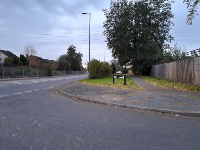
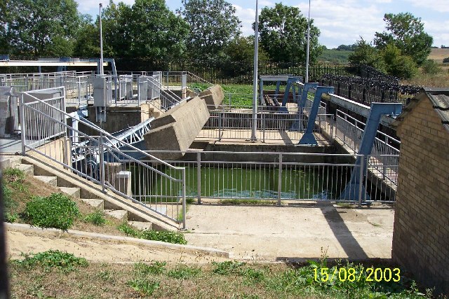
Wormley Images

Images are sourced within 2km of 51.732509/-0.02479618 or Grid Reference TL3605. Thanks to Geograph Open Source API. All images are credited.

Houses on Perrysfield Road, Turnford The birch tree has suffered a recent accident, it was perfect a few years earlier.
Houses on Perrysfield Road, Turnford
The birch tree has suffered a recent accident, it was perfect a few years earlier.
Perrysfield Road, Turnford
Cheshunt Wash at the corner of Perrysfield Road
High Road, Turnford
High Road, Turnford
Great Cambridge Road, Turnford I didn't realise the Great Cambridge Road split in Cheshunt, as this is the name of it from Tottenham onwards, but no longer follows the newer section of the A10 but remained with the original part.
Great Cambridge Road, Turnford
I didn't realise the Great Cambridge Road split in Cheshunt, as this is the name of it from Tottenham onwards, but no longer follows the newer section of the A10 but remained with the original part.
Approaching Aqueduct Lock Taken from the south of the lock - which is also enumerated Lock 8 on the Lee Navigation.
Approaching Aqueduct Lock
Taken from the south of the lock - which is also enumerated Lock 8 on the Lee Navigation.
Railway Pit One of the pits - now ponds - on Turnford Marsh to the west of the Lee Navigation and the River Lea. The name Railway Pit perhaps gives a clue as to the use of the sand and gravel extracted from this former quarry pit.
Railway Pit
One of the pits - now ponds - on Turnford Marsh to the west of the Lee Navigation and the River Lea. The name Railway Pit perhaps gives a clue as to the use of the sand and gravel extracted from this former quarry pit.
King's Weir One of the main weirs at King's Weir on the Lee Navigation.
King's Weir
One of the main weirs at King's Weir on the Lee Navigation.
River Lee Navigation at King's Weir The canal and footbridge looking south.
River Lee Navigation at King's Weir
The canal and footbridge looking south.
Wormley Playing Fields Photograph shows all weather courts used mainly for netball with the cricket ground in the background
Wormley Playing Fields
Photograph shows all weather courts used mainly for netball with the cricket ground in the background
St Augustine's Church, Church Fields, Broxbourne St Augustine's is the Church of England Parish Church at Broxbourne, and is situated at Church Fields, Broxbourne.  This image was taken at wedding of Andrew Church and Sorrel Wallis on 24 July 2004.

<span class="nowrap"><a title="http://www.acny.org.uk/venue.php?V=7853" rel="nofollow ugc noopener" href="http://www.acny.org.uk/venue.php?V=7853">Link</a><img style="margin-left:2px;" alt="External link" title="External link - shift click to open in new window" src="https://s1.geograph.org.uk/img/external.png" width="10" height="10"/></span>
St Augustine's Church, Church Fields, Broxbourne
St Augustine's is the Church of England Parish Church at Broxbourne, and is situated at Church Fields, Broxbourne. This image was taken at wedding of Andrew Church and Sorrel Wallis on 24 July 2004. LinkExternal link
Kiora Radial Gates, Nazeing Marsh Part of the river management infrastructure on the River Lee Flood Relief Channel, these massive gates can be quickly lowered or opened to control water levels in a flood event.
Kiora Radial Gates, Nazeing Marsh
Part of the river management infrastructure on the River Lee Flood Relief Channel, these massive gates can be quickly lowered or opened to control water levels in a flood event.
The New River, Broxbourne The New River is something of a misnomer since it is neither a river nor new. It is an aqueduct built under the direction of Sir Hugh Myddleton between 1607 and 1612 to bring fresh drinking water from Chadwell and Amwell Springs near Ware about 40 miles down the Lee Valley to London. <span class="nowrap"><a title="http://www.engineering-timelines.com/scripts/engineeringItem.asp?id=438" rel="nofollow ugc noopener" href="http://www.engineering-timelines.com/scripts/engineeringItem.asp?id=438">Link</a><img style="margin-left:2px;" alt="External link" title="External link - shift click to open in new window" src="https://s1.geograph.org.uk/img/external.png" width="10" height="10"/></span> for further information.
The New River, Broxbourne
The New River is something of a misnomer since it is neither a river nor new. It is an aqueduct built under the direction of Sir Hugh Myddleton between 1607 and 1612 to bring fresh drinking water from Chadwell and Amwell Springs near Ware about 40 miles down the Lee Valley to London. LinkExternal link for further information.
Broxbourne: Recreation Ground Viewed looking westwards from The New River
Broxbourne: Recreation Ground
Viewed looking westwards from The New River
Broxbourne railway station Viewed looking northwards from the Station Road bridge, Broxbourne station was moved from its old location by the bridge and rebuilt on its present site in 1960. The station is on the Liverpool Street to Cambridge and Stansted Airport and Hertford East lines. A southbound train for Liverpool Street is just leaving the station.
Broxbourne railway station
Viewed looking northwards from the Station Road bridge, Broxbourne station was moved from its old location by the bridge and rebuilt on its present site in 1960. The station is on the Liverpool Street to Cambridge and Stansted Airport and Hertford East lines. A southbound train for Liverpool Street is just leaving the station.
The New River, Broxbourne The New River is something of a misnomer since it is neither a river nor new. It is an aqueduct built under the direction of Sir Hugh Myddleton between 1607 and 1612 to bring fresh drinking water from Chadwell and Amwell Springs near Ware about 40 miles down the Lee Valley to London. <span class="nowrap"><a title="http://www.engineering-timelines.com/scripts/engineeringItem.asp?id=438" rel="nofollow ugc noopener" href="http://www.engineering-timelines.com/scripts/engineeringItem.asp?id=438">Link</a><img style="margin-left:2px;" alt="External link" title="External link - shift click to open in new window" src="https://s1.geograph.org.uk/img/external.png" width="10" height="10"/></span> for further information.
The New River, Broxbourne
The New River is something of a misnomer since it is neither a river nor new. It is an aqueduct built under the direction of Sir Hugh Myddleton between 1607 and 1612 to bring fresh drinking water from Chadwell and Amwell Springs near Ware about 40 miles down the Lee Valley to London. LinkExternal link for further information.
Coal Tax Obelisk East side of the railway line, north side of Slipe Lane by level crossing. (Nail Number 21 <span class="nowrap"><a title="http://www.rhaworth.myby.co.uk/coalwine/cowinort.htm#TL369051" rel="nofollow ugc noopener" href="http://www.rhaworth.myby.co.uk/coalwine/cowinort.htm#TL369051">Link</a><img style="margin-left:2px;" alt="External link" title="External link - shift click to open in new window" src="https://s1.geograph.org.uk/img/external.png" width="10" height="10"/></span> )
Coal Tax Obelisk
East side of the railway line, north side of Slipe Lane by level crossing. (Nail Number 21 LinkExternal link )
Entrance to walk by Turnford Brook, Turnford, Hertfordshire Entrance to the walk by the Turnford Brook, looking east towards the railway line
Entrance to walk by Turnford Brook, Turnford, Hertfordshire
Entrance to the walk by the Turnford Brook, looking east towards the railway line
Show me another place!

Wormley is located at Grid Ref: TL3605 (Lat: 51.732509, Lng: -0.02479618)

Administrative County: Hertfordshire

District: Broxbourne

Police Authority: Hertfordshire

What 3 Words

///proper.lamps.drape. Near Broxbourne, Hertfordshire

Nearby Locations

Wormley

Related Wikis

Wormley Rovers F.C.

Wormley Rovers Football Club is a football club based in Wormley, Hertfordshire. They are currently members of the Eastern Counties League Division One...

Wormleybury Brook

Wormleybury Brook is a tributary of the River Lea which rises in the hills south of White Stubbs Lane in Hertfordshire, England.

Kings Weir

Kings Weir is a weir on the River Lea near Turnford and Nazeing in Hertfordshire, England. == Ecology == It is a well known fishery where barbel can be...

The Broxbourne School

The Broxbourne School is a coeducational secondary school and sixth form with academy status located in Broxbourne, Hertfordshire, England. The school...

Nearby Amenities

Located within 500m of 51.732509,-0.02479618
Created By: YahooApplet 1.0
Lat/Long: 51.7320655/-0.0191303
Created By: YahooApplet 1.0
Lat/Long: 51.733813/-0.0185392
Created By: YahooApplet 1.0
Lat/Long: 51.7295073/-0.0272894
Created By: YahooApplet 1.0
Lat/Long: 51.7315607/-0.026452
Crossing Barrier: half
Maxheight: 5.02
Railway: level_crossing
Lat/Long: 51.7316079/-0.0193197
Created By: YahooApplet 1.0
Lat/Long: 51.7314758/-0.0186994
Created By: YahooApplet 1.0
Lat/Long: 51.7313961/-0.0182789
Created By: YahooApplet 1.0
Lat/Long: 51.7324031/-0.0266992
Created By: YahooApplet 1.0
Lat/Long: 51.7298407/-0.0270261
Created By: YahooApplet 1.0
Lat/Long: 51.7289641/-0.0256261
Created By: YahooApplet 1.0
Lat/Long: 51.7367802/-0.0245059
Created By: YahooApplet 1.0
Lat/Long: 51.7347534/-0.0192538
Created By: YahooApplet 1.0
Lat/Long: 51.7352287/-0.019066
Created By: YahooApplet 1.0
Lat/Long: 51.734767/-0.0194142
Created By: YahooApplet 1.0
Lat/Long: 51.7345044/-0.0197635
Created By: YahooApplet 1.0
Lat/Long: 51.7348868/-0.0198229
Created By: YahooApplet 1.0
Lat/Long: 51.735149/-0.0201442
Created By: YahooApplet 1.0
Lat/Long: 51.7352952/-0.0201924
Created By: YahooApplet 1.0
Lat/Long: 51.7354609/-0.0201391
Created By: YahooApplet 1.0
Lat/Long: 51.7355706/-0.019989
Created By: YahooApplet 1.0
Lat/Long: 51.734898/-0.0231507
Created By: YahooApplet 1.0
Lat/Long: 51.7346858/-0.0231656
Created By: YahooApplet 1.0
Lat/Long: 51.7346702/-0.0230448
Created By: YahooApplet 1.0
Lat/Long: 51.7348751/-0.0229318
Created By: YahooApplet 1.0
Lat/Long: 51.7347423/-0.023246
Created By: YahooApplet 1.0
Lat/Long: 51.7348047/-0.02326
Created By: YahooApplet 1.0
Lat/Long: 51.7337606/-0.0194169
Created By: YahooApplet 1.0
Lat/Long: 51.735285/-0.0218721
Created By: YahooApplet 1.0
Lat/Long: 51.7353713/-0.0218026
Created By: YahooApplet 1.0
Lat/Long: 51.7355308/-0.0214372
Created By: YahooApplet 1.0
Lat/Long: 51.7356672/-0.021094
Created By: YahooApplet 1.0
Lat/Long: 51.735707/-0.0209714
Created By: YahooApplet 1.0
Lat/Long: 51.7356704/-0.0206053
Created By: YahooApplet 1.0
Lat/Long: 51.7356174/-0.0202836
Created By: YahooApplet 1.0
Lat/Long: 51.7358331/-0.021727
Created By: YahooApplet 1.0
Lat/Long: 51.7359329/-0.0217539
Created By: YahooApplet 1.0
Lat/Long: 51.7360161/-0.0216356
Created By: YahooApplet 1.0
Lat/Long: 51.7361455/-0.0213296
Created By: YahooApplet 1.0
Lat/Long: 51.7352387/-0.0215984
Created By: YahooApplet 1.0
Lat/Long: 51.7350752/-0.0205541
Created By: YahooApplet 1.0
Lat/Long: 51.7340937/-0.0213581
Created By: YahooApplet 1.0
Lat/Long: 51.7337242/-0.0215462
Created By: YahooApplet 1.0
Lat/Long: 51.7334314/-0.0216949
Created By: YahooApplet 1.0
Lat/Long: 51.7341654/-0.0217557
Created By: YahooApplet 1.0
Lat/Long: 51.7341357/-0.0219202
Created By: YahooApplet 1.0
Lat/Long: 51.7340861/-0.021961
Created By: YahooApplet 1.0
Lat/Long: 51.733874/-0.0220762
Created By: YahooApplet 1.0
Lat/Long: 51.7337889/-0.0221727
Created By: YahooApplet 1.0
Lat/Long: 51.7337814/-0.0222679
Created By: YahooApplet 1.0
Lat/Long: 51.7338367/-0.0226176
Created By: YahooApplet 1.0
Lat/Long: 51.7350592/-0.0234485
Created By: YahooApplet 1.0
Lat/Long: 51.7359231/-0.0234059
Created By: YahooApplet 1.0
Lat/Long: 51.7350459/-0.0237063
Created By: YahooApplet 1.0
Lat/Long: 51.7351324/-0.0240016
Created By: YahooApplet 1.0
Lat/Long: 51.7353748/-0.024817
Created By: YahooApplet 1.0
Lat/Long: 51.7354142/-0.0248864
Created By: YahooApplet 1.0
Lat/Long: 51.7355538/-0.0248597
Created By: YahooApplet 1.0
Lat/Long: 51.7359664/-0.0245806
Created By: YahooApplet 1.0
Lat/Long: 51.7360156/-0.0246125
Created By: YahooApplet 1.0
Lat/Long: 51.7360825/-0.0248063
Created By: YahooApplet 1.0
Lat/Long: 51.7326072/-0.0240012
Created By: YahooApplet 1.0
Lat/Long: 51.7324211/-0.024259
Created By: YahooApplet 1.0
Lat/Long: 51.7334858/-0.0195235
Created By: YahooApplet 1.0
Lat/Long: 51.733233/-0.0196222
Created By: YahooApplet 1.0
Lat/Long: 51.7330903/-0.0198246
Created By: YahooApplet 1.0
Lat/Long: 51.7331909/-0.0200041
Created By: YahooApplet 1.0
Lat/Long: 51.7332919/-0.0205899
Created By: YahooApplet 1.0
Lat/Long: 51.7331466/-0.0191108
Created By: YahooApplet 1.0
Lat/Long: 51.7337052/-0.0189191
Created By: YahooApplet 1.0
Lat/Long: 51.7338607/-0.0200706
Created By: YahooApplet 1.0
Lat/Long: 51.7338744/-0.0202753
Created By: YahooApplet 1.0
Lat/Long: 51.7339165/-0.0207722
Created By: YahooApplet 1.0
Lat/Long: 51.7329676/-0.0201579
Created By: YahooApplet 1.0
Lat/Long: 51.7328121/-0.0200813
Created By: YahooApplet 1.0
Lat/Long: 51.7327023/-0.0199161
Created By: YahooApplet 1.0
Lat/Long: 51.7326708/-0.0197337
Created By: YahooApplet 1.0
Lat/Long: 51.7325986/-0.0193025
Created By: YahooApplet 1.0
Lat/Long: 51.7323448/-0.0198725
Created By: YahooApplet 1.0
Lat/Long: 51.7329278/-0.0204812
Created By: YahooApplet 1.0
Lat/Long: 51.7328365/-0.0207179
Created By: YahooApplet 1.0
Lat/Long: 51.7326642/-0.0208767
Created By: YahooApplet 1.0
Lat/Long: 51.7322425/-0.0211113
Created By: YahooApplet 1.0
Lat/Long: 51.7331789/-0.0225532
Created By: YahooApplet 1.0
Lat/Long: 51.7326886/-0.0233682
Created By: YahooApplet 1.0
Lat/Long: 51.7324344/-0.0222417
Created By: YahooApplet 1.0
Lat/Long: 51.732318/-0.0215645
Created By: YahooApplet 1.0
Lat/Long: 51.7320924/-0.020435
Created By: YahooApplet 1.0
Lat/Long: 51.73193/-0.0201285
Created By: YahooApplet 1.0
Lat/Long: 51.7317269/-0.0199668
Created By: YahooApplet 1.0
Lat/Long: 51.7316273/-0.0200747
Created By: YahooApplet 1.0
Lat/Long: 51.7315709/-0.0203538
Created By: YahooApplet 1.0
Lat/Long: 51.7316371/-0.0210082
Created By: YahooApplet 1.0
Lat/Long: 51.7318068/-0.0220483
Created By: YahooApplet 1.0
Lat/Long: 51.7319131/-0.0227033
Created By: YahooApplet 1.0
Lat/Long: 51.7319958/-0.023228
Created By: YahooApplet 1.0
Lat/Long: 51.7329529/-0.0188297
Created By: YahooApplet 1.0
Lat/Long: 51.7333982/-0.0253908
Created By: YahooApplet 1.0
Lat/Long: 51.7335346/-0.0254286
Created By: YahooApplet 1.0
Lat/Long: 51.7335776/-0.0255251
Created By: YahooApplet 1.0
Lat/Long: 51.7336474/-0.0259112
Created By: YahooApplet 1.0
Lat/Long: 51.7339531/-0.0257719
Created By: YahooApplet 1.0
Lat/Long: 51.7331187/-0.0261796
Created By: YahooApplet 1.0
Lat/Long: 51.7333052/-0.024908
Created By: YahooApplet 1.0
Lat/Long: 51.7332321/-0.024849
Created By: YahooApplet 1.0
Lat/Long: 51.7329152/-0.0250053
Created By: YahooApplet 1.0
Lat/Long: 51.7307669/-0.0194895
Created By: YahooApplet 1.0
Lat/Long: 51.731119/-0.0250101
Created By: YahooApplet 1.0
Lat/Long: 51.7314188/-0.0250364
Created By: YahooApplet 1.0
Lat/Long: 51.7302048/-0.0248115
Created By: YahooApplet 1.0
Lat/Long: 51.7292284/-0.0252297
Created By: YahooApplet 1.0
Lat/Long: 51.7294808/-0.0250635
Created By: YahooApplet 1.0
Lat/Long: 51.7306239/-0.0243673
Created By: YahooApplet 1.0
Lat/Long: 51.7305906/-0.0239053
Created By: YahooApplet 1.0
Lat/Long: 51.7306839/-0.0235236
Created By: YahooApplet 1.0
Lat/Long: 51.730946/-0.0231701
Created By: YahooApplet 1.0
Lat/Long: 51.7310492/-0.0229392
Created By: YahooApplet 1.0
Lat/Long: 51.7310293/-0.0226497
Created By: YahooApplet 1.0
Lat/Long: 51.7308798/-0.0219095
Created By: YahooApplet 1.0
Lat/Long: 51.7307504/-0.021305
Created By: YahooApplet 1.0
Lat/Long: 51.7305742/-0.0202358
Created By: YahooApplet 1.0
Lat/Long: 51.7305276/-0.0200105
Created By: YahooApplet 1.0
Lat/Long: 51.730425/-0.0198759
Created By: YahooApplet 1.0
Lat/Long: 51.7302354/-0.0199081
Created By: YahooApplet 1.0
Lat/Long: 51.7292553/-0.0201767
Created By: YahooApplet 1.0
Lat/Long: 51.7290158/-0.0202409
Created By: YahooApplet 1.0
Lat/Long: 51.7288694/-0.0205892
Created By: YahooApplet 1.0
Lat/Long: 51.7291254/-0.0220379
Created By: YahooApplet 1.0
Lat/Long: 51.7291548/-0.0221549
Created By: YahooApplet 1.0
Lat/Long: 51.7292347/-0.0223745
Created By: YahooApplet 1.0
Lat/Long: 51.7293981/-0.0232612
Created By: YahooApplet 1.0
Lat/Long: 51.7294441/-0.0234639
Created By: YahooApplet 1.0
Lat/Long: 51.7296438/-0.0243933
Created By: YahooApplet 1.0
Lat/Long: 51.7304842/-0.0237602
Created By: YahooApplet 1.0
Lat/Long: 51.7305272/-0.0234971
Created By: YahooApplet 1.0
Lat/Long: 51.730481/-0.0236423
Created By: YahooApplet 1.0
Lat/Long: 51.7303847/-0.0232558
Created By: YahooApplet 1.0
Lat/Long: 51.7303252/-0.0232505
Created By: YahooApplet 1.0
Lat/Long: 51.7302356/-0.0232665
Created By: YahooApplet 1.0
Lat/Long: 51.7301161/-0.0232026
Created By: YahooApplet 1.0
Lat/Long: 51.7299833/-0.0230464
Created By: YahooApplet 1.0
Lat/Long: 51.7318601/-0.0264581
Created By: YahooApplet 1.0
Lat/Long: 51.7312318/-0.0265494
Created By: YahooApplet 1.0
Lat/Long: 51.7284511/-0.0256964
Created By: YahooApplet 1.0
Lat/Long: 51.7289991/-0.0254013
Created By: YahooApplet 1.0
Lat/Long: 51.7288695/-0.0249621
Created By: YahooApplet 1.0
Lat/Long: 51.7288/-0.0245397
Created By: YahooApplet 1.0
Lat/Long: 51.7287534/-0.0239163
Mini Roundabout
Direction: clockwise
Lat/Long: 51.7284211/-0.0223655
Created By: YahooApplet 1.0
Lat/Long: 51.7281752/-0.0230682
Created By: YahooApplet 1.0
Lat/Long: 51.7287634/-0.024104
Created By: YahooApplet 1.0
Lat/Long: 51.7286337/-0.0241107
Created By: YahooApplet 1.0
Lat/Long: 51.72878/-0.0258041
Created By: YahooApplet 1.0
Lat/Long: 51.7285341/-0.0258255
Created By: YahooApplet 1.0
Lat/Long: 51.7283113/-0.0272098
Created By: YahooApplet 1.0
Lat/Long: 51.7284079/-0.0270323
Created By: YahooApplet 1.0
Lat/Long: 51.7284179/-0.0268988
Created By: YahooApplet 1.0
Lat/Long: 51.7283914/-0.0267654
Created By: YahooApplet 1.0
Lat/Long: 51.7282882/-0.0263942
Noexit: yes
Lat/Long: 51.7281685/-0.0260616
Crossing Barrier: half
Maxheight: 5.02
Railway: level_crossing
Lat/Long: 51.7315991/-0.0192702
Clinic
Wormley Health Centre
Lat/Long: 51.730235/-0.0229641
Community Centre
Wormley Community Centre
Polling Station: yes
Lat/Long: 51.7302182/-0.0228665
Noexit: yes
Lat/Long: 51.7301779/-0.020554
Noexit: yes
Lat/Long: 51.7293845/-0.0209666
Pub
The Queens Head
Addr Postcode: EN10 6JN
Fhrs Id: 172052
Toilets: yes
Toilets Access: customers
Wikidata: Q26392912
Lat/Long: 51.7313445/-0.0255587
Noexit: yes
Lat/Long: 51.7283576/-0.0254624
Fuel
murco
Lat/Long: 51.7301495/-0.0251151
Post Box
Collection Times: Mo-Fr 17:15, Sa 12:00
Operator: Royal Mail
Ref: EN10 201
Royal Cypher: EIIR
Royal Cypher Wikidata: Q33102113
Source: gps+mapnoter
Lat/Long: 51.7354345/-0.0228601
Post Office
Wormley Post Office
Addr Postcode: EN10 6PZ
Branch: Wormley
Brand: Post Office
Brand Wikidata: Q1783168
Check Date: 2020-02-20
Contact Website: https://www.postoffice.co.uk/branch-finder/1680056/wormley
Ref Pol Id: 19310
Lat/Long: 51.7353424/-0.0227451
Bus Stop
The Queens Head PH
Naptan AtcoCode: 210021701220
Naptan Bearing: N
Naptan CommonName: The Queens Head PH
Naptan Crossing: Church lane
Naptan Indicator: o/s
Naptan Landmark: Church lane
Naptan NaptanCode: hrtamdwm
Naptan PlusbusZoneRef: BROXBRN;CHESHNT
Naptan ShortCommonName: NA
Naptan Street: High Road
Naptan Verified: no
Public Transport: platform
Source: naptan_import
Lat/Long: 51.7314494/-0.0251963
Bus Stop
Old Star PH
Local Ref: NR
Naptan AtcoCode: 210021701240
Naptan Bearing: N
Naptan CommonName: Old Star PH
Naptan Crossing: St Laurence Drive
Naptan Indicator: nr
Naptan Landmark: St Laurence Drive
Naptan NaptanCode: hrtamdwp
Naptan PlusbusZoneRef: BROXBRN
Naptan ShortCommonName: NA
Naptan Street: High Road
Naptan Verified: no
Public Transport: platform
Source: naptan_import
Lat/Long: 51.7338164/-0.0233493
Bus Stop
Old Star PH
Naptan AtcoCode: 210021702680
Naptan Bearing: S
Naptan CommonName: Old Star PH
Naptan Crossing: Wharf Road
Naptan Indicator: opp
Naptan Landmark: Wharf Road
Naptan NaptanCode: hrtamapd
Naptan PlusbusZoneRef: BROXBRN
Naptan ShortCommonName: NA
Naptan Street: High Road
Naptan Verified: no
Public Transport: platform
Source: naptan_import
Lat/Long: 51.733642/-0.0232635
Bus Stop
The Queens Head PH
Naptan AtcoCode: 210021702700
Naptan Bearing: S
Naptan CommonName: The Queens Head PH
Naptan Crossing: Fairfield Drive
Naptan Indicator: opp
Naptan Landmark: Fairfield Drive
Naptan NaptanCode: hrtamadw
Naptan PlusbusZoneRef: BROXBRN;CHESHNT
Naptan ShortCommonName: NA
Naptan Street: High Road
Naptan Verified: no
Public Transport: platform
Source: naptan_import
Lat/Long: 51.7304342/-0.0247192
Addr Housenumber: 1
Source: gps+mapnoter
Lat/Long: 51.7288112/-0.0258655
Cafe
Wormley Social Club
Source: gps+mapnoter
Lat/Long: 51.7338327/-0.0298691
Barrier: height_restrictor
Lat/Long: 51.7334906/-0.0299514
Leisure: picnic_table
Source: gps+mapnoter
Lat/Long: 51.7342579/-0.0305557
Waste Basket
Source: gps+mapnoter
Lat/Long: 51.7337795/-0.0296974
Waste Basket
Source: gps+mapnoter
Lat/Long: 51.7342048/-0.0303841
Waste Basket
Source: gps+mapnoter
Lat/Long: 51.7331416/-0.0275517
Bench
Source: gps+mapnoter
Lat/Long: 51.7343111/-0.0309849
Bench
Source: gps+mapnoter
Lat/Long: 51.7342579/-0.0304779
Waste Basket
Source: gps+mapnoter
Lat/Long: 51.7343111/-0.0308132
Bench
Source: gps+mapnoter
Lat/Long: 51.7334606/-0.0278091
Waste Basket
Source: gps+mapnoter
Lat/Long: 51.733939/-0.0298691
Church Lane Allotments
Lat/Long: 51.7333049/-0.0272521
Bench
Source: gps+mapnoter
Lat/Long: 51.7343111/-0.0307274
Bench
Source: gps+mapnoter
Lat/Long: 51.7341516/-0.0303841
Leisure: playground
Source: gps+mapnoter
Lat/Long: 51.7332479/-0.0277233
Barrier: cycle_barrier
Lat/Long: 51.7341349/-0.0310995
Barrier: bollard
Lat/Long: 51.7337519/-0.0236129
Bench
Source: gps+mapnoter
Lat/Long: 51.7337529/-0.0234264
Addr Housenumber: 17
Addr Postcode: EN10 6LD
Source: gps+mapnoter
Lat/Long: 51.7338742/-0.024958
Addr Housenumber: 1
Source: gps+mapnoter
Lat/Long: 51.7331669/-0.0264742
Addr Housenumber: 37
Addr Street: The Croft
Source: gps+mapnoter
Lat/Long: 51.733924/-0.0253281
Addr Housenumber: 11
Source: gps+mapnoter
Lat/Long: 51.7338264/-0.0261792
Addr Housenumber: 10
Source: gps+mapnoter
Lat/Long: 51.7336303/-0.0262596
Addr Housenumber: 16
Source: gps+mapnoter
Lat/Long: 51.7340772/-0.0260531
Addr Housenumber: 28
Source: gps+mapnoter
Lat/Long: 51.7337134/-0.0239985
Waste Basket
Source: gps+mapnoter
Lat/Long: 51.7338692/-0.0241801
Waste Basket
Source: gps+mapnoter
Waste: dog
Lat/Long: 51.7356084/-0.0231153
Waste Basket
Source: gps+mapnoter
Lat/Long: 51.7358775/-0.0230911
Barrier: cycle_barrier
Lat/Long: 51.7358579/-0.022933
Addr Housenumber: 36
Source: gps+mapnoter
Lat/Long: 51.7325473/-0.0195246
Addr Housenumber: 38
Source: gps+mapnoter
Lat/Long: 51.732725/-0.0192993
Addr Housenumber: 58
Addr Postcode: EN10 6HY
Source: gps+mapnoter
Lat/Long: 51.7331137/-0.0195139
Addr Housenumber: 54
Source: gps+mapnoter
Lat/Long: 51.7328263/-0.0198492
Addr Housenumber: 70
Addr Postcode: EN10 6HY
Source: gps+mapnoter
Lat/Long: 51.7330523/-0.0191142
Addr Housenumber: 80
Source: gps+mapnoter
Lat/Long: 51.7333563/-0.0193664
Addr Housenumber: 89
Source: gps+mapnoter
Lat/Long: 51.7333081/-0.0197821
Addr Housenumber: 72
Source: gps+mapnoter
Lat/Long: 51.7333097/-0.0191008
Addr Housenumber: 12
Source: gps+mapnoter
Lat/Long: 51.73273/-0.0202649
Addr Housenumber: 91
Source: gps+mapnoter
Lat/Long: 51.7336586/-0.019589
Addr Housenumber: 10
Source: gps+mapnoter
Lat/Long: 51.7327682/-0.0204473
Addr Housenumber: 141
Source: gps+mapnoter
Lat/Long: 51.733936/-0.0194549
Addr Housenumber: 39
Source: gps+mapnoter
Lat/Long: 51.7322649/-0.0205063
Addr Housenumber: 2
Source: gps+mapnoter
Lat/Long: 51.7323612/-0.0207745
Addr Housenumber: 8
Source: gps+mapnoter
Lat/Long: 51.7325971/-0.0206511
Addr Housenumber: 14
Source: gps+mapnoter
Lat/Long: 51.7326353/-0.0199243
Addr Housenumber: 82
Source: gps+mapnoter
Lat/Long: 51.7336682/-0.0192422
Addr Housenumber: 92
Source: gps+mapnoter
Lat/Long: 51.7336187/-0.0189077
Addr Housenumber: 100
Source: gps+mapnoter
Lat/Long: 51.733931/-0.0191491
Addr Housenumber: 94
Source: gps+mapnoter
Lat/Long: 51.7339245/-0.0187818
Addr Housenumber: 63
Source: gps+mapnoter
Lat/Long: 51.733255/-0.0206942
Waste Basket
Source: gps+mapnoter
Waste: dog
Lat/Long: 51.733032/-0.0202185
Addr Housenumber: 1
Source: gps+mapnoter
Lat/Long: 51.7327051/-0.0209918
Addr Housenumber: 61
Source: gps+mapnoter
Lat/Long: 51.7330058/-0.0206029
Addr Housenumber: 38
Source: gps+mapnoter
Lat/Long: 51.7319991/-0.0206672
Addr Housenumber: 38A
Source: gps+mapnoter
Lat/Long: 51.7320851/-0.0209373
Addr Housenumber: 40
Source: gps+mapnoter
Lat/Long: 51.7318629/-0.0202408
Barrier: cycle_barrier
Lat/Long: 51.7343035/-0.0207148
Buryholme
Source: gps+mapnoter
Lat/Long: 51.7343194/-0.0215006
Addr Housenumber: 222
Source: gps+mapnoter
Lat/Long: 51.7364638/-0.022831
Addr Housenumber: 51-73
Addr Interpolation: yes
Addr Postcode: EN10 6HZ
Source: gps+mapnoter
Lat/Long: 51.7318629/-0.0197258
Addr Housenumber: 49
Source: gps+mapnoter
Lat/Long: 51.732139/-0.0199942
Crossing
Lat/Long: 51.7332353/-0.0234919
Post Box
Post Box Type: pillar
Ref: EN10 119
Royal Cypher: EVIIR
Royal Cypher Wikidata: Q33102324
Lat/Long: 51.73232/-0.0245643
Noexit: yes
Lat/Long: 51.7282727/-0.0236692
Coal tax post
Heritage: 2
Heritage Operator: he
Heritage Website: https://historicengland.org.uk/listing/the-list/list-entry/1296351
Historic: boundary_stone
Inscription: ACT 24 & 25 VICT CAP 42
Listed Status: Grade II
Material: iron
Nhle Inscription Date: 1983-11-08
Note: Coal tax boundary marker 22
Ref GB Nhle: 1296351
Start Date: 1861
Lat/Long: 51.7292387/-0.025118
Noexit: yes
Lat/Long: 51.7287733/-0.0215777
Noexit: yes
Lat/Long: 51.7290518/-0.0224281
Noexit: yes
Lat/Long: 51.7298892/-0.0228086
Noexit: yes
Lat/Long: 51.7301517/-0.0200989
Colour: yellow
Marker: post
Material: concrete
Utility: gas
Lat/Long: 51.7317149/-0.0194533
Colour: yellow
Marker: post
Material: concrete
Utility: gas
Lat/Long: 51.7317194/-0.0194809
The data included in this document is from www.openstreetmap.org. The data is made available under ODbL.

Have you been to Wormley?

Leave your review of Wormley below (or comments, questions and feedback).