Woollensbrook

Settlement in Hertfordshire Broxbourne

England

Woollensbrook

Footpath in Hoddesdon Park Wood Hoddesdon Park Wood is managed by the Woodland Trust <span class="nowrap"><a title="https://www.woodlandtrust.org.uk/visiting-woods/woods/hoddesdon-park-wood/" rel="nofollow ugc noopener" href="https://www.woodlandtrust.org.uk/visiting-woods/woods/hoddesdon-park-wood/">Link</a><img style="margin-left:2px;" alt="External link" title="External link - shift click to open in new window" src="https://s1.geograph.org.uk/img/external.png" width="10" height="10"/></span>

Part of Broxbourne Woods National Nature Reserve <span class="nowrap"><a title="https://www.gov.uk/government/publications/hertfordshires-national-nature-reserve" rel="nofollow ugc noopener" href="https://www.gov.uk/government/publications/hertfordshires-national-nature-reserve">Link</a><img style="margin-left:2px;" alt="External link" title="External link - shift click to open in new window" src="https://s1.geograph.org.uk/img/external.png" width="10" height="10"/></span>

This is the Hertfordshire Way Long Distance Footpath <span class="nowrap"><a title="https://ldwa.org.uk/ldp/members/show_path.php?path_name=Hertfordshire+Way" rel="nofollow ugc noopener" href="https://ldwa.org.uk/ldp/members/show_path.php?path_name=Hertfordshire+Way">Link</a><img style="margin-left:2px;" alt="External link" title="External link - shift click to open in new window" src="https://s1.geograph.org.uk/img/external.png" width="10" height="10"/></span>
Footpath in Hoddesdon Park Wood Credit: Roger Jones

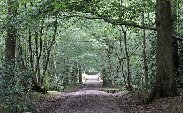
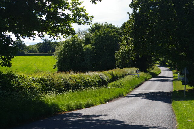
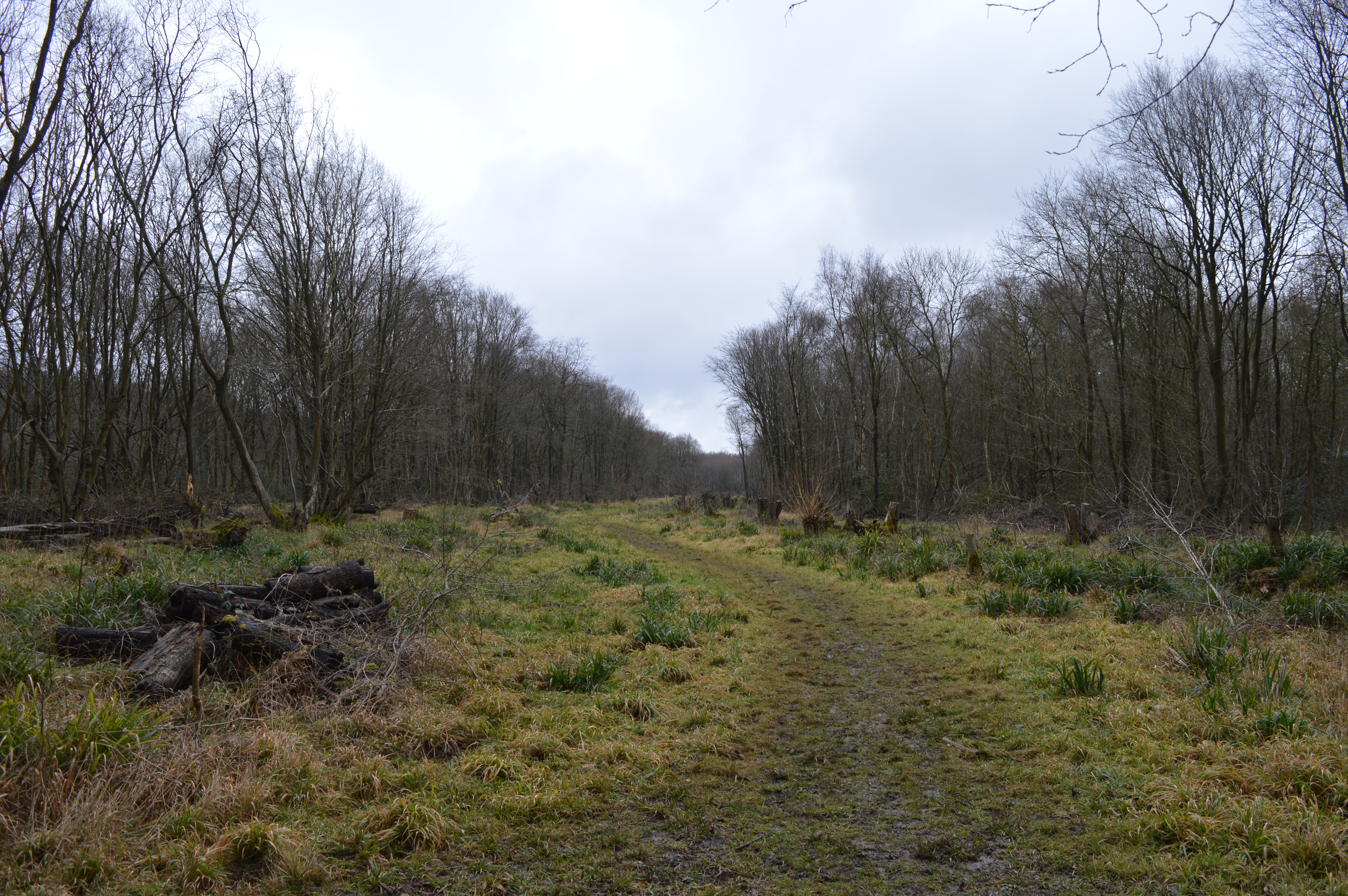
Woollensbrook is a small village located in the county of Hertfordshire, England. Situated approximately 20 miles north of London, it is part of the borough of Broxbourne. The village is set in a picturesque rural landscape, characterized by rolling hills, green fields, and pockets of woodland.

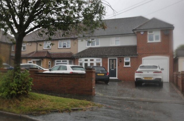
Woollensbrook is known for its tranquil atmosphere and close-knit community. The village predominantly consists of residential properties, ranging from quaint cottages to modern houses. The architecture reflects a mix of traditional and contemporary styles, creating a charming and diverse aesthetic.

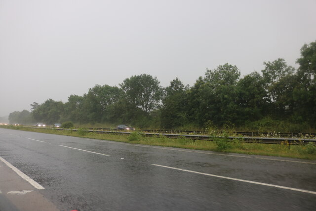
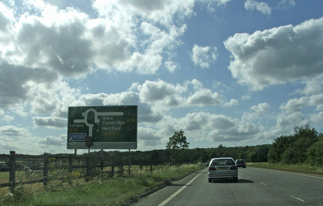
The village benefits from excellent transport links, with the nearby A10 providing easy access to London and other major towns in the region. The local bus service also connects Woollensbrook to neighboring villages and towns.

In terms of amenities, Woollensbrook offers a range of facilities to cater to its residents' needs. These include a village hall, a primary school, a small grocery store, and a handful of local shops and businesses. For recreational activities, there are several parks and green spaces, providing opportunities for outdoor leisure and relaxation.

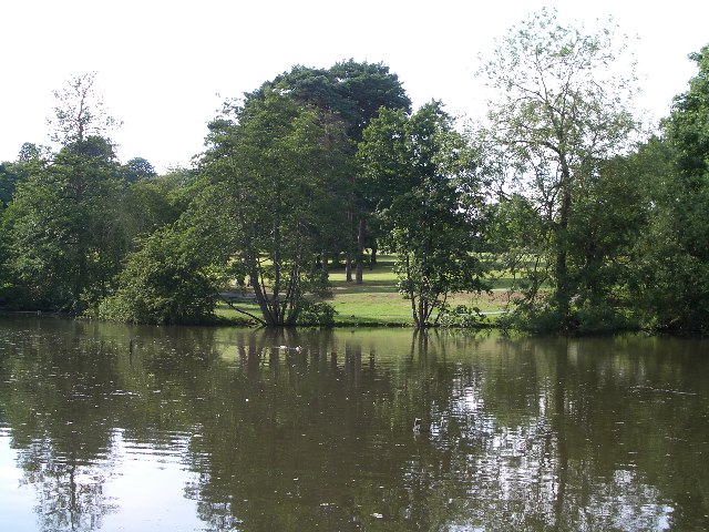
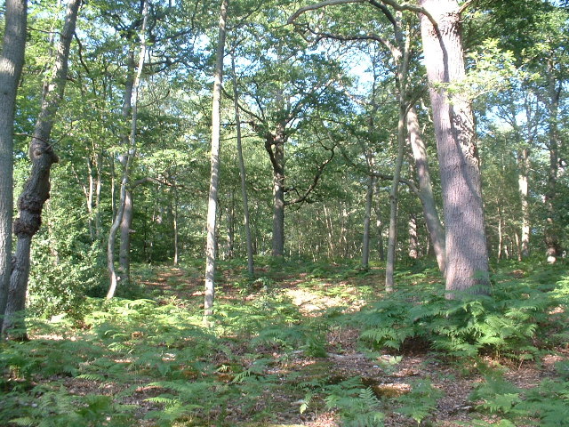
The surrounding countryside offers ample opportunities for hiking, cycling, and exploring nature. Additionally, the nearby River Lea provides a picturesque setting for boating and fishing enthusiasts.

Overall, Woollensbrook is a charming village that provides a peaceful and idyllic living environment whilst still offering convenient access to nearby towns and cities.

If you have any feedback on the listing, please let us know in the comments section below.

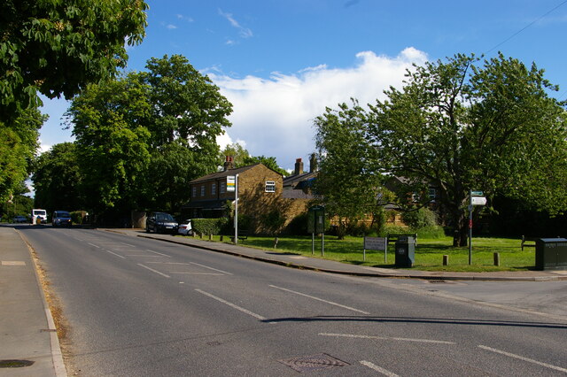
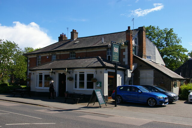
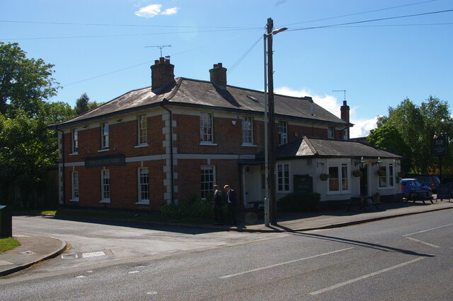
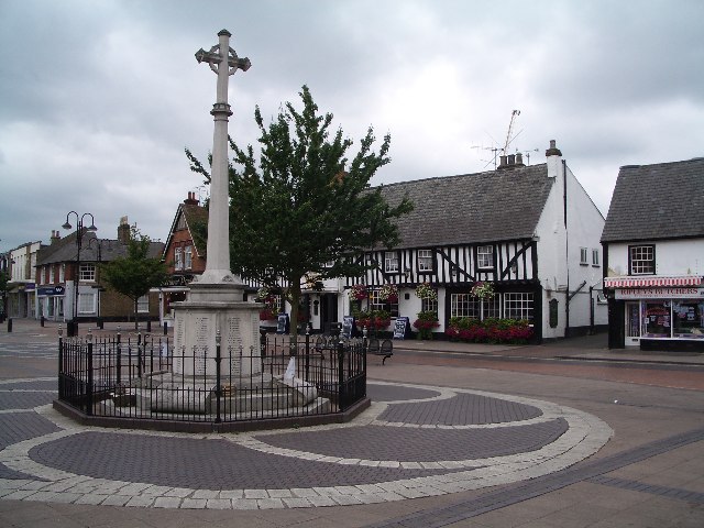
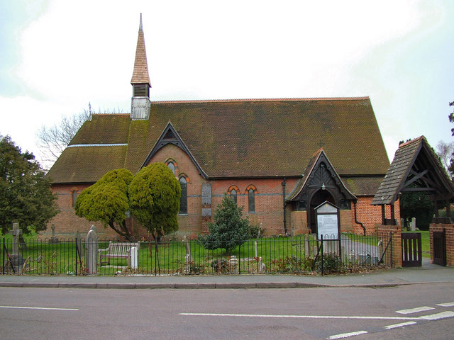
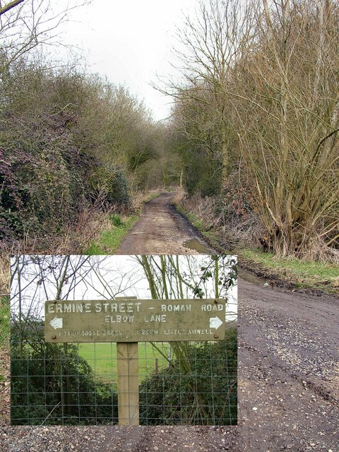
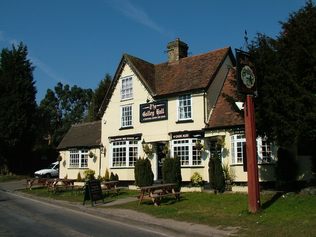
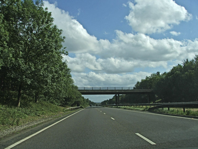
Woollensbrook Images

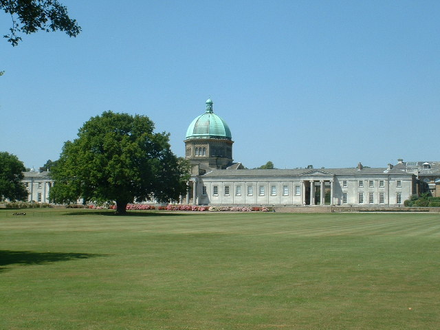
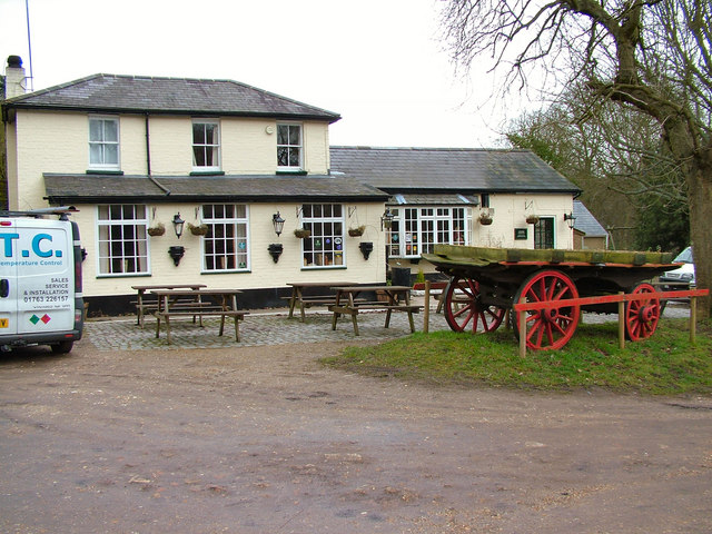
Images are sourced within 2km of 51.7712/-0.029604 or Grid Reference TL3609. Thanks to Geograph Open Source API. All images are credited.

Footpath in Hoddesdon Park Wood Hoddesdon Park Wood is managed by the Woodland Trust <span class="nowrap"><a title="https://www.woodlandtrust.org.uk/visiting-woods/woods/hoddesdon-park-wood/" rel="nofollow ugc noopener" href="https://www.woodlandtrust.org.uk/visiting-woods/woods/hoddesdon-park-wood/">Link</a><img style="margin-left:2px;" alt="External link" title="External link - shift click to open in new window" src="https://s1.geograph.org.uk/img/external.png" width="10" height="10"/></span>

Part of Broxbourne Woods National Nature Reserve <span class="nowrap"><a title="https://www.gov.uk/government/publications/hertfordshires-national-nature-reserve" rel="nofollow ugc noopener" href="https://www.gov.uk/government/publications/hertfordshires-national-nature-reserve">Link</a><img style="margin-left:2px;" alt="External link" title="External link - shift click to open in new window" src="https://s1.geograph.org.uk/img/external.png" width="10" height="10"/></span>

This is the Hertfordshire Way Long Distance Footpath <span class="nowrap"><a title="https://ldwa.org.uk/ldp/members/show_path.php?path_name=Hertfordshire+Way" rel="nofollow ugc noopener" href="https://ldwa.org.uk/ldp/members/show_path.php?path_name=Hertfordshire+Way">Link</a><img style="margin-left:2px;" alt="External link" title="External link - shift click to open in new window" src="https://s1.geograph.org.uk/img/external.png" width="10" height="10"/></span>
Footpath in Hoddesdon Park Wood
Hoddesdon Park Wood is managed by the Woodland Trust LinkExternal link Part of Broxbourne Woods National Nature Reserve LinkExternal link This is the Hertfordshire Way Long Distance Footpath LinkExternal link
The A10, Woollensbrook On the edge of Hoddesdon
The A10, Woollensbrook
On the edge of Hoddesdon
St Margarets Road at the junction of Ware Road Many of the nearby roads were flooded up to a foot, especially in Ware
St Margarets Road at the junction of Ware Road
Many of the nearby roads were flooded up to a foot, especially in Ware
Houses on St Margarets Road, Hailey
Hailey Lane, along the south side of Haileybury College
London Road, Hertford Heath
The College Arms, Hertford Heath
Hoddesdon Town Hoddesdon Town Centre showing War Memorial and White Swan Public House
Hoddesdon Town
Hoddesdon Town Centre showing War Memorial and White Swan Public House
Barclay Park The photograph faces north across the Lake in Barclay Park. The park was given to the town of Hoddesdon in 1935 as a recreational area
Barclay Park
The photograph faces north across the Lake in Barclay Park. The park was given to the town of Hoddesdon in 1935 as a recreational area
Hoddesdon Wood Nature reserve Hoddesdon Wood is a nature reserve cared for by the Woodland trust
Hoddesdon Wood Nature reserve
Hoddesdon Wood is a nature reserve cared for by the Woodland trust
Haileybury College at Hertford Heath Photograph taken looking north across Sports field to the main school buildings originally built as a classical academic quadrangle.
Haileybury College at Hertford Heath
Photograph taken looking north across Sports field to the main school buildings originally built as a classical academic quadrangle.
The Huntsman, Goose Green The pub was known as the Green Man years ago.
The Huntsman, Goose Green
The pub was known as the Green Man years ago.
Holy Trinity Church, Hertford Heath The Church overlooks the village green, where for several years, on the first Sunday of each month, at midday, owners of classic cars meet around, to show off their cars.
Holy Trinity Church, Hertford Heath
The Church overlooks the village green, where for several years, on the first Sunday of each month, at midday, owners of classic cars meet around, to show off their cars.
Ermine Street This is The Old Roman Ermine Street, or the remains of it. It was built in the 1st Century A.D.to connect London to York, covering 200 miles.
Ermine Street
This is The Old Roman Ermine Street, or the remains of it. It was built in the 1st Century A.D.to connect London to York, covering 200 miles.
The Galley Hall A nice pub on a quiet country road close to Haileybury College.
The Galley Hall
A nice pub on a quiet country road close to Haileybury College.
Bridge over A10 carrying Lord Street Southbound A10 travelling towards the bridge which carries Lord Street over the A10.
Bridge over A10 carrying Lord Street
Southbound A10 travelling towards the bridge which carries Lord Street over the A10.
Hoddesdon By-Pass A10 Dinant Link Road Dinant Link Road A10, Hoddesdon By-Pass Westbound.
Hoddesdon By-Pass A10 Dinant Link Road
Dinant Link Road A10, Hoddesdon By-Pass Westbound.
Show me another place!

Woollensbrook is located at Grid Ref: TL3609 (Lat: 51.7712, Lng: -0.029604)

Administrative County: Hertfordshire

District: Broxbourne

Police Authority: Hertfordshire

What 3 Words

///stem.bravo.candy. Near Little Amwell, Hertfordshire

Nearby Locations

Woollensbrook

Related Wikis

Woollensbrook

Woollensbrook is a hamlet in Hertfordshire, England. It is in the town of Hoddesdon.

Woollens Brook

Woollens Brook, a minor tributary of the River Lea, rises close to Ermine Street, south of Hertford Heath (51.7745°N 0.0410°W / 51.7745; -0.0410 (Woollens...

Haileybury and Imperial Service College

Haileybury and Imperial Service College is an English co-educational independent boarding and day school for 11- to 18-year-olds near Hertford in England...

Hoddesdon Cemetery

Hoddesdon Cemetery is the burial ground for the town of Hoddesdon in Hertfordshire in the UK and is owned and maintained by the Borough of Broxbourne....

Hertford Heath nature reserve

Hertford Heath nature reserve is a 28 hectare biological Site of Special Scientific Interest in Hertford Heath in Hertfordshire. It is managed by the Herts...

Balls Wood

Balls Wood is a 58.5-hectare (145-acre) nature reserve managed by the Herts and Middlesex Wildlife Trust in Hertford Heath in East Hertfordshire. The wood...

Barclay Park

Barclay Park is a park in Hoddesdon, Hertfordshire, England. == History == In 1403 there was a house on the land called High Wyches which by 1677 had been...

Hoddesdon Town Hall

Hoddesdon Town Hall, also known as Hoddesdon Clock House, was a municipal building in the High Street in Hoddesdon, Hertfordshire, England. Except for...

Nearby Amenities

Located within 500m of 51.7712,-0.029604
Motorway Junction
Hoddesdon Interchange
Lat/Long: 51.7682296/-0.0264842
Created By: YahooApplet 1.0
Lat/Long: 51.7752082/-0.0324061
Created By: YahooApplet 1.0
Lat/Long: 51.7751826/-0.0311249
Created By: YahooApplet 1.0
Lat/Long: 51.7753886/-0.0306663
Created By: YahooApplet 1.0
Lat/Long: 51.7751365/-0.0302066
Created By: YahooApplet 1.0
Lat/Long: 51.7748185/-0.0293053
Created By: YahooApplet 1.0
Lat/Long: 51.7745715/-0.0283696
Created By: YahooApplet 1.0
Lat/Long: 51.7714591/-0.0294765
Created By: YahooApplet 1.0
Lat/Long: 51.7712469/-0.0297118
Created By: YahooApplet 1.0
Lat/Long: 51.7711602/-0.0301508
Created By: YahooApplet 1.0
Lat/Long: 51.7718178/-0.0311073
Created By: YahooApplet 1.0
Lat/Long: 51.7726144/-0.0318798
Created By: YahooApplet 1.0
Lat/Long: 51.7728528/-0.0319976
Created By: YahooApplet 1.0
Lat/Long: 51.7730924/-0.0311073
Created By: YahooApplet 1.0
Lat/Long: 51.7733106/-0.0303451
Created By: YahooApplet 1.0
Lat/Long: 51.7734278/-0.0301684
Created By: YahooApplet 1.0
Lat/Long: 51.7740219/-0.0317944
Created By: YahooApplet 1.0
Lat/Long: 51.7746787/-0.0320405
Created By: YahooApplet 1.0
Lat/Long: 51.7747104/-0.0324584
Bus Stop
Hertford Road
Naptan AtcoCode: 210021701860
Naptan Bearing: W
Naptan CommonName: Hertford Road
Naptan Indicator: W-bound
Naptan Landmark: Unknown
Naptan NaptanCode: hrtamdja
Naptan PlusbusZoneRef: BROXBRN
Naptan ShortCommonName: NA
Naptan Street: Hertford Road
Naptan Verified: no
Source: naptan_import
Lat/Long: 51.7704186/-0.02867
Bus Stop
Boxwood Lodge
Naptan AtcoCode: 210021701880
Naptan Bearing: N
Naptan CommonName: Boxwood Lodge
Naptan Indicator: opp
Naptan Landmark: Unknown
Naptan NaptanCode: hrtamdjd
Naptan PlusbusZoneRef: BROXBRN
Naptan ShortCommonName: NA
Naptan Street: Hertford Road
Naptan Verified: no
Source: naptan_import
Lat/Long: 51.7725067/-0.0341451
Bus Stop
Boxwood Lodge
Local Ref: NR
Naptan AtcoCode: 210021702400
Naptan Bearing: S
Naptan CommonName: Boxwood Lodge
Naptan Indicator: nr
Naptan Landmark: Unknown
Naptan NaptanCode: hrtamapw
Naptan PlusbusZoneRef: BROXBRN
Naptan ShortCommonName: NA
Naptan Street: Hertford Road
Naptan Verified: no
Source: naptan_import
Lat/Long: 51.7728598/-0.0342892
Bus Stop
Hertford Road
Naptan AtcoCode: 210021702420
Naptan Bearing: E
Naptan CommonName: Hertford Road
Naptan Indicator: E-bound
Naptan Landmark: Unknown
Naptan NaptanCode: hrtamata
Naptan PlusbusZoneRef: BROXBRN
Naptan ShortCommonName: NA
Naptan Street: Hertford Road
Naptan Verified: no
Source: naptan_import
Lat/Long: 51.7704497/-0.0294513
Crossing
Crossing: marked
Lat/Long: 51.7714497/-0.0338724
Crossing
Crossing: unmarked
Crossing Island: yes
Tactile Paving: yes
Lat/Long: 51.7695769/-0.0264345
Crossing
Crossing: unmarked
Crossing Island: yes
Tactile Paving: yes
Lat/Long: 51.7681109/-0.0281686
Crossing
Crossing: unmarked
Crossing Island: yes
Tactile Paving: yes
Lat/Long: 51.7679927/-0.0283271
Crossing
Crossing: unmarked
Crossing Island: yes
Tactile Paving: yes
Lat/Long: 51.7683574/-0.0277776
Crossing
Crossing: unmarked
Crossing Island: yes
Tactile Paving: yes
Lat/Long: 51.7682511/-0.0279459
Crossing
Crossing: unmarked
Crossing Island: yes
Tactile Paving: yes
Lat/Long: 51.7680561/-0.0286359
Crossing
Crossing: unmarked
Crossing Island: yes
Tactile Paving: yes
Lat/Long: 51.7679274/-0.0286648
Crossing
Crossing: unmarked
Crossing Island: yes
Tactile Paving: yes
Lat/Long: 51.7688428/-0.0276431
Give Way
Direction: backward
Lat/Long: 51.7716096/-0.0333555
Crossing
Crossing: uncontrolled
Crossing Markings: yes
Lat/Long: 51.771396/-0.0344183
Crossing
Crossing: unmarked
Crossing Island: yes
Tactile Paving: yes
Lat/Long: 51.7690674/-0.026592
Crossing
Crossing: unmarked
Crossing Island: yes
Tactile Paving: yes
Lat/Long: 51.7696007/-0.0260891
Crossing
Crossing: unmarked
Crossing Island: yes
Tactile Paving: yes
Lat/Long: 51.7693773/-0.0274149
Crossing
Crossing: unmarked
Crossing Island: yes
Tactile Paving: yes
Lat/Long: 51.7688802/-0.0269649
Power: pole
Lat/Long: 51.7742126/-0.0252557
Power: pole
Lat/Long: 51.7737777/-0.025312
Power: pole
Lat/Long: 51.7728969/-0.0254354
Power: pole
Lat/Long: 51.7722558/-0.025304
Power: pole
Lat/Long: 51.7718521/-0.0252429
Power: pole
Lat/Long: 51.7707649/-0.0250471
The data included in this document is from www.openstreetmap.org. The data is made available under ODbL.

Have you been to Woollensbrook?

Leave your review of Woollensbrook below (or comments, questions and feedback).