Woolaston Common

Settlement in Gloucestershire Forest of Dean

England

Woolaston Common

A picnic area off the A48
A picnic area off the A48 Credit: Ian S

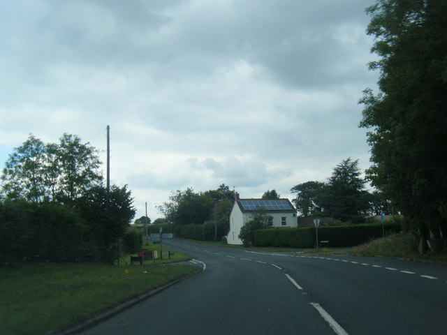
Woolaston Common is a picturesque village located in the county of Gloucestershire, England. Situated approximately 10 miles southwest of the city of Gloucester, it falls within the Forest of Dean district. The village is surrounded by stunning natural beauty, nestled amidst rolling hills and lush green fields.

The heart of Woolaston Common is its village green, a central open space that serves as a focal point for community events and gatherings. The green is flanked by charming cottages and traditional houses, showcasing the area's rustic charm and character.

Woolaston Common boasts a close-knit community, with a population of around 1,500 residents. The village offers a range of amenities to cater to their needs, including a local shop, a primary school, and a pub. The village pub, with its traditional architecture and warm atmosphere, acts as a social hub for locals and visitors alike.

Nature enthusiasts are drawn to Woolaston Common for its stunning countryside and access to outdoor activities. The area is known for its scenic walks and trails, offering breathtaking views of the surrounding landscape. Nearby attractions include the Wye Valley Area of Outstanding Natural Beauty and the stunning Forest of Dean, both of which provide opportunities for hiking, cycling, and wildlife spotting.

Overall, Woolaston Common is a charming village that seamlessly blends natural beauty with a strong sense of community. Whether exploring the idyllic countryside or immersing oneself in the local culture, visitors are sure to find solace and a warm welcome in this hidden gem of Gloucestershire.

If you have any feedback on the listing, please let us know in the comments section below.

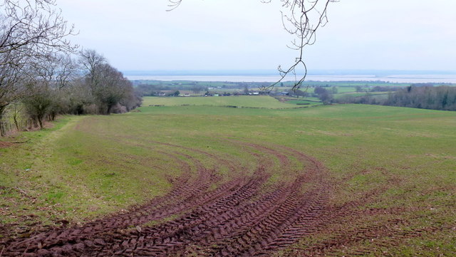
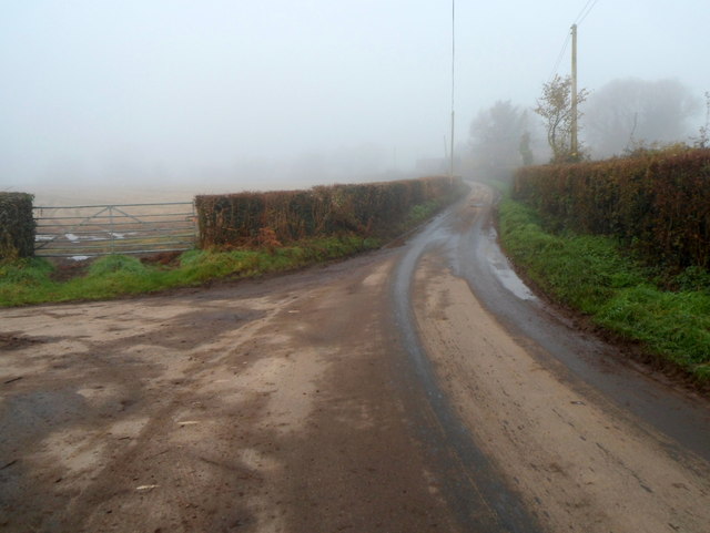
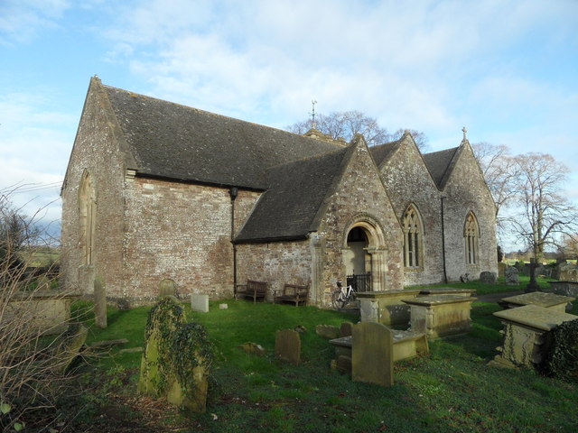
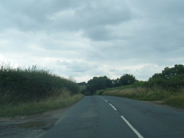
Woolaston Common Images

Images are sourced within 2km of 51.706156/-2.6092069 or Grid Reference SO5801. Thanks to Geograph Open Source API. All images are credited.

A picnic area off the A48
Pastoral scene to the mighty Severn View from Park Hill Road over High Woolaston.
Pastoral scene to the mighty Severn
View from Park Hill Road over High Woolaston.
Public toilets in a picnic and parking area near the A48, Woolaston There was an unexpected bank of fog in the Woolaston area on a November Sunday that was clear 
and sunny with bright blue skies elsewhere, hence the poor visibility in the background.
Public toilets in a picnic and parking area near the A48, Woolaston
There was an unexpected bank of fog in the Woolaston area on a November Sunday that was clear and sunny with bright blue skies elsewhere, hence the poor visibility in the background.
Church Lane, Woolaston On the left, a sign pointing to the sky shows CHURCH.
The sign should of course be interpreted as pointing ahead, towards this <a title="https://www.geograph.org.uk/photo/1899890" href="https://www.geograph.org.uk/photo/1899890">Link</a> church.
Church Lane, Woolaston
On the left, a sign pointing to the sky shows CHURCH. The sign should of course be interpreted as pointing ahead, towards this Link church.
Keynsham Lane, Woolaston Keynsham Lane heads towards Keynsham Farm. Out of shot on the left is Church Lane. <a title="https://www.geograph.org.uk/photo/3230351" href="https://www.geograph.org.uk/photo/3230351">Link</a>
Keynsham Lane, Woolaston
Keynsham Lane heads towards Keynsham Farm. Out of shot on the left is Church Lane. Link
Woolaston Inn and Gurkha Restaurant & Bar, Woolaston The Gurkha Restaurant & Bar is an addition since this view <a title="https://www.geograph.org.uk/photo/625390" href="https://www.geograph.org.uk/photo/625390">Link</a> taken 5 years earlier.
The location is alongside the A48 between Chepstow and Lydney.
Woolaston Inn and Gurkha Restaurant & Bar, Woolaston
The Gurkha Restaurant & Bar is an addition since this view Link taken 5 years earlier. The location is alongside the A48 between Chepstow and Lydney.
Left turn ahead for Netherend and Woolaston Common A view across the A48 from the corner of Kerrin Lane, Woolaston. <a title="https://www.geograph.org.uk/photo/3230581" href="https://www.geograph.org.uk/photo/3230581">Link</a>
Left turn ahead for Netherend and Woolaston Common
A view across the A48 from the corner of Kerrin Lane, Woolaston. Link
A48 at Brookend
A48 at Brookend
Minor road junction at Woolaston Junction of A38 with minor road that leads to Station Road at Woolaston. Photograph taken looking across from the Woolaston Inn.
Minor road junction at Woolaston
Junction of A38 with minor road that leads to Station Road at Woolaston. Photograph taken looking across from the Woolaston Inn.
St Andrew's Church, Woolaston Churches and chapels (no. 3). The church at Woolaston is first recorded in 1131 but was extensively renovated in Victorian times.
St Andrew's Church, Woolaston
Churches and chapels (no. 3). The church at Woolaston is first recorded in 1131 but was extensively renovated in Victorian times.
B4228 nears bend in Oak Hill Wood
B4228 northbound near Cowshill Farm
B4228 at Hewelsfield Cross
Woolaston Methodist Church Churches and chapels. No. 51. My aim is to cycle to all the churches within 25 km of my home.
Woolaston Methodist Church
Churches and chapels. No. 51. My aim is to cycle to all the churches within 25 km of my home.
Ordnance Survey Flush Bracket S1361 This can be found on the roadside wall of a house in Kerrin Lane at Brookend.
For more detail see : <span class="nowrap"><a title="http://www.bench-marks.org.uk/bm16012" rel="nofollow ugc noopener" href="http://www.bench-marks.org.uk/bm16012">Link</a><img style="margin-left:2px;" alt="External link" title="External link - shift click to open in new window" src="https://s1.geograph.org.uk/img/external.png" width="10" height="10"/></span>
Ordnance Survey Flush Bracket S1361
This can be found on the roadside wall of a house in Kerrin Lane at Brookend. For more detail see : LinkExternal link
The Church of St Andrew at Woolaston Viewed from the north-west.
The Church of St Andrew at Woolaston
Viewed from the north-west.
St Mary Magdalene, Hewelsfield Set in a circular churchyard containing some venerable yews, one of which was 350 years old at the Conquest, St Mary Magdalene dates from the late 12th century in its present form. It was restored by William Butterfield 1863-7, who showed considerable restraint and sensitivity. All of the main roofs and furnishings are by him and the whole place is a delight for admirers of his work.
St Mary Magdalene, Hewelsfield
Set in a circular churchyard containing some venerable yews, one of which was 350 years old at the Conquest, St Mary Magdalene dates from the late 12th century in its present form. It was restored by William Butterfield 1863-7, who showed considerable restraint and sensitivity. All of the main roofs and furnishings are by him and the whole place is a delight for admirers of his work.
St Mary Magdalene, Hewelsfield The lychgate is the work of William Butterfield, who restored the church between 1863 and 1867.
St Mary Magdalene, Hewelsfield
The lychgate is the work of William Butterfield, who restored the church between 1863 and 1867.
Show me another place!

Woolaston Common is located at Grid Ref: SO5801 (Lat: 51.706156, Lng: -2.6092069)

Administrative County: Gloucestershire

District: Forest of Dean

Police Authority: Gloucestershire

What 3 Words

///tolls.animated.reporters. Near Bream, Gloucestershire

Related Wikis

Woolaston

Woolaston is a village and civil parish in the Forest of Dean district of Gloucestershire in South West England. It lies on the north side of the Severn...

Hewelsfield

Hewelsfield is a village in Hewelsfield and Brockweir civil parish, in the Forest of Dean district of Gloucestershire, England. The village is located...

Hewelsfield Motte

The Hewelsfield Motte is a roughly circular mound, in Hewelsfield, Gloucestershire, England. It is thought to be a castle motte dating from the period...

East Wood, Tidenham

East Wood (grid reference SO561001) (west site) and (grid reference SO563001) (east site) is a 0.82-hectare (2.0-acre) nature reserve in Gloucestershire...

Nearby Amenities

Located within 500m of 51.706156,-2.6092069
Woolaston Woodside
Is In: Gloucestershire, England, UK
Place: hamlet
Source: NPE
Lat/Long: 51.7029435/-2.6121465
Woolaston Common
Is In: Gloucestershire, UK
Note: This is not a common - common rights ceased during the enclosures
Place: hamlet
Lat/Long: 51.7057749/-2.6036008
Bus Stop
Pleasant View
Naptan AtcoCode: 1600GL5348
Naptan Bearing: N
Naptan CommonName: Pleasant View
Naptan NaptanCode: gloadtwd
Naptan Street: Woodside
Naptan Verified: no
Source: naptan_import
Lat/Long: 51.7069851/-2.6087327
Bus Stop
Sand Tumps Turn
Naptan AtcoCode: 1600GLF431
Naptan Bearing: NW
Naptan CommonName: Sand Tumps Turn
Naptan NaptanCode: gloadwmg
Naptan Street: Woodside
Naptan Verified: no
Source: naptan_import
Lat/Long: 51.7047445/-2.6038402
Bus Stop
Sand Tumps Turn
Naptan AtcoCode: 1600GLF432
Naptan Bearing: NE
Naptan CommonName: Sand Tumps Turn
Naptan NaptanCode: gloadwmj
Naptan Street: Sand Tumps
Naptan Verified: no
Source: naptan_import
Lat/Long: 51.7048716/-2.6035959
Barrier: stile
Lat/Long: 51.704333/-2.6095485
Barrier: stile
Lat/Long: 51.7050978/-2.606217
The data included in this document is from www.openstreetmap.org. The data is made available under ODbL.

Have you been to Woolaston Common?

Leave your review of Woolaston Common below (or comments, questions and feedback).