Woodstock

Settlement in Kent Swale

England

Woodstock

Entrance to Old Rectory Stables, Milstead The drive leads off Horn Hill.
Entrance to Old Rectory Stables, Milstead Credit: pam fray

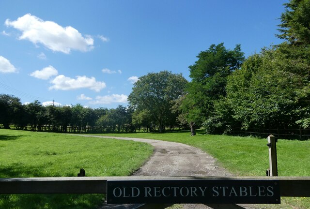
Woodstock is a picturesque village located in the county of Kent, England. Situated within the district of Ashford, it is nestled in the heart of the Kent Downs Area of Outstanding Natural Beauty. With its quaint charm and idyllic surroundings, Woodstock offers a peaceful retreat for residents and visitors alike.

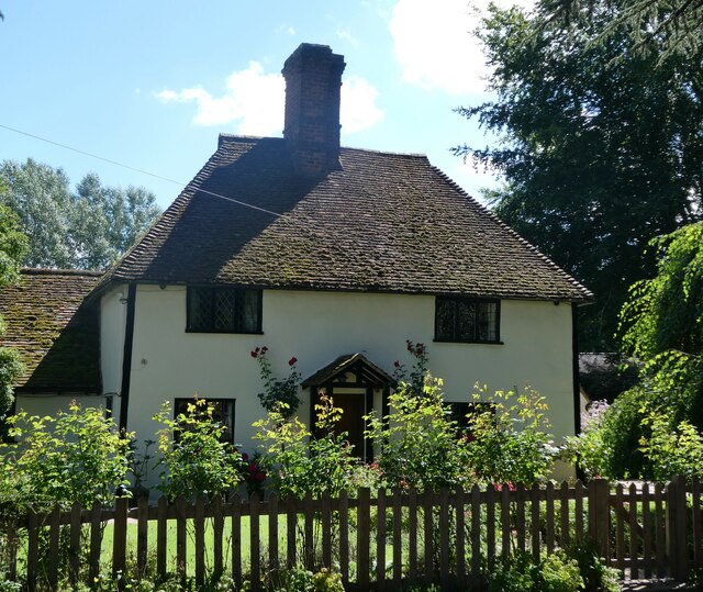
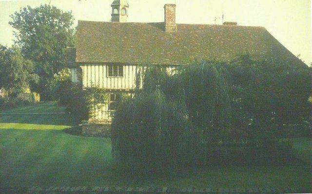
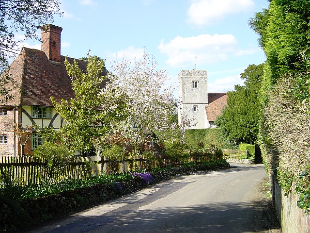
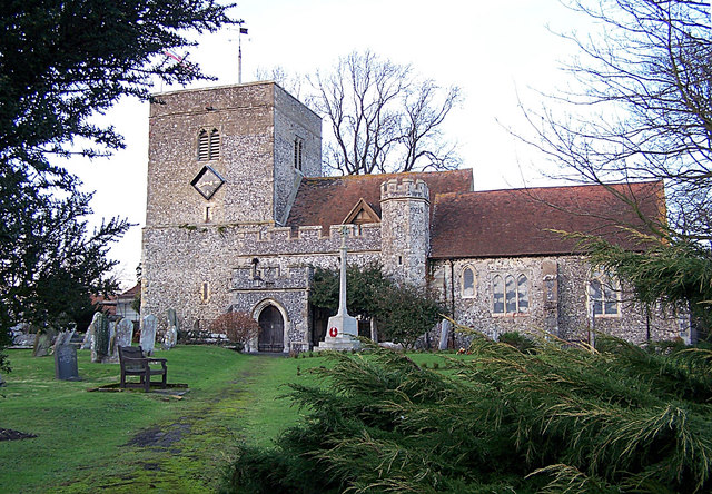
The village is known for its historic significance, dating back to the medieval period. It features a collection of beautiful, timber-framed houses that are a testament to its rich heritage. Woodstock is also home to the Grade I listed St. Mary's Church, a stunning example of Norman architecture.

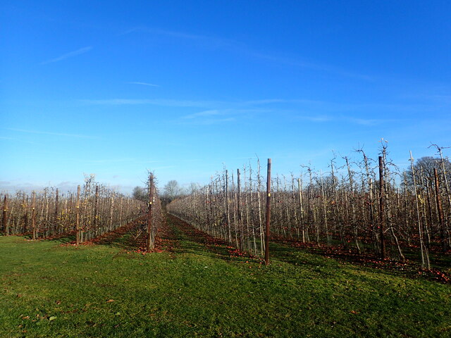
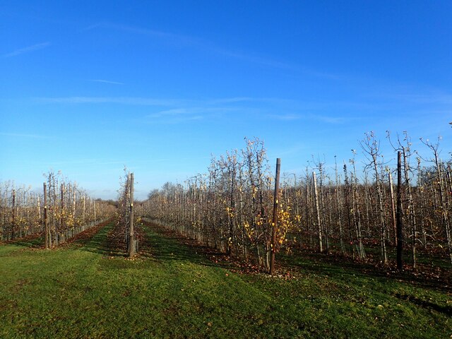
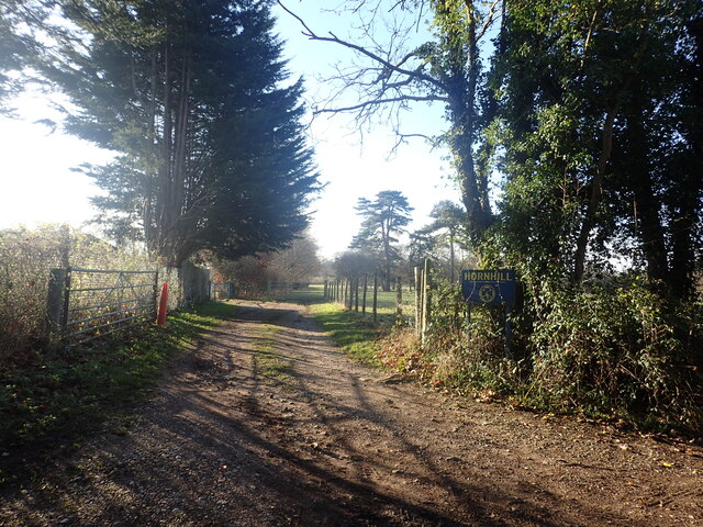
Nature enthusiasts are drawn to Woodstock for its stunning landscapes and abundant wildlife. The village is surrounded by rolling hills, lush green fields, and winding footpaths, making it a haven for walkers and hikers. The nearby Kings Wood, known for its bluebells in springtime, offers a peaceful sanctuary for those seeking to connect with nature.

Despite its small size, Woodstock boasts a strong sense of community. Residents take pride in their village and actively participate in various community events and activities. The annual Woodstock Festival, held in the village hall, brings locals together to celebrate local talent and showcase the vibrant arts scene.

Woodstock benefits from its proximity to the town of Ashford, which provides a range of amenities including shopping centers, schools, and leisure facilities. The village is well-connected with good transport links, making it an ideal location for commuters.

In summary, Woodstock is a charming village with a rich history, stunning natural surroundings, and a close-knit community. It offers a peaceful and idyllic lifestyle for residents and a charming destination for visitors to explore.

If you have any feedback on the listing, please let us know in the comments section below.

Woodstock Images

Images are sourced within 2km of 51.309914/0.729745 or Grid Reference TQ9060. Thanks to Geograph Open Source API. All images are credited.

Entrance to Old Rectory Stables, Milstead The drive leads off Horn Hill.
Entrance to Old Rectory Stables, Milstead
The drive leads off Horn Hill.
Signpost and cottage, Milstead Northwards, Rawling Street leads to Sittingbourne, southwards Frinsted Road leads to Frinsted and Doddington. Rose Cottage is a Grade II listed building.
Signpost and cottage, Milstead
Northwards, Rawling Street leads to Sittingbourne, southwards Frinsted Road leads to Frinsted and Doddington. Rose Cottage is a Grade II listed building.
Rose Cottage, Milstead On Rawling Street, a Grade II listed building.
Rose Cottage, Milstead
On Rawling Street, a Grade II listed building.
Village sign, Milstead A wooden sign on the wall of the Village Hall. The plaque beneath states that it was carved by Mr. Norman Smithers and unveiled by Cllr. Jean Newman in 1993.
Village sign, Milstead
A wooden sign on the wall of the Village Hall. The plaque beneath states that it was carved by Mr. Norman Smithers and unveiled by Cllr. Jean Newman in 1993.
Ceramic tiles round the base of the Village Hall, Milstead One set of 26, one for each letter of the alphabet, created by local people. This is one of 8 contributed by Nigel Hobbins.
Ceramic tiles round the base of the Village Hall, Milstead
One set of 26, one for each letter of the alphabet, created by local people. This is one of 8 contributed by Nigel Hobbins.
Milstead Cricket Club ground and pavilion The entrance is in Rawling Street, opposite the Village Hall.
Milstead Cricket Club ground and pavilion
The entrance is in Rawling Street, opposite the Village Hall.
19th century gravestone in Milstead churchyard On the western side of the Church of St. Mary and the Holy Cross.
19th century gravestone in Milstead churchyard
On the western side of the Church of St. Mary and the Holy Cross.
Lych gate, the church of St. Mary and the Holy Cross, Milstead
Gravestone, the church of St. Mary and the Holy Cross, Milstead The remains of an 18th  century gravestone.
Gravestone, the church of St. Mary and the Holy Cross, Milstead
The remains of an 18th century gravestone.
Out of season apple trees This is seen from Manor Road. As can be seen, there are still a great many windfalls.
Out of season apple trees
This is seen from Manor Road. As can be seen, there are still a great many windfalls.
Apple orchard in December This is seen from Manor Road. As can be seen, there are still a great many windfalls.
Apple orchard in December
This is seen from Manor Road. As can be seen, there are still a great many windfalls.
An unusual war memorial The wording on the memorial states "In this field the 3rd Battalion Gloucestershire Regiment Lt Col G. H. Burges Commanding was encamped during the summers of 1916 - 1917". The memorial is next to Horn Hill and close to the entrance to the Girl Guiding Hall at Hornhill. See also <a title="www.geograph.org.uk/photo/7672535" href="https://www.geograph.org.uk/photo/7672535">Link</a>
An unusual war memorial
The wording on the memorial states "In this field the 3rd Battalion Gloucestershire Regiment Lt Col G. H. Burges Commanding was encamped during the summers of 1916 - 1917". The memorial is next to Horn Hill and close to the entrance to the Girl Guiding Hall at Hornhill. See also Link
War memorial alongside Horn Hill The wording on the memorial states "In this field the 3rd Battalion Gloucestershire Regiment Lt Col G. H. Burges Commanding was encamped during the summers of 1916 - 1917". The memorial is next to Horn Hill and close to the entrance to the Girl Guiding Hall at Hornhill. See also <a title="www.geograph.org.uk/photo/7672531" href="https://www.geograph.org.uk/photo/7672531">Link</a>
War memorial alongside Horn Hill
The wording on the memorial states "In this field the 3rd Battalion Gloucestershire Regiment Lt Col G. H. Burges Commanding was encamped during the summers of 1916 - 1917". The memorial is next to Horn Hill and close to the entrance to the Girl Guiding Hall at Hornhill. See also Link
Entrance to the Girl Guiding Hall at Hornhill This is seen from Horn Hill and is close to the war memorial seen at <a title="www.geograph.org.uk/photo/7672531" href="https://www.geograph.org.uk/photo/7672531">Link</a>
Entrance to the Girl Guiding Hall at Hornhill
This is seen from Horn Hill and is close to the war memorial seen at Link
M2: Sawpit Road Bridge
St Mary & The Holy Cross church, Milstead in 1969 As seen from Rawling Street
St Mary & The Holy Cross church, Milstead in 1969
As seen from Rawling Street
Milstead Manor in 1969 As seen from Frinsted Road over the garden wall, before bushes were planted to hide the view
Milstead Manor in 1969
As seen from Frinsted Road over the garden wall, before bushes were planted to hide the view
St. Mary  and the Holy Cross church, Milstead Looking along the nave to the chancel. Originally Norman, the church was restored twice in the 19th century. The second restoration was by William Butterfield in 1872 and it has changed little since.
St. Mary and the Holy Cross church, Milstead
Looking along the nave to the chancel. Originally Norman, the church was restored twice in the 19th century. The second restoration was by William Butterfield in 1872 and it has changed little since.
Show me another place!

Woodstock is located at Grid Ref: TQ9060 (Lat: 51.309914, Lng: 0.729745)

Administrative County: Kent

District: Swale

Police Authority: Kent

What 3 Words

///copies.dance.impose. Near Sittingbourne, Kent

Related Wikis

Cromers Wood

Cromers Wood is a 28-hectare (69-acre) nature reserve between Milstead and Sittingbourne in Kent. It is managed by Kent Wildlife Trust.This ancient semi...

Sittingbourne Community F.C.

Sittingbourne Community F.C. is an English football club located in Sittingbourne, in Kent. The club plays in the Kent County Football League Division...

Woodstock Sports F.C.

Woodstock Sports Football Club was an English football team based in Sittingbourne, Kent, last played in the Southern Counties East League. During the...
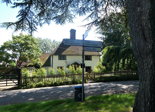
Highsted

Highsted is a village near Sittingbourne in Kent, England. It is in the civil parish of Rodmersham. Most of the village is on Highsted Valley road leading...
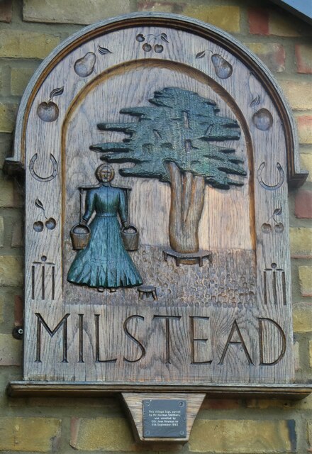
Milstead

Milstead is a village and civil parish in the borough of Swale in Kent, England. It is surrounded by the villages of Frinsted, Wichling, Doddington and...

Bexon

Bexon is a village in Kent, England, situated North of the parishes of Frinsted and Bicknor, just south of the M2 motorway. Bexon is also the name of...

Dungate

Dungate is a village near the M2 motorway, in the Swale district, in the English county of Kent. It is near the town of Sittingbourne. == References... ==

Borden, Kent

Borden is a village and electoral ward situated immediately south west of Sittingbourne, Kent, from which it is separated by a small area of rural land...

Nearby Amenities

Located within 500m of 51.309914,0.729745
Curve Geometry: yes
Lat/Long: 51.308314/0.7364001
Curve Geometry: yes
Lat/Long: 51.3068862/0.7346989
Curve Geometry: yes
Lat/Long: 51.3062634/0.7308417
Curve Geometry: yes
Lat/Long: 51.3076013/0.730024
Curve Geometry: yes
Lat/Long: 51.3097646/0.7296365
Curve Geometry: yes
Lat/Long: 51.3117126/0.7297535
Curve Geometry: yes
Lat/Long: 51.3127061/0.7291011
Broadoak
Place: hamlet
Source: npe
Lat/Long: 51.3071129/0.7265203
Curve Geometry: yes
Lat/Long: 51.3056207/0.7306607
Curve Geometry: yes
Lat/Long: 51.3060207/0.7308144
Curve Geometry: yes
Lat/Long: 51.3083955/0.7297456
Curve Geometry: yes
Lat/Long: 51.3067124/0.73048
Curve Geometry: yes
Lat/Long: 51.3103823/0.7292181
Curve Geometry: yes
Lat/Long: 51.3092827/0.7297533
Post Box
Fixme: Double-check ref. Second half not easily readable.
Postal Code: ME9
Ref: ME9 37
Source: survey
Lat/Long: 51.3103659/0.7295945
Curve Geometry: yes
Lat/Long: 51.3064478/0.7307634
Curve Geometry: yes
Lat/Long: 51.3057117/0.732045
Curve Geometry: yes
Lat/Long: 51.3061796/0.7336065
Curve Geometry: yes
Lat/Long: 51.3073951/0.7352897
Curve Geometry: yes
Lat/Long: 51.3057792/0.7322864
Woodstock Cottage Farm
Landuse: farm
Note Retag: CS #48756035
Lat/Long: 51.3077377/0.7287086
Curve Geometry: yes
Lat/Long: 51.3135721/0.7280818
Curve Geometry: yes
Lat/Long: 51.3131258/0.7286462
Curve Geometry: yes
Lat/Long: 51.3121717/0.7295353
Curve Geometry: yes
Lat/Long: 51.3112348/0.7296043
Curve Geometry: yes
Lat/Long: 51.3109861/0.7294328
Curve Geometry: yes
Lat/Long: 51.3106731/0.7292821
Curve Geometry: yes
Lat/Long: 51.3058972/0.7329207
Curve Geometry: yes
Lat/Long: 51.3066377/0.7343628
Leisure: picnic_table
Lat/Long: 51.3124728/0.7350376
Barrier: yes
Lat/Long: 51.3131601/0.7339079
Post Box
Collection Plate: CP8
Collection Times: Mo-Fr 16:30; Sa 09:00
Note: This postbox is within Kent Science Park which has security staff on the gate. On Friday 6th January 2023 i used this postbox while with a driver making a delivery in Kent Science Park. if you want to patronise this postbox, ask the security staff.
Operator: Royal Mail
Operator Wikidata: Q638098
Post Box Type: pillar
Royal Cypher: EIIR
Source: survey
Survey Date: 2023-01-06
Lat/Long: 51.3132711/0.7264736
The data included in this document is from www.openstreetmap.org. The data is made available under ODbL.

Have you been to Woodstock?

Leave your review of Woodstock below (or comments, questions and feedback).