Braunston-in-Rutland

Settlement in Rutland

England

Braunston-in-Rutland

Bridleway to Braunston Road
Bridleway to Braunston Road Credit: Jonathan Thacker

Braunston-in-Rutland is a small village situated in the county of Rutland, in the East Midlands region of England. Located just a few miles southeast of Oakham, the village sits on the eastern side of Rutland Water, a large reservoir renowned for its stunning beauty and abundance of wildlife.

With a population of around 200 residents, Braunston-in-Rutland is a quaint and picturesque village that exudes a sense of tranquility. Its charming cottages and historic buildings, such as the 17th-century All Saints Church, add to its character and appeal. The village is well-preserved, with many of its original features still intact.

Braunston-in-Rutland offers a range of amenities for its residents and visitors. There is a village hall that hosts various community events throughout the year, including social gatherings and local fairs. The village also has a primary school, providing education for children in the area.

The surrounding countryside offers ample opportunities for outdoor activities. Rutland Water provides a haven for birdwatchers, cyclists, and walkers, with numerous trails and nature reserves to explore. Sailing, windsurfing, and fishing are also popular pastimes on the reservoir.

Despite its small size, Braunston-in-Rutland benefits from its proximity to larger towns and cities. Oakham, the county town of Rutland, is just a short drive away and offers a wider range of amenities, including shops, restaurants, and leisure facilities.

Overall, Braunston-in-Rutland is a charming village that captures the essence of rural England, offering a peaceful and idyllic setting for residents and visitors alike.

If you have any feedback on the listing, please let us know in the comments section below.

Braunston-in-Rutland Images

Images are sourced within 2km of 52.651514/-0.766344 or Grid Reference SK8306. Thanks to Geograph Open Source API. All images are credited.

Bridleway to Braunston Road
Bridleway to Gunthorpe
Barn at Home Farm, Brooke
Hedge trimming, Braunston Lane
Footbridge over the River Gwash, Braunston
Rough grazing between Braunston and Brooke
Footpath towards Gunthorpe This footpath connects with a bridleway to Gunthorpe after a couple of fields. The footpath sign isn't quite pointing in the right direction but does point to where the footpath and bridleway join.
Footpath towards Gunthorpe
This footpath connects with a bridleway to Gunthorpe after a couple of fields. The footpath sign isn't quite pointing in the right direction but does point to where the footpath and bridleway join.
Junction of bridleways near Bridge Farm, Brooke
Bridleway from Gunthorpe near Brooke
Recently laid hedge, Ridlington Road
St. Peter's church, Brooke The church has a thirteenth century west tower and the north aisle dates from about 1579 <span class="nowrap"><a title="https://historicengland.org.uk/listing/the-list/list-entry/1215370?section=official-list-entry" rel="nofollow ugc noopener" href="https://historicengland.org.uk/listing/the-list/list-entry/1215370?section=official-list-entry">Link</a><img style="margin-left:2px;" alt="External link" title="External link - shift click to open in new window" src="https://s1.geograph.org.uk/img/external.png" width="10" height="10"/></span>
St. Peter's church, Brooke
The church has a thirteenth century west tower and the north aisle dates from about 1579 LinkExternal link
Ridlington Road near Braunston
Weir on the River Gwash, Braunston in Rutland
Snowdrops in the churchyard, Braunston in Rutland
All Saints' church, Braunston in Rutland Externally the church is largely of the fourteenth century but earlier work survives inside <span class="nowrap"><a title="https://historicengland.org.uk/listing/the-list/list-entry/1214996?section=official-list-entry" rel="nofollow ugc noopener" href="https://historicengland.org.uk/listing/the-list/list-entry/1214996?section=official-list-entry">Link</a><img style="margin-left:2px;" alt="External link" title="External link - shift click to open in new window" src="https://s1.geograph.org.uk/img/external.png" width="10" height="10"/></span>
All Saints' church, Braunston in Rutland
Externally the church is largely of the fourteenth century but earlier work survives inside LinkExternal link
The churchyard, Braunston in Rutland
All Saints' church, Braunston in Rutland Fourteenth century west tower <span class="nowrap"><a title="https://historicengland.org.uk/listing/the-list/list-entry/1214996?section=official-list-entry" rel="nofollow ugc noopener" href="https://historicengland.org.uk/listing/the-list/list-entry/1214996?section=official-list-entry">Link</a><img style="margin-left:2px;" alt="External link" title="External link - shift click to open in new window" src="https://s1.geograph.org.uk/img/external.png" width="10" height="10"/></span>
All Saints' church, Braunston in Rutland
Fourteenth century west tower LinkExternal link
The "Goddess" of Braunston Enigmatic sculpture of unknown date.
The "Goddess" of Braunston
Enigmatic sculpture of unknown date.
Show me another place!

Braunston-in-Rutland is located at Grid Ref: SK8306 (Lat: 52.651514, Lng: -0.766344)

Unitary Authority: Rutland

Police Authority: Leicestershire

What 3 Words

///skinning.predict.apron. Near Brooke, Rutland

Nearby Locations

Braunston-in-Rutland

Related Wikis

Braunston-in-Rutland

Braunston-in-Rutland is a village and civil parish in the county of Rutland in the East Midlands of England. The population of the civil parish was 392...

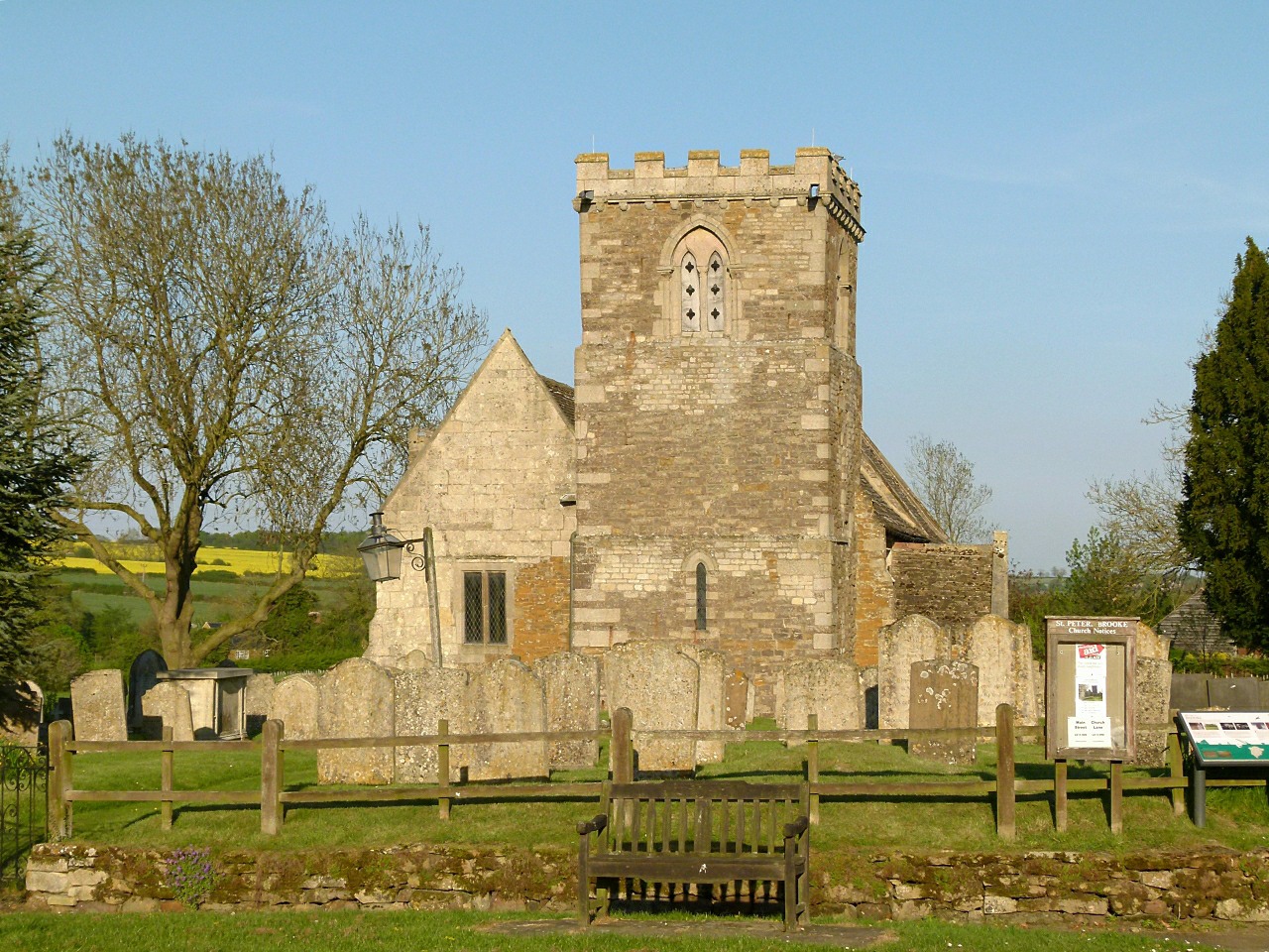
All Saints' Church, Braunston-in-Rutland

All Saints' Church is a Church of England parish church in Braunston-in-Rutland, Rutland. It is a Grade II* listed building. == History == The church dates...

Brooke Priory

Brooke Priory was a minor house of Augustinian monks in Brooke, Rutland. It was a cell of St Mary's Abbey, Kenilworth. == History == It was founded by...

Oakham Urban District

Oakham was an Urban District in Rutland, England from 1911 to 1974. It was created under the Local Government Act 1894. Oakham Rural District had included...

Brooke, Rutland

Brooke is a village and civil parish in the county of Rutland in the East Midlands of England. It is situated about three miles (4.8 km) southwest of Oakham...

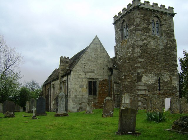
St Peter's Church, Brooke, Rutland

St Peter's Church is a Church of England parish church in Brooke, Rutland. It is a Grade I listed building. == History == The church has a carved doorway...

Flitteriss Park

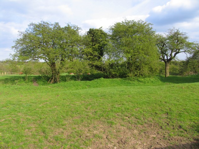
Flitteriss Park is an ancient deer park in the English Midland counties of Leicestershire and Rutland west of Oakham. It is a modern livestock farm today...
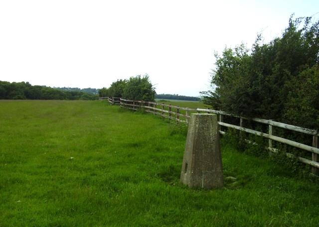
Cold Overton Park

A hill with a trig point pillar to the east of Cold Overton Park Wood is, at 197 m (646 ft), the highest point in the county of Rutland, England. The summit...

Related Videos

Reopening

The Blue Ball at Braunston, Oakham, Rutland is Reopening from Friday 10 July 2020.

The Blue Ball At Braunston - Home of Hospitality for 400 Years

The Blue Ball At Braunston Country Pub & Kitchen near Oakham, Rutland.

Christmas - Braunston-in-Rutland

Advent and Christmas Braunston-in-Rutland near Oakham. The Blue Ball at Braunston, Country Pub & Restaurant.

Visiting The Blue Ball at Braunston - what’s it like after reopening?

Visitor video - sneak preview of what it's like visiting The Blue Ball pub restaurant now? Near Oakham, Rutland LE15 8QS.

Nearby Amenities

Located within 500m of 52.651514,-0.766344
Braunston in Rutland
Is In Country: UK
Is In County: Rutland
Loc Name: Braunston
Place: village
Source Loc Name: RichardF fount of wisdom on all things Motlo in Parvem; sign at S of village
Wikidata: Q3105437
Lat/Long: 52.6519674/-0.7692973
Pub
Blue Ball
Addr City: Oakham
Addr Country: GB
Addr Housenumber: 6
Addr Postcode: LE15 8QS
Addr Street: Cedar Street
Addr Village: Braunston In Rutland
Fhrs Authority: Rutland
Fhrs Id: 1153488
Fhrs Local Authority Id: 100060
Source Addr: FHRS Open Data
Website: https://www.theblueballbraunston.co.uk/
Lat/Long: 52.6510439/-0.7699442
Pub
Old Plough
Addr City: Oakham
Addr Country: GB
Addr Housenumber: 1
Addr Postcode: LE15 8QY
Addr Street: Oakham Road
Addr Village: Braunston In Rutland
Fhrs Authority: Rutland
Fhrs Id: 1153534
Fhrs Local Authority Id: 100150
Source Addr: FHRS Open Data
Lat/Long: 52.6533545/-0.7673153
Historic: memorial
Memorial: war_memorial
Lat/Long: 52.65071/-0.7698828
Post Box
Post Box Type: lamp
Ref: LE15 34
Royal Cypher: EIIR
Royal Cypher Wikidata: Q33102113
Lat/Long: 52.6520155/-0.7705886
Post Box
Post Box Type: wall
Ref: LE15 42
Royal Cypher: GR
Royal Cypher Wikidata: Q33102273
Lat/Long: 52.6525792/-0.7678199
Bench
Source: survey
Lat/Long: 52.6520268/-0.7706419
Telephone
Booth: K6
Covered: booth
Listed Status: Grade II
Man Made: telephone_box
Source: survey
Lat/Long: 52.6521291/-0.7706511
Barrier: kissing_gate
Source: survey
Lat/Long: 52.6506872/-0.7722043
Addr Housenumber: 1
Addr Street: Knossington Road
Source: survey
Lat/Long: 52.651947/-0.771853
Addr Housenumber: 4
Addr Street: Knossington Road
Source: survey
Lat/Long: 52.6518966/-0.7723466
Addr Housenumber: 2
Addr Street: Knossington Road
Source: survey
Lat/Long: 52.6519194/-0.7719925
Addr Housenumber: 3
Addr Street: Knossington Road
Source: survey
Lat/Long: 52.6518932/-0.772191
Bench
Source: survey
Lat/Long: 52.650723/-0.7708779
Artwork Type: sculpture
Sculpture: sheela_na_gig
Source: survey
Tourism: artwork
Lat/Long: 52.6506808/-0.7709638
Gable Cottage Bed and Breakfast
Addr City: Oakham
Addr Country: GB
Addr Housenumber: 3
Addr Postcode: LE15 8QW
Addr Street: Ratts Lane
Addr Village: Braunston In Rutland
Fhrs Authority: Rutland
Fhrs Id: 1153835
Fhrs Local Authority Id: 104523
Tourism: guest_house
Lat/Long: 52.651236/-0.7714435
The data included in this document is from www.openstreetmap.org. The data is made available under ODbL.

Have you been to Braunston-in-Rutland?

Leave your review of Braunston-in-Rutland below (or comments, questions and feedback).