Woodditton

Settlement in Cambridgeshire East Cambridgeshire

England

Woodditton

Bridle path and farm track This bridle way leads from Woodditton to the B1061 between Dullingham and Newmarket. A sign on the gate behind the camera insists that the land is private and asks users to stick to the public right of way.
Bridle path and farm track Credit: John Sutton

Woodditton is a small village located in the county of Cambridgeshire, England. Situated approximately 10 miles east of the city of Cambridge, it lies on the outskirts of the Newmarket town, famous for its horse racing heritage. The village is nestled in a rural setting, surrounded by open fields and farmland.

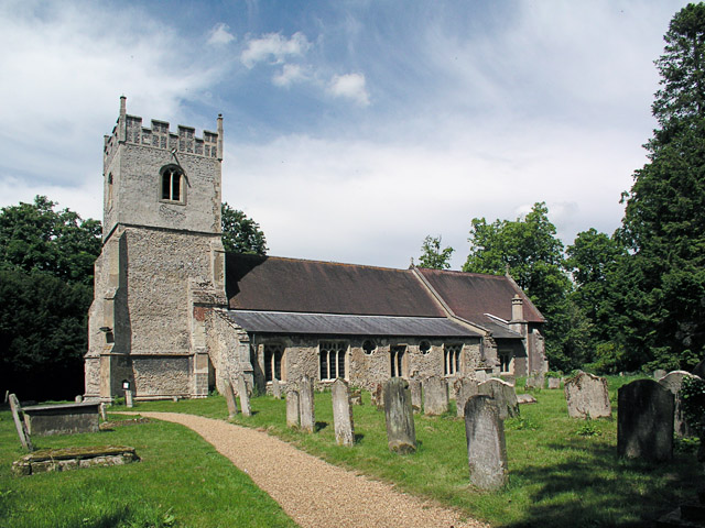
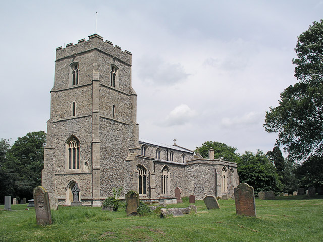
Woodditton has a long history, with evidence of human settlement dating back to the Roman times. The village is home to several historic buildings, including St. Mary's Church, a Grade I listed structure that dates back to the 13th century. The church features beautiful stained glass windows and a historic bell tower.

Despite its small size, Woodditton offers a close-knit community atmosphere. The village has a local pub, The Three Blackbirds, which serves as a hub for social gatherings and events. Additionally, there is a primary school, providing education for the local children.

The surrounding countryside provides ample opportunities for outdoor activities. There are several footpaths and bridleways that wind through the picturesque landscape, making it a popular destination for walkers, cyclists, and horse riders. The nearby Devil's Dyke, an ancient earthwork, offers panoramic views of the Cambridgeshire countryside.

Woodditton is well-connected to neighboring towns and cities. It is easily accessible by road, with the A14 and A11 connecting it to Cambridge and Newmarket. The village also benefits from regular bus services, providing convenient transportation options for residents and visitors alike.

If you have any feedback on the listing, please let us know in the comments section below.
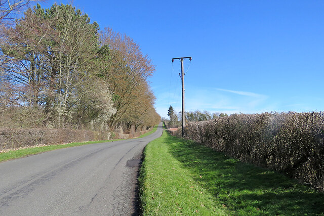
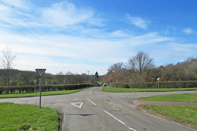
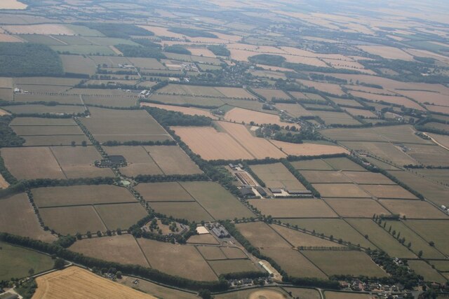
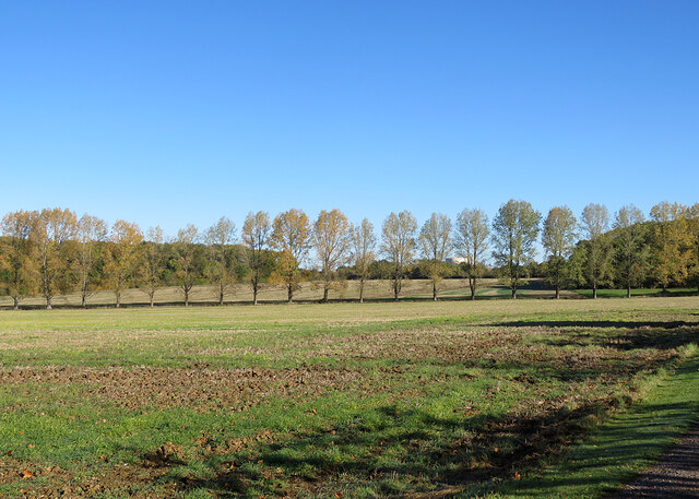
Woodditton Images

Images are sourced within 2km of 52.205402/0.425636 or Grid Reference TL6559. Thanks to Geograph Open Source API. All images are credited.

Bridle path and farm track This bridle way leads from Woodditton to the B1061 between Dullingham and Newmarket. A sign on the gate behind the camera insists that the land is private and asks users to stick to the public right of way.
Bridle path and farm track
This bridle way leads from Woodditton to the B1061 between Dullingham and Newmarket. A sign on the gate behind the camera insists that the land is private and asks users to stick to the public right of way.
Two miles to Newmarket Looking towards Newmarket on Woodditton Road. The crossroad is staggered: Stetchworth and Dullingham to the left, Cheveley to the right (out of the picture).
Two miles to Newmarket
Looking towards Newmarket on Woodditton Road. The crossroad is staggered: Stetchworth and Dullingham to the left, Cheveley to the right (out of the picture).
Uphill to the crossroads The road from Dullingham and Stetchworth to Cheveley (ahead), photographed on a bright March morning. Early blossom shows in some trees and the hedgerow on the left.
Uphill to the crossroads
The road from Dullingham and Stetchworth to Cheveley (ahead), photographed on a bright March morning. Early blossom shows in some trees and the hedgerow on the left.
Give way at the crossroads This is where the road from Cheveley to Stetchworth and Dullingham (ahead) crosses the road from Kirtling and Saxon Street (left) to Newmarket.
Give way at the crossroads
This is where the road from Cheveley to Stetchworth and Dullingham (ahead) crosses the road from Kirtling and Saxon Street (left) to Newmarket.
Saxon Street and Rutland Stud, looking towards Little Ditton: aerial 2022
A fine autumn morning in East Cambridgeshire The road from Woodditton to Stetchworth.
A fine autumn morning in East Cambridgeshire
The road from Woodditton to Stetchworth.
Stetchworth Ley: barns at Ley Farm A mild and cloudless morning in October.
Stetchworth Ley: barns at Ley Farm
A mild and cloudless morning in October.
A line of trees near Stetchworth Ley The trees crossing the picture line a drain. Ditton Green water tower shows in the distance beyond them.
A line of trees near Stetchworth Ley
The trees crossing the picture line a drain. Ditton Green water tower shows in the distance beyond them.
Stetchworth Ley: footpath to Ditton Green The shadowed north-western edge of Great Chitlings Wood is on the right and Little Chitlings Wood in the distance in the centre of the picture.
Stetchworth Ley: footpath to Ditton Green
The shadowed north-western edge of Great Chitlings Wood is on the right and Little Chitlings Wood in the distance in the centre of the picture.
Autumn in East Cambridgeshire The road from Stetchworth Park Farm to Stetchworth on a mild and cloudless October morning.
Autumn in East Cambridgeshire
The road from Stetchworth Park Farm to Stetchworth on a mild and cloudless October morning.
Stetchworth Ley: Round House On the edge of Great Chitlings Wood.
Stetchworth Ley: Round House
On the edge of Great Chitlings Wood.
Towards Charcoals Wood In the gentle hills of East Cambridgeshire on a bright October morning.
Towards Charcoals Wood
In the gentle hills of East Cambridgeshire on a bright October morning.
Signpost near Lower Ley Farm This is where the lane to Stetchworth Ley and Stetchworth Park Farm (no through road) leaves the road from Stetchworth to Woodditton.
Signpost near Lower Ley Farm
This is where the lane to Stetchworth Ley and Stetchworth Park Farm (no through road) leaves the road from Stetchworth to Woodditton.
Stetchworth: flint and pantiles A row of cottages whose Gothick ground-floor window and door reveals suggest they might have been built early in the 19th century.
Stetchworth: flint and pantiles
A row of cottages whose Gothick ground-floor window and door reveals suggest they might have been built early in the 19th century.
Stetchworth: The Marquis of Granby A 19th-century brick pub at the corner of High Street (ahead) and Tea Kettle Lane the road to Dullingham.
Stetchworth: The Marquis of Granby
A 19th-century brick pub at the corner of High Street (ahead) and Tea Kettle Lane the road to Dullingham.
Six miles to Reach on The Devil's Dyke This is the wooded southern section of the Dyke, which ends about a mile behind the camera, near Woodditton.

The Devil's Dyke is the largest and longest of Cambridgeshire's Anglo-Saxon defensive ramparts, which date from the 6th and 7th centuries. It stretches from the edge of the fens at Reach across Newmarket Heath to what was once the edge of impenetrable forest at Woodditton.
Six miles to Reach on The Devil's Dyke
This is the wooded southern section of the Dyke, which ends about a mile behind the camera, near Woodditton. The Devil's Dyke is the largest and longest of Cambridgeshire's Anglo-Saxon defensive ramparts, which date from the 6th and 7th centuries. It stretches from the edge of the fens at Reach across Newmarket Heath to what was once the edge of impenetrable forest at Woodditton.
Steps on The Devil's Dyke This is where the path on the rampart of The Devil's Dyke drops down to cross the road from Dullingham and Stetchworth to Cheveley. The steps and handrails make the task easier when the path is slippery, or if you are a septuagenarian like the man with the camera. This section of the Dyke is wooded, unlike the stretch across Newmarket Heath and at the fens' edge near Reach (ahead).

The Devil's Dyke is the largest and longest of Cambridgeshire's Anglo-Saxon defensive ramparts, which date from the 6th and 7th centuries. It stretches from the edge of the fens at Reach across Newmarket Heath to what was once the edge of impenetrable forest at Woodditton.
Steps on The Devil's Dyke
This is where the path on the rampart of The Devil's Dyke drops down to cross the road from Dullingham and Stetchworth to Cheveley. The steps and handrails make the task easier when the path is slippery, or if you are a septuagenarian like the man with the camera. This section of the Dyke is wooded, unlike the stretch across Newmarket Heath and at the fens' edge near Reach (ahead). The Devil's Dyke is the largest and longest of Cambridgeshire's Anglo-Saxon defensive ramparts, which date from the 6th and 7th centuries. It stretches from the edge of the fens at Reach across Newmarket Heath to what was once the edge of impenetrable forest at Woodditton.
Nearing the southern end of The Devil's Dyke The southern part of the Dyke is wooded, unlike the stretches across Newmarket Heath and at the edge of the fens near Reach. This picture gives some idea of the depth of the ditch on the south-western side of the rampart on which the path runs. The height of the rampart and the depth of the ditch vary from place to place.

The Devil's Dyke is the largest and longest of Cambridgeshire's Anglo-Saxon defensive ramparts, which date from the 6th and 7th centuries. It stretches from the edge of the fens at Reach across Newmarket Heath to what was once the edge of impenetrable forest at Woodditton.
Nearing the southern end of The Devil's Dyke
The southern part of the Dyke is wooded, unlike the stretches across Newmarket Heath and at the edge of the fens near Reach. This picture gives some idea of the depth of the ditch on the south-western side of the rampart on which the path runs. The height of the rampart and the depth of the ditch vary from place to place. The Devil's Dyke is the largest and longest of Cambridgeshire's Anglo-Saxon defensive ramparts, which date from the 6th and 7th centuries. It stretches from the edge of the fens at Reach across Newmarket Heath to what was once the edge of impenetrable forest at Woodditton.
Show me another place!

Woodditton is located at Grid Ref: TL6559 (Lat: 52.205402, Lng: 0.425636)

Administrative County: Cambridgeshire

District: East Cambridgeshire

Police Authority: Cambridgeshire

What 3 Words

///moons.drilled.shudders. Near Newmarket, Suffolk

Nearby Locations

Woodditton Woodditton

Related Wikis

Woodditton

Woodditton is a village and civil parish in East Cambridgeshire, England. The other settlements in the parish are Ditton Green, Little Ditton and Saxon...

Stetchworth

Stetchworth is a small village and civil parish in East Cambridgeshire, England, 3 miles (5 km) to the south of the horse-racing centre of Newmarket and...
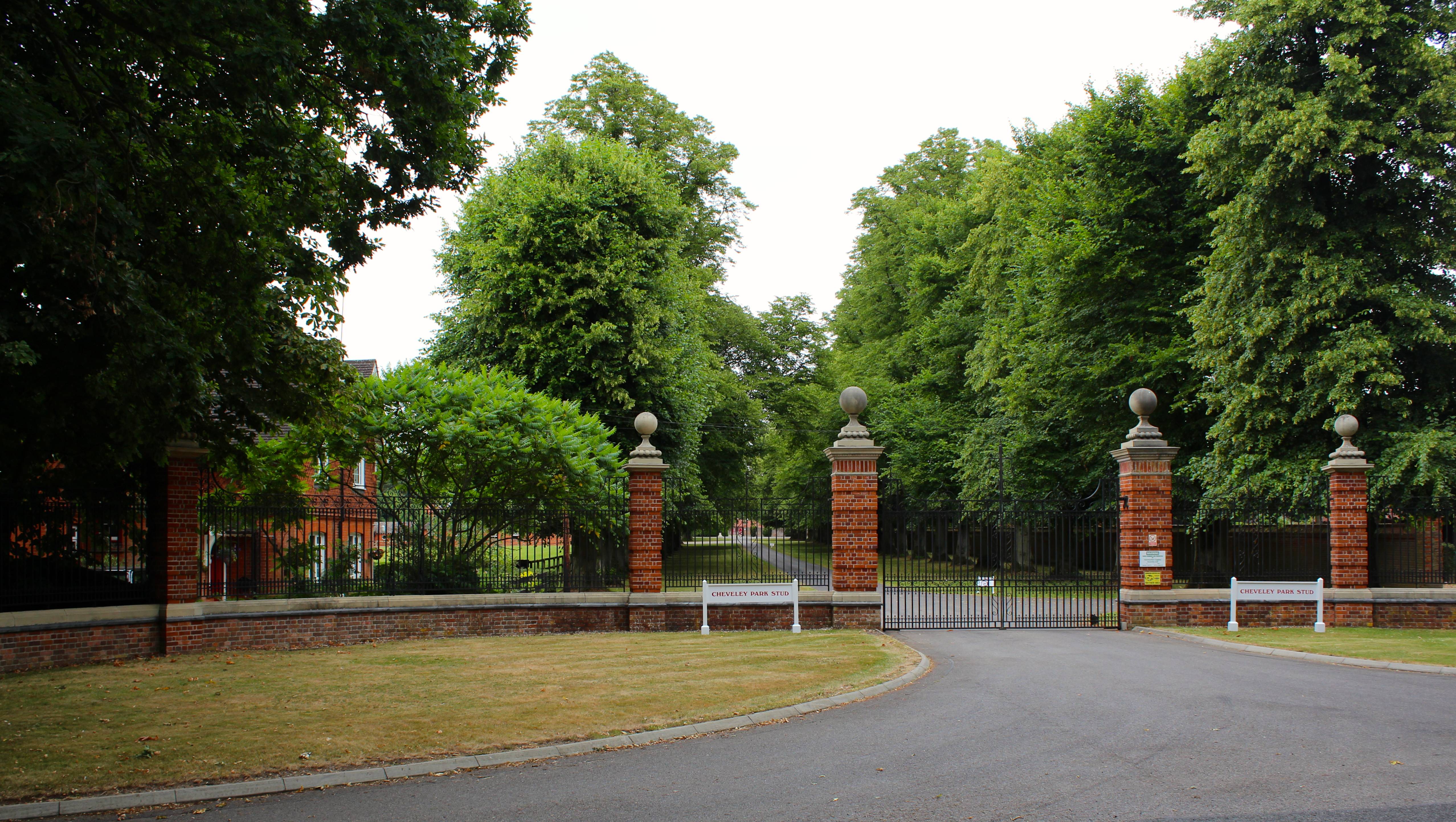
Cheveley Park Stud

Cheveley Park Stud is a thoroughbred racehorse ownership and breeding operation in Newmarket, Suffolk, UK, which has bred and owned many notable horses...

Cheveley

The village of Cheveley is situated in the county of Cambridgeshire and lies about four miles east-south-east of the market town of Newmarket. The population...

Cheveley Castle

Cheveley Castle was a medieval fortified manor house near Cheveley, Cambridgeshire, England. == Details == Cheveley Castle was built by Sir John Pulteney...

Dullingham

Dullingham is a small village and civil parish in East Cambridgeshire, England. It is situated 4 miles (6 km) south of Newmarket and 14 miles (23 km) east...

Kirtling Tower

Kirtling Tower was a medieval castle and Tudor country house in Kirtling, Cambridgeshire, England, of which the gatehouse still remains. == History... ==

Beech House Stud

Beech House Stud is an English Thoroughbred racehorse breeding farm located on Cheveley Road near Newmarket, Suffolk currently owned by Sheikh Hamdan bin...

Nearby Amenities

Located within 500m of 52.205402,0.425636
Post Box
Collection Times: Mo-Fr 16:00; Sa 10:30
Operator: Royal Mail
Post Box Type: lamp
Ref: CB8 80
Royal Cypher: EIIR
Royal Cypher Wikidata: Q33102113
Source: survey
Lat/Long: 52.2055748/0.4257258
Waste Basket
Waste: dog_excrement
Lat/Long: 52.2062897/0.4256676
The data included in this document is from www.openstreetmap.org. The data is made available under ODbL.

Have you been to Woodditton?

Leave your review of Woodditton below (or comments, questions and feedback).