Woodborough

Settlement in Nottinghamshire Gedling

England

Woodborough

Rough grassland on the edge of Calverton
Rough grassland on the edge of Calverton Credit: Jonathan Thacker

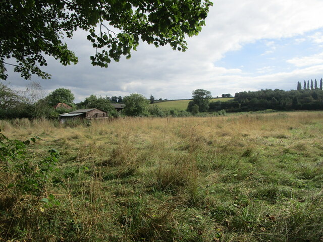
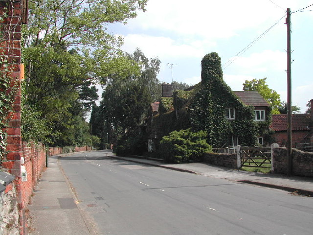
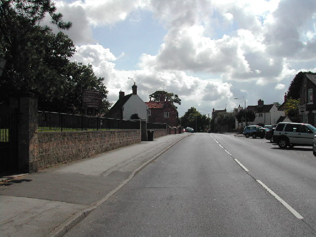
Woodborough is a picturesque village located in the Gedling district of Nottinghamshire, England. Situated approximately 7 miles northeast of the city of Nottingham, it is nestled amidst the rolling countryside of the Nottinghamshire Wolds. The village is known for its charming rural setting, with an abundance of green fields, woodlands, and scenic landscapes.

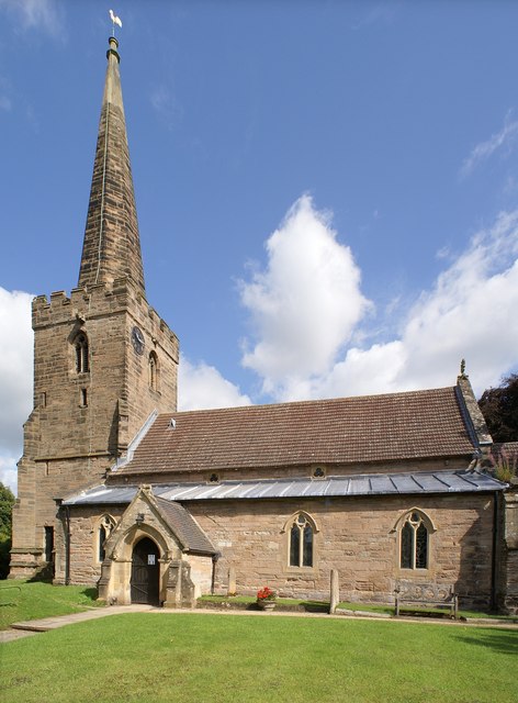
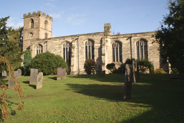
Woodborough has a rich history that dates back to Roman times, with evidence of settlements and Roman roads in the area. The village grew during the medieval period, and its historic core still retains many well-preserved buildings from this era, including the 13th-century St. Swithun's Church.

The village is home to a close-knit community, with a population of around 2,500 people. It offers a range of amenities, including a primary school, a post office, a village hall, and several shops and pubs. Woodborough also has a cricket club, which adds to the community spirit and provides recreational opportunities for residents.

The surrounding countryside provides ample opportunities for outdoor activities, such as walking, cycling, and horse riding. Nearby attractions include the stunning Sherwood Forest, which is famous for its association with the legendary outlaw Robin Hood. The village is also well-connected, with regular bus services to Nottingham and surrounding towns, making it easily accessible for both residents and visitors.

Overall, Woodborough offers a peaceful and idyllic setting, with a strong sense of community and a rich historical heritage, making it an attractive place to live or visit in Nottinghamshire.

If you have any feedback on the listing, please let us know in the comments section below.

Woodborough Images

Images are sourced within 2km of 53.023167/-1.0546225 or Grid Reference SK6347. Thanks to Geograph Open Source API. All images are credited.

Rough grassland on the edge of Calverton
Windles Square, Calverton Former framework knitters' cottages dating from 1834 <span class="nowrap"><a title="https://historicengland.org.uk/listing/the-list/list-entry/1235886" rel="nofollow ugc noopener" href="https://historicengland.org.uk/listing/the-list/list-entry/1235886">Link</a><img style="margin-left:2px;" alt="External link" title="External link - shift click to open in new window" src="https://s1.geograph.org.uk/img/external.png" width="10" height="10"/></span>
Windles Square, Calverton
Former framework knitters' cottages dating from 1834 LinkExternal link
The Gleaners Inn
The Gleaners Inn
Field trees off Hungerhill Lane
Field and tree viewed through a hedge Looking north from the bridleway.
Field and tree viewed through a hedge
Looking north from the bridleway.
Fields below High Pastures Looking north from the bridleway.
Fields below High Pastures
Looking north from the bridleway.
Hedge and footpath  Looking east towards Woodborough village.
Hedge and footpath
Looking east towards Woodborough village.
View over Bank Farm Looking north east from Nottingham Road.
View over Bank Farm
Looking north east from Nottingham Road.
Fields below High Pastures Looking north from Hungerhill Lane
Fields below High Pastures
Looking north from Hungerhill Lane
Looking east near High Pastures
Green Lane, near Lambley
Track to Lambley House Bridlepath to the right
Track to Lambley House
Bridlepath to the right
Bridleway to Nottingham Road
Hungerhill Lane A bridleway.
Hungerhill Lane
A bridleway.
Field of beans and footpath to Bank Hill
Allotments off Foxwood Lane
What is the point of this gate? Older OS maps show that there was once a fence or hedge to the left of this gate but there is no sign of it now.
What is the point of this gate?
Older OS maps show that there was once a fence or hedge to the left of this gate but there is no sign of it now.
Grass field and footpath to Lingwood Lane The footpath follows the fence on the elft.
Grass field and footpath to Lingwood Lane
The footpath follows the fence on the elft.
Show me another place!

Woodborough is located at Grid Ref: SK6347 (Lat: 53.023167, Lng: -1.0546225)

Administrative County: Nottinghamshire

District: Gedling

Police Authority: Nottinghamshire

What 3 Words

///finger.covertly.fish. Near Calverton, Nottinghamshire

Nearby Locations

Woodborough

Related Wikis

St Swithun's Church, Woodborough

St Swithun's Church is a parish church in the Church of England in Woodborough, Nottinghamshire. == History == The church is medieval with the chancel...

Woodborough, Nottinghamshire

Woodborough is a village and civil parish in the Gedling district, in the county of Nottinghamshire, England. It is located 7 miles north-east of Nottingham...

HM Prison Lowdham Grange

HM Prison Lowdham Grange is a Category B men's private prison, located in the village of Lowdham (near Nottingham) in Nottinghamshire, England. The prison...

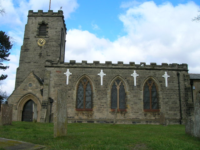
Holy Cross Church, Epperstone

Holy Cross Church is a Grade I listed parish church in the Church of England at Epperstone in the Diocese of Southwell and Nottingham. == History == The...

Epperstone

Epperstone is an English village and civil parish in mid-Nottinghamshire, located near Lowdham and Calverton. It had a population (including Gonalston...

St Wilfrid's Church, Calverton

St Wilfrid's Church is a Grade II* listed parish church in the Church of England in Calverton, Nottinghamshire. == History == St Wilfrid’s church seems...

Holy Trinity Church, Lambley

Holy Trinity Church, Lambley is a Grade I listed parish church in the Church of England in Lambley, Nottinghamshire. == History == The church dates from...

Calverton, Nottinghamshire

Calverton () is a village and civil parish in Nottinghamshire, of some 3,300 acres (1,300 ha), in the Gedling district, about 7 miles north-east of Nottingham...

Nearby Amenities

Located within 500m of 53.023167,-1.0546225
Post Box
Lat/Long: 53.0251472/-1.0516372
Post Office
Woodborough Post Office
Addr Postcode: NG14 6DD
Branch: Woodborough
Brand: Post Office
Brand Wikidata: Q1783168
Check Date: 2020-02-20
Contact Website: https://www.postoffice.co.uk/branch-finder/3622274/woodborough
Ref Pol Id: 13806
Lat/Long: 53.0232836/-1.0556198
Post Box
Post Box Design: type_k
Post Box Type: pillar
Royal Cypher: EIIR
Royal Cypher Wikidata: Q33102113
Lat/Long: 53.0231684/-1.0555171
Public Bookcase
Woodborough Book Exchange
Booth: K6
Disused Amenity: telephone
Man Made: telephone_box
Public Bookcase Type: phone_box
Lat/Long: 53.0233138/-1.0576091
Bench
Lat/Long: 53.0245226/-1.0606838
Bench
Lat/Long: 53.0254002/-1.0604692
Bench
Lat/Long: 53.0257822/-1.0603662
Turning Circle
Lat/Long: 53.0249298/-1.0522872
Bus Stop
Ploughman Avenue
Bench: no
Bin: no
Bus: yes
Lit: no
Naptan AtcoCode: 3300GE0189
Naptan Bearing: W
Naptan CommonName: Ploughman Avenue
Naptan Crossing: Ploughman Avenue
Naptan Indicator: opp
Naptan Landmark: Nags Head
Naptan NaptanCode: ntsawpwp
Naptan Notes: none
Naptan Street: Main Street
Naptan Verified: yes
Public Transport: platform
Shelter: no
Source: naptan_import
Tactile Paving: no
Lat/Long: 53.0233666/-1.0527242
Bus Stop
Ploughman Avenue
Bench: no
Bin: no
Bus: yes
Lit: no
Naptan AtcoCode: 3300GE0224
Naptan Bearing: E
Naptan CommonName: Ploughman Avenue
Naptan Crossing: Ploughman Avenue
Naptan Indicator: adj
Naptan Landmark: Nags Head
Naptan NaptanCode: ntsatwdj
Naptan Notes: none
Naptan Street: Main Street
Naptan Verified: yes
Public Transport: platform
Shelter: no
Source: naptan_import
Tactile Paving: no
Lat/Long: 53.0234785/-1.0523951
Bus Stop
Smalls Croft
Bench: no
Bin: no
Bus: yes
Lit: no
Naptan AtcoCode: 3300GE0279
Naptan Bearing: E
Naptan CommonName: Smalls Croft
Naptan Crossing: Smalls Croft
Naptan Indicator: opp
Naptan NaptanCode: ntsawadj
Naptan Notes: none
Naptan Street: Main Street
Naptan Verified: yes
Public Transport: platform
Shelter: no
Source: naptan_import
Tactile Paving: no
Lat/Long: 53.0231963/-1.0552623
Bus Stop
Smalls Croft
Bench: no
Bin: no
Bus: yes
Lit: no
Naptan AtcoCode: 3300GE0280
Naptan Bearing: W
Naptan CommonName: Smalls Croft
Naptan Crossing: Smalls Croft
Naptan Indicator: adj
Naptan NaptanCode: ntsawadm
Naptan Notes: none
Naptan Street: Main Street
Naptan Verified: yes
Public Transport: platform
Shelter: no
Source: naptan_import
Tactile Paving: no
Lat/Long: 53.0231199/-1.0558307
Bus Stop
St Swithuns Church
Bench: no
Bus: yes
Check Date Shelter: 2021-06-06
Local Ref: NR
Naptan AtcoCode: 3300GE0281
Naptan Bearing: W
Naptan CommonName: St Swithuns Church
Naptan Crossing: Lingwood Lane
Naptan Indicator: nr
Naptan Landmark: St Swithuns Church
Naptan NaptanCode: ntsawadp
Naptan Notes: none
Naptan Street: Main Street
Naptan Verified: no
Public Transport: platform
Shelter: yes
Source: naptan_import
Lat/Long: 53.0230863/-1.0606768
Bus Stop
St Swithuns Church
Bus: yes
Naptan AtcoCode: 3300GE0288
Naptan Bearing: E
Naptan CommonName: St Swithuns Church
Naptan Crossing: Lingwood Lane
Naptan Indicator: opp
Naptan Landmark: St Swithuns Church
Naptan NaptanCode: ntsatwdt
Naptan Notes: none
Naptan Street: Main Street
Naptan Verified: yes
Public Transport: platform
Shelter: no
Source: naptan_import
Tactile Paving: no
Lat/Long: 53.0232522/-1.060062
Bus Stop
St Swithuns Church
Bus: yes
Naptan AtcoCode: 3300GE0676
Naptan Bearing: S
Naptan CommonName: St Swithuns Church
Naptan Crossing: Main Street
Naptan Indicator: adj
Naptan Landmark: St Swithuns Church
Naptan NaptanCode: ntsatata
Naptan Notes: None
Naptan Street: Lingwood Lane
Naptan Verified: no
Public Transport: platform
Shelter: yes
Source: naptan_import
Tactile Paving: no
Lat/Long: 53.0228582/-1.0602494
Ele: 39.0000000
Information: board
Tourism: information
Lat/Long: 53.023244/-1.0556263
Place Of Worship
Woodborough Baptist Church
Denomination: baptist
Ele: 40.0000000
Religion: christian
Lat/Long: 53.0240926/-1.0522467
Place Of Worship
Woodborough Methodist Church
Denomination: methodist
Ele: 41.0000000
Religion: christian
Lat/Long: 53.0233053/-1.0605938
Ele: 40.0000000
Information: board
Tourism: information
Lat/Long: 53.023344/-1.0593063
Bus Stop
Main Street Woodborough United Kingdom
Bench: no
Bus: yes
Lit: no
Public Transport: platform
Shelter: no
Tactile Paving: no
Lat/Long: 53.0231009/-1.0558111
Direction: 190
Generator Method: photovoltaic
Generator Output Electricity: yes
Generator Solar Modules: 20
Generator Source: solar
Generator Type: solar_photovoltaic_panel
Location: roof
Power: generator
Lat/Long: 53.0212782/-1.0541752
Generator Method: photovoltaic
Generator Output Electricity: yes
Generator Source: solar
Generator Type: solar_photovoltaic_panel
Location: roof
Power: generator
Lat/Long: 53.0218858/-1.0563223
Direction: 95
Generator Method: photovoltaic
Generator Output Electricity: yes
Generator Solar Modules: 16
Generator Source: solar
Generator Type: solar_photovoltaic_panel
Location: roof
Power: generator
Lat/Long: 53.0219868/-1.0578241
Direction: 185
Generator Method: photovoltaic
Generator Output Electricity: yes
Generator Solar Modules: 8
Generator Source: solar
Generator Type: solar_photovoltaic_panel
Location: roof
Power: generator
Lat/Long: 53.0222536/-1.0569835
Direction: 275
Generator Method: photovoltaic
Generator Output Electricity: yes
Generator Solar Modules: 8
Generator Source: solar
Generator Type: solar_photovoltaic_panel
Location: roof
Power: generator
Lat/Long: 53.0223153/-1.0570742
Direction: S
Generator Method: photovoltaic
Generator Output Electricity: yes
Generator Solar Modules: 16
Generator Source: solar
Generator Type: solar_photovoltaic_panel
Location: roof
Power: generator
Lat/Long: 53.0225572/-1.0529709
Direction: 85
Generator Method: photovoltaic
Generator Output Electricity: yes
Generator Solar Modules: 6
Generator Source: solar
Generator Type: solar_photovoltaic_panel
Location: roof
Power: generator
Lat/Long: 53.0215092/-1.0534328
Direction: 265
Generator Method: photovoltaic
Generator Output Electricity: yes
Generator Solar Modules: 10
Generator Source: solar
Generator Type: solar_photovoltaic_panel
Location: roof
Power: generator
Lat/Long: 53.0214976/-1.0534693
Direction: S
Generator Method: photovoltaic
Generator Output Electricity: yes
Generator Solar Modules: 16
Generator Source: solar
Generator Type: solar_photovoltaic_panel
Location: roof
Power: generator
Lat/Long: 53.0262239/-1.0527622
Direction: 185
Generator Method: photovoltaic
Generator Output Electricity: yes
Generator Solar Modules: 18
Generator Source: solar
Generator Type: solar_photovoltaic_panel
Location: roof
Power: generator
Lat/Long: 53.0259143/-1.0535881
Direction: 185
Generator Method: photovoltaic
Generator Output Electricity: yes
Generator Solar Modules: 16
Generator Source: solar
Generator Type: solar_photovoltaic_panel
Location: roof
Power: generator
Lat/Long: 53.0246904/-1.0560962
Direction: 190
Generator Method: photovoltaic
Generator Output Electricity: yes
Generator Solar Modules: 16
Generator Source: solar
Generator Type: solar_photovoltaic_panel
Location: roof
Power: generator
Lat/Long: 53.0249906/-1.0551261
Generator Method: photovoltaic
Generator Output Electricity: yes
Generator Source: solar
Generator Type: solar_photovoltaic_panel
Location: roof
Power: generator
Lat/Long: 53.0246816/-1.0553916
Generator Method: photovoltaic
Generator Output Electricity: yes
Generator Source: solar
Generator Type: solar_photovoltaic_panel
Location: roof
Power: generator
Lat/Long: 53.02236/-1.0585692
Generator Method: photovoltaic
Generator Output Electricity: yes
Generator Source: solar
Generator Type: solar_photovoltaic_panel
Location: roof
Power: generator
Lat/Long: 53.0224031/-1.0618425
Direction: S
Generator Method: photovoltaic
Generator Output Electricity: yes
Generator Solar Modules: 8
Generator Source: solar
Generator Type: solar_photovoltaic_panel
Location: roof
Power: generator
Lat/Long: 53.0263281/-1.055625
Generator Method: photovoltaic
Generator Output Electricity: yes
Generator Source: solar
Generator Type: solar_photovoltaic_panel
Location: roof
Power: generator
Lat/Long: 53.026312/-1.0540962
Generator Method: photovoltaic
Generator Output Electricity: yes
Generator Source: solar
Generator Type: solar_photovoltaic_panel
Location: roof
Power: generator
Lat/Long: 53.0262555/-1.0541552
Generator Method: photovoltaic
Generator Output Electricity: yes
Generator Source: solar
Generator Type: solar_photovoltaic_panel
Location: roof
Power: generator
Lat/Long: 53.0262555/-1.0541096
Generator Method: photovoltaic
Generator Output Electricity: yes
Generator Source: solar
Generator Type: solar_photovoltaic_panel
Location: roof
Power: generator
Lat/Long: 53.0263233/-1.0542303
Direction: S
Generator Method: photovoltaic
Generator Output Electricity: yes
Generator Solar Modules: 16
Generator Source: solar
Generator Type: solar_photovoltaic_panel
Location: roof
Power: generator
Lat/Long: 53.026212/-1.0525351
Direction: 185
Generator Method: photovoltaic
Generator Output Electricity: yes
Generator Solar Modules: 16
Generator Source: solar
Generator Type: solar_photovoltaic_panel
Location: roof
Power: generator
Lat/Long: 53.0255651/-1.0527953
Direction: 185
Generator Method: photovoltaic
Generator Output Electricity: yes
Generator Solar Modules: 9
Generator Source: solar
Generator Type: solar_photovoltaic_panel
Location: roof
Power: generator
Lat/Long: 53.0251649/-1.0530935
Direction: 185
Generator Method: photovoltaic
Generator Output Electricity: yes
Generator Solar Modules: 6
Generator Source: solar
Generator Type: solar_photovoltaic_panel
Location: roof
Power: generator
Lat/Long: 53.0251504/-1.0532781
Generator Method: photovoltaic
Generator Output Electricity: yes
Generator Source: solar
Generator Type: solar_photovoltaic_panel
Location: roof
Power: generator
Lat/Long: 53.0250932/-1.0538347
Direction: S
Generator Method: photovoltaic
Generator Output Electricity: yes
Generator Solar Modules: 5
Generator Source: solar
Generator Type: solar_photovoltaic_panel
Location: roof
Power: generator
Lat/Long: 53.0247415/-1.0543067
Generator Method: photovoltaic
Generator Output Electricity: yes
Generator Source: solar
Generator Type: solar_photovoltaic_panel
Location: roof
Power: generator
Lat/Long: 53.0246728/-1.0553327
Direction: 100
Generator Method: photovoltaic
Generator Output Electricity: yes
Generator Solar Modules: 8
Generator Source: solar
Generator Type: solar_photovoltaic_panel
Location: roof
Power: generator
Lat/Long: 53.0239466/-1.0528505
Direction: 280
Generator Method: photovoltaic
Generator Output Electricity: yes
Generator Solar Modules: 8
Generator Source: solar
Generator Type: solar_photovoltaic_panel
Location: roof
Power: generator
Lat/Long: 53.0239553/-1.0529353
Generator Method: photovoltaic
Generator Output Electricity: yes
Generator Source: solar
Generator Type: solar_photovoltaic_panel
Location: roof
Power: generator
Lat/Long: 53.0230162/-1.0504376
Direction: S
Generator Method: photovoltaic
Generator Output Electricity: yes
Generator Solar Modules: 3
Generator Source: solar
Generator Type: solar_photovoltaic_panel
Location: roof
Power: generator
Lat/Long: 53.0247135/-1.0543241
Direction: N
Generator Method: photovoltaic
Generator Output Electricity: yes
Generator Solar Modules: 8
Generator Source: solar
Generator Type: solar_photovoltaic_panel
Location: roof
Power: generator
Lat/Long: 53.0263553/-1.0556247
Historic: memorial
Memorial: war_memorial
Lat/Long: 53.0230967/-1.0601592
Direction: S
Generator Method: photovoltaic
Generator Output Electricity: yes
Generator Solar Modules: 8
Generator Source: solar
Generator Type: solar_photovoltaic_panel
Location: roof
Power: generator
Lat/Long: 53.0254336/-1.0556839
Generator Method: photovoltaic
Generator Output Electricity: yes
Generator Source: solar
Generator Type: solar_photovoltaic_panel
Location: roof
Power: generator
Lat/Long: 53.0227055/-1.0498112
Direction: SSW
Generator Method: photovoltaic
Generator Output Electricity: yes
Generator Solar Modules: 11
Generator Source: solar
Generator Type: solar_photovoltaic_panel
Location: roof
Power: generator
Lat/Long: 53.0207795/-1.0599031
Direction: SSW
Generator Method: photovoltaic
Generator Output Electricity: yes
Generator Solar Modules: 9
Generator Source: solar
Generator Type: solar_photovoltaic_panel
Location: roof
Power: generator
Lat/Long: 53.0207267/-1.060005
Direction: SSW
Generator Method: photovoltaic
Generator Output Electricity: yes
Generator Solar Modules: 16
Generator Source: solar
Generator Type: solar_photovoltaic_panel
Location: roof
Power: generator
Lat/Long: 53.0208554/-1.0600955
Direction: ESE
Generator Method: photovoltaic
Generator Output Electricity: yes
Generator Solar Modules: 16
Generator Source: solar
Generator Type: solar_photovoltaic_panel
Location: roof
Power: generator
Lat/Long: 53.0209558/-1.0597783
Direction: ESE
Generator Method: photovoltaic
Generator Output Electricity: yes
Generator Solar Modules: 16
Generator Source: solar
Generator Type: solar_photovoltaic_panel
Location: roof
Power: generator
Lat/Long: 53.0213039/-1.0599815
Direction: 275
Generator Method: photovoltaic
Generator Output Electricity: yes
Generator Solar Modules: 8
Generator Source: solar
Generator Type: solar_photovoltaic_panel
Location: roof
Power: generator
Lat/Long: 53.022286/-1.0545836
Direction: 275
Generator Method: photovoltaic
Generator Output Electricity: yes
Generator Solar Modules: 8
Generator Source: solar
Generator Type: solar_photovoltaic_panel
Location: roof
Power: generator
Lat/Long: 53.0222683/-1.0546419
Generator Method: photovoltaic
Generator Output Electricity: yes
Generator Source: solar
Generator Type: solar_photovoltaic_panel
Location: roof
Power: generator
Lat/Long: 53.0219658/-1.0611731
Generator Method: photovoltaic
Generator Output Electricity: yes
Generator Source: solar
Generator Type: solar_photovoltaic_panel
Location: roof
Power: generator
Lat/Long: 53.0217092/-1.0612911
Generator Method: photovoltaic
Generator Output Electricity: yes
Generator Source: solar
Generator Type: solar_photovoltaic_panel
Location: roof
Power: generator
Lat/Long: 53.0214124/-1.0610001
Power: substation
Lat/Long: 53.0221166/-1.0496289
Turning Loop
Lat/Long: 53.0260124/-1.0519447
The data included in this document is from www.openstreetmap.org. The data is made available under ODbL.

Have you been to Woodborough?

Leave your review of Woodborough below (or comments, questions and feedback).