Brattleby

Settlement in Lincolnshire West Lindsey

England

Brattleby

Guide Post at a Road Junction on Middle Street The post carries a cut bench mark.  For a closer view see <a title="www.geograph.org.uk/photo/3378064" href="https://www.geograph.org.uk/photo/3378064">Link</a> and <span class="nowrap"><a title="https://www.bench-marks.org.uk/bm47770" rel="nofollow ugc noopener" href="https://www.bench-marks.org.uk/bm47770">Link</a><img style="margin-left:2px;" alt="External link" title="External link - shift click to open in new window" src="https://s1.geograph.org.uk/img/external.png" width="10" height="10"/></span> for details of the mark.
Guide Post at a Road Junction on Middle Street Credit: Brian Westlake

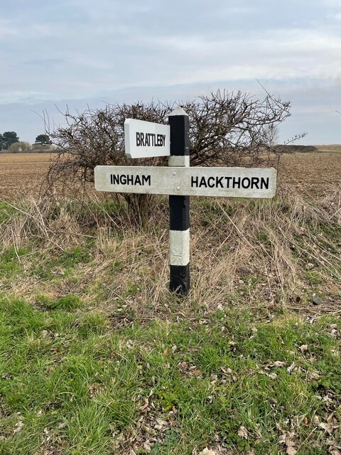
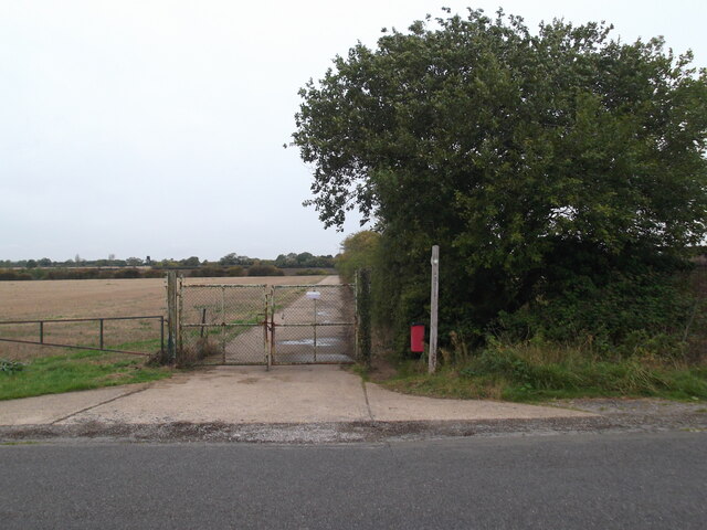
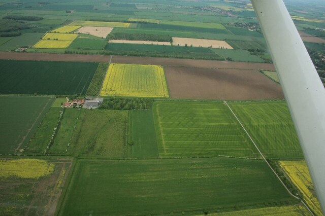
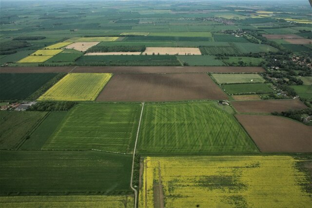
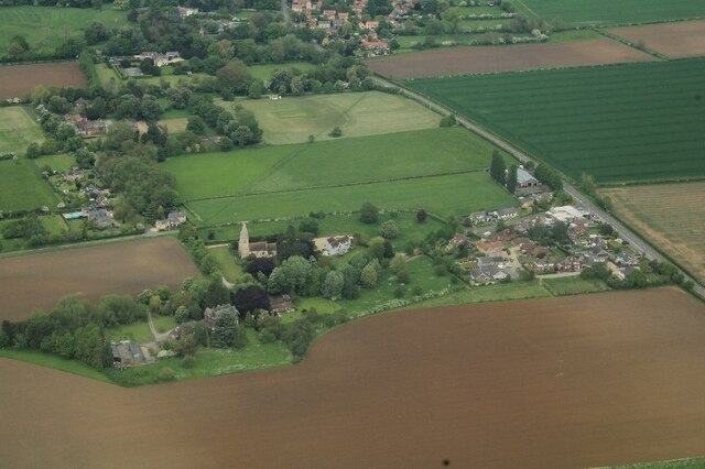
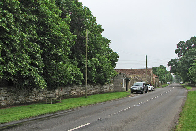
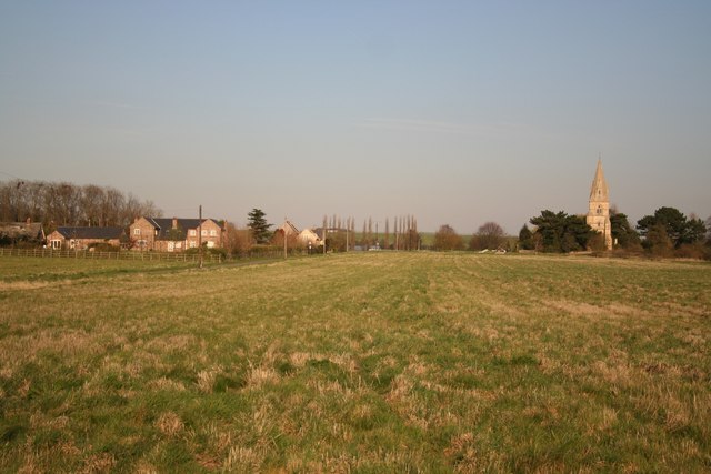
Brattleby is a small village located in the West Lindsey district of Lincolnshire, England. Situated approximately 7 miles north of Lincoln, it encompasses an area of about 5 square miles. Brattleby is nestled amidst picturesque countryside, offering its residents a tranquil and idyllic setting.

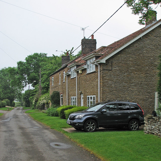
The village has a relatively small population, with around 300 inhabitants. It is predominantly a residential area, characterized by charming traditional cottages and well-maintained gardens. The community in Brattleby is close-knit, fostering a friendly and welcoming atmosphere.

Although Brattleby is a rural village, it benefits from its proximity to Lincoln, which provides access to a wider range of amenities and facilities. The city offers excellent shopping opportunities, cultural attractions, and educational institutions.

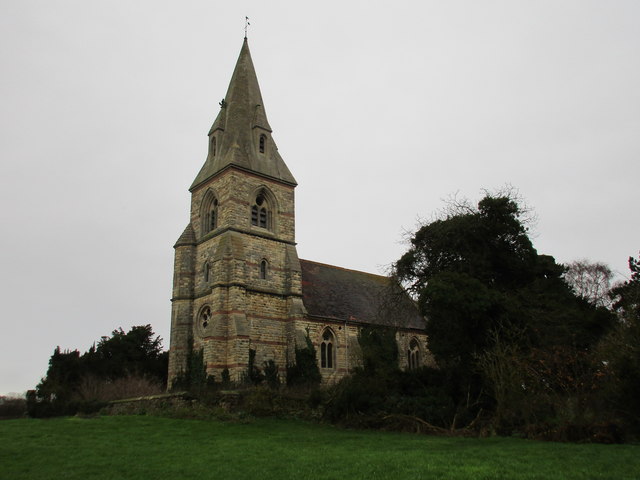
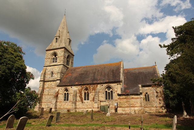
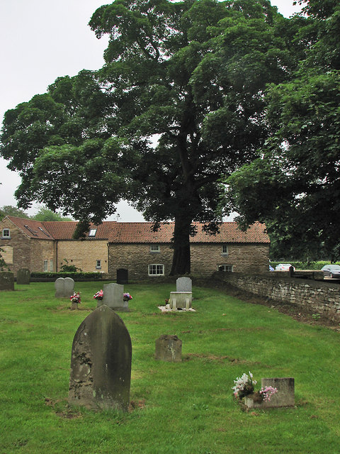
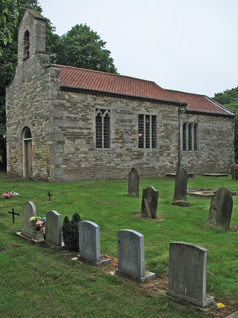
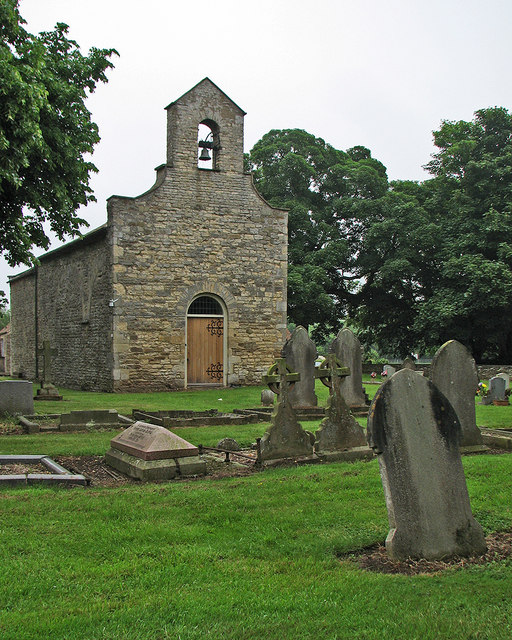
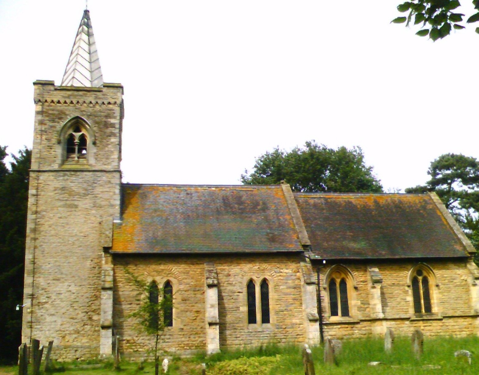
In terms of infrastructure, Brattleby boasts a primary school, which serves the local children, and a village hall that serves as a hub for community events and gatherings. The village also has a church, St. Cuthbert's, which dates back to the 12th century, adding a touch of historical significance to the area.

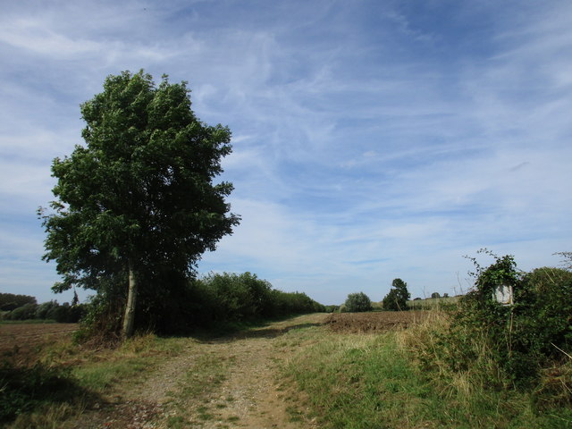
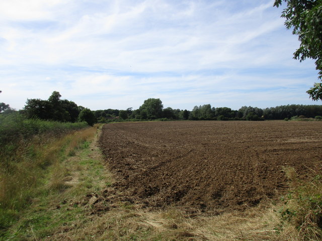
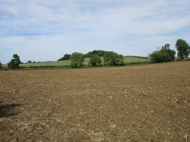
Nature enthusiasts will appreciate the surrounding countryside, which provides ample opportunities for walking, cycling, and exploring the outdoors. The nearby Lincolnshire Wolds, an Area of Outstanding Natural Beauty, offers stunning landscapes and picturesque views.

Overall, Brattleby is a charming village that offers residents a peaceful and rural lifestyle, while still benefiting from its proximity to the amenities and opportunities of the city of Lincoln.

If you have any feedback on the listing, please let us know in the comments section below.

Brattleby Images

Images are sourced within 2km of 53.316234/-0.577716 or Grid Reference SK9480. Thanks to Geograph Open Source API. All images are credited.

Guide Post at a Road Junction on Middle Street The post carries a cut bench mark.  For a closer view see <a title="www.geograph.org.uk/photo/3378064" href="https://www.geograph.org.uk/photo/3378064">Link</a> and <span class="nowrap"><a title="https://www.bench-marks.org.uk/bm47770" rel="nofollow ugc noopener" href="https://www.bench-marks.org.uk/bm47770">Link</a><img style="margin-left:2px;" alt="External link" title="External link - shift click to open in new window" src="https://s1.geograph.org.uk/img/external.png" width="10" height="10"/></span> for details of the mark.
Guide Post at a Road Junction on Middle Street
The post carries a cut bench mark. For a closer view see Link and LinkExternal link for details of the mark.
End of the bridleway at Ingham
Modern drainage patterns west of Aisthorpe: aerial 2023 (1) Low Farm.
Modern drainage patterns west of Aisthorpe: aerial 2023 (1)
Low Farm.
Modern drainage patterns west of Aisthorpe: aerial 2023 (2)
Aisthorpe: aerial 2023
St. Peter's Aisthorpe Designed by T.C. Hine of Nottingham 1867.
St. Peter's Aisthorpe
Designed by T.C. Hine of Nottingham 1867.
B1398 Brattleby
B1398 Brattleby
St.Peter's church South view of St.Peter's church, usually obscured by an overgrown churchyard.

In 1866 the Lincoln Diocesan Architectural Society described the old church as "miserable in character", prompting Rev.Robert William Otter (Rector of Aisthorpe 1850-1875) to commission and pay for a new St.Peter's church. The church was rebuilt by architect Thomas Chambers Hine of Nottingham in a neo-Early English style and completed by 1868.
St.Peter's church was grade II listed in November 1966. It has been closed for many years due to structural safety concerns.
St.Peter's church
South view of St.Peter's church, usually obscured by an overgrown churchyard. In 1866 the Lincoln Diocesan Architectural Society described the old church as "miserable in character", prompting Rev.Robert William Otter (Rector of Aisthorpe 1850-1875) to commission and pay for a new St.Peter's church. The church was rebuilt by architect Thomas Chambers Hine of Nottingham in a neo-Early English style and completed by 1868. St.Peter's church was grade II listed in November 1966. It has been closed for many years due to structural safety concerns.
Red Arrows over Aisthorpe The Red Arrows practising in the skies above Aisthorpe and Scampton, with the spire of St.Peter's church <a title="https://www.geograph.org.uk/photo/4964199" href="https://www.geograph.org.uk/photo/4964199">Link</a> in the centre.
Red Arrows over Aisthorpe
The Red Arrows practising in the skies above Aisthorpe and Scampton, with the spire of St.Peter's church Link in the centre.
Red Arrows over Aisthorpe The Red Arrows practising in the skies above Aisthorpe and Scampton, with the spire of St. Peter's church <a title="https://www.geograph.org.uk/photo/4964199" href="https://www.geograph.org.uk/photo/4964199">Link</a> in the centre.
Red Arrows over Aisthorpe
The Red Arrows practising in the skies above Aisthorpe and Scampton, with the spire of St. Peter's church Link in the centre.
In Cammeringham churchyard A damp Sunday morning in June.
In Cammeringham churchyard
A damp Sunday morning in June.
Cammeringham parish church St Michael's Church was once much larger - "now no more than a nave with a bellcote and chancel" (Nikolaus Pevsner and John Harris). The lights were on inside for morning service on a drab Sunday in June.
Cammeringham parish church
St Michael's Church was once much larger - "now no more than a nave with a bellcote and chancel" (Nikolaus Pevsner and John Harris). The lights were on inside for morning service on a drab Sunday in June.
Cammeringham: St Michael This was once a much larger church, and the arcades of a former aisle show in the north wall (left). Colours were muted on a damp morning in June.
Cammeringham: St Michael
This was once a much larger church, and the arcades of a former aisle show in the north wall (left). Colours were muted on a damp morning in June.
Middle Street at Cammeringham Looking towards Lincoln on the B1398. The postbox is let into the Manor House's fine fine drystone wall. This was another disappointingly drab day in June 2016.
Middle Street at Cammeringham
Looking towards Lincoln on the B1398. The postbox is let into the Manor House's fine fine drystone wall. This was another disappointingly drab day in June 2016.
Cammeringham: Blackthorn Lane Another wet day in the disappointing first weeks of June 2016.
Cammeringham: Blackthorn Lane
Another wet day in the disappointing first weeks of June 2016.
Farm track near Brattleby Leads to a willow plantation.
Farm track near Brattleby
Leads to a willow plantation.
Behind the hedge on School Lane
View towards Half Acre Plantation The trees of Half Acre Plantation stand above the surrounding short rotation coppice willow.
View towards Half Acre Plantation
The trees of Half Acre Plantation stand above the surrounding short rotation coppice willow.
Show me another place!

Brattleby is located at Grid Ref: SK9480 (Lat: 53.316234, Lng: -0.577716)

Division: Parts of Lindsey

Administrative County: Lincolnshire

District: West Lindsey

Police Authority: Lincolnshire

What 3 Words

///paler.pegs.climber. Near Burton, Lincolnshire

Nearby Locations

Aisthorpe Brattleby

Related Wikis

Brattleby

Brattleby is a village and civil parish in the West Lindsey district of Lincolnshire, England. The population of the civil parish at the 2011 census was...

Aisthorpe

Aisthorpe is a small village and civil parish in the West Lindsey district of Lincolnshire, England. Aisthorpe is recorded as Æstorp in 1086, probably...

Cammeringham Priory

Cammeringham Priory was a priory in Cammeringham, Lincolnshire, England, and was one of nine Premonstratensian houses in the historical county. It was...

Cammeringham

Cammeringham is a village and civil parish in the West Lindsey district of Lincolnshire, England. It is situated 6 miles (10 km) north of Lincoln, and...

Nearby Amenities

Located within 500m of 53.316234,-0.577716
Brattleby
Is In: Lincolnshire, England, UK
Place: hamlet
Wikidata: Q4958137
Lat/Long: 53.3166402/-0.5772083
Bus Stop
Brattleby Hall
Naptan AtcoCode: 2700LBBS1629
Naptan Bearing: S
Naptan CommonName: Brattleby Hall
Naptan Indicator: opp
Naptan Landmark: Brattleby Hall
Naptan NaptanCode: linamdwt
Naptan Street: Middle Street
Naptan Verified: no
Shelter: yes
Source: naptan_import
Lat/Long: 53.3161984/-0.5776042
Bus Stop
Brattleby Hall
Naptan AtcoCode: 2700LBL00647
Naptan Bearing: N
Naptan CommonName: Brattleby Hall
Naptan Indicator: adj
Naptan Landmark: Brattleby Hall
Naptan NaptanCode: linagapw
Naptan Street: Middle Street
Naptan Verified: no
Source: naptan_import
Lat/Long: 53.3162637/-0.5777972
Shepherds Farm
Place: farm
Source: Bing
Lat/Long: 53.3169982/-0.5747126
Public Bookcase
Brattleby Book Exchange
Booth: K6
Disused Amenity: telephone
Man Made: telephone_box
Public Bookcase Type: phone_box
Tourism: information
Lat/Long: 53.315628/-0.5773274
Post Box
Post Box Type: lamp
Lat/Long: 53.3161944/-0.5776399
Man Made: village_sign
Lat/Long: 53.3166126/-0.5777204
Power: pole
Lat/Long: 53.312401/-0.5782001
Power: pole
Lat/Long: 53.3131759/-0.5773755
Power: pole
Lat/Long: 53.3133314/-0.5772233
Power: pole
Lat/Long: 53.3141021/-0.5763562
Power: pole
Lat/Long: 53.3149309/-0.5754201
Power: pole
Lat/Long: 53.3153809/-0.5749408
Power: pole
Lat/Long: 53.3159759/-0.5743249
Power: pole
Lat/Long: 53.316583/-0.5737098
Power: pole
Lat/Long: 53.3169712/-0.5732871
Power: pole
Lat/Long: 53.3178873/-0.5736522
Power: pole
Lat/Long: 53.3186402/-0.5739245
Power: pole
Lat/Long: 53.3194695/-0.5742457
The data included in this document is from www.openstreetmap.org. The data is made available under ODbL.

Have you been to Brattleby?

Leave your review of Brattleby below (or comments, questions and feedback).