Wolverley

Settlement in Worcestershire Wyre Forest

England

Wolverley

Staffordshire and Worcestershire Canal near Kidderminster in Worcestershire This is the Staffordshire and Worcestershire Canal meandering southwards towards Kidderminster, with Springfield Park behind the trees on the left.
Staffordshire and Worcestershire Canal near Kidderminster in Worcestershire Credit: Roger D Kidd

Wolverley is a small village located in the district of Wyre Forest, Worcestershire, England. Situated approximately 4 miles northwest of Kidderminster, Wolverley is surrounded by picturesque countryside, offering residents and visitors a tranquil and scenic setting.

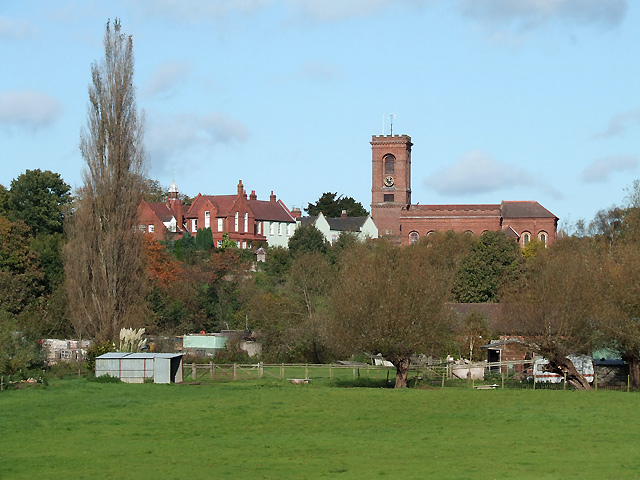
The village has a rich history dating back to the medieval period, with the Wolverley Court being one of the notable landmarks. This Grade II listed building was constructed in the early 17th century and has served as a manor house and a school over the years. Additionally, the village is home to St. John the Baptist Church, a beautiful 14th-century structure that showcases stunning architectural details.

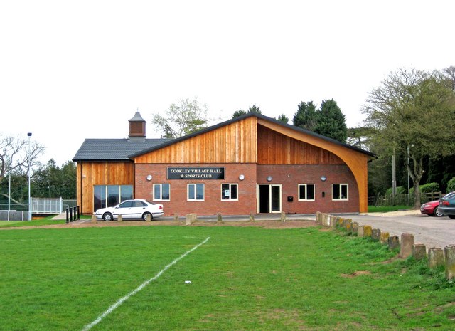
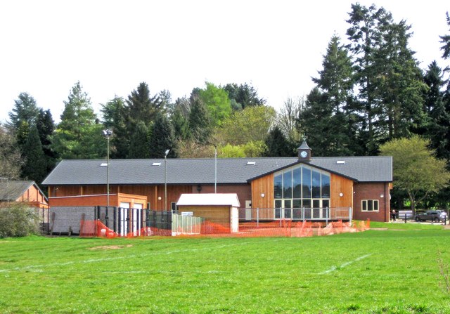
Wolverley is known for its close-knit community and offers a range of amenities for its residents. There is a primary school, village hall, and various local shops, including a post office and a convenience store. The community also benefits from several pubs and restaurants that provide a welcoming atmosphere and delicious food options.

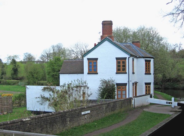
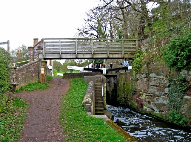
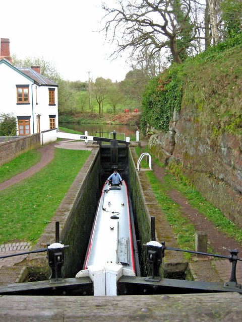
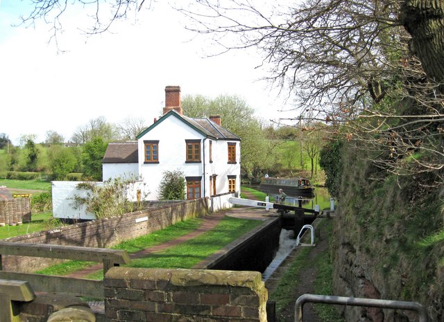
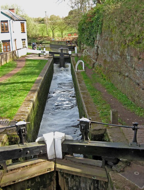
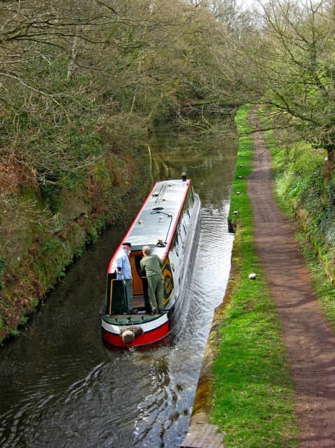
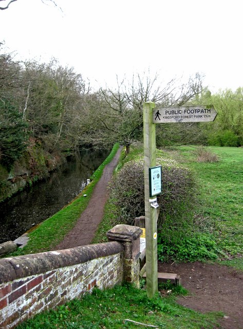
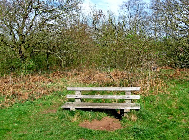
For outdoor enthusiasts, Wolverley is a great starting point for exploring the surrounding countryside. The nearby Wyre Forest offers ample opportunities for walking, hiking, and cycling, with its extensive network of trails. Additionally, the River Stour flows through the village, providing a serene spot for fishing and boating.

Transport links in Wolverley are convenient, with regular bus services connecting the village to nearby towns and cities. The village is also easily accessible by car, with the A449 and A442 roads passing close by.

In summary, Wolverley is a charming village with a rich history, stunning natural beauty, and a strong sense of community. It offers a peaceful and idyllic living environment, making it an attractive place to reside or visit.

If you have any feedback on the listing, please let us know in the comments section below.
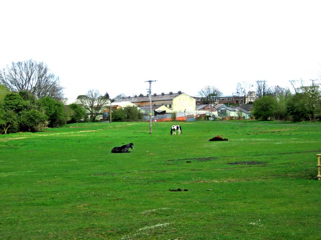
Wolverley Images

Images are sourced within 2km of 52.413025/-2.249903 or Grid Reference SO8379. Thanks to Geograph Open Source API. All images are credited.

Staffordshire and Worcestershire Canal near Kidderminster in Worcestershire This is the Staffordshire and Worcestershire Canal meandering southwards towards Kidderminster, with Springfield Park behind the trees on the left.
Staffordshire and Worcestershire Canal near Kidderminster in Worcestershire
This is the Staffordshire and Worcestershire Canal meandering southwards towards Kidderminster, with Springfield Park behind the trees on the left.
Canal approaching Kidderminster in Worcestershire This is the Staffordshire and Worcestershire Canal meandering southwards towards Kidderminster, with Springfield Park behind the trees on the left. The kingfisher wood sculpture by Matt Hawes can be seen ahead.
Canal approaching Kidderminster in Worcestershire
This is the Staffordshire and Worcestershire Canal meandering southwards towards Kidderminster, with Springfield Park behind the trees on the left. The kingfisher wood sculpture by Matt Hawes can be seen ahead.
Kingfishers wood carving in Springfield Park, Kidderminster By the Staffordshire and Worcestershire Canal, this excellent piece of environmental decoration in Springield Park, with a limited lifespan, was carved by Matthew Hawes in 2013.
Kingfishers wood carving in Springfield Park, Kidderminster
By the Staffordshire and Worcestershire Canal, this excellent piece of environmental decoration in Springield Park, with a limited lifespan, was carved by Matthew Hawes in 2013.
Canal north of Kidderminster centre in Worcestershire Looking north, the image shows the Staffordshire and Worcestershire Canal by the winding hole and Springfield Park (off to the riht).
Canal north of Kidderminster centre in Worcestershire
Looking north, the image shows the Staffordshire and Worcestershire Canal by the winding hole and Springfield Park (off to the riht).
Canal by Springfield Park in Kidderminster Looking north, the image shows the Staffordshire and Worcestershire Canal by the winding hole and Springfield Park.There is a winding hole off to the right where boats up to seventy feet long can turn round.
Canal by Springfield Park in Kidderminster
Looking north, the image shows the Staffordshire and Worcestershire Canal by the winding hole and Springfield Park.There is a winding hole off to the right where boats up to seventy feet long can turn round.
Cookley Village Hall & Sports Club (1), Lea Lane, Cookley This £945,000 project was officially opened on the 5th February 2011. Over 300 people attended the opening. The facility replaced the old Parish Hall. The building comprises a sports club lounge, two meeting rooms with computers and internet, a kitchen, a snooker room and a 200 metre square hall, with a stage for performances.

<a href="https://www.geograph.org.uk/photo/2337173">SO8480 : Cookley Village Hall & Sports Club (2), Lea Lane, Cookley</a>.
Cookley Village Hall & Sports Club (1), Lea Lane, Cookley
This £945,000 project was officially opened on the 5th February 2011. Over 300 people attended the opening. The facility replaced the old Parish Hall. The building comprises a sports club lounge, two meeting rooms with computers and internet, a kitchen, a snooker room and a 200 metre square hall, with a stage for performances. SO8480 : Cookley Village Hall & Sports Club (2), Lea Lane, Cookley.
Cookley Village Hall & Sports Club (2), Lea Lane, Cookley Outside the new village hall are various sports facilities, a play area for children, and an area for BMX bikes etc and skateboarding, called the Wheels Area.

<a href="https://www.geograph.org.uk/photo/2337154">SO8480 : Cookley Village Hall & Sports Club (1), Lea Lane, Cookley</a>.
Cookley Village Hall & Sports Club (2), Lea Lane, Cookley
Outside the new village hall are various sports facilities, a play area for children, and an area for BMX bikes etc and skateboarding, called the Wheels Area. SO8480 : Cookley Village Hall & Sports Club (1), Lea Lane, Cookley.
Lea Lane, Cookley At the approach to the village of Cookley. On the left is the new Village Hall.

<a href="https://www.geograph.org.uk/photo/2337154">SO8480 : Cookley Village Hall & Sports Club (1), Lea Lane, Cookley</a>.
Lea Lane, Cookley
At the approach to the village of Cookley. On the left is the new Village Hall. SO8480 : Cookley Village Hall & Sports Club (1), Lea Lane, Cookley.
Former Lock Keeper's Cottage, Debdale Lock, Staffs & Worcs Canal near Cookley In the long ago days of freight being carried on the canal, there would have been a resident lock keeper living here.

A different view:- <a href="https://www.geograph.org.uk/photo/3217505">SO8480 : Former Lock Keeper's Cottage, Debdale Lock, near Cookley</a>.
Former Lock Keeper's Cottage, Debdale Lock, Staffs & Worcs Canal near Cookley
In the long ago days of freight being carried on the canal, there would have been a resident lock keeper living here. A different view:- SO8480 : Former Lock Keeper's Cottage, Debdale Lock, near Cookley.
Debdale Lock, Staffs & Worcs Canal, near Cookley A footpath continues from the bridge up to Cookley Playing Fields. In the other direction it goes to Kingsford Forest Park.
Debdale Lock, Staffs & Worcs Canal, near Cookley
A footpath continues from the bridge up to Cookley Playing Fields. In the other direction it goes to Kingsford Forest Park.
Boat in Debdale Lock, Staffs & Worcs Canal, near Cookley There is a cavern beside this lock, which apparently used to be used as a stables for horses pulling boats along the canal. There is room for about four horses to lie down.
Boat in Debdale Lock, Staffs & Worcs Canal, near Cookley
There is a cavern beside this lock, which apparently used to be used as a stables for horses pulling boats along the canal. There is room for about four horses to lie down.
Plaque at Debdale Bridge (No. 22), Staffs & Worcs Canal, near Cookley The small bridge at Debdale Lock is, not surprisingly, called Debdale Bridge, and numbered 22. Usually these plaques are affixed to the bridge, but this one is attached to the lock wall under the bridge. The style of the plaque would seem to indicate it is probably a replacement, rather than an original.

<a href="https://www.geograph.org.uk/photo/2340638">SO8480 : Debdale Lock, Staffs & Worcs Canal, near Cookley</a>.
Plaque at Debdale Bridge (No. 22), Staffs & Worcs Canal, near Cookley
The small bridge at Debdale Lock is, not surprisingly, called Debdale Bridge, and numbered 22. Usually these plaques are affixed to the bridge, but this one is attached to the lock wall under the bridge. The style of the plaque would seem to indicate it is probably a replacement, rather than an original. SO8480 : Debdale Lock, Staffs & Worcs Canal, near Cookley.
Debdale Lock, Staffs & Worcs Canal, near Cookley A narrowboat can be seen approaching the lock. The former lock keeper's cottage is on the left.

<a href="https://www.geograph.org.uk/photo/2340591">SO8480 : Former Lock Keeper's Cottage, Debdale Lock, Staffs & Worcs Canal near Cookley</a>.
Debdale Lock, Staffs & Worcs Canal, near Cookley
A narrowboat can be seen approaching the lock. The former lock keeper's cottage is on the left. SO8480 : Former Lock Keeper's Cottage, Debdale Lock, Staffs & Worcs Canal near Cookley.
Debdale Lock, Staffs & Worcs Canal, near Cookley Another view of the lock:- <a href="https://www.geograph.org.uk/photo/2340721">SO8480 : Debdale Lock, Staffs & Worcs Canal, near Cookley</a>, and <a href="https://www.geograph.org.uk/photo/2340638">SO8480 : Debdale Lock, Staffs & Worcs Canal, near Cookley</a>.
Debdale Lock, Staffs & Worcs Canal, near Cookley
Narrowboat west of Debdale Lock, Staffs & Worcs Canal, near Cookley The narrowboat has just left Debdale Lock. The canal is particularly narrow at this point, and it wouldn't be much fun meeting another boat around here. Photographed from Debdale Bridge.

<a href="https://www.geograph.org.uk/photo/2340658">SO8480 : Boat in Debdale Lock, Staffs & Worcs Canal, near Cookley</a>.
Narrowboat west of Debdale Lock, Staffs & Worcs Canal, near Cookley
The narrowboat has just left Debdale Lock. The canal is particularly narrow at this point, and it wouldn't be much fun meeting another boat around here. Photographed from Debdale Bridge. SO8480 : Boat in Debdale Lock, Staffs & Worcs Canal, near Cookley.
Signpost by Debdale Bridge, Staffs & Worcs Canal, near Cookley The signpost points across a field, where there is a public footpath to Kingsford Forest Park, about a mile and a half away. Behind the signpost can be seen the canal and towpath.

<a href="https://www.geograph.org.uk/photo/2340826">SO8480 : Footpath across a field, near Cookley</a>.
Signpost by Debdale Bridge, Staffs & Worcs Canal, near Cookley
The signpost points across a field, where there is a public footpath to Kingsford Forest Park, about a mile and a half away. Behind the signpost can be seen the canal and towpath. SO8480 : Footpath across a field, near Cookley.
Footpath across a field, near Cookley There is a public footpath across this field, although it isn't immediately obvious quite where the footpath is. It leads to the popular Kingsford Forest Park, which is a nice place for walking, riding and other outdoor pursuits. In the distance can be seen some industrial buildings, which are on the edge of the village of Cookley.

<a href="https://www.geograph.org.uk/photo/2340802">SO8480 : Signpost by Debdale Bridge, Staffs & Worcs Canal, near Cookley</a>.
Footpath across a field, near Cookley
There is a public footpath across this field, although it isn't immediately obvious quite where the footpath is. It leads to the popular Kingsford Forest Park, which is a nice place for walking, riding and other outdoor pursuits. In the distance can be seen some industrial buildings, which are on the edge of the village of Cookley. SO8480 : Signpost by Debdale Bridge, Staffs & Worcs Canal, near Cookley.
Seat in Horseshoe Meadow, near Cookley Horseshoe Meadow is part of Cookley Playing Fields, which is an area open to the public to enjoy. There is a path from near the seat, which leads down to a path by the Staffs & Worcs Canal, on the opposite side to the towpath.
Seat in Horseshoe Meadow, near Cookley
Horseshoe Meadow is part of Cookley Playing Fields, which is an area open to the public to enjoy. There is a path from near the seat, which leads down to a path by the Staffs & Worcs Canal, on the opposite side to the towpath.
Show me another place!

Wolverley is located at Grid Ref: SO8379 (Lat: 52.413025, Lng: -2.249903)

Administrative County: Worcestershire

District: Wyre Forest

Police Authority: West Mercia

What 3 Words

///smug.grass.making. Near Kidderminster, Worcestershire

Related Wikis

Wolverley

Wolverley is a village; with nearby Cookley (1 mi northeast), it forms a civil parish in the Wyre Forest District of Worcestershire, England. It is 2 miles...

Wolverley Church of England Secondary School

Wolverley CofE Secondary School is located in the village of Wolverley, near Kidderminster in Worcestershire, England. The mixed gender school has approximately...

Heathfield Knoll School

Heathfield Knoll School and First Steps Day Nursery is a small, independent, non-denominational day school and day nursery in Wolverley, near Kidderminster...

Cookley

Cookley is a village in the Wyre Forest District of Worcestershire, England, a few miles to the north of Kidderminster. Also, a few miles south-west of...
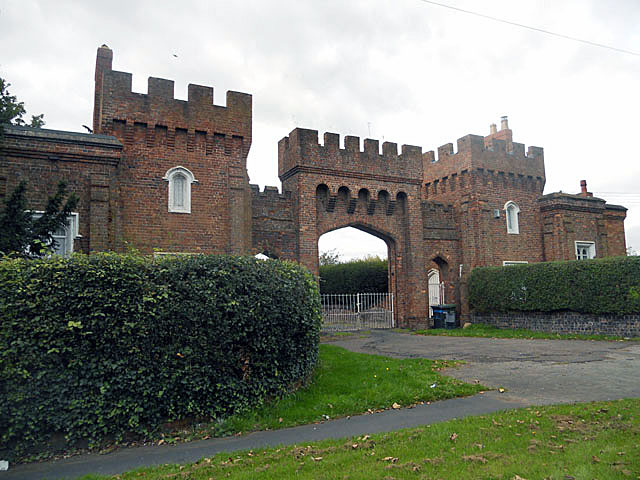
Lea Castle, England

Lea Castle is a ruined Grade II listed Neo Gothic mock castle mansion near Wolverley, England. == History == Lea Castle was built by Edward Knight in 1762...

Wyre Forest (UK Parliament constituency)

Wyre Forest is a county constituency represented in the House of Commons of the Parliament of the United Kingdom. It elects one Member of Parliament...

Blakeshall

Blakeshall is a hamlet in Worcestershire, England. It is one of the ancient townships of the manor of Wolverley, whose extent was similar to that of the...

Drakelow Hillfort

Drakelow Hillfort, is a small multivallate Iron Age hillfort, located on a promontory (known as Drakelow Hill) at Drakelow at the southern end of Kinver...

Nearby Amenities

Located within 500m of 52.413025,-2.249903
Seamark Type: gate
Waterway: lock_gate
Lat/Long: 52.410207/-2.2498616
Pub
The Lock Inn
Food: yes
Outdoor Seating: yes
Real Ale: yes
Source: survey
Website: https://thelockinnwolverley.co.uk/
Lat/Long: 52.4100031/-2.249732
Cafe
Old Smithy Tea Rooms
Source: survey
Lat/Long: 52.4104771/-2.2498991
Pub
The Queens Head
Source: survey
Lat/Long: 52.4125429/-2.2534713
Old Village Store
Shop: convenience
Source: survey
Lat/Long: 52.4124287/-2.2535599
Bus Stop
Franche Road
Bus: yes
Naptan AtcoCode: 2000G101500
Naptan Bearing: N
Naptan CommonName: Franche Road
Naptan Indicator: opp
Naptan Landmark: School
Naptan NaptanCode: wocdjdjd
Naptan PlusbusZoneRef: KDRMNST
Naptan Street: Franche Road
Naptan Verified: no
Public Transport: platform
Shelter: no
Source: naptan_import
Lat/Long: 52.4105531/-2.2552797
The Old Post Office
Description: Former Post Office, now a private home
Naptan AtcoCode: 2000G108400
Naptan Bearing: N
Naptan BusStopType: CUS
Naptan CommonName: Post Office
Naptan Indicator: Adj
Naptan Landmark: Post Office
Naptan NaptanCode: wocdgjgm
Naptan PlusbusZoneRef: KDRMNST
Naptan Street: Blakeshall Lane
Naptan Verified: no
Source: naptan_import
Lat/Long: 52.4126804/-2.25345
Bus Stop
Wolverley Secondary School
Bus: yes
Naptan AtcoCode: 2000G198100
Naptan Bearing: SE
Naptan CommonName: Wolverley Secondary School
Naptan Indicator: adj
Naptan Landmark: Wolverley Secondary School
Naptan NaptanCode: wocdjwma
Naptan Street: Blakeshall Lane
Naptan Verified: no
Public Transport: platform
Source: naptan_import
Lat/Long: 52.4162701/-2.2515733
Elan Aqueduct siphon
Man Made: manhole
Manhole: water
Source: Bing; http://www.geograph.org.uk/photo/1260231
Water: siphon
Lat/Long: 52.4166089/-2.2520508
Traffic Signals
Lat/Long: 52.4140587/-2.2519871
Traffic Signals
Lat/Long: 52.4134138/-2.2528581
Traffic Signals
Lat/Long: 52.4138121/-2.2521063
Barrier: lift_gate
Bicycle: yes
Foot: yes
Lat/Long: 52.410546/-2.2473876
Wolverley Camping and Caravanning Club Site
Tourism: camp_site
Lat/Long: 52.4106621/-2.248086
Seamark Type: gate
Waterway: lock_gate
Lat/Long: 52.4100069/-2.2499647
Wolverley
Place: village
Source: OS_OpenData_StreetView
Wikidata: Q8030557
Lat/Long: 52.4129412/-2.250748
Toilets
Lat/Long: 52.4105397/-2.24709
Shower
Shower: yes
Lat/Long: 52.4105713/-2.2470681
Toilets
Wheelchair: yes
Lat/Long: 52.4105944/-2.2470402
Drinking Water
Lat/Long: 52.4106371/-2.2478847
Toilets
Lat/Long: 52.4106479/-2.2470064
Shower
Shower: yes
Lat/Long: 52.4106771/-2.2469745
Drinking Water
Lat/Long: 52.4106822/-2.2470617
Mini-Pro Golf Parks
Leisure: miniature_golf
Website: https://miniprogolfparks.com/
Lat/Long: 52.4107754/-2.2513364
Fixme: to be continued
Lat/Long: 52.4149808/-2.247112
Man Made: manhole
Manhole: water
Pipeline: inspection chamber
Lat/Long: 52.4165914/-2.252214
Man Made: manhole
Manhole: water
Pipeline: inspection chamber
Lat/Long: 52.4166329/-2.2518472
Dragon Tree
Opening Hours: 24/7
Tourism: artwork
Website: https://flic.kr/p/FSZ9S5
Lat/Long: 52.4139768/-2.2459585
The Giant
Artwork Type: sculpture
Tourism: artwork
Lat/Long: 52.4133205/-2.2504207
Turning Circle
Lat/Long: 52.4136184/-2.2546691
Power: pole
Lat/Long: 52.4167956/-2.2484684
Power: pole
Lat/Long: 52.4168064/-2.2473394
Power: pole
Lat/Long: 52.4168302/-2.2462069
Power: pole
Lat/Long: 52.4168841/-2.2461785
Barrier: entrance
Lat/Long: 52.411465/-2.2567276
Bench
Lat/Long: 52.4163504/-2.2456098
Post Box
Lat/Long: 52.4122455/-2.2533065
Waste Basket
Lat/Long: 52.4103309/-2.2499546
Waste Basket
Lat/Long: 52.4122597/-2.2532553
Waste Basket
Lat/Long: 52.414798/-2.2517961
Barrier: entrance
Lat/Long: 52.4113588/-2.2559975
Cemetery: grave
Lat/Long: 52.4117861/-2.2535723
Cemetery: grave
Lat/Long: 52.4117802/-2.2535759
Cemetery: grave
Lat/Long: 52.4117673/-2.2535868
Cemetery: grave
Lat/Long: 52.4117376/-2.2535501
Cemetery: grave
Lat/Long: 52.4117284/-2.2535569
Cemetery: grave
Lat/Long: 52.4117184/-2.2535627
Cemetery: grave
Lat/Long: 52.4117092/-2.2535678
Cemetery: grave
Lat/Long: 52.4116992/-2.2535733
Cemetery: grave
Lat/Long: 52.4116884/-2.2535398
Cemetery: grave
Lat/Long: 52.411701/-2.2535347
Cemetery: grave
Lat/Long: 52.4117219/-2.2535244
Cemetery: grave
Lat/Long: 52.4117371/-2.2535151
Cemetery: grave
Lat/Long: 52.4117488/-2.2535077
Cemetery: grave
Lat/Long: 52.4117508/-2.2534662
Cemetery: grave
Lat/Long: 52.4117394/-2.2534694
Cemetery: grave
Lat/Long: 52.4117323/-2.2534755
Cemetery: grave
Lat/Long: 52.4117225/-2.2534813
Cemetery: grave
Lat/Long: 52.4117096/-2.2534868
Cemetery: grave
Lat/Long: 52.4116998/-2.2534929
Cemetery: grave
Lat/Long: 52.4116886/-2.2534974
Cemetery: grave
Lat/Long: 52.4116811/-2.2535028
Cemetery: grave
Lat/Long: 52.411669/-2.2535048
Cemetery: grave
Lat/Long: 52.411659/-2.2535135
Cemetery: grave
Lat/Long: 52.4116476/-2.2535183
Cemetery: grave
Lat/Long: 52.4116293/-2.2535286
Cemetery: grave
Lat/Long: 52.4116203/-2.2535315
Cemetery: grave
Lat/Long: 52.4117392/-2.2534208
Cemetery: grave
Lat/Long: 52.4117321/-2.2534237
Cemetery: grave
Lat/Long: 52.4117243/-2.2534257
Cemetery: grave
Lat/Long: 52.4117096/-2.2534331
Cemetery: grave
Lat/Long: 52.411701/-2.2534366
Cemetery: grave
Lat/Long: 52.4116888/-2.2534401
Cemetery: grave
Lat/Long: 52.411666/-2.2534517
Cemetery: grave
Lat/Long: 52.411658/-2.2534147
Cemetery: grave
Lat/Long: 52.41167/-2.2534093
Cemetery: grave
Lat/Long: 52.4116815/-2.2534019
Cemetery: grave
Lat/Long: 52.411628/-2.2534289
Cemetery: grave
Lat/Long: 52.4115899/-2.253544
Cemetery: grave
Lat/Long: 52.4115713/-2.253554
Cemetery: grave
Lat/Long: 52.4115589/-2.2535614
Cemetery: grave
Lat/Long: 52.4115479/-2.2535662
Cemetery: grave
Lat/Long: 52.4115515/-2.2535054
Cemetery: grave
Lat/Long: 52.4115619/-2.2535019
Cemetery: grave
Lat/Long: 52.4115797/-2.2534967
Cemetery: grave
Lat/Long: 52.4115885/-2.2534916
Cemetery: grave
Lat/Long: 52.4116023/-2.253488
Cemetery: grave
Lat/Long: 52.4116176/-2.253479
Cemetery: grave
Lat/Long: 52.4116115/-2.2534372
Cemetery: grave
Lat/Long: 52.4116696/-2.2535498
Cemetery: grave
Lat/Long: 52.4116558/-2.2535543
Cemetery: grave
Lat/Long: 52.4116464/-2.2535601
Cemetery: grave
Lat/Long: 52.4116376/-2.2535656
Cemetery: grave
Lat/Long: 52.4116262/-2.2535685
Cemetery: grave
Lat/Long: 52.4116009/-2.2535849
Cemetery: grave
Lat/Long: 52.4115895/-2.25359
Cemetery: grave
Lat/Long: 52.4115785/-2.2535961
Cemetery: grave
Lat/Long: 52.4115687/-2.2536009
Cemetery: grave
Lat/Long: 52.4115583/-2.2536048
Cemetery: grave
Lat/Long: 52.4115471/-2.2536093
Cemetery: grave
Lat/Long: 52.4115779/-2.2536427
Cemetery: grave
Lat/Long: 52.4116168/-2.2536202
Cemetery: grave
Lat/Long: 52.4116307/-2.2536128
Cemetery: grave
Lat/Long: 52.4116403/-2.2536067
Cemetery: grave
Lat/Long: 52.4116474/-2.2536038
Cemetery: grave
Lat/Long: 52.4116545/-2.2535971
Cemetery: grave
Lat/Long: 52.4116656/-2.2535932
Cemetery: grave
Lat/Long: 52.4116864/-2.2536292
Cemetery: grave
Lat/Long: 52.411676/-2.2536341
Cemetery: grave
Lat/Long: 52.4116672/-2.2536389
Cemetery: grave
Lat/Long: 52.4116545/-2.2536415
Cemetery: grave
Lat/Long: 52.4116258/-2.2536546
Cemetery: grave
Lat/Long: 52.4116144/-2.2536611
Cemetery: grave
Lat/Long: 52.4116176/-2.2537219
Cemetery: grave
Lat/Long: 52.4116445/-2.2536894
Cemetery: grave
Lat/Long: 52.4116647/-2.2536797
Cemetery: grave
Lat/Long: 52.4116755/-2.2536746
Cemetery: grave
Lat/Long: 52.4116845/-2.2536662
Cemetery: grave
Lat/Long: 52.4116935/-2.2536624
Cemetery: grave
Lat/Long: 52.4117039/-2.2537026
Cemetery: grave
Lat/Long: 52.4116911/-2.2537042
Cemetery: grave
Lat/Long: 52.4116825/-2.25371
Cemetery: grave
Lat/Long: 52.4116751/-2.2537232
Cemetery: grave
Lat/Long: 52.4116649/-2.2537344
Cemetery: grave
Lat/Long: 52.4116537/-2.2537415
Cemetery: grave
Lat/Long: 52.4117443/-2.2536959
Cemetery: grave
Lat/Long: 52.41175/-2.253692
Cemetery: grave
Lat/Long: 52.4117575/-2.2536905
Cemetery: grave
Lat/Long: 52.4117866/-2.2536763
Cemetery: grave
Lat/Long: 52.411777/-2.2536797
Cemetery: grave
Lat/Long: 52.4118208/-2.2536581
Cemetery: grave
Lat/Long: 52.4117776/-2.2535282
Cemetery: grave
Lat/Long: 52.4117704/-2.2535423
Cemetery: grave
Lat/Long: 52.4115901/-2.2534502
Cemetery: grave
Lat/Long: 52.4115821/-2.2534538
Cemetery: grave
Lat/Long: 52.4115703/-2.2534592
Cemetery: grave
Lat/Long: 52.4115522/-2.2534686
Cemetery: grave
Lat/Long: 52.4115085/-2.2534953
Cemetery: grave
Lat/Long: 52.4116448/-2.2533687
Cemetery: grave
Lat/Long: 52.4116287/-2.2533852
Cemetery: grave
Lat/Long: 52.4118322/-2.253806
Cemetery: grave
Lat/Long: 52.4118244/-2.2538082
Cemetery: grave
Lat/Long: 52.4118093/-2.2539269
Cemetery: grave
Lat/Long: 52.4116993/-2.2540794
Cemetery: grave
Lat/Long: 52.4116897/-2.2539998
Cemetery: grave
Lat/Long: 52.4116626/-2.2539487
Cemetery: grave
Lat/Long: 52.4116498/-2.253948
Cemetery: grave
Lat/Long: 52.4116434/-2.253954
Cemetery: grave
Lat/Long: 52.4116319/-2.2539607
Cemetery: grave
Lat/Long: 52.4116113/-2.2539727
Cemetery: grave
Lat/Long: 52.4116017/-2.2539788
Cemetery: grave
Lat/Long: 52.4115971/-2.254141
Cemetery: grave
Lat/Long: 52.4116081/-2.2541313
Cemetery: grave
Lat/Long: 52.4116255/-2.2541275
Cemetery: grave
Lat/Long: 52.4116883/-2.2540524
Cemetery: grave
Lat/Long: 52.4116745/-2.2540584
Cemetery: grave
Lat/Long: 52.4116631/-2.2540614
Cemetery: grave
Lat/Long: 52.4116539/-2.2540637
Cemetery: grave
Lat/Long: 52.4116493/-2.2540374
Cemetery: grave
Lat/Long: 52.4116571/-2.2540291
Cemetery: grave
Lat/Long: 52.4116677/-2.2540238
Cemetery: grave
Lat/Long: 52.4117547/-2.2540862
Cemetery: grave
Lat/Long: 52.411741/-2.2540922
Cemetery: grave
Lat/Long: 52.4117309/-2.2540975
Cemetery: grave
Lat/Long: 52.411719/-2.2541035
Cemetery: grave
Lat/Long: 52.4116998/-2.2541268
Cemetery: grave
Lat/Long: 52.411642/-2.2541553
Cemetery: grave
Lat/Long: 52.411626/-2.2541696
Cemetery: grave
Lat/Long: 52.4116145/-2.2541778
Cemetery: grave
Lat/Long: 52.4116301/-2.2542154
Cemetery: grave
Lat/Long: 52.4116461/-2.2542071
Cemetery: grave
Lat/Long: 52.4116617/-2.2541989
Cemetery: grave
Lat/Long: 52.4116764/-2.2541951
Cemetery: grave
Lat/Long: 52.411691/-2.2541854
Cemetery: grave
Lat/Long: 52.4116645/-2.2542447
Cemetery: grave
Lat/Long: 52.4116748/-2.2542408
Cemetery: grave
Lat/Long: 52.4116843/-2.2542324
Cemetery: grave
Lat/Long: 52.4116891/-2.2542263
Cemetery: grave
Lat/Long: 52.4116991/-2.2542223
Cemetery: grave
Lat/Long: 52.4117131/-2.2542156
Cemetery: grave
Lat/Long: 52.4117203/-2.2542092
Cemetery: grave
Lat/Long: 52.4117139/-2.2541882
Cemetery: grave
Lat/Long: 52.4117098/-2.2541688
Cemetery: grave
Lat/Long: 52.411699/-2.2541747
Cemetery: grave
Lat/Long: 52.4117221/-2.2542616
Cemetery: grave
Lat/Long: 52.411692/-2.2542802
Cemetery: grave
Lat/Long: 52.411629/-2.2541194
Cemetery: grave
Lat/Long: 52.4117403/-2.2542495
Cemetery: grave
Lat/Long: 52.4117461/-2.2542436
Cemetery: grave
Lat/Long: 52.4117582/-2.2542366
Cemetery: grave
Lat/Long: 52.4117674/-2.2542319
Cemetery: grave
Lat/Long: 52.4117764/-2.254276
Cemetery: grave
Lat/Long: 52.4117701/-2.2542766
Cemetery: grave
Lat/Long: 52.4117618/-2.2542841
Cemetery: grave
Lat/Long: 52.4117502/-2.2542875
Cemetery: grave
Lat/Long: 52.4117902/-2.2541704
Cemetery: grave
Lat/Long: 52.4117753/-2.2541784
Cemetery: grave
Lat/Long: 52.4117642/-2.2541817
Cemetery: grave
Lat/Long: 52.4117534/-2.2541916
Cemetery: grave
Lat/Long: 52.4117422/-2.2541971
Cemetery: grave
Lat/Long: 52.411745/-2.2541527
Cemetery: grave
Lat/Long: 52.4117349/-2.2541584
Cemetery: grave
Lat/Long: 52.4117558/-2.2541443
Cemetery: grave
Lat/Long: 52.4118009/-2.2540786
Cemetery: grave
Lat/Long: 52.4117707/-2.2540359
Cemetery: grave
Lat/Long: 52.4117057/-2.2544775
Cemetery: grave
Lat/Long: 52.4117098/-2.2545172
Cemetery: grave
Lat/Long: 52.4116991/-2.2545228
Cemetery: grave
Lat/Long: 52.4116991/-2.2545647
Cemetery: grave
Lat/Long: 52.411803/-2.2545507
Cemetery: grave
Lat/Long: 52.4118111/-2.2545514
Cemetery: grave
Lat/Long: 52.4118254/-2.2545485
Cemetery: grave
Lat/Long: 52.4118254/-2.2545859
Cemetery: grave
Lat/Long: 52.4118111/-2.2545874
Cemetery: grave
Lat/Long: 52.4117939/-2.2545915
Cemetery: grave
Lat/Long: 52.4118136/-2.2546289
Cemetery: grave
Lat/Long: 52.4118294/-2.2546307
Cemetery: grave
Lat/Long: 52.4118425/-2.2546267
Cemetery: grave
Lat/Long: 52.4118769/-2.2546204
Cemetery: grave
Lat/Long: 52.4118005/-2.2544611
Cemetery: grave
Lat/Long: 52.4117976/-2.254421
Cemetery: grave
Lat/Long: 52.4117912/-2.2545122
Cemetery: grave
Lat/Long: 52.4118046/-2.2545107
Cemetery: grave
Lat/Long: 52.4117994/-2.2545351
Cemetery: grave
Lat/Long: 52.4117928/-2.2545626
Cemetery: grave
Lat/Long: 52.4117632/-2.2546915
Cemetery: grave
Lat/Long: 52.4117429/-2.2546989
Cemetery: grave
Lat/Long: 52.411815/-2.2546648
Cemetery: grave
Lat/Long: 52.4118294/-2.2546667
Cemetery: grave
Lat/Long: 52.4118522/-2.2546674
Cemetery: grave
Lat/Long: 52.4118873/-2.2546137
Cemetery: grave
Lat/Long: 52.4118968/-2.2546085
Cemetery: grave
Lat/Long: 52.4117187/-2.2557368
Cemetery: grave
Lat/Long: 52.4117402/-2.2561335
Cemetery: grave
Lat/Long: 52.411716/-2.2561387
Cemetery: grave
Lat/Long: 52.4117384/-2.2560125
Cemetery: grave
Lat/Long: 52.4117975/-2.2561252
Cemetery: grave
Lat/Long: 52.4117421/-2.2561733
Cemetery: grave
Lat/Long: 52.4117095/-2.2562086
Cemetery: grave
Lat/Long: 52.4117279/-2.2562214
Cemetery: grave
Lat/Long: 52.4117416/-2.2562199
Cemetery: grave
Lat/Long: 52.4117618/-2.2560546
Cemetery: grave
Lat/Long: 52.411721/-2.2559096
Cemetery: grave
Lat/Long: 52.4118502/-2.2557368
Cemetery: grave
Lat/Long: 52.4118516/-2.2556256
Turning Circle
Lat/Long: 52.4141792/-2.2521517
The data included in this document is from www.openstreetmap.org. The data is made available under ODbL.

Have you been to Wolverley?

Leave your review of Wolverley below (or comments, questions and feedback).