Wolverhampton
Settlement in Staffordshire
England
Wolverhampton
Wolverhampton is a historic city located in the county of Staffordshire, England. Situated northwest of Birmingham, Wolverhampton is the 13th largest city in the United Kingdom, with a population of over 250,000 people. The city is known for its industrial heritage, particularly in the manufacturing of automobiles, motorcycles, and metalwork.
Wolverhampton has a rich history that dates back to the Anglo-Saxon era, and it became a prominent market town in the Middle Ages. The city experienced significant growth during the Industrial Revolution, thanks to its iron, coal, and limestone deposits. This led to the establishment of various industries, including lock and key manufacturing, brass and iron foundries, and the famous Wolverhampton Grand Theatre.
Today, Wolverhampton is a bustling city with a vibrant cultural scene. It is home to several museums, art galleries, and performance venues, such as the Wolverhampton Art Gallery and the Arena Theatre. The city also boasts a wide range of shopping options, including the Mander Centre and the Wulfrun Shopping Centre.
Wolverhampton is home to the University of Wolverhampton, which attracts a diverse student population and contributes to the city's educational and research sectors. The city has a well-connected transportation network, with direct train links to major cities like Birmingham and London, making it an attractive place for commuters.
In recent years, Wolverhampton has undergone significant regeneration efforts, with the development of new housing, commercial spaces, and the Wolverhampton Interchange transportation hub. This has helped to revitalize the city and attract investment, making Wolverhampton a promising destination for business and leisure.
If you have any feedback on the listing, please let us know in the comments section below.
Wolverhampton Images
Images are sourced within 2km of 52.586205/-2.1299156 or Grid Reference SO9198. Thanks to Geograph Open Source API. All images are credited.


Wolverhampton is located at Grid Ref: SO9198 (Lat: 52.586205, Lng: -2.1299156)
Unitary Authority: Wolverhampton
Police Authority: West Midlands
What 3 Words
///rating.keep.assets. Near Wolverhampton, West Midlands
Nearby Locations
Related Wikis
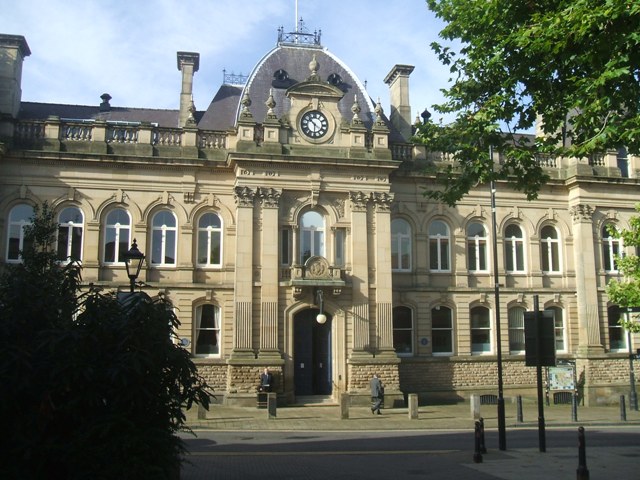
Old Town Hall, Wolverhampton
The old Town Hall is a former municipal facility in North Street, Wolverhampton, West Midlands, United Kingdom. It is a Grade II listed building. ��2...
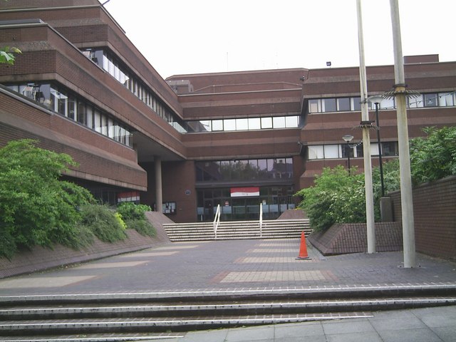
Wolverhampton Civic Centre
Wolverhampton Civic Centre is a municipal building in the City of Wolverhampton, West Midlands, England. The building houses a council chamber for City...
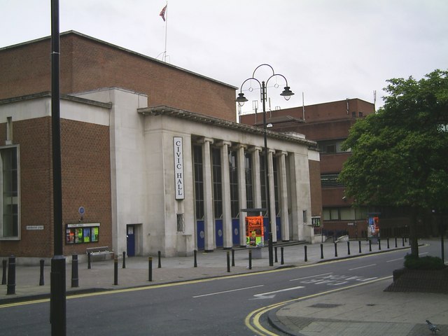
Wolverhampton Civic Hall
The Halls, Wolverhampton is a music venue in Wolverhampton, West Midlands, England. It has been one of the most notable live music venues in the county...

St Peter's (Wolverhampton ward)
St Peter's is a ward of Wolverhampton City Council, West Midlands. It has two parts: the city centre (i.e. the area inside the city's Ring Road), and the...

Wolverhampton Pillar
The Wolverhampton Pillar is the shaft of an Anglo-Saxon High cross, dating from the ninth or tenth centuries AD. The scheduled monument is still standing...

St Peter's Collegiate Church
St Peter's Collegiate Church is located in central Wolverhampton, England. For many centuries it was a chapel royal and from 1480 a royal peculiar, independent...
Signal 107
Signal 107 was a British Independent Local Radio station serving Wolverhampton and surrounding areas, Telford and Wrekin, Shrewsbury, Oswestry in north...

107.7 The Wolf
107.7 The Wolf was a British Independent Local Radio station serving Wolverhampton and the surrounding areas, owned and operated by Forever Broadcasting...
Nearby Amenities
Located within 500m of 52.586205,-2.1299156Have you been to Wolverhampton?
Leave your review of Wolverhampton below (or comments, questions and feedback).