Branxholme

Settlement in Roxburghshire

Scotland

Branxholme

Hill Head Rough grazing above the Allan Water.
Hill Head Credit: Richard Webb

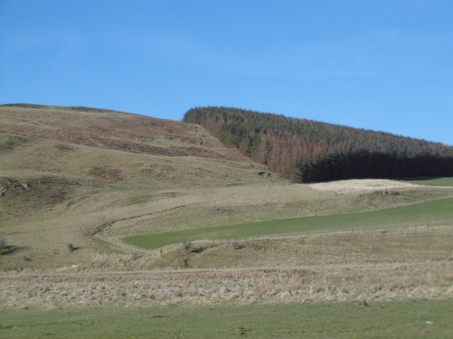
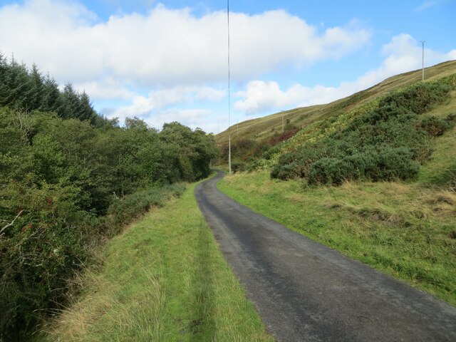
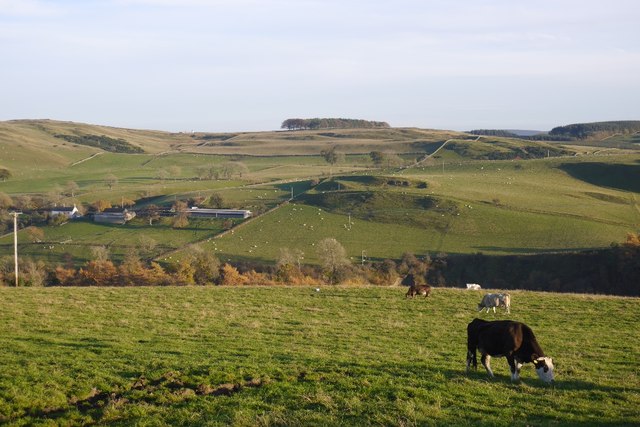
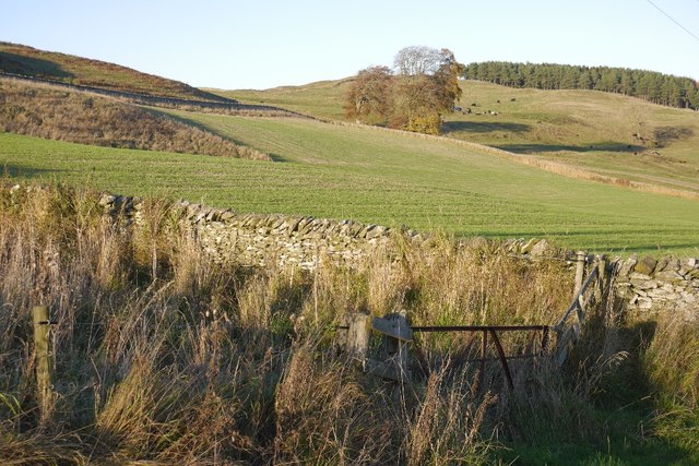
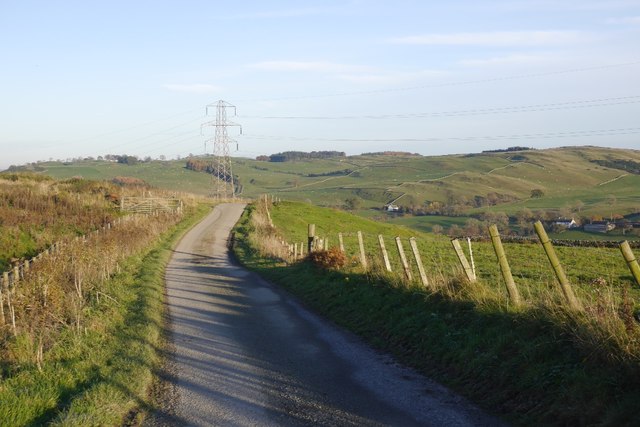
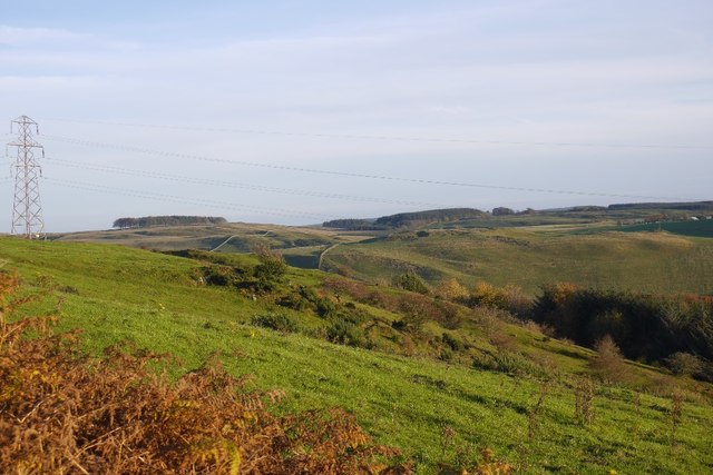
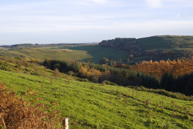
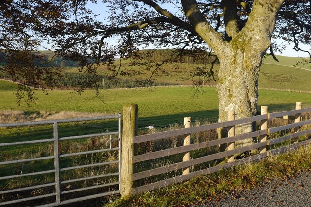
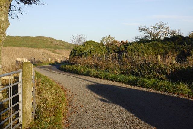
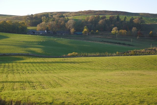
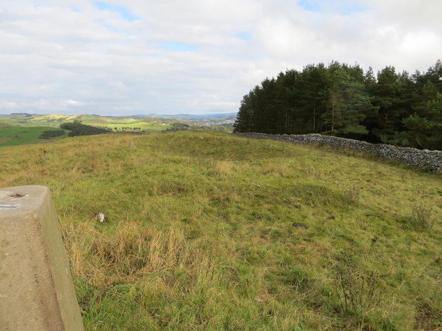
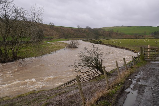
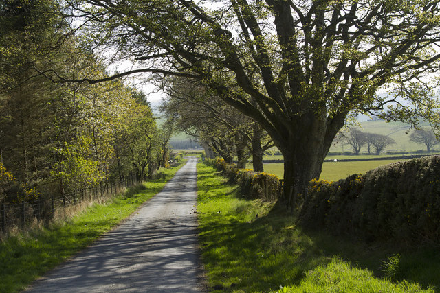
Branxholme is a small village located in the Roxburghshire region of Scotland. Situated in the southern part of the country, it lies approximately three miles southeast of Hawick. The village is nestled amidst picturesque rolling hills and offers breathtaking views of the surrounding countryside.

Branxholme has a rich history, dating back many centuries. It was once home to a prominent castle, which was constructed in the 16th century. Although the castle is now in ruins, its remnants still stand as a reminder of the village's past. The area is also known for its connection to the famous Scottish poet, Sir Walter Scott, who visited the village in the early 19th century.

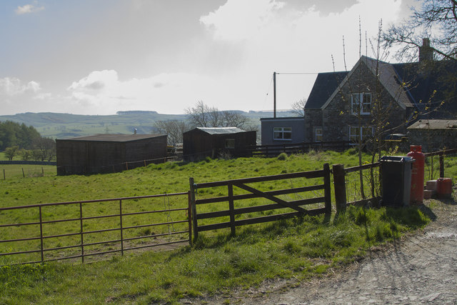
Despite its small size, Branxholme boasts a strong sense of community and a friendly atmosphere. The village is home to a close-knit population, and residents take pride in maintaining the beauty and charm of their surroundings. The countryside around Branxholme offers numerous opportunities for outdoor activities, such as hiking, cycling, and fishing.

In terms of amenities, Branxholme has a few local businesses, including a small shop and a pub, providing basic necessities and a place for locals to socialize. For more extensive shopping and entertainment options, residents typically travel to nearby Hawick or other larger towns in the region.

Overall, Branxholme is a tranquil and picturesque village, offering a peaceful retreat for those seeking a more rural lifestyle, while still providing easy access to larger towns and cities in the area.

If you have any feedback on the listing, please let us know in the comments section below.
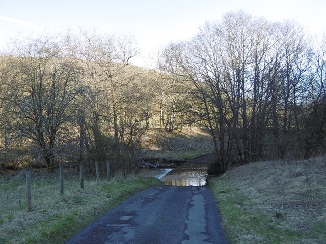
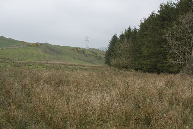
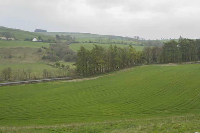
Branxholme Images

Images are sourced within 2km of 55.396194/-2.8456922 or Grid Reference NT4611. Thanks to Geograph Open Source API. All images are credited.

Hill Head Rough grazing above the Allan Water.
Hill Head
Rough grazing above the Allan Water.
Minor road beside Allan Water Looking north-westward in the direction of Newmill.
Minor road beside Allan Water
Looking north-westward in the direction of Newmill.
Grazing, Branxholme A view across Teviotdale.
Grazing, Branxholme
A view across Teviotdale.
Branxholmpark Hill Grass fields above the Teviot, upstream of Hawick.
Branxholmpark Hill
Grass fields above the Teviot, upstream of Hawick.
Narrow road, Branxholme A scenic road with a couple of gates.
Narrow road, Branxholme
A scenic road with a couple of gates.
Branxholme Knowe A scrubby steep piece of hillside amongst improved fields.
Branxholme Knowe
A scrubby steep piece of hillside amongst improved fields.
Branxholm Glen Wooded slopes above the Teviot.
Branxholm Glen
Wooded slopes above the Teviot.
Branxholmtown Beeches beside a narrow, gated road.
Branxholmtown
Beeches beside a narrow, gated road.
Road, Branxholmtown
Road, Branxholmtown
Grassland, Branxholmtown Improved grazing with a view towards Chapelhill.
Grassland, Branxholmtown
Improved grazing with a view towards Chapelhill.
Ordnance Survey Flush Bracket G486 This can be found on the retaining wall of Branxholm Bridge.
For more detail see : <span class="nowrap"><a title="http://www.bench-marks.org.uk/bm20289" rel="nofollow ugc noopener" href="http://www.bench-marks.org.uk/bm20289">Link</a><img style="margin-left:2px;" alt="External link" title="External link - shift click to open in new window" src="https://s1.geograph.org.uk/img/external.png" width="10" height="10"/></span>
Ordnance Survey Flush Bracket G486
This can be found on the retaining wall of Branxholm Bridge. For more detail see : LinkExternal link
Wall-side view from Branxholmpark Hill Triangulation Pillar Looking north-eastward.
Wall-side view from Branxholmpark Hill Triangulation Pillar
Looking north-eastward.
Spate, Borthwick Water For the last couple of months the Teviot and its tributaries had been running high with occasional damaging flooding.
Spate, Borthwick Water
For the last couple of months the Teviot and its tributaries had been running high with occasional damaging flooding.
Allan Water ford The road surface was appalling between the Allan Water ford and Teviot ford, almost certainly due to the severe flooding in December 2015 and January 2016.
Allan Water ford
The road surface was appalling between the Allan Water ford and Teviot ford, almost certainly due to the severe flooding in December 2015 and January 2016.
Rushes and woods A piece of quite poor ground. Wet to have so many rushes growing and so of very little use for sheep and cattle.
Rushes and woods
A piece of quite poor ground. Wet to have so many rushes growing and so of very little use for sheep and cattle.
Improved pasture Looking down across improved pasture to the A7 road. This is close to Branxholm Bridge.
Improved pasture
Looking down across improved pasture to the A7 road. This is close to Branxholm Bridge.
A straight road for a change The sun has come out properly and it brightens this image of a straight stretch of a minor road.
A straight road for a change
The sun has come out properly and it brightens this image of a straight stretch of a minor road.
A farm lane and buildings The houses are visible but none of the barns and other buildings of the farm yard.
A farm lane and buildings
The houses are visible but none of the barns and other buildings of the farm yard.
Show me another place!

Branxholme is located at Grid Ref: NT4611 (Lat: 55.396194, Lng: -2.8456922)

Unitary Authority: The Scottish Borders

Police Authority: The Lothians and Scottish Borders

What 3 Words

///shame.owns.lorry. Near Hawick, Scottish Borders

Related Wikis

Branxholme Castle

Branxholme Castle is a five-storey tower at Branxholme, about 3 miles south-west of Hawick in the Borders region of Scotland. == History == The present...

Branxholme

Branxholme is a hamlet in the Scottish Borders area of Scotland, overlooking the River Teviot, 3 miles (5 kilometres) southwest of Hawick, on the A7 road...

Newmill-on-Teviot

Newmill-on-Teviot, commonly called Newmill, is a hamlet in the Scottish Borders, 7 kilometres (4.3 mi) south of Hawick on the River Teviot. The remains...

Borthwick Water

The Borthwick Water (Border Scots: Borthwick Witter) is a river in the Scottish Borders area of Scotland, and a tributary of the River Teviot. The Aithouse...

Nearby Amenities

Located within 500m of 55.396194,-2.8456922
Parking
Source: survey
Lat/Long: 55.3974652/-2.8431049
Power: tower
Lat/Long: 55.3986295/-2.8502977
Branxholm
Place: hamlet
Lat/Long: 55.3963569/-2.8482363
Power: pole
Lat/Long: 55.4002661/-2.8446585
Power: pole
Lat/Long: 55.3996378/-2.8456671
Power: pole
Lat/Long: 55.3989509/-2.8467737
Power: pole
Lat/Long: 55.3983239/-2.8477797
Power: pole
Lat/Long: 55.397823/-2.8485793
Power: pole
Lat/Long: 55.3973381/-2.8493583
Power: pole
Lat/Long: 55.3965052/-2.8507026
Power: pole
Lat/Long: 55.3960388/-2.8514554
Power: pole
Lat/Long: 55.3953796/-2.8524846
Power: pole
Lat/Long: 55.3960183/-2.8495646
Power: pole
Lat/Long: 55.3960329/-2.8493273
Power: pole
Lat/Long: 55.3960637/-2.8489327
Power: pole
Lat/Long: 55.3999762/-2.8439105
Power: pole
Lat/Long: 55.3996642/-2.8431521
Power: pole
Lat/Long: 55.3999396/-2.8423989
Power: pole
Lat/Long: 55.3989216/-2.8413284
Power: pole
Lat/Long: 55.3977234/-2.8383646
Power: tower
Lat/Long: 55.3998274/-2.8480134
Events Venue
Branxholm Park
Addr City: Hawick
Addr Postcode: TD9 0JT
Website: https://www.branxholmpark.co.uk/
Lat/Long: 55.3963669/-2.8483632
The data included in this document is from www.openstreetmap.org. The data is made available under ODbL.

Have you been to Branxholme?

Leave your review of Branxholme below (or comments, questions and feedback).