Wilden

Settlement in Worcestershire Wyre Forest

England

Wilden

Hartlebury Common An area of lowland heath. Picture taken from grid ref SO 82651 71379, approx. 50 metres west of the trigpoint, looking SSW along the public footpath.
Hartlebury Common Credit: Martyn B

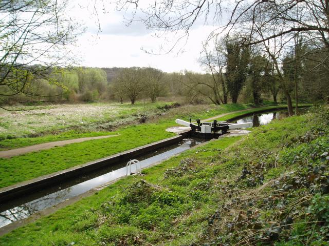
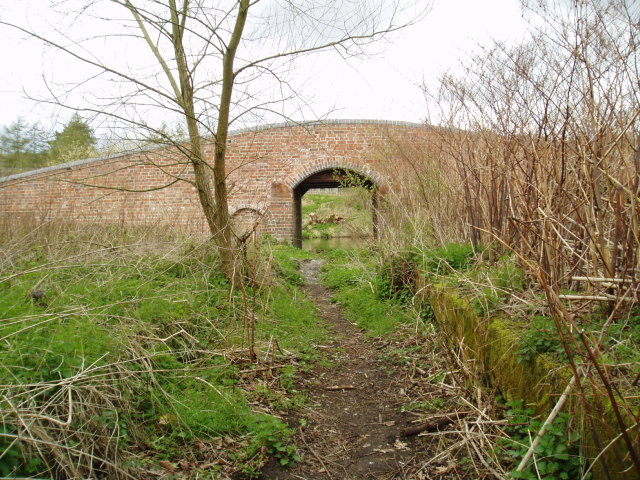
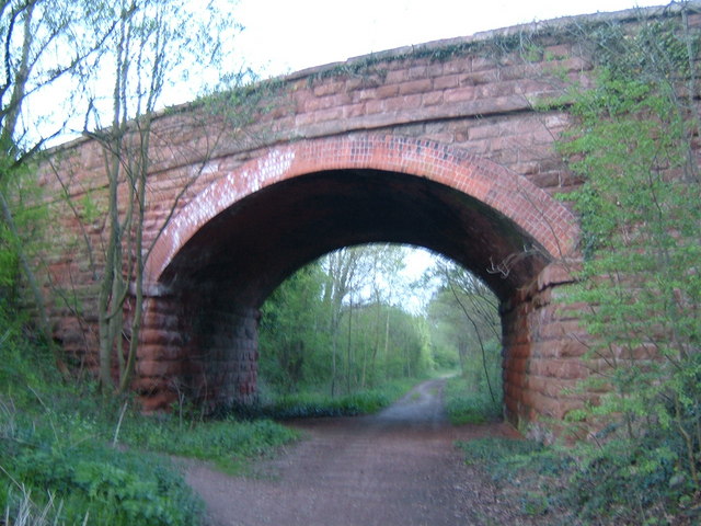
Wilden is a charming village located in the county of Worcestershire, England. Situated on the banks of the River Stour, it is nestled in the picturesque countryside, surrounded by rolling hills and lush greenery. The village is part of the Wyre Forest district and is approximately 5 miles northeast of Kidderminster.

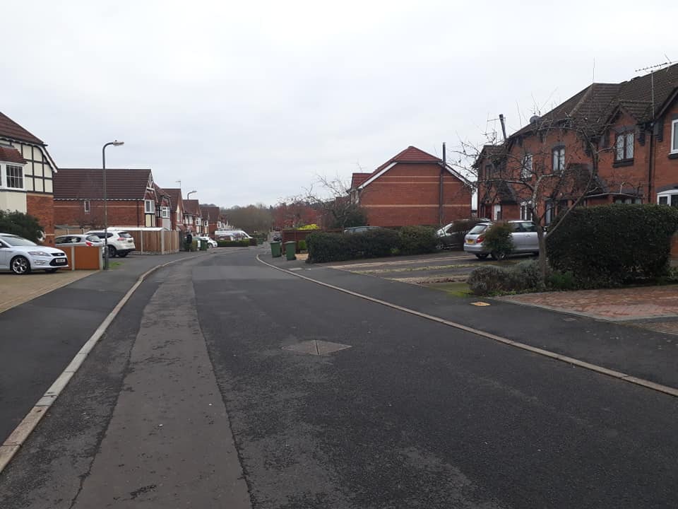
Wilden is a small and close-knit community with a population of around 600 residents. It exudes a tranquil and rural atmosphere, making it an ideal place for those seeking a peaceful and idyllic lifestyle. The village is known for its beautiful countryside, offering residents and visitors plenty of opportunities for outdoor activities such as hiking, cycling, and fishing.

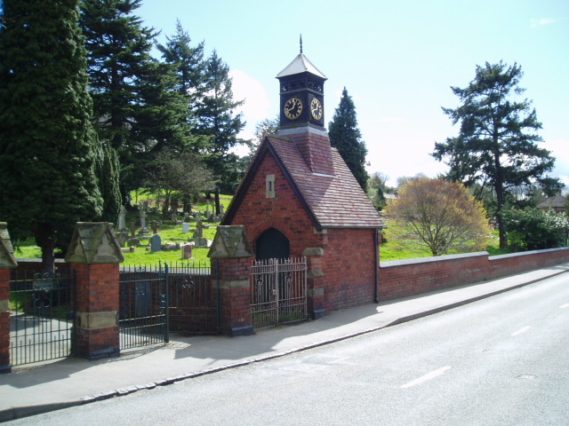
The village is rich in history, with evidence of Roman settlements in the area. It features several historic buildings, including St. Lawrence Church, which dates back to the 13th century and has a distinctive timber-framed tower. The church is a focal point of the community and holds regular services and events.

Despite its small size, Wilden has a strong sense of community spirit. It boasts a village hall that serves as a hub for various social and recreational activities, including community gatherings, clubs, and events. The village also has a primary school, providing education for local children.

Wilden is well-connected to neighboring towns and cities, with good transport links. The nearby town of Kidderminster offers a wide range of amenities, including shops, restaurants, and leisure facilities. Overall, Wilden offers a peaceful and picturesque setting, making it a desirable place to live for those seeking a rural lifestyle with easy access to urban conveniences.

If you have any feedback on the listing, please let us know in the comments section below.
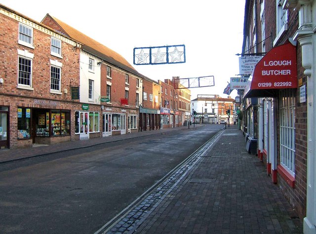
Wilden Images

Images are sourced within 2km of 52.350941/-2.2584767 or Grid Reference SO8272. Thanks to Geograph Open Source API. All images are credited.

Hartlebury Common An area of lowland heath. Picture taken from grid ref SO 82651 71379, approx. 50 metres west of the trigpoint, looking SSW along the public footpath.
Hartlebury Common
An area of lowland heath. Picture taken from grid ref SO 82651 71379, approx. 50 metres west of the trigpoint, looking SSW along the public footpath.
Falling Sands Lock, Staffs.& Worcs. Canal The picture shows the canal at a point close to the River Stour, the course of which can be seen running almost parallel to the canal. The Stour was navigable in the 18th century to a point a few hundred metres downstream from where the picture was taken, at SO 82774 74520.
Falling Sands Lock, Staffs.& Worcs. Canal
The picture shows the canal at a point close to the River Stour, the course of which can be seen running almost parallel to the canal. The Stour was navigable in the 18th century to a point a few hundred metres downstream from where the picture was taken, at SO 82774 74520.
Railway Bridge across Staffs.& Worcs. Canal The railway bridge over the Staffs. & Worcs. Canal at SO 81737 71817 reflects the decline of both modes of transport. The canal soon fell victim to the railway, and the railway eventually fell victim to a certain Mr. Beeching. What goes round, comes round...
Railway Bridge across Staffs.& Worcs. Canal
The railway bridge over the Staffs. & Worcs. Canal at SO 81737 71817 reflects the decline of both modes of transport. The canal soon fell victim to the railway, and the railway eventually fell victim to a certain Mr. Beeching. What goes round, comes round...
Platt's Wharf, Staffs. & Worcs. Canal The bridge at Platt’s Wharf takes the canal towpath over a disused lock, which used to link the Staffs. & Worcs. Canal to the River Stour. The wall of the lock is clearly visible on the right. The picture was taken from SO 82506 73773, looking from the River Stour towards the canal, which is visible through the arch of the bridge.
Platt's Wharf, Staffs. & Worcs. Canal
The bridge at Platt’s Wharf takes the canal towpath over a disused lock, which used to link the Staffs. & Worcs. Canal to the River Stour. The wall of the lock is clearly visible on the right. The picture was taken from SO 82506 73773, looking from the River Stour towards the canal, which is visible through the arch of the bridge.
Wilden, Alfred Baldwin Clocktower Memorial Wilden’s past was shaped by the industrialist Alfred Baldwin, father of the famous Prime Minister, Stanley Baldwin. The industries have now all but disappeared, but  the clocktower, erected at the entrance to the cemetery in 1910 by his grandson Oliver, is a lasting tribute to Alfred’s influence on the community. Taken from SO 82397 72204.
Wilden, Alfred Baldwin Clocktower Memorial
Wilden’s past was shaped by the industrialist Alfred Baldwin, father of the famous Prime Minister, Stanley Baldwin. The industries have now all but disappeared, but the clocktower, erected at the entrance to the cemetery in 1910 by his grandson Oliver, is a lasting tribute to Alfred’s influence on the community. Taken from SO 82397 72204.
Staffordshire & Worcestershire Canal Bridge carrying the route of the original Severn Valley Railway across the canal.
Staffordshire & Worcestershire Canal
Bridge carrying the route of the original Severn Valley Railway across the canal.
Carpet Town Although most of the large carpet factories in the centre of Kidderminster have been closed, demolished or converted to other uses carpet manufacturing still takes place in the town.  This is part of the modern factory of one of the well known brands slightly out of town beside the Stourport Road.
Carpet Town
Although most of the large carpet factories in the centre of Kidderminster have been closed, demolished or converted to other uses carpet manufacturing still takes place in the town. This is part of the modern factory of one of the well known brands slightly out of town beside the Stourport Road.
Upper Mitton Bridge Over the Staffordshire and Worcestershire Canal.  This lane, which used to be a local rat-run around traffic congestion in Stourport on summer weekends, has been stopped up and is now just a pleasant footpath across the Stour flood plain.
Upper Mitton Bridge
Over the Staffordshire and Worcestershire Canal. This lane, which used to be a local rat-run around traffic congestion in Stourport on summer weekends, has been stopped up and is now just a pleasant footpath across the Stour flood plain.
Wharf House, near Upper Mitton Bridge A tranquil view on the Staffordshire and Worcestershire Canal.
Wharf House, near Upper Mitton Bridge
A tranquil view on the Staffordshire and Worcestershire Canal.
Upper Mitton Bridge silhouette Seen against the late afternoon sun over the Staffordshire and Worcestershire canal.
Upper Mitton Bridge silhouette
Seen against the late afternoon sun over the Staffordshire and Worcestershire canal.
Brintons No. 8 The entrance to the factory one of the remaining large carpet manufacturers in Kidderminster.  Brintons have had factories at many sites within the town over the years, hence the number.  This entrance is right on the northern edge of the square and some of the buildings in the view are in the next square.
Brintons No. 8
The entrance to the factory one of the remaining large carpet manufacturers in Kidderminster. Brintons have had factories at many sites within the town over the years, hence the number. This entrance is right on the northern edge of the square and some of the buildings in the view are in the next square.
Carpets of Worth A manufacturer of quality carpets, formerly T Bond Worth of Stourport. This is the powerhouse that was home to four Belliss & Morcom steam engines and also included two Lancashire boilers with pulverised coal firing (hens' teeth territory). Demolished 2005.
Carpets of Worth
A manufacturer of quality carpets, formerly T Bond Worth of Stourport. This is the powerhouse that was home to four Belliss & Morcom steam engines and also included two Lancashire boilers with pulverised coal firing (hens' teeth territory). Demolished 2005.
Junction of High Street and York Street, Stourport A focal crossroads in Stourport, with Georgian building in all directions. Seen from the end of New Street.
Junction of High Street and York Street, Stourport
A focal crossroads in Stourport, with Georgian building in all directions. Seen from the end of New Street.
Stourport: the junction of High Street and Mitton Street With other roads on the left. Taken from close to the Swan Inn. Mitton Street is the road going off to the right.
Stourport: the junction of High Street and Mitton Street
With other roads on the left. Taken from close to the Swan Inn. Mitton Street is the road going off to the right.
York Street, Stourport Georgian buildings along the north side of York Street.
York Street, Stourport
Georgian buildings along the north side of York Street.
Stour flood plain Looking across the meadows by the Stour from Upper Mitton.  The buildings by Wilden lane can be seen in the distance.
Stour flood plain
Looking across the meadows by the Stour from Upper Mitton. The buildings by Wilden lane can be seen in the distance.
Stourport fire station Stourport fire station, Foundry Street, Stourport, Worcestershire, forms part of the Hereford & Worcester Fire & Rescue Service.
Stourport fire station
Stourport fire station, Foundry Street, Stourport, Worcestershire, forms part of the Hereford & Worcester Fire & Rescue Service.
Disused railway Leapgate A wonderful find on a quest for a Geograph, we will definitely have to walk along here one day.
Disused railway Leapgate
A wonderful find on a quest for a Geograph, we will definitely have to walk along here one day.
Show me another place!

Wilden is located at Grid Ref: SO8272 (Lat: 52.350941, Lng: -2.2584767)

Administrative County: Worcestershire

District: Wyre Forest

Police Authority: West Mercia

What 3 Words

///prices.reach.carbon. Near Stourport-on-Severn, Worcestershire

Nearby Locations

Wilden Pool Wilden

Related Wikis

Wilden, Worcestershire

Wilden is a small village about 1 mile north east of Stourport-on-Severn, Worcestershire. It is in the Stour valley and both the River Stour and the Staffordshire...

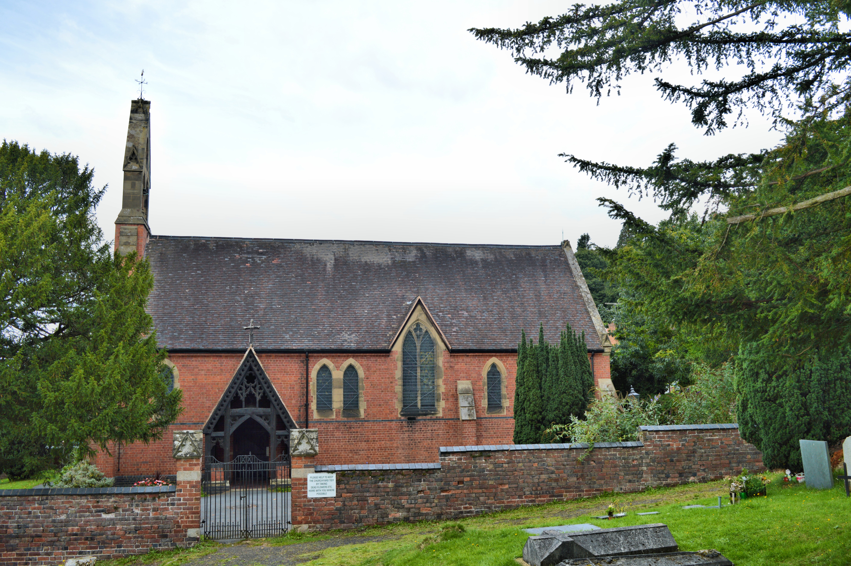
Church of All Saints, Wilden

All Saints Church in Wilden, Worcestershire about one mile to the north east of Stourport. It was designed by William Hopkins with funds provided by Alfred...

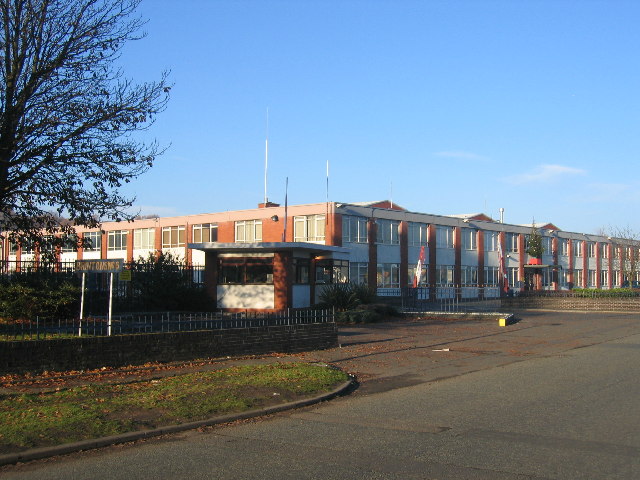
The Stourport High School and Sixth Form Centre

The Stourport High School & VIth Form Centre, formerly known as the Stourport High School and Language College, opened to students in 1956 as an 11-18...
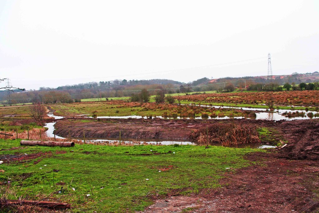
Wilden Marsh

Wilden Marsh is a nature reserve of the Worcestershire Wildlife Trust. It is situated between Kidderminster and Stourport-on-Severn, in Worcestershire...

Stourport-on-Severn railway station

Stourport-on-Severn railway station was the main station in Stourport-on-Severn, Worcestershire, England. The station, originally named 'Stourport', opened...

Chain Wire Club Ground

The Chain Wire Club Ground in Stourport-on-Severn, Worcestershire was used for first-class cricket by Worcestershire County Cricket Club on a single occasion...

Summerfield Research Station

The Summerfield Research Station is a development and production site for solid rocket motors in the United Kingdom officially formed on 1 September 1951...

Stourport-on-Severn

Stourport-on-Severn, often shortened to Stourport, is a town and civil parish in the Wyre Forest District of North Worcestershire, England, a few miles...

Nearby Amenities

Located within 500m of 52.350941,-2.2584767
Bus Stop
Bigbury Lane
Bus: yes
Naptan AtcoCode: 2000G102700
Naptan Bearing: N
Naptan CommonName: Bigbury Lane
Naptan Crossing: Bigbury Lane
Naptan Indicator: Opp
Naptan Landmark: Wilden Industrial Estate
Naptan NaptanCode: wocdjawg
Naptan PlusbusZoneRef: KDRMNST
Naptan Street: Wilden Lane
Naptan Verified: no
Public Transport: platform
Source: naptan_import
Lat/Long: 52.350778/-2.2585862
Bus Stop
Watchtower Road
Bus: yes
Naptan AtcoCode: 2000G103200
Naptan Bearing: E
Naptan CommonName: Watchtower Road
Naptan Crossing: Watchtower Road
Naptan Indicator: Adj
Naptan NaptanCode: wocdmwmj
Naptan PlusbusZoneRef: KDRMNST
Naptan Street: Wivelden Avenue
Naptan Verified: no
Public Transport: platform
Source: naptan_import
Lat/Long: 52.3512356/-2.254845
Bus Stop
Bigbury Lane
Bus: yes
Naptan AtcoCode: 2000G500180
Naptan Bearing: W
Naptan CommonName: Bigbury Lane
Naptan Crossing: Wilden Lane
Naptan Indicator: Westbound
Naptan Landmark: opp Wilden Industrial Estate
Naptan NaptanCode: wocgagwt
Naptan PlusbusZoneRef: KDRMNST
Naptan Street: Bigbury Lane
Naptan Verified: no
Public Transport: platform
Source: naptan_import
Lat/Long: 52.3508595/-2.2583077
Bus Stop
Bigbury Lane
Bus: yes
Naptan AtcoCode: 2000G500181
Naptan Bearing: SW
Naptan CommonName: Bigbury Lane
Naptan Crossing: Bigbury Lane
Naptan Indicator: Adj
Naptan Landmark: opp Wilden Industrial Estate
Naptan NaptanCode: wocgajad
Naptan PlusbusZoneRef: KDRMNST
Naptan Street: Wilden Lane
Naptan Verified: no
Public Transport: platform
Source: naptan_import
Lat/Long: 52.350382/-2.25876
Bus Stop
Bus: yes
Naptan AtcoCode: 2000G500182
Naptan Bearing: NE
Naptan CommonName: School
Naptan Indicator: opp
Naptan Landmark: School
Naptan NaptanCode: wocgajag
Naptan PlusbusZoneRef: KDRMNST
Naptan Street: Wilden Lane
Naptan Verified: no
Public Transport: platform
Source: naptan_import
Lat/Long: 52.3479699/-2.2599938
Bus Stop
Bus: yes
Naptan AtcoCode: 2000G500183
Naptan Bearing: SW
Naptan CommonName: School
Naptan Indicator: Adj
Naptan Landmark: School
Naptan NaptanCode: wocgajaj
Naptan PlusbusZoneRef: KDRMNST
Naptan Street: Wilden Lane
Naptan Verified: no
Public Transport: platform
Source: naptan_import
Lat/Long: 52.3480334/-2.2597152
Bus Stop
Wilden Industrial Estate
Bus: yes
Naptan AtcoCode: 2000G500594
Naptan Bearing: S
Naptan CommonName: Wilden Industrial Estate
Naptan Indicator: Opp
Naptan NaptanCode: wocgajdm
Naptan PlusbusZoneRef: KDRMNST
Naptan Street: Wilden Works
Naptan Verified: no
Public Transport: platform
Source: naptan_import
Lat/Long: 52.3525762/-2.2585086
Power: tower
Lat/Long: 52.3522488/-2.2649781
Power: tower
Lat/Long: 52.3542644/-2.2630535
Wilden
Place: village
Wikidata: Q8001067
Lat/Long: 52.3488836/-2.2602108
Man Made: pipeline_marker
Source: survey
Substance: gas
Lat/Long: 52.3543073/-2.2580123
Board Type: nature
Information: board
Operator: Worestershire Wildlife Trust
Tourism: information
Lat/Long: 52.3550867/-2.2568783
The data included in this document is from www.openstreetmap.org. The data is made available under ODbL.

Have you been to Wilden?

Leave your review of Wilden below (or comments, questions and feedback).