Wilcott Marsh

Settlement in Shropshire

England

Wilcott Marsh

Old Milestone Old milestone on what would have been the A.5 near to Great Ness, Shropshire. For overall view see <a title="https://www.geograph.org.uk/photo/4776149" href="https://www.geograph.org.uk/photo/4776149">Link</a>
Old Milestone Credit: Keith Evans

Wilcott Marsh is a small village located in the county of Shropshire, England. Situated near the town of Ellesmere, Wilcott Marsh is known for its picturesque countryside and tranquil surroundings. The village is surrounded by farmland and rolling hills, making it the perfect destination for those seeking a peaceful retreat.

Wilcott Marsh is home to a small community of residents who enjoy the rural lifestyle and close-knit atmosphere. The village has a charming mix of traditional cottages and modern homes, giving it a unique character. There are also a few local amenities in the village, including a small shop and a pub, providing residents with the essentials they need.

The surrounding area offers plenty of opportunities for outdoor activities, with numerous walking and cycling routes nearby. The nearby Shropshire countryside is known for its natural beauty, with several nature reserves and wildlife habitats to explore. Overall, Wilcott Marsh is a quaint and idyllic village that offers a peaceful escape from the hustle and bustle of city life.

If you have any feedback on the listing, please let us know in the comments section below.

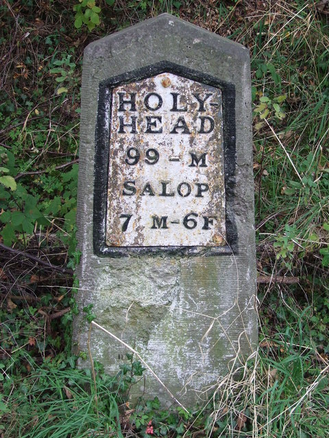
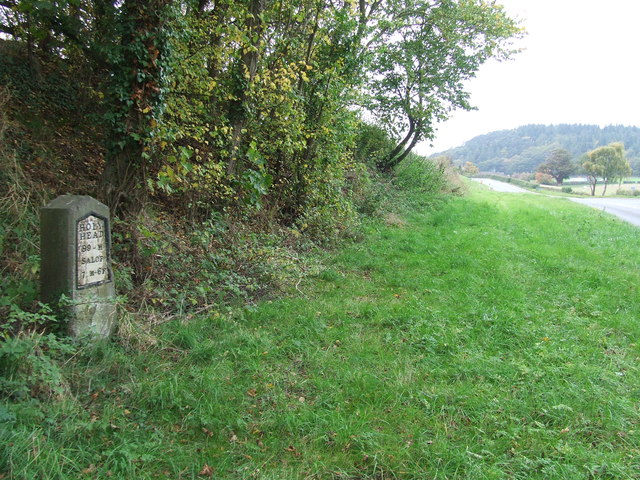
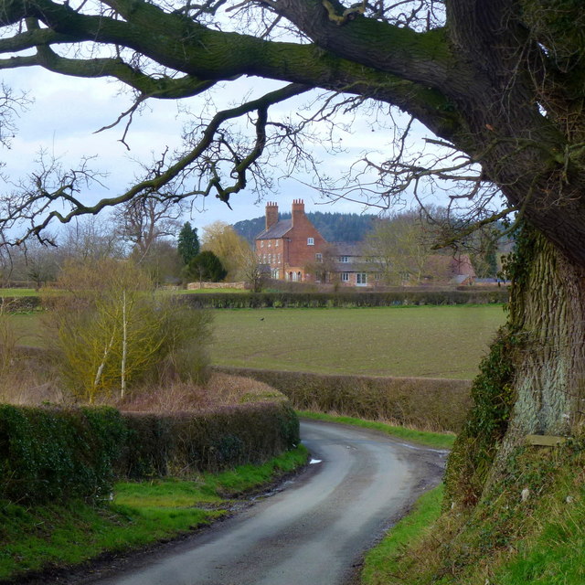
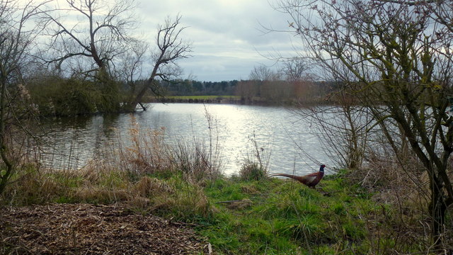
Wilcott Marsh Images

Images are sourced within 2km of 52.756017/-2.9143989 or Grid Reference SJ3817. Thanks to Geograph Open Source API. All images are credited.

Old Milestone Old milestone on what would have been the A.5 near to Great Ness, Shropshire. For overall view see <a title="https://www.geograph.org.uk/photo/4776149" href="https://www.geograph.org.uk/photo/4776149">Link</a>
Old Milestone
Old milestone on what would have been the A.5 near to Great Ness, Shropshire. For overall view see Link
Holyhead 99 Old milestone on what would have been the A.5 near to Great Ness, Shropshire. For close up view see <a title="https://www.geograph.org.uk/photo/4776146" href="https://www.geograph.org.uk/photo/4776146">Link</a>
Holyhead 99
Old milestone on what would have been the A.5 near to Great Ness, Shropshire. For close up view see Link
A glimpse of Folly Farm Framed by the shape of a fine old oak tree by the lane next to Folly Pool.
A glimpse of Folly Farm
Framed by the shape of a fine old oak tree by the lane next to Folly Pool.
Folly Pool Late afternoon and a pheasant surveys his territory.
Folly Pool
Late afternoon and a pheasant surveys his territory.
Milestone Milestone on what would have been the A5 near to Nesscliffe, Shropshire; for overall view see <a title="https://www.geograph.org.uk/photo/4930458" href="https://www.geograph.org.uk/photo/4930458">Link</a>
Milestone
Milestone on what would have been the A5 near to Nesscliffe, Shropshire; for overall view see Link
Holyhead 98 Milestone on what would have been the A5 near to Nesscliffe, Shropshire; for close up view see <a title="https://www.geograph.org.uk/photo/4930452" href="https://www.geograph.org.uk/photo/4930452">Link</a>
Holyhead 98
Milestone on what would have been the A5 near to Nesscliffe, Shropshire; for close up view see Link
Kynaston's Cave, Nesscliffe Reputedly the hideaway of the highwayman Humphrey Kynaston.
Kynaston's Cave, Nesscliffe
Reputedly the hideaway of the highwayman Humphrey Kynaston.
Nesscliffe Footbridge Suspension footbridge with a lightweight FRP (fibre reinforced polymer) deck. Although FRP has been used for smaller elements for walkways and gratings its use in larger structures has been limited. This structure seems to be performing well after some early remedial work.
Nesscliffe Footbridge
Suspension footbridge with a lightweight FRP (fibre reinforced polymer) deck. Although FRP has been used for smaller elements for walkways and gratings its use in larger structures has been limited. This structure seems to be performing well after some early remedial work.
The Church of St Andrew at Great Ness Viewed from the south-east.
The Church of St Andrew at Great Ness
Viewed from the south-east.
Road in Great Ness with the option to visit St Andrew's Church Looking south-westward
Road in Great Ness with the option to visit St Andrew's Church
Looking south-westward
A5 north of Felton Butler
A5 overbridge crossing near Wilcott
Shropshire crossroads 1 - Pentre, Shropshire Here at this crossroads at Pentre on the Severn Way members of Railway Ramblers study the map for the next stage of their day's walk in Shropshire. Time taken 12.49 pm BST (British Summer Time).
Shropshire crossroads 1 - Pentre, Shropshire
Here at this crossroads at Pentre on the Severn Way members of Railway Ramblers study the map for the next stage of their day's walk in Shropshire. Time taken 12.49 pm BST (British Summer Time).
Not this way - Pentre, Shropshire This sign beside the Severn Way at Pentre discourages you from proceeding any further northwards into a sector of the Nesscliffe Military Training Area. Time taken 12.50 pm BST (British Summer Time).
Not this way - Pentre, Shropshire
This sign beside the Severn Way at Pentre discourages you from proceeding any further northwards into a sector of the Nesscliffe Military Training Area. Time taken 12.50 pm BST (British Summer Time).
Woodland in Spring Nesscliffe Hill Country Park.
Woodland in Spring
Nesscliffe Hill Country Park.
Nesscliffe Telephone Exchange Situated near Wilcott, this TE is of a design common in rural areas and has the code WNNCL. It provides telephone and broadband services to 407 residential and 42 non-residential premises in Nesscliffe plus Felton Butler, Great Ness, Hopton, Kinton, Pentre and Wilcott nearby. Ventilation louvres can be seen on the front of this TE whilst BT antennas can just be seen to the left of the photo. The numbering range of this TE is (01743) 741xxx, the (01743) referring to the Shrewsbury group of thirteen TEs, and its postcode is SY4 1BJ.
Nesscliffe Telephone Exchange
Situated near Wilcott, this TE is of a design common in rural areas and has the code WNNCL. It provides telephone and broadband services to 407 residential and 42 non-residential premises in Nesscliffe plus Felton Butler, Great Ness, Hopton, Kinton, Pentre and Wilcott nearby. Ventilation louvres can be seen on the front of this TE whilst BT antennas can just be seen to the left of the photo. The numbering range of this TE is (01743) 741xxx, the (01743) referring to the Shrewsbury group of thirteen TEs, and its postcode is SY4 1BJ.
Modern Milestone by St Andrew's church, Great Ness New metal plate attached to new stone post by the UC road, in parish of GREAT NESS (SHREWSBURY AND ATCHAM District), near St Andrew's church, on the verge to the old road, on West side of road. Telford-type iron plate, erected by the parish in the 21st century. 

Inscription reads:- : HOLY- / HEAD / 99 - M / SALOP / 7 M - 6F :

The original Thomas Telford milestone is on the old A5 to the South West at Grid reference: SJ 3918 1860 

Milestone Society National ID: SA_HH099aR.
Modern Milestone by St Andrew's church, Great Ness
New metal plate attached to new stone post by the UC road, in parish of GREAT NESS (SHREWSBURY AND ATCHAM District), near St Andrew's church, on the verge to the old road, on West side of road. Telford-type iron plate, erected by the parish in the 21st century. Inscription reads:- : HOLY- / HEAD / 99 - M / SALOP / 7 M - 6F : The original Thomas Telford milestone is on the old A5 to the South West at Grid reference: SJ 3918 1860 Milestone Society National ID: SA_HH099aR.
Old Milestone by the former A5, Nesscliffe Metal plate attached to stone post by the UC road (was A5), in parish of GREAT NESS (SHREWSBURY AND ATCHAM District), 30m South East of the junction between the A5 and Well Lane, Nesscliffe, by North end of bus stop layby, on verge, by large tree, on South West side of road. Telford gabled iron plate, erected by the Holyhead Road turnpike trust in the 19th century. 

Inscription reads:-
HOLY-
HEAD
98 - M
SALOP
8M-6F

Grade II Listed. List Entry Number: 1175339 
<span class="nowrap"><a title="https://historicengland.org.uk/listing/the-list/list-entry/1175339" rel="nofollow ugc noopener" href="https://historicengland.org.uk/listing/the-list/list-entry/1175339">Link</a><img style="margin-left:2px;" alt="External link" title="External link - shift click to open in new window" src="https://s1.geograph.org.uk/img/external.png" width="10" height="10"/></span>

Milestone Society National ID: SA_HH098.
Old Milestone by the former A5, Nesscliffe
Metal plate attached to stone post by the UC road (was A5), in parish of GREAT NESS (SHREWSBURY AND ATCHAM District), 30m South East of the junction between the A5 and Well Lane, Nesscliffe, by North end of bus stop layby, on verge, by large tree, on South West side of road. Telford gabled iron plate, erected by the Holyhead Road turnpike trust in the 19th century. Inscription reads:- HOLY- HEAD 98 - M SALOP 8M-6F Grade II Listed. List Entry Number: 1175339 LinkExternal link Milestone Society National ID: SA_HH098.
Show me another place!

Wilcott Marsh is located at Grid Ref: SJ3817 (Lat: 52.756017, Lng: -2.9143989)

Unitary Authority: Shropshire

Police Authority: West Mercia

What 3 Words

///snips.solicitor.foiled. Near Great Ness, Shropshire

Nearby Locations

Wilcott Marsh

Related Wikis

Nesscliffe and Pentre railway station

Nesscliffe and Pentre railway station was a station in Nesscliffe, Shropshire, England. The station was opened in 1866 and closed in 1933. == References... ==

Nesscliffe

Nesscliffe is a village in Shropshire, England, located north of the River Severn. The village comes under the Great Ness parish. The A5 road, which previously...

St Andrew's Church, Great Ness

St Andrew's Church is in the village of Great Ness, Shropshire, England. It is an active Anglican parish church in the deanery of Ellesmere, the archdeaconry...

Great Ness

Great Ness and Little Ness are civil parishes in Shropshire, England. == Common local governance == The two parishes share a parish council. The parishes...

Nearby Amenities

Located within 500m of 52.756017,-2.9143989
Give Way
Direction: backward
Lat/Long: 52.7560204/-2.9144598
Give Way
Direction: forward
Lat/Long: 52.7560378/-2.9143717
Give Way
Direction: backward
Lat/Long: 52.7594501/-2.9153489
Give Way
Direction: forward
Lat/Long: 52.7593587/-2.915075
The data included in this document is from www.openstreetmap.org. The data is made available under ODbL.

Have you been to Wilcott Marsh?

Leave your review of Wilcott Marsh below (or comments, questions and feedback).