Brampton

Settlement in Westmorland Eden

England

Brampton

A66 Appleby Bypass Viewed from a passing train.
A66 Appleby Bypass Credit: Stephen Craven

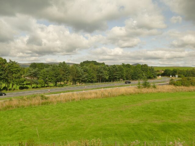
Brampton is a small village located in the county of Westmorland in North West England. Situated in the picturesque Lake District National Park, Brampton is known for its stunning natural beauty and peaceful atmosphere. The village is nestled in a valley, surrounded by rolling hills and lush greenery, providing residents and visitors with breathtaking views in every direction.

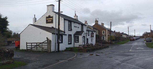
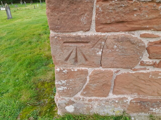
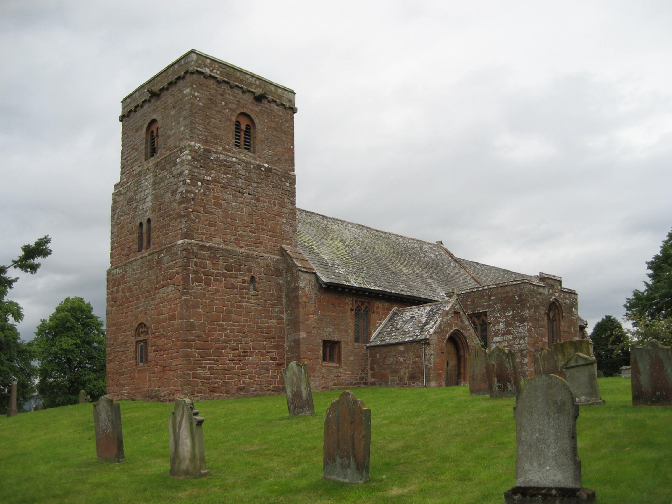
Brampton is a close-knit community, with a population of around 500 people. The village is characterized by its charming stone houses, many of which date back several centuries, giving it a traditional and historic feel. The local church, St. Mary's, is a prominent landmark in the village, with its striking architecture and peaceful churchyard.

The village offers a range of amenities to cater to the needs of its residents. These include a local pub, a primary school, a village hall, and a post office. There are also several walking and cycling paths that wind through the surrounding countryside, allowing visitors to explore the area's natural beauty.

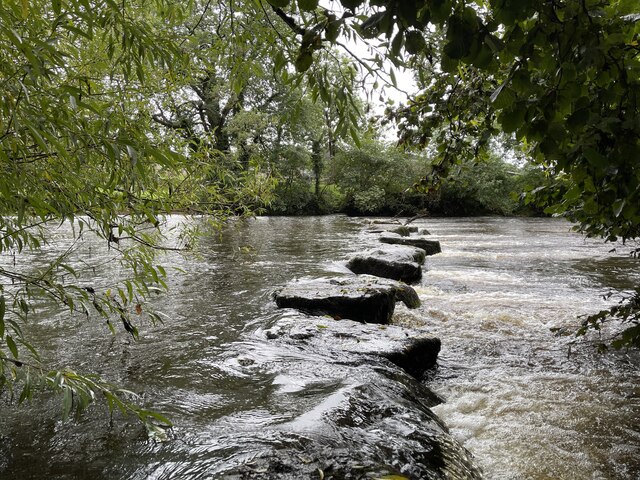
Brampton is conveniently located near the market town of Kirkby Stephen, which provides additional amenities and services. The village also benefits from its proximity to the Lake District National Park, which offers a wide range of outdoor activities such as hiking, boating, and wildlife spotting.

Overall, Brampton is a small but vibrant village that offers a peaceful and idyllic lifestyle amidst the stunning landscapes of Westmorland.

If you have any feedback on the listing, please let us know in the comments section below.

Brampton Images

Images are sourced within 2km of 54.604321/-2.495347 or Grid Reference NY6823. Thanks to Geograph Open Source API. All images are credited.

A66 Appleby Bypass Viewed from a passing train.
A66 Appleby Bypass
Viewed from a passing train.
The Masons Arms, Long Marton The Masons Arms, Long Marton, a public house and restaurant.
The Masons Arms, Long Marton
The Masons Arms, Long Marton, a public house and restaurant.
Crossroads Crossroads on the Dufton to Appleby-in-Westmorland road.
Crossroads
Crossroads on the Dufton to Appleby-in-Westmorland road.
Dufton's old school Dufton is an important staging post on the Pennine Way before or after the ascent of Cross Fell, the highest point in the Pennines.
Dufton's old school
Dufton is an important staging post on the Pennine Way before or after the ascent of Cross Fell, the highest point in the Pennines.
Brampton by Appleby The smaller of the two places with this name in Cumbria.
Brampton by Appleby
The smaller of the two places with this name in Cumbria.
Benchmark, Brampton, Clickham Farm Detail of an Ordnance Survey benchmark on the corner of the farmhouse at Clickham Farm.  The benchmark marks a height of 166.1983m above mean sea level (Ordnance Datum Newlyn) last verified in 1955.
Benchmark, Brampton, Clickham Farm
Detail of an Ordnance Survey benchmark on the corner of the farmhouse at Clickham Farm. The benchmark marks a height of 166.1983m above mean sea level (Ordnance Datum Newlyn) last verified in 1955.
Road junction near Brampton
Benchmark, Long Marton, Bridge 253 Detail of an Ordnance Survey cut benchmark on the end pier of the south east abutment of Park Lane Bridge on the Settle to Carlisle railway, railway engineers’ bridge reference number SAC/253.  The benchmark marks a height of 132.4021m above mean sea level (Ordnance Datum Newlyn) last verified in 1955.
Benchmark, Long Marton, Bridge 253
Detail of an Ordnance Survey cut benchmark on the end pier of the south east abutment of Park Lane Bridge on the Settle to Carlisle railway, railway engineers’ bridge reference number SAC/253. The benchmark marks a height of 132.4021m above mean sea level (Ordnance Datum Newlyn) last verified in 1955.
The Pennine Way leaving Dufton
Stepping Stones at Colby Laithes Far too slippery to attempt a crossing today. These stepping stones are found on the River Eden just outside Appleby-in-Westmorland.
Stepping Stones at Colby Laithes
Far too slippery to attempt a crossing today. These stepping stones are found on the River Eden just outside Appleby-in-Westmorland.
Ordnance Survey Cut Mark This OS cut mark can be found on No1 Town End. It marks a point 170.822m above mean sea level.
Ordnance Survey Cut Mark
This OS cut mark can be found on No1 Town End. It marks a point 170.822m above mean sea level.
Ordnance Survey Cut Mark This OS cut mark can be found on the gatepost NW side of the road. It marks a point 165.314m above mean sea level.
Ordnance Survey Cut Mark
This OS cut mark can be found on the gatepost NW side of the road. It marks a point 165.314m above mean sea level.
Ordnance Survey Cut Mark This OS cut mark can be found on the outbuilding at Park House. It marks a point 125.605m above mean sea level.
Ordnance Survey Cut Mark
This OS cut mark can be found on the outbuilding at Park House. It marks a point 125.605m above mean sea level.
Ordnance Survey Cut Mark This damaged OS cut mark can be found on the north parapet of the bridge. It marked a point 123.819m above mean sea level.
Ordnance Survey Cut Mark
This damaged OS cut mark can be found on the north parapet of the bridge. It marked a point 123.819m above mean sea level.
Ordnance Survey Cut Mark This OS cut mark can be found on the SE abutment of the railway bridge. It marks a point 132.402m above mean sea level.
Ordnance Survey Cut Mark
This OS cut mark can be found on the SE abutment of the railway bridge. It marks a point 132.402m above mean sea level.
Ordnance Survey Cut Mark This OS cut mark can be found on the SE side of the railway bridge. It marks a point 134.612m above mean sea level.
Ordnance Survey Cut Mark
This OS cut mark can be found on the SE side of the railway bridge. It marks a point 134.612m above mean sea level.
Ordnance Survey Cut Mark This OS cut mark can be found on the NE side of the railway bridge. It marks a point 134.615m above mean sea level.
Ordnance Survey Cut Mark
This OS cut mark can be found on the NE side of the railway bridge. It marks a point 134.615m above mean sea level.
Ordnance Survey Cut Mark This OS cut mark can be found on the SW angle of the Church of St Margaret & St James. It marks a point 128.446m above mean sea level.
Ordnance Survey Cut Mark
This OS cut mark can be found on the SW angle of the Church of St Margaret & St James. It marks a point 128.446m above mean sea level.
Show me another place!

Brampton is located at Grid Ref: NY6823 (Lat: 54.604321, Lng: -2.495347)

Administrative County: Cumbria

District: Eden

Police Authority: Cumbria

What 3 Words

///cuddling.start.upward. Near Appleby-in-Westmorland, Cumbria

Related Wikis

Brampton, Eden

Brampton is a village in the Eden district, in the county of Cumbria, England. Before 1974 it was in the county of Westmorland; the nearest town is Appleby...

Broom, Cumbria

Broom is a hamlet near the village of Long Marton, in the Eden district, in the county of Cumbria, England. == Location == It is located about two miles...

St Margaret and St James' Church, Long Marton

St Margaret and St James' Church is located about 0.5 miles (0.8 km) to the south of the village of Long Marton, Cumbria, England. It is an active Anglican...

Appleby Horse Fair

The Appleby Horse Fair, also known as Appleby New Fair, is "an annual gathering of Gypsies and Travellers in the town of Appleby-in-Westmorland in Cumbria...

Dufton

Dufton is a village and civil parish in Cumbria, England. Historically part of Westmorland, it lies in the Eden Valley and below Great Dun Fell. It is...

Long Marton

Long Marton is a village and civil parish in the Eden District of the English county of Cumbria. In 2011 the population was 827. The village previously...

Long Marton railway station

Long Marton railway station was a railway station which served the village of Long Marton in Cumbria, England. Situated on the Settle-Carlisle Line, it...

North Westmorland Rural District

North Westmorland was a rural district in Westmorland, England from 1935 to 1974. It now forms part of the Eden district of Cumbria. It was formed in...

Nearby Amenities

Located within 500m of 54.604321,-2.495347
Brampton
Place: village
Source: NPE
Wikidata: Q611732
Lat/Long: 54.6053501/-2.4996663
Watergate (S bound)
Local Ref: AT
Naptan AtcoCode: 090074401045
Naptan Bearing: S
Naptan BusStopType: CUS
Naptan CommonName: Watergate (S bound)
Naptan Indicator: at
Naptan Landmark: Watergate
Naptan NaptanCode: cumdapdm
Naptan Street: No name
Naptan Verified: no
Source: naptan_import
Lat/Long: 54.6041278/-2.4969765
Watergate (N bound)
Naptan AtcoCode: 090074403409
Naptan Bearing: NW
Naptan BusStopType: CUS
Naptan CommonName: Watergate (N bound)
Naptan Indicator: opp
Naptan Landmark: Watergate
Naptan NaptanCode: cumdapga
Naptan Street: No name
Naptan Verified: no
Source: naptan_import
Lat/Long: 54.6040373/-2.4971148
Grit Bin
Lat/Long: 54.6063135/-2.5008616
Post Box
Note: In the wall of a private house.
Ref: CA16 212
Lat/Long: 54.6028765/-2.4946765
Espland Wood
Place: locality
Lat/Long: 54.6036962/-2.4878539
Power: pole
Lat/Long: 54.6005736/-2.4952685
Power: pole
Lat/Long: 54.6013514/-2.4947682
Power: pole
Lat/Long: 54.6019779/-2.4943628
Power: pole
Lat/Long: 54.6026216/-2.4939753
Power: pole
Lat/Long: 54.6032928/-2.4935462
Power: pole
Lat/Long: 54.6040659/-2.4930479
Power: pole
Lat/Long: 54.6049409/-2.4925002
Power: pole
Lat/Long: 54.6055548/-2.4921087
Power: pole
Lat/Long: 54.6062108/-2.4916971
Power: pole
Lat/Long: 54.6068753/-2.4912802
Power: pole
Lat/Long: 54.6077685/-2.4907601
Power: pole
Lat/Long: 54.6026663/-2.4953654
Power: pole
Lat/Long: 54.6026434/-2.4946753
Power: pole
Lat/Long: 54.6019848/-2.4959605
Power: pole
Lat/Long: 54.6026342/-2.4971984
Power: pole
Lat/Long: 54.6032985/-2.4978509
Power: pole
Lat/Long: 54.604106/-2.4986339
Power: pole
Lat/Long: 54.6036822/-2.4999469
Power: pole
Lat/Long: 54.603452/-2.5006765
Power: pole
Lat/Long: 54.6031233/-2.5014615
Power: pole
Lat/Long: 54.6054987/-2.490766
Power: pole
Lat/Long: 54.6048/-2.4898308
Power: pole
Lat/Long: 54.6042766/-2.4894294
Power: pole
Lat/Long: 54.6037795/-2.4890655
Power: pole
Lat/Long: 54.6034634/-2.4888144
Power: pole
Lat/Long: 54.6027167/-2.4886523
The data included in this document is from www.openstreetmap.org. The data is made available under ODbL.

Have you been to Brampton?

Leave your review of Brampton below (or comments, questions and feedback).