Whippingham

Settlement in Hampshire

England

Whippingham

Swiss Cottage and Gardens In front of the cottage are the gardens where Victoria and Albert's children each had their own plot to look after.
Swiss Cottage and Gardens Credit: Des Blenkinsopp

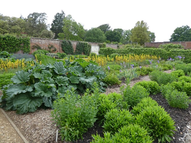
Whippingham is a small village located in Hampshire, England. Situated on the east bank of the River Medina, it is part of the East Cowes civil parish and lies approximately two miles north of the town of East Cowes. The village is surrounded by picturesque countryside and offers a tranquil and idyllic setting.

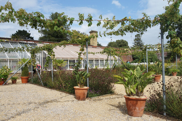
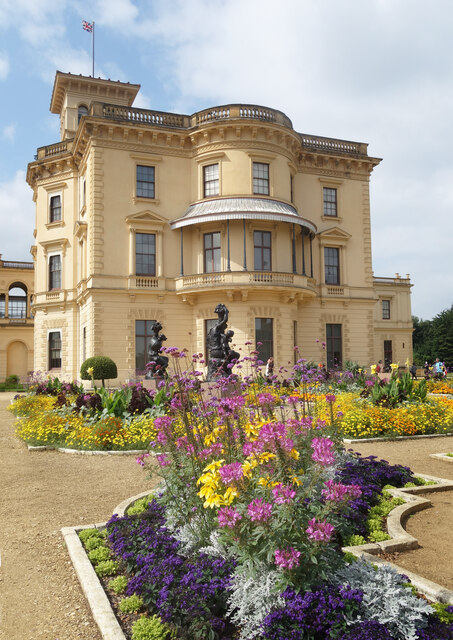
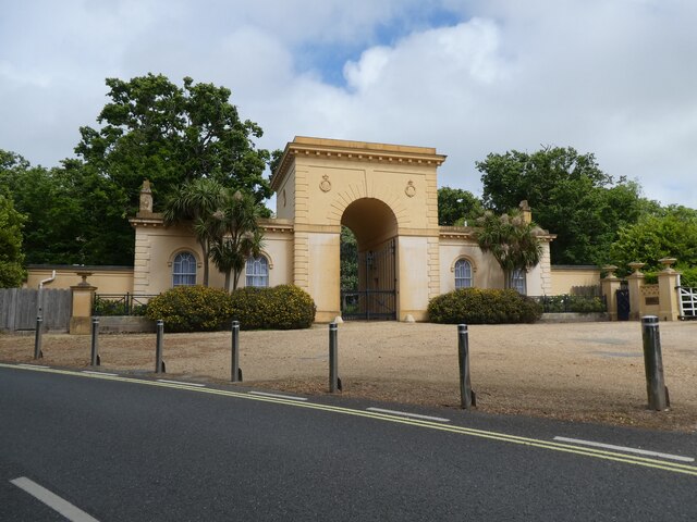
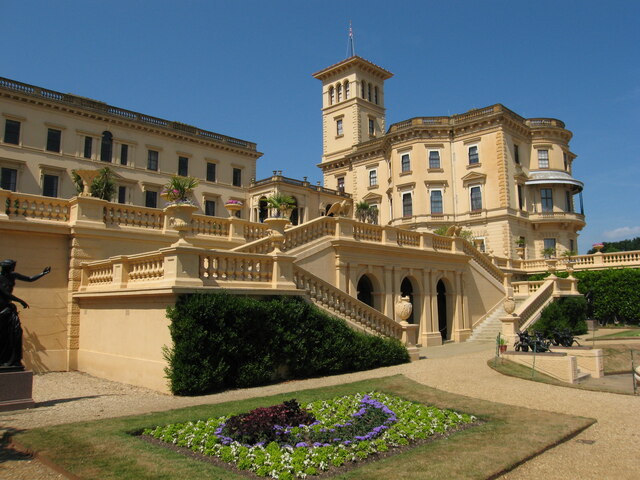
Historically, Whippingham was known for its connection to the British royal family. Osborne House, the former residence of Queen Victoria and Prince Albert, is just a short distance away. The village itself is home to the beautiful All Saints Church, where the royal family attended services during their stays at Osborne House.

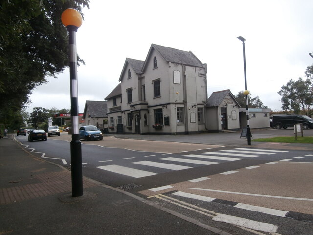
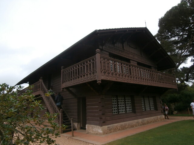
Whippingham has a charming and quintessentially English atmosphere, with many traditional cottages and buildings lining its streets. The village is primarily residential, with a small number of shops and amenities serving the local community.

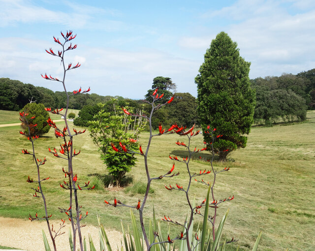
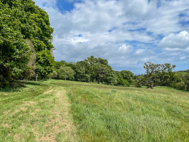
Nature lovers will enjoy exploring the surrounding countryside, which offers scenic walks and opportunities for wildlife spotting. The nearby River Medina also provides a picturesque backdrop for boating and fishing enthusiasts.

Although small in size, Whippingham is well-connected to neighboring towns and cities. The nearby ferry terminal in East Cowes offers regular services to Southampton, making it easily accessible for those wishing to explore further afield.

Overall, Whippingham is a delightful village with a rich history and natural beauty, making it an appealing destination for visitors and a peaceful place to call home.

If you have any feedback on the listing, please let us know in the comments section below.

Whippingham Images

Images are sourced within 2km of 50.737495/-1.2685809 or Grid Reference SZ5193. Thanks to Geograph Open Source API. All images are credited.

Swiss Cottage and Gardens In front of the cottage are the gardens where Victoria and Albert's children each had their own plot to look after.
Swiss Cottage and Gardens
In front of the cottage are the gardens where Victoria and Albert's children each had their own plot to look after.
In the Walled Garden, Osborne House
Seat on the Terrace, Osborne House An intricate ironwork seat on the upper terrace.
Seat on the Terrace, Osborne House
An intricate ironwork seat on the upper terrace.
The  Park at Osborne House Part of the extensive grounds surrounding Osborne House.
The Park at Osborne House
Part of the extensive grounds surrounding Osborne House.
Flower Beds at Osborne House The flower beds on the terraces are planted with varieties that would have been grown in Victorian times.
Flower Beds at Osborne House
The flower beds on the terraces are planted with varieties that would have been grown in Victorian times.
The Prince of Wales The Prince of Wales public house <span class="nowrap"><a title="https://www.iowprinceofwales.co.uk/" rel="nofollow ugc noopener" href="https://www.iowprinceofwales.co.uk/">Link</a><img style="margin-left:2px;" alt="External link" title="External link - shift click to open in new window" src="https://s1.geograph.org.uk/img/external.png" width="10" height="10"/></span> stands just opposite the entrance to Osborne House.  Somehow it looks like a remnant of a once larger building, though older photographs show it looking much as it does now, apart from the replacement of the former refreshment room (the leftmost part of the main block).
The Prince of Wales
The Prince of Wales public house LinkExternal link stands just opposite the entrance to Osborne House. Somehow it looks like a remnant of a once larger building, though older photographs show it looking much as it does now, apart from the replacement of the former refreshment room (the leftmost part of the main block).
The Swiss Cottage, Osborne House The Swiss Cottage was built as a place where Victoria and Albert's children 'could play at being adults and learn the skills that Prince Albert believed would make them better rulers' <span class="nowrap"><a title="https://www.english-heritage.org.uk/visit/places/osborne/things-to-do/swiss-cottage/" rel="nofollow ugc noopener" href="https://www.english-heritage.org.uk/visit/places/osborne/things-to-do/swiss-cottage/">Link</a><img style="margin-left:2px;" alt="External link" title="External link - shift click to open in new window" src="https://s1.geograph.org.uk/img/external.png" width="10" height="10"/></span> . Or alternatively as a place where they were conveniently out of the way a lot of the time.
The Swiss Cottage, Osborne House
The Swiss Cottage was built as a place where Victoria and Albert's children 'could play at being adults and learn the skills that Prince Albert believed would make them better rulers' LinkExternal link . Or alternatively as a place where they were conveniently out of the way a lot of the time.
Paddle Steamer Ryde The slow deterioration of the paddle steamer Ryde continues (see <a title="https://www.geograph.org.uk/photo/1854261" href="https://www.geograph.org.uk/photo/1854261">Link</a> when although still "beached", she was in somewhat better health!!)
Paddle Steamer Ryde
The slow deterioration of the paddle steamer Ryde continues (see Link when although still "beached", she was in somewhat better health!!)
Osborne House
Osborne House
Queen Victoria's death bed, Osborne House
The walled garden, Osborne House
Entrance to the walled garden, Osborne House
Royal Entrance, Osborne House
Osborne House
Osborne House
The Park Parkland at Osborne House.
The Park
Parkland at Osborne House.
Path from Swiss Cottage to Osborne House
Overlooking the terrace of Osborne House
PS Ryde at Binfield The old paddle steamer continues to deteriorate.
PS Ryde at Binfield
The old paddle steamer continues to deteriorate.
Show me another place!

Whippingham is located at Grid Ref: SZ5193 (Lat: 50.737495, Lng: -1.2685809)

Unitary Authority: Isle of Wight

Police Authority: Hampshire

What 3 Words

///buzzards.rejoiced.surpassed. Near East Cowes, Isle of Wight

Related Wikis

Priory School, Isle of Wight

Priory School is a co-educational independent school in Whippingham, Isle of Wight. == History == The school was founded by Elizabeth Joan Goldthorpe in...

Whippingham

Whippingham is a village and civil parish on the Isle of Wight. The population of the Civil Parish at the 2011 Census was 787. It is located 1+1⁄2 miles...

St Mildred's Church, Whippingham

St Mildred's Church, Whippingham is the Church of England parish church of the village of Whippingham, Isle of Wight. == History == The village of Whippingham...

East Cowes Victoria Athletic A.F.C.

East Cowes Victoria Athletic Association Football Club is a football club based in East Cowes, Isle of Wight, England They are currently members of the...

Nearby Amenities

Located within 500m of 50.737495,-1.2685809
Crossing
Crossing: uncontrolled
Crossing Island: yes
Kerb: lowered
Lat/Long: 50.7377638/-1.2686549
Bus Stop
Whippingham Forge
Bus: yes
Contact Website: https://www.islandbuses.info/stops/230000006250
Naptan AtcoCode: 230000006250
Naptan Bearing: N
Naptan CommonName: Whippingham
Naptan Indicator: towards East Cowes
Naptan NaptanCode: iowdwgm
Public Transport: platform
Shelter: yes
Source: naptan_import
Lat/Long: 50.7381039/-1.2688837
Bus Stop
Whippingham Forge
Bench: yes
Bin: yes
Bus: yes
Contact Website: https://www.islandbuses.info/stops/230000006260
Naptan AtcoCode: 230000006260
Naptan Bearing: S
Naptan CommonName: Whippingham
Naptan Indicator: towards Newport
Naptan NaptanCode: iowdwgp
Public Transport: platform
Shelter: yes
Source: naptan_import
Lat/Long: 50.7378991/-1.2685578
Bus Stop
Whippingham, Campfield Road
Bench: yes
Bus: yes
Contact Website: https://www.islandbuses.info/stops/230000006290
Naptan AtcoCode: 230000006290
Naptan Bearing: N
Naptan CommonName: Whippingham Heights
Naptan Indicator: towards East Cowes
Naptan NaptanCode: iowdwgw
Public Transport: platform
Shelter: yes
Short Name: Campfield Road
Source: naptan_import
Tactile Paving: no
Lat/Long: 50.7395008/-1.2693607
Bus Stop
Whippingham, Campfield Road
Bench: yes
Bus: yes
Contact Website: https://www.islandbuses.info/stops/230000006300
Naptan AtcoCode: 230000006300
Naptan Bearing: S
Naptan CommonName: Whippingham Heights
Naptan Indicator: towards Newport
Naptan NaptanCode: iowdwja
Public Transport: platform
Shelter: yes
Short Name: Campfield Road
Source: naptan_import
Tactile Paving: no
Lat/Long: 50.7399586/-1.2692261
Post Box
Whippingham Heights
Check Date Collection Times: 2020-12-12
Collection Plate: CP7D
Collection Times: Mo-Fr 09:00; Sa 07:00; Su off
Operator: Royal Mail
Operator Wikidata: Q638098
Post Box Type: lamp
Ref: PO32 353D
Royal Cypher: EIIR
Royal Cypher Wikidata: Q33102113
Website: https://www.royalmail.com/services-near-you/postbox/whippingham-heights-po32-6fd/000PO32353
Lat/Long: 50.7405783/-1.2693788
Post Box
Collection Plate: CP7
Collection Times: Mo-Fr 16:15; Sa 08:45
Operator: Royal Mail
Operator Wikidata: Q638098
Post Box Type: lamp
Ref: PO32 28
Ref GB Uprn: 10015472292
Royal Cypher: EIIR
Royal Cypher Wikidata: Q33102113
Website: https://www.royalmail.com/services-near-you/postbox/alverstone-road-po30-2qe/0000PO3228
Lat/Long: 50.7372067/-1.2668169
Power: tower
Source: Bing
Lat/Long: 50.7341369/-1.273135
Power: pole
Source: Bing
Lat/Long: 50.7354352/-1.2722462
Power: pole
Source: Bing
Lat/Long: 50.7364337/-1.2741554
Power: pole
Source: Bing
Lat/Long: 50.7369633/-1.2752208
Power: pole
Source: Bing
Lat/Long: 50.7340262/-1.2720725
Crossing
Crossing: uncontrolled
Crossing Island: yes
Kerb: lowered
Source: Bing
Lat/Long: 50.7383294/-1.2689461
Whippingham
Place: village
Source: OS_OpenData_StreetView
Wikidata: Q2382264
Wikipedia: en:Whippingham
Lat/Long: 50.740502/-1.2703607
Crossing
Crossing: uncontrolled
Crossing Island: yes
Kerb: lowered
Source: Bing
Lat/Long: 50.7406795/-1.2695026
Bench
Lat/Long: 50.7384264/-1.2690218
Community Centre
Whippingham Community Centre
Lat/Long: 50.7372343/-1.2681368
Bench
Lat/Long: 50.7380255/-1.2688905
Hiking: yes
Information: guidepost
Tourism: information
Lat/Long: 50.7405609/-1.2733575
Crossing
Button Operated: yes
Crossing: traffic_signals
Crossing Ref: pelican
Kerb: lowered
Source: Mapillary
Lat/Long: 50.7393326/-1.269136
Barrier: stile
Foot: yes
Lat/Long: 50.7405496/-1.2732984
Georges Field (Isle of Wight Pony Club)
Place: locality
Lat/Long: 50.7397347/-1.2743819
Bench
Backrest: yes
Mapillary: 930256251106912
Survey Date: 2018-04-19
Lat/Long: 50.7375902/-1.2684657
Bench
Lat/Long: 50.7370162/-1.2717775
Addr City: Whippingham
Addr Housenumber: 1
Addr Street: Alverstone Road
Lat/Long: 50.7365771/-1.2692998
Addr City: Whippingham
Addr Housenumber: 2
Addr Street: Alverstone Road
Lat/Long: 50.7366014/-1.2693903
Power: substation
Ref GB Uprn: 10025277668
Lat/Long: 50.7370917/-1.2686674
Addr City: Whippingham
Addr Housenumber: 80
Addr Street: Alverstone Road
Lat/Long: 50.7355673/-1.2624698
Addr City: Whippingham
Addr Housenumber: 74
Addr Street: Alverstone Road
Lat/Long: 50.7355706/-1.2627146
Addr City: Whippingham
Addr Housenumber: 76
Addr Street: Alverstone Road
Lat/Long: 50.7355693/-1.2626199
Addr City: Whippingham
Addr Housenumber: 78
Addr Street: Alverstone Road
Lat/Long: 50.7355686/-1.2625454
Addr City: Whippingham
Addr Housenumber: 82
Addr Street: Alverstone Road
Lat/Long: 50.7355558/-1.2622639
Hiking: yes
Information: guidepost
Tourism: information
Lat/Long: 50.7371706/-1.2686768
Traffic Calming: hump
Lat/Long: 50.7367296/-1.2726972
Addr City: Whippingham
Addr Housenumber: 5
Addr Street: Alverstone Road
Lat/Long: 50.7359199/-1.262899
Addr City: Whippingham
Addr Housenumber: 1
Addr Street: Alverstone Road
Lat/Long: 50.736015/-1.2631373
Addr City: Whippingham
Addr Housenumber: 2
Addr Street: Alverstone Road
Lat/Long: 50.7359968/-1.2630849
Addr City: Whippingham
Addr Housenumber: 3
Addr Street: Alverstone Road
Lat/Long: 50.7359712/-1.2630275
Addr City: Whippingham
Addr Housenumber: 4
Addr Street: Alverstone Road
Lat/Long: 50.7359455/-1.2629616
Addr City: Whippingham
Addr Housenumber: 6
Addr Street: Alverstone Road
Lat/Long: 50.7358899/-1.2628365
Addr City: Whippingham
Addr Housenumber: 58
Addr Street: Alverstone Road
Lat/Long: 50.7361037/-1.263358
Addr City: Whippingham
Addr Housenumber: 60
Addr Street: Alverstone Road
Lat/Long: 50.7360732/-1.2632896
Post Office
Whippingham Post Office
Addr City: East Cowes
Addr Country: GB
Addr Housename: Whippingham Community Hall
Addr Postcode: PO32 6NZ
Addr Street: Alverstone Road
Addr Village: Whippingham
Brand: Post Office
Brand Wikidata: Q1783168
Contact Website: https://www.postoffice.co.uk/branch-finder/2984717/whippingham
Ref Pol Id: 129795
Survey Date: 2019-11-09
Lat/Long: 50.7373059/-1.2681536
Defibrillator
Access: yes
Defibrillator Location: On outside shed wall
Emergency: defibrillator
Indoor: no
Level: 0
Opening Hours: 24/7
Survey Date: 2019-11-09
Lat/Long: 50.737365/-1.268072
Power: substation
Ref GB Uprn: 10025277669
Lat/Long: 50.7404582/-1.2685823
Generator Solar Modules: 12
Generator Source: solar
Location: roof
Power: generator
Lat/Long: 50.7411613/-1.2682879
Traffic Signals
Source: Bing
Traffic Signals Direction: forward
Lat/Long: 50.7393085/-1.2691293
Traffic Signals
Source: Bing
Traffic Signals Direction: backward
Lat/Long: 50.7393886/-1.2691517
Crossing
Crossing: uncontrolled
Crossing Island: yes
Kerb: lowered
Lat/Long: 50.7388104/-1.2689749
Barrier: kerb
Lat/Long: 50.7406799/-1.2694433
Barrier: kerb
Lat/Long: 50.7406792/-1.2695459
Barrier: kerb
Lat/Long: 50.73933/-1.2691856
Barrier: kerb
Lat/Long: 50.7393357/-1.269078
Barrier: kerb
Lat/Long: 50.7377713/-1.2685913
Barrier: kerb
Lat/Long: 50.7377572/-1.2687198
Barrier: kerb
Lat/Long: 50.7388169/-1.2689121
Generator Source: solar
Location: roof
Power: generator
Lat/Long: 50.739901/-1.2680921
Generator Source: solar
Location: roof
Power: generator
Lat/Long: 50.737623/-1.2681592
Generator Source: solar
Location: roof
Power: generator
Lat/Long: 50.7368939/-1.2644725
Generator Source: solar
Location: roof
Power: generator
Lat/Long: 50.7368668/-1.2643933
Generator Source: solar
Location: roof
Power: generator
Lat/Long: 50.7368532/-1.2642619
Generator Source: solar
Location: roof
Power: generator
Lat/Long: 50.7368218/-1.2641573
Generator Source: solar
Location: roof
Power: generator
Lat/Long: 50.7368193/-1.2642203
The data included in this document is from www.openstreetmap.org. The data is made available under ODbL.

Have you been to Whippingham?

Leave your review of Whippingham below (or comments, questions and feedback).