Weston Hills

Settlement in Lincolnshire South Holland

England

Weston Hills

Church of St John the Evangelist, Weston Hills Dates from 1888 with the tower added in 1896 <span class="nowrap"><a title="https://historicengland.org.uk/listing/the-list/list-entry/1064469?section=official-list-entry" rel="nofollow ugc noopener" href="https://historicengland.org.uk/listing/the-list/list-entry/1064469?section=official-list-entry">Link</a><img style="margin-left:2px;" alt="External link" title="External link - shift click to open in new window" src="https://s1.geograph.org.uk/img/external.png" width="10" height="10"/></span>
Church of St John the Evangelist, Weston Hills Credit: Jonathan Thacker

Weston Hills is a small village located in the county of Lincolnshire, England. Situated approximately 6 miles northeast of the town of Spalding, it falls under the South Holland district. The village lies on the B1166 road, which connects it to nearby areas and provides convenient access to surrounding towns.

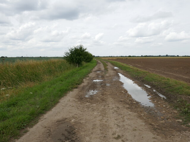
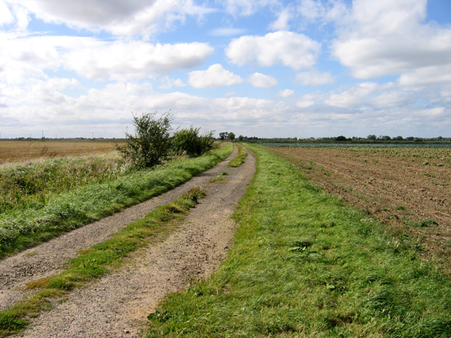
With a population of around 1,200 residents, Weston Hills offers a peaceful and close-knit community atmosphere. The village is surrounded by picturesque countryside, characterized by vast fields and farmland, making it an ideal location for those seeking a rural setting. The nearby Weston Hills Nature Reserve provides an opportunity for locals and visitors alike to enjoy the natural beauty of the area.

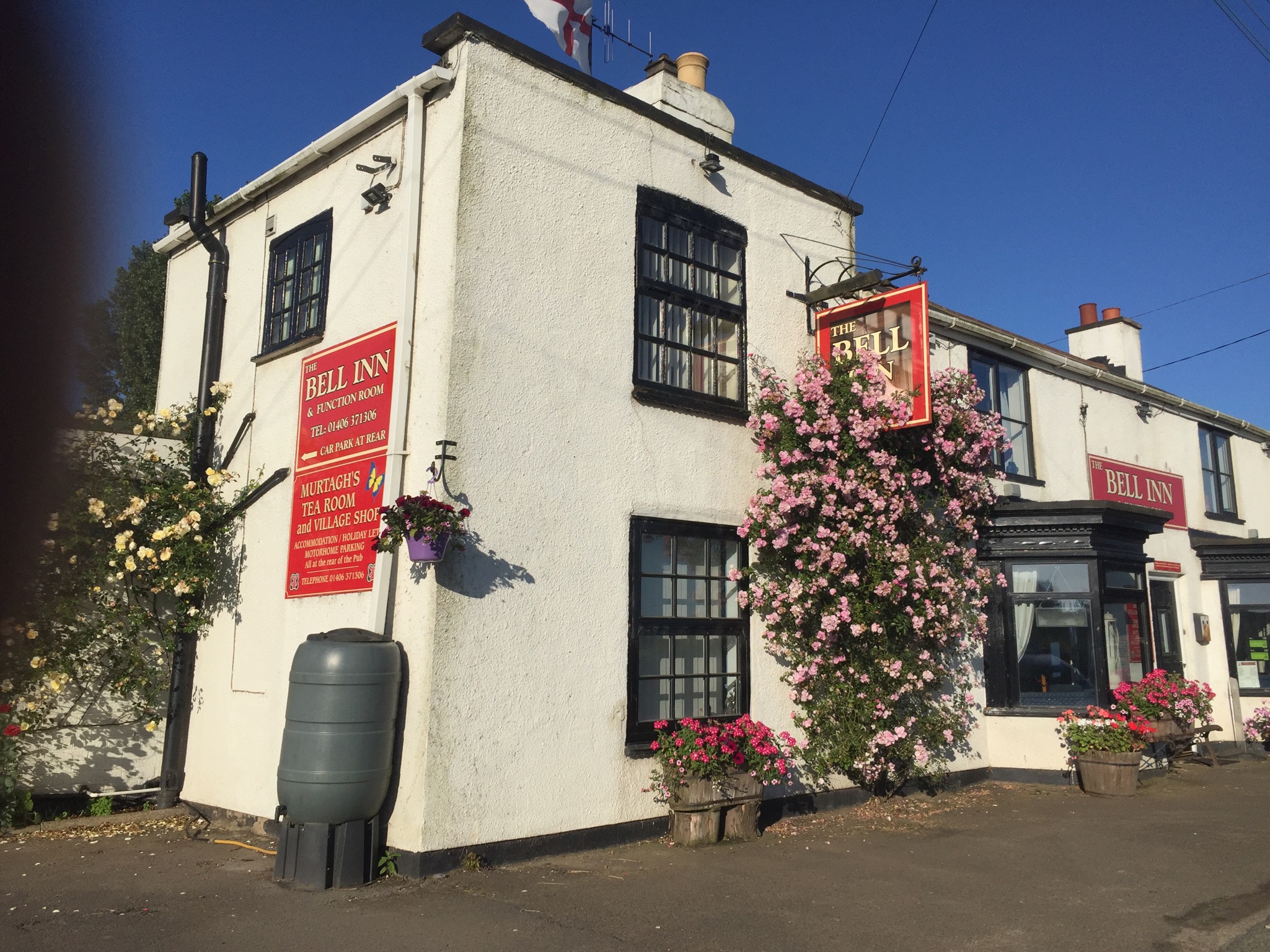
Weston Hills is home to a primary school, providing education for children aged 4 to 11. The village also has a pub, The Bell Inn, which serves as a social hub for locals and visitors, offering a range of food and drink options.

For amenities and services, residents typically rely on nearby towns such as Spalding for shopping, healthcare, and other needs. The village benefits from good transport links, with regular bus services connecting it to Spalding and other surrounding areas.

Overall, Weston Hills offers a tranquil and picturesque setting, making it an attractive place to reside for those seeking a slower pace of life in the heart of rural Lincolnshire.

If you have any feedback on the listing, please let us know in the comments section below.

Weston Hills Images

Images are sourced within 2km of 52.772092/-0.096631 or Grid Reference TF2821. Thanks to Geograph Open Source API. All images are credited.

Church of St John the Evangelist, Weston Hills Dates from 1888 with the tower added in 1896 <span class="nowrap"><a title="https://historicengland.org.uk/listing/the-list/list-entry/1064469?section=official-list-entry" rel="nofollow ugc noopener" href="https://historicengland.org.uk/listing/the-list/list-entry/1064469?section=official-list-entry">Link</a><img style="margin-left:2px;" alt="External link" title="External link - shift click to open in new window" src="https://s1.geograph.org.uk/img/external.png" width="10" height="10"/></span>
Church of St John the Evangelist, Weston Hills
Dates from 1888 with the tower added in 1896 LinkExternal link
Delgate Bank and Swanpens Farm
Potato field and farm buildings, West Gate
Whirl Gate A byway.
Whirl Gate
A byway.
Whirl Gate, Moulton, Lincs View west along the public-access track from the B1357 Fen Gate.
Whirl Gate, Moulton, Lincs
View west along the public-access track from the B1357 Fen Gate.
Broad Gate, Weston Hills, Lincs
Delgate Bank Old straw bales on Delgate Bank
Delgate Bank
Old straw bales on Delgate Bank
Delgate Bank View north along Delgate Bank near Swanpens Farm
Delgate Bank
View north along Delgate Bank near Swanpens Farm
View to Weston Hills Fenland view from Delgate Bank
View to Weston Hills
Fenland view from Delgate Bank
Delgate Bank Looking north along Delgate Bank
Delgate Bank
Looking north along Delgate Bank
Sewage Works Track to the sewage works from Delgate Bank.
Sewage Works
Track to the sewage works from Delgate Bank.
Swanpens Farm Farm adjacent to Delegate Bank
Swanpens Farm
Farm adjacent to Delegate Bank
The Sycamores Farm Buildings at The Sycamores from West Gate.
The Sycamores
Farm Buildings at The Sycamores from West Gate.
Drain off Delgate Bank
Track to sewage works
Delgate Bank heading north
Farmland off Broad Gate
Broad Gate heading south
Show me another place!

Weston Hills is located at Grid Ref: TF2821 (Lat: 52.772092, Lng: -0.096631)

Division: Parts of Holland

Administrative County: Lincolnshire

District: South Holland

Police Authority: Lincolnshire

What 3 Words

///earphones.perfect.snuggled. Near Moulton Chapel, Lincolnshire

Nearby Locations

Weston Hills

Related Wikis

Weston Hills, Lincolnshire

Weston Hills is a hamlet in the civil parish of Weston in the South Holland district of Lincolnshire, England. Weston Hills, a linear village on a north...

Austendike

Austendike is a village in the civil parish of Moulton in Lincolnshire, England. The population is included in the civil parish of Weston

Weston railway station (Lincolnshire)

Weston railway station was a station in Weston, Lincolnshire on the Midland and Great Northern Joint Railway, Built by the Norwich and Spalding Railway...

South Holland and The Deepings (UK Parliament constituency)

South Holland and The Deepings is a constituency in Lincolnshire represented in the House of Commons of the UK Parliament since its 1997 creation by John...

Related Videos

Found a hidden Drain full of earth

A customer that I have been to 3 times because of a blocked drain. I didn't expect to see that one of them would be a drain full of ...

Santas WinterWonderland - Baytree Garden Center 2023

Visiting Santas grotto at Baytree garden center in Spalding Lincolnshire for Jude's first Christmas! #christmas #grotto #winter ...

Lincolnshire walk

Beautiful Rural Lincolnshire, UK walk..

Paul & Lynsey's Zoo Tour #94 Baytree Owl and Wildlife Centre

We spent a nice couple of hours walking round the Baytree Owl and Wildlife Centre. The collection is small but has a nice array of ...

Nearby Amenities

Located within 500m of 52.772092,-0.096631
Power: pole
Source: bing
Lat/Long: 52.770907/-0.0941598
Power: pole
Source: bing
Lat/Long: 52.7719027/-0.1004121
Power: pole
Source: bing
Lat/Long: 52.7709559/-0.0981797
Power: pole
Source: bing
Lat/Long: 52.7709689/-0.099443
Power: pole
Source: bing
Lat/Long: 52.7710238/-0.1024666
Power: pole
Source: bing
Lat/Long: 52.7709524/-0.0969332
Power: pole
Source: bing
Lat/Long: 52.771449/-0.0900158
Power: pole
Source: bing
Lat/Long: 52.7712934/-0.0913481
Power: pole
Source: bing
Lat/Long: 52.7712837/-0.0973187
Power: pole
Source: bing
Lat/Long: 52.770938/-0.0957201
Power: pole
Source: bing
Lat/Long: 52.7709754/-0.1038204
Power: pole
Source: bing
Lat/Long: 52.7715952/-0.0988556
Power: pole
Source: bing
Lat/Long: 52.7706054/-0.0940678
Power: pole
Source: bing
Lat/Long: 52.7699644/-0.0909618
Power: pole
Source: bing
Lat/Long: 52.7701962/-0.0920597
Power: pole
Source: bing
Lat/Long: 52.7703052/-0.0926677
Power: pole
Source: bing
Lat/Long: 52.7741509/-0.10157
Power: pole
Source: bing
Lat/Long: 52.7739399/-0.1001109
Turning Circle
Lat/Long: 52.7750802/-0.0999128
Turning Circle
Lat/Long: 52.7752365/-0.0997954
Halgarth Farm
Place: farm
Source: Bing
Lat/Long: 52.769679/-0.1020977
West View Farm
Place: farm
Source: Bing
Lat/Long: 52.7712379/-0.1009646
Magpie Holt Farm
Historic Place: farm
Source: Bing
Lat/Long: 52.7683487/-0.0925438
Power: pole
Lat/Long: 52.7677128/-0.0963759
Power: pole
Lat/Long: 52.7677358/-0.0979399
Note: End of Public Highway
Lat/Long: 52.7698751/-0.1023678
The data included in this document is from www.openstreetmap.org. The data is made available under ODbL.

Have you been to Weston Hills?

Leave your review of Weston Hills below (or comments, questions and feedback).