Braidley

Settlement in Yorkshire Richmondshire

England

Braidley

Ford and Footbridge at Braidley This ford is found on the River Cover at Braidley.
Ford and Footbridge at Braidley Credit: John Walton

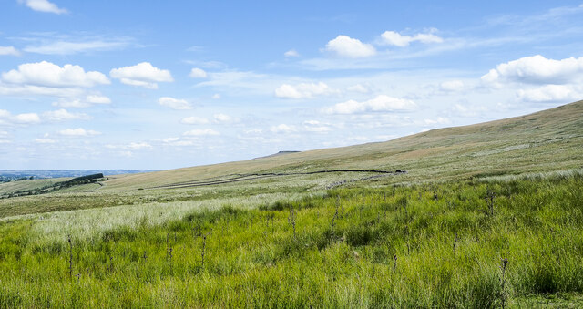
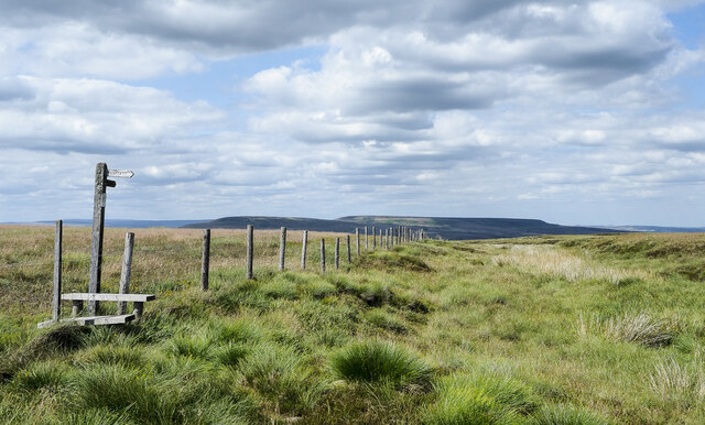
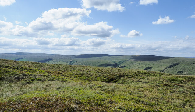
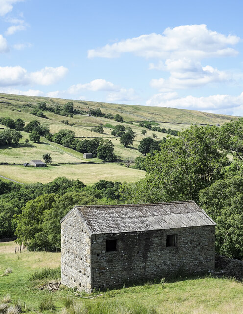
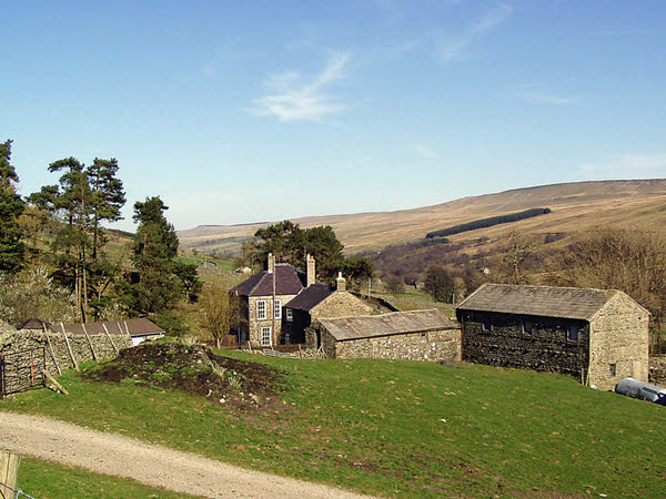
Braidley is a small village located in the county of Yorkshire, England. Situated in the picturesque Yorkshire Dales, Braidley is surrounded by rolling hills, lush green fields, and charming countryside scenery. It is a tranquil and idyllic setting, perfect for those seeking a peaceful retreat away from the hustle and bustle of city life.

The village itself is relatively small, with a population of around 200 residents. The community in Braidley is close-knit and friendly, with a strong sense of community spirit. The village is known for its warm and welcoming atmosphere, making it a popular destination for tourists and visitors.

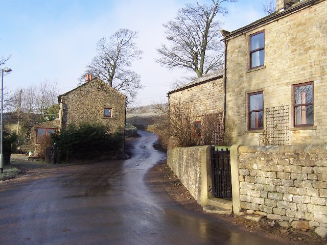
Braidley is rich in history and heritage, with traces of its past evident throughout the village. The architecture of the houses and buildings reflects the traditional Yorkshire style, adding to the charm and character of the area. The village is also home to a quaint church, which dates back several centuries.

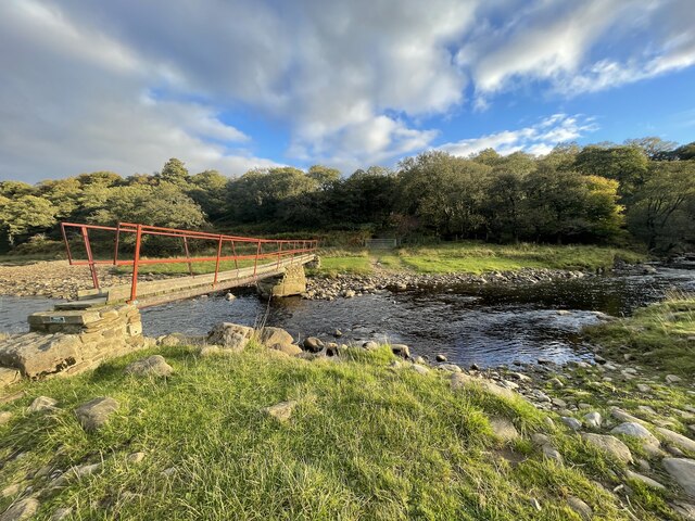
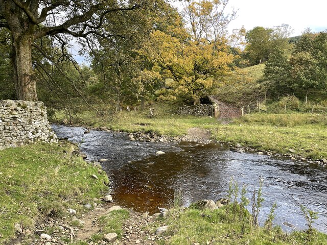
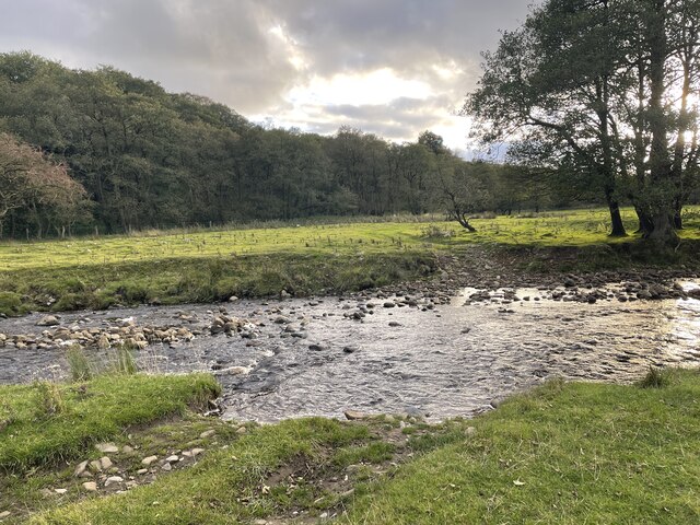
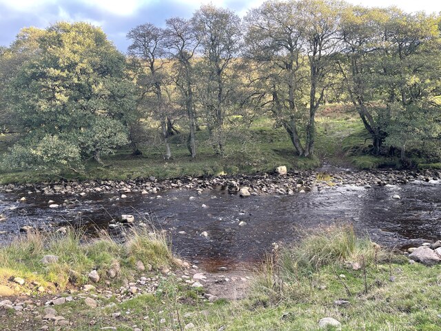
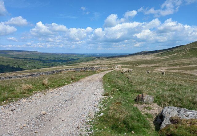
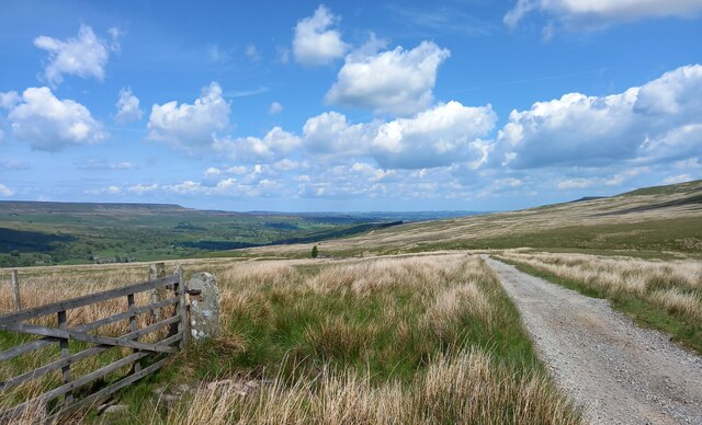
Nature enthusiasts will find Braidley to be a haven for outdoor activities. The surrounding countryside offers numerous walking and hiking trails, allowing visitors to explore the stunning landscapes and enjoy breathtaking views. The village is also located close to several nature reserves and parks, providing opportunities for birdwatching, wildlife spotting, and picnicking.

Although Braidley is a small village, it is within close proximity to larger towns and cities. The nearby market town of Skipton offers a range of amenities, including shops, restaurants, and leisure facilities. Braidley is also well-connected by road, making it easily accessible to those traveling from other parts of the country.

Overall, Braidley is a charming and picturesque village in Yorkshire, offering a peaceful and serene escape for residents and visitors alike.

If you have any feedback on the listing, please let us know in the comments section below.
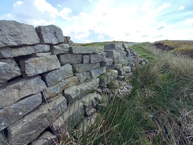
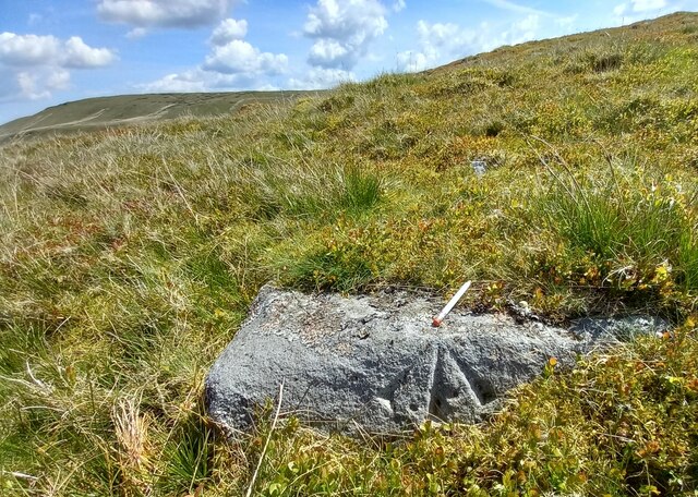
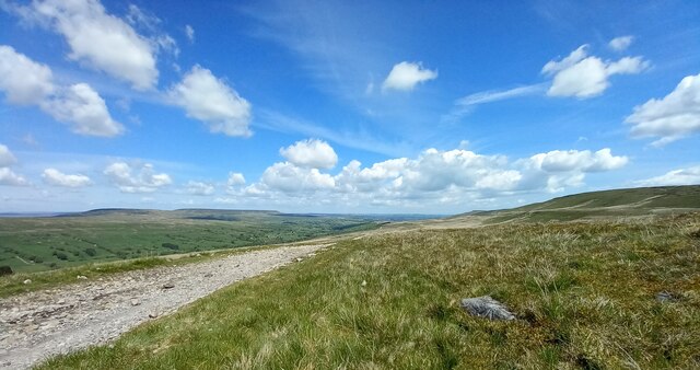
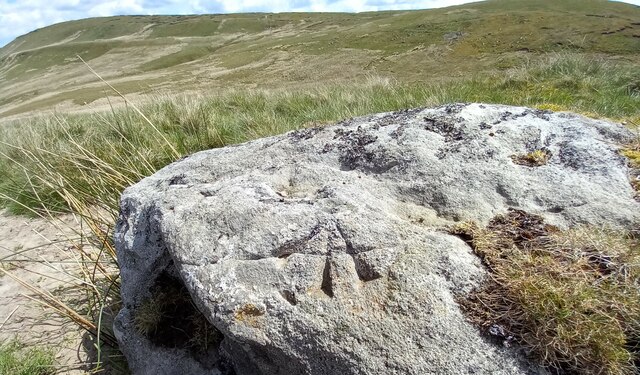
Braidley Images

Images are sourced within 2km of 54.216096/-1.948916 or Grid Reference SE0380. Thanks to Geograph Open Source API. All images are credited.

Ford and Footbridge at Braidley This ford is found on the River Cover at Braidley.
Ford and Footbridge at Braidley
This ford is found on the River Cover at Braidley.
Ford on the River Cover This is a second ford on the River Cover at Braidley.
Ford on the River Cover
This is a second ford on the River Cover at Braidley.
River Cover Ford A third ford on the River Cover at this location.
River Cover Ford
A third ford on the River Cover at this location.
River Cover Ford This is another of the series of fords on the River Cover at this location.
River Cover Ford
This is another of the series of fords on the River Cover at this location.
River Cover Ford This is the final ford at this stretch of the River Cover.
River Cover Ford
This is the final ford at this stretch of the River Cover.
Sun and mist in Coverdale A similar view to one taken almost 3 years previously, but on this occasion the late November sun contrasted with lengthening shadows and mist that was creeping over the fell tops from Nidderdale.
Sun and mist in Coverdale
A similar view to one taken almost 3 years previously, but on this occasion the late November sun contrasted with lengthening shadows and mist that was creeping over the fell tops from Nidderdale.
Mist creeping into the dale The view up Coverdale towards Woodale on a late autumn afternoon when mist was creeping in over the felltops to eventually fill the valley.
Mist creeping into the dale
The view up Coverdale towards Woodale on a late autumn afternoon when mist was creeping in over the felltops to eventually fill the valley.
Moorland with Arkleside Pasture Arkleside Pasture is an area of enclosed, marginal farmland on the south side of Coverdale above the small settlement of Arkleside; it lies beyond the rough vegetation in the foreground and the groove of Arkleside Gill which can just be discerned in the image.
Moorland with Arkleside Pasture
Arkleside Pasture is an area of enclosed, marginal farmland on the south side of Coverdale above the small settlement of Arkleside; it lies beyond the rough vegetation in the foreground and the groove of Arkleside Gill which can just be discerned in the image.
Fence with stile and footpath indicator The fence descends from the ridge between Little Whernside and Dead Man's Hill going down beside Harkera Gill. The route of the public footpath indicated by the finger post follows a similar route.
Pen Hill is the flat-topped feature in the distance.
Fence with stile and footpath indicator
The fence descends from the ridge between Little Whernside and Dead Man's Hill going down beside Harkera Gill. The route of the public footpath indicated by the finger post follows a similar route. Pen Hill is the flat-topped feature in the distance.
Rough moorland slope on Little Whernside The location is east-north-east of Little Whernside's summit where there's heather and grass moorland mingled with bilberry.
Buckden Pike is at the far left of the image with hill domes on the north side of Coverdale nearer and to the right.
Rough moorland slope on Little Whernside
The location is east-north-east of Little Whernside's summit where there's heather and grass moorland mingled with bilberry. Buckden Pike is at the far left of the image with hill domes on the north side of Coverdale nearer and to the right.
Large barn beside Harkera Gill The barn appears to be in good repair. Harkera Gill flows unseen within the trees as it descends to join the River Cover.
Large barn beside Harkera Gill
The barn appears to be in good repair. Harkera Gill flows unseen within the trees as it descends to join the River Cover.
West parapet of bridge near Little Whernside According to the OS benchmark database there is a benchmark cut into the west face of the bridge, and on the north side of the stream. The bridge has gone through several repairs and refits, and nothing was found.
West parapet of bridge near Little Whernside
According to the OS benchmark database there is a benchmark cut into the west face of the bridge, and on the north side of the stream. The bridge has gone through several repairs and refits, and nothing was found.
Pivot benchmark cut into boulder on moorland, Nidderdale The pivot benchmark is cut into a large boulder on the east side of the track which leads from Scar House reservoir to Horsehouse in Coverdale. Wider view <a href="https://www.geograph.org.uk/photo/7557646">SE0478 : Views to Coverdale</a>
Pivot benchmark cut into boulder on moorland, Nidderdale
The pivot benchmark is cut into a large boulder on the east side of the track which leads from Scar House reservoir to Horsehouse in Coverdale. Wider view SE0478 : Views to Coverdale
Views to Coverdale There is a pivot benchmark cut into the large boulder on the east side of the track which leads from Scar House reservoir to Horsehouse in Coverdale. Closer view <a href="https://www.geograph.org.uk/photo/7557645">SE0478 : Pivot benchmark cut into boulder on moorland, Nidderdale</a>
Views to Coverdale
There is a pivot benchmark cut into the large boulder on the east side of the track which leads from Scar House reservoir to Horsehouse in Coverdale. Closer view SE0478 : Pivot benchmark cut into boulder on moorland, Nidderdale
Benchmark cut into boulder, Nidderdale The pivot benchmark is cut into a large boulder on the east side of the track which leads from Scar House reservoir to Horsehouse in Coverdale. Wider view <a href="https://www.geograph.org.uk/photo/7557650">SE0479 : Views to Coverdale</a>
Benchmark cut into boulder, Nidderdale
The pivot benchmark is cut into a large boulder on the east side of the track which leads from Scar House reservoir to Horsehouse in Coverdale. Wider view SE0479 : Views to Coverdale
Views to Coverdale There is a pivot benchmark cut into the large boulder on the east side of the track which leads from Scar House reservoir to Horsehouse in Coverdale. Closer view <a href="https://www.geograph.org.uk/photo/7557648">SE0479 : Benchmark cut into boulder, Nidderdale</a>
Views to Coverdale
There is a pivot benchmark cut into the large boulder on the east side of the track which leads from Scar House reservoir to Horsehouse in Coverdale. Closer view SE0479 : Benchmark cut into boulder, Nidderdale
Benchmark cut into gatepost, Nidderdale The benchmark is cut into a stone gatepost on the west side of the track which leads from Scar House reservoir to Horsehouse in Coverdale. Wider view <a href="https://www.geograph.org.uk/photo/7557652">SE0479 : Views to Coverdale</a>
Benchmark cut into gatepost, Nidderdale
The benchmark is cut into a stone gatepost on the west side of the track which leads from Scar House reservoir to Horsehouse in Coverdale. Wider view SE0479 : Views to Coverdale
Views to Coverdale There is a benchmark cut into the stone gatepost on the west side of the track which leads from Scar House reservoir to Horsehouse in Coverdale. Closer view <a href="https://www.geograph.org.uk/photo/7557651">SE0479 : Benchmark cut into gatepost, Nidderdale</a>
Views to Coverdale
There is a benchmark cut into the stone gatepost on the west side of the track which leads from Scar House reservoir to Horsehouse in Coverdale. Closer view SE0479 : Benchmark cut into gatepost, Nidderdale
Show me another place!

Braidley is located at Grid Ref: SE0380 (Lat: 54.216096, Lng: -1.948916)

Division: West Riding

Administrative County: North Yorkshire

District: Richmondshire

Police Authority: North Yorkshire

What 3 Words

///bath.trombone.lobster. Near Leyburn, North Yorkshire

Nearby Locations

Braidley

Related Wikis

Braidley

Braidley is a hamlet in Coverdale in the Yorkshire Dales, England. It lies in the civil parish of Carlton Highdale in the Richmondshire district of North...

Carlton Highdale

Carlton Highdale is a civil parish in Coverdale, North Yorkshire, England. According to the 2001 census it had a population of 95. The parish covers the...

Woodale

Woodale is a hamlet in Coverdale in the Yorkshire Dales in England. It lies in the civil parish of Carlton Highdale in the Richmondshire district of North...

Horsehouse

Horsehouse is a village in Coverdale in the Yorkshire Dales, North Yorkshire, England. It is listed as a hamlet in many texts, but the presence of the...

Nearby Amenities

Located within 500m of 54.216096,-1.948916
Braidley
Place: hamlet
Wikidata: Q4955664
Lat/Long: 54.2158998/-1.9487112
Post Box
Post Box Type: lamp
Royal Cypher: EIIR
Royal Cypher Wikidata: Q33102113
Lat/Long: 54.2155958/-1.9498706
Ford: yes
Lat/Long: 54.2139662/-1.9493577
Power: pole
Lat/Long: 54.2127244/-1.9523337
Power: pole
Lat/Long: 54.2131419/-1.9508487
Power: pole
Lat/Long: 54.2135688/-1.9493819
Power: pole
Lat/Long: 54.2139836/-1.9478991
Power: pole
Lat/Long: 54.2143478/-1.9469638
Power: pole
Lat/Long: 54.2147026/-1.946049
Power: pole
Lat/Long: 54.2152895/-1.9445275
Power: pole
Lat/Long: 54.2157257/-1.9433732
Power: pole
Lat/Long: 54.2159725/-1.945043
Power: pole
Lat/Long: 54.21649/-1.9454468
Power: pole
Lat/Long: 54.2173357/-1.9463045
Power: pole
Lat/Long: 54.2162926/-1.9419383
The data included in this document is from www.openstreetmap.org. The data is made available under ODbL.

Have you been to Braidley?

Leave your review of Braidley below (or comments, questions and feedback).