Westbrook

Settlement in Kent Thanet

England

Westbrook

Arlington House Arlington House seen from the exit of Margate railway station. Built in 1964 as luxury apartments in the brutalist style.
Arlington House Credit: Daniel Parks

Westbrook is a small village located in Kent, England. Situated approximately 10 miles east of Canterbury, it is part of the larger civil parish of St. Nicholas-at-Wade. With a population of around 500 residents, Westbrook offers a peaceful and close-knit community atmosphere.

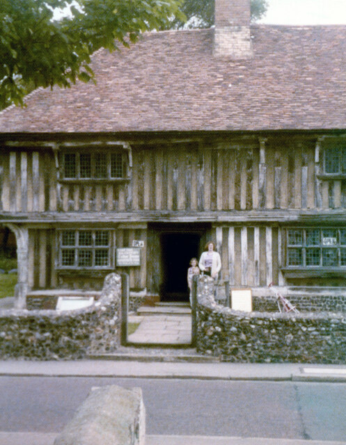
The village is surrounded by picturesque countryside, characterized by lush green fields and rolling hills. It is well-known for its charming thatched cottages and historic buildings, giving it a quintessential English village feel. The local church, St. John the Baptist, is a prominent landmark and dates back to the 13th century.

Despite its small size, Westbrook offers some amenities to its residents. These include a village hall, a primary school, and a pub. The village hall serves as a hub for various community events and gatherings, while the primary school provides education for the local children. The pub, known as The Dog Inn, is a popular spot for locals and visitors alike to enjoy a drink or a meal.

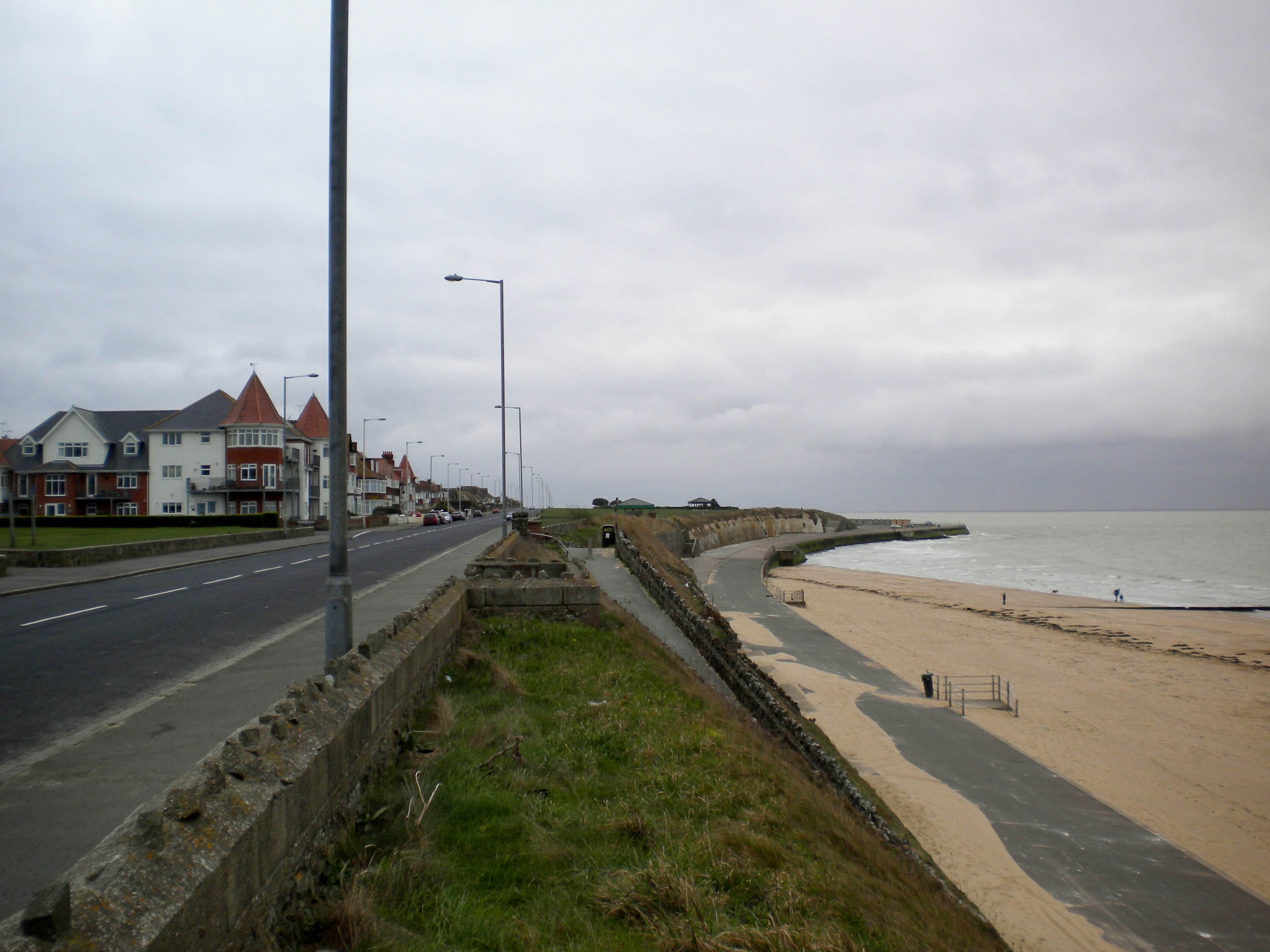
For those seeking outdoor activities, Westbrook has ample opportunities. The village is surrounded by beautiful walking trails, offering residents the chance to explore the picturesque countryside. Additionally, the nearby coast is within easy reach, providing access to sandy beaches and scenic coastal paths.

Overall, Westbrook exudes a sense of tranquility and charm, making it an attractive place to live for those who appreciate the beauty of rural Kent.

If you have any feedback on the listing, please let us know in the comments section below.
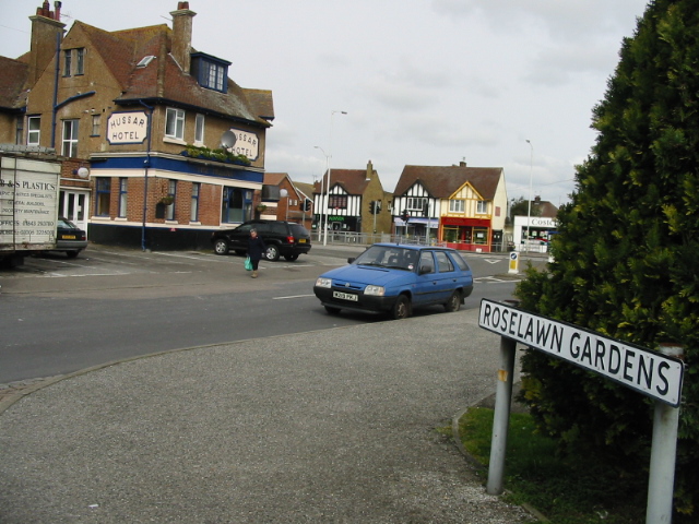
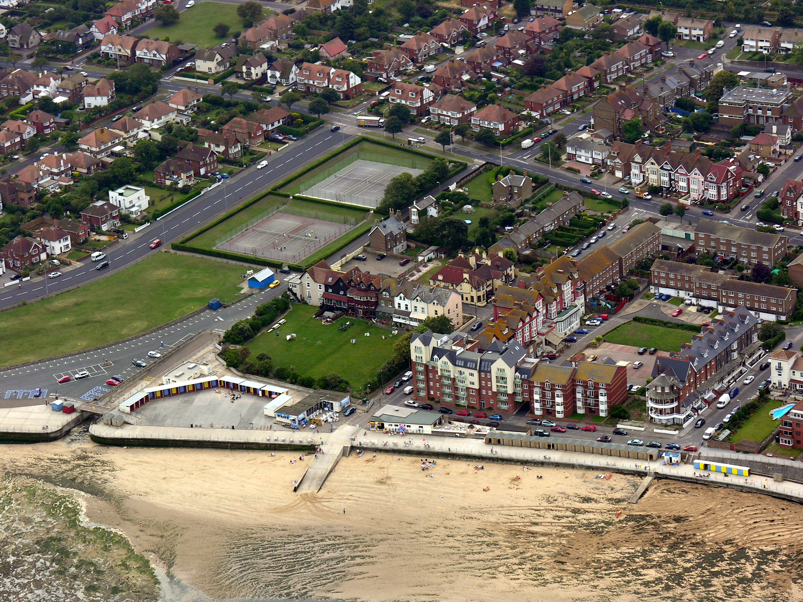
Westbrook Images

Images are sourced within 2km of 51.382425/1.35861 or Grid Reference TR3370. Thanks to Geograph Open Source API. All images are credited.

Arlington House Arlington House seen from the exit of Margate railway station. Built in 1964 as luxury apartments in the brutalist style.
Arlington House
Arlington House seen from the exit of Margate railway station. Built in 1964 as luxury apartments in the brutalist style.
Platform 1, Margate Station The station entrance is to the right of the photograph.
Platform 1, Margate Station
The station entrance is to the right of the photograph.
Nayland Rock Hotel The Nayland Rock Hotel seen from the Royal Crescent Promenade. Built as a crescent in the mid-19th Century, it is Grade II listed and currently due to be renovated and reopened as a spa and hotel. Arlington House is seen in the background.
Nayland Rock Hotel
The Nayland Rock Hotel seen from the Royal Crescent Promenade. Built as a crescent in the mid-19th Century, it is Grade II listed and currently due to be renovated and reopened as a spa and hotel. Arlington House is seen in the background.
Margate beach and the Ferris wheel
Tudor house, King Street, Margate Grade II* Listed house. Originally a yeoman farmer's house it was built in 1525 and reputedly the oldest building in old Margate. King Street was previously called Bridge Street as when the Tudor House was built, it stood on the banks of a stream which ran along King Street and there was once a crossing point here. In the 18th century it had a sizeable farmyard surrounding it with a malthouse, which still exists, to the rear. Francis Cobb was recorded as owner of the farmhouse in 1802. In 1815 it had lost much of the land and was subdivided into 3 cottages. Purchased by the council in the 1930s for slum clearance it was saved by a local builder who discovered its Tudor origins and Mayor, Alderman Cllr Claude Hosking funded the restoration, which was completed in 1951. It is currently (2022) open to visitors 2 to 3 days a week 6 months of the year.
This 1979 picture shows only about half the building, the best our then camera would do.
Tudor house, King Street, Margate
Grade II* Listed house. Originally a yeoman farmer's house it was built in 1525 and reputedly the oldest building in old Margate. King Street was previously called Bridge Street as when the Tudor House was built, it stood on the banks of a stream which ran along King Street and there was once a crossing point here. In the 18th century it had a sizeable farmyard surrounding it with a malthouse, which still exists, to the rear. Francis Cobb was recorded as owner of the farmhouse in 1802. In 1815 it had lost much of the land and was subdivided into 3 cottages. Purchased by the council in the 1930s for slum clearance it was saved by a local builder who discovered its Tudor origins and Mayor, Alderman Cllr Claude Hosking funded the restoration, which was completed in 1951. It is currently (2022) open to visitors 2 to 3 days a week 6 months of the year. This 1979 picture shows only about half the building, the best our then camera would do.
The Turner Contemporary, Margate To mark their 10th anniversary, the current exhibition celebrates and showcases the wealth of artistic talent living, working and training in Kent. Here, The Sunley Gallery displays the new exhibition called Sirens. Paintings are by Sophie von Hellermann and cut-outs by Ann Ryan. Both artists live and work in Margate.
The Turner Contemporary, Margate
To mark their 10th anniversary, the current exhibition celebrates and showcases the wealth of artistic talent living, working and training in Kent. Here, The Sunley Gallery displays the new exhibition called Sirens. Paintings are by Sophie von Hellermann and cut-outs by Ann Ryan. Both artists live and work in Margate.
The Turner Contemporary, Margate To mark their 10th anniversary, the current exhibition celebrates and showcases the wealth of artistic talent living, working and training in Kent. Here, The Sunley Gallery displays the new exhibition called Sirens. Paintings are by Sophie von Hellermann and cut-outs by Ann Ryan. Both artists live and work in Margate. The gallery shop is on the right.
The Turner Contemporary, Margate
To mark their 10th anniversary, the current exhibition celebrates and showcases the wealth of artistic talent living, working and training in Kent. Here, The Sunley Gallery displays the new exhibition called Sirens. Paintings are by Sophie von Hellermann and cut-outs by Ann Ryan. Both artists live and work in Margate. The gallery shop is on the right.
Margate Harbour and the stone pier Viewed from the top of the steps of The Turner Contemporary Gallery. On the right is Droit House, now the information centre.  The stone pier is known as the Harbour Arm and was built between 1812 and 1815. The lighthouse at the end was rebuilt in 1955.
Margate Harbour and the stone pier
Viewed from the top of the steps of The Turner Contemporary Gallery. On the right is Droit House, now the information centre. The stone pier is known as the Harbour Arm and was built between 1812 and 1815. The lighthouse at the end was rebuilt in 1955.
Space in front of Margate station
Promenade and beach in Margate
Margate : special offer
Margate : clock tower "Built in 1888-9 to commemorate Queen Victoria's Golden Jubilee in 1887." - <span class="nowrap"><a title="https://historicengland.org.uk/listing/the-list/list-entry/1351073?section=official-list-entry" rel="nofollow ugc noopener" href="https://historicengland.org.uk/listing/the-list/list-entry/1351073?section=official-list-entry">Link</a><img style="margin-left:2px;" alt="External link" title="External link - shift click to open in new window" src="https://s1.geograph.org.uk/img/external.png" width="10" height="10"/></span>.
Margate : clock tower
"Built in 1888-9 to commemorate Queen Victoria's Golden Jubilee in 1887." - LinkExternal link.
Margate : Turner Contemporary To the right, Droit House. Turner Contemporary was completed in 2011 : it is built to a design by architect David Chipperfield.
Margate : Turner Contemporary
To the right, Droit House. Turner Contemporary was completed in 2011 : it is built to a design by architect David Chipperfield.
Margate : T.S. Eliot plaque, Margate Railway Station
Margate : Tudor House Grade II* listed - description at this <span class="nowrap"><a title="https://historicengland.org.uk/listing/the-list/list-entry/1351107?section=official-list-entry" rel="nofollow ugc noopener" href="https://historicengland.org.uk/listing/the-list/list-entry/1351107?section=official-list-entry">Link</a><img style="margin-left:2px;" alt="External link" title="External link - shift click to open in new window" src="https://s1.geograph.org.uk/img/external.png" width="10" height="10"/></span>.
Margate : Tudor House
Grade II* listed - description at this LinkExternal link.
Margate : former post office Architect: Henry Collins
Year: 1910
Listed building status: Grade II - <span class="nowrap"><a title="https://historicengland.org.uk/listing/the-list/list-entry/1241810?section=official-list-entry" rel="nofollow ugc noopener" href="https://historicengland.org.uk/listing/the-list/list-entry/1241810?section=official-list-entry">Link</a><img style="margin-left:2px;" alt="External link" title="External link - shift click to open in new window" src="https://s1.geograph.org.uk/img/external.png" width="10" height="10"/></span>. 
**Archive sources**
British Postal Museum and Archive: POST 91/2316
National Archives: WORK 13/349
**Selected bibliographical references**
Academy Architecture 1911, pt 2, p. 133)
Architect & Building News 17 Aug 1928, p. 217 (illustration)
Builder 2 May 1908, p. 518
Western Gazette 22 July 1910, p. 4
**History**
Opened: 19 July 1910
​Closed: 18 Mar 2015
Current use: Restaurant
Margate : former post office
Architect: Henry Collins Year: 1910 Listed building status: Grade II - LinkExternal link. **Archive sources** British Postal Museum and Archive: POST 91/2316 National Archives: WORK 13/349 **Selected bibliographical references** Academy Architecture 1911, pt 2, p. 133) Architect & Building News 17 Aug 1928, p. 217 (illustration) Builder 2 May 1908, p. 518 Western Gazette 22 July 1910, p. 4 **History** Opened: 19 July 1910 ​Closed: 18 Mar 2015 Current use: Restaurant
Margate : Cecil Square Baptist Church "A view of Cecil Square Baptist Church (Margate Baptist Church) in Cecil Square, Margate, Kent. The Cecil Square building dates from 1899 when it was built as an extension to the existing Ebenezer Chapel (1815) in New Street." - <span class="nowrap"><a title="http://www.visitoruk.com/Margate/cecil-square-baptist-church-I2530.html" rel="nofollow ugc noopener" href="http://www.visitoruk.com/Margate/cecil-square-baptist-church-I2530.html">Link</a><img style="margin-left:2px;" alt="External link" title="External link - shift click to open in new window" src="https://s1.geograph.org.uk/img/external.png" width="10" height="10"/></span>
Margate : Cecil Square Baptist Church
"A view of Cecil Square Baptist Church (Margate Baptist Church) in Cecil Square, Margate, Kent. The Cecil Square building dates from 1899 when it was built as an extension to the existing Ebenezer Chapel (1815) in New Street." - LinkExternal link
Margate : Lifeboat station
Show me another place!

Westbrook is located at Grid Ref: TR3370 (Lat: 51.382425, Lng: 1.35861)

Administrative County: Kent

District: Thanet

Police Authority: Kent

What 3 Words

///glassware.command.roadblock. Near Westgate on Sea, Kent

Nearby Locations

Westbrook Bay Westbrook

Related Wikis

Westbrook, Kent

Westbrook is a Victorian seaside resort on the Thanet peninsula in the southeast corner of England. It is the westernmost part of Margate and is part of...

Garlinge

Garlinge is a village and suburb of Margate in Kent, England, situated 2 miles (3.2 km) southwest of the centre of the town. It is in the Thanet local...

Royal Sea Bathing Hospital

The Royal Sea Bathing Hospital in Margate, Kent was founded in 1791 by Dr John Coakley Lettsom, a Quaker physician and philanthropist, for the treatment...

Margate West

Margate West is an electoral division of Kent County Council covering Westgate-on-Sea, Westbrook and Garlinge. In the 2009 election, 3668 people voted...

Nearby Amenities

Located within 500m of 51.382425,1.35861
Direction: both
Traffic Calming: island
Lat/Long: 51.3808894/1.3590877
Mini Roundabout
Direction: clockwise
Lat/Long: 51.3780402/1.3589709
Turning Circle
Lat/Long: 51.3816519/1.351595
Bicycle Parking
Bicycle Parking: stands
Capacity: 4
Covered: no
Source: visual_estimate
Lat/Long: 51.3838465/1.3652184
Post Box
Collection Times: Mo-Fr 09:00; Sa 07:00
Drive Through: no
Operator: Royal Mail
Operator Wikidata: Q638098
Post Box Type: pillar
Postal Code: CT9
Ref: CT9 67
Royal Cypher: GR
Royal Cypher Wikidata: Q33102273
Source: survey
Lat/Long: 51.3832737/1.3618166
Post Box
Collection Times: Mo-Fr 09:00; Sa 07:00
Drive Through: no
Operator: Royal Mail
Operator Wikidata: Q638098
Post Box Type: pillar
Postal Code: CT9
Ref: CT9 105
Royal Cypher: EIIR
Royal Cypher Wikidata: Q33102113
Source: survey
Lat/Long: 51.3852358/1.3589612
Turning Circle
Lat/Long: 51.3815075/1.3545703
Restaurant
Flavours by Kumar
Addr City: Margate
Addr Housenumber: 176
Addr Postcode: CT9 5JW
Addr Street: Canterbury Road
Cuisine: indian
Fhrs Id: 1073206
Internet Access: wlan
Opening Hours: Mo-Su 12:30-22:00
Phone: +441843226666
Url: https://www.flavoursbykumar.co.uk/
Lat/Long: 51.3799923/1.3548648
Hussar Hotel
Addr City: Margate
Addr Housenumber: 219
Addr Postcode: CT9 5JP
Addr Street: Canterbury Road
Fhrs Id: 637700
Source Addr Postcode: website
Tourism: hotel
Website: https://www.hussarhotel.co.uk/
Lat/Long: 51.3795869/1.3549093
Addr Housenumber: 174
Addr Street: Canterbury Road
Shop: vacant
Lat/Long: 51.3799845/1.3549854
Crossing
Button Operated: yes
Crossing: traffic_signals
Crossing Island: yes
Crossing Signals: yes
Crossing Ref: pelican
Tactile Paving: yes
Traffic Signals Sound: no
Traffic Signals Vibration: yes
Lat/Long: 51.3797578/1.3548914
Crossing
Button Operated: yes
Crossing: traffic_signals
Crossing Island: yes
Crossing Signals: yes
Crossing Ref: pelican
Tactile Paving: yes
Traffic Signals Sound: no
Traffic Signals Vibration: yes
Lat/Long: 51.3798302/1.3550546
Post Box
Collection Plate: CP1
Collection Times: Mo-Fr 17:00; Sa 12:00
Drive Through: no
Lastcheck: 2023-09-11
Operator: Royal Mail
Operator Wikidata: Q638098
Post Box Design: type_b
Post Box Type: pillar
Postal Code: CT9
Ref: CT9 13
Royal Cypher: GR
Royal Cypher Wikidata: Q33102273
Source: survey
Lat/Long: 51.3798934/1.3552987
Fast Food
Panda Express
Addr City: Margate
Addr County: Kent
Addr Housenumber: 172
Addr Postcode: CT9 5JW
Addr Street: Canterbury Road
Brand: Panda Express
Brand Wikidata: Q1358690
Brand Wikipedia: en:Panda Express
Cuisine: chinese
Fhrs Id: 568368
Phone: +44 1843 299288
Source Addr: FHRS Open Data
Takeaway: yes
Lat/Long: 51.3799772/1.3551002
Costcutter
Addr City: Margate
Addr Country: GB
Addr County: Kent
Addr Housenumber: 166-168
Addr Postcode: CT9 5JW
Addr Street: Canterbury Road
Brand: Costcutter
Brand Wikidata: Q5175072
Brand Wikipedia: en:Costcutter
Contact Website: https://store-locator.costcutter.co.uk/costcutter-b9705b0af546
Fhrs Id: 658522
Shop: convenience
Source Addr: FHRS Open Data
Lat/Long: 51.3799948/1.3553223
Place Of Worship
Garlinge Methodist Church
Denomination: methodist
Religion: christian
Source: visual_estimate
Lat/Long: 51.3795698/1.3556879
Bicycle Parking
Bicycle Parking: stands
Capacity: 2
Check Date Capacity: 2021-04-26
Covered: no
Cyclestreets Id: 26875
Source: survey
Lat/Long: 51.3797465/1.3529415
Post Box
Collection Times: Mo-Fr 09:00; Sa 07:00
Drive Through: no
Operator: Royal Mail
Operator Wikidata: Q638098
Post Box Mounting: brick_pillar
Post Box Type: wall
Postal Code: CT9
Ref: CT9 65
Royal Cypher: GR
Royal Cypher Wikidata: Q33102273
Source: survey
Lat/Long: 51.37862/1.361593
Bus Stop
The Hussar
Bench: no
Bin: no
Bus: yes
Flag: yes
Lit: no
Local Ref: adj
Naptan AtcoCode: 2400100212
Naptan Bearing: W
Naptan BusStopType: MKD
Naptan CommonName: The Hussar
Naptan Indicator: adj
Naptan Landmark: The Hussar
Naptan NaptanCode: kntgwdta
Naptan PlusbusZoneRef: THANET
Naptan RevisionNumber: 3
Naptan Status: act
Naptan Street: Canterbury Road
Naptan Verified: no
Public Transport: platform
Ref: kntgwdta
Shelter: no
Source: naptan_import
Source Date: 2018-02-20
Tactile Paving: no
Lat/Long: 51.3797455/1.3545798
Bus Stop
Maynard Avenue
Bus: yes
Local Ref: adj
Naptan AtcoCode: 2400100360
Naptan Bearing: W
Naptan BusStopType: MKD
Naptan CommonName: Maynard Avenue
Naptan Indicator: adj
Naptan Landmark: Waverley Road
Naptan NaptanCode: kntgwgwt
Naptan PlusbusZoneRef: THANET
Naptan RevisionNumber: 2
Naptan Status: act
Naptan Street: George V Avenue
Naptan Verified: no
Public Transport: platform
Ref: kntgwgwt
Source: naptan_import
Source Date: 2018-02-20
Lat/Long: 51.3806876/1.360972
Bus Stop
The Hussar
Bench: yes
Bin: yes
Bus: yes
Local Ref: opp
Naptan AtcoCode: 2400A042580A
Naptan Bearing: NE
Naptan BusStopType: MKD
Naptan CommonName: The Hussar
Naptan Indicator: opp
Naptan Landmark: The Hussar
Naptan NaptanCode: kntdtjtd
Naptan PlusbusZoneRef: THANET
Naptan RevisionNumber: 3
Naptan Status: act
Naptan Street: Canterbury Road
Naptan Verified: no
Public Transport: platform
Ref: kntdtjtd
Shelter: no
Source: naptan_import
Source Date: 2018-02-20
Lat/Long: 51.380073/1.3560305
Bus Stop
Waverley Road
Bench: no
Bin: yes
Bus: yes
Covered: no
Lit: no
Local Ref: opp
Naptan AtcoCode: 2400A042590A
Naptan Bearing: NE
Naptan BusStopType: MKD
Naptan CommonName: Waverley Road
Naptan Indicator: opp
Naptan Landmark: Waverley Road
Naptan NaptanCode: kntdtjtg
Naptan PlusbusZoneRef: THANET
Naptan RevisionNumber: 4
Naptan Status: act
Naptan Street: Canterbury Road
Naptan Verified: no
Passenger Information Display: no
Public Transport: platform
Ref: kntdtjtg
Shelter: no
Source: naptan_import
Source Date: 2018-02-20
Tactile Paving: no
Lat/Long: 51.381413/1.3604162
Bus Stop
Westcliffe Road
Bus: yes
Naptan AtcoCode: 2400A042600A
Naptan Bearing: W
Naptan CommonName: Westcliffe Road
Naptan Indicator: opp
Naptan Landmark: Westcliffe Road
Naptan NaptanCode: kntdtjtj
Naptan PlusbusZoneRef: THANET
Naptan Street: Westbrook Avenue
Naptan Verified: no
Public Transport: platform
Ref: kntdtjtj
Shelter: no
Source: naptan_import
Tactile Paving: no
Lat/Long: 51.3833358/1.3631526
Bus Stop
Cliffe Avenue
Bus: yes
Naptan AtcoCode: 2400A042610A
Naptan Bearing: W
Naptan CommonName: Cliffe Avenue
Naptan Indicator: opp
Naptan Landmark: Cliffe Avenue
Naptan NaptanCode: kntdtjtm
Naptan PlusbusZoneRef: THANET
Naptan Street: Westbrook Avenue
Naptan Verified: no
Public Transport: platform
Ref: kntdtjtm
Source: naptan_import
Lat/Long: 51.3830096/1.3594774
Bus Stop
Bridge Road
Naptan AtcoCode: 2400A042620A
Naptan Bearing: W
Naptan CommonName: Bridge Road
Naptan Indicator: adj
Naptan Landmark: Bridge Road
Naptan NaptanCode: kntdtjtp
Naptan PlusbusZoneRef: THANET
Naptan Street: Westbrook Avenue
Naptan Verified: no
Public Transport: platform
Ref: kntdtjtp
Source: naptan_import
Lat/Long: 51.3827254/1.3552736
Bus Stop
Bridge Road
Bench: yes
Bin: no
Lit: no
Naptan AtcoCode: 2400A042680A
Naptan Bearing: E
Naptan CommonName: Bridge Road
Naptan Indicator: opp
Naptan Landmark: Barnes Avenue
Naptan NaptanCode: kntdtjwm
Naptan PlusbusZoneRef: THANET
Naptan Street: Westbrook Avenue
Naptan Verified: no
Public Transport: platform
Ref: kntdtjwm
Shelter: no
Source: naptan_import
Tactile Paving: no
Lat/Long: 51.3828072/1.3543021
Bus Stop
Cliffe Avenue
Bus: yes
Naptan AtcoCode: 2400A042700A
Naptan Bearing: E
Naptan CommonName: Cliffe Avenue
Naptan Indicator: adj
Naptan Landmark: Cliffe Avenue
Naptan NaptanCode: kntdtjwt
Naptan PlusbusZoneRef: THANET
Naptan Street: Westbrook Avenue
Naptan Verified: no
Public Transport: platform
Ref: kntdtjwt
Source: naptan_import
Lat/Long: 51.3830605/1.3583312
Bus Stop
Rancorn Road
Bench: no
Bus: yes
Bus Routes: 8, 8A, 35
Covered: no
Naptan AtcoCode: 2400A042710A
Naptan Bearing: E
Naptan CommonName: Rancorn Road
Naptan Indicator: E-bound
Naptan Landmark: Westcliff Gardens
Naptan NaptanCode: kntdtmad
Naptan PlusbusZoneRef: THANET
Naptan Street: Rancorn Road
Naptan Verified: no
Operator: Stagecoach
Public Transport: platform
Ref: kntdtmad
Shelter: no
Source: naptan_import
Lat/Long: 51.3840067/1.3626556
Bus Stop
Waverley Road
Bench: yes
Bin: yes
Bus: yes
Lit: yes
Local Ref: adj
Naptan AtcoCode: 2400A042760A
Naptan Bearing: SW
Naptan BusStopType: MKD
Naptan CommonName: Waverley Road
Naptan Indicator: adj
Naptan Landmark: Waverley Road
Naptan NaptanCode: kntdtmat
Naptan PlusbusZoneRef: THANET
Naptan RevisionNumber: 3
Naptan Status: act
Naptan Street: Canterbury Road
Naptan Verified: no
Passenger Information Display: no
Public Transport: platform
Ref: kntdtmat
Shelter: yes
Source: naptan_import
Source Date: 2018-02-20
Tactile Paving: no
Lat/Long: 51.3812791/1.3604496
Bus Stop
Burlington Gardens
Bus: yes
Local Ref: opp
Naptan AtcoCode: 2400A043600A
Naptan Bearing: W
Naptan BusStopType: MKD
Naptan CommonName: Burlington Gardens
Naptan Indicator: opp
Naptan Landmark: Burlington Gardens
Naptan NaptanCode: kntdtptp
Naptan PlusbusZoneRef: THANET
Naptan RevisionNumber: 2
Naptan Status: act
Naptan Street: Westfield Road
Naptan Verified: no
Public Transport: platform
Ref: kntdtptp
Source: naptan_import
Source Date: 2018-02-20
Lat/Long: 51.3789963/1.3630281
Bus Stop
Caxton Road
Bus: yes
Local Ref: adj
Naptan AtcoCode: 2400A043610A
Naptan Bearing: SW
Naptan BusStopType: MKD
Naptan CommonName: Caxton Road
Naptan Indicator: adj
Naptan Landmark: Caxton Road
Naptan NaptanCode: kntdtptw
Naptan PlusbusZoneRef: THANET
Naptan RevisionNumber: 5
Naptan Status: act
Naptan Street: Westfield Road
Naptan Verified: no
Public Transport: platform
Ref: kntdtptw
Source: naptan_import
Source Date: 2018-02-20
Lat/Long: 51.3781656/1.3596957
Bus Stop
Burlington Gardens
Bus: yes
Local Ref: adj
Naptan AtcoCode: 2400A043680A
Naptan Bearing: E
Naptan BusStopType: MKD
Naptan CommonName: Burlington Gardens
Naptan Indicator: adj
Naptan Landmark: Burlington Gardens
Naptan NaptanCode: kntdtpwt
Naptan PlusbusZoneRef: THANET
Naptan RevisionNumber: 2
Naptan Status: act
Naptan Street: Westfield Road
Naptan Verified: no
Public Transport: platform
Ref: kntdtpwt
Source: naptan_import
Source Date: 2018-02-20
Lat/Long: 51.3791698/1.3633843
Post Box
Collection Times: Mo-Fr 09:00; Sa 07:00
Drive Through: no
Operator: Royal Mail
Operator Wikidata: Q638098
Post Box Type: pillar
Postal Code: CT9
Ref: CT9 77
Royal Cypher: GR
Royal Cypher Wikidata: Q33102273
Source: survey
Lat/Long: 51.3828504/1.3556027
Turning Circle
Lat/Long: 51.3812878/1.3628674
Garlinge
Place: suburb
Source: OS_OpenData_StreetView
Wikidata: Q5523481
Lat/Long: 51.3783141/1.3563826
Westbrook
Place: suburb
Source: OS_OpenData_StreetView
Wikidata: Q7987159
Lat/Long: 51.3838284/1.3647233
Leisure: slipway
Lat/Long: 51.3859028/1.3573883
Leisure: slipway
Lat/Long: 51.3855778/1.3597013
Crossing
Crossing: unmarked
Crossing Markings: no
Tactile Paving: no
Lat/Long: 51.3807692/1.3613628
Crossing
Crossing: unmarked
Crossing Island: no
Crossing Markings: no
Tactile Paving: no
Lat/Long: 51.3815551/1.3612933
Crossing
Crossing: unmarked
Crossing Island: yes
Crossing Markings: no
Crossing Ref: island
Tactile Paving: yes
Lat/Long: 51.381198/1.359939
Access: private
Entrance: yes
Lat/Long: 51.3840005/1.3628524
Access: private
Entrance: yes
Lat/Long: 51.3840277/1.3626173
Post Office
Garlinge Post Office
Addr City: Margate
Addr Housenumber: 166-168
Addr Postcode: CT9 5JW
Addr Street: Canterbury Road
Addr Suburb: Garlinge
Brand: Post Office
Brand Wikidata: Q1783168
Brand Wikipedia: en:Post Office Ltd
Contact Website: https://www.postoffice.co.uk/branch-finder/2009099/garlinge
Ref Pol Id: 6910
Source Addr: pol_branch_list_2018-01
Lat/Long: 51.3799954/1.3552924
Mini Roundabout
Direction: clockwise
Lat/Long: 51.3779427/1.3588791
Post Box
Collection Times: Mo-Fr 09:00; Sa 07:00
Drive Through: no
Operator: Royal Mail
Operator Wikidata: Q638098
Post Box Mounting: brick_pillar
Post Box Type: wall
Ref: CT9 59D
Royal Cypher: EVIIR
Royal Cypher Wikidata: Q33102324
Lat/Long: 51.3817173/1.3612914
Generator Method: photovoltaic
Generator Output Electricity: yes
Generator Source: solar
Generator Type: solar_photovoltaic_panel
Location: roof
Power: generator
Lat/Long: 51.3792393/1.3617334
Generator Method: photovoltaic
Generator Output Electricity: yes
Generator Source: solar
Generator Type: solar_photovoltaic_panel
Location: roof
Power: generator
Lat/Long: 51.3807359/1.3624066
Generator Method: photovoltaic
Generator Output Electricity: yes
Generator Source: solar
Generator Type: solar_photovoltaic_panel
Location: roof
Power: generator
Lat/Long: 51.3797566/1.3612103
Generator Method: photovoltaic
Generator Output Electricity: yes
Generator Source: solar
Generator Type: solar_photovoltaic_panel
Location: roof
Power: generator
Lat/Long: 51.3799173/1.3567069
Generator Method: photovoltaic
Generator Output Electricity: yes
Generator Solar Modules: 12
Generator Source: solar
Generator Type: solar_photovoltaic_panel
Location: roof
Power: generator
Lat/Long: 51.383483/1.3594113
Generator Method: photovoltaic
Generator Output Electricity: yes
Generator Source: solar
Generator Type: solar_photovoltaic_panel
Location: roof
Power: generator
Lat/Long: 51.3836241/1.3581734
Generator Method: photovoltaic
Generator Output Electricity: yes
Generator Source: solar
Generator Type: solar_photovoltaic_panel
Location: roof
Power: generator
Lat/Long: 51.383745/1.3580554
Generator Method: photovoltaic
Generator Output Electricity: yes
Generator Source: solar
Generator Type: solar_photovoltaic_panel
Location: roof
Power: generator
Lat/Long: 51.3841308/1.3574405
Generator Method: photovoltaic
Generator Output Electricity: yes
Generator Solar Modules: 6
Generator Source: solar
Generator Type: solar_photovoltaic_panel
Location: roof
Power: generator
Lat/Long: 51.3841501/1.3575237
Generator Method: photovoltaic
Generator Output Electricity: yes
Generator Solar Modules: 6
Generator Source: solar
Generator Type: solar_photovoltaic_panel
Location: roof
Power: generator
Lat/Long: 51.3842982/1.3627647
Generator Method: photovoltaic
Generator Output Electricity: yes
Generator Solar Modules: 4
Generator Source: solar
Generator Type: solar_photovoltaic_panel
Location: roof
Power: generator
Lat/Long: 51.3843803/1.3632147
Generator Method: photovoltaic
Generator Output Electricity: yes
Generator Solar Modules: 10
Generator Source: solar
Generator Type: solar_photovoltaic_panel
Location: roof
Power: generator
Lat/Long: 51.3843919/1.3632763
Generator Method: photovoltaic
Generator Output Electricity: yes
Generator Solar Modules: 9
Generator Source: solar
Generator Type: solar_photovoltaic_panel
Location: roof
Power: generator
Lat/Long: 51.3832018/1.3628834
Generator Method: photovoltaic
Generator Output Electricity: yes
Generator Source: solar
Generator Type: solar_photovoltaic_panel
Location: roof
Power: generator
Lat/Long: 51.383945/1.3616368
Generator Method: photovoltaic
Generator Output Electricity: yes
Generator Solar Modules: 18
Generator Source: solar
Generator Type: solar_photovoltaic_panel
Location: roof
Power: generator
Lat/Long: 51.3839852/1.3546255
Generator Method: photovoltaic
Generator Output Electricity: yes
Generator Source: solar
Generator Type: solar_photovoltaic_panel
Location: roof
Power: generator
Lat/Long: 51.3814625/1.3597807
Generator Method: photovoltaic
Generator Output Electricity: yes
Generator Source: solar
Generator Type: solar_photovoltaic_panel
Location: roof
Power: generator
Lat/Long: 51.3815077/1.3599819
Generator Method: photovoltaic
Generator Output Electricity: yes
Generator Source: solar
Generator Type: solar_photovoltaic_panel
Location: roof
Power: generator
Lat/Long: 51.3814917/1.3600429
Generator Method: photovoltaic
Generator Output Electricity: yes
Generator Source: solar
Generator Type: solar_photovoltaic_panel
Location: roof
Power: generator
Lat/Long: 51.3812599/1.3619708
Generator Method: photovoltaic
Generator Output Electricity: yes
Generator Source: solar
Generator Type: solar_photovoltaic_panel
Location: roof
Power: generator
Lat/Long: 51.3805015/1.3599752
Generator Method: photovoltaic
Generator Output Electricity: yes
Generator Source: solar
Generator Type: solar_photovoltaic_panel
Location: roof
Power: generator
Lat/Long: 51.3815361/1.3533555
Generator Method: photovoltaic
Generator Output Electricity: yes
Generator Source: solar
Generator Type: solar_photovoltaic_panel
Location: roof
Power: generator
Lat/Long: 51.3815847/1.3532992
Generator Method: photovoltaic
Generator Output Electricity: yes
Generator Source: solar
Generator Type: solar_photovoltaic_panel
Location: roof
Power: generator
Lat/Long: 51.3826929/1.3526876
Generator Method: photovoltaic
Generator Output Electricity: yes
Generator Source: solar
Generator Type: solar_photovoltaic_panel
Location: roof
Power: generator
Lat/Long: 51.380222/1.3572863
Generator Method: photovoltaic
Generator Output Electricity: yes
Generator Source: solar
Generator Type: solar_photovoltaic_panel
Location: roof
Power: generator
Lat/Long: 51.3796745/1.3571817
Generator Method: photovoltaic
Generator Output Electricity: yes
Generator Source: solar
Generator Type: solar_photovoltaic_panel
Location: roof
Power: generator
Lat/Long: 51.3787805/1.3570073
Generator Method: photovoltaic
Generator Output Electricity: yes
Generator Source: solar
Generator Type: solar_photovoltaic_panel
Location: roof
Power: generator
Lat/Long: 51.3786876/1.3612586
Generator Method: photovoltaic
Generator Output Electricity: yes
Generator Source: solar
Generator Type: solar_photovoltaic_panel
Location: roof
Power: generator
Lat/Long: 51.3782733/1.3591933
Generator Method: photovoltaic
Generator Output Electricity: yes
Generator Source: solar
Generator Type: solar_photovoltaic_panel
Location: roof
Power: generator
Lat/Long: 51.3792501/1.3616663
Generator Method: photovoltaic
Generator Output Electricity: yes
Generator Solar Modules: 4
Generator Source: solar
Generator Type: solar_photovoltaic_panel
Location: roof
Power: generator
Lat/Long: 51.3838839/1.3562603
Generator Method: photovoltaic
Generator Output Electricity: yes
Generator Source: solar
Generator Type: solar_photovoltaic_panel
Location: roof
Power: generator
Lat/Long: 51.3839149/1.3562094
Generator Method: photovoltaic
Generator Output Electricity: yes
Generator Source: solar
Generator Type: solar_photovoltaic_panel
Location: roof
Power: generator
Lat/Long: 51.3838504/1.3574807
Crossing
Crossing: unmarked
Crossing Island: no
Crossing Markings: no
Tactile Paving: yes
Lat/Long: 51.3823882/1.3634969
Crossing
Crossing: unmarked
Crossing Island: yes
Crossing Markings: no
Crossing Ref: island
Tactile Paving: yes
Lat/Long: 51.3814985/1.3608626
Crossing
Crossing: unmarked
Crossing Island: yes
Crossing Markings: no
Tactile Paving: yes
Lat/Long: 51.3825504/1.3636095
Crossing
Crossing: unmarked
Crossing Island: yes
Crossing Markings: no
Tactile Paving: yes
Lat/Long: 51.383858/1.3653801
Crossing
Crossing: unmarked
Crossing Island: no
Crossing Markings: no
Tactile Paving: no
Lat/Long: 51.3807425/1.3590302
Crossing
Crossing: unmarked
Crossing Island: no
Crossing Markings: no
Tactile Paving: yes
Lat/Long: 51.3822275/1.3633087
Crossing
Crossing: unmarked
Crossing Island: no
Crossing Markings: no
Tactile Paving: yes
Lat/Long: 51.382311/1.3634469
Crossing
Crossing: unmarked
Crossing Island: no
Crossing Markings: no
Lat/Long: 51.3808348/1.3593428
Crossing
Crossing: unmarked
Crossing Island: yes
Crossing Markings: no
Tactile Paving: yes
Lat/Long: 51.380689/1.358052
Bench
Backrest: yes
Colour: white
Material: wood
Survey Date: 2020-12-29
Lat/Long: 51.3809358/1.3609742
Bench
Backrest: yes
Colour: white
Material: wood
Survey Date: 2020-12-29
Lat/Long: 51.3809439/1.3610301
Waste Basket
Colour: black
Material: plastic
Survey Date: 2020-12-29
Waste: trash
Lat/Long: 51.380995/1.3605129
Man Made: mast
Survey Date: 2020-12-29
Tower Type: communication
Lat/Long: 51.3808579/1.3600143
Bench
Backrest: yes
Lat/Long: 51.3831763/1.364409
Bench
Backrest: yes
Lat/Long: 51.3828948/1.3643194
Crossing
Crossing: unmarked
Crossing Island: yes
Crossing Markings: no
Lat/Long: 51.3804405/1.3640561
Crossing
Crossing: unmarked
Crossing Island: yes
Crossing Markings: no
Lat/Long: 51.3802794/1.3641254
Crossing
Crossing: unmarked
Crossing Island: yes
Crossing Markings: no
Lat/Long: 51.380613/1.3613708
Social Facility
Rosedene Residential Home
Addr City: Margate
Addr Housenumber: 29-31
Addr Postcode: CT9 5DY
Addr Street: Westonville Avenue
Fhrs Id: 510216
Note: Location inaccurate
Social Facility: group_home
Source: FHRS Open Data
Lat/Long: 51.3837872/1.3577993
Mia's Cuisine
Addr City: Margate
Addr Housenumber: 225
Addr Postcode: CT9 5JP
Addr Street: Canterbury Road
Craft: caterer
Fhrs Id: 1302098
Source: FHRS Open Data
Lat/Long: 51.3796174/1.3542522
Historic: memorial
Inscription: THIS AVENUE WAS ORDERED BY THE MARGATE TOWN COUNCIL TO BE NAMED GEORGE V AVENUE AND PLANTED WITH TREES TO COMMEMORATE THE SILVER JUBILEE OF THE REIGN OF HIS MOST GRACIOUS MAJESTY KING GEORGE V.
Material: stone
Memorial: stele
Start Date: 1935-05-06
Lat/Long: 51.3809238/1.3594079
Generator Method: photovoltaic
Generator Output Electricity: yes
Generator Solar Modules: 8
Generator Source: solar
Generator Type: solar_photovoltaic_panel
Location: roof
Power: generator
Lat/Long: 51.3832043/1.3568397
Generator Method: photovoltaic
Generator Output Electricity: yes
Generator Solar Modules: 8
Generator Source: solar
Generator Type: solar_photovoltaic_panel
Location: roof
Power: generator
Lat/Long: 51.3832503/1.3568866
Generator Method: photovoltaic
Generator Output Electricity: yes
Generator Source: solar
Generator Type: solar_photovoltaic_panel
Location: roof
Power: generator
Lat/Long: 51.38376/1.3581882
Generator Method: photovoltaic
Generator Output Electricity: yes
Generator Source: solar
Generator Type: solar_photovoltaic_panel
Location: roof
Power: generator
Lat/Long: 51.3836064/1.3581157
Generator Method: photovoltaic
Generator Output Electricity: yes
Generator Source: solar
Generator Type: solar_photovoltaic_panel
Location: roof
Power: generator
Lat/Long: 51.3827029/1.3647334
The data included in this document is from www.openstreetmap.org. The data is made available under ODbL.

Have you been to Westbrook?

Leave your review of Westbrook below (or comments, questions and feedback).