Westbrook

Settlement in Lancashire

England

Westbrook

Restaurant building, Burtonwood service station
Restaurant building, Burtonwood service station Credit: Christopher Hilton

Westbrook is a small village located in the county of Lancashire, England. Situated in the West Lancashire district, it is part of the civil parish of Aughton. The village is positioned about 8 miles northeast of the bustling city of Liverpool and around 30 miles west of the city of Manchester.

Despite its proximity to these major cities, Westbrook maintains a peaceful and rural atmosphere. The village is nestled amidst picturesque countryside, with rolling hills, green fields, and charming farmlands surrounding it. The rural setting makes it an ideal location for those seeking a tranquil and idyllic escape from urban life.

The village itself is relatively small, with a close-knit community of residents. It consists mainly of traditional stone-built houses, giving it a quaint and timeless appeal. Westbrook does not have its own amenities such as shops or schools; however, the neighboring villages of Aughton and Ormskirk provide convenient access to essential services.

The village benefits from excellent transport links, with the M58 motorway located just a short drive away, connecting Westbrook to the wider region. Additionally, the nearby railway stations of Aughton Park and Ormskirk offer regular train services to Liverpool and other major cities.

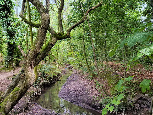
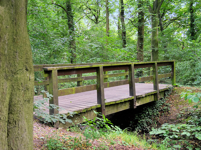
Westbrook is surrounded by an abundance of natural beauty, making it an attractive destination for outdoor enthusiasts. The area features several walking trails and cycling routes, allowing residents and visitors to explore the stunning countryside. Nearby attractions include the historic market town of Ormskirk, with its vibrant street market, and the beautiful Martin Mere Wetland Centre, home to a diverse range of bird species.

In summary, Westbrook is a peaceful and scenic village in Lancashire, offering a charming rural lifestyle within easy reach of major cities and surrounded by stunning natural landscapes.

If you have any feedback on the listing, please let us know in the comments section below.
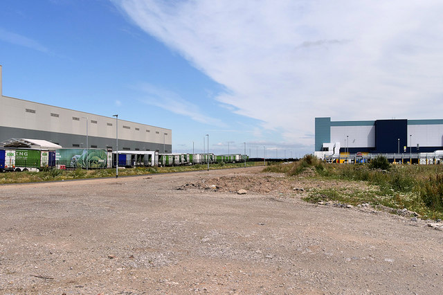
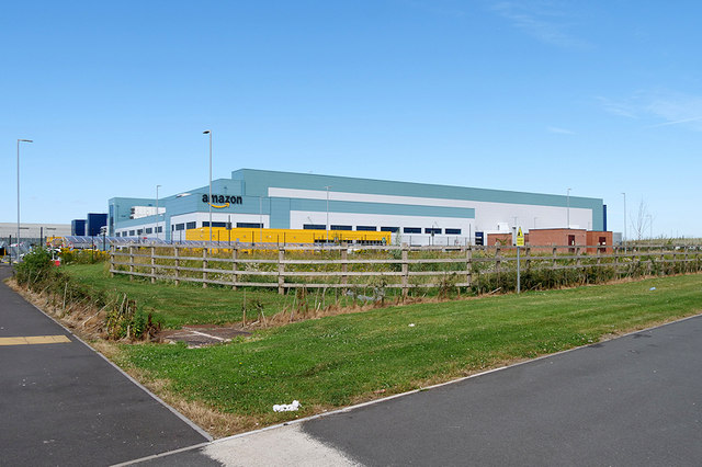
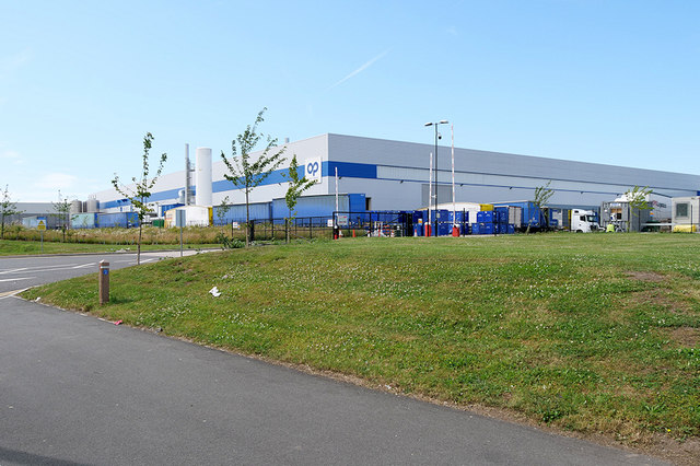
Westbrook Images

Images are sourced within 2km of 53.407397/-2.6359106 or Grid Reference SJ5790. Thanks to Geograph Open Source API. All images are credited.

Restaurant building, Burtonwood service station
Alfa interchange at Burtonwood Alfa coaches depart from a dedicated parking lot at Burtonwood Services on the M62. Passengers on their outward journey  are picked up from points around the North West of England and North Wales on feeder coaches. There is then up to an hour's wait as luggage is transferred. The procedure is reversed for the return journey. It is efficient but can create frustrating long waits.
Alfa interchange at Burtonwood
Alfa coaches depart from a dedicated parking lot at Burtonwood Services on the M62. Passengers on their outward journey are picked up from points around the North West of England and North Wales on feeder coaches. There is then up to an hour's wait as luggage is transferred. The procedure is reversed for the return journey. It is efficient but can create frustrating long waits.
H.Z. Transport At Burtonwood services.
H.Z. Transport
At Burtonwood services.
Burtonwood Services Alfa coaches depart from a dedicated parking lot next to the lorry park at Burtonwood Services.
Burtonwood Services
Alfa coaches depart from a dedicated parking lot next to the lorry park at Burtonwood Services.
Course of the Sankey Canal, Bewsey Meadows
Steam Wagon at Burtonwood Steam Rally 1972 Yorkshire Patent Steam Wagon ‘Pendle Queen’, built in 1917, seen at the Burtonwood Steam Rally in 1972. This rally took place regularly on the former USAF base at Burtonwood during the 1970s (& perhaps longer).  Exact position of photo unknown because of redevelopment of the old base.
Steam Wagon at Burtonwood Steam Rally 1972
Yorkshire Patent Steam Wagon ‘Pendle Queen’, built in 1917, seen at the Burtonwood Steam Rally in 1972. This rally took place regularly on the former USAF base at Burtonwood during the 1970s (& perhaps longer). Exact position of photo unknown because of redevelopment of the old base.
Traction Engine at Burtonwood Steam Rally 1972 A Burrell Traction Engine seen at the Burtonwood Steam Rally in 1972. Charles Burrell & Sons of Thetford, Norfolk, were a major builder of various types of engines.  The plate on the side reads ' S T Rosbotham, Bickerstaffe' - the name of the original owner. This rally took place regularly on the former USAF base at Burtonwood during the 1970s (& perhaps longer). Exact position of photo unknown because of redevelopment of the old base. An old aircraft hangar forms the background.
Traction Engine at Burtonwood Steam Rally 1972
A Burrell Traction Engine seen at the Burtonwood Steam Rally in 1972. Charles Burrell & Sons of Thetford, Norfolk, were a major builder of various types of engines. The plate on the side reads ' S T Rosbotham, Bickerstaffe' - the name of the original owner. This rally took place regularly on the former USAF base at Burtonwood during the 1970s (& perhaps longer). Exact position of photo unknown because of redevelopment of the old base. An old aircraft hangar forms the background.
Burtonwood Services Welcome Break services on the M62.
Burtonwood Services
Welcome Break services on the M62.
Westbrook Way/Cromwell Avenue Roundabout Footbridge One of 4 near identical footbridges at this roundabout.
Westbrook Way/Cromwell Avenue Roundabout Footbridge
One of 4 near identical footbridges at this roundabout.
Footpath Behind Gulliver's World
The Miller & Carter Steakhouse Originally called The Memphis Belle: See <a href="https://www.geograph.org.uk/photo/3320173">SJ5890 : Memphis Belle</a> & <a href="https://www.geograph.org.uk/photo/509908">SJ5890 : Memphis Belle</a>
The Miller & Carter Steakhouse
Originally called The Memphis Belle: See SJ5890 : Memphis Belle & SJ5890 : Memphis Belle
Burtonwood Services, M62 Burtonwood Services is on the M62 at Junction 8. Opened in 1974, it was originally a traditional service area on both sides of the motorway, but in 2008 the westbound side was closed. However it is accessible from both carriageways. You have to be careful entering the service area since access is via the slip road onto the eastbound carriageway from the roundabout at Junction 8.
The service area is quite attractive and has a small, octagonal, pagoda-style building with a conical roof.
Burtonwood Services, M62
Burtonwood Services is on the M62 at Junction 8. Opened in 1974, it was originally a traditional service area on both sides of the motorway, but in 2008 the westbound side was closed. However it is accessible from both carriageways. You have to be careful entering the service area since access is via the slip road onto the eastbound carriageway from the roundabout at Junction 8. The service area is quite attractive and has a small, octagonal, pagoda-style building with a conical roof.
Red Footbridge over Westbrook Way
Stream in Mary Ann Plantation Mary Ann Plantation is a 10-acre strip of mature broadleaf woodland with some newer planting, in Westbrook, in the north-west Warrington. The site is part of the Mersey Forest, an expanding network of woodlands across Merseyside and North Cheshire. The eastern section of the plantation falls within a local Site of Importance for Nature Conservation (<span class="nowrap"><a title="http://www.woodlandtrust.org.uk/visiting-woods/wood-information/mary-ann-plantation/" rel="nofollow ugc noopener" href="http://www.woodlandtrust.org.uk/visiting-woods/wood-information/mary-ann-plantation/">Link</a><img style="margin-left:2px;" alt="External link" title="External link - shift click to open in new window" src="https://s1.geograph.org.uk/img/external.png" width="10" height="10"/></span> Woodland Trust ).
Stream in Mary Ann Plantation
Mary Ann Plantation is a 10-acre strip of mature broadleaf woodland with some newer planting, in Westbrook, in the north-west Warrington. The site is part of the Mersey Forest, an expanding network of woodlands across Merseyside and North Cheshire. The eastern section of the plantation falls within a local Site of Importance for Nature Conservation (LinkExternal link Woodland Trust ).
Bridge over Stream in Mary Ann Plantation Mary Ann Plantation is a 10-acre strip of mature broadleaf woodland with some newer planting, in Westbrook, in the north-west Warrington. The site is part of the Mersey Forest, an expanding network of woodlands across Merseyside and North Cheshire. The eastern section of the plantation falls within a local Site of Importance for Nature Conservation (<span class="nowrap"><a title="http://www.woodlandtrust.org.uk/visiting-woods/wood-information/mary-ann-plantation/" rel="nofollow ugc noopener" href="http://www.woodlandtrust.org.uk/visiting-woods/wood-information/mary-ann-plantation/">Link</a><img style="margin-left:2px;" alt="External link" title="External link - shift click to open in new window" src="https://s1.geograph.org.uk/img/external.png" width="10" height="10"/></span>  Woodland Trust).
Bridge over Stream in Mary Ann Plantation
Mary Ann Plantation is a 10-acre strip of mature broadleaf woodland with some newer planting, in Westbrook, in the north-west Warrington. The site is part of the Mersey Forest, an expanding network of woodlands across Merseyside and North Cheshire. The eastern section of the plantation falls within a local Site of Importance for Nature Conservation (LinkExternal link Woodland Trust).
Redevelopment of former Burtonwood Airfield Land behind the back of the Asda logistics centre at Omega South Business Park.
Redevelopment of former Burtonwood Airfield
Land behind the back of the Asda logistics centre at Omega South Business Park.
Amazon Distribution Centre, Warrington Part of the Omega South Business Park on the site of the former Burtonwood Airfield.
Amazon Distribution Centre, Warrington
Part of the Omega South Business Park on the site of the former Burtonwood Airfield.
OP Plastics, Omega Business Park Part of the Omega South Business Park on the site of the former Burtonwood Airfield.
OP Plastics, Omega Business Park
Part of the Omega South Business Park on the site of the former Burtonwood Airfield.
Show me another place!

Westbrook is located at Grid Ref: SJ5790 (Lat: 53.407397, Lng: -2.6359106)

Unitary Authority: Warrington

Police Authority: Cheshire

What 3 Words

///proof.vows.liner. Near Great Sankey, Cheshire

Related Wikis

Westbrook, Cheshire

Westbrook is a ward and suburb in north west Warrington, in the Warrington district, in the ceremonial county of Cheshire, England. Within the boundaries...
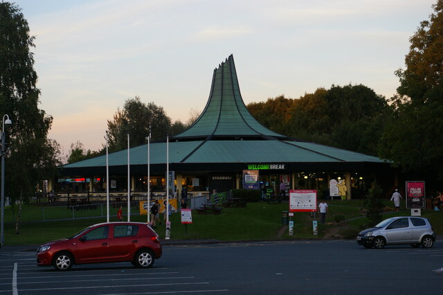
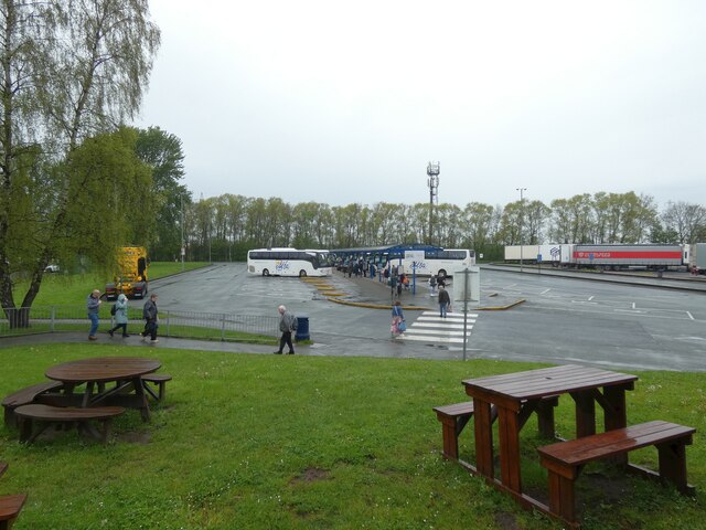
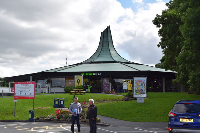
Burtonwood services

Burtonwood services is a motorway service station on the M62 in Cheshire, near Warrington in England. == History == The services originally opened in August...

Bewsey Old Hall

Bewsey Old Hall is a brick-built, three-storey, mainly Jacobean building, incorporating or reusing elements of a former medieval hall on the edge of Sankey...

Gulliver's World

Gulliver's World is a theme park located in Warrington, England, loosely based on the world of Lilliput from Gulliver's Travels. It consists of the themed...

Nearby Amenities

Located within 500m of 53.407397,-2.6359106
Crossing
Crossing: uncontrolled
Crossing Island: no
Crossing Markings: zebra
Tactile Paving: yes
Lat/Long: 53.4075967/-2.6332266
Crossing
Crossing: uncontrolled
Crossing Island: no
Crossing Markings: zebra
Tactile Paving: yes
Lat/Long: 53.4076532/-2.6309524
Crossing
Crossing: unmarked
Crossing Island: no
Crossing Markings: no
Kerb: lowered
Tactile Paving: yes
Lat/Long: 53.4090312/-2.6375417
Crossing
Crossing: unmarked
Crossing Island: no
Crossing Markings: no
Tactile Paving: no
Lat/Long: 53.4092689/-2.6395553
Turning Circle
Lat/Long: 53.4112959/-2.6372717
Turning Circle
Lat/Long: 53.4101383/-2.6376149
Turning Circle
Lat/Long: 53.4103997/-2.6411393
Crossing
Crossing: unmarked
Crossing Island: no
Crossing Markings: no
Tactile Paving: yes
Lat/Long: 53.4055506/-2.6371104
Turning Circle
Lat/Long: 53.405699/-2.6294325
Turning Circle
Lat/Long: 53.403707/-2.6318696
Turning Circle
Lat/Long: 53.4039245/-2.6312292
Turning Circle
Lat/Long: 53.4045881/-2.6385443
Turning Circle
Lat/Long: 53.4051418/-2.6385601
Turning Circle
Lat/Long: 53.4047041/-2.6413406
Turning Circle
Lat/Long: 53.405143/-2.6394848
Turning Circle
Lat/Long: 53.4048765/-2.6394657
Turning Circle
Lat/Long: 53.4043287/-2.6406662
Turning Circle
Lat/Long: 53.4032802/-2.6389226
Westbrook
Is In City: Warrington
Is In Parish: Burtonwood and Westbrook
Place: suburb
Wikidata: Q7987158
Lat/Long: 53.4081793/-2.6369637
Turning Circle
Lat/Long: 53.4030013/-2.6365312
Turning Circle
Lat/Long: 53.4030084/-2.6364125
Barrier: bollard
Bollard: fixed
Material: wood
Lat/Long: 53.4056984/-2.6371394
Barrier: cycle_barrier
Cycle Barrier: double
Lat/Long: 53.4054785/-2.6405062
Barrier: cycle_barrier
Cycle Barrier: single
Lat/Long: 53.4057548/-2.63696
Barrier: cycle_barrier
Bicycle: dismount
Cycle Barrier: double
Foot: yes
Lat/Long: 53.4045208/-2.63855
Crossing
Crossing: unmarked
Crossing Island: no
Tactile Paving: yes
Lat/Long: 53.4108361/-2.635503
Crossing
Crossing: unmarked
Crossing Island: no
Kerb: lowered
Tactile Paving: yes
Lat/Long: 53.4107545/-2.6346619
Crossing
Crossing: unmarked
Crossing Island: no
Crossing Markings: no
Kerb: lowered
Tactile Paving: yes
Lat/Long: 53.4087761/-2.636947
Crossing
Crossing: unmarked
Crossing Island: no
Crossing Markings: no
Kerb: lowered
Tactile Paving: yes
Lat/Long: 53.408799/-2.6367842
Crossing
Crossing: uncontrolled
Crossing Island: no
Crossing Markings: zebra
Tactile Paving: yes
Lat/Long: 53.4083911/-2.63187
Post Box
Brand: Royal Mail
Brand Wikidata: Q638098
Brand Wikipedia: en:Royal Mail
Collection Times: Mo-Fr 17:30; Sa 07:30
Operator: Royal Mail
Operator Wikidata: Q638098
Post Box Design: type_k
Post Box Type: pillar
Ref: WA5 332
Royal Cypher: EIIR
Lat/Long: 53.4116647/-2.637496
Post Box
Brand: Royal Mail
Brand Wikidata: Q638098
Brand Wikipedia: en:Royal Mail
Collection Times: Mo-Fr 17:30; Sa 11:00
Operator: Royal Mail
Operator Wikidata: Q638098
Post Box Design: type_k
Post Box Type: pillar
Ref: WA5 321
Royal Cypher: EIIR
Lat/Long: 53.4069793/-2.6295729
Post Box
Collection Times: Mo-Fr 17:15; Sa 12:00
Level: 0
Operator: Royal Mail
Operator Wikidata: Q638098
Post Box Type: indoor_pillar
Ref: WA5 120
Lat/Long: 53.4080759/-2.6294297
Bus Stop
Kingswood Road
Bench: stand_up_bench
Bus: yes
Public Transport: platform
Shelter: yes
Lat/Long: 53.4101132/-2.6368649
Bus Stop
Kingswood Road
Bench: yes
Bus: yes
Naptan AtcoCode: 069000014604
Naptan NaptanCode: wrgmgwd
Public Transport: platform
Shelter: yes
Lat/Long: 53.4104163/-2.6369789
Bus Stop
Sevenwoods
Alt Name: Seven Woods
Bench: stand_up_bench
Bus: yes
Departures Board: timetable
Public Transport: platform
Shelter: yes
Lat/Long: 53.4081417/-2.6365677
Bus Stop
Sevenwoods
Alt Name: Seven Woods
Bench: stand_up_bench
Bus: yes
Departures Board: timetable
Public Transport: platform
Shelter: yes
Lat/Long: 53.4078576/-2.6361888
Bus Stop
UCI Cinema
Bench: stand_up_bench
Bus: yes
Departures Board: timetable
Public Transport: platform
Shelter: yes
Lat/Long: 53.4064368/-2.6330789
Bus Stop
UCI Cinema
Bench: yes
Bus: yes
Departures Board: timetable
Public Transport: platform
Shelter: yes
Lat/Long: 53.4063896/-2.6333484
Bus Stop
Asda
Bench: yes
Bus: yes
Departures Board: realtime
Naptan AtcoCode: 069000014601
Naptan NaptanCode: wrgmgjm
Public Transport: platform
Shelter: yes
Lat/Long: 53.4067884/-2.630196
Bus Stop
Asda
Bench: yes
Bin: yes
Bus: yes
Departures Board: realtime
Public Transport: platform
Shelter: yes
Lat/Long: 53.4072227/-2.6292926
Crossing
Button Operated: yes
Crossing: traffic_signals
Crossing Island: no
Crossing Markings: dots
Crossing Ref: pelican
Kerb: lowered
Tactile Paving: yes
Lat/Long: 53.4072448/-2.6286053
Crossing
Button Operated: yes
Crossing: traffic_signals
Crossing Island: no
Crossing Markings: dots
Crossing Ref: pelican
Kerb: lowered
Tactile Paving: yes
Lat/Long: 53.4073608/-2.6286099
Crossing
Button Operated: yes
Crossing: traffic_signals
Crossing Island: no
Crossing Markings: dots
Crossing Ref: pelican
Kerb: lowered
Tactile Paving: yes
Lat/Long: 53.4075465/-2.6285394
Crossing
Button Operated: yes
Crossing: traffic_signals
Crossing Island: no
Crossing Markings: dots
Crossing Ref: pelican
Kerb: lowered
Tactile Paving: yes
Lat/Long: 53.4076032/-2.6284267
Traffic Signals
Traffic Signals: signal
Traffic Signals Direction: forward
Lat/Long: 53.407216/-2.6284429
Turning Circle
Lat/Long: 53.4100903/-2.6419265
Crossing
Crossing: unmarked
Crossing Island: no
Tactile Paving: no
Lat/Long: 53.4087829/-2.6408979
Turning Circle
Lat/Long: 53.4081092/-2.6412231
Crossing
Crossing: unmarked
Crossing Island: no
Crossing Markings: no
Kerb: lowered
Tactile Paving: yes
Lat/Long: 53.4111056/-2.6361005
Crossing
Crossing: unmarked
Crossing Island: no
Crossing Markings: no
Kerb: lowered
Tactile Paving: yes
Lat/Long: 53.4111697/-2.6360039
Crossing
Crossing: unmarked
Crossing Island: no
Crossing Markings: no
Kerb: lowered
Tactile Paving: yes
Lat/Long: 53.4113844/-2.636033
Crossing
Crossing: unmarked
Crossing Island: no
Crossing Markings: no
Kerb: lowered
Tactile Paving: yes
Lat/Long: 53.4114496/-2.6361336
Crossing
Crossing: unmarked
Crossing Island: no
Crossing Markings: no
Kerb: lowered
Tactile Paving: yes
Lat/Long: 53.4114185/-2.6365145
Crossing
Crossing: unmarked
Crossing Island: no
Crossing Markings: no
Kerb: lowered
Tactile Paving: yes
Lat/Long: 53.4113557/-2.636604
Crossing
Crossing: unmarked
Crossing Island: no
Crossing Markings: no
Kerb: lowered
Tactile Paving: yes
Lat/Long: 53.4111362/-2.6365576
Crossing
Crossing: unmarked
Crossing Island: no
Crossing Markings: no
Kerb: lowered
Tactile Paving: yes
Lat/Long: 53.4110795/-2.6364491
Crossing
Button Operated: yes
Crossing: traffic_signals
Crossing Island: no
Crossing Markings: dots
Crossing Ref: puffin
Tactile Paving: yes
Wheelchair: yes
Lat/Long: 53.4073619/-2.6358785
Crossing
Crossing: unmarked
Crossing Island: no
Crossing Markings: no
Kerb: lowered
Tactile Paving: yes
Lat/Long: 53.4089223/-2.6374208
Crossing
Crossing: unmarked
Crossing Island: no
Tactile Paving: yes
Lat/Long: 53.4107408/-2.6354348
Crossing
Crossing: unmarked
Crossing Island: no
Tactile Paving: yes
Lat/Long: 53.4101788/-2.6340883
Turning Circle
Lat/Long: 53.4082271/-2.6408652
Turning Circle
Lat/Long: 53.4039042/-2.6349296
Turning Circle
Lat/Long: 53.4032107/-2.6356474
Crossing
Crossing: unmarked
Crossing Island: no
Crossing Markings: no
Tactile Paving: no
Lat/Long: 53.4063392/-2.6328619
Crossing
Crossing: unmarked
Crossing Island: no
Crossing Markings: no
Tactile Paving: no
Wheelchair: yes
Lat/Long: 53.406851/-2.6349744
Crossing
Crossing: unmarked
Crossing Island: no
Crossing Markings: no
Tactile Paving: no
Lat/Long: 53.4063711/-2.6315944
Crossing
Crossing: unmarked
Crossing Island: yes
Crossing Markings: no
Tactile Paving: yes
Lat/Long: 53.4069098/-2.6300999
Crossing
Crossing: unmarked
Crossing Island: no
Crossing Markings: no
Tactile Paving: no
Lat/Long: 53.4073404/-2.6349956
Crossing
Crossing: unmarked
Crossing Island: no
Crossing Markings: no
Tactile Paving: no
Lat/Long: 53.4067111/-2.6322178
Traffic Signals
Traffic Signals: signal
Traffic Signals Direction: forward
Lat/Long: 53.4073245/-2.6287449
Crossing
Crossing: unmarked
Crossing Island: no
Tactile Paving: no
Lat/Long: 53.4116861/-2.6373715
Crossing
Crossing: unmarked
Lat/Long: 53.4116055/-2.6377966
Crossing
Crossing: unmarked
Crossing Island: no
Crossing Markings: no
Tactile Paving: yes
Lat/Long: 53.4093394/-2.6371885
Crossing
Crossing: uncontrolled
Crossing Island: no
Crossing Markings: zebra
Tactile Paving: yes
Lat/Long: 53.4089738/-2.6294551
Crossing
Crossing: unmarked
Crossing Island: no
Tactile Paving: no
Lat/Long: 53.4079677/-2.6365206
Generator Method: photovoltaic
Generator Output Electricity: yes
Generator Source: solar
Generator Type: solar_photovoltaic_panel
Location: roof
Power: generator
Lat/Long: 53.4102679/-2.638488
Generator Method: photovoltaic
Generator Output Electricity: yes
Generator Source: solar
Generator Type: solar_photovoltaic_panel
Location: roof
Power: generator
Lat/Long: 53.4105764/-2.6381099
Generator Method: photovoltaic
Generator Output Electricity: yes
Generator Source: solar
Generator Type: solar_photovoltaic_panel
Location: roof
Power: generator
Lat/Long: 53.4108594/-2.6377424
Generator Method: photovoltaic
Generator Output Electricity: yes
Generator Source: solar
Generator Type: solar_photovoltaic_panel
Location: roof
Power: generator
Lat/Long: 53.4109777/-2.6380508
Generator Method: photovoltaic
Generator Output Electricity: yes
Generator Source: solar
Generator Type: solar_photovoltaic_panel
Location: roof
Power: generator
Lat/Long: 53.4114526/-2.6382601
Generator Method: photovoltaic
Generator Output Electricity: yes
Generator Source: solar
Generator Type: solar_photovoltaic_panel
Location: roof
Power: generator
Lat/Long: 53.411339/-2.6382815
Generator Method: photovoltaic
Generator Output Electricity: yes
Generator Source: solar
Generator Type: solar_photovoltaic_panel
Location: roof
Power: generator
Lat/Long: 53.4113534/-2.6385471
Generator Method: photovoltaic
Generator Output Electricity: yes
Generator Source: solar
Generator Type: solar_photovoltaic_panel
Location: roof
Power: generator
Lat/Long: 53.411379/-2.6386168
Crossing
Crossing: uncontrolled
Crossing Island: no
Crossing Markings: zebra
Tactile Paving: yes
Lat/Long: 53.4076046/-2.6326463
Crossing
Crossing: unmarked
Crossing Island: no
Tactile Paving: yes
Lat/Long: 53.4078551/-2.632231
Crossing
Crossing: uncontrolled
Crossing Island: no
Crossing Markings: zebra
Tactile Paving: yes
Lat/Long: 53.4076155/-2.6317797
Pharmacy
Asda
Brand: Asda
Brand Wikidata: Q297410
Brand Wikipedia: en:Asda
Contact Phone: +44 1925 625810
Contact Website: https://storelocator.asda.com/north-west/warrington/westbrook-shopping-centre/pharmacy
Drive Through: no
Healthcare: pharmacy
Level: 0
Operator: Asda Stores Ltd
Lat/Long: 53.4083815/-2.6294933
Asda Opticians
Addr City: Warrington
Addr Housenumber: Unit 3
Addr Postcode: WA5 8UG
Addr Street: Westbrook Centre
Brand: Asda
Brand Wikidata: Q297410
Brand Wikipedia: en:Asda
Contact Phone: +44 1925 625820
Contact Website: https://storelocator.asda.com/north-west/warrington/westbrook-shopping-centre/opticians
Level: 0
Operator: Asda Stores Ltd
Shop: optician
Lat/Long: 53.4079083/-2.6299604
Cafe
Asda Café
Brand: Asda
Brand Wikidata: Q297410
Brand Wikipedia: en:Asda
Contact Phone: +44 1925 638633
Contact Website: https://storelocator.asda.com/north-west/warrington/westbrook-shopping-centre/cafe
Cuisine: coffee_shop
Drinking Water Refill: yes
Drinking Water Refill Network: Refill
Fhrs Id: 420112
Internet Access: wlan
Internet Access Fee: no
Level: 1
Opening Hours Covid19: Mo-Su off
Operator: Asda Stores Ltd
Takeaway: yes
Lat/Long: 53.4079997/-2.6298266
Crossing
Crossing: unmarked
Crossing Island: no
Tactile Paving: yes
Lat/Long: 53.4072187/-2.6305365
Barrier: kissing_gate
Bicycle: yes
Foot: yes
Horse: no
Motor Vehicle: no
Lat/Long: 53.407803/-2.638121
Barrier: height_restrictor
Lat/Long: 53.4055998/-2.638125
Crossing
Crossing: unmarked
Crossing Island: no
Crossing Markings: no
Tactile Paving: yes
Lat/Long: 53.4091465/-2.6364164
Crossing
Crossing: unmarked
Crossing Island: no
Crossing Markings: no
Tactile Paving: yes
Lat/Long: 53.4092268/-2.6364535
Crossing
Crossing: unmarked
Crossing Island: no
Crossing Markings: no
Tactile Paving: yes
Lat/Long: 53.4093298/-2.6370068
Crossing
Crossing: unmarked
Crossing Island: no
Tactile Paving: yes
Lat/Long: 53.4100679/-2.6335189
Crossing
Crossing: unmarked
Crossing Island: no
Tactile Paving: yes
Lat/Long: 53.4103379/-2.634605
Crossing
Crossing: unmarked
Crossing Island: no
Crossing Markings: no
Tactile Paving: no
Lat/Long: 53.4063379/-2.6319257
Turning Circle
Turning Circle: circle
Lat/Long: 53.4085552/-2.6313193
Crossing
Crossing: uncontrolled
Crossing Island: no
Crossing Markings: zebra
Tactile Paving: yes
Lat/Long: 53.4076514/-2.6311049
Crossing
Crossing: marked
Crossing Island: no
Tactile Paving: yes
Lat/Long: 53.4072579/-2.6307282
Crossing
Crossing: uncontrolled
Crossing Island: no
Crossing Markings: zebra
Tactile Paving: yes
Traffic Calming: bump
Lat/Long: 53.4074634/-2.6301375
Crossing
Crossing: uncontrolled
Crossing Island: no
Crossing Markings: zebra
Tactile Paving: yes
Lat/Long: 53.4074675/-2.629386
Give Way
Direction: backward
Lat/Long: 53.4076783/-2.6310655
Crossing
Crossing: uncontrolled
Crossing Island: no
Crossing Markings: zebra
Tactile Paving: yes
Lat/Long: 53.4075322/-2.6295212
Crossing
Crossing: uncontrolled
Crossing Island: no
Crossing Markings: zebra
Tactile Paving: yes
Lat/Long: 53.407529/-2.6297605
Crossing
Crossing: uncontrolled
Crossing Island: no
Crossing Markings: zebra
Tactile Paving: yes
Lat/Long: 53.407529/-2.6299926
Crossing
Crossing: uncontrolled
Crossing Island: no
Crossing Markings: zebra
Tactile Paving: yes
Lat/Long: 53.4075243/-2.6302296
Crossing
Crossing: uncontrolled
Crossing Island: no
Crossing Markings: zebra
Tactile Paving: yes
Lat/Long: 53.4077914/-2.6307203
Crossing
Crossing: uncontrolled
Crossing Island: no
Crossing Markings: zebra
Tactile Paving: yes
Lat/Long: 53.4077875/-2.6293896
Crossing
Crossing: uncontrolled
Crossing Island: no
Crossing Markings: zebra
Tactile Paving: yes
Lat/Long: 53.4084636/-2.6287967
Crossing
Crossing: uncontrolled
Crossing Island: no
Crossing Markings: zebra
Tactile Paving: yes
Lat/Long: 53.4084579/-2.629284
Crossing
Crossing: uncontrolled
Crossing Island: no
Crossing Markings: zebra
Tactile Paving: yes
Lat/Long: 53.4079992/-2.6287818
Crossing
Crossing: uncontrolled
Crossing Island: no
Crossing Markings: zebra
Tactile Paving: yes
Lat/Long: 53.4079956/-2.6292668
Crossing
Crossing: marked
Crossing Island: no
Tactile Paving: yes
Lat/Long: 53.4071764/-2.6325433
Crossing
Crossing: marked
Crossing Island: no
Tactile Paving: yes
Lat/Long: 53.4074079/-2.6329202
Crossing
Crossing: unmarked
Crossing Island: no
Tactile Paving: no
Lat/Long: 53.4074825/-2.6332106
Crossing
Crossing: unmarked
Crossing Island: no
Tactile Paving: yes
Lat/Long: 53.4073649/-2.6322228
Crossing
Crossing: unmarked
Crossing Island: no
Tactile Paving: no
Lat/Long: 53.4080097/-2.6323457
Crossing
Crossing: unmarked
Crossing Island: no
Tactile Paving: no
Lat/Long: 53.4082547/-2.6322709
Crossing
Crossing: unmarked
Crossing Island: no
Tactile Paving: no
Lat/Long: 53.4085285/-2.6317594
Crossing
Crossing: unmarked
Crossing Island: yes
Crossing Markings: no
Tactile Paving: yes
Lat/Long: 53.407069/-2.6299985
Crossing
Crossing: unmarked
Crossing Island: no
Tactile Paving: no
Lat/Long: 53.4074069/-2.6313529
Crossing
Crossing: unmarked
Crossing Island: no
Tactile Paving: yes
Lat/Long: 53.4071887/-2.6300174
Traffic Signals
Traffic Signals: signal
Traffic Signals Direction: forward
Lat/Long: 53.4076744/-2.6284373
Traffic Signals
Traffic Signals: signal
Traffic Signals Direction: forward
Lat/Long: 53.4072139/-2.6285437
Crossing
Crossing: pavement
Crossing Island: no
Tactile Paving: no
Lat/Long: 53.4101285/-2.6340376
Crossing
Crossing: pavement
Crossing Island: no
Tactile Paving: no
Lat/Long: 53.4101369/-2.6335199
Crossing
Crossing: pavement
Crossing Island: no
Tactile Paving: no
Lat/Long: 53.4101734/-2.632776
Crossing
Crossing: unmarked
Crossing Island: no
Tactile Paving: yes
Lat/Long: 53.4102834/-2.6326624
Crossing
Crossing: pavement
Crossing Island: no
Tactile Paving: no
Lat/Long: 53.4103671/-2.6320338
Crossing
Crossing: pavement
Crossing Island: no
Tactile Paving: no
Lat/Long: 53.4105808/-2.6318684
Crossing
Crossing: unmarked
Crossing Island: no
Crossing Markings: no
Tactile Paving: no
Lat/Long: 53.4069633/-2.6351879
Give Way
Direction: forward
Lat/Long: 53.4077325/-2.6310198
Give Way
Direction: backward
Lat/Long: 53.4070225/-2.6299349
Traffic Signals
Traffic Signals: crossing
Traffic Signals Direction: backward
Lat/Long: 53.4073878/-2.6359036
Traffic Signals
Traffic Signals: crossing
Traffic Signals Direction: forward
Lat/Long: 53.4073321/-2.6358493
Crossing
Crossing: unmarked
Crossing Island: no
Tactile Paving: yes
Lat/Long: 53.407887/-2.6362846
Crossing
Crossing: unmarked
Crossing Island: no
Tactile Paving: yes
Lat/Long: 53.4099277/-2.6359203
Access: yes
Entrance: yes
Level: 0
Lat/Long: 53.4080807/-2.6294108
Access: yes
Entrance: main
Level: 0
Lat/Long: 53.4080235/-2.629489
Give Way
Direction: backward
Lat/Long: 53.4076081/-2.6322843
Give Way
Direction: forward
Lat/Long: 53.4076095/-2.6321743
Fast Food
Greggs
Addr City: Warrington
Addr Housenumber: Unit 1
Addr Postcode: WA5 8UG
Addr Street: Westbrook Centre
Brand: Greggs
Brand Wikidata: Q3403981
Brand Wikipedia: en:Greggs
Contact Website: https://www.greggs.co.uk/shop-finder?shop-code=5481
Cuisine: sandwich;bakery
Drive Through: no
Fhrs Id: 1295953
Level: 0
Opening Hours: Mo-Sa 06:30-21:00; Su 07:30-21:00
Takeaway: yes
Lat/Long: 53.4079066/-2.6297502
Fast Food
Subway
Addr City: Warrington
Addr Housenumber: Unit 2
Addr Postcode: WA5 8UG
Addr Street: Westbrook Centre
Brand: Subway
Brand Wikidata: Q244457
Brand Wikipedia: en:Subway (restaurant)
Contact Phone: +44 1925 259340
Contact Website: https://restaurants.subway.com/united-kingdom/en/warrington/unit-2-westbrook-cresentwarrington
Cuisine: sandwich
Drive Through: no
Fhrs Id: 1172509
Level: 0
Opening Hours: Mo-Sa 08:00-20:00; Su 09:00-19:00
Takeaway: yes
Lat/Long: 53.4079074/-2.6298538
Card Factory
Addr City: Warrington
Addr Housenumber: Unit 5
Addr Postcode: WA5 8UG
Addr Street: Westbrook Centre
Brand: Card Factory
Brand Wikidata: Q5038192
Brand Wikipedia: en:Card Factory
Contact Phone: +44 1925 242045
Contact Website: https://www.cardfactory.co.uk
Level: 0
Shop: gift
Lat/Long: 53.407906/-2.6301711
Dave Pluck Bookmakers
Addr City: Warrington
Addr Housenumber: Unit 4
Addr Postcode: WA5 8UG
Addr Street: Westbrook Centre
Contact Phone: +44 151 647 0530
Contact Website: https://www.davepluck.co.uk/stores/unit-4-westbrook-centre-warrington-wa5-8ug/
Level: 0
Shop: bookmaker
Lat/Long: 53.4079083/-2.6300595
British Heart Foundation
Addr City: Warrington
Addr Housenumber: Unit 7
Addr Postcode: WA5 8UG
Addr Street: Westbrook Centre
Brand: British Heart Foundation
Brand Wikidata: Q4970039
Brand Wikipedia: en:British Heart Foundation
Level: 0
Shop: charity
Website: https://www.bhf.org.uk/what-we-do/find-bhf-near-you/warrington-furniture-electrical-store
Lat/Long: 53.4079043/-2.630461
Pharmacy
Cohens Chemist
Addr City: Warrington
Addr Housenumber: Unit 6
Addr Postcode: WA5 8UG
Addr Street: Westbrook Centre
Brand: Cohens Chemist
Brand Wikidata: Q107998495
Contact Phone: +44 1925 444758
Contact Website: https://www.cohenschemist.co.uk/mycohens/locate/
Dispensing: yes
Drive Through: no
Healthcare: pharmacy
Level: 0
Lat/Long: 53.407906/-2.6303288
Westbrook Carpets & Laminates
Addr City: Warrington
Addr Housenumber: Unit 8
Addr Postcode: WA5 8UG
Addr Street: Westbrook Centre
Contact Phone: +44 1925 244784
Contact Website: https://www.westbrookcarpetsandlaminates.co.uk
Level: 0
Shop: flooring
Lat/Long: 53.407903/-2.63058
Brewsters Hairdressing & Barbers Shop
Addr City: Warrington
Addr Housenumber: Unit 10
Addr Postcode: WA5 8UG
Addr Street: Westbrook Centre
Contact Phone: +44 1925 417717
Contact Website: http://www.brewsters-hair.co.uk/brewsters-westbrook
Shop: hairdresser
Lat/Long: 53.4080781/-2.6310029
Halton Kelly
Addr City: Warrington
Addr Postcode: WA5 8UH
Addr Street: Westbrook Centre
Contact Email: simonkelly@haltonkelly.co.uk
Contact Facebook: https://www.facebook.com/HKELLYESTATES/
Contact Phone: +44 1925 575750
Contact Website: https://haltonkelly.co.uk
Office: estate_agent
Lat/Long: 53.4080968/-2.6312758
Edwards Grounds
Addr City: Warrington
Addr Housenumber: 411
Addr Postcode: WA5 8UG
Addr Street: Westbrook Centre
Contact Phone: +44 1925 232333
Contact Website: https://edwardsgrounds.co.uk/
Email: westbrook@edwardsgrounds.co.uk
Office: estate_agent
Lat/Long: 53.4081147/-2.6310687
American Golf
Addr City: Warrington
Addr Housename: Westbrook House
Addr Housenumber: 611
Addr Postcode: WA5 8UH
Addr Street: Westbrook Centre
Brand: American Golf
Brand Wikidata: Q62657494
Contact Phone: +44 1925 488400
Contact Website: https://www.americangolf.co.uk
Office: yes
Sport: golf
Lat/Long: 53.4080567/-2.6314288
Cafe
Costa
Addr City: Warrington
Addr Housenumber: 100
Addr Postcode: WA5 8UD
Addr Street: Westbrook Centre
Brand: Costa
Brand Wikidata: Q608845
Brand Wikipedia: en:Costa Coffee
Contact Phone: +44 1925 416698
Contact Website: https://www.costa.co.uk/locations/store-locator/map?latitude=53.40720000000002&longitude=-2.6329000000000065
Cuisine: coffee_shop
Internet Access: wlan
Internet Access Fee: no
Opening Hours: Mo-Fr 08:00-18:00; Sa-Su 09:00-18:00
Outdoor Seating: yes
Takeaway: yes
Wheelchair: yes
Lat/Long: 53.4073499/-2.6331499
Crossing
Crossing: unmarked
Crossing Island: no
Tactile Paving: no
Lat/Long: 53.4076419/-2.6329572
Cycleway: asl
Direction: forward
Lat/Long: 53.4073452/-2.6286679
Cycleway: asl
Direction: forward
Lat/Long: 53.4072587/-2.6284628
Cycleway: asl
Direction: forward
Lat/Long: 53.4076294/-2.6284308
Crossing
Crossing: unmarked
Crossing Island: no
Crossing Markings: no
Tactile Paving: no
Lat/Long: 53.4065977/-2.6305571
Crossing
Crossing: pavement
Lat/Long: 53.4058113/-2.6321244
Crossing
Crossing: unmarked
Crossing Island: no
Crossing Markings: no
Tactile Paving: no
Lat/Long: 53.4062522/-2.6325606
Crossing
Crossing: unmarked
Crossing Island: no
Crossing Markings: no
Tactile Paving: no
Lat/Long: 53.4063267/-2.6325436
Crossing
Crossing: unmarked
Crossing Island: no
Crossing Markings: no
Tactile Paving: no
Lat/Long: 53.4061035/-2.632152
Crossing
Crossing: unmarked
Crossing Island: no
Crossing Markings: no
Tactile Paving: no
Lat/Long: 53.4061/-2.632293
Crossing
Crossing: unmarked
Crossing Island: no
Crossing Markings: no
Tactile Paving: no
Lat/Long: 53.4072446/-2.6353172
Crossing
Crossing: unmarked
Crossing Island: no
Crossing Markings: no
Tactile Paving: no
Lat/Long: 53.4071822/-2.6352289
Crossing
Crossing: unmarked
Crossing Island: no
Crossing Markings: no
Tactile Paving: no
Lat/Long: 53.4069028/-2.6352674
Crossing
Crossing: unmarked
Crossing Island: no
Crossing Markings: no
Tactile Paving: no
Lat/Long: 53.4068902/-2.6356869
Crossing
Crossing: unmarked
Crossing Island: no
Crossing Markings: no
Tactile Paving: no
Lat/Long: 53.406949/-2.6357897
Crossing
Crossing: unmarked
Crossing Island: no
Crossing Markings: no
Tactile Paving: no
Lat/Long: 53.4063999/-2.6337273
Give Way
Direction: forward
Lat/Long: 53.4108701/-2.6366298
Crossing
Lat/Long: 53.4098536/-2.64124
Crossing
Lat/Long: 53.4097582/-2.6411561
Crossing
Crossing: unmarked
Crossing Island: no
Crossing Markings: no
Tactile Paving: no
Lat/Long: 53.4062497/-2.6319171
Barrier: block
Lat/Long: 53.4072368/-2.6307642
Barrier: bollard
Lat/Long: 53.4069507/-2.632154
Crossing
Crossing: unmarked
Crossing Island: no
Tactile Paving: no
Lat/Long: 53.4069983/-2.6320029
Entrance: yes
Lat/Long: 53.4080422/-2.6328503
Crossing
Crossing: pavement
Crossing Island: no
Tactile Paving: no
Lat/Long: 53.4096487/-2.63356
Crossing
Crossing: pavement
Crossing Island: no
Tactile Paving: no
Lat/Long: 53.409535/-2.6357948
Crossing
Crossing: pavement
Crossing Island: no
Tactile Paving: no
Lat/Long: 53.4098658/-2.6366459
Crossing
Crossing: unmarked
Crossing Island: no
Tactile Paving: yes
Lat/Long: 53.4104827/-2.6357417
Crossing
Crossing: pavement
Lat/Long: 53.4096737/-2.6337117
Crossing
Crossing: unmarked
Crossing Island: no
Tactile Paving: yes
Lat/Long: 53.4102378/-2.6357062
Crossing
Crossing: unmarked
Crossing Island: no
Tactile Paving: yes
Lat/Long: 53.4096068/-2.6346476
Crossing
Crossing: pavement
Lat/Long: 53.4109614/-2.6324098
Crossing
Crossing: pavement
Lat/Long: 53.4108025/-2.6322825
Crossing
Crossing: pavement
Lat/Long: 53.4106517/-2.6331224
Crossing
Crossing: unmarked
Crossing Island: no
Tactile Paving: no
Lat/Long: 53.4079672/-2.6374321
Crossing
Crossing: unmarked
Crossing Island: no
Tactile Paving: no
Lat/Long: 53.4079285/-2.6376491
Crossing
Crossing: unmarked
Crossing Island: no
Tactile Paving: no
Lat/Long: 53.4078735/-2.6369361
Crossing
Crossing: unmarked
Crossing Island: no
Tactile Paving: no
Lat/Long: 53.4117148/-2.6377027
Crossing
Crossing: unmarked
Crossing Island: no
Tactile Paving: yes
Lat/Long: 53.4102544/-2.6369175
Turning Circle
Lat/Long: 53.4048562/-2.6413886
Crossing
Crossing: unmarked
Crossing Island: no
Tactile Paving: no
Lat/Long: 53.4050936/-2.6403495
Turning Circle
Lat/Long: 53.4050546/-2.6395067
Turning Circle
Lat/Long: 53.4043517/-2.6396506
Turning Circle
Lat/Long: 53.4044094/-2.6396913
Waste Basket
Colour: #000000
Material: plastic
Lat/Long: 53.4069699/-2.629587
Barrier: kissing_gate
Lat/Long: 53.4091313/-2.6305435
Turning Circle
Lat/Long: 53.4043331/-2.6387167
Turning Circle
Lat/Long: 53.4043366/-2.638542
Turning Circle
Lat/Long: 53.4051293/-2.6384064
Crossing
Crossing: unmarked
Crossing Island: no
Tactile Paving: no
Lat/Long: 53.4030751/-2.6374737
Addr City: Warrington
Addr Housenumber: 18
Addr Postcode: WA5 8AU
Addr Street: Carina Park
Addr Suburb: Westbrook
Lat/Long: 53.4100422/-2.6324886
Addr City: Warrington
Addr Housenumber: 20
Addr Postcode: WA5 8AU
Addr Street: Carina Park
Addr Suburb: Westbrook
Lat/Long: 53.4100784/-2.632516
Addr City: Warrington
Addr Housenumber: 26
Addr Postcode: WA5 8AU
Addr Street: Carina Park
Addr Suburb: Westbrook
Lat/Long: 53.4101188/-2.6320619
Addr City: Warrington
Addr Housenumber: 28
Addr Postcode: WA5 8AU
Addr Street: Carina Park
Addr Suburb: Westbrook
Lat/Long: 53.4101005/-2.6321262
Addr City: Warrington
Addr Housenumber: 30
Addr Postcode: WA5 8AU
Addr Street: Carina Park
Addr Suburb: Westbrook
Lat/Long: 53.4100802/-2.6321972
Addr City: Warrington
Addr Housenumber: 1
Addr Postcode: WA5 8AU
Addr Street: Carina Park
Addr Suburb: Westbrook
Lat/Long: 53.4106865/-2.6337017
Addr City: Warrington
Addr Housenumber: 3
Addr Postcode: WA5 8AU
Addr Street: Carina Park
Addr Suburb: Westbrook
Lat/Long: 53.4106473/-2.6336668
Addr City: Warrington
Addr Housenumber: 7
Addr Postcode: WA5 8AU
Addr Street: Carina Park
Addr Suburb: Westbrook
Lat/Long: 53.4104166/-2.6334686
Addr City: Warrington
Addr Housenumber: 9
Addr Postcode: WA5 8AU
Addr Street: Carina Park
Addr Suburb: Westbrook
Lat/Long: 53.4103751/-2.6334478
Addr City: Warrington
Addr Housenumber: 15
Addr Postcode: WA5 8AU
Addr Street: Carina Park
Addr Suburb: Westbrook
Lat/Long: 53.4102271/-2.6332513
Addr City: Warrington
Addr Housenumber: 17
Addr Postcode: WA5 8AU
Addr Street: Carina Park
Addr Suburb: Westbrook
Lat/Long: 53.4102365/-2.6331744
Addr City: Warrington
Addr Housenumber: 27
Addr Postcode: WA5 8AU
Addr Street: Carina Park
Addr Suburb: Westbrook
Lat/Long: 53.41047/-2.6322791
Addr City: Warrington
Addr Housenumber: 29
Addr Postcode: WA5 8AU
Addr Street: Carina Park
Addr Suburb: Westbrook
Lat/Long: 53.4104894/-2.6322108
Addr City: Warrington
Addr Housenumber: 3
Addr Postcode: WA5 8AT
Addr Street: Hydra Close
Addr Suburb: Westbrook
Lat/Long: 53.4107011/-2.6333832
Addr City: Warrington
Addr Housenumber: 4
Addr Postcode: WA5 8AT
Addr Street: Hydra Close
Addr Suburb: Westbrook
Lat/Long: 53.4107188/-2.6333233
Addr City: Warrington
Addr Housenumber: 5
Addr Postcode: WA5 8AT
Addr Street: Hydra Close
Addr Suburb: Westbrook
Lat/Long: 53.4107424/-2.633243
Addr City: Warrington
Addr Housenumber: 6
Addr Postcode: WA5 8AT
Addr Street: Hydra Close
Addr Suburb: Westbrook
Lat/Long: 53.4107592/-2.6331859
Addr City: Warrington
Addr Housenumber: 7
Addr Postcode: WA5 8AT
Addr Street: Hydra Close
Addr Suburb: Westbrook
Lat/Long: 53.4108122/-2.6330678
Addr City: Warrington
Addr Housenumber: 8
Addr Postcode: WA5 8AT
Addr Street: Hydra Close
Addr Suburb: Westbrook
Lat/Long: 53.4108307/-2.6330068
Addr City: Warrington
Addr Housenumber: 14
Addr Postcode: WA5 8AT
Addr Street: Hydra Close
Addr Suburb: Westbrook
Lat/Long: 53.411115/-2.6323948
Addr City: Warrington
Addr Housenumber: 15
Addr Postcode: WA5 8AT
Addr Street: Hydra Close
Addr Suburb: Westbrook
Lat/Long: 53.4110929/-2.6323302
Addr City: Warrington
Addr Housenumber: 19
Addr Postcode: WA5 8AT
Addr Street: Hydra Close
Addr Suburb: Westbrook
Lat/Long: 53.4107431/-2.6323889
Addr City: Warrington
Addr Housenumber: 20
Addr Postcode: WA5 8AT
Addr Street: Hydra Close
Addr Suburb: Westbrook
Lat/Long: 53.4107226/-2.6324549
Addr City: Warrington
Addr Housenumber: 1
Addr Postcode: WA5 8AS
Addr Street: Pegasus Drive
Addr Suburb: Westbrook
Lat/Long: 53.4102679/-2.6353126
Addr City: Warrington
Addr Housenumber: 3
Addr Postcode: WA5 8AS
Addr Street: Pegasus Drive
Addr Suburb: Westbrook
Lat/Long: 53.4102364/-2.6352638
Addr City: Warrington
Addr Housenumber: 9
Addr Postcode: WA5 8AS
Addr Street: Pegasus Drive
Addr Suburb: Westbrook
Lat/Long: 53.4098898/-2.6346488
Addr City: Warrington
Addr Housenumber: 11
Addr Postcode: WA5 8AS
Addr Street: Pegasus Drive
Addr Suburb: Westbrook
Lat/Long: 53.4098555/-2.634599
Addr City: Warrington
Addr Housenumber: 10
Addr Postcode: WA5 8AS
Addr Street: Pegasus Drive
Addr Suburb: Westbrook
Lat/Long: 53.4098707/-2.6351214
Addr City: Warrington
Addr Housenumber: 8
Addr Postcode: WA5 8AS
Addr Street: Pegasus Drive
Addr Suburb: Westbrook
Lat/Long: 53.4099023/-2.6351712
Addr City: Warrington
Addr Housenumber: 15
Addr Postcode: WA5 8AQ
Addr Street: Volans Drive
Addr Suburb: Westbrook
Lat/Long: 53.4096648/-2.6356741
Addr City: Warrington
Addr Housenumber: 17
Addr Postcode: WA5 8AQ
Addr Street: Volans Drive
Addr Suburb: Westbrook
Lat/Long: 53.4096151/-2.6355974
Addr City: Warrington
Addr Housenumber: 12
Addr Postcode: WA5 8AQ
Addr Street: Volans Drive
Addr Suburb: Westbrook
Lat/Long: 53.4095719/-2.6361685
Addr City: Warrington
Addr Housenumber: 14
Addr Postcode: WA5 8AQ
Addr Street: Volans Drive
Addr Suburb: Westbrook
Lat/Long: 53.4095668/-2.6362432
Barrier: kerb
Lat/Long: 53.4094872/-2.6353996
Turning Circle
Lat/Long: 53.4044309/-2.6377233
Turning Circle
Lat/Long: 53.4043394/-2.6376577
Turning Circle
Lat/Long: 53.4039129/-2.6372226
Turning Circle
Lat/Long: 53.4040028/-2.6371986
Turning Circle
Lat/Long: 53.4059964/-2.6349445
Turning Circle
Lat/Long: 53.4058996/-2.6350193
Turning Circle
Lat/Long: 53.4057648/-2.634336
Turning Circle
Lat/Long: 53.405688/-2.634263
Turning Circle
Lat/Long: 53.4053899/-2.6345928
Turning Circle
Lat/Long: 53.4053074/-2.6346916
Turning Circle
Lat/Long: 53.4054426/-2.6353818
Turning Circle
Lat/Long: 53.4053763/-2.6354042
Turning Circle
Lat/Long: 53.4060427/-2.6297036
Turning Circle
Lat/Long: 53.406118/-2.6298192
Turning Circle
Lat/Long: 53.4049033/-2.635791
Turning Circle
Lat/Long: 53.4049725/-2.6358495
Turning Circle
Lat/Long: 53.4033022/-2.6346274
Turning Circle
Lat/Long: 53.4033978/-2.6346798
Turning Circle
Lat/Long: 53.4039654/-2.635026
Turning Circle
Lat/Long: 53.4040453/-2.6338032
Turning Circle
Lat/Long: 53.404017/-2.6340128
Turning Circle
Lat/Long: 53.4035076/-2.6337486
Turning Circle
Lat/Long: 53.4034183/-2.6337326
Turning Circle
Lat/Long: 53.4039392/-2.6319892
Turning Circle
Lat/Long: 53.403855/-2.6319445
Give Way
Lat/Long: 53.4072558/-2.630065
Give Way
Lat/Long: 53.4071733/-2.6300334
Waste Basket
Colour: #000000
Material: plastic
Lat/Long: 53.4064257/-2.6330167
Information: guidepost
Tourism: information
Lat/Long: 53.4088792/-2.6366481
Information: guidepost
Tourism: information
Lat/Long: 53.4088582/-2.6373913
Barrier: bollard
Lat/Long: 53.4065369/-2.6298113
Barrier: bollard
Lat/Long: 53.4061831/-2.6298305
Car Wash
Automated: no
Self Service: yes
Lat/Long: 53.4073668/-2.6293558
Grit Bin
Material: plastic
Lat/Long: 53.4071753/-2.6299182
Man Made: street_cabinet
Lat/Long: 53.4073086/-2.6292148
Man Made: street_cabinet
Street Cabinet: traffic_control
Lat/Long: 53.4074048/-2.6287715
Man Made: street_cabinet
Lat/Long: 53.4096028/-2.6294204
Man Made: street_cabinet
Lat/Long: 53.4096028/-2.6294415
Man Made: street_cabinet
Lat/Long: 53.4096016/-2.6294862
Man Made: street_cabinet
Lat/Long: 53.4096009/-2.6295231
Communication Mobile Phone: yes
Man Made: mast
Tower Type: communication
Lat/Long: 53.4095775/-2.6294718
Barrier: bollard
Lat/Long: 53.4087348/-2.6370677
Waste Basket
Material: metal
Lat/Long: 53.4050346/-2.6320352
Street Lamp
Lamp Mount: straight_mast
Lamp Type: led
Lat/Long: 53.4080371/-2.6286359
Street Lamp
Lamp Mount: straight_mast
Lamp Type: led
Lat/Long: 53.4070914/-2.6285202
Street Lamp
Lamp Mount: straight_mast
Lamp Type: led
Lat/Long: 53.4074639/-2.628621
Street Lamp
Lamp Mount: straight_mast
Lamp Type: led
Lat/Long: 53.4072236/-2.6286818
Street Lamp
Lamp Mount: straight_mast
Lamp Type: led
Lat/Long: 53.4073406/-2.6288884
Street Lamp
Lamp Mount: straight_mast
Lamp Type: led
Lat/Long: 53.4071445/-2.6296605
Street Lamp
Lamp Mount: straight_mast
Lamp Type: led
Lat/Long: 53.4069574/-2.629785
Street Lamp
Lamp Mount: straight_mast
Lamp Type: led
Lat/Long: 53.4070492/-2.6301678
Street Lamp
Lamp Mount: straight_mast
Lamp Type: led
Lat/Long: 53.4073174/-2.6302413
Street Lamp
Lamp Mount: straight_mast
Lamp Type: led
Lat/Long: 53.4088243/-2.6381844
Street Lamp
Lamp Mount: straight_mast
Lamp Type: led
Lat/Long: 53.4091841/-2.6381569
Street Lamp
Lamp Mount: straight_mast
Lamp Type: led
Lat/Long: 53.4088549/-2.6384205
Street Lamp
Lamp Mount: straight_mast
Lamp Type: led
Lat/Long: 53.4086374/-2.6387178
Street Lamp
Lamp Mount: straight_mast
Lamp Type: led
Lat/Long: 53.408673/-2.638843
Street Lamp
Lamp Mount: straight_mast
Lamp Type: led
Lat/Long: 53.4084889/-2.6394251
Street Lamp
Lamp Mount: straight_mast
Lamp Type: led
Lat/Long: 53.4084541/-2.639243
Street Lamp
Lamp Mount: straight_mast
Lamp Type: led
Lat/Long: 53.4082686/-2.6397748
Street Lamp
Lamp Mount: straight_mast
Lamp Type: led
Lat/Long: 53.4082707/-2.6399785
Street Lamp
Lamp Mount: straight_mast
Lamp Type: led
Lat/Long: 53.4080759/-2.6405031
Street Lamp
Lamp Mount: straight_mast
Lamp Type: led
Lat/Long: 53.4080838/-2.6403118
Street Lamp
Lamp Mount: straight_mast
Lamp Type: led
Lat/Long: 53.4079342/-2.6408348
Street Lamp
Lamp Mount: straight_mast
Lamp Type: led
Lat/Long: 53.4077996/-2.6413846
Street Lamp
Lamp Mount: straight_mast
Lamp Type: led
Lat/Long: 53.407687/-2.641946
Street Lamp
Lamp Mount: straight_mast
Lamp Type: led
Lat/Long: 53.4076046/-2.6425336
Street Lamp
Lamp Mount: straight_mast
Lamp Type: led
Lat/Long: 53.4075664/-2.6429999
Street Lamp
Lamp Mount: straight_mast
Lamp Type: led
Lat/Long: 53.4074362/-2.6431127
Street Lamp
Lamp Mount: straight_mast
Lamp Type: led
Lat/Long: 53.4095713/-2.6304159
Street Lamp
Lamp Mount: straight_mast
Lamp Type: led
Lat/Long: 53.4095787/-2.6298092
Street Lamp
Lamp Mount: straight_mast
Lamp Type: led
Lat/Long: 53.4095612/-2.631013
Street Lamp
Lamp Mount: straight_mast
Lamp Type: led
Lat/Long: 53.409547/-2.6316136
Street Lamp
Lamp Mount: straight_mast
Lamp Type: led
Lat/Long: 53.4095242/-2.6322204
Street Lamp
Lamp Mount: straight_mast
Lamp Type: led
Lat/Long: 53.4095015/-2.6328194
Street Lamp
Lamp Mount: straight_mast
Lamp Type: led
Lat/Long: 53.4094333/-2.6340325
Street Lamp
Lamp Mount: straight_mast
Lamp Type: led
Lat/Long: 53.4094653/-2.6334128
Street Lamp
Lamp Mount: straight_mast
Lamp Type: led
Lat/Long: 53.4093896/-2.6346324
Street Lamp
Lamp Mount: straight_mast
Lamp Type: led
Lat/Long: 53.4093469/-2.6352547
Street Lamp
Lamp Mount: straight_mast
Lamp Type: led
Lat/Long: 53.4092999/-2.6358688
Street Lamp
Lamp Mount: straight_mast
Lamp Type: led
Lat/Long: 53.4093027/-2.6368397
Street Lamp
Lamp Mount: straight_mast
Lamp Type: led
Lat/Long: 53.409188/-2.6364892
Street Lamp
Lamp Mount: straight_mast
Lamp Type: led
Lat/Long: 53.4091308/-2.6366688
Street Lamp
Lamp Mount: straight_mast
Lamp Type: led
Lat/Long: 53.4094697/-2.6370189
Street Lamp
Lamp Mount: straight_mast
Lamp Type: led
Lat/Long: 53.4089165/-2.636357
Street Lamp
Lamp Mount: straight_mast
Lamp Type: led
Lat/Long: 53.4089256/-2.6366955
Street Lamp
Lamp Mount: straight_mast
Lamp Type: led
Lat/Long: 53.4088765/-2.6369164
Street Lamp
Lamp Mount: straight_mast
Lamp Type: led
Lat/Long: 53.4087626/-2.6368437
Street Lamp
Lamp Mount: straight_mast
Lamp Type: led
Lat/Long: 53.4088613/-2.6371888
Street Lamp
Lamp Mount: straight_mast
Lamp Type: led
Lat/Long: 53.4090109/-2.6373659
Street Lamp
Lamp Mount: straight_mast
Lamp Type: led
Lat/Long: 53.4089536/-2.6375911
Street Lamp
Lamp Mount: straight_mast
Lamp Type: led
Lat/Long: 53.4090621/-2.6378679
Street Lamp
Lamp Mount: straight_mast
Lamp Type: led
Lat/Long: 53.4092275/-2.6373491
Street Lamp
Lamp Mount: straight_mast
Lamp Type: led
Lat/Long: 53.4098051/-2.6371104
Street Lamp
Lamp Mount: straight_mast
Lamp Type: led
Lat/Long: 53.4100967/-2.6368808
Street Lamp
Lamp Mount: straight_mast
Lamp Type: led
Lat/Long: 53.4107405/-2.6366749
Street Lamp
Lamp Mount: straight_mast
Lamp Type: led
Lat/Long: 53.4104464/-2.6369379
Street Lamp
Lamp Mount: straight_mast
Lamp Type: led
Lat/Long: 53.4110779/-2.6366822
Street Lamp
Lamp Mount: straight_mast
Lamp Type: led
Lat/Long: 53.4110792/-2.6363252
Street Lamp
Lamp Mount: straight_mast
Lamp Type: led
Lat/Long: 53.4112566/-2.6366033
Street Lamp
Lamp Mount: straight_mast
Lamp Type: led
Lat/Long: 53.4114375/-2.636349
Street Lamp
Lamp Mount: straight_mast
Lamp Type: led
Lat/Long: 53.4114876/-2.6365951
Street Lamp
Lamp Mount: straight_mast
Lamp Type: led
Lat/Long: 53.4116241/-2.6369964
Street Lamp
Lamp Mount: straight_mast
Lamp Type: led
Lat/Long: 53.411674/-2.6374921
Street Lamp
Lamp Mount: straight_mast
Lamp Type: led
Lat/Long: 53.4102249/-2.641534
Grit Bin
Material: plastic
Lat/Long: 53.4100796/-2.6414779
Man Made: street_cabinet
Lat/Long: 53.4099683/-2.6414244
Street Lamp
Lamp Mount: straight_mast
Lamp Type: led
Lat/Long: 53.4101065/-2.6412789
Street Lamp
Lamp Mount: straight_mast
Lamp Type: led
Lat/Long: 53.4097318/-2.6411177
Street Lamp
Lamp Mount: straight_mast
Lamp Type: led
Lat/Long: 53.4096374/-2.6408613
Street Lamp
Lamp Mount: straight_mast
Lamp Type: led
Lat/Long: 53.4094966/-2.6408303
Street Lamp
Lamp Mount: straight_mast
Lamp Type: led
Lat/Long: 53.4097763/-2.6422383
Street Lamp
Lamp Mount: straight_mast
Lamp Type: led
Lat/Long: 53.4098345/-2.6418907
Street Lamp
Lamp Mount: straight_mast
Lamp Type: led
Lat/Long: 53.4100179/-2.6416484
Man Made: street_cabinet
Lat/Long: 53.4100594/-2.6416042
Street Lamp
Lamp Mount: straight_mast
Lamp Type: led
Lat/Long: 53.4099413/-2.6413014
Street Lamp
Lamp Mount: straight_mast
Lamp Type: led
Lat/Long: 53.4112917/-2.6360162
Street Lamp
Lamp Mount: straight_mast
Lamp Type: led
Lat/Long: 53.4111643/-2.6359003
Street Lamp
Lamp Mount: straight_mast
Lamp Type: led
Lat/Long: 53.4109559/-2.6358338
Street Lamp
Lamp Mount: straight_mast
Lamp Type: led
Lat/Long: 53.4114369/-2.635861
Street Lamp
Lamp Mount: straight_mast
Lamp Type: led
Lat/Long: 53.411613/-2.6354454
Street Lamp
Lamp Mount: straight_mast
Lamp Type: led
Lat/Long: 53.4117514/-2.6349498
Street Lamp
Lamp Mount: straight_mast
Lamp Type: high_pressure_sodium
Lat/Long: 53.411108/-2.6320236
Street Lamp
Lamp Mount: straight_mast
Lamp Type: high_pressure_sodium
Lat/Long: 53.4110875/-2.6318155
Street Lamp
Lamp Mount: straight_mast
Lamp Type: led
Lat/Long: 53.4071082/-2.6292009
Street Lamp
Lamp Mount: straight_mast
Lamp Type: led
Lat/Long: 53.4068295/-2.6300843
Street Lamp
Lamp Mount: straight_mast
Lamp Type: led
Lat/Long: 53.4067807/-2.6306053
Street Lamp
Lamp Mount: straight_mast
Lamp Type: led
Lat/Long: 53.4065608/-2.6309193
Street Lamp
Lamp Mount: straight_mast
Lamp Type: led
Lat/Long: 53.4064898/-2.6314295
Street Lamp
Lamp Mount: straight_mast
Lamp Type: led
Lat/Long: 53.4062633/-2.6317479
Street Lamp
Lamp Mount: straight_mast
Lamp Type: led
Lat/Long: 53.4064142/-2.6320362
Street Lamp
Lamp Mount: straight_mast
Lamp Type: led
Lat/Long: 53.4066014/-2.632119
Street Lamp
Lamp Mount: straight_mast
Lamp Type: led
Lat/Long: 53.4063908/-2.63246
Street Lamp
Lamp Mount: straight_mast
Lamp Type: led
Lat/Long: 53.4063884/-2.6327603
Street Lamp
Lamp Mount: straight_mast
Lamp Type: led
Lat/Long: 53.4061621/-2.6324468
Street Lamp
Lamp Mount: straight_mast
Lamp Type: led
Lat/Long: 53.4061115/-2.6320763
Man Made: street_cabinet
Lat/Long: 53.4060537/-2.6320763
Street Lamp
Lamp Mount: straight_mast
Lamp Type: led
Lat/Long: 53.4059773/-2.6320916
Street Lamp
Lamp Mount: straight_mast
Lamp Type: led
Lat/Long: 53.4063708/-2.6332779
Street Lamp
Lamp Mount: straight_mast
Lamp Type: led
Lat/Long: 53.4065806/-2.6337104
Street Lamp
Lamp Mount: straight_mast
Lamp Type: led
Lat/Long: 53.4066106/-2.6342549
Street Lamp
Lamp Mount: straight_mast
Lamp Type: led
Lat/Long: 53.4068144/-2.6346706
Street Lamp
Lamp Mount: straight_mast
Lamp Type: led
Lat/Long: 53.4068455/-2.6351952
Street Lamp
Lamp Mount: straight_mast
Lamp Type: led
Lat/Long: 53.4070419/-2.6351978
Street Lamp
Lamp Mount: straight_mast
Lamp Type: led
Lat/Long: 53.4072438/-2.6350656
Street Lamp
Lamp Mount: straight_mast
Lamp Type: led
Lat/Long: 53.4072448/-2.6354847
Street Lamp
Lamp Mount: straight_mast
Lamp Type: led
Lat/Long: 53.4073264/-2.6357259
Man Made: street_cabinet
Lat/Long: 53.4073503/-2.6360292
Street Lamp
Lamp Mount: straight_mast
Lamp Type: led
Lat/Long: 53.407562/-2.6361323
Street Lamp
Lamp Mount: straight_mast
Lamp Type: led
Lat/Long: 53.4070505/-2.6358369
Street Lamp
Lamp Mount: straight_mast
Lamp Type: led
Lat/Long: 53.406864/-2.6354697
Street Lamp
Lamp Mount: straight_mast
Lamp Type: led
Lat/Long: 53.4067815/-2.6357861
Street Lamp
Lamp Mount: straight_mast
Lamp Type: led
Lat/Long: 53.4078924/-2.6362062
Street Lamp
Lamp Mount: straight_mast
Lamp Type: led
Lat/Long: 53.4081644/-2.6365614
Street Lamp
Lamp Mount: straight_mast
Lamp Type: led
Lat/Long: 53.4084911/-2.6366021
Turning Circle
Lat/Long: 53.4080436/-2.6423125
Turning Circle
Lat/Long: 53.408033/-2.6421612
Turning Circle
Lat/Long: 53.4079979/-2.643289
Turning Circle
Lat/Long: 53.4079312/-2.6433877
Turning Circle
Lat/Long: 53.4082413/-2.640735
Turning Circle
Lat/Long: 53.4103207/-2.6412128
Turning Circle
Lat/Long: 53.4103602/-2.6377014
Turning Circle
Lat/Long: 53.4094384/-2.6420473
Turning Circle
Lat/Long: 53.4093405/-2.6420635
Crossing
Crossing: unmarked
Tactile Paving: no
Lat/Long: 53.403258/-2.637315
Crossing
Crossing: unmarked
Crossing Island: no
Tactile Paving: no
Lat/Long: 53.4093612/-2.6424342
Crossing
Crossing: unmarked
Crossing Island: no
Tactile Paving: no
Lat/Long: 53.4091523/-2.6427294
Crossing
Crossing: pavement
Lat/Long: 53.4090667/-2.6425117
Crossing
Crossing: unmarked
Crossing Island: no
Crossing Markings: no
Tactile Paving: no
Lat/Long: 53.4084882/-2.6425713
Crossing
Crossing: unmarked
Crossing Island: no
Tactile Paving: no
Lat/Long: 53.4082554/-2.6423674
Crossing
Crossing: unmarked
Crossing Island: no
Tactile Paving: no
Lat/Long: 53.4084858/-2.6407646
Crossing
Crossing: unmarked
Crossing Island: no
Tactile Paving: no
Lat/Long: 53.4095728/-2.6408872
Access: no
Barrier: block
Bicycle: yes
Foot: yes
Material: concrete
Motor Vehicle: no
Lat/Long: 53.4068334/-2.6321106
Access: no
Barrier: block
Bicycle: yes
Foot: yes
Material: concrete
Motor Vehicle: no
Lat/Long: 53.4075644/-2.6313914
Barrier: cycle_barrier
Bicycle: dismount
Cycle Barrier: double
Foot: yes
Lat/Long: 53.4044081/-2.6385694
Crossing
Crossing: pavement
Lat/Long: 53.4043084/-2.6407266
Crossing
Crossing: unmarked
Crossing Island: no
Tactile Paving: no
Lat/Long: 53.4042411/-2.6403619
Crossing
Lat/Long: 53.404841/-2.6394276
Crossing
Crossing: pavement
Lat/Long: 53.4043989/-2.6400771
Crossing
Crossing: pavement
Lat/Long: 53.4038142/-2.639648
Crossing
Crossing: unmarked
Crossing Island: no
Tactile Paving: no
Lat/Long: 53.403974/-2.6387796
Playground: roundabout
Lat/Long: 53.4103647/-2.6338837
Playground: swing
Lat/Long: 53.4103362/-2.6339876
Playground: basketswing
Lat/Long: 53.4102603/-2.6338907
Playground: structure
Lat/Long: 53.4103229/-2.6337845
Bench
Backrest: yes
Material: metal
Lat/Long: 53.4102533/-2.6337541
Bench
Backrest: yes
Material: metal
Lat/Long: 53.4104322/-2.6338744
Crossing
Crossing: unmarked
Crossing Island: no
Tactile Paving: no
Lat/Long: 53.4071258/-2.6323308
Barrier: kerb
Lat/Long: 53.4074617/-2.6332101
Barrier: kerb
Lat/Long: 53.4075041/-2.6332112
Bicycle Parking
Bicycle Parking: stands
Capacity: 14
Covered: yes
Fee: no
Level: 0
Lat/Long: 53.4086703/-2.6294842
Surface: plastic
Traffic Calming: bump
Lat/Long: 53.4077883/-2.6293288
Surface: plastic
Traffic Calming: bump
Lat/Long: 53.4077867/-2.6294488
Direction: backward
Surface: plastic
Traffic Calming: bump
Lat/Long: 53.4074672/-2.6293147
Direction: forward
Surface: plastic
Traffic Calming: bump
Lat/Long: 53.4074679/-2.6294457
Surface: plastic
Traffic Calming: bump
Lat/Long: 53.4074727/-2.6288429
Surface: plastic
Traffic Calming: bump
Lat/Long: 53.4075446/-2.6287667
Surface: plastic
Traffic Calming: bump
Lat/Long: 53.4079595/-2.6287797
Surface: plastic
Traffic Calming: bump
Lat/Long: 53.408031/-2.6287835
Surface: plastic
Traffic Calming: bump
Lat/Long: 53.4084238/-2.6287952
Surface: plastic
Traffic Calming: bump
Lat/Long: 53.4085015/-2.6287981
Traffic Calming: bump
Lat/Long: 53.4077746/-2.6305841
Direction: backward
Surface: plastic
Traffic Calming: bump
Lat/Long: 53.4074644/-2.6301099
Direction: forward
Surface: plastic
Traffic Calming: bump
Lat/Long: 53.4074623/-2.6301661
Waste Basket
Colour: #000000
Material: plastic
Lat/Long: 53.4116283/-2.6374705
Crossing
Crossing: unmarked
Crossing Island: no
Crossing Markings: no
Tactile Paving: no
Lat/Long: 53.4095734/-2.6404151
Man Made: street_cabinet
Operator: Royal Mail
Operator Wikidata: Q638098
Lat/Long: 53.4109393/-2.6394154
Barrier: swing_gate
Locked: yes
Lat/Long: 53.4059156/-2.6380331
Waste Basket
Material: metal
Lat/Long: 53.4077918/-2.6382269
Waste Basket
Material: metal
Lat/Long: 53.4057599/-2.6383357
Waste Basket
Material: metal
Lat/Long: 53.4055753/-2.6376655
Street Lamp
Direction: 155
Lamp Type: led
Lat/Long: 53.4055627/-2.6373799
Door: garage
Entrance: service
Lat/Long: 53.4085243/-2.6311446
Door: garage
Entrance: service
Lat/Long: 53.4085907/-2.6310172
Door: garage
Entrance: service
Lat/Long: 53.4086764/-2.6308375
Power: substation
Lat/Long: 53.4081287/-2.6306341
Power: substation
Lat/Long: 53.408433/-2.6313058
Natural: hill
Lat/Long: 53.4059466/-2.6375377
Natural: hill
Lat/Long: 53.4055104/-2.6377817
Waste Basket
Material: metal
Lat/Long: 53.4057054/-2.6390318
Waste Basket
Material: metal
Lat/Long: 53.4076061/-2.6383411
Tactile Paving: yes
Lat/Long: 53.4096643/-2.6295731
Fire Hydrant
Emergency: fire_hydrant
Fire Hydrant Type: underground
Lat/Long: 53.4047534/-2.6412616
Fire Hydrant
Emergency: fire_hydrant
Fire Hydrant Type: underground
Lat/Long: 53.403829/-2.6392731
Fire Hydrant
Emergency: fire_hydrant
Fire Hydrant Type: underground
Lat/Long: 53.4059187/-2.6350769
Fire Hydrant
Emergency: fire_hydrant
Fire Hydrant Type: underground
Lat/Long: 53.4051855/-2.6364089
Fire Hydrant
Emergency: fire_hydrant
Fire Hydrant Type: underground
Lat/Long: 53.4074222/-2.6368241
Fire Hydrant
Emergency: fire_hydrant
Fire Hydrant Type: underground
Lat/Long: 53.4063892/-2.6370937
Man Made: street_cabinet
Lat/Long: 53.4042661/-2.6363651
Man Made: street_cabinet
Lat/Long: 53.4042512/-2.6363671
Street Lamp
Lamp Type: led
Lat/Long: 53.4044173/-2.6362527
Street Lamp
Lamp Type: led
Lat/Long: 53.4043345/-2.6357529
Street Lamp
Lamp Type: led
Lat/Long: 53.4044358/-2.6366722
Street Lamp
Lamp Type: led
Lat/Long: 53.4046953/-2.6369713
Street Lamp
Lamp Type: led
Lat/Long: 53.4057028/-2.6365944
Street Lamp
Lamp Type: led
Lat/Long: 53.4062102/-2.6365634
Street Lamp
Lamp Type: led
Lat/Long: 53.4066549/-2.6360715
Street Lamp
Lamp Type: led
Lat/Long: 53.4065267/-2.6364139
Street Lamp
Lamp Type: led
Lat/Long: 53.4063526/-2.6363811
Street Lamp
Lamp Type: led
Lat/Long: 53.4059565/-2.6364909
Street Lamp
Lamp Type: led
Lat/Long: 53.4057096/-2.6355388
Street Lamp
Lamp Type: led
Lat/Long: 53.4060765/-2.6352207
Street Lamp
Lamp Type: led
Lat/Long: 53.4060017/-2.6356921
Street Lamp
Lamp Type: led
Lat/Long: 53.405862/-2.6350542
Street Lamp
Lamp Type: led
Lat/Long: 53.4053978/-2.6353559
Street Lamp
Lamp Type: led
Lat/Long: 53.4055822/-2.6357825
Street Lamp
Lamp Type: led
Lat/Long: 53.4053443/-2.6361117
Street Lamp
Lamp Type: led
Lat/Long: 53.4051041/-2.6363071
Street Lamp
Lamp Type: led
Lat/Long: 53.4052159/-2.6364452
Street Lamp
Lamp Type: led
Lat/Long: 53.4054644/-2.6366779
Street Lamp
Lamp Type: led
Lat/Long: 53.4056263/-2.6369177
Street Lamp
Lamp Type: led
Lat/Long: 53.4049448/-2.6357893
Street Lamp
Lamp Type: led
Lat/Long: 53.405323/-2.6376776
Street Lamp
Lamp Type: led
Lat/Long: 53.4051185/-2.6374826
Street Lamp
Lamp Type: led
Lat/Long: 53.40494/-2.6377821
Street Lamp
Lamp Type: led
Lat/Long: 53.4047528/-2.6381501
Street Lamp
Lamp Type: led
Lat/Long: 53.4051751/-2.6385038
Street Lamp
Lamp Type: led
Lat/Long: 53.404982/-2.6384223
Street Lamp
Lamp Type: led
Lat/Long: 53.4046429/-2.6386161
Street Lamp
Lamp Type: led
Lat/Long: 53.4045476/-2.6373773
Street Lamp
Lamp Type: led
Lat/Long: 53.4042982/-2.6377031
Street Lamp
Lamp Type: led
Lat/Long: 53.4041444/-2.6363821
Man Made: street_cabinet
Operator: Royal Mail
Operator Wikidata: Q638098
Utility: post
Lat/Long: 53.4042218/-2.636221
Street Lamp
Lamp Type: led
Lat/Long: 53.4039371/-2.6363281
Street Lamp
Lamp Type: led
Lat/Long: 53.403965/-2.6366641
Street Lamp
Lamp Type: led
Lat/Long: 53.404007/-2.6371301
Street Lamp
Lamp Type: led
Lat/Long: 53.4037438/-2.6360596
Street Lamp
Lamp Type: led
Lat/Long: 53.4035802/-2.6357356
Street Lamp
Lamp Type: led
Lat/Long: 53.4032181/-2.6355867
Street Lamp
Lamp Type: led
Lat/Long: 53.4033394/-2.6353418
Street Lamp
Lamp Type: led
Lat/Long: 53.4033467/-2.634828
Street Lamp
Lamp Type: led
Lat/Long: 53.4033513/-2.634583
Barrier: cycle_barrier
Bicycle: dismount
Foot: yes
Lat/Long: 53.4033693/-2.6345304
Street Lamp
Lamp Type: led
Lat/Long: 53.4038397/-2.6355812
Street Lamp
Lamp Type: led
Lat/Long: 53.4038438/-2.6352626
Street Lamp
Lamp Type: led
Lat/Long: 53.4039063/-2.6348585
Street Lamp
Lamp Type: led
Lat/Long: 53.4043108/-2.6352831
Street Lamp
Lamp Type: led
Lat/Long: 53.4063893/-2.6367519
Street Lamp
Lamp Type: led
Lat/Long: 53.4065529/-2.637065
Street Lamp
Lamp Type: led
Lat/Long: 53.4068645/-2.6370609
Street Lamp
Lamp Type: led
Lat/Long: 53.407063/-2.6370301
Street Lamp
Lamp Type: led
Lat/Long: 53.40735/-2.6370885
Street Lamp
Lamp Type: led
Lat/Long: 53.4073049/-2.6374627
Street Lamp
Lamp Type: led
Lat/Long: 53.4074959/-2.6367903
Street Lamp
Lamp Type: led
Lat/Long: 53.4069115/-2.6362155
Street Lamp
Lamp Type: led
Lat/Long: 53.4071542/-2.6362457
Westbrook
Board Type: welcome_sign
Direction: 340
Information: board
Inscription: Borough of Warrington;Westbrook;Parish of;Burtonwood and Westbrook
Is In City: Warrington
Is In Parish: Burtonwood and Westbrook
Operator: Warrington Borough Council
Operator Wikidata: Q17033474
Operator Wikipedia: en:Warrington Borough Council
Subject Wikidata: Q7987158
Subject Wikipedia: en:Westbrook, Cheshire
Tourism: information
Lat/Long: 53.4084954/-2.6366085
Street Lamp
Lat/Long: 53.4079114/-2.6369453
Street Lamp
Lamp Type: led
Lat/Long: 53.407854/-2.6371933
Street Lamp
Lamp Type: led
Lat/Long: 53.407957/-2.6367071
Kingswood
Board Type: welcome_sign
Direction: 115
Information: board
Inscription: Borough of Warrington;Westbrook;Parish of;Burtonwood and Westbrook
Is In City: Warrington
Is In Parish: Burtonwood and Westbrook
Operator: Warrington Borough Council
Operator Wikidata: Q17033474
Operator Wikipedia: en:Warrington Borough Council
Tourism: information
Lat/Long: 53.4116738/-2.637486
The data included in this document is from www.openstreetmap.org. The data is made available under ODbL.

Have you been to Westbrook?

Leave your review of Westbrook below (or comments, questions and feedback).