Braes of Coul

Settlement in Angus

Scotland

Braes of Coul

Sand and mud flats, Loch of Lintrathen The northernmost corner of the loch where low water levels expose areas of sand and mud.
Sand and mud flats, Loch of Lintrathen Credit: Gordon Hatton

Braes of Coul is a small, picturesque village located in the county of Angus, Scotland. Nestled in the heart of the countryside, this charming village is surrounded by rolling hills, lush green meadows, and serene farmland. It is situated approximately 10 miles northwest of the town of Forfar and 15 miles northeast of Dundee.

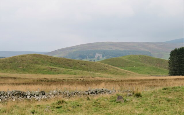
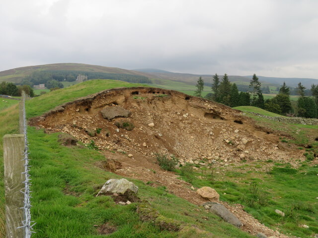
The area is known for its natural beauty and tranquility, making it a popular destination for those seeking a peaceful retreat. Visitors to Braes of Coul can enjoy breathtaking views of the surrounding landscape, with the Angus Glens and the Grampian Mountains visible in the distance.

The village itself is characterized by its quaint cottages and traditional stone buildings, giving it a timeless and idyllic feel. The local community is close-knit and friendly, with a strong sense of pride in their village.

Despite its small size, Braes of Coul offers a range of amenities to its residents and visitors. There is a local pub where visitors can enjoy a pint of the finest Scottish ale, as well as a few small shops that cater to the needs of the community.

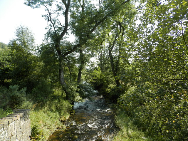
For those who enjoy outdoor activities, the surrounding countryside provides ample opportunities for walking, hiking, and birdwatching. The nearby Loch of Lintrathen is also a popular spot for fishing and boating.

In summary, Braes of Coul is a charming village in the Angus countryside, offering stunning natural beauty and a peaceful atmosphere. It is a hidden gem for those seeking a tranquil escape from the hustle and bustle of everyday life.

If you have any feedback on the listing, please let us know in the comments section below.

Braes of Coul Images

Images are sourced within 2km of 56.698988/-3.193692 or Grid Reference NO2757. Thanks to Geograph Open Source API. All images are credited.

Sand and mud flats, Loch of Lintrathen The northernmost corner of the loch where low water levels expose areas of sand and mud.
Sand and mud flats, Loch of Lintrathen
The northernmost corner of the loch where low water levels expose areas of sand and mud.
Melgam Water enters the Loch of Lintrathen The OS maps shows much of this area in blue, but with water levels low in the loch there is much sand and mud exposed which has become green with vegetation.
Melgam Water enters the Loch of Lintrathen
The OS maps shows much of this area in blue, but with water levels low in the loch there is much sand and mud exposed which has become green with vegetation.
Hummocky ground at Coul There are a lot of humps, hollows and ridges in this area, all signs of glacial deposition where ice from the glens met lower ground and deposited material. These humps look like moraines, but might be an esker.
Hummocky ground at Coul
There are a lot of humps, hollows and ridges in this area, all signs of glacial deposition where ice from the glens met lower ground and deposited material. These humps look like moraines, but might be an esker.
Rabbits just love moraines An exposed section of a glacial moraine at Coul with many different rocks embedded. The soft material is much liked by rabbits, as can be seen by the number of burrows in the mound.
Rabbits just love moraines
An exposed section of a glacial moraine at Coul with many different rocks embedded. The soft material is much liked by rabbits, as can be seen by the number of burrows in the mound.
The Back Water at Dykend
Field above Loch of Lintrathen A mapped clump of trees.
Field above Loch of Lintrathen
A mapped clump of trees.
Pitmudie View upstream, along the Melgam Water.
Pitmudie
View upstream, along the Melgam Water.
Woodland, Pitmudie
Woodland, Pitmudie
Pitmudie Fields amongst the woodlands near Loch of Lintrathen.
Pitmudie
Fields amongst the woodlands near Loch of Lintrathen.
Near Pitewan Grass field above the Melgam Water.
Near Pitewan
Grass field above the Melgam Water.
B951 A bridge over the Inzion Burn.
B951
A bridge over the Inzion Burn.
B951 Leaving Glen Isla for Kirriemuir.
B951
Leaving Glen Isla for Kirriemuir.
North of Loch of Lintrathen Cattle were grazing a set of fields with the interconnecting gates left open.  The woodlands are by the Inzeon Burn.
North of Loch of Lintrathen
Cattle were grazing a set of fields with the interconnecting gates left open. The woodlands are by the Inzeon Burn.
North of Loch of Lintrathen Cattle were grazing these fields.
North of Loch of Lintrathen
Cattle were grazing these fields.
Milestone, B954
Milestone, B954
Milestone, B954 On the Alyth to Glenisla road.
Milestone, B954
On the Alyth to Glenisla road.
Woodland, Glen Isla Looking down the Melgam Water from the B954.
Woodland, Glen Isla
Looking down the Melgam Water from the B954.
Woodland near Dykend A narrow woodland between moors and the B951.
Woodland near Dykend
A narrow woodland between moors and the B951.
Show me another place!

Braes of Coul is located at Grid Ref: NO2757 (Lat: 56.698988, Lng: -3.193692)

Unitary Authority: Angus

Police Authority: Tayside

What 3 Words

///microfilm.chair.calculating. Near Alyth, Perth & Kinross

Nearby Locations

Braes of Coul

Related Wikis

Loch of Lintrathen

Loch of Lintrathen is a man-made loch occupying a glacial basin at the southern end of Glen Isla, approximately 13 kilometres (8.1 mi) west of town of...

Backwater Reservoir

Backwater Reservoir is a reservoir in north west Angus, Scotland. The reservoir's sole purpose is to provide drinking water, and as such, it supplies Angus...

Balintore, Angus

Balintore (Scottish Gaelic: Baile an Todhair) is a village in Angus, Scotland. It lies in Glen Isla, four miles north of the Loch of Lintrathen and seven...

Balintore Castle

Balintore Castle is a Victorian Category A listed building in Scotland. The castle occupies an elevated site in moorland above Balintore village, a few...

Nearby Amenities

Located within 500m of 56.698988,-3.193692
Wester Coul
Place: isolated_dwelling
Lat/Long: 56.701634/-3.1902371
Power: pole
Lat/Long: 56.702232/-3.1906697
Power: pole
Lat/Long: 56.7022209/-3.1894892
Power: pole
Lat/Long: 56.7022062/-3.1882974
The data included in this document is from www.openstreetmap.org. The data is made available under ODbL.

Have you been to Braes of Coul?

Leave your review of Braes of Coul below (or comments, questions and feedback).