Bradnor Green

Settlement in Herefordshire

England

Bradnor Green

One man and his dog Out for a walk on Offa's Dyke Path on Hergest Ridge.
One man and his dog Credit: Oliver Dixon

Bradnor Green is a small rural village located in the county of Herefordshire, England. Situated approximately 7 miles east of the city of Hereford, it is nestled in the picturesque countryside, surrounded by rolling hills and lush green fields. The village is part of the Herefordshire Council and falls within the parliamentary constituency of North Herefordshire.

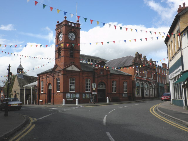
With a population of around 500 residents, Bradnor Green exudes a tranquil and peaceful atmosphere. The village boasts a charming mix of traditional and modern architecture, with several well-preserved historic buildings that add to its character. The heart of the village is the village green, a central space that serves as a gathering point for locals and visitors alike.

Despite its small size, Bradnor Green offers a range of amenities to its residents. These include a village hall, a primary school, a local pub, and a few small shops catering to essential needs. The village also benefits from good transport links, with regular bus services connecting it to nearby towns and cities.

Surrounded by the stunning Herefordshire countryside, Bradnor Green is a haven for nature lovers and outdoor enthusiasts. The village is blessed with an abundance of walking trails and scenic routes, providing opportunities for leisurely strolls and peaceful escapes. The nearby Bradnor Hill is a popular spot for hikers, offering panoramic views of the surrounding landscape.

In summary, Bradnor Green is a delightful village in Herefordshire that offers a tranquil lifestyle amidst beautiful natural surroundings. With its close-knit community and range of amenities, it provides a peaceful retreat for those seeking a slower pace of life.

If you have any feedback on the listing, please let us know in the comments section below.

Bradnor Green Images

Images are sourced within 2km of 52.211628/-3.0364639 or Grid Reference SO2957. Thanks to Geograph Open Source API. All images are credited.

One man and his dog Out for a walk on Offa's Dyke Path on Hergest Ridge.
One man and his dog
Out for a walk on Offa's Dyke Path on Hergest Ridge.
Offa's Dyke Path on Hergest Ridge
Out for a walk The section of Offa's Dyke Path on Hergest Ridge is extremely popular with walkers.
Out for a walk
The section of Offa's Dyke Path on Hergest Ridge is extremely popular with walkers.
"Welcome to Kington" Notice that greets Offa's Dyke walkers coming down off the bridleway on the Hergest Ridge in to Winterbourne Road in Kington. The town describes itself as "the centre for walking".
"Welcome to Kington"
Notice that greets Offa's Dyke walkers coming down off the bridleway on the Hergest Ridge in to Winterbourne Road in Kington. The town describes itself as "the centre for walking".
"Thank you for visiting Kington" Notice that bids farewell to Offa's Dyke walkers coming up from Winterbourne Road in Kington on to the bridleway on the Hergest Ridge. Kington describes itself as "the centre for walking".
"Thank you for visiting Kington"
Notice that bids farewell to Offa's Dyke walkers coming up from Winterbourne Road in Kington on to the bridleway on the Hergest Ridge. Kington describes itself as "the centre for walking".
Wind sculpture in Hergest Croft Gardens This finely balanced sculpture has three moving parts which rotate with the wind.
Wind sculpture in Hergest Croft Gardens
This finely balanced sculpture has three moving parts which rotate with the wind.
"Origin" Sculpture by Rolf Hook made from  Ledbury Yew (whatever that might be), standing in Hergest Croft Gardens.
"Origin"
Sculpture by Rolf Hook made from Ledbury Yew (whatever that might be), standing in Hergest Croft Gardens.
"Nascence" Sculpture by Rolf Hook made from  Ledbury Yew (whatever that might be), standing in Hergest Croft Gardens.
"Nascence"
Sculpture by Rolf Hook made from Ledbury Yew (whatever that might be), standing in Hergest Croft Gardens.
Stamping station, Offa's Dyke Path For those who wish to authenticate their walk along Offa's Dyke Path, this stamping station is provided beside the path into Hergest Croft Gardens.
Stamping station, Offa's Dyke Path
For those who wish to authenticate their walk along Offa's Dyke Path, this stamping station is provided beside the path into Hergest Croft Gardens.
Elegant houses off Church Street
High Street, Kington
Coach House Colonnaded 19th century structure in Mill Street adjacent to the Market Hall.
Coach House
Colonnaded 19th century structure in Mill Street adjacent to the Market Hall.
Market Hall Historic building in the centre of Kington. The Coach House lies beyond.
Market Hall
Historic building in the centre of Kington. The Coach House lies beyond.
Hedging your bets The street sign for Llewellin Road - an unusual spelling - is buried deep in the hedge.
Hedging your bets
The street sign for Llewellin Road - an unusual spelling - is buried deep in the hedge.
Duke Street, Kington The street was closed as a post-Covid government fund is paying to spruce up the frontages of its many fascinating and beautiful old buildings.
Duke Street, Kington
The street was closed as a post-Covid government fund is paying to spruce up the frontages of its many fascinating and beautiful old buildings.
Ridgebourne Road Offa's Dyke Path follows Ridgebourne Road as it descends from Hergest Ridge into Kington.
Ridgebourne Road
Offa's Dyke Path follows Ridgebourne Road as it descends from Hergest Ridge into Kington.
War Memorial on The Square War Memorial on The Square in Kington.
War Memorial on The Square
War Memorial on The Square in Kington.
Market Hall, Kington Kington's Market Hall was built in the 1880s and is Grade II listed, see: <span class="nowrap"><a title="https://historicengland.org.uk/listing/the-list/list-entry/1208120?section=official-list-entry" rel="nofollow ugc noopener" href="https://historicengland.org.uk/listing/the-list/list-entry/1208120?section=official-list-entry">Link</a><img style="margin-left:2px;" alt="External link" title="External link - shift click to open in new window" src="https://s1.geograph.org.uk/img/external.png" width="10" height="10"/></span>
Market Hall, Kington
Kington's Market Hall was built in the 1880s and is Grade II listed, see: LinkExternal link
Show me another place!

Bradnor Green is located at Grid Ref: SO2957 (Lat: 52.211628, Lng: -3.0364639)

Unitary Authority: County of Herefordshire

Police Authority: West Mercia

What 3 Words

///motivates.loved.display. Near Kington, Herefordshire

Nearby Locations

Newton Bradnor Green

Related Wikis

Kington Castle

Kington Castle stood in the medieval market town of Kington in Herefordshire, England (grid reference SO291569). It was built in the 11th century and destroyed...

Church of St Mary, Kington

The Church of St Mary, or St. Mary the Virgin Church, Kington, Herefordshire, England is a Grade I listed parish church. The church was established c....

Kington Museum

Kington Museum is a volunteer-run local history museum in the market town of Kington, Herefordshire, England. It opened in June 1986 and occupies the stable...

Kington, Herefordshire

Kington is a market town, electoral ward and civil parish in Herefordshire, England. The ward had a population of 3,240, while the 2011 Census registered...

Nearby Amenities

Located within 500m of 52.211628,-3.0364639
Barrier: stile
Lat/Long: 52.2107104/-3.0374259
Barrier: cattle_grid
Lat/Long: 52.2152287/-3.0392839
Power: pole
Lat/Long: 52.2104748/-3.0432692
Power: pole
Lat/Long: 52.2105339/-3.0418664
Power: pole
Lat/Long: 52.2105307/-3.040933
Power: pole
Lat/Long: 52.210552/-3.0393827
Power: pole
Lat/Long: 52.2105685/-3.038055
Power: pole
Lat/Long: 52.2106095/-3.0365154
Power: pole
Lat/Long: 52.210626/-3.0354103
Power: pole
Lat/Long: 52.2106375/-3.0345011
Power: pole
Lat/Long: 52.2106539/-3.0335033
Power: pole
Lat/Long: 52.2107082/-3.0325243
Power: pole
Lat/Long: 52.2107788/-3.0314782
Power: pole
Lat/Long: 52.210861/-3.0301747
Power: pole
Lat/Long: 52.2111355/-3.0291903
Power: pole
Lat/Long: 52.2114938/-3.0415338
Power: pole
Lat/Long: 52.2119983/-3.0397636
Power: pole
Lat/Long: 52.2123796/-3.0382562
Power: pole
Lat/Long: 52.2126607/-3.0370277
Power: pole
Lat/Long: 52.212871/-3.0361748
Power: pole
Lat/Long: 52.213415/-3.0350027
Power: pole
Lat/Long: 52.2134692/-3.0346298
Power: pole
Lat/Long: 52.2136549/-3.0333182
Power: pole
Lat/Long: 52.2138604/-3.0318913
Power: pole
Lat/Long: 52.2140806/-3.0304724
Direction: SSW
Generator Method: photovoltaic
Generator Output Electricity: yes
Generator Solar Modules: 7
Generator Source: solar
Generator Type: solar_photovoltaic_panel
Location: roof
Power: generator
Lat/Long: 52.2118405/-3.0376259
Bradnor Green
Place: hamlet
Lat/Long: 52.2124881/-3.0370277
Direction: 165
Generator Method: photovoltaic
Generator Output Electricity: yes
Generator Solar Modules: 8
Generator Source: solar
Generator Type: solar_photovoltaic_panel
Location: roof
Power: generator
Lat/Long: 52.2082986/-3.0348927
Access: no
Foot: yes
Lat/Long: 52.2080521/-3.0350053
Crossing
Crossing: unmarked
Crossing Markings: no
Lat/Long: 52.2121422/-3.0384779
Barrier: stile
Material: wood
Lat/Long: 52.2102152/-3.0393459
Barrier: stile
Material: wood
Lat/Long: 52.2095733/-3.0407015
Information: guidepost
Tourism: information
Lat/Long: 52.2095125/-3.0407687
Crossing
Crossing: unmarked
Crossing Markings: no
Lat/Long: 52.2130566/-3.0421099
Crossing
Crossing: unmarked
Crossing Markings: no
Lat/Long: 52.2133893/-3.0418506
Information: guidepost
Tourism: information
Lat/Long: 52.214056/-3.0417069
Information: guidepost
Tourism: information
Lat/Long: 52.2149711/-3.0396899
Rhue Ville
Place: locality
Lat/Long: 52.208087/-3.034868
Barrier: kissing_gate
Lat/Long: 52.2079588/-3.0346944
Access: no
Barrier: swing_gate
Foot: yes
Lat/Long: 52.2080343/-3.0352455
The data included in this document is from www.openstreetmap.org. The data is made available under ODbL.

Have you been to Bradnor Green?

Leave your review of Bradnor Green below (or comments, questions and feedback).