Halton, West

Settlement in Lincolnshire

England

Halton, West

On the bend in Northlands Road Straight ahead is the complex known as Northlands, while Northlands Road bends to the left here.
On the bend in Northlands Road Credit: Marathon

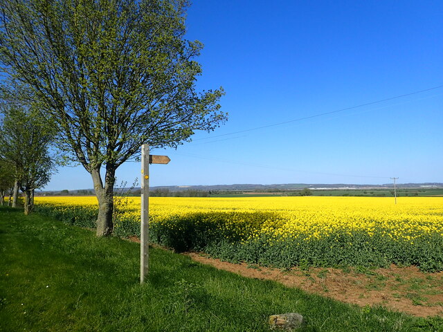
Halton West is a small village located in the county of Lincolnshire, in the East Midlands region of England. Situated near the River Witham, the village is nestled amidst picturesque countryside, offering residents and visitors a tranquil and scenic environment.

With a population of approximately 200 people, Halton West is a close-knit community that maintains a strong sense of local pride and community spirit. The village is known for its friendly and welcoming atmosphere, with residents often organizing various social events and activities throughout the year.

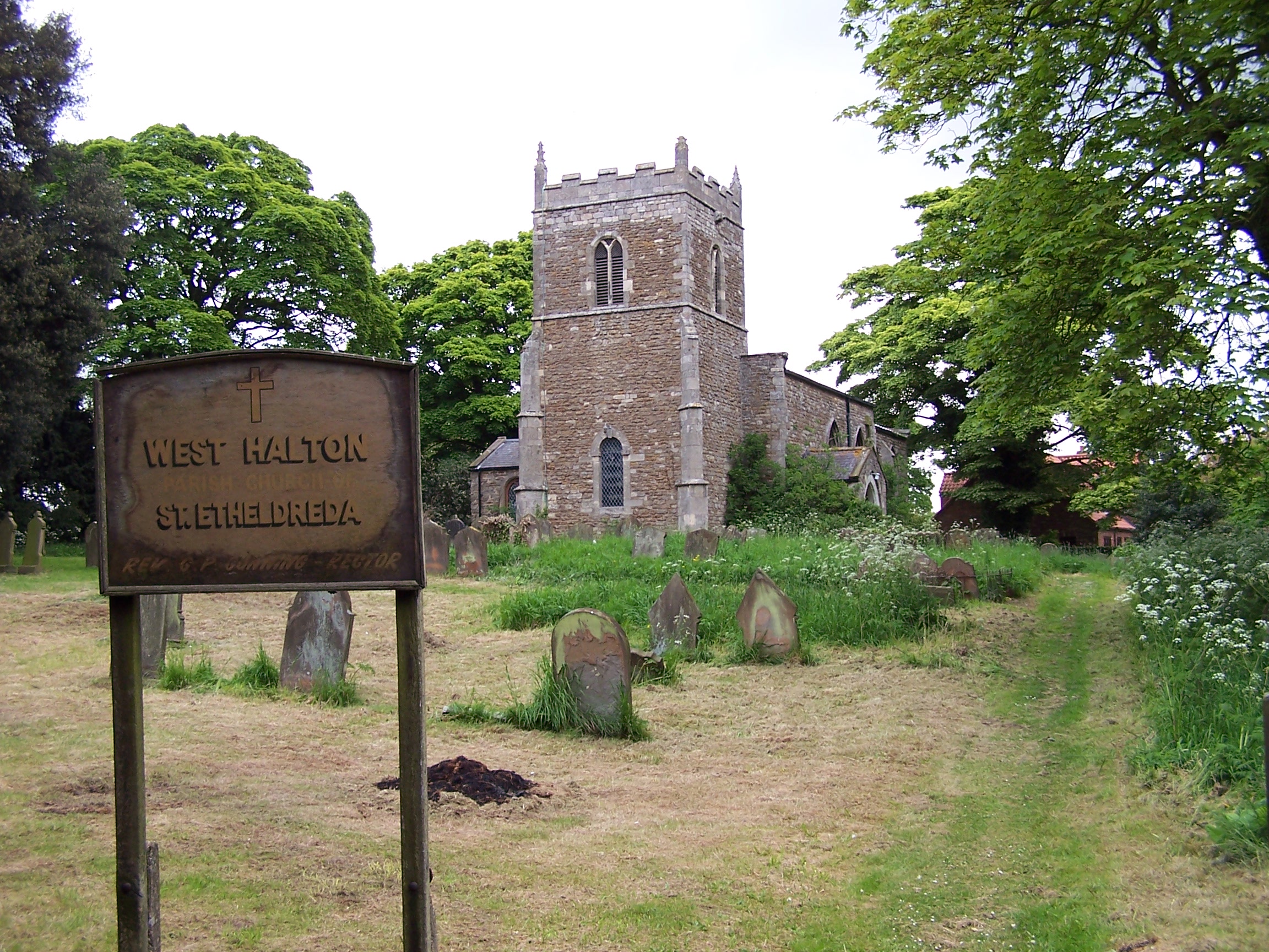
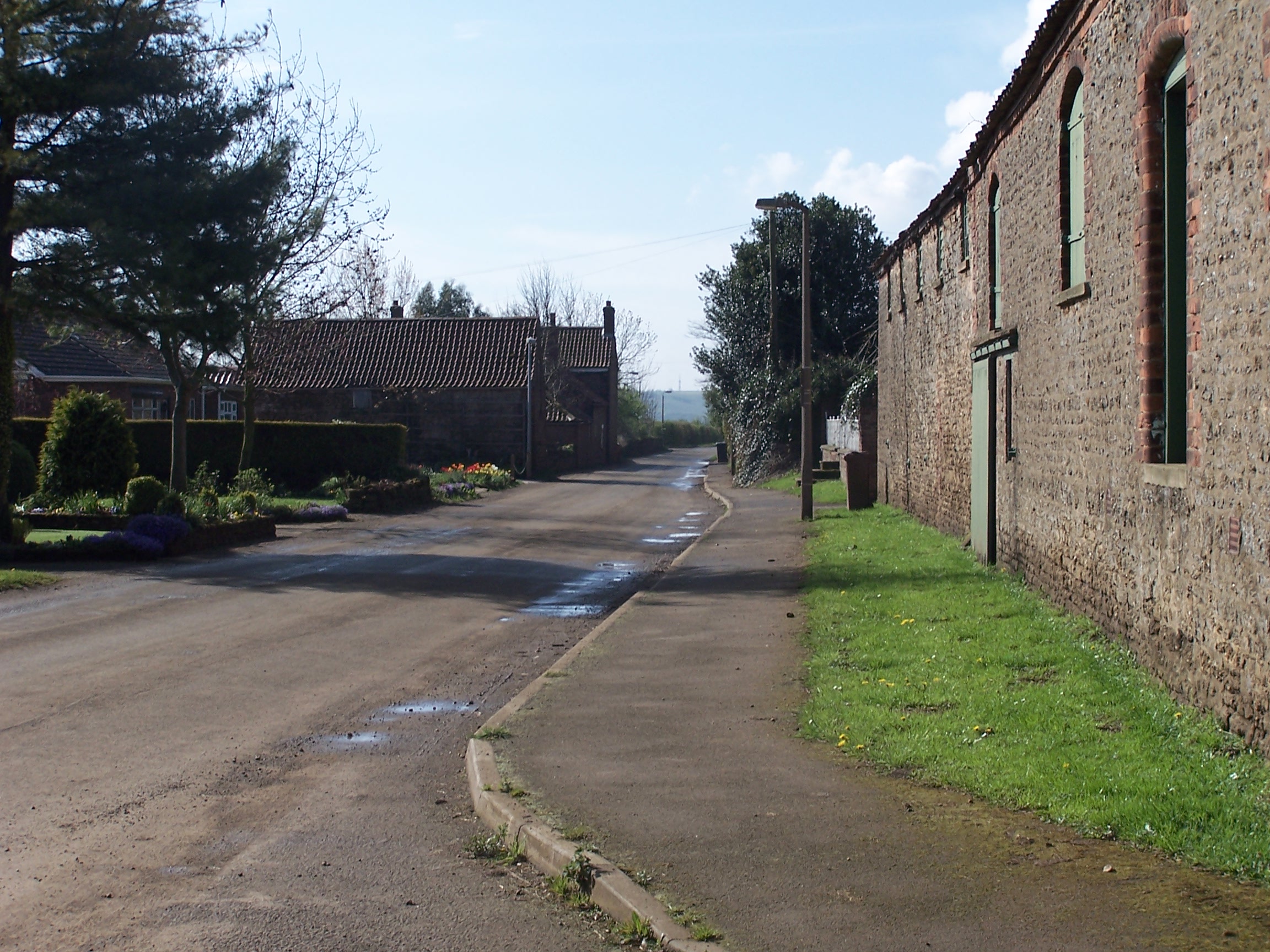
The village features a mix of traditional and modern architecture, with charming cottages and contemporary houses dotting the landscape. The local church, St. Mary's, is a notable landmark, known for its beautiful stained glass windows and historic significance.

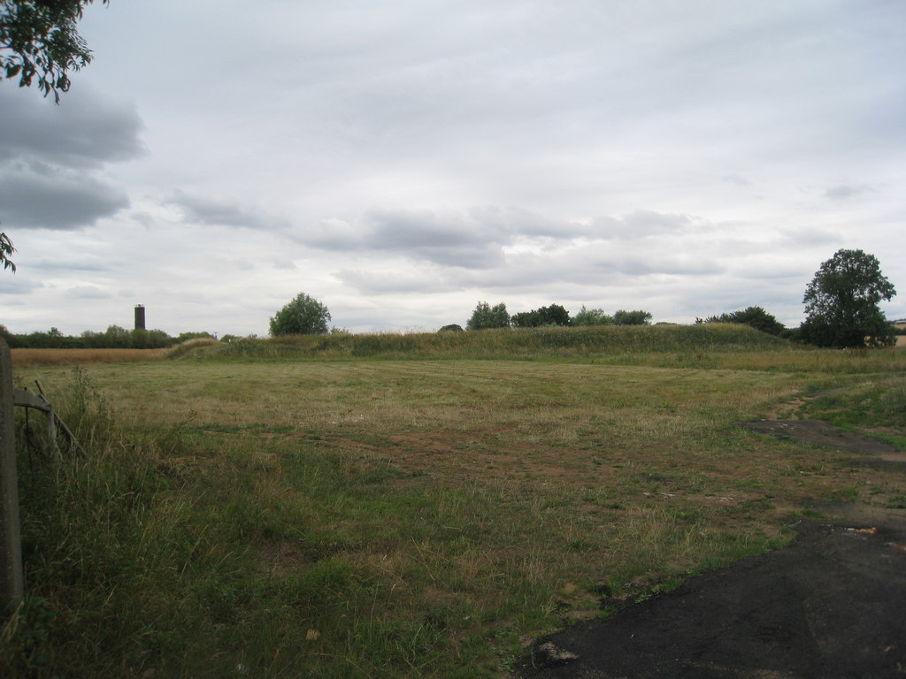
Halton West benefits from its idyllic rural location, with ample opportunities for outdoor activities such as hiking, cycling, and fishing. The surrounding countryside offers stunning views and is a haven for nature enthusiasts.

While the village itself is relatively small, it benefits from its close proximity to nearby towns and cities. Lincoln, the county town of Lincolnshire, is just a short drive away and offers a wide range of amenities, including shopping centers, restaurants, and cultural attractions.

Overall, Halton West is a charming and peaceful village that provides a haven for those seeking a rural lifestyle while still being within easy reach of larger towns and cities.

If you have any feedback on the listing, please let us know in the comments section below.

Halton, West Images

Images are sourced within 2km of 53.677789/-0.628637 or Grid Reference SE9021. Thanks to Geograph Open Source API. All images are credited.

On the bend in Northlands Road Straight ahead is the complex known as Northlands, while Northlands Road bends to the left here.
On the bend in Northlands Road
Straight ahead is the complex known as Northlands, while Northlands Road bends to the left here.
The entrance to Northlands Straight ahead is the complex known as Northlands, while Northlands Road bends to the left here.
The entrance to Northlands
Straight ahead is the complex known as Northlands, while Northlands Road bends to the left here.
A1077 Mere Lane
A1077 Mere Lane
View from Whitton Road The footpath leads past Bishopthorpe to Winteringham. The Yorkshire Wolds can be seen in the distance beyond the River Humber.
View from Whitton Road
The footpath leads past Bishopthorpe to Winteringham. The Yorkshire Wolds can be seen in the distance beyond the River Humber.
Whitton Road This is between West Halton and Whitton, looking towards the latter. The Yorkshire Wolds can be seen in the distance  on the right, beyond the River Humber.
Whitton Road
This is between West Halton and Whitton, looking towards the latter. The Yorkshire Wolds can be seen in the distance on the right, beyond the River Humber.
St Etheldreda's Church, West Halton The church dates from 1692, when there was a fire, and is in Gothic style, although there are earlier parts remaining.
St Etheldreda's Church, West Halton
The church dates from 1692, when there was a fire, and is in Gothic style, although there are earlier parts remaining.
On the slope of the Lincolnshire Wolds This is at the northern end of the Lincolnshire Wolds, between West Halton and Top Road (A1077).
On the slope of the Lincolnshire Wolds
This is at the northern end of the Lincolnshire Wolds, between West Halton and Top Road (A1077).
Top Road This is the A1077. Continuing straight ahead brings you to Winteringham, although the A1077 turns sharp right just ahead.
Top Road
This is the A1077. Continuing straight ahead brings you to Winteringham, although the A1077 turns sharp right just ahead.
View from Whitton Road This is just north of Wetherhills. The Yorkshire Wolds can be seen in the distance beyond the River Humber.
View from Whitton Road
This is just north of Wetherhills. The Yorkshire Wolds can be seen in the distance beyond the River Humber.
Whitton Road The road from West Halton to Whitton is dead straight. Whitton can be seen in the distance. The Yorkshire Wolds can be seen in the distance, on the right, beyond the River Humber.
Whitton Road
The road from West Halton to Whitton is dead straight. Whitton can be seen in the distance. The Yorkshire Wolds can be seen in the distance, on the right, beyond the River Humber.
Alongside Whitton Road This is between West Halton and Whitton, looking towards the latter. The Yorkshire Wolds can be seen in the distance on the right, beyond the River Humber.
Alongside Whitton Road
This is between West Halton and Whitton, looking towards the latter. The Yorkshire Wolds can be seen in the distance on the right, beyond the River Humber.
Whitton Road The road from Whitton to West Halton is dead straight. This looks in the direction of the latter.
Whitton Road
The road from Whitton to West Halton is dead straight. This looks in the direction of the latter.
St Etheldreda's Church, West Halton The church dates from 1692, when there was a fire, and is in Gothic style, although there are earlier parts remaining.
St Etheldreda's Church, West Halton
The church dates from 1692, when there was a fire, and is in Gothic style, although there are earlier parts remaining.
Winterton Beck This is at the northern end of the Lincolnshire Wolds, between West Halton and Top Road (A1077). Winterton Beck joins Halton Drain just north of here, which in its turn flows into the River Humber. This view looks upstream.
Winterton Beck
This is at the northern end of the Lincolnshire Wolds, between West Halton and Top Road (A1077). Winterton Beck joins Halton Drain just north of here, which in its turn flows into the River Humber. This view looks upstream.
Winterton Beck This is at the northern end of the Lincolnshire Wolds, between West Halton and Top Road (A1077). Winterton Beck joins Halton Drain just north of here, which in its turn flows into the River Humber. This view looks downstream.
Winterton Beck
This is at the northern end of the Lincolnshire Wolds, between West Halton and Top Road (A1077). Winterton Beck joins Halton Drain just north of here, which in its turn flows into the River Humber. This view looks downstream.
Pylons seen from Top Road This view is from the junction of Top Road with the road to West Halton,
Pylons seen from Top Road
This view is from the junction of Top Road with the road to West Halton,
Farmland near Coleby
Show me another place!

Halton, West is located at Grid Ref: SE9021 (Lat: 53.677789, Lng: -0.628637)

Division: Parts of Lindsey

Unitary Authority: North Lincolnshire

Police Authority: Humberside

What 3 Words

///headstone.twists.seeing. Near Whitton, Lincolnshire

Nearby Locations

Halton, West West Halton

Related Wikis

West Halton

West Halton is a village and civil parish in North Lincolnshire, England. It is situated 2.5 miles (4 km) north-west from Winterton, approximately 7 miles...

West Halton railway station

West Halton railway station was a station in West Halton, Lincolnshire. The station was built by the North Lindsey Light Railway on its line from Scunthorpe...

Coleby, North Lincolnshire

Coleby is a hamlet in the civil parish of West Halton in North Lincolnshire, England. It is situated approximately 7 miles (11 km) north from Scunthorpe...

Winterton and Thealby railway station

Winterton and Thealby railway station was a station built by the North Lindsey Light Railway in Winterton, Lincolnshire, on their line from Scunthorpe...

Nearby Amenities

Located within 500m of 53.677789,-0.628637
West Halton
Place: village
Source: NPE
Wikidata: Q1138666
Lat/Long: 53.6777943/-0.6307715
Bus Stop
Coleby Road
Alt Name: St Etheldeda Close
Naptan AltCommonName: St Etheldeda Close
Naptan AltIndicator: opp
Naptan AltStreet: Alkborough Lane
Naptan AtcoCode: 227000010660
Naptan Bearing: E
Naptan CommonName: Coleby Road
Naptan Indicator: adj
Naptan NaptanCode: scudpga
Naptan Street: Alkborough Lane
Naptan Verified: no
Source: naptan_import
Lat/Long: 53.6782337/-0.6325817
Bus Stop
Coleby Road
Alt Name: St Etheldreda Close
Naptan AltCommonName: St Etheldreda Close
Naptan AltIndicator: adj
Naptan AltStreet: Alkborough Lane
Naptan AtcoCode: 227000010661
Naptan Bearing: W
Naptan CommonName: Coleby Road
Naptan Indicator: opp
Naptan NaptanCode: scudtga
Naptan Street: Alkborough Lane
Naptan Verified: no
Source: naptan_import
Lat/Long: 53.678145/-0.6326905
Bus Stop
Short Lane
Alt Name: West Street
Naptan AltCommonName: West Street
Naptan AltIndicator: opp
Naptan AltStreet: Alkborough Lane
Naptan AtcoCode: 227000010662
Naptan Bearing: N
Naptan CommonName: Short Lane
Naptan Indicator: adj
Naptan Landmark: Short Lane
Naptan NaptanCode: scudwga
Naptan Street: Church Side
Naptan Verified: no
Source: naptan_import
Lat/Long: 53.6775494/-0.6301209
Bus Stop
Short Lane
Alt Name: West Street
Naptan AltCommonName: West Street
Naptan AltIndicator: adj
Naptan AltStreet: Church Side
Naptan AtcoCode: 227000010663
Naptan Bearing: S
Naptan CommonName: Short Lane
Naptan Indicator: opp
Naptan NaptanCode: scugaga
Naptan Street: Church Side
Naptan Verified: no
Source: naptan_import
Lat/Long: 53.677521/-0.6300007
Pub
The Butcher's Arms
Addr Housename: The Butcher's Arms
Addr Street: White House Lane
Lat/Long: 53.6778096/-0.6277252
Glebe Farm
Place: farm
Source: Bing
Lat/Long: 53.6748411/-0.6326787
Generator Method: photovoltaic
Generator Output Electricity: yes
Generator Source: solar
Generator Type: solar_photovoltaic_panel
Location: roof
Power: generator
Lat/Long: 53.6771549/-0.6327841
Generator Method: photovoltaic
Generator Output Electricity: yes
Generator Source: solar
Generator Type: solar_photovoltaic_panel
Location: roof
Power: generator
Lat/Long: 53.6772518/-0.6327948
Generator Method: photovoltaic
Generator Output Electricity: yes
Generator Source: solar
Generator Type: solar_photovoltaic_panel
Location: roof
Power: generator
Lat/Long: 53.6773757/-0.6328431
Generator Method: photovoltaic
Generator Output Electricity: yes
Generator Source: solar
Generator Type: solar_photovoltaic_panel
Location: roof
Power: generator
Lat/Long: 53.6774758/-0.6328163
Generator Method: photovoltaic
Generator Output Electricity: yes
Generator Source: solar
Generator Type: solar_photovoltaic_panel
Location: roof
Power: generator
Lat/Long: 53.6775855/-0.6328753
Generator Method: photovoltaic
Generator Output Electricity: yes
Generator Source: solar
Generator Type: solar_photovoltaic_panel
Location: roof
Power: generator
Lat/Long: 53.6777157/-0.6328806
Generator Method: photovoltaic
Generator Output Electricity: yes
Generator Source: solar
Generator Type: solar_photovoltaic_panel
Location: roof
Power: generator
Lat/Long: 53.6767704/-0.6286374
Generator Method: photovoltaic
Generator Output Electricity: yes
Generator Source: solar
Generator Type: solar_photovoltaic_panel
Location: roof
Power: generator
Lat/Long: 53.6774536/-0.6280714
Generator Method: photovoltaic
Generator Output Electricity: yes
Generator Source: solar
Generator Type: solar_photovoltaic_panel
Location: roof
Power: generator
Lat/Long: 53.6776808/-0.6281358
Generator Method: photovoltaic
Generator Output Electricity: yes
Generator Source: solar
Generator Type: solar_photovoltaic_panel
Location: roof
Power: generator
Lat/Long: 53.6787579/-0.628852
Generator Method: photovoltaic
Generator Output Electricity: yes
Generator Source: solar
Generator Type: solar_photovoltaic_panel
Location: roof
Power: generator
Lat/Long: 53.6788008/-0.6286079
Generator Method: photovoltaic
Generator Output Electricity: yes
Generator Source: solar
Generator Type: solar_photovoltaic_panel
Location: roof
Power: generator
Lat/Long: 53.6798454/-0.6237705
Post Office
West Halton Post Office
Addr City: Scunthorpe
Addr Country: GB
Addr Postcode: DN15 9AP
Addr Street: Coleby Road
Addr Village: West Halton
Brand: Post Office
Brand Wikidata: Q1783168
Check Date: 2022-05-27
Opening Hours: Th 10:00-12:00
Ref Pol Id: 167981
Lat/Long: 53.6775851/-0.6318854
The data included in this document is from www.openstreetmap.org. The data is made available under ODbL.

Have you been to Halton, West?

Leave your review of Halton, West below (or comments, questions and feedback).