Grinstead, West

Settlement in Sussex Horsham

England

Grinstead, West

Trees and rape-field SW of Clothalls Farm
Trees and rape-field SW of Clothalls Farm Credit: Ian Cunliffe

Grinstead is a small village located in the district of West Sussex, England. Situated approximately 10 miles south-west of the county town of Chichester, Grinstead is nestled in the picturesque South Downs National Park. With a population of around 500 residents, it is a close-knit community with a peaceful and rural atmosphere.

The village is surrounded by rolling hills, offering breathtaking views of the surrounding countryside. This makes it an ideal destination for nature lovers and outdoor enthusiasts, who can explore the numerous walking and cycling trails in the area. The nearby Kingley Vale National Nature Reserve is particularly popular, boasting ancient yew woodlands and diverse wildlife.

Despite its small size, Grinstead has a rich history. It is home to a number of historical buildings, including the Grade II listed St. James Church, which dates back to the 13th century. The church's stunning architecture and beautiful stained glass windows attract visitors from far and wide.

While Grinstead lacks some of the amenities found in larger towns, it does have a charming village pub, The Fox and Hounds, which serves traditional British cuisine and local ales. The village also hosts an annual summer fete, bringing residents together for a day of games, food, and entertainment.

Grinstead offers a tranquil retreat from the hustle and bustle of city life, providing a peaceful environment for those seeking a slower pace of living. With its natural beauty and historical charm, Grinstead is a hidden gem in the heart of West Sussex.

If you have any feedback on the listing, please let us know in the comments section below.

Grinstead, West Images

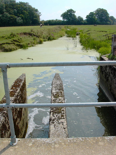
Images are sourced within 2km of 50.977758/-0.330451 or Grid Reference TQ1721. Thanks to Geograph Open Source API. All images are credited.

Trees and rape-field SW of Clothalls Farm
Tree trunk south of Clothalls Farm
The Weir at Hatterell Bridge
Jasmine Cottage, Rookcross Lane Situated at the junction of the lane with the entrance to Rooklands Farm.
Jasmine Cottage, Rookcross Lane
Situated at the junction of the lane with the entrance to Rooklands Farm.
Bridleway off the Downs Link This bridleway leaves the Downs Link near Partridge Green heading west to the River Adur and Hatterell bridge.
Bridleway off the Downs Link
This bridleway leaves the Downs Link near Partridge Green heading west to the River Adur and Hatterell bridge.
Bridleway to Hatterell bridge After dropping through Whitewick Rough (woodland) the bridleway crosses the flood plain to the river Adur and Hatterell bridge.
Bridleway to Hatterell bridge
After dropping through Whitewick Rough (woodland) the bridleway crosses the flood plain to the river Adur and Hatterell bridge.
Hatterell bridge Hatterell bridge crosses the river Adur and is now a gauging station.  Once, when the river was part of the Adur navigation, there was a drawbridge here.
For more on the Adur navigation and the Baybridge canal <span class="nowrap"><a title="http://www.sussex.co.uk/waterways/baybridge.htm" rel="nofollow ugc noopener" href="http://www.sussex.co.uk/waterways/baybridge.htm">Link</a><img style="margin-left:2px;" alt="External link" title="External link - shift click to open in new window" src="https://s1.geograph.org.uk/img/external.png" width="10" height="10"/></span> and on the river Adur <span class="nowrap"><a title="http://www.adur.org.uk/index.htm" rel="nofollow ugc noopener" href="http://www.adur.org.uk/index.htm">Link</a><img style="margin-left:2px;" alt="External link" title="External link - shift click to open in new window" src="https://s1.geograph.org.uk/img/external.png" width="10" height="10"/></span>
Hatterell bridge
Hatterell bridge crosses the river Adur and is now a gauging station. Once, when the river was part of the Adur navigation, there was a drawbridge here. For more on the Adur navigation and the Baybridge canal LinkExternal link and on the river Adur LinkExternal link
Pond at Hatterell's farm Hatterell farm has now gone and has been ploughed under (see Old Maps <span class="nowrap"><a title="http://www.old-maps.co.uk/" rel="nofollow ugc noopener" href="http://www.old-maps.co.uk/">Link</a><img style="margin-left:2px;" alt="External link" title="External link - shift click to open in new window" src="https://s1.geograph.org.uk/img/external.png" width="10" height="10"/></span> for an 1879 OS map) but its pond survives (but for how long?).
Pond at Hatterell's farm
Hatterell farm has now gone and has been ploughed under (see Old Maps LinkExternal link for an 1879 OS map) but its pond survives (but for how long?).
Clothall's Farmhouse Clothalls is on a moated site with the southern (right) representing the earliest portion.  A three-bay hall and northern cross-wing being added in the  C15.
Clothall is a small parish in Hertfordshire and a family from there seems to have made its way to Sussex.  Adam de Clothale married into the 'de Grensted' family about 1270.  The last, Richard de Clothale, died in 1454.
'Wealden Buildings' Editor John Warren.  Coach Publishing, Horsham 1990.  ISBN 0 902608 06 1
'The Victoria County History' A History of the County of Sussex: Volume 6 Part 2
Bramber Rape (North-Western Part) including Horsham
Clothall's Farmhouse
Clothalls is on a moated site with the southern (right) representing the earliest portion. A three-bay hall and northern cross-wing being added in the C15. Clothall is a small parish in Hertfordshire and a family from there seems to have made its way to Sussex. Adam de Clothale married into the 'de Grensted' family about 1270. The last, Richard de Clothale, died in 1454. 'Wealden Buildings' Editor John Warren. Coach Publishing, Horsham 1990. ISBN 0 902608 06 1 'The Victoria County History' A History of the County of Sussex: Volume 6 Part 2 Bramber Rape (North-Western Part) including Horsham
River Adur looking north from Hatterell bridge This section of the river Adur was part of the Baybridge canal which ran for 3.5 miles from Pike's brook, near Knepp castle, to Locks farm.  From Locks farm, as the Adur Navigation, the river ran to the sea at Shoreham.
See <span class="nowrap"><a title="http://www.sussex.co.uk/waterways/baybridge.htm" rel="nofollow ugc noopener" href="http://www.sussex.co.uk/waterways/baybridge.htm">Link</a><img style="margin-left:2px;" alt="External link" title="External link - shift click to open in new window" src="https://s1.geograph.org.uk/img/external.png" width="10" height="10"/></span>
for just a little more.
The canal had closed by 1875 due to competition from the Horsham to Shoreham railway.
River Adur looking north from Hatterell bridge
This section of the river Adur was part of the Baybridge canal which ran for 3.5 miles from Pike's brook, near Knepp castle, to Locks farm. From Locks farm, as the Adur Navigation, the river ran to the sea at Shoreham. See LinkExternal link for just a little more. The canal had closed by 1875 due to competition from the Horsham to Shoreham railway.
Furze Wood Viewed from the junction of footpaths near Sussex Farm at sunrise.
Furze Wood
Viewed from the junction of footpaths near Sussex Farm at sunrise.
River Adur This is the western branch of the river which splits north-west of Henfield and rises near Itchingfield. Hookshile Wood provides the back drop.
River Adur
This is the western branch of the river which splits north-west of Henfield and rises near Itchingfield. Hookshile Wood provides the back drop.
Footpath to West Grinstead Following the eastern bank of the Adur though here it moves away from the river following the eastern edge of the flood plain.
Footpath to West Grinstead
Following the eastern bank of the Adur though here it moves away from the river following the eastern edge of the flood plain.
Farmland near the River Adur The line of reeds in the foreground mark the course of the river.
Farmland near the River Adur
The line of reeds in the foreground mark the course of the river.
River Adur Looking towards Hatterell Bridge which can just be made out in the distance. The woods to the east are blocking the sunlight and causing long shadows here. This is the western branch of the river that splits north-west of Henfield and rises near Itchingfield.
River Adur
Looking towards Hatterell Bridge which can just be made out in the distance. The woods to the east are blocking the sunlight and causing long shadows here. This is the western branch of the river that splits north-west of Henfield and rises near Itchingfield.
Hatterell Bridge Once a drawbridge over this section of the river that was straightened during the late 18th century and was navigable as far as Bay Bridge now the point where the A24 crosses the river. It was replaced by the current gauging station during the 1960s.
Hatterell Bridge
Once a drawbridge over this section of the river that was straightened during the late 18th century and was navigable as far as Bay Bridge now the point where the A24 crosses the river. It was replaced by the current gauging station during the 1960s.
River Adur Taken from Hatterell's Bridge. The river was straightened and made navigable in 1825 as far as the wharf at Bay Bridge and saw regular barges travelling the waterway until the opening of the Horsham-Shoreham railway in 1861 ruined it. The company operating it ceased to function in 1875 though some traffic remained until the 1890s.
River Adur
Taken from Hatterell's Bridge. The river was straightened and made navigable in 1825 as far as the wharf at Bay Bridge and saw regular barges travelling the waterway until the opening of the Horsham-Shoreham railway in 1861 ruined it. The company operating it ceased to function in 1875 though some traffic remained until the 1890s.
Bridleway to Clothalls Farm Linking the farm with Jolesfield Common via Haterells Bridge.
Bridleway to Clothalls Farm
Linking the farm with Jolesfield Common via Haterells Bridge.
Show me another place!

Grinstead, West is located at Grid Ref: TQ1721 (Lat: 50.977758, Lng: -0.330451)

Administrative County: West Sussex

District: Horsham

Police Authority: Sussex

What 3 Words

///instilled.blip.absorbs. Near Partridge Green, West Sussex

Related Wikis

Shrine of Our Lady of Consolation

The Church of Our Lady of Consolation and St Francis is a Roman Catholic parish church in West Grinstead, in West Sussex. It was built from 1875 to 1876...

West Grinstead

West Grinstead is a village and civil parish in the Horsham District of West Sussex, England. It lies just off the B2135 road four miles (6.3 km) northwest...

St George's Church, West Grinstead

St George's Church is an Anglican church in West Grinstead, West Sussex, England. It is in the Diocese of Chichester, occupying a rural position in the...

Knepp Castle

The medieval Knepp Castle (sometimes referred to as 'Old Knepp Castle', to distinguish it from the nearby 19th-century mansion) is to the west of the village...

Nearby Amenities

Located within 500m of 50.977758,-0.330451
West Grinstead
Is In: West Sussex, England, UK
Place: village
Source: npe
Wikidata: Q847396
Lat/Long: 50.97801/-0.3255026
The Priory
Naptan AtcoCode: 4400HR0472
Naptan Bearing: N
Naptan BusStopType: CUS
Naptan CommonName: The Priory
Naptan Indicator: opp West Grinstead Church
Naptan Landmark: Steyning Road
Naptan NaptanCode: wsxawmaw
Naptan ShortCommonName: W Grinstead Priory
Naptan Street: Park Lane
Naptan Verified: no
Source: naptan_import
Lat/Long: 50.977838/-0.325185
Steyning Road
Naptan AtcoCode: 4400HR0815
Naptan Bearing: NW
Naptan BusStopType: CUS
Naptan CommonName: Steyning Road
Naptan Indicator: HAR
Naptan Landmark: Hail & Ride
Naptan NaptanCode: wsxdwmdj
Naptan Street: Steyning Road
Naptan Verified: no
Source: naptan_import
Lat/Long: 50.9778887/-0.3344253
Steyning Road
Naptan AtcoCode: 4400HR0816
Naptan Bearing: E
Naptan BusStopType: CUS
Naptan CommonName: Steyning Road
Naptan Indicator: HAR
Naptan Landmark: Hail & Ride
Naptan NaptanCode: wsxdwmdm
Naptan Street: Steyning Road
Naptan Verified: no
Source: naptan_import
Lat/Long: 50.977961/-0.3344512
Barrier: stile
Lat/Long: 50.9778635/-0.3303671
Power: pole
Lat/Long: 50.9744291/-0.3352591
Barrier: stile
Lat/Long: 50.9748018/-0.331747
Power: pole
Lat/Long: 50.9743704/-0.326602
Power: pole
Lat/Long: 50.9745367/-0.3284024
Power: pole
Lat/Long: 50.9762798/-0.3258166
Power: pole
Lat/Long: 50.9774971/-0.3252988
Power: pole
Lat/Long: 50.9752776/-0.3262289
Power: pole
Lat/Long: 50.9769992/-0.3255106
Post Box
Collection Times: Mo-Fr 16:00; Sa 08:45
Operator: Royal Mail
Operator Wikidata: Q638098
Post Box Mounting: brick_wall
Post Box Type: wall
Ref: RH13 187
Royal Cypher: GR
Royal Cypher Wikidata: Q33102273
Lat/Long: 50.9778625/-0.3250676
Glebe House
Place: isolated_dwelling
Lat/Long: 50.973737/-0.3321046
Glebe Farm
Place: isolated_dwelling
Lat/Long: 50.9742223/-0.331072
The data included in this document is from www.openstreetmap.org. The data is made available under ODbL.

Have you been to Grinstead, West?

Leave your review of Grinstead, West below (or comments, questions and feedback).