West Garforth

Settlement in Yorkshire

England

West Garforth

Garforth station: former station building There has been a station here since 1834. The two-storey building seen here is probably the original station building, no longer in railway use (currently an Italian restaurant), but the lower building to the left still includes a ticket office staffed at peak times.
Garforth station: former station building Credit: Stephen Craven

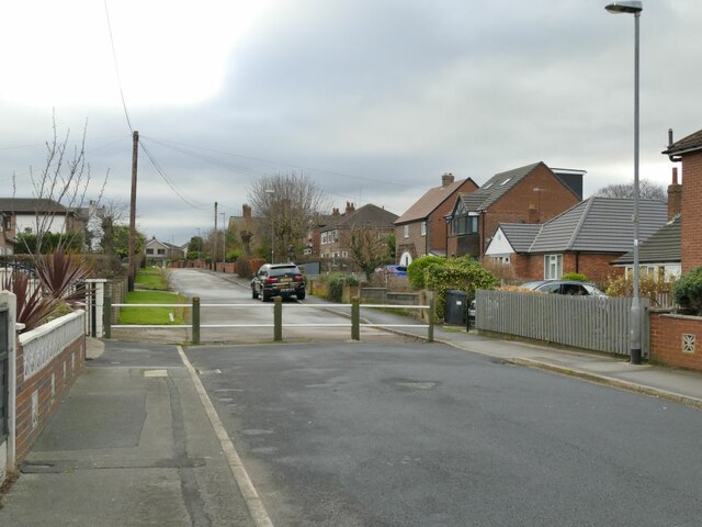
West Garforth is a small village located in the county of Yorkshire, England. Situated approximately 8 miles east of Leeds city center, West Garforth is a primarily residential area with a population of around 3,000 residents. The village is known for its quiet and peaceful atmosphere, making it a popular choice for families and retirees looking for a tranquil place to live.

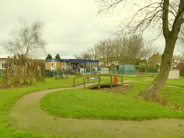
West Garforth is well-connected to the surrounding areas by road and public transport, with easy access to the nearby towns of Garforth and Kippax. The village is also close to several green spaces and parks, providing residents with plenty of opportunities for outdoor activities and recreation.

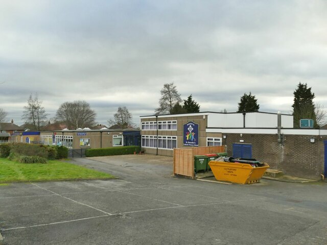
In terms of amenities, West Garforth has a small selection of shops, pubs, and restaurants, as well as a primary school and community center. The village is also home to a number of historic buildings, including St Mary's Church, which dates back to the 12th century.

Overall, West Garforth offers a peaceful and picturesque setting for those looking to escape the hustle and bustle of city life, while still being within easy reach of larger urban areas.

If you have any feedback on the listing, please let us know in the comments section below.

West Garforth Images

Images are sourced within 2km of 53.787414/-1.401939 or Grid Reference SE3932. Thanks to Geograph Open Source API. All images are credited.

Garforth station: former station building There has been a station here since 1834. The two-storey building seen here is probably the original station building, no longer in railway use (currently an Italian restaurant), but the lower building to the left still includes a ticket office staffed at peak times.
Garforth station: former station building
There has been a station here since 1834. The two-storey building seen here is probably the original station building, no longer in railway use (currently an Italian restaurant), but the lower building to the left still includes a ticket office staffed at peak times.
Garforth station: quarter-mile post A cast iron post on the westbound platform, indicating a quarter mile.
Garforth station: quarter-mile post
A cast iron post on the westbound platform, indicating a quarter mile.
Garforth station: westbound arrival Northern's Sprinter unit 158756 arrives with the 13.12 to Halifax (originating at Hull) with quite a few passengers waiting to board.
Garforth station: westbound arrival
Northern's Sprinter unit 158756 arrives with the 13.12 to Halifax (originating at Hull) with quite a few passengers waiting to board.
Garforth station: historic footbridge There has been a station at Garforth since 1834 but the footbridge was only added c.1900. It is listed grade II (list entry 1393728) as "an attractive example of the standard North Eastern Railway design".

Update April 2023 - the bridge is about to be removed (despite its listed status) to enable electrification work on the line, and given to the narrow-gauge Bredgar and Wormshill Railway in Kent <a title="https://www.geograph.org.uk/stuff/list.php?label=Bredgar+Wormshill+Light+Railway&gridref=TQ8758" href="https://www.geograph.org.uk/stuff/list.php?label=Bredgar+Wormshill+Light+Railway&gridref=TQ8758">Link</a>
Garforth station: historic footbridge
There has been a station at Garforth since 1834 but the footbridge was only added c.1900. It is listed grade II (list entry 1393728) as "an attractive example of the standard North Eastern Railway design". Update April 2023 - the bridge is about to be removed (despite its listed status) to enable electrification work on the line, and given to the narrow-gauge Bredgar and Wormshill Railway in Kent Link
Garforth station: road bridge The bridge was built in the early 1830s to the designs of engineer James Walker to carry the Aberford Road (now A642) over the Leeds-Selby railway line adjacent to Garforth station. Listed at Grade II (list entry 1419088) as "an original ... distinctive, single-span overbridge with unprecedented span of 60ft (18.2m) ... demonstrating a high level of craftsmanship in its construction, detailing, and dressing" (the same notes apply to other similar bridges on the line). The flat arch is certainly remarkable.
Garforth station: road bridge
The bridge was built in the early 1830s to the designs of engineer James Walker to carry the Aberford Road (now A642) over the Leeds-Selby railway line adjacent to Garforth station. Listed at Grade II (list entry 1419088) as "an original ... distinctive, single-span overbridge with unprecedented span of 60ft (18.2m) ... demonstrating a high level of craftsmanship in its construction, detailing, and dressing" (the same notes apply to other similar bridges on the line). The flat arch is certainly remarkable.
Garforth station: through TransPennine train A Nova 1 (Class 802) unit passes through on the late running 11.42 Newcastle-Liverpool service.
Garforth station: through TransPennine train
A Nova 1 (Class 802) unit passes through on the late running 11.42 Newcastle-Liverpool service.
Garforth station: cycle storage A 'double deck' cycle rack, unused on a Saturday but probably used by commuters midweek (and given how much space is allocated to car parking at this station, a bit more space could have been given to a larger facility at ground level, much easier to use).
Garforth station: cycle storage
A 'double deck' cycle rack, unused on a Saturday but probably used by commuters midweek (and given how much space is allocated to car parking at this station, a bit more space could have been given to a larger facility at ground level, much easier to use).
Garforth station: car park (1) Garforth is the principal commuter station in East Leeds, and the car park has been extended in recent years to a length of c.250 metres, occupying about 0.8ha.  This is the older part immediately outside the station but it has been resurfaced.
Garforth station: car park (1)
Garforth is the principal commuter station in East Leeds, and the car park has been extended in recent years to a length of c.250 metres, occupying about 0.8ha. This is the older part immediately outside the station but it has been resurfaced.
Garforth station: car park (2) Garforth is the principal commuter station in East Leeds, and the car park has been extended in recent years to a length of c.250 metres, occupying about 0.8ha.  This is the extension, on the site of former railway goods sidings.
Garforth station: car park (2)
Garforth is the principal commuter station in East Leeds, and the car park has been extended in recent years to a length of c.250 metres, occupying about 0.8ha. This is the extension, on the site of former railway goods sidings.
St Benedict's Catholic Primary School, Garforth On Station Fields.
St Benedict's Catholic Primary School, Garforth
On Station Fields.
St Benedict's Catholic Primary School, Garforth - garden Quite an attractive garden area for this suburban school.
St Benedict's Catholic Primary School, Garforth - garden
Quite an attractive garden area for this suburban school.
Barrier on Station Fields, Garforth This would have been a through road from Church Lane to the railway station, but this barrier now prevents through motor traffic while permitting pedestrians and cyclists to pass.
Barrier on Station Fields, Garforth
This would have been a through road from Church Lane to the railway station, but this barrier now prevents through motor traffic while permitting pedestrians and cyclists to pass.
Oak Crescent, Garforth The 'Crescent' is laid out, not as a smooth curve, but as a series of four straight sections. The single yellow lines indicate a parking restriction which applies from 10am to 2pm; probably intended to deter commuters from parking here for the nearby railway station.
Oak Crescent, Garforth
The 'Crescent' is laid out, not as a smooth curve, but as a series of four straight sections. The single yellow lines indicate a parking restriction which applies from 10am to 2pm; probably intended to deter commuters from parking here for the nearby railway station.
Garforth St Mary: north side Viewed from Oak Crescent.
Garforth St Mary: north side
Viewed from Oak Crescent.
Garforth St Mary: south side with main entrance The adjacent church hall and trees prevent a wider view of the south side of the building.
Garforth St Mary: south side with main entrance
The adjacent church hall and trees prevent a wider view of the south side of the building.
Garforth St Mary: nave Looking east towards the chancel.
Garforth St Mary: nave
Looking east towards the chancel.
Garforth St Mary: altars There are two altars (communion tables), a modern one at the front of the nave and the high altar in the sanctuary. The Christmas tree and crib are still in place in late January, following a tradition in some Christian circles that the Christmas
 season lasts for forty days rather than twelve.
Garforth St Mary: altars
There are two altars (communion tables), a modern one at the front of the nave and the high altar in the sanctuary. The Christmas tree and crib are still in place in late January, following a tradition in some Christian circles that the Christmas season lasts for forty days rather than twelve.
Garforth St Mary: east window The window has three narrow lancets, the middle one including an image of St Mary with the infant Jesus. The wording at the bottom is "These three windows the work and gift of Mary Isabella and Elizabeth Oliver Gascoigne Anno Domini MDCCCXLV" (1845, contemporary with the building of the church). The Gascoignes of Parlington Hall ('Oliver' being added when Richard Oliver of County Limerick married into the family after the male line of descent perished) were the landowners of Garforth, and the sisters endowed the rebuilt church.
Garforth St Mary: east window
The window has three narrow lancets, the middle one including an image of St Mary with the infant Jesus. The wording at the bottom is "These three windows the work and gift of Mary Isabella and Elizabeth Oliver Gascoigne Anno Domini MDCCCXLV" (1845, contemporary with the building of the church). The Gascoignes of Parlington Hall ('Oliver' being added when Richard Oliver of County Limerick married into the family after the male line of descent perished) were the landowners of Garforth, and the sisters endowed the rebuilt church.
Show me another place!

West Garforth is located at Grid Ref: SE3932 (Lat: 53.787414, Lng: -1.401939)

Division: West Riding

Unitary Authority: Leeds

Police Authority: West Yorkshire

What 3 Words

///notes.cheeks.applauded. Near Garforth, West Yorkshire

Related Wikis

Garforth Academy

Garforth Academy (formerly known as Garforth Comprehensive School until September 1992 and Garforth Community College until November 2010) is a secondary...

Garforth

Garforth () is a town in the metropolitan borough of the City of Leeds, West Yorkshire, England. It sits in the Garforth and Swillington ward of Leeds...

SLP College

SLP College is an independent, co-educational performing arts college based in Garforth near Leeds, West Yorkshire, England. == Overview == In 1974 Sandra...

Masters Performing Arts College

Masters Performing Arts College is an independent dance/musical theatre college based in the town of Rayleigh in Essex, England. == Training == Key areas...

Nearby Amenities

Located within 500m of 53.787414,-1.401939
Odbl: clean
Lat/Long: 53.786845/-1.4073069
Odbl: clean
Lat/Long: 53.7869681/-1.4072414
Bus Stop
Wakefield Road
Bus: yes
Local Ref: 45010192
Naptan AtcoCode: 450010192
Naptan Bearing: N
Naptan CommonName: Wakefield Road
Naptan Crossing: Dar Villas
Naptan Indicator: Stop 45010192
Naptan PlusbusZoneRef: LEEDS
Naptan ShortCommonName: Dar Villas
Naptan Street: Wakefield Road
Naptan Verified: no
Network: Metro West Yorkshire
Network Wikidata: Q7987043
Public Transport: platform
Source: naptan_import
Lat/Long: 53.7897019/-1.4036054
Bus Stop
Garforth Bridge
Bus: yes
Local Ref: 45010193
Naptan AtcoCode: 450010193
Naptan Bearing: S
Naptan CommonName: Garforth Bridge
Naptan Crossing: Ringway
Naptan Indicator: Stop 45010193
Naptan Landmark: The George PH
Naptan PlusbusZoneRef: LEEDS
Naptan ShortCommonName: Ringway
Naptan Street: Wakefield Road
Naptan Verified: no
Network: Metro West Yorkshire
Network Wikidata: Q7987043
Public Transport: platform
Source: naptan_import
Lat/Long: 53.7877435/-1.4038305
Bus Stop
Garforth Bridge
Bus: yes
Local Ref: 45010194
Naptan AtcoCode: 450010194
Naptan Bearing: N
Naptan CommonName: Garforth Bridge
Naptan Crossing: Selby Road
Naptan Indicator: Stop 45010194
Naptan Landmark: The George PH
Naptan PlusbusZoneRef: LEEDS
Naptan ShortCommonName: Garforth Bridge
Naptan Street: Wakefield Road
Naptan Verified: no
Network: Metro West Yorkshire
Network Wikidata: Q7987043
Public Transport: platform
Source: naptan_import
Lat/Long: 53.7871703/-1.4042484
Bus Stop
Kingsway Westbourne Drive
Bus: yes
Local Ref: 45011691
Naptan AtcoCode: 450011691
Naptan Bearing: E
Naptan CommonName: Kingsway Westbourne Drive
Naptan Crossing: Westbourne Drive
Naptan Indicator: Stop 45011691
Naptan PlusbusZoneRef: LEEDS
Naptan ShortCommonName: Westbourne Drive
Naptan Street: Kingsway
Naptan Verified: no
Public Transport: platform
Source: naptan_import
Lat/Long: 53.7903288/-1.3977675
Bus Stop
Kingsway Westbourne Drive
Bus: yes
Local Ref: 45011692
Naptan AtcoCode: 450011692
Naptan Bearing: W
Naptan CommonName: Kingsway Westbourne Drive
Naptan Crossing: Westborne Avenue
Naptan Indicator: Stop 45011692
Naptan PlusbusZoneRef: LEEDS
Naptan ShortCommonName: Westborne Avenue
Naptan Street: Kingsway
Naptan Verified: no
Public Transport: platform
Source: naptan_import
Lat/Long: 53.7902398/-1.3979357
Bus Stop
Alandale Crescent Kingsway
Bus: yes
Local Ref: 45011693
Naptan AtcoCode: 450011693
Naptan Bearing: S
Naptan CommonName: Alandale Crescent Kingsway
Naptan Crossing: Kingsway
Naptan Indicator: Stop 45011693
Naptan PlusbusZoneRef: LEEDS
Naptan ShortCommonName: Kingsway
Naptan Street: Alandale Crescent
Naptan Verified: no
Public Transport: platform
Source: naptan_import
Lat/Long: 53.7904457/-1.399557
Bus Stop
Alandale Crescent
Bus: yes
Local Ref: 45011694
Naptan AtcoCode: 450011694
Naptan Bearing: N
Naptan CommonName: Alandale Crescent
Naptan Crossing: Alandale Drive
Naptan Indicator: Stop 45011694
Naptan PlusbusZoneRef: LEEDS
Naptan ShortCommonName: Alandale Drive
Naptan Street: Alandale Crescent
Naptan Verified: no
Public Transport: platform
Source: naptan_import
Lat/Long: 53.7907335/-1.3995985
Bus Stop
Alandale Crescent
Bus: yes
Local Ref: 45011696
Naptan AtcoCode: 450011696
Naptan Bearing: NW
Naptan CommonName: Alandale Crescent
Naptan Crossing: Wakefield Road
Naptan Indicator: Stop 45011696
Naptan PlusbusZoneRef: LEEDS
Naptan ShortCommonName: Wakefield Road
Naptan Street: Alandale Crescent
Naptan Verified: no
Public Transport: platform
Source: naptan_import
Lat/Long: 53.7913433/-1.4011078
Bus Stop
Ringway
Bus: yes
Local Ref: 45011697
Naptan AtcoCode: 450011697
Naptan Bearing: E
Naptan CommonName: Ringway
Naptan Crossing: Westbourne Grove
Naptan Indicator: Stop 45011697
Naptan PlusbusZoneRef: LEEDS
Naptan ShortCommonName: Westbourne Grove
Naptan Street: Ringway
Naptan Verified: no
Public Transport: platform
Source: naptan_import
Lat/Long: 53.7888556/-1.3997315
Bus Stop
Alandale Road Kingsway
Bus: yes
Local Ref: 45011698
Naptan AtcoCode: 450011698
Naptan Bearing: S
Naptan CommonName: Alandale Road Kingsway
Naptan Crossing: Kingsway
Naptan Indicator: Stop 45011698
Naptan PlusbusZoneRef: LEEDS
Naptan ShortCommonName: Kingsway
Naptan Street: Alandale Road
Naptan Verified: no
Public Transport: platform
Source: naptan_import
Lat/Long: 53.7906843/-1.3969579
Bus Stop
Wakefield Road
Bus: yes
Local Ref: 45012865
Naptan AtcoCode: 450012865
Naptan Bearing: NE
Naptan CommonName: Wakefield Road
Naptan Crossing: Selby Road
Naptan Indicator: Stop 45012865
Naptan Landmark: Hilton Hotel
Naptan PlusbusZoneRef: LEEDS
Naptan ShortCommonName: Selby Road
Naptan Street: Wakefield Road
Naptan Verified: no
Public Transport: platform
Source: naptan_import
Lat/Long: 53.7854977/-1.4058962
Bus Stop
Selby Road Rockley Grange Gardens
Bus: yes
Local Ref: 45011653
Naptan AtcoCode: 450011653
Naptan Bearing: W
Naptan CommonName: Selby Road Rockley Grange Gardens
Naptan Crossing: Rockley Grange Gardens
Naptan Indicator: Stop 45011653
Naptan Landmark: Filling Station
Naptan PlusbusZoneRef: LEEDS
Naptan ShortCommonName: Rockley Grange Gdns
Naptan Street: Selby Road
Naptan Verified: no
Network: Metro West Yorkshire
Network Wikidata: Q7987043
Public Transport: platform
Source: naptan_import
Lat/Long: 53.7863603/-1.3961196
Bus Stop
Selby Road Goosefield Rise
Bus: yes
Local Ref: 45011654
Naptan AtcoCode: 450011654
Naptan Bearing: E
Naptan CommonName: Selby Road Goosefield Rise
Naptan Crossing: Goosefield Drive
Naptan Indicator: Stop 45011654
Naptan Landmark: Filling Station
Naptan PlusbusZoneRef: LEEDS
Naptan ShortCommonName: Goosefield Rise
Naptan Street: Selby Road
Naptan Verified: no
Network: Metro West Yorkshire
Network Wikidata: Q7987043
Public Transport: platform
Source: naptan_import
Lat/Long: 53.7866519/-1.3971817
Bus Stop
Selby Road Nelson Croft
Bus: yes
Local Ref: 45011655
Naptan AtcoCode: 450011655
Naptan Bearing: W
Naptan CommonName: Selby Road Nelson Croft
Naptan Crossing: Nelson Croft
Naptan Indicator: Stop 45011655
Naptan Landmark: Gaping Goose PH
Naptan PlusbusZoneRef: LEEDS
Naptan ShortCommonName: Nelson Croft
Naptan Street: Selby Road
Naptan Verified: no
Network: Metro West Yorkshire
Network Wikidata: Q7987043
Public Transport: platform
Source: naptan_import
Lat/Long: 53.7867426/-1.3991294
Bus Stop
Garforth Bridge Garforth
Bus: yes
Local Ref: 45011656
Naptan AtcoCode: 450011656
Naptan Bearing: W
Naptan CommonName: Garforth Bridge Garforth
Naptan Crossing: Springfield Place
Naptan Indicator: Stop 45011656
Naptan PlusbusZoneRef: LEEDS
Naptan ShortCommonName: Springfield Place
Naptan Street: Selby Road
Naptan Verified: no
Network: Metro West Yorkshire
Network Wikidata: Q7987043
Public Transport: platform
Source: naptan_import
Lat/Long: 53.7867576/-1.4025847
Bus Stop
Garforth Bridge Garforth
Bus: yes
Local Ref: 45011657
Naptan AtcoCode: 450011657
Naptan Bearing: E
Naptan CommonName: Garforth Bridge Garforth
Naptan Crossing: Springfield Place
Naptan Indicator: Stop 45011657
Naptan PlusbusZoneRef: LEEDS
Naptan ShortCommonName: Springfield Place
Naptan Street: Selby Road
Naptan Verified: no
Network: Metro West Yorkshire
Network Wikidata: Q7987043
Public Transport: platform
Source: naptan_import
Lat/Long: 53.7868569/-1.4026743
Bus Stop
Wakefield Road
Bus: yes
Local Ref: 45011658
Naptan AtcoCode: 450011658
Naptan Bearing: S
Naptan CommonName: Wakefield Road
Naptan Crossing: Ringway
Naptan Indicator: Stop 45011658
Naptan PlusbusZoneRef: LEEDS
Naptan ShortCommonName: Ringway
Naptan Street: Wakefield Road
Naptan Verified: no
Network: Metro West Yorkshire
Network Wikidata: Q7987043
Public Transport: platform
Source: naptan_import
Lat/Long: 53.7892877/-1.4034746
Bus Stop
Wakefield Road Alandale Crescent
Bus: yes
Local Ref: 45011659
Naptan AtcoCode: 450011659
Naptan Bearing: NE
Naptan CommonName: Wakefield Road Alandale Crescent
Naptan Crossing: Alandale Crescent
Naptan Indicator: Stop 45011659
Naptan PlusbusZoneRef: LEEDS
Naptan ShortCommonName: Alandale Crescent
Naptan Street: Wakefield Road
Naptan Verified: no
Network: Metro West Yorkshire
Network Wikidata: Q7987043
Public Transport: platform
Source: naptan_import
Lat/Long: 53.7918655/-1.4012977
Bus Stop
Ringway Goosefield Rise
Bus: yes
Naptan AtcoCode: 450028926
Naptan Bearing: E
Naptan CommonName: Ringway Goosefield Rise
Naptan Crossing: Goosefield Rise
Naptan Landmark: Unknown
Naptan ShortCommonName: Goosefield Rise
Naptan Street: Ringway
Naptan Verified: no
Public Transport: platform
Source: naptan_import
Lat/Long: 53.7887526/-1.3966754
Ringway Goosefield Rise
Naptan AtcoCode: 450028930
Naptan Bearing: W
Naptan BusStopType: CUS
Naptan CommonName: Ringway Goosefield Rise
Naptan Crossing: Goosefield Rise
Naptan Landmark: Unknown
Naptan ShortCommonName: Goosefield Rise
Naptan Street: Ringway
Naptan Verified: no
Source: naptan_import
Lat/Long: 53.7886151/-1.3965777
Bus Stop
Ringway Garforth
Bus: yes
Local Ref: 45050033
Naptan AtcoCode: 450050033
Naptan Bearing: W
Naptan BusStopType: CUS
Naptan CommonName: Ringway Garforth
Naptan Indicator: Stop 45050033
Naptan PlusbusZoneRef: LEEDS
Naptan ShortCommonName: Ringway
Naptan Street: Ringway
Naptan Verified: no
Public Transport: platform
Source: naptan_import
Lat/Long: 53.7888018/-1.3997627
Bus Stop
Alandale Road
Bus: yes
Local Ref: 45050034
Naptan AtcoCode: 450050034
Naptan Bearing: N
Naptan BusStopType: CUS
Naptan CommonName: Alandale Road
Naptan Indicator: Stop 45050034
Naptan PlusbusZoneRef: LEEDS
Naptan ShortCommonName: Alandale Drive
Naptan Street: Alandale Road
Naptan Verified: no
Public Transport: platform
Source: naptan_import
Lat/Long: 53.790676/-1.3970946
Fuel
Shell Garforth West
Addr City: Leeds
Addr Postcode: LS25 1LP
Addr Street: Selby Road
Addr Suburb: Garforth
Brand: Shell
Brand Wikidata: Q110716465
Designation: 2373
Fhrs Id: 1216425
Fuel Diesel: yes
Fuel Octane 95: yes
Fuel Octane 98: yes
Operator: Motor Fuel Group
Operator Website: https://www.motorfuelgroup.com/locations/garforth-west-fs965/
Operator Wikidata: Q107271358
Phone: +44 113 287 0826;+44 113 232 0303
Ref Navads: NVDS353_12038499
Source: GPS
Website: https://find.shell.com/gb/fuel/12038499-mfg-garforth-west
Lat/Long: 53.786212/-1.3961751
Noexit: yes
Lat/Long: 53.7873994/-1.4076043
Addr City: Leeds
Addr Housename: Brookfield House
Addr Postcode: LS25 1NB
Addr Street: Selby Road
Addr Town: Leeds
Office: company
Lat/Long: 53.7875275/-1.4075188
Turning Circle
Lat/Long: 53.7898385/-1.4015469
Turning Circle
Lat/Long: 53.7869337/-1.3947707
Turning Circle
Lat/Long: 53.7875639/-1.3956167
Turning Circle
Lat/Long: 53.7868586/-1.3969153
Turning Circle
Lat/Long: 53.7878572/-1.3999
Turning Circle
Lat/Long: 53.7883244/-1.4001537
Turning Circle
Lat/Long: 53.7878216/-1.4004868
Turning Circle
Lat/Long: 53.7874241/-1.4032536
Turning Circle
Lat/Long: 53.789895/-1.4025605
Restaurant
Miller & Carter
Addr City: Leeds
Addr Postcode: LS25 1NB
Addr Street: Selby Road
Addr Suburb: Garforth
Branch: Garforth
Brand: Miller & Carter
Brand Wikidata: Q87067401
Cuisine: steak
Fhrs Id: 320557
Internet Access: wlan
Opening Hours: Su-Th 12:00-23:00; Fr-Sa 12:00-23:30
Operator: Miller & Carter
Phone: +44 113 286 2100
Website: https://www.millerandcarter.co.uk/restaurants/yorkshire-and-the-humber/millerandcartergarforth
Lat/Long: 53.7869778/-1.4046035
Bus Stop
Alandale Crescent
Bus: yes
Local Ref: 45011695
Naptan AtcoCode: 450011695
Naptan Bearing: SE
Naptan CommonName: Alandale Crescent
Naptan Crossing: Wakefield Road
Naptan Indicator: Stop 45011695
Naptan PlusbusZoneRef: LEEDS
Naptan ShortCommonName: Wakefield Road
Naptan Street: Alandale Crescent
Naptan Verified: no
Public Transport: platform
Source: naptan_import
Lat/Long: 53.7913588/-1.4010182
Turning Circle
Lat/Long: 53.7905494/-1.4012811
Noexit: yes
Lat/Long: 53.7908896/-1.4020805
Bench
Lat/Long: 53.787179/-1.4072855
Noexit: yes
Lat/Long: 53.7872571/-1.3960253
Power: pole
Lat/Long: 53.7830636/-1.4035844
Material: wood
Power: pole
Lat/Long: 53.7836468/-1.4058479
Proposed
Crossing: marked
Proposed: crossing
Traffic Calming: table
Lat/Long: 53.7850753/-1.3998728
Post Box
Brand: Royal Mail
Brand Wikidata: Q638098
Brand Wikipedia: en:Royal Mail
Operator: Royal Mail
Operator Wikidata: Q638098
Post Box Type: pillar
Ref: LS25 863
Royal Cypher: EIIR
Royal Cypher Wikidata: Q33102113
Lat/Long: 53.7902721/-1.3974564
Post Box
Brand: Royal Mail
Brand Wikidata: Q638098
Operator: Royal Mail
Operator Wikidata: Q638098
Post Box Type: lamp
Ref: LS25 31
Lat/Long: 53.7869192/-1.4007126
Turning Circle
Lat/Long: 53.7856849/-1.404333
Man Made: silo
Lat/Long: 53.7855707/-1.406976
Post Box
Brand: Royal Mail
Brand Wikidata: Q638098
Colour: red
Operator: Royal Mail
Operator Wikidata: Q638098
Post Box Type: pillar
Royal Cypher: EIIR
Lat/Long: 53.7861601/-1.4058331
Barrier: stile
Lat/Long: 53.7841581/-1.4046205
Barrier: stile
Material: wood
Stile: stepover
Lat/Long: 53.7867299/-1.399706
Noexit: yes
Lat/Long: 53.7872521/-1.3998579
Waste Basket
Collection Times: We
Ref UK Leedscc Bin: 43
Lat/Long: 53.790715/-1.399568
Waste Basket
Collection Times: We
Ref UK Leedscc Bin: 44
Lat/Long: 53.791348/-1.401103
Waste Basket
Collection Times: We
Ref UK Leedscc Bin: 42
Lat/Long: 53.790396/-1.402448
Power: pole
Lat/Long: 53.7837362/-1.3992151
Power: pole
Lat/Long: 53.7837239/-1.4012767
Power: pole
Lat/Long: 53.783725/-1.4022478
Power: pole
Lat/Long: 53.783716/-1.4034161
Line Management: termination
Location Transition: yes
Material: wood
Power: pole
Lat/Long: 53.7842057/-1.4067902
Noexit: yes
Lat/Long: 53.7873692/-1.3995364
Noexit: yes
Lat/Long: 53.7883824/-1.3960885
Noexit: yes
Lat/Long: 53.7868419/-1.3965424
Noexit: yes
Lat/Long: 53.7864031/-1.3974494
Noexit: yes
Lat/Long: 53.7863289/-1.3970847
Noexit: yes
Lat/Long: 53.7863412/-1.397153
Noexit: yes
Lat/Long: 53.7862787/-1.3967756
Noexit: yes
Lat/Long: 53.7864703/-1.399684
Noexit: yes
Lat/Long: 53.7863487/-1.3989463
Noexit: yes
Lat/Long: 53.7866228/-1.3988082
Noexit: yes
Lat/Long: 53.7866359/-1.3992286
Noexit: yes
Lat/Long: 53.7865222/-1.3984481
Noexit: yes
Lat/Long: 53.7865305/-1.3985319
Noexit: yes
Lat/Long: 53.7864691/-1.398084
Noexit: yes
Lat/Long: 53.7858697/-1.3979908
Noexit: yes
Lat/Long: 53.7861086/-1.3954018
Addr City: Leeds
Addr Housenumber: 2
Addr Street: Springbank
Addr Town: Garforth
Lat/Long: 53.7885752/-1.4033537
Addr City: Leeds
Addr Housenumber: 4
Addr Street: Springbank
Addr Town: Garforth
Lat/Long: 53.7884133/-1.4033798
Addr City: Leeds
Addr Housenumber: 6
Addr Street: Springbank
Addr Town: Garforth
Lat/Long: 53.7882653/-1.4034137
Addr City: Leeds
Addr Housenumber: 8
Addr Street: Springbank
Addr Town: Garforth
Lat/Long: 53.7881219/-1.4034268
Addr City: Leeds
Addr Housenumber: 10
Addr Street: Springbank
Addr Town: Garforth
Lat/Long: 53.7880155/-1.4034633
Addr City: Leeds
Addr Housenumber: 12
Addr Street: Springbank
Addr Town: Garforth
Lat/Long: 53.7878937/-1.4034346
Addr City: Leeds
Addr Housenumber: 14
Addr Street: Springbank
Addr Town: Garforth
Lat/Long: 53.787755/-1.403445
Addr City: Leeds
Addr Housenumber: 16
Addr Street: Springbank
Addr Town: Garforth
Lat/Long: 53.7876532/-1.403492
Addr City: Leeds
Addr Housenumber: 18
Addr Street: Springbank
Addr Town: Garforth
Lat/Long: 53.7875252/-1.4036199
Addr City: Leeds
Addr Housenumber: 20
Addr Street: Springbank
Addr Town: Garforth
Lat/Long: 53.7874173/-1.4036695
Addr City: Leeds
Addr Housenumber: 22
Addr Street: Springbank
Addr Town: Garforth
Lat/Long: 53.7872647/-1.4035181
Addr City: Leeds
Addr Housenumber: 1
Addr Street: Springbank
Addr Town: Garforth
Lat/Long: 53.78864/-1.4028474
Addr City: Leeds
Addr Housenumber: 3
Addr Street: Springbank
Addr Town: Garforth
Lat/Long: 53.7885135/-1.4028343
Addr City: Leeds
Addr Housenumber: 5
Addr Street: Springbank
Addr Town: Garforth
Lat/Long: 53.7884179/-1.4028526
Addr City: Leeds
Addr Housenumber: 7
Addr Street: Springbank
Addr Town: Garforth
Lat/Long: 53.7883014/-1.4028655
Addr City: Leeds
Addr Housenumber: 9
Addr Street: Springbank
Addr Town: Garforth
Lat/Long: 53.7881904/-1.4029246
Addr City: Leeds
Addr Housenumber: 11
Addr Street: Springbank
Addr Town: Garforth
Lat/Long: 53.788089/-1.4028924
Addr City: Leeds
Addr Housenumber: 13
Addr Street: Springbank
Addr Town: Garforth
Lat/Long: 53.7879654/-1.4029219
Addr City: Leeds
Addr Housename: The Riding
Addr Housenumber: 15
Addr Street: Springbank
Addr Town: Garforth
Lat/Long: 53.7878418/-1.4029326
Addr City: Leeds
Addr Housenumber: 17
Addr Street: Springbank
Addr Town: Garforth
Lat/Long: 53.7877151/-1.4029192
Addr City: Leeds
Addr Housenumber: 19
Addr Street: Springbank
Addr Town: Garforth
Lat/Long: 53.7876026/-1.402997
Addr City: Leeds
Addr Housenumber: 21
Addr Street: Springbank
Addr Town: Garforth
Lat/Long: 53.7875091/-1.4030023
Milestone
Lat/Long: 53.7907074/-1.4029022
Waste Basket
Lat/Long: 53.7896781/-1.4036078
Bench
Lat/Long: 53.7896389/-1.4036147
Waste Basket
Lat/Long: 53.7892518/-1.4034711
Waste Basket
Lat/Long: 53.7878152/-1.4038194
Waste Basket
Lat/Long: 53.787228/-1.4042281
Addr City: Leeds
Addr Housenumber: 84
Addr Street: Ringway
Addr Town: Garforth
Lat/Long: 53.7893598/-1.4018839
Addr City: Leeds
Addr Housenumber: 86
Addr Street: Ringway
Addr Town: Garforth
Lat/Long: 53.7892505/-1.4021413
Addr City: Leeds
Addr Housenumber: 82
Addr Street: Ringway
Addr Town: Garforth
Lat/Long: 53.789279/-1.4015405
Addr City: Leeds
Addr Housenumber: 80
Addr Street: Ringway
Addr Town: Garforth
Lat/Long: 53.7892442/-1.4014359
Addr City: Leeds
Addr Housenumber: 78
Addr Street: Ringway
Addr Town: Garforth
Lat/Long: 53.7892109/-1.4012938
Addr City: Leeds
Addr Housenumber: 76
Addr Street: Ringway
Addr Town: Garforth
Lat/Long: 53.7892046/-1.4011811
Addr City: Leeds
Addr Housenumber: 74
Addr Street: Ringway
Addr Town: Garforth
Lat/Long: 53.7891459/-1.4010282
Addr City: Leeds
Addr Housenumber: 72
Addr Street: Ringway
Addr Town: Garforth
Lat/Long: 53.789165/-1.4009102
Addr City: Leeds
Addr Housenumber: 70
Addr Street: Ringway
Addr Town: Garforth
Lat/Long: 53.7891063/-1.4007654
Addr City: Leeds
Addr Housenumber: 68
Addr Street: Ringway
Addr Town: Garforth
Lat/Long: 53.7891032/-1.4006635
Addr City: Leeds
Addr Housenumber: 66
Addr Street: Ringway
Addr Town: Garforth
Lat/Long: 53.7890715/-1.4004703
Addr City: Leeds
Addr Housenumber: 64
Addr Street: Ringway
Addr Town: Garforth
Lat/Long: 53.7890588/-1.4003765
Addr City: Leeds
Addr Housenumber: 79
Addr Street: Ringway
Addr Town: Garforth
Lat/Long: 53.7887973/-1.4006018
Addr City: Leeds
Addr Housenumber: 77
Addr Street: Ringway
Addr Town: Garforth
Lat/Long: 53.788791/-1.4004945
Addr City: Leeds
Addr Housenumber: 81
Addr Street: Ringway
Addr Town: Garforth
Lat/Long: 53.7888814/-1.4009987
Addr City: Leeds
Addr Housenumber: 83
Addr Street: Ringway
Addr Town: Garforth
Lat/Long: 53.7888976/-1.4010808
Addr City: Leeds
Addr Housenumber: 85
Addr Street: Ringway
Addr Town: Garforth
Lat/Long: 53.788923/-1.4012262
Addr City: Leeds
Addr Housenumber: 87
Addr Street: Ringway
Addr Town: Garforth
Lat/Long: 53.7889437/-1.4013447
Addr City: Leeds
Addr Housenumber: 89
Addr Street: Ringway
Addr Town: Garforth
Lat/Long: 53.7889739/-1.4014848
Addr City: Leeds
Addr Housenumber: 91
Addr Street: Ringway
Addr Town: Garforth
Lat/Long: 53.7889851/-1.4016464
Addr City: Leeds
Addr Housename: West View
Addr Housenumber: 95
Addr Street: Ringway
Addr Town: Garforth
Lat/Long: 53.788845/-1.402554
Addr City: Leeds
Addr Housenumber: 97
Addr Street: Ringway
Addr Town: Garforth
Lat/Long: 53.7888116/-1.4026833
Addr City: Leeds
Addr Housenumber: 62
Addr Street: Ringway
Addr Town: Garforth
Lat/Long: 53.788993/-1.3999953
Addr City: Leeds
Addr Housenumber: 60
Addr Street: Ringway
Addr Town: Garforth
Lat/Long: 53.7889883/-1.3998795
Addr City: Leeds
Addr Housenumber: 58
Addr Street: Ringway
Addr Town: Garforth
Lat/Long: 53.7889469/-1.3997206
Addr City: Leeds
Addr Housenumber: 56
Addr Street: Ringway
Addr Town: Garforth
Lat/Long: 53.7889501/-1.3996506
Addr City: Leeds
Addr Housenumber: 75
Addr Street: Ringway
Addr Town: Garforth
Lat/Long: 53.7887559/-1.4003212
Addr City: Leeds
Addr Housenumber: 73
Addr Street: Ringway
Addr Town: Garforth
Lat/Long: 53.7887496/-1.4002216
Addr City: Leeds
Addr Housenumber: 71
Addr Street: Ringway
Addr Town: Garforth
Lat/Long: 53.7887305/-1.40006
Addr City: Leeds
Addr Housenumber: 69
Addr Street: Ringway
Addr Town: Garforth
Lat/Long: 53.7887066/-1.3999603
Addr City: Leeds
Addr Housenumber: 67
Addr Street: Ringway
Addr Town: Garforth
Lat/Long: 53.7886764/-1.3998122
Addr City: Leeds
Addr Housenumber: 65
Addr Street: Ringway
Addr Town: Garforth
Lat/Long: 53.7886605/-1.3997044
Addr City: Leeds
Addr Housenumber: 63
Addr Street: Ringway
Addr Town: Garforth
Lat/Long: 53.7886557/-1.3995213
Addr City: Leeds
Addr Housenumber: 61
Addr Street: Ringway
Addr Town: Garforth
Lat/Long: 53.7886366/-1.3993947
Give Way
Lat/Long: 53.7888402/-1.3991757
Give Way
Lat/Long: 53.7889596/-1.4002091
Give Way
Lat/Long: 53.7889021/-1.400743
Give Way
Lat/Long: 53.7886717/-1.398947
Give Way
Lat/Long: 53.7887917/-1.3980244
Give Way
Lat/Long: 53.7886446/-1.3963471
Give Way
Lat/Long: 53.7886055/-1.3953954
Addr City: Leeds
Addr Housenumber: 59
Addr Street: Ringway
Addr Town: Garforth
Lat/Long: 53.7885968/-1.3991834
Addr City: Leeds
Addr Housenumber: 57
Addr Street: Ringway
Addr Town: Garforth
Lat/Long: 53.7885968/-1.3987013
Addr City: Leeds
Addr Housenumber: 54
Addr Street: Ringway
Addr Town: Garforth
Lat/Long: 53.7888578/-1.3987713
Addr City: Leeds
Addr Housenumber: 52
Addr Street: Ringway
Addr Town: Garforth
Lat/Long: 53.7888801/-1.3986151
Addr City: Leeds
Addr Housenumber: 55
Addr Street: Ringway
Addr Town: Garforth
Lat/Long: 53.788608/-1.3984885
Addr City: Leeds
Addr Housename: Ridgefield
Addr Housenumber: 53
Addr Street: Ringway
Addr Town: Garforth
Lat/Long: 53.7885809/-1.3982596
Addr City: Leeds
Addr Housenumber: 51
Addr Street: Ringway
Addr Town: Garforth
Lat/Long: 53.7885634/-1.3980845
Addr City: Leeds
Addr Housenumber: 49
Addr Street: Ringway
Addr Town: Garforth
Lat/Long: 53.7885634/-1.3979795
Addr City: Leeds
Addr Housenumber: 47
Addr Street: Ringway
Addr Town: Garforth
Lat/Long: 53.7885332/-1.3978071
Addr City: Leeds
Addr Housenumber: 45
Addr Street: Ringway
Addr Town: Garforth
Lat/Long: 53.7885316/-1.3977074
Addr City: Leeds
Addr Housenumber: 50
Addr Street: Ringway
Addr Town: Garforth
Lat/Long: 53.7887941/-1.3974542
Addr City: Leeds
Addr Housenumber: 48
Addr Street: Ringway
Addr Town: Garforth
Lat/Long: 53.7887862/-1.397333
Addr City: Leeds
Addr Housenumber: 46
Addr Street: Ringway
Addr Town: Garforth
Lat/Long: 53.7887734/-1.3971634
Addr City: Leeds
Addr Housenumber: 44
Addr Street: Ringway
Addr Town: Garforth
Lat/Long: 53.7887671/-1.3970475
Addr City: Leeds
Addr Housenumber: 42
Addr Street: Ringway
Addr Town: Garforth
Lat/Long: 53.7887941/-1.3968994
Addr City: Leeds
Addr Housenumber: 40
Addr Street: Ringway
Addr Town: Garforth
Lat/Long: 53.7887925/-1.3967782
Addr City: Leeds
Addr Housename: Homeland
Addr Housenumber: 38
Addr Street: Ringway
Addr Town: Garforth
Lat/Long: 53.7888196/-1.3966247
Addr City: Leeds
Addr Housenumber: 36
Addr Street: Ringway
Addr Town: Garforth
Lat/Long: 53.788818/-1.3964873
Addr City: Leeds
Addr Housenumber: 34
Addr Street: Ringway
Addr Town: Garforth
Lat/Long: 53.7888562/-1.3963526
Addr City: Leeds
Addr Housenumber: 32
Addr Street: Ringway
Addr Town: Garforth
Lat/Long: 53.788845/-1.3962018
Addr City: Leeds
Addr Housenumber: 43
Addr Street: Ringway
Addr Town: Garforth
Lat/Long: 53.7884982/-1.3975189
Addr City: Leeds
Addr Housenumber: 41
Addr Street: Ringway
Addr Town: Garforth
Lat/Long: 53.7885061/-1.3973788
Addr City: Leeds
Addr Housenumber: 39
Addr Street: Ringway
Addr Town: Garforth
Lat/Long: 53.7885014/-1.3972172
Addr City: Leeds
Addr Housenumber: 37
Addr Street: Ringway
Addr Town: Garforth
Lat/Long: 53.7884918/-1.3970826
Addr City: Leeds
Addr Housenumber: 35
Addr Street: Ringway
Addr Town: Garforth
Lat/Long: 53.7885236/-1.3969236
Addr City: Leeds
Addr Housenumber: 33
Addr Street: Ringway
Addr Town: Garforth
Lat/Long: 53.7885141/-1.3968159
Addr City: Leeds
Addr Housenumber: 31
Addr Street: Ringway
Addr Town: Garforth
Lat/Long: 53.7885523/-1.3966462
Addr City: Leeds
Addr Housenumber: 29
Addr Street: Ringway
Addr Town: Garforth
Lat/Long: 53.7885395/-1.3965116
Addr City: Leeds
Addr Housenumber: 25
Addr Street: Ringway
Addr Town: Garforth
Lat/Long: 53.788557/-1.3961426
Addr City: Leeds
Addr Housenumber: 21
Addr Street: Ringway
Addr Town: Garforth
Lat/Long: 53.7885491/-1.3959756
Addr City: Leeds
Addr Housename: Chase End
Addr Housenumber: 19
Addr Street: Ringway
Addr Town: Garforth
Lat/Long: 53.7885602/-1.3958005
Addr City: Leeds
Addr Housenumber: 17
Addr Street: Ringway
Addr Town: Garforth
Lat/Long: 53.788538/-1.395612
Addr City: Leeds
Addr Housenumber: 15
Addr Street: Ringway
Addr Town: Garforth
Lat/Long: 53.788522/-1.3951945
Addr City: Leeds
Addr Housenumber: 13
Addr Street: Ringway
Addr Town: Garforth
Lat/Long: 53.7885077/-1.3950383
Addr City: Leeds
Addr Housenumber: 11
Addr Street: Ringway
Addr Town: Garforth
Lat/Long: 53.7885077/-1.3948174
Addr City: Leeds
Addr Housenumber: 9
Addr Street: Ringway
Addr Town: Garforth
Lat/Long: 53.7884918/-1.3946747
Addr City: Leeds
Addr Housenumber: 30
Addr Street: Ringway
Addr Town: Garforth
Lat/Long: 53.7888387/-1.3960671
Addr City: Leeds
Addr Housenumber: 28
Addr Street: Ringway
Addr Town: Garforth
Lat/Long: 53.7888339/-1.3958975
Addr City: Leeds
Addr Housenumber: 26
Addr Street: Ringway
Addr Town: Garforth
Lat/Long: 53.7888323/-1.3957628
Addr City: Leeds
Addr Housenumber: 24
Addr Street: Ringway
Addr Town: Garforth
Lat/Long: 53.7888085/-1.3956093
Addr City: Leeds
Addr Housenumber: 22
Addr Street: Ringway
Addr Town: Garforth
Lat/Long: 53.7888275/-1.3953588
Addr City: Leeds
Addr Housenumber: 20
Addr Street: Ringway
Addr Town: Garforth
Lat/Long: 53.788818/-1.3952807
Addr City: Leeds
Addr Housenumber: 18
Addr Street: Ringway
Addr Town: Garforth
Lat/Long: 53.7887957/-1.395111
Addr City: Leeds
Addr Housenumber: 16
Addr Street: Ringway
Addr Town: Garforth
Lat/Long: 53.7888021/-1.3949252
Addr City: Leeds
Addr Housenumber: 14
Addr Street: Ringway
Addr Town: Garforth
Lat/Long: 53.7887957/-1.3948174
Proposed
Crossing: marked
Proposed: crossing
Traffic Calming: table
Lat/Long: 53.785655/-1.3996201
Addr City: Leeds
Addr Housenumber: 62
Addr Street: Kingsway
Addr Suburb: Garforth
Lat/Long: 53.7903073/-1.3994799
Addr City: Leeds
Addr Housenumber: 27
Addr Street: Alandale Crescent
Addr Suburb: Garforth
Lat/Long: 53.7904404/-1.3994182
Addr City: Leeds
Addr Housenumber: 29
Addr Street: Alandale Crescent
Addr Suburb: Garforth
Lat/Long: 53.7904071/-1.3994303
Addr City: Leeds
Addr Housenumber: 31
Addr Street: Alandale Crescent
Addr Suburb: Garforth
Lat/Long: 53.7903707/-1.3994477
Addr City: Leeds
Addr Housenumber: 60A
Addr Street: Kingsway
Addr Suburb: Garforth
Lat/Long: 53.7903009/-1.3994156
Addr City: Leeds
Addr Housenumber: 60
Addr Street: Kingsway
Addr Suburb: Garforth
Lat/Long: 53.7902906/-1.3993338
Generator Method: photovoltaic
Generator Output Electricity: yes
Generator Source: solar
Generator Type: solar_photovoltaic_panel
Power: generator
Lat/Long: 53.7885469/-1.4011375
Addr City: Leeds
Addr Housenumber: 28
Addr Street: Westway
Addr Suburb: Garforth
Lat/Long: 53.7880707/-1.4013065
Addr City: Leeds
Addr Housenumber: 30
Addr Street: Westway
Addr Suburb: Garforth
Lat/Long: 53.7879954/-1.4013052
Addr City: Leeds
Addr Housenumber: 58
Addr Street: Westway
Addr Suburb: Garforth
Lat/Long: 53.787364/-1.4013293
Generator Method: photovoltaic
Generator Output Electricity: yes
Generator Source: solar
Generator Type: solar_photovoltaic_panel
Power: generator
Lat/Long: 53.7882222/-1.4006625
Waste Basket
Waste: dog_excrement
Lat/Long: 53.7878209/-1.3986854
Addr City: Leeds
Addr Housenumber: 1
Addr Street: Springfield Place
Addr Suburb: Garforth
Lat/Long: 53.7872774/-1.4021058
Addr City: Leeds
Addr Housenumber: 4
Addr Street: Springfield Place
Addr Suburb: Garforth
Lat/Long: 53.7874129/-1.4020897
Addr City: Leeds
Addr Housenumber: 23
Addr Street: Springbank
Addr Town: Garforth
Lat/Long: 53.7873638/-1.4028313
Addr City: Leeds
Addr Housenumber: 25
Addr Street: Springbank
Addr Town: Garforth
Lat/Long: 53.7872402/-1.4029681
Addr City: Leeds
Addr Housenumber: 27
Addr Street: Springbank
Addr Town: Garforth
Lat/Long: 53.7871087/-1.4029534
Addr City: Leeds
Addr Housenumber: 29
Addr Street: Springbank
Addr Town: Garforth
Lat/Long: 53.7869938/-1.4029319
Addr City: Leeds
Addr Housenumber: 24
Addr Street: Springbank
Addr Town: Garforth
Lat/Long: 53.7869954/-1.4033745
Addr City: Leeds
Addr Housenumber: 26
Addr Street: Springbank
Addr Town: Garforth
Lat/Long: 53.7869899/-1.4032149
Power: substation
Lat/Long: 53.7874001/-1.3969499
Addr City: Leeds
Addr Housenumber: 60
Addr Street: Westway
Addr Suburb: Garforth
Lat/Long: 53.7873624/-1.4012128
Power: pole
Lat/Long: 53.7837402/-1.3978021
Addr City: Leeds
Addr Housenumber: 64
Addr Street: Kingsway
Addr Suburb: Garforth
Lat/Long: 53.7904106/-1.3998863
Addr City: Leeds
Addr Housenumber: 66
Addr Street: Kingsway
Addr Suburb: Garforth
Lat/Long: 53.7903678/-1.3998461
Addr City: Leeds
Addr Housenumber: 32
Addr Street: Westbourne Crescent
Addr Suburb: Garforth
Lat/Long: 53.789439/-1.3970607
Addr City: Leeds
Addr Housenumber: 34
Addr Street: Westbourne Crescent
Addr Suburb: Garforth
Lat/Long: 53.7894659/-1.3972055
Addr City: Leeds
Addr Housenumber: 14
Addr Street: Westbourne Crescent
Addr Suburb: Garforth
Lat/Long: 53.7895198/-1.395395
Addr City: Leeds
Addr Housenumber: 16
Addr Street: Westbourne Crescent
Addr Suburb: Garforth
Lat/Long: 53.7894485/-1.3953789
Addr City: Leeds
Addr Housenumber: 18
Addr Street: Westbourne Crescent
Addr Suburb: Garforth
Lat/Long: 53.7893661/-1.3954835
Addr City: Leeds
Addr Housenumber: 20
Addr Street: Westbourne Crescent
Addr Suburb: Garforth
Lat/Long: 53.7893693/-1.3956793
Addr City: Leeds
Addr Housenumber: 22
Addr Street: Westbourne Crescent
Addr Suburb: Garforth
Lat/Long: 53.7893645/-1.3959181
Addr City: Leeds
Addr Housenumber: 24
Addr Street: Westbourne Crescent
Addr Suburb: Garforth
Lat/Long: 53.7893598/-1.3960924
Addr City: Leeds
Addr Housenumber: 26
Addr Street: Westbourne Crescent
Addr Suburb: Garforth
Lat/Long: 53.7893661/-1.3962319
Addr City: Leeds
Addr Housenumber: 28
Addr Street: Westbourne Crescent
Addr Suburb: Garforth
Lat/Long: 53.7893804/-1.3963901
Addr City: Leeds
Addr Housenumber: 30
Addr Street: Westbourne Crescent
Addr Suburb: Garforth
Lat/Long: 53.7893883/-1.3965242
Addr City: Leeds
Addr Housenumber: 1
Addr Street: Westbourne Gardens
Addr Suburb: Garforth
Lat/Long: 53.789523/-1.3969507
Addr City: Leeds
Addr Housenumber: 3
Addr Street: Westbourne Gardens
Addr Suburb: Garforth
Lat/Long: 53.7896038/-1.3969158
Addr City: Leeds
Addr Housenumber: 5
Addr Street: Westbourne Gardens
Addr Suburb: Garforth
Lat/Long: 53.7897084/-1.3969936
Addr City: Leeds
Addr Housenumber: 7
Addr Street: Westbourne Gardens
Addr Suburb: Garforth
Lat/Long: 53.7897924/-1.3969722
Addr City: Leeds
Addr Housenumber: 9
Addr Street: Westbourne Gardens
Addr Suburb: Garforth
Lat/Long: 53.7898763/-1.3970258
Addr City: Leeds
Addr Housenumber: 11
Addr Street: Westbourne Gardens
Addr Suburb: Garforth
Lat/Long: 53.7899524/-1.3969722
Addr City: Leeds
Addr Housenumber: 13
Addr Street: Westbourne Gardens
Addr Suburb: Garforth
Lat/Long: 53.7899888/-1.3967442
Addr City: Leeds
Addr Housenumber: 15
Addr Street: Westbourne Gardens
Addr Suburb: Garforth
Lat/Long: 53.790011/-1.3965913
Addr City: Leeds
Addr Housenumber: 17
Addr Street: Westbourne Gardens
Addr Suburb: Garforth
Lat/Long: 53.7899841/-1.3964223
Addr City: Leeds
Addr Housenumber: 19
Addr Street: Westbourne Gardens
Addr Suburb: Garforth
Lat/Long: 53.7899952/-1.3962855
Addr City: Leeds
Addr Housenumber: 2
Addr Street: Westbourne Gardens
Addr Suburb: Garforth
Lat/Long: 53.7894675/-1.3965108
Addr City: Leeds
Addr Housenumber: 4
Addr Street: Westbourne Gardens
Addr Suburb: Garforth
Lat/Long: 53.7895626/-1.3964626
Addr City: Leeds
Addr Housenumber: 6
Addr Street: Westbourne Gardens
Addr Suburb: Garforth
Lat/Long: 53.7896672/-1.3964652
Addr City: Leeds
Addr Housenumber: 21
Addr Street: Westbourne Gardens
Addr Suburb: Garforth
Lat/Long: 53.7899618/-1.3960871
Addr City: Leeds
Addr Housenumber: 23
Addr Street: Westbourne Gardens
Addr Suburb: Garforth
Lat/Long: 53.7899745/-1.3959315
Addr City: Leeds
Addr Housenumber: 18
Addr Street: Westbourne Gardens
Addr Suburb: Garforth
Lat/Long: 53.7898731/-1.3957357
Addr City: Leeds
Addr Housenumber: 16
Addr Street: Westbourne Gardens
Addr Suburb: Garforth
Lat/Long: 53.7897669/-1.3957652
Addr City: Leeds
Addr Housenumber: 8
Addr Street: Westbourne Gardens
Addr Suburb: Garforth
Lat/Long: 53.7896671/-1.396299
Addr City: Leeds
Addr Housenumber: 10
Addr Street: Westbourne Gardens
Addr Suburb: Garforth
Lat/Long: 53.7896703/-1.3961944
Noexit: yes
Lat/Long: 53.7869632/-1.4064937
Garforth Bridge Garforth
Bus: yes
Local Ref: 45011657
Public Transport: stop_position
Lat/Long: 53.7867981/-1.4025307
Selby Road Goosefield Rise
Bus: yes
Local Ref: 45011654
Public Transport: stop_position
Lat/Long: 53.7865556/-1.3970648
Wakefield Road Alandale Crescent
Bus: yes
Local Ref: 45011659
Public Transport: stop_position
Lat/Long: 53.7918581/-1.4011638
Wakefield Road
Bus: yes
Local Ref: 45010192
Public Transport: stop_position
Lat/Long: 53.7898321/-1.4034944
Garforth Bridge
Bus: yes
Local Ref: 45010194
Public Transport: stop_position
Lat/Long: 53.7872791/-1.4040798
Selby Road Rockley Grange Gardens
Bus: yes
Local Ref: 45011653
Public Transport: stop_position
Lat/Long: 53.7864379/-1.3963477
Selby Road Nelson Croft
Bus: yes
Local Ref: 45011655
Public Transport: stop_position
Lat/Long: 53.7868239/-1.3992588
Garforth Bridge Garforth
Bus: yes
Local Ref: 45011656
Public Transport: stop_position
Lat/Long: 53.7867964/-1.4026771
Wakefield Road
Bus: yes
Local Ref: 45011658
Public Transport: stop_position
Lat/Long: 53.7892194/-1.40356
Garforth Bridge
Bus: yes
Local Ref: 45010193
Public Transport: stop_position
Lat/Long: 53.787699/-1.4039446
The data included in this document is from www.openstreetmap.org. The data is made available under ODbL.

Have you been to West Garforth?

Leave your review of West Garforth below (or comments, questions and feedback).