West Ewell

Settlement in Surrey Epsom and Ewell

England

West Ewell

Service station on Chessington Road / Ruxley Lane Petrol 183.9p
Diesel 193.9p.
Service station on Chessington Road / Ruxley Lane Credit: JThomas

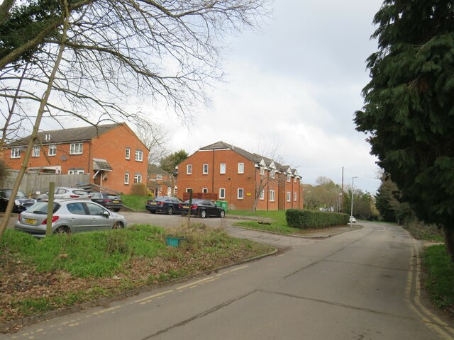
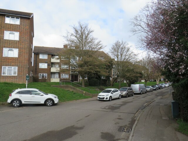
West Ewell is a small suburban area located in the borough of Epsom and Ewell in Surrey, England. It is situated approximately 15 miles southwest of central London. The area is primarily residential, with a mix of housing types including detached houses, semi-detached houses, and some apartment buildings.

West Ewell is well-connected to the rest of Surrey and London with its own railway station, Ewell West, providing regular services to London Waterloo and other surrounding areas. The area is also served by several bus routes, making it easy to travel to nearby towns and attractions.

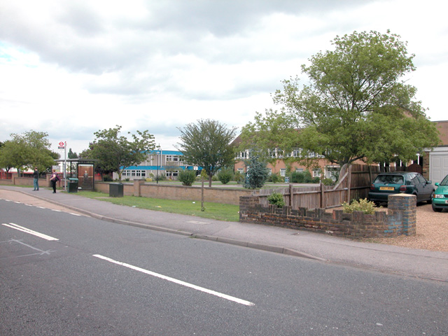
There are a number of local amenities in West Ewell, including shops, schools, parks, and recreational facilities. The area is surrounded by green spaces, including Nonsuch Park, providing residents with plenty of opportunities for outdoor activities and leisure.

Overall, West Ewell offers a peaceful and family-friendly environment for those looking to live in a suburban setting while still having easy access to the amenities and attractions of London and the surrounding areas.

If you have any feedback on the listing, please let us know in the comments section below.
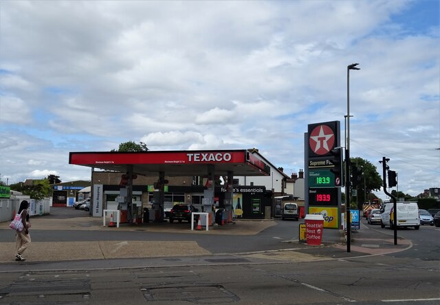
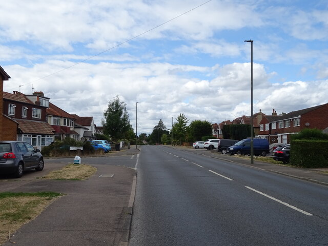
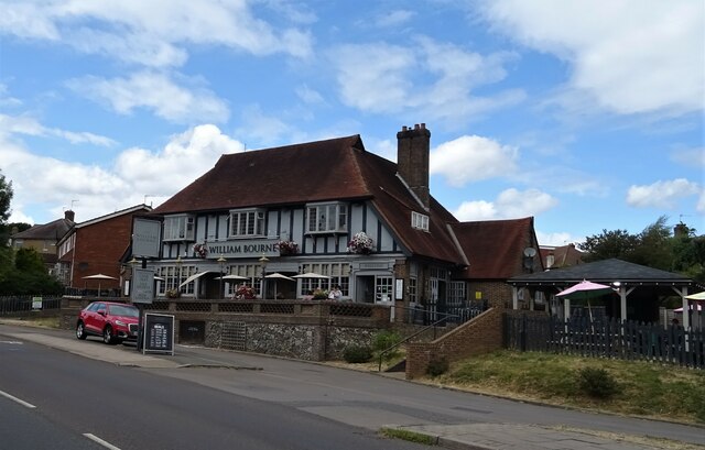
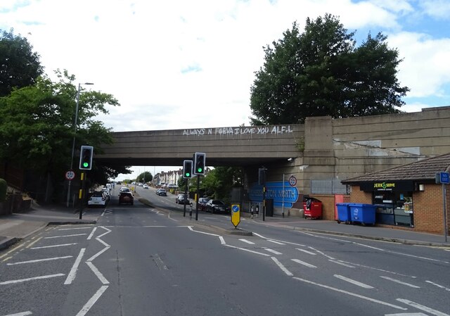
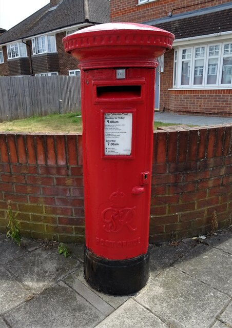
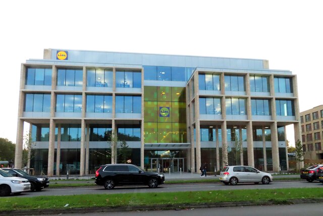
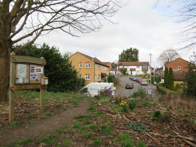
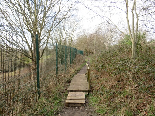
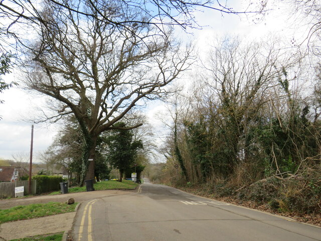
West Ewell Images

Images are sourced within 2km of 51.35825/-0.27681217 or Grid Reference TQ2063. Thanks to Geograph Open Source API. All images are credited.

Service station on Chessington Road / Ruxley Lane Petrol 183.9p
Diesel 193.9p.
Service station on Chessington Road / Ruxley Lane
Petrol 183.9p Diesel 193.9p.
Chessington Road
Chessington Road
The William Bourne, Chessington Formerly The Bonesgate - on Moor Lane.
The William Bourne, Chessington
Formerly The Bonesgate - on Moor Lane.
Moor Lane, Chessington
Houses on Padley Close, Chessington
Padley Close, Chessington
Chessington Methodist Church
Moor Lane, Chessington
The Chessington Oak
The Chessington Oak
The Chessington Oak On Moor Lane.
The Chessington Oak
On Moor Lane.
Railway bridge over Bridge Road
George VI postbox on Moor Lane, Chessington Postbox No. KT9 305.
George VI postbox on Moor Lane, Chessington
Postbox No. KT9 305.
Lidl House on Kingston Road Lidl House is the headquarters of Lidl UK.
Lidl House on Kingston Road
Lidl House is the headquarters of Lidl UK.
Vivien Close, Chessington Vivien Close is a residential cul-de-sac in Chessington, on the fringe of south west London.  This photo was taken from a nearby public footpath.
Vivien Close, Chessington
Vivien Close is a residential cul-de-sac in Chessington, on the fringe of south west London. This photo was taken from a nearby public footpath.
Public footpath, Chessington A short wooden bridge on a public footpath in Chessington, on the fringe of south west London.
Public footpath, Chessington
A short wooden bridge on a public footpath in Chessington, on the fringe of south west London.
Green Lane, Chessington Green Lane in Chessington, on the outer fringe of south west London, passing a modern housing development.
Green Lane, Chessington
Green Lane in Chessington, on the outer fringe of south west London, passing a modern housing development.
Green Lane, Chessington Green Lane in Chessington, on the outer fringe of south west London.
Green Lane, Chessington
Green Lane in Chessington, on the outer fringe of south west London.
Green Lane, Chessington Green Lane is a minor road through a housing estate in Chessington, in the outskirts of south west London.
Green Lane, Chessington
Green Lane is a minor road through a housing estate in Chessington, in the outskirts of south west London.
Show me another place!

West Ewell is located at Grid Ref: TQ2063 (Lat: 51.35825, Lng: -0.27681217)

Administrative County: Surrey

District: Epsom and Ewell

Police Authority: Surrey

What 3 Words

///half.reach.finest. Near Chessington, London

Nearby Locations

West Ewell Ewell, West

Related Wikis

Epsom and Ewell High School

Epsom and Ewell High School is a secondary school located at Ruxley Lane, Epsom, Surrey, England that opened in 1989. It is a coeducational, academy that...

Hogsmill LNR

Hogsmill LNR is a 36-hectare (89-acre) Local Nature Reserve in Ewell in Surrey. It is owned by Epsom and Ewell Borough Council and Surrey County Council...

Castle Hill, Chessington

Castle Hill is a 3.5-hectare (8.6-acre) scheduled monument, local nature reserve and Site of Borough Importance for Nature Conservation, Grade 1, in Chessington...

Bonesgate Open Space

Bonesgate Open Space is a public park, Local Nature Reserve (LNR) and Site of Borough Importance for Nature Conservation, Grade 1, in Chessington in the...

Nearby Amenities

Located within 500m of 51.35825,-0.27681217
Crossing
Bicycle: yes
Button Operated: yes
Crossing: traffic_signals
Crossing Island: separate
Crossing Markings: dots
Crossing Signals: yes
Crossing Ref: toucan
Kerb: lowered
Tactile Paving: yes
Lat/Long: 51.3555401/-0.2727655
Traffic Calming: bump
Lat/Long: 51.3597249/-0.27056
Turning Circle
Lat/Long: 51.3583392/-0.2745246
Turning Circle
Lat/Long: 51.3589102/-0.2749795
Bus Stop
Hook Road
Bus: yes
Naptan AtcoCode: 40004406084A
Naptan Bearing: SE
Naptan CommonName: Hook Road
Naptan Indicator: Just Before
Naptan Landmark: Hook Road
Naptan NaptanCode: surajtmw
Naptan Street: Chessington Road
Naptan Verified: no
Public Transport: platform
Source: naptan_import
Lat/Long: 51.3563226/-0.2737023
Bus Stop
Hook Road
Bus: yes
Naptan AtcoCode: 40004406084C
Naptan Bearing: NW
Naptan CommonName: Hook Road
Naptan Indicator: Just after
Naptan Landmark: Hook Road
Naptan NaptanCode: surajtpm
Naptan Street: Chessington Road
Naptan Verified: no
Public Transport: platform
Source: naptan_import
Lat/Long: 51.3568338/-0.27474
Bus Stop
Chessington Close
Bench: no
Bin: no
Bus: yes
Naptan AtcoCode: 40004406085A
Naptan Bearing: SE
Naptan CommonName: Chessington Close
Naptan Indicator: Just after
Naptan Landmark: Chessington Close
Naptan NaptanCode: surajtpt
Naptan Street: Chessington Road
Naptan Verified: no
Public Transport: platform
Shelter: no
Source: naptan_import
Tactile Paving: no
Lat/Long: 51.3580596/-0.2762603
Bus Stop
Chessington Close
Bus: yes
Naptan AtcoCode: 40004406085B
Naptan Bearing: NW
Naptan CommonName: Chessington Close
Naptan Indicator: Opp
Naptan Landmark: Chessington Close
Naptan NaptanCode: surajtpw
Naptan Street: Chessington Road
Naptan Verified: no
Public Transport: platform
Source: naptan_import
Lat/Long: 51.3585518/-0.2777863
Bus Stop
Nightingale Drive
Bus: yes
Naptan AtcoCode: 40004406086A
Naptan Bearing: NW
Naptan CommonName: Chessington Road
Naptan Indicator: Just Before
Naptan Landmark: Chessington Road
Naptan NaptanCode: surajtwa
Naptan Street: Ruxley Lane
Naptan Verified: no
Public Transport: platform
Source: naptan_import
Lat/Long: 51.3599139/-0.2809474
Bus Stop
Nightingale Drive
Bench: yes
Bin: no
Bus: yes
Naptan AtcoCode: 40004406086B
Naptan Bearing: SE
Naptan CommonName: Chessington Road
Naptan Indicator: Just after
Naptan Landmark: Chessington Road
Naptan NaptanCode: surajwaw
Naptan Street: Chessington Road
Naptan Verified: no
Public Transport: platform
Shelter: yes
Source: naptan_import
Lat/Long: 51.3600655/-0.2802118
Bus Stop
Godwin Close
Bench: yes
Bus: yes
Naptan AtcoCode: 40004406088A
Naptan Bearing: SW
Naptan CommonName: Gatley Avenue
Naptan Indicator: Opp
Naptan Landmark: Gatley Avenue
Naptan NaptanCode: surajwdp
Naptan Street: Ruxley Lane
Naptan Verified: no
Public Transport: platform
Shelter: yes
Source: naptan_import
Lat/Long: 51.362446/-0.2765317
Bus Stop
Godwin Close
Bench: yes
Bin: yes
Bus: yes
Lit: yes
Naptan AtcoCode: 40004406088B
Naptan Bearing: NE
Naptan CommonName: Gatley Avenue
Naptan Indicator: Just Before
Naptan Landmark: Gatley Avenue
Naptan NaptanCode: surajwdt
Naptan Street: Ruxley Lane
Public Transport: platform
Shelter: yes
Source: naptan_import
Tactile Paving: no
Lat/Long: 51.362072/-0.2777075
Bus Stop
Cherry Way
Bench: no
Bin: no
Bus: yes
Lit: no
Naptan AtcoCode: 40004406100A
Naptan Bearing: NW
Naptan CommonName: Cherry Way
Naptan Indicator: Just Before
Naptan Landmark: Poole Road
Naptan NaptanCode: surajwta
Naptan Street: Poole Road
Naptan Verified: no
Public Transport: platform
Shelter: no
Source: naptan_import
Tactile Paving: no
Lat/Long: 51.3597571/-0.2707337
Bus Stop
Cherry Way
Bench: no
Bin: no
Bus: yes
Lit: no
Naptan AtcoCode: 40004406100B
Naptan Bearing: SE
Naptan CommonName: Cherry Way
Naptan Indicator: Just after
Naptan Landmark: Poole Road
Naptan NaptanCode: surajwtd
Naptan Street: Poole Road
Naptan Verified: no
Public Transport: platform
Shelter: no
Source: naptan_import
Tactile Paving: no
Lat/Long: 51.3598682/-0.2706646
Bus Stop
Danetree Close
Bus: yes
Naptan AtcoCode: 40004406904A
Naptan Bearing: SW
Naptan CommonName: Danetree Close
Naptan Indicator: Opp
Naptan Landmark: Danetree Close
Naptan NaptanCode: suramgap
Naptan Street: Danetree Road
Naptan Verified: no
Public Transport: platform
Source: naptan_import
Lat/Long: 51.356112/-0.2720055
Danetree Close
Naptan AtcoCode: 40004406904B
Naptan Bearing: NE
Naptan BusStopType: CUS
Naptan CommonName: Danetree Close
Naptan Indicator: adj
Naptan Landmark: Danetree Close
Naptan NaptanCode: surgpmpm
Naptan Street: Danetree Road
Naptan Verified: no
Source: naptan_import
Lat/Long: 51.3562661/-0.2720184
Dentist
Horton Dental Practice
Healthcare: dentist
Wheelchair: limited
Lat/Long: 51.3606128/-0.2804887
Telephone
Booth: KXPlus
Covered: booth
Lat/Long: 51.3606975/-0.2805519
Post Box
Post Box Type: pillar
Ref: KT19 52
Royal Cypher: GR
Royal Cypher Wikidata: Q33102273
Lat/Long: 51.3606861/-0.2805346
Speed Camera
Lat/Long: 51.3621535/-0.2773503
McColl's
Addr Housenumber: 166
Addr Postcode: KT19 9HA
Addr Street: Ruxley Lane
Brand: McColl's
Brand Wikidata: Q16997477
Brand Wikipedia: en:McColl's
Fhrs Id: 20699
Opening Hours: Mo-Sa 07:00-23:00; Su 08:00-22:00
Shop: convenience
Source Addr: FHRS Open Data
Wheelchair: yes
Lat/Long: 51.3625621/-0.2769759
Bicycle Parking
Bicycle Parking: stands
Capacity: 8
Covered: no
Lat/Long: 51.3625661/-0.2768396
Crossing
Button Operated: yes
Crossing: traffic_signals
Crossing Island: no
Crossing Ref: pelican
Tactile Paving: yes
Traffic Signals Sound: yes
Traffic Signals Vibration: yes
Lat/Long: 51.3627177/-0.2762627
Traffic Signals
Crossing: no
Traffic Signals: traffic_lights
Traffic Signals Direction: backward
Lat/Long: 51.3605275/-0.2808853
Crossing
Bicycle: yes
Button Operated: yes
Crossing: traffic_signals
Crossing Island: separate
Crossing Markings: dots
Crossing Signals: yes
Crossing Ref: toucan
Kerb: lowered
Tactile Paving: yes
Lat/Long: 51.3554411/-0.2740125
Post Office
Poole Road Post Office
Addr Postcode: KT19 9SQ
Brand: Post Office
Brand Wikidata: Q1783168
Ref Pol Id: 19178
Source: OS OpenData StreetView
Lat/Long: 51.3596645/-0.2708689
Traffic Signals
Crossing: no
Traffic Signals: traffic_lights
Traffic Signals Direction: forward
Lat/Long: 51.3602237/-0.2812189
Crossing
Bicycle: yes
Button Operated: yes
Crossing: traffic_signals
Crossing Markings: dots
Crossing Signals: yes
Crossing Ref: toucan
Lat/Long: 51.3583292/-0.2773433
Turning Circle
Lat/Long: 51.3567739/-0.2710584
Crossing
Bicycle: yes
Button Operated: yes
Crossing: traffic_signals
Crossing Markings: dots
Crossing Signals: yes
Crossing Ref: toucan
Tactile Paving: yes
Lat/Long: 51.3597281/-0.2801915
Crossing
Bicycle: yes
Button Operated: yes
Crossing: traffic_signals
Crossing Markings: dots
Crossing Signals: yes
Crossing Ref: toucan
Lat/Long: 51.3585049/-0.2772443
Crossing
Bicycle: yes
Button Operated: yes
Crossing: traffic_signals
Crossing Markings: dots
Crossing Signals: yes
Crossing Ref: toucan
Tactile Paving: yes
Lat/Long: 51.3599183/-0.2801166
Crossing
Button Operated: yes
Check Date Crossing: 2024-01-07
Crossing: traffic_signals
Crossing Markings: dots
Crossing Signals: yes
Crossing Type: toucan
Kerb: lowered
Tactile Paving: yes
Lat/Long: 51.35664/-0.27396
Crossing
Button Operated: yes
Check Date Crossing: 2024-01-07
Crossing: traffic_signals
Crossing Markings: dots
Crossing Signals: yes
Kerb: lowered
Tactile Paving: yes
Lat/Long: 51.356417/-0.2740752
Bus: yes
Public Transport: stop_position
Lat/Long: 51.356313/-0.2737919
Bus: yes
Public Transport: stop_position
Lat/Long: 51.3600753/-0.2804157
Cycleway: asl
Direction: forward
Lat/Long: 51.3602979/-0.2810737
Crossing
Bicycle: yes
Button Operated: yes
Crossing: traffic_signals
Crossing Island: no
Crossing Markings: dots
Crossing Signals: yes
Crossing Ref: toucan
Kerb: lowered
Tactile Paving: yes
Lat/Long: 51.3543962/-0.2755293
Crossing
Bicycle: yes
Button Operated: yes
Crossing: traffic_signals
Crossing Island: separate
Crossing Markings: dots
Crossing Signals: yes
Crossing Ref: toucan
Kerb: lowered
Tactile Paving: yes
Lat/Long: 51.3554217/-0.2727919
Crossing
Bicycle: yes
Button Operated: yes
Crossing: traffic_signals
Crossing Island: separate
Crossing Markings: dots
Crossing Signals: yes
Crossing Ref: toucan
Kerb: lowered
Tactile Paving: yes
Lat/Long: 51.3555007/-0.2742046
Traffic Signals
Crossing: no
Traffic Signals: traffic_lights
Traffic Signals Direction: forward
Lat/Long: 51.3601778/-0.2809307
Give Way
Direction: backward
Lat/Long: 51.3558248/-0.2727009
Tactile Paving: yes
Lat/Long: 51.3552074/-0.2749104
Tactile Paving: yes
Lat/Long: 51.3553402/-0.2727999
Tactile Paving: yes
Lat/Long: 51.3553849/-0.2729056
Post Box
Collection Times: Mo-Fr 17:00; Sa 12:30
Operator: Royal Mail
Post Box Type: pillar
Ref: KT19 171
Royal Cypher: GVIR
Royal Cypher Wikidata: Q33102169
Lat/Long: 51.3597282/-0.2708074
Golf: pin
Lat/Long: 51.3557068/-0.2783243
Tactile Paving: yes
Lat/Long: 51.3599329/-0.2800943
Tactile Paving: yes
Lat/Long: 51.3597545/-0.2801666
Crossing
Crossing: unmarked
Crossing Island: no
Crossing Markings: no
Tactile Paving: yes
Lat/Long: 51.3599935/-0.2801397
Tactile Paving: yes
Lat/Long: 51.3598994/-0.28014
Parcel Locker
Brand: Amazon Locker
Brand Wikidata: Q16974764
Operator: Amazon
Operator Wikidata: Q3884
Operator Wikipedia: en:Amazon (company)
Lat/Long: 51.3626416/-0.2769247
Traffic Calming: hump
Lat/Long: 51.361152/-0.2723842
Traffic Calming: hump
Lat/Long: 51.3607205/-0.2722409
Traffic Calming: hump
Lat/Long: 51.3603508/-0.2716929
Barrier: kerb
Kerb: lowered
Tactile Paving: yes
Lat/Long: 51.3555606/-0.2727352
Crossing
Button Operated: yes
Crossing: traffic_signals
Crossing Markings: dots
Crossing Signals: yes
Crossing Ref: pelican
Lat/Long: 51.3602922/-0.2812414
Traffic Signals
Traffic Signals Direction: forward
Lat/Long: 51.3602634/-0.2810854
Crossing: no
Lat/Long: 51.3602771/-0.2810815
Traffic Signals
Crossing: no
Traffic Signals: traffic_lights
Traffic Signals Direction: forward
Lat/Long: 51.3604289/-0.281192
Crossing
Crossing: traffic_signals
Crossing Island: yes
Crossing Markings: dots
Crossing Signals: yes
Crossing Ref: pelican
Lat/Long: 51.360416/-0.2811364
West Ewell
Place: suburb
Lat/Long: 51.3618197/-0.2733742
Barrier: bollard
Lat/Long: 51.3625757/-0.2780832
Give Way
Direction: forward
Lat/Long: 51.3603159/-0.280744
Golf: pin
Lat/Long: 51.3573764/-0.2776058
Golf: pin
Lat/Long: 51.357847/-0.2809586
Golf: pin
Lat/Long: 51.3596144/-0.2821955
Golf: pin
Lat/Long: 51.359007/-0.2801342
Golf: pin
Lat/Long: 51.3580647/-0.2814689
Golf: pin
Lat/Long: 51.3583942/-0.278533
Golf: pin
Lat/Long: 51.3577524/-0.2786548
Golf: pin
Lat/Long: 51.3568918/-0.276471
Give Way
Direction: backward
Lat/Long: 51.3626608/-0.2765612
Post Box
Collection Times: Mo-Fr 09:00; Sa 07:00
Operator: Royal Mail
Post Box Type: pillar
Ref: KT19 350D
Royal Cypher: GR
Royal Cypher Wikidata: Q33102273
Lat/Long: 51.3624844/-0.2769582
Noexit: yes
Lat/Long: 51.3621308/-0.2782789
Bus: yes
Public Transport: stop_position
Lat/Long: 51.3599141/-0.2807451
Cycleway: asl
Direction: forward
Lat/Long: 51.3602542/-0.2812314
Traffic Calming: bump
Lat/Long: 51.3599698/-0.2710086
Tactile Paving: yes
Lat/Long: 51.3597018/-0.2802164
Tactile Paving: yes
Lat/Long: 51.3599746/-0.280103
Tactile Paving: yes
Lat/Long: 51.3600202/-0.2801885
Barrier: kerb
Kerb: lowered
Tactile Paving: yes
Lat/Long: 51.3566223/-0.2740157
Barrier: kerb
Kerb: lowered
Tactile Paving: yes
Lat/Long: 51.3566586/-0.27391
Barrier: kerb
Kerb: lowered
Tactile Paving: yes
Lat/Long: 51.3564353/-0.2740238
Barrier: kerb
Kerb: lowered
Tactile Paving: yes
Lat/Long: 51.3564025/-0.2741175
Bus: yes
Public Transport: stop_position
Lat/Long: 51.3568642/-0.2746948
Traffic Signals
Crossing: no
Traffic Signals: pedestrian_crossing
Traffic Signals Direction: forward
Lat/Long: 51.3597053/-0.2801283
Traffic Signals
Crossing: no
Traffic Signals: pedestrian_crossing
Traffic Signals Direction: forward
Lat/Long: 51.3599381/-0.2801486
Barrier: cycle_barrier
Bicycle: yes
Cycle Barrier: double
Cycle Barrier Installation: fixed
Foot: yes
Lat/Long: 51.3543309/-0.2753437
Tactile Paving: yes
Lat/Long: 51.3543545/-0.2754116
Give Way
Direction: forward
Lat/Long: 51.3582531/-0.2767744
Bus: yes
Public Transport: stop_position
Lat/Long: 51.3585822/-0.2777409
Traffic Signals
Crossing: no
Traffic Signals: pedestrian_crossing
Traffic Signals Direction: forward
Lat/Long: 51.3582974/-0.2772895
Traffic Signals
Crossing: no
Traffic Signals: pedestrian_crossing
Traffic Signals Direction: forward
Lat/Long: 51.3585332/-0.2772864
Traffic Signals
Crossing: no
Traffic Signals: pedestrian_crossing
Traffic Signals Direction: forward
Lat/Long: 51.3563772/-0.2740415
Traffic Signals
Crossing: no
Traffic Signals: pedestrian_crossing
Traffic Signals Direction: forward
Lat/Long: 51.356672/-0.2739875
Barrier: kerb
Kerb: lowered
Tactile Paving: yes
Lat/Long: 51.3543799/-0.2754843
Barrier: kerb
Kerb: lowered
Tactile Paving: yes
Lat/Long: 51.3544133/-0.2755765
Traffic Signals
Crossing: no
Traffic Signals: pedestrian_crossing
Traffic Signals Direction: forward
Lat/Long: 51.3544311/-0.2755018
Traffic Signals
Crossing: no
Traffic Signals: pedestrian_crossing
Traffic Signals Direction: backward
Lat/Long: 51.3543648/-0.2755576
Give Way
Direction: backward
Lat/Long: 51.354466/-0.2755734
Give Way
Direction: forward
Lat/Long: 51.354382/-0.2756423
Tactile Paving: yes
Lat/Long: 51.3543917/-0.2756346
Tactile Paving: yes
Lat/Long: 51.3544571/-0.2755809
Direction: forward
Traffic Sign: GB:614
Lat/Long: 51.355002/-0.2748726
Give Way
Direction: backward
Lat/Long: 51.3553852/-0.2729309
Barrier: kerb
Kerb: lowered
Tactile Paving: no
Lat/Long: 51.3551875/-0.272273
Give Way
Direction: forward
Lat/Long: 51.3555179/-0.2720907
Give Way
Direction: backward
Lat/Long: 51.3553344/-0.2722964
Barrier: kerb
Kerb: lowered
Tactile Paving: yes
Lat/Long: 51.3555203/-0.272797
Barrier: kerb
Kerb: lowered
Tactile Paving: yes
Lat/Long: 51.3554445/-0.2727611
Barrier: kerb
Kerb: lowered
Tactile Paving: yes
Lat/Long: 51.355399/-0.2728228
Traffic Signals
Crossing: no
Traffic Signals: pedestrian_crossing
Traffic Signals Direction: forward
Lat/Long: 51.3553951/-0.2727314
Traffic Signals
Crossing: no
Traffic Signals: pedestrian_crossing
Traffic Signals Direction: forward
Lat/Long: 51.3555704/-0.272813
Give Way
Direction: backward
Lat/Long: 51.35535/-0.2740023
Give Way
Direction: forward
Lat/Long: 51.35537/-0.2739242
Tactile Paving: yes
Lat/Long: 51.3553514/-0.2739982
Tactile Paving: yes
Lat/Long: 51.3553692/-0.273929
Tactile Paving: yes
Lat/Long: 51.3553779/-0.2746688
Tactile Paving: yes
Lat/Long: 51.3555446/-0.2743049
Give Way
Direction: forward
Lat/Long: 51.3552673/-0.2747715
Traffic Signals
Crossing: no
Traffic Signals: pedestrian_crossing
Traffic Signals Direction: forward
Lat/Long: 51.3554521/-0.2739513
Traffic Signals
Crossing: no
Traffic Signals: pedestrian_crossing
Traffic Signals Direction: forward
Lat/Long: 51.3554768/-0.2742604
Barrier: kerb
Kerb: lowered
Tactile Paving: yes
Lat/Long: 51.3554074/-0.2739914
Barrier: kerb
Kerb: lowered
Tactile Paving: yes
Lat/Long: 51.3554783/-0.2740358
Barrier: kerb
Kerb: lowered
Tactile Paving: yes
Lat/Long: 51.3554738/-0.2741831
Barrier: kerb
Kerb: lowered
Tactile Paving: yes
Lat/Long: 51.3555327/-0.2742301
Tactile Paving: yes
Lat/Long: 51.3555848/-0.2742298
The data included in this document is from www.openstreetmap.org. The data is made available under ODbL.

Have you been to West Ewell?

Leave your review of West Ewell below (or comments, questions and feedback).