West End

Settlement in Yorkshire

England

West End

Bridlington Road in Skipsea
Bridlington Road in Skipsea Credit: peter robinson

West End is a small village located in the county of Yorkshire, England. Situated in the picturesque Yorkshire Dales National Park, West End is known for its stunning natural beauty and charming rural atmosphere. The village is surrounded by rolling hills, lush green meadows, and quaint stone cottages, providing a peaceful and idyllic setting for residents and visitors alike.

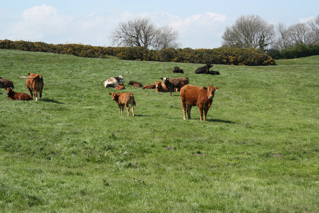
West End is home to a tight-knit community of friendly locals who take pride in their village and its heritage. The village has a few amenities, including a local pub, a small grocery store, and a village hall where community events and gatherings are held. The primary industry in West End is agriculture, with many residents working as farmers or in related industries.

Visitors to West End can enjoy scenic walks and hikes in the surrounding countryside, with numerous trails and paths offering breathtaking views of the Dales. The village is also a popular destination for outdoor enthusiasts, with opportunities for fishing, birdwatching, and cycling. Overall, West End offers a peaceful retreat from the hustle and bustle of city life, where visitors can relax and unwind in a beautiful natural setting.

If you have any feedback on the listing, please let us know in the comments section below.
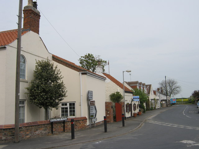
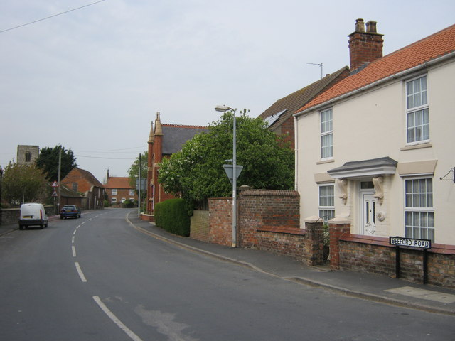
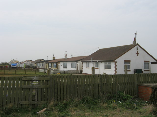
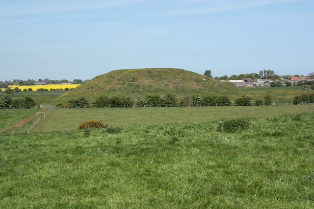
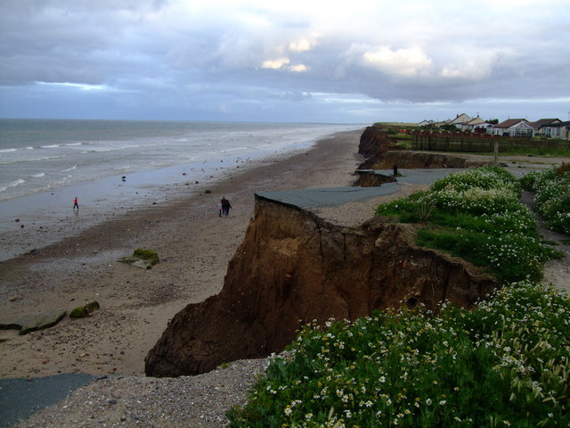
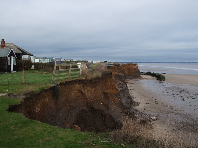
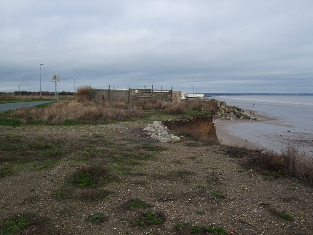
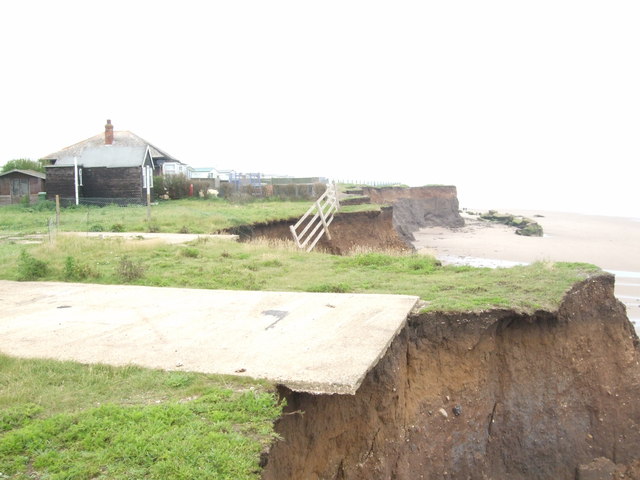
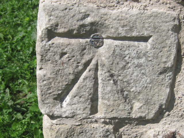
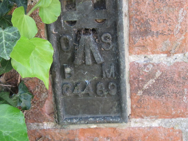
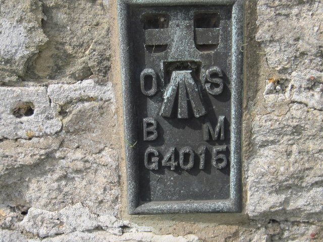
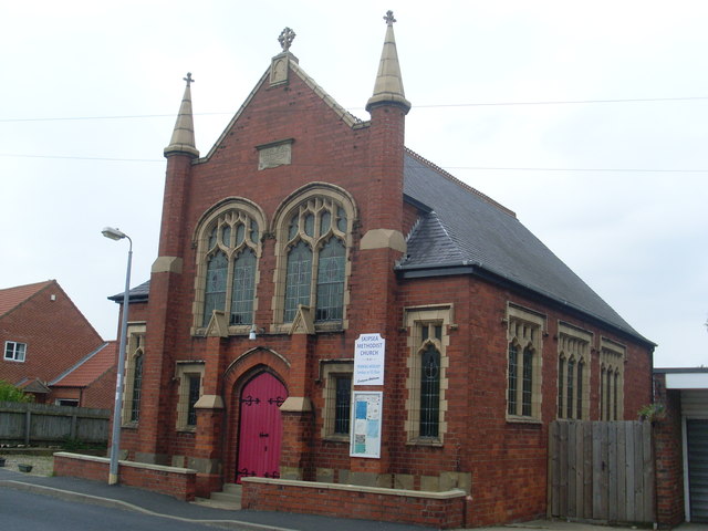
West End Images

Images are sourced within 2km of 53.992882/-0.22954064 or Grid Reference TA1656. Thanks to Geograph Open Source API. All images are credited.

Bridlington Road in Skipsea
Beeford Road in Skipsea
Bungalows in Green Lane  Skipsea
Bungalows in Green Lane Skipsea
Skipsea Castle William the Conqueror made his trusted follower and husband of his cousin, Drogo de la Beauvriére, the first Lord of Holderness, who built a motte-and-bailey castle here c1086. His successors, the counts of Aumale lived here for the next 150 years until the castle declined after c1200 when the Lords of Holderness moved their principal residence to Burstwick.

Popular tradition says that Drogo fled back to Flanders because death of his wife whom he "unhappily killed". Drogo's hasty flight out has given rise to the legend that Drogo murdered his wife by giving her a poison draught which he convinced her was a love potion. He then rode a fast horse to the king's court, borrowed a large sum of money from William and took ship to the continent before news of his deeds could reach the court. The ghost of a 'lady in white' is said to haunt Castle Hill.
Skipsea Castle
William the Conqueror made his trusted follower and husband of his cousin, Drogo de la Beauvriére, the first Lord of Holderness, who built a motte-and-bailey castle here c1086. His successors, the counts of Aumale lived here for the next 150 years until the castle declined after c1200 when the Lords of Holderness moved their principal residence to Burstwick. Popular tradition says that Drogo fled back to Flanders because death of his wife whom he "unhappily killed". Drogo's hasty flight out has given rise to the legend that Drogo murdered his wife by giving her a poison draught which he convinced her was a love potion. He then rode a fast horse to the king's court, borrowed a large sum of money from William and took ship to the continent before news of his deeds could reach the court. The ghost of a 'lady in white' is said to haunt Castle Hill.
All Saints' church 11th century nave and chancel with later additions, including a 15th century tower, all restored by James Fowler 1856-60
All Saints' church
11th century nave and chancel with later additions, including a 15th century tower, all restored by James Fowler 1856-60
Castle bailey cattle Cattle grazing in the bailey of Skipsea Castle

William the Conqueror made his trusted follower and husband of his cousin, Drogo de la Beauvriére, the first Lord of Holderness, who built a motte-and-bailey castle here c1086. His successors, the counts of Aumale lived here for the next 150 years until the castle declined after c1200 when the Lords of Holderness moved their principal residence to Burstwick.
 
Popular tradition says that Drogo fled back to Flanders because death of his wife whom he "unhappily killed". Drogo's hasty flight out has given rise to the legend that Drogo murdered his wife by giving her a poison draught which he convinced her was a love potion. He then rode a fast horse to the king's court, borrowed a large sum of money from William and took ship to the continent before news of his deeds could reach the court. The ghost of a 'lady in white' is said to haunt Castle Hill.
Castle bailey cattle
Cattle grazing in the bailey of Skipsea Castle William the Conqueror made his trusted follower and husband of his cousin, Drogo de la Beauvriére, the first Lord of Holderness, who built a motte-and-bailey castle here c1086. His successors, the counts of Aumale lived here for the next 150 years until the castle declined after c1200 when the Lords of Holderness moved their principal residence to Burstwick. Popular tradition says that Drogo fled back to Flanders because death of his wife whom he "unhappily killed". Drogo's hasty flight out has given rise to the legend that Drogo murdered his wife by giving her a poison draught which he convinced her was a love potion. He then rode a fast horse to the king's court, borrowed a large sum of money from William and took ship to the continent before news of his deeds could reach the court. The ghost of a 'lady in white' is said to haunt Castle Hill.
Ulrome-cliff-top chalet site July 2011 Just over six months on from our last photo <a title="https://www.geograph.org.uk/photo/2209920" href="https://www.geograph.org.uk/photo/2209920">Link</a> taken at Christmas 2010 it is like this chalet home never existed, the only datum points for recognition are the warning boards to the extreme left of the photo and the distinctive fence which is still in place and was visible to the side of the chalet.
Ulrome-cliff-top chalet site July 2011
Just over six months on from our last photo Link taken at Christmas 2010 it is like this chalet home never existed, the only datum points for recognition are the warning boards to the extreme left of the photo and the distinctive fence which is still in place and was visible to the side of the chalet.
Ulrome erosion situation summer 2011 I wasn't due to visit here for my annual update till December but happened to be in the area.  As predicted it is getting harder to find suitable datum points for my photos because the telegraph pole I used six months ago has disappeared, luckily the distinctive bungalow with wooden outbuilding beside it is still here (for now!) This photo taken in July, the green vegetation makes the erosion less visible but my next winter photo won't have these issues. At the present rate of cliff loss I would estimate the bungalow has less than 18 months left, all of this is very sad but you can't beat the forces of nature.
Ulrome erosion situation summer 2011
I wasn't due to visit here for my annual update till December but happened to be in the area. As predicted it is getting harder to find suitable datum points for my photos because the telegraph pole I used six months ago has disappeared, luckily the distinctive bungalow with wooden outbuilding beside it is still here (for now!) This photo taken in July, the green vegetation makes the erosion less visible but my next winter photo won't have these issues. At the present rate of cliff loss I would estimate the bungalow has less than 18 months left, all of this is very sad but you can't beat the forces of nature.
Ulrome Erosion situation summer 2011 There is no longer a road here, like there was only a couple of years back, now that has gone, it's the back gardens next. Even though the weather was quite reasonable in the first half of 2011 I was surprised to see how much more land had gone in the space of six months, the weather does determine to a large extent the actual rate of erosion here. Apparently in really bad storms, several feet can be lost in a matter of hours.
Ulrome Erosion situation summer 2011
There is no longer a road here, like there was only a couple of years back, now that has gone, it's the back gardens next. Even though the weather was quite reasonable in the first half of 2011 I was surprised to see how much more land had gone in the space of six months, the weather does determine to a large extent the actual rate of erosion here. Apparently in really bad storms, several feet can be lost in a matter of hours.
Cliff top bungalows living on borrowed time summer 2011 Looking along the row of bungalows on green lane, where it meets Mill Lane. This is summer 2011, I will be photographing the erosion devastation on a yearly basis as from today.
Cliff top bungalows living on borrowed time summer 2011
Looking along the row of bungalows on green lane, where it meets Mill Lane. This is summer 2011, I will be photographing the erosion devastation on a yearly basis as from today.
Ulrome erosion situation 2012 Almost exactly a year on from the last picture <a title="https://www.geograph.org.uk/photo/2209920," href="https://www.geograph.org.uk/photo/2209920,">Link</a> my predictions of the rate of erosion were actually incorrect. I had estimated that the crumbling cliff would have taken the boundary fence by now, if you look at the first fence panel compared with my last photo, the first panel has been moved inwards, otherwise it too would have gone over by now. In essence 2011 hasn't been a particularly bad year for Ulrome, I think mainly due to the reasonable weather we have had this year, the bad weather has a considerable effect obviously. We can only see what another year brings.
Ulrome erosion situation 2012
Almost exactly a year on from the last picture Link my predictions of the rate of erosion were actually incorrect. I had estimated that the crumbling cliff would have taken the boundary fence by now, if you look at the first fence panel compared with my last photo, the first panel has been moved inwards, otherwise it too would have gone over by now. In essence 2011 hasn't been a particularly bad year for Ulrome, I think mainly due to the reasonable weather we have had this year, the bad weather has a considerable effect obviously. We can only see what another year brings.
Ulrome - what a difference a year makes... This is the site where Cliff Farm used to reside and the distinctive yellow cabin that was behind it, bordering the fence that is still visible in the background. It is like they never existed at all, but if you take a look at my 2010 photo <a title="https://www.geograph.org.uk/photo/2210692" href="https://www.geograph.org.uk/photo/2210692">Link</a> taken in the same spot exactly the same time last year, things were very different...
Ulrome - what a difference a year makes...
This is the site where Cliff Farm used to reside and the distinctive yellow cabin that was behind it, bordering the fence that is still visible in the background. It is like they never existed at all, but if you take a look at my 2010 photo Link taken in the same spot exactly the same time last year, things were very different...
Ulrome erosion situation, summer 2012 Because of the sheer rate of erosion in this particular area of coast I have started to visit Ulrome twice a year, once in the winter and once in the summer.  I wasn't expecting to see that much erosion following my visit at Christmas time,but I was quite surprised at the changes. This distinctive black outbuilding is the focus of my photos but it is getting harder and harder to find a suitable place to stand!  If you look at my other photos of this exact spot only a few years ago there was a road here which you could walk down; that is long gone,and getting this photo involved a certain amount of fence climbing.
Ulrome erosion situation, summer 2012
Because of the sheer rate of erosion in this particular area of coast I have started to visit Ulrome twice a year, once in the winter and once in the summer. I wasn't expecting to see that much erosion following my visit at Christmas time,but I was quite surprised at the changes. This distinctive black outbuilding is the focus of my photos but it is getting harder and harder to find a suitable place to stand! If you look at my other photos of this exact spot only a few years ago there was a road here which you could walk down; that is long gone,and getting this photo involved a certain amount of fence climbing.
Ordnance Survey Cut Mark with Bolt This mark and bolt can be found on the wall of the church.
For more detail see : <span class="nowrap"><a title="http://www.bench-marks.org.uk/bm24578" rel="nofollow ugc noopener" href="http://www.bench-marks.org.uk/bm24578">Link</a><img style="margin-left:2px;" alt="External link" title="External link - shift click to open in new window" src="https://s1.geograph.org.uk/img/external.png" width="10" height="10"/></span>
Ordnance Survey Cut Mark with Bolt
This mark and bolt can be found on the wall of the church. For more detail see : LinkExternal link
Ordnance Survey  Flush Bracket G4489 This bracket can be found on the wall of 'Old School House'.
For more detail see : <span class="nowrap"><a title="http://www.bench-marks.org.uk/bm15895" rel="nofollow ugc noopener" href="http://www.bench-marks.org.uk/bm15895">Link</a><img style="margin-left:2px;" alt="External link" title="External link - shift click to open in new window" src="https://s1.geograph.org.uk/img/external.png" width="10" height="10"/></span>
Ordnance Survey Flush Bracket G4489
This bracket can be found on the wall of 'Old School House'. For more detail see : LinkExternal link
Ordnance Survey  Flush Bracket G4015 This bracket can be found on the wall of All Saints Church.
For more detail see : <span class="nowrap"><a title="http://www.bench-marks.org.uk/bm2502" rel="nofollow ugc noopener" href="http://www.bench-marks.org.uk/bm2502">Link</a><img style="margin-left:2px;" alt="External link" title="External link - shift click to open in new window" src="https://s1.geograph.org.uk/img/external.png" width="10" height="10"/></span>
Ordnance Survey Flush Bracket G4015
This bracket can be found on the wall of All Saints Church. For more detail see : LinkExternal link
Skipsea Methodist Church (1) Situated on the B1249 Beeford Road, this Church dates from 1910 and is one of nine Methodist Churches in the Bridlington Circuit. Services take place here at 10.30am every Sunday morning and activities are held during the week. The postcode of this Church is YO25 8TG.
Skipsea Methodist Church (1)
Situated on the B1249 Beeford Road, this Church dates from 1910 and is one of nine Methodist Churches in the Bridlington Circuit. Services take place here at 10.30am every Sunday morning and activities are held during the week. The postcode of this Church is YO25 8TG.
Skipsea Methodist Church (2) This photo shows this Wesleyan Church dating from 1910 with the side entrance on the left.
Skipsea Methodist Church (2)
This photo shows this Wesleyan Church dating from 1910 with the side entrance on the left.
Show me another place!

West End is located at Grid Ref: TA1656 (Lat: 53.992882, Lng: -0.22954064)

Division: East Riding

Unitary Authority: East Riding of Yorkshire

Police Authority: Humberside

What 3 Words

///coaching.jousting.dime. Near Ulrome, East Yorkshire

Nearby Locations

West End End, West Ulrome

Related Wikis

Ulrome

Ulrome is a village and civil parish in the East Riding of Yorkshire, England. It is situated approximately 6 miles (9.7 km) north of the town of Hornsea...
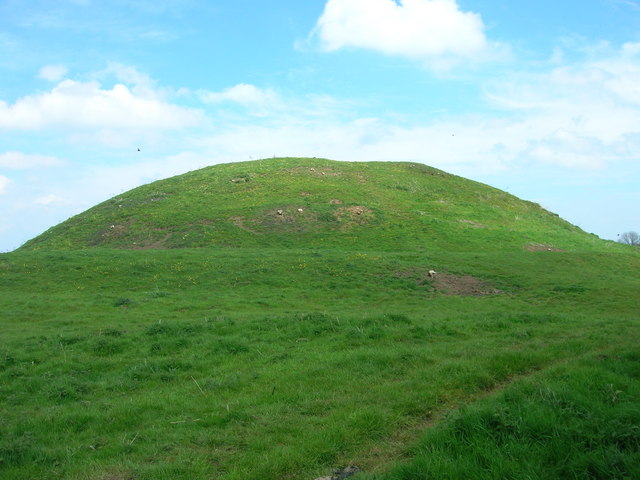
Skipsea Castle

Skipsea Castle was a Norman motte and bailey castle near the village of Skipsea, East Riding of Yorkshire, England. Built around 1086 by Drogo de la Beuvrière...

Skipsea

Skipsea is a village and civil parish on the North Sea coast of the East Riding of Yorkshire, England. It is situated approximately 10 miles (16 km) south...

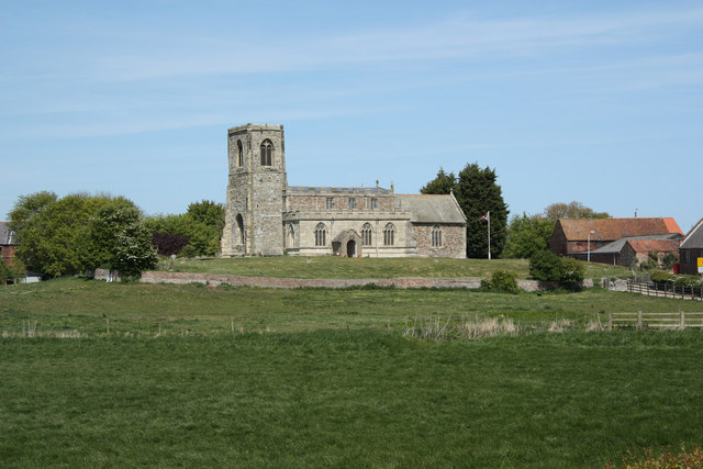
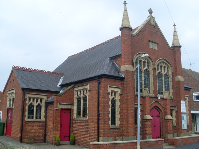
Church of All Saints, Skipsea

The Church of All Saints, is the church for the village and parish of Skipsea, in the East Riding of Yorkshire, England. The church dates back to the late...

Nearby Amenities

Located within 500m of 53.992882,-0.22954064
Ulrome
Is In: East Riding of Yorkshire, England, UK
Place: village
Source: npe
Wikidata: Q6559150
Lat/Long: 53.9943178/-0.2238625
Place Of Worship
Ulrome Methodist Chapel
Denomination: methodist
Religion: christian
Lat/Long: 53.9944396/-0.224999
Bus Stop
Ulrome Main Street
Naptan AtcoCode: 2200YEA01132
Naptan Bearing: E
Naptan CommonName: Ulrome Main Street
Naptan Street: Main Street
Naptan Verified: no
Source: naptan_import
Lat/Long: 53.9929705/-0.2287056
Bus Stop
Ulrome Main Street
Naptan AtcoCode: 2200YEA01133
Naptan Bearing: W
Naptan CommonName: Ulrome Main Street
Naptan Street: Main Street
Naptan Verified: no
Source: naptan_import
Lat/Long: 53.9928182/-0.2287093
The data included in this document is from www.openstreetmap.org. The data is made available under ODbL.

Have you been to West End?

Leave your review of West End below (or comments, questions and feedback).