West End

Settlement in Wiltshire

England

West End

'The Castle', Milkwell
'The Castle', Milkwell Credit: Roger Cornfoot

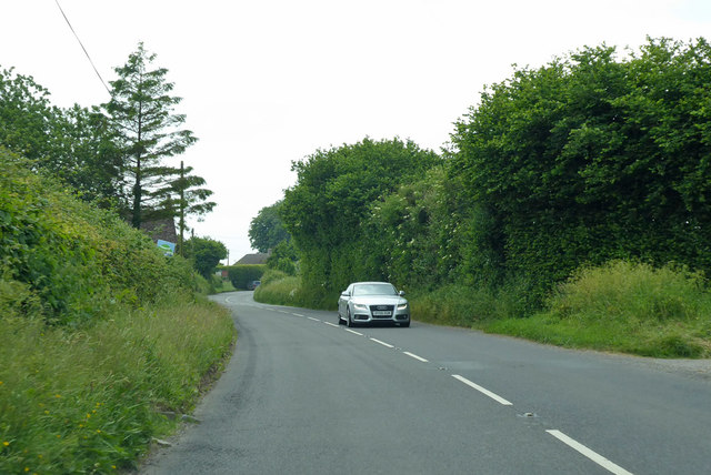
West End is a small village located in the county of Wiltshire, England. Situated approximately 12 miles west of the historic city of Salisbury, West End is nestled in the beautiful countryside of the Wylye Valley. The village is part of the civil parish of Codford, and falls under the jurisdiction of the Wiltshire Council.

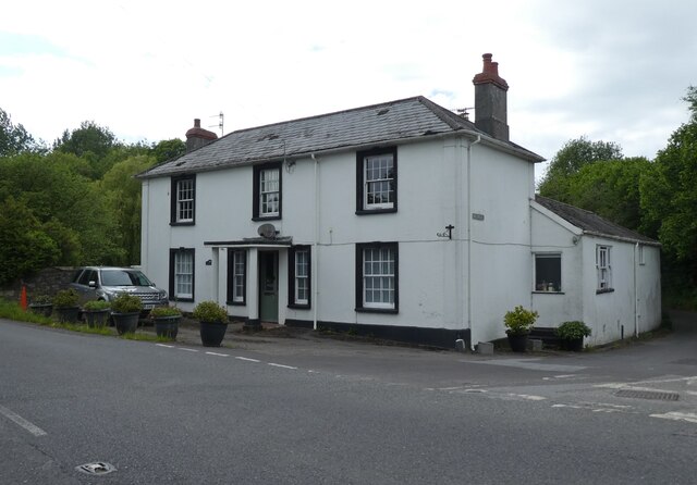
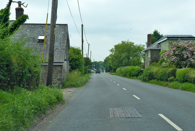
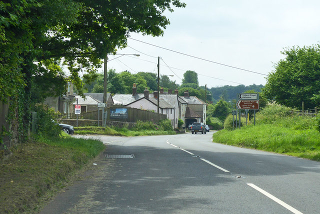
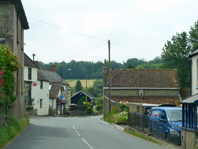
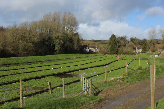
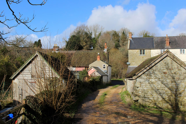
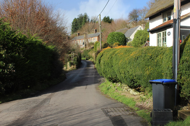
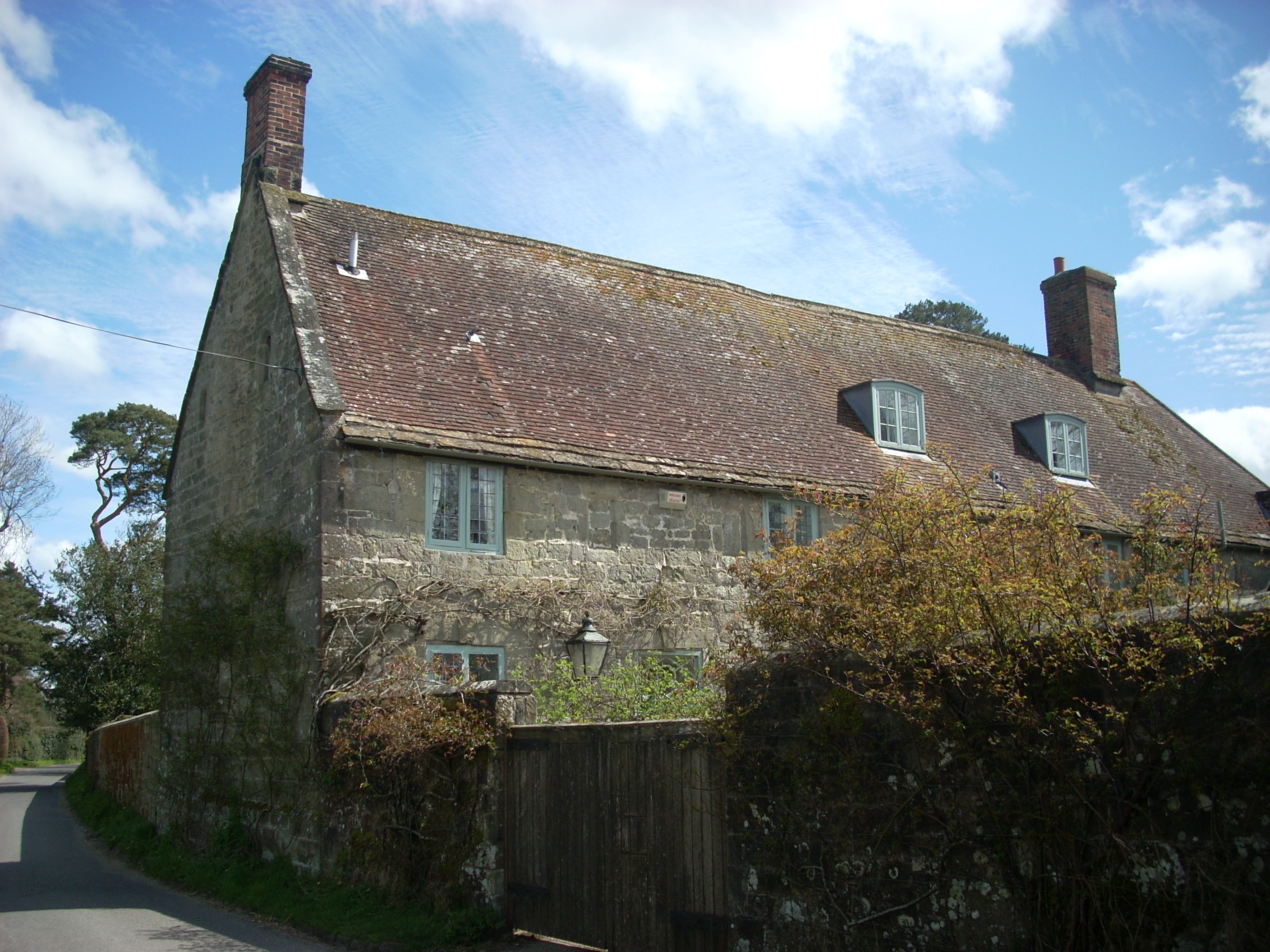
With a population of around 300 residents, West End offers a peaceful and close-knit community atmosphere. The village is characterized by its picturesque thatched cottages, traditional stone houses, and well-maintained gardens. The surrounding landscape is predominantly rural, with rolling hills, meadows, and farmland providing a scenic backdrop.

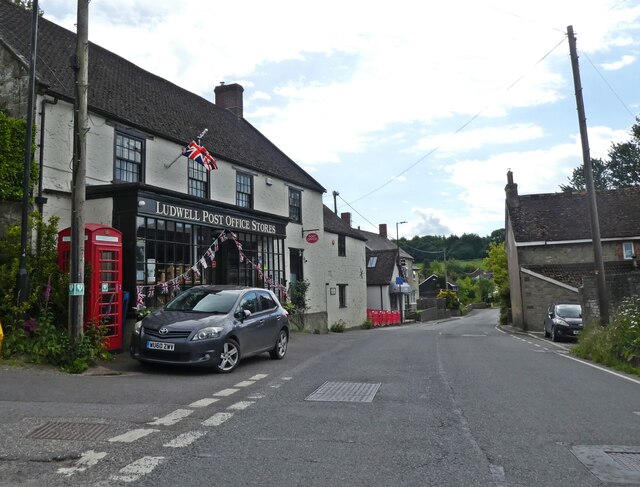
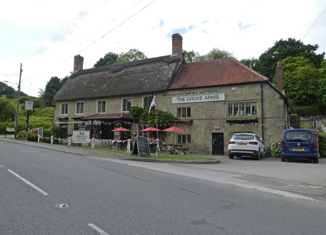
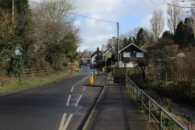
West End benefits from its proximity to the larger village of Codford, which offers a range of amenities including a primary school, post office, convenience stores, and a pub. The village is also well-connected, with regular bus services linking it to neighboring towns and cities.

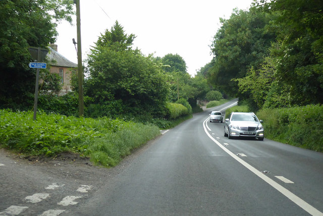
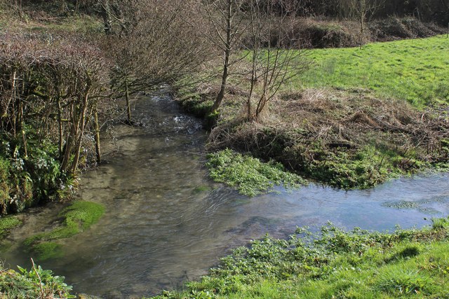
Nature lovers will appreciate the abundance of outdoor activities available in the area. West End is situated near the Cranborne Chase Area of Outstanding Natural Beauty, providing ample opportunities for walking, hiking, and exploring the local flora and fauna. The nearby Wylye River also offers fishing and boating opportunities.

Overall, West End, Wiltshire combines the charm of a rural English village with convenient access to amenities and natural beauty. It is an idyllic destination for those seeking a tranquil and picturesque setting.

If you have any feedback on the listing, please let us know in the comments section below.
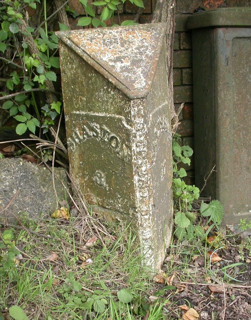
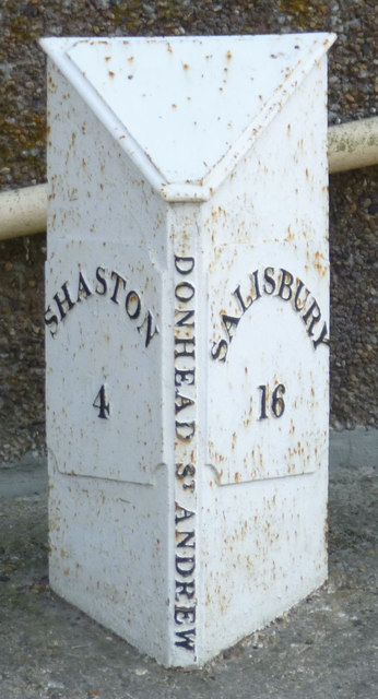
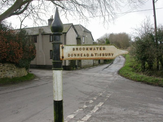
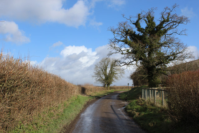
West End Images

Images are sourced within 2km of 51.014711/-2.125418 or Grid Reference ST9123. Thanks to Geograph Open Source API. All images are credited.

'The Castle', Milkwell
Ludwell Post Office Stores
The Grove Arms, Ludwell
A30 heading west The left turn goes to Berwick St John.  The blue sign shows the way the Ed and Camilla's wedding.
A30 heading west
The left turn goes to Berwick St John. The blue sign shows the way the Ed and Camilla's wedding.
A30 heading west Nearing Whitesand Cross.
A30 heading west
Nearing Whitesand Cross.
A30 heading west by Windyridge Farm The farm is on the left. The house on the right is called 'Ours'.
A30 heading west by Windyridge Farm
The farm is on the left. The house on the right is called 'Ours'.
A30 heading west at crossroads, Peckons Hill
A30 heading west Through Ludwell.
A30 heading west
Through Ludwell.
Old Milepost by the A30, Peckons Hill, Ludwell Cast iron post by the A30, in parish of DONHEAD ST MARY (SALISBURY District), Ludwell; East of village next to the junction with Dennis Lane, on the verge, on South side of road. Cockey iron casting, erected by the Whitesheet turnpike trust in the 19th century. 

Inscription reads:-
: SHASTON / 3 : : DONHEAD ST MARY : : SALISBURY / 17 :  

Milestone Society National ID: WI_SHSA03.
Old Milepost by the A30, Peckons Hill, Ludwell
Cast iron post by the A30, in parish of DONHEAD ST MARY (SALISBURY District), Ludwell; East of village next to the junction with Dennis Lane, on the verge, on South side of road. Cockey iron casting, erected by the Whitesheet turnpike trust in the 19th century. Inscription reads:- : SHASTON / 3 : : DONHEAD ST MARY : : SALISBURY / 17 : Milestone Society National ID: WI_SHSA03.
Old Milepost by the A30, Whitesand Cross, Donhead St Andrew Cast iron post by the A30, in parish of DONHEAD ST ANDREW (SALISBURY District), Whitesand Cross; 100m East of crossroads by No. 150, on concrete plinth, on South side of road. Cockey iron casting, erected by the Whitesheet turnpike trust in the 19th century. 

Inscription reads:-
: SHASTON / 4 : : DONHEAD ST MARY : : SALISBURY / 16 :

Grade II listed.
List Entry Number: 1200764 <span class="nowrap"><a title="https://historicengland.org.uk/listing/the-list/list-entry/1200764" rel="nofollow ugc noopener" href="https://historicengland.org.uk/listing/the-list/list-entry/1200764">Link</a><img style="margin-left:2px;" alt="External link" title="External link - shift click to open in new window" src="https://s1.geograph.org.uk/img/external.png" width="10" height="10"/></span>

Milestone Society National ID: WI_SHSA04.
Old Milepost by the A30, Whitesand Cross, Donhead St Andrew
Cast iron post by the A30, in parish of DONHEAD ST ANDREW (SALISBURY District), Whitesand Cross; 100m East of crossroads by No. 150, on concrete plinth, on South side of road. Cockey iron casting, erected by the Whitesheet turnpike trust in the 19th century. Inscription reads:- : SHASTON / 4 : : DONHEAD ST MARY : : SALISBURY / 16 : Grade II listed. List Entry Number: 1200764 LinkExternal link Milestone Society National ID: WI_SHSA04.
Direction Sign - Signpost near Rowberry House, Donhead St Andrew parish Spear and ball finial - 1 arm; by the UC road, in parish of Donhead St Andrew (Salisbury District), Rowberry House, at crossroads.

Grade II listed.
List Entry Number: 1200692 <span class="nowrap"><a title="https://historicengland.org.uk/listing/the-list/list-entry/1200692" rel="nofollow ugc noopener" href="https://historicengland.org.uk/listing/the-list/list-entry/1200692">Link</a><img style="margin-left:2px;" alt="External link" title="External link - shift click to open in new window" src="https://s1.geograph.org.uk/img/external.png" width="10" height="10"/></span>

Surveyed

Milestone Society National ID: WI_ST9223
Direction Sign - Signpost near Rowberry House, Donhead St Andrew parish
Spear and ball finial - 1 arm; by the UC road, in parish of Donhead St Andrew (Salisbury District), Rowberry House, at crossroads. Grade II listed. List Entry Number: 1200692 LinkExternal link Surveyed Milestone Society National ID: WI_ST9223
Country Lane near Peckons Hill The Wessex Ridgeway long distance footpath crossing this lane, south of Ludwell
Country Lane near Peckons Hill
The Wessex Ridgeway long distance footpath crossing this lane, south of Ludwell
Watercress Beds at Ludwell Passed by on the Wessex Ridgeway long distance footpath as it approaches the village of Ludwell from the south
Watercress Beds at Ludwell
Passed by on the Wessex Ridgeway long distance footpath as it approaches the village of Ludwell from the south
Wessex Ridgeway entering Ludwell The long distance footpath entering the village from the south, squeezing between the houses to reach the A30.
Wessex Ridgeway entering Ludwell
The long distance footpath entering the village from the south, squeezing between the houses to reach the A30.
A30 Crossing Ludwell Bridge The main road crossing the River Nadder in Ludwell
A30 Crossing Ludwell Bridge
The main road crossing the River Nadder in Ludwell
Wessex Ridgeway descending towards Mullins Bridge The long distance footpath descends through a green tunnel between Ludwell and Mullins Bridge
Wessex Ridgeway descending towards Mullins Bridge
The long distance footpath descends through a green tunnel between Ludwell and Mullins Bridge
River Nadder at Mullins Bridge
In Milkwell Hamlet passed through on the Wessex Ridgeway long distance footpath
In Milkwell
Hamlet passed through on the Wessex Ridgeway long distance footpath
Show me another place!

West End is located at Grid Ref: ST9123 (Lat: 51.014711, Lng: -2.125418)

Unitary Authority: Wiltshire

Police Authority: Wiltshire

What 3 Words

///scrapped.selling.gurgling. Near Shaftesbury, Dorset

Related Wikis

Lower Coombe and Ferne Brook Meadows

Lower Coombe and Ferne Brook Meadows (grid reference ST916236) is an 11.34 hectare biological Site of Special Scientific Interest in Wiltshire, England...

Donhead St Mary

Donhead St Mary is a village and civil parish in southwest Wiltshire, England, on the county border with Dorset. The village lies about 2+1⁄2 miles (4...

Donhead St Andrew

Donhead St Andrew is a village and civil parish in Wiltshire, England, on the River Nadder. It lies 4 miles (6.4 km) east of the Dorset market town of...

Shute House, Donhead St Mary

Shute House, Donhead St Mary, Wiltshire, England is a former rectory, now a private home, notable for its gardens designed by Geoffrey Jellicoe. About...

Ludwell, Wiltshire

Ludwell is a small village in south Wiltshire, England, approximately 3 miles (5 km) east of the Dorset town of Shaftesbury. It lies within the Cranborne...

Ferne House

Ferne House is a country house in the parish of Donhead St Andrew in Wiltshire, England, owned by Viscount Rothermere.There has been a settlement on the...

Gutch Common

Gutch Common (grid reference ST896259) is a 35.1 hectare biological Site of Special Scientific Interest in Wiltshire, notified in 1951. == Sources == Natural...

St Mary's School, Shaftesbury

St Mary's School was a private Roman Catholic day and boarding school for girls, founded in 1945 in a rural setting near Shaftesbury, England. The school...

Nearby Amenities

Located within 500m of 51.014711,-2.125418
Post Box
Operator: Royal Mail
Post Box Type: wall
Ref: SP7 91D
Royal Cypher: GR
Lat/Long: 51.0151922/-2.1300487
Addr Housenumber: 5
Addr Postcode: SP7 9DL
Lat/Long: 51.0142931/-2.1305769
Addr Housenumber: 1
Addr Postcode: SP7 9DL
Lat/Long: 51.0140637/-2.1307513
The data included in this document is from www.openstreetmap.org. The data is made available under ODbL.

Have you been to West End?

Leave your review of West End below (or comments, questions and feedback).