West Curry

Settlement in Cornwall

England

West Curry

Field Edge view at Clubworthy Triangulation Pillar Looking westward towards communications mast.
Field Edge view at Clubworthy Triangulation Pillar Credit: Peter Wood

West Curry is a small coastal village located in the county of Cornwall, England. Situated on the southern coast of the county, West Curry is renowned for its picturesque beauty and charming atmosphere. Nestled between lush green hills and overlooking the sparkling waters of the Celtic Sea, this village offers a tranquil and idyllic setting for residents and visitors alike.

The village itself is characterized by its quaint, traditional cottages made from local stone, which add to its rustic charm. The streets are lined with vibrant flowers and well-maintained gardens, creating a visually stunning environment. West Curry is also home to a small harbor where fishing boats can be seen bobbing in the water, a reminder of the village's maritime heritage.

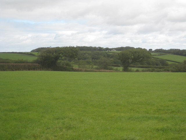
The surrounding natural landscape is a major draw for tourists, with stunning coastal paths offering breathtaking views of the rugged cliffs and pristine beaches. The sandy shores are perfect for sunbathing, picnicking, or exploring rock pools at low tide. Additionally, the nearby West Curry Downs provide ample opportunities for walking, hiking, and enjoying panoramic vistas of the surrounding countryside.

Though small, West Curry has a close-knit community that takes pride in preserving its local traditions and culture. The village hosts various festivals and events throughout the year, showcasing traditional music, dance, and food. There are also a handful of charming local shops, cafes, and restaurants, offering visitors a taste of authentic Cornish cuisine and locally sourced products.

In summary, West Curry is a peaceful and enchanting village in Cornwall, known for its natural beauty, welcoming community, and rich cultural heritage.

If you have any feedback on the listing, please let us know in the comments section below.
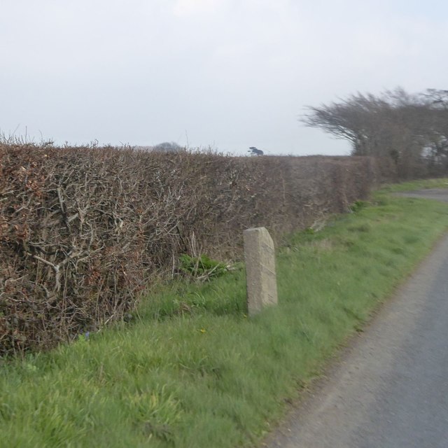
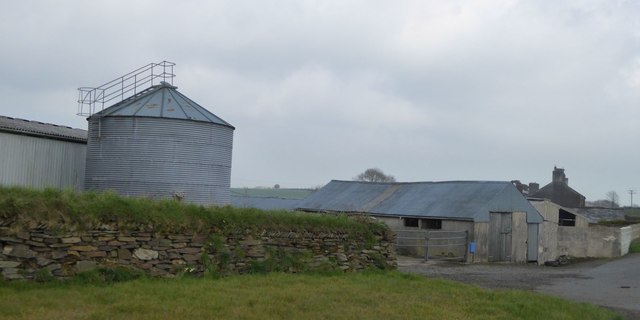
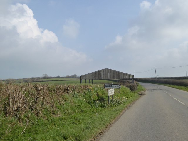
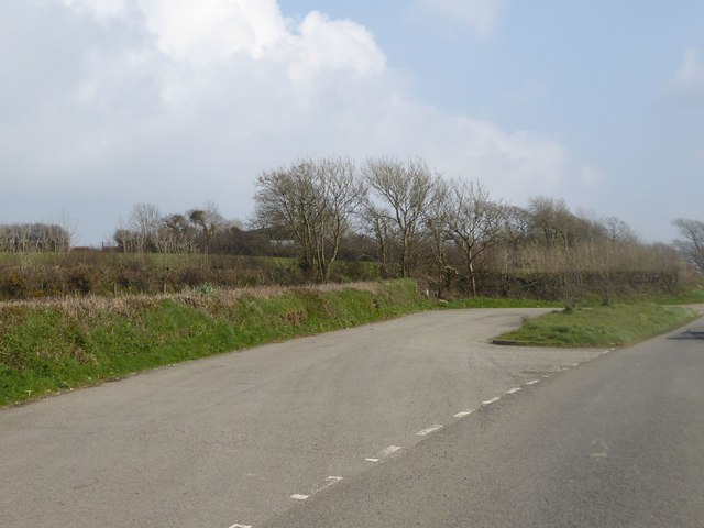
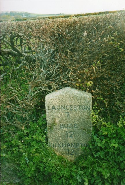
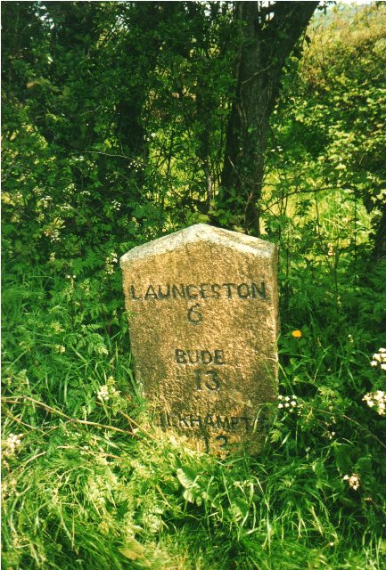
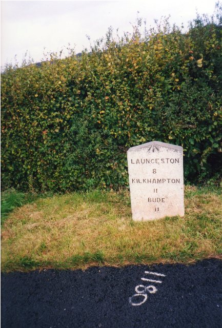
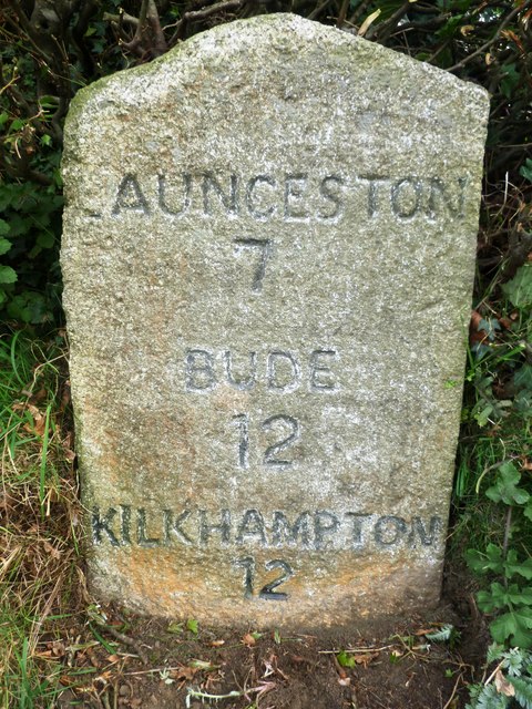
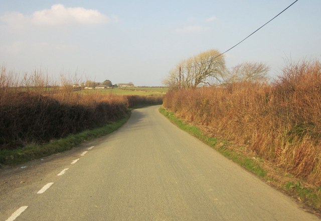
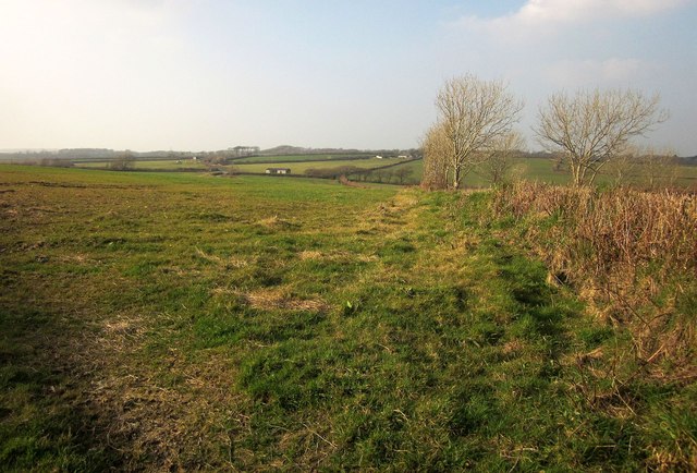
West Curry Images

Images are sourced within 2km of 50.717597/-4.434695 or Grid Reference SX2893. Thanks to Geograph Open Source API. All images are credited.

Field Edge view at Clubworthy Triangulation Pillar Looking westward towards communications mast.
Field Edge view at Clubworthy Triangulation Pillar
Looking westward towards communications mast.
Milestone north of Dolsdon Kilkhampton 11, Launceston 8
Milestone north of Dolsdon
Kilkhampton 11, Launceston 8
Farm buildings at Dolsdon
Open barn at junction for West Curry
Lay-by near Curry Lane This lay-by was created as a result of road realignment; formerly the road had two moderately sharp bends, now it has moderate bends
Lay-by near Curry Lane
This lay-by was created as a result of road realignment; formerly the road had two moderately sharp bends, now it has moderate bends
Old Milestone by the B3254 near West Curry Carved stone post by the B3254, in parish of BOYTON (NORTH CORNWALL District), Parkhurst, West Curry, against hedge on bend, on East side of road. Kilkhampton County stone, erected by the Local Highways Board in the 19th century. 

Inscription reads:-
LAUNCESTON
7
BUDE
12
KILKHAMPTON
12 

Milestone Society National ID: CW_KHLA12.
Old Milestone by the B3254 near West Curry
Carved stone post by the B3254, in parish of BOYTON (NORTH CORNWALL District), Parkhurst, West Curry, against hedge on bend, on East side of road. Kilkhampton County stone, erected by the Local Highways Board in the 19th century. Inscription reads:- LAUNCESTON 7 BUDE 12 KILKHAMPTON 12 Milestone Society National ID: CW_KHLA12.
Old Milestone by the B3254, north of Bennacott Carved stone post by the B3254, in parish of BOYTON (NORTH CORNWALL District), The Grange, 100m North West of Daracott cottage, in hedge on narrow section of road, on East side of road. Kilkhampton County stone, erected by the Local Highways Board in the 19th century. 

Inscription reads:-
LAUNCESTON
6
BUDE
13
KILKHAMPTON
13   

Grade II Listed. List Entry Number: 1142940
<span class="nowrap"><a title="https://historicengland.org.uk/listing/the-list/list-entry/1142940" rel="nofollow ugc noopener" href="https://historicengland.org.uk/listing/the-list/list-entry/1142940">Link</a><img style="margin-left:2px;" alt="External link" title="External link - shift click to open in new window" src="https://s1.geograph.org.uk/img/external.png" width="10" height="10"/></span>

Milestone Society National ID: CW_KHLA13.
Old Milestone by the B3254, north of Bennacott
Carved stone post by the B3254, in parish of BOYTON (NORTH CORNWALL District), The Grange, 100m North West of Daracott cottage, in hedge on narrow section of road, on East side of road. Kilkhampton County stone, erected by the Local Highways Board in the 19th century. Inscription reads:- LAUNCESTON 6 BUDE 13 KILKHAMPTON 13 Grade II Listed. List Entry Number: 1142940 LinkExternal link Milestone Society National ID: CW_KHLA13.
Old Milestone by the B3254, north of Dolsdon, North Tamerton Parish Carved stone post by the B3254, in parish of NORTH TAMERTON (NORTH CORNWALL District), South of Willsworthy Cross, on verge on straight road, on East side of road. Kilkhampton County stone, erected by the Local Highways Board in the 19th century. 

Inscription reads:- : LAUNCESTON / 8 / KILKHAMPTON / 11 / BUDE / 11 : 
Carved Benchmark on top of front face.

Milestone Society National ID: CW_KHLA11.
Old Milestone by the B3254, north of Dolsdon, North Tamerton Parish
Carved stone post by the B3254, in parish of NORTH TAMERTON (NORTH CORNWALL District), South of Willsworthy Cross, on verge on straight road, on East side of road. Kilkhampton County stone, erected by the Local Highways Board in the 19th century. Inscription reads:- : LAUNCESTON / 8 / KILKHAMPTON / 11 / BUDE / 11 : Carved Benchmark on top of front face. Milestone Society National ID: CW_KHLA11.
Old Milestone by the B3254, near West Curry Carved stone post by the B3254, in parish of BOYTON (NORTH CORNWALL District), Parkhurst, West Curry, against hedge on bend, on East side of road. Kilkhampton County stone, erected by the Local Highways Board in the 19th century. 

Inscription reads:-
LAUNCESTON
7
BUDE
12
KILKHAMPTON
12 

Cornwall & Scilly HER.
HER Number: 176713 <span class="nowrap"><a title="https://www.heritagegateway.org.uk/Gateway/Results_Single.aspx?uid=MCO52524&resourceID=1020" rel="nofollow ugc noopener" href="https://www.heritagegateway.org.uk/Gateway/Results_Single.aspx?uid=MCO52524&resourceID=1020">Link</a><img style="margin-left:2px;" alt="External link" title="External link - shift click to open in new window" src="https://s1.geograph.org.uk/img/external.png" width="10" height="10"/></span>

Milestone Society National ID: CW_KHLA12.
Old Milestone by the B3254, near West Curry
Carved stone post by the B3254, in parish of BOYTON (NORTH CORNWALL District), Parkhurst, West Curry, against hedge on bend, on East side of road. Kilkhampton County stone, erected by the Local Highways Board in the 19th century. Inscription reads:- LAUNCESTON 7 BUDE 12 KILKHAMPTON 12 Cornwall & Scilly HER. HER Number: 176713 LinkExternal link Milestone Society National ID: CW_KHLA12.
Old Milestone by the B3254, north of Bennacott Carved stone post by the B3254, in parish of BOYTON (NORTH CORNWALL District), The Grange, 100m Northwest of Daracott Cottage, in hedge on narrow section of road, on East side of road. Kilkhampton County stone, erected by the Local Highways Board in the 19th century. 

Inscription reads:-
LAUNCESTON
6
BUDE
13
KILKHAMPTON
13 

Grade II listed.
List Entry Number: 1142940 <span class="nowrap"><a title="https://historicengland.org.uk/listing/the-list/list-entry/1142940" rel="nofollow ugc noopener" href="https://historicengland.org.uk/listing/the-list/list-entry/1142940">Link</a><img style="margin-left:2px;" alt="External link" title="External link - shift click to open in new window" src="https://s1.geograph.org.uk/img/external.png" width="10" height="10"/></span>

Milestone Society National ID: CW_KHLA13.
Old Milestone by the B3254, north of Bennacott
Carved stone post by the B3254, in parish of BOYTON (NORTH CORNWALL District), The Grange, 100m Northwest of Daracott Cottage, in hedge on narrow section of road, on East side of road. Kilkhampton County stone, erected by the Local Highways Board in the 19th century. Inscription reads:- LAUNCESTON 6 BUDE 13 KILKHAMPTON 13 Grade II listed. List Entry Number: 1142940 LinkExternal link Milestone Society National ID: CW_KHLA13.
B3254 northbound
B3254 northbound
B3254 northbound
B3254 northbound
Field at Dolsdon Looking towards Dolsdon Plantation.
Field at Dolsdon
Looking towards Dolsdon Plantation.
Lane near Maxworthy Cross North of the junction, and approaching a T junction with a road north-west of Clubworthy. Ahead is Buttern Farm.
Lane near Maxworthy Cross
North of the junction, and approaching a T junction with a road north-west of Clubworthy. Ahead is Buttern Farm.
Field near Clubworthy On the other side of the lane from <a href="https://www.geograph.org.uk/photo/608429">SX2793 : Field near Clubworthy</a>.
Field near Clubworthy
On the other side of the lane from SX2793 : Field near Clubworthy.
Lane near Clubworthy Taken from the same junction as <a href="https://www.geograph.org.uk/photo/608814">SX2792 : Lane junction near Clubworthy</a>, looking in the opposite direction, with the lane curving a little towards the hamlet.
Lane near Clubworthy
Taken from the same junction as SX2792 : Lane junction near Clubworthy, looking in the opposite direction, with the lane curving a little towards the hamlet.
Field near Nescott From the lane which shaves across the south-west corner of the square, with one of the wind turbines that are now a feature of this part of Cornwall.
Field near Nescott
From the lane which shaves across the south-west corner of the square, with one of the wind turbines that are now a feature of this part of Cornwall.
Farm lane to Youngcott From the junction with the Langdon - Clubworthy lane. The farm lane is followed by footpath 529 2/1. On the right is a wind turbine across the Bolesbridge Water valley.
Farm lane to Youngcott
From the junction with the Langdon - Clubworthy lane. The farm lane is followed by footpath 529 2/1. On the right is a wind turbine across the Bolesbridge Water valley.
Show me another place!

West Curry is located at Grid Ref: SX2893 (Lat: 50.717597, Lng: -4.434695)

Unitary Authority: Cornwall

Police Authority: Devon and Cornwall

What 3 Words

///indicated.tickles.gent. Near Boyton, Cornwall

Related Wikis

West Curry

West Curry (Cornish: Kori Veur) is a farm north of Bennacott in north Cornwall, England, UK.It appears in the Domesday Book (1086) as Chori, where in 1086...

Curry Lane

Curry Lane is a hamlet in the parish of Boyton Cornwall, England. == References ==

Clubworthy

Clubworthy is a hamlet in east Cornwall, England, United Kingdom. It is located six miles (8.5 km) north-northwest of Launceston . == References ==

Bennacott

Bennacott is a village in east Cornwall, England, in the United Kingdom. It is five miles (8 km) north of Launceston and in the parish of Boyton. ��2...

Nearby Amenities

Located within 500m of 50.717597,-4.434695
The data included in this document is from www.openstreetmap.org. The data is made available under ODbL.

Have you been to West Curry?

Leave your review of West Curry below (or comments, questions and feedback).