West Burton

Settlement in Yorkshire Richmondshire

England

West Burton

Benchmark on SW face of Eastburn Farmhouse Ordnance Survey cut mark benchmark levelled at 195.288m above Newlyn Datum verified 1954
Benchmark on SW face of Eastburn Farmhouse Credit: Roger Templeman

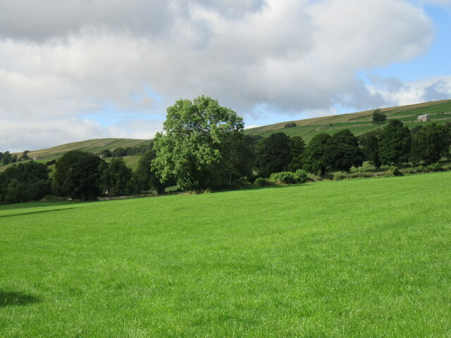
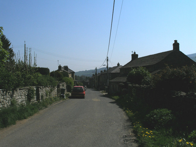
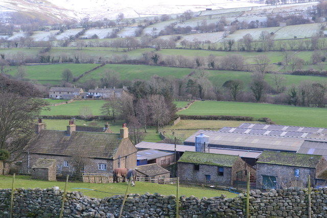
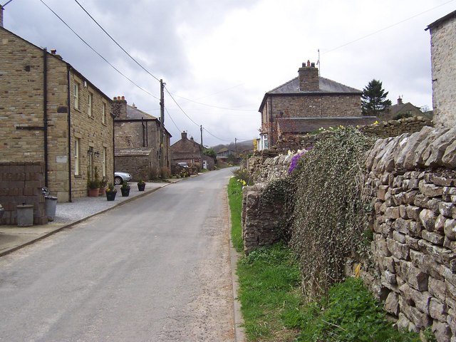
West Burton is a small village located in the Yorkshire Dales National Park, in the county of North Yorkshire, England. Situated in the upper reaches of the River Ure valley, it is nestled amongst picturesque rolling hills, offering stunning views of the surrounding countryside. The village is part of the Richmondshire district and lies approximately 7 miles west of Leyburn.

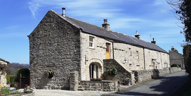
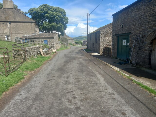
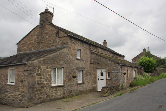
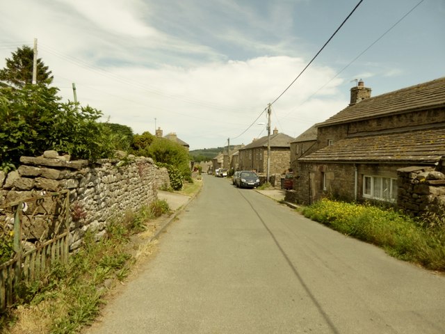
West Burton is known for its idyllic charm and traditional character. It features a collection of well-preserved stone-built houses and cottages, many of which date back to the 18th and 19th centuries. The village is centered around a large village green, which is surrounded by these historic buildings, creating a truly quintessential English scene.

One of the main attractions in West Burton is the magnificent Cauldron Falls. This waterfall, located on Walden Beck, is a popular spot for visitors, who come to admire its natural beauty and enjoy the tranquil atmosphere. The village is also home to a small, but well-regarded, pub and a charming tea room, both of which offer a warm welcome to locals and tourists alike.

The surrounding area provides ample opportunities for outdoor activities, such as hiking, cycling, and birdwatching. The nearby Aysgarth Falls, a series of impressive cascades on the River Ure, is a must-visit for nature enthusiasts. West Burton is also within easy reach of the market towns of Leyburn and Hawes, where visitors can explore local shops, museums, and historical landmarks.

Overall, West Burton offers a peaceful retreat in the heart of the Yorkshire Dales, with its stunning landscapes, historic architecture, and natural wonders making it a popular destination for those seeking a taste of rural Yorkshire.

If you have any feedback on the listing, please let us know in the comments section below.
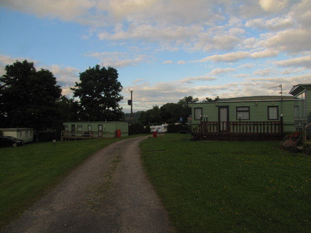
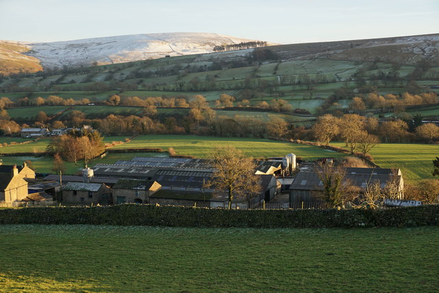
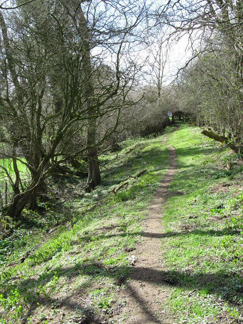
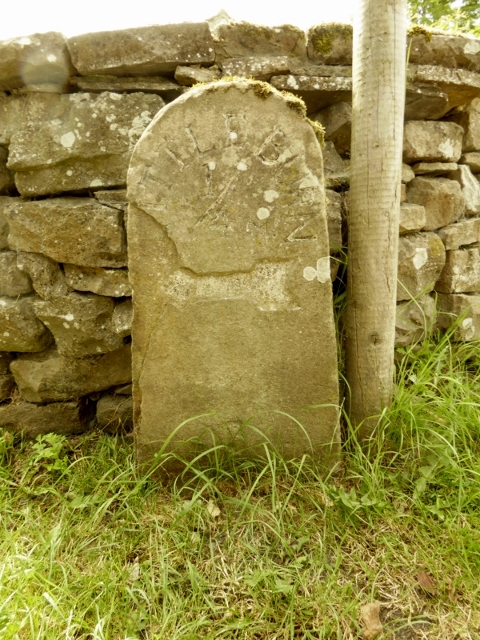
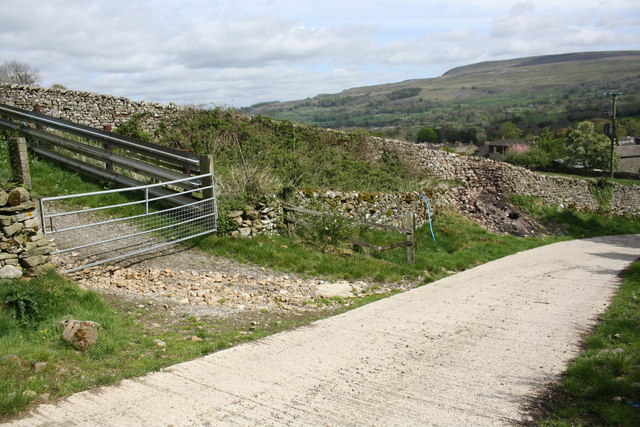
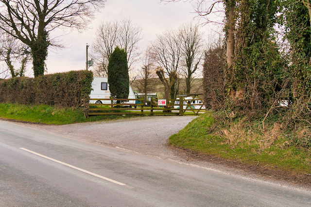
West Burton Images

Images are sourced within 2km of 54.276105/-1.9752255 or Grid Reference SE0186. Thanks to Geograph Open Source API. All images are credited.

Benchmark on SW face of Eastburn Farmhouse Ordnance Survey cut mark benchmark levelled at 195.288m above Newlyn Datum verified 1954
Benchmark on SW face of Eastburn Farmhouse
Ordnance Survey cut mark benchmark levelled at 195.288m above Newlyn Datum verified 1954
Eastburn Farmhouse and Eastburn Cottage There is an Ordnance Survey benchmark <a href="https://www.geograph.org.uk/photo/7152876">SD9985 : Benchmark on SW face of Eastburn Farmhouse</a> on the near corner of the building beside the stone gatepost
Eastburn Farmhouse and Eastburn Cottage
There is an Ordnance Survey benchmark SD9985 : Benchmark on SW face of Eastburn Farmhouse on the near corner of the building beside the stone gatepost
Bishopdale near Thoralby Looking NW.
Bishopdale near Thoralby
Looking NW.
Westfield, Lane, Thoralby Looking north-eastward from Town Head Farm.
Westfield, Lane, Thoralby
Looking north-eastward from Town Head Farm.
Western end of Thoralby
Benchmark on 'Peggy Garth', Westfield Lane Ordnance Survey cut mark benchmark described on the Bench Mark Database at <span class="nowrap"><a title="http://www.bench-marks.org.uk/bm43326" rel="nofollow ugc noopener" href="http://www.bench-marks.org.uk/bm43326">Link</a><img style="margin-left:2px;" alt="External link" title="External link - shift click to open in new window" src="https://s1.geograph.org.uk/img/external.png" width="10" height="10"/></span>
Benchmark on 'Peggy Garth', Westfield Lane
Ordnance Survey cut mark benchmark described on the Bench Mark Database at LinkExternal link
'Peggy Garth' on Westfield Lane There is an OS benchmark <a href="https://www.geograph.org.uk/photo/3072279">SD9986 : Benchmark on 'Peggy Garth', Westfield Lane</a> on the window surround (formerly a doorway) on the road face of the house.
'Peggy Garth' on Westfield Lane
There is an OS benchmark SD9986 : Benchmark on 'Peggy Garth', Westfield Lane on the window surround (formerly a doorway) on the road face of the house.
Mile Stone, Thoralby This can be found at the junction of the roads to Old Hall and Littleburn.
Mile Stone, Thoralby
This can be found at the junction of the roads to Old Hall and Littleburn.
Street Head Caravan Site
Town Head Farm A farm in Bishopdale on the edge of Thoralby.
Town Head Farm
A farm in Bishopdale on the edge of Thoralby.
Dale bottom path Thoralby The path follows the line of the former mill race, now no more than a dried up and vegetation filled groove to the left of the path.
Dale bottom path Thoralby
The path follows the line of the former mill race, now no more than a dried up and vegetation filled groove to the left of the path.
The main street in Thoralby
View above farm at Thoralby
Old Milestone by Humphrey Hill, Thoralby, Aysgarth parish Stone post by the UC road, in parish of Aysgarth (Richmondshire District), Thoralby, Humphrey Hill, junction of lanes to Old Hall Farm and Littledean.

Inscription reads:-
LITTLEDEAN
½
{<-arrow}  

Surveyed

Milestone Society National ID: YN_XAYSb
Old Milestone by Humphrey Hill, Thoralby, Aysgarth parish
Stone post by the UC road, in parish of Aysgarth (Richmondshire District), Thoralby, Humphrey Hill, junction of lanes to Old Hall Farm and Littledean. Inscription reads:- LITTLEDEAN ½ {<-arrow} Surveyed Milestone Society National ID: YN_XAYSb
Gateway off farm road NW of Town Head Farm Ordnance Survey documents indicate that in 1954 a benchmark levelled at 189.772m above Newlyn Datum was verified in 1954 on a stone at the base of the wall near the blue pipe. It was not found.
Gateway off farm road NW of Town Head Farm
Ordnance Survey documents indicate that in 1954 a benchmark levelled at 189.772m above Newlyn Datum was verified in 1954 on a stone at the base of the wall near the blue pipe. It was not found.
Entrance to Street Head Caravan Park, Bishopdale
Old milestone In Thoralby on Humphrey Hill.  The broad, deeply indented arrow points to LITTLEBURN/ ¼.  Unfortunately the L and part of the arrow have flaked away.
Old milestone
In Thoralby on Humphrey Hill. The broad, deeply indented arrow points to LITTLEBURN/ ¼. Unfortunately the L and part of the arrow have flaked away.
Thoralby (West) The western end of the village stretches down the lane towards Town Head.
Thoralby (West)
The western end of the village stretches down the lane towards Town Head.
Show me another place!

West Burton is located at Grid Ref: SE0186 (Lat: 54.276105, Lng: -1.9752255)

Division: North Riding

Administrative County: North Yorkshire

District: Richmondshire

Police Authority: North Yorkshire

What 3 Words

///over.bikers.strapping. Near Leyburn, North Yorkshire

Related Wikis

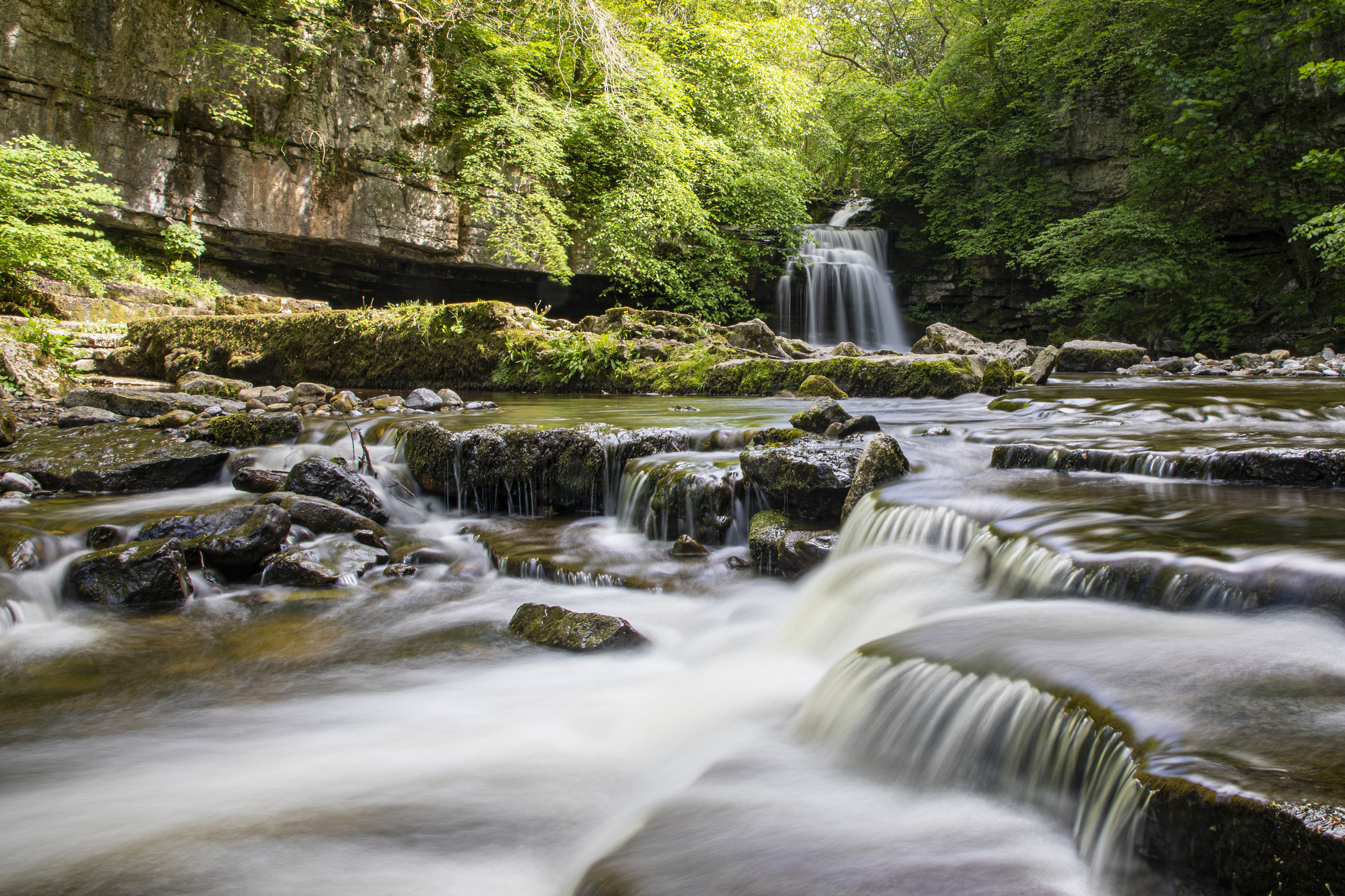
Cauldron Falls (North Yorkshire)

Cauldron Falls (also known as West Burton falls), is a series of waterfalls on Walden Beck in the village of West Burton, North Yorkshire, England. It...

West Burton, North Yorkshire

West Burton is a village in Bishopdale, a side valley of Wensleydale, in the Yorkshire Dales, North Yorkshire, England. It lies 6.2 miles (10 km) south...

Thoralby

Thoralby is a village and civil parish in the Richmondshire district of North Yorkshire, England. It lies south of Aysgarth, is within a mile of both Newbiggin...

St Andrew's Church, Aysgarth

St Andrew's Church, Aysgarth, is a Grade II* listed parish church in the Church of England: 66  in Aysgarth, North Yorkshire. It is located on the south...

Nearby Amenities

Located within 500m of 54.276105,-1.9752255
West Burton
Is In Country Code: GB
Is In County: North Yorkshire
Is In Historic County: Yorkshire
Is In Municipality: Richmondshire
Place: village
Source: NPE
Wikidata: Q7984619
Lat/Long: 54.2762387/-1.9736583
Ford: yes
Lat/Long: 54.2720405/-1.9732349
Barrier: stile
Lat/Long: 54.2750638/-1.9693658
Barrier: stile
Lat/Long: 54.2735477/-1.9701521
Barrier: stile
Lat/Long: 54.2729482/-1.9702963
Leisure: playground
Lat/Long: 54.275389/-1.9752459
Historic: memorial
Lat/Long: 54.2754344/-1.9751117
Cauldron Falls
Waterway: waterfall
Wikidata: Q113134252
Lat/Long: 54.2755797/-1.9711543
Barrier: stile
Lat/Long: 54.2768654/-1.9677597
Barrier: stile
Lat/Long: 54.2767037/-1.9706903
Barrier: stile
Lat/Long: 54.2774671/-1.9757656
Post Box
Post Box Type: lamp
Lat/Long: 54.275909/-1.975372
Cafe
Tea Room
Cuisine: coffee_shop
Lat/Long: 54.2759372/-1.9754041
Ashington Farm
Place: farm
Lat/Long: 54.2779359/-1.9786852
Telephone
Booth: KX100
Covered: booth
Source: survey
Lat/Long: 54.2748959/-1.9755293
Tourism: information
Lat/Long: 54.2762974/-1.9724972
Barrier: kissing_gate
Lat/Long: 54.2765131/-1.972107
Power: pole
Lat/Long: 54.2791214/-1.978965
Power: pole
Lat/Long: 54.2783772/-1.9782775
Power: pole
Lat/Long: 54.277627/-1.9775824
Power: pole
Lat/Long: 54.277/-1.977556
Power: pole
Lat/Long: 54.2762953/-1.9770617
Power: pole
Lat/Long: 54.2755041/-1.9764896
Power: pole
Lat/Long: 54.2788328/-1.9793339
Power: pole
Lat/Long: 54.2781134/-1.9801971
Power: pole
Lat/Long: 54.2778292/-1.981512
Power: pole
Lat/Long: 54.2738748/-1.9753353
Power: pole
Lat/Long: 54.273655/-1.9745449
Power: pole
Lat/Long: 54.2727729/-1.9744119
Power: pole
Lat/Long: 54.2722819/-1.9743509
Power: pole
Lat/Long: 54.2723127/-1.9740157
Power: pole
Lat/Long: 54.2724692/-1.9723114
Power: pole
Lat/Long: 54.2725669/-1.9712474
The data included in this document is from www.openstreetmap.org. The data is made available under ODbL.

Have you been to West Burton?

Leave your review of West Burton below (or comments, questions and feedback).