Bradford-on-Tone

Settlement in Somerset Somerset West and Taunton

England

Bradford-on-Tone

Hillfarance church
Hillfarance church Credit: Martin Southwood

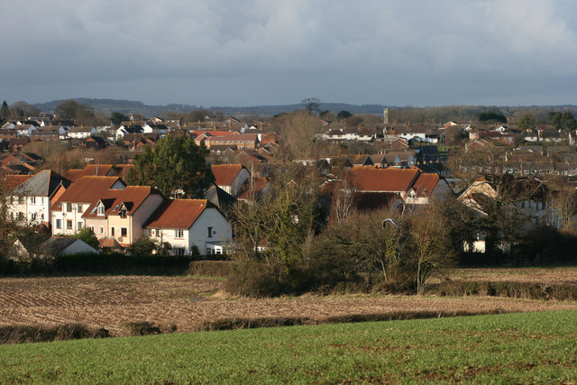
Bradford-on-Tone is a small village located in the county of Somerset, in southwest England. Situated about four miles southwest of Taunton, the village lies on the banks of the River Tone, which flows through the heart of the village. The name "Bradford" is derived from the Old English words "brad" meaning broad, and "ford" meaning a river crossing, referring to the village's position near a wide crossing point of the river.

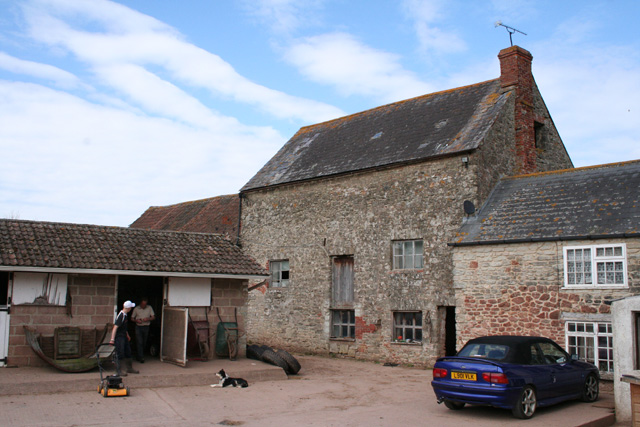
The village is characterized by its picturesque rural setting with rolling hills, open fields, and charming countryside views. The surrounding area is predominantly agricultural, with a mix of farmland and small pockets of woodland. The village itself is made up of a collection of stone-built cottages and houses, some of which date back several centuries, giving it a quaint and historic feel.

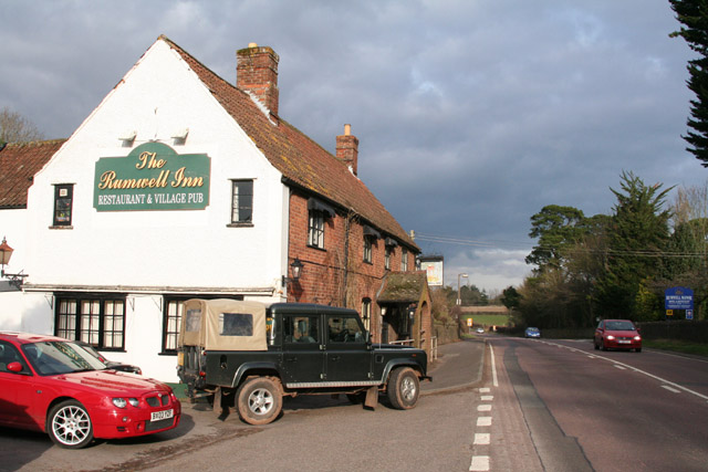
Despite its small size, Bradford-on-Tone has a strong sense of community, with various social events and activities organized throughout the year. The village is home to a local pub, which serves as a hub for residents and visitors alike. Nearby, the River Tone offers opportunities for leisurely walks, picnics, and fishing.

For amenities, residents have easy access to the nearby town of Taunton, which provides a wider range of services such as supermarkets, shops, schools, and healthcare facilities. The village is well-connected by road, with the A38 passing close by, providing convenient links to surrounding towns and cities.

Overall, Bradford-on-Tone offers a peaceful and idyllic countryside living experience, while still providing easy access to the amenities and services of nearby urban areas.

If you have any feedback on the listing, please let us know in the comments section below.

Bradford-on-Tone Images

Images are sourced within 2km of 50.999209/-3.178928 or Grid Reference ST1722. Thanks to Geograph Open Source API. All images are credited.

Hillfarance church
Hillfarance church
Bradford-on-Tone, St. Giles church
Bradford-on-Tone: Sheppy’s Cider A cider production facility, museum of farm bygones and a shop at Three Bridges Farm. Established as a family business in 1917. See [/ <span class="nowrap"><a title="http://www.sheppyscider.com" rel="nofollow ugc noopener" href="http://www.sheppyscider.com">Link</a><img style="margin-left:2px;" alt="External link" title="External link - shift click to open in new window" src="https://s1.geograph.org.uk/img/external.png" width="10" height="10"/></span>]
Bradford-on-Tone: Sheppy’s Cider
A cider production facility, museum of farm bygones and a shop at Three Bridges Farm. Established as a family business in 1917. See [/ LinkExternal link]
Rumwell, near Taunton: The Rumwell Inn On the A38 Trunk Road, between Taunton and Wellington. Looking north east
Rumwell, near Taunton: The Rumwell Inn
On the A38 Trunk Road, between Taunton and Wellington. Looking north east
Oake: ditching near Knapp Farm Clearing ditches on the side of the lane between Allerford and Hillfarrance
Oake: ditching near Knapp Farm
Clearing ditches on the side of the lane between Allerford and Hillfarrance
Oake: ditching near Knapp Farm On the lane between Allerford and Hillfarrance
Oake: ditching near Knapp Farm
On the lane between Allerford and Hillfarrance
Bradford-on-Tone: Rumwell Farm Shop By the A38 between Taunton and Wellington. Looking north-north-west
Bradford-on-Tone: Rumwell Farm Shop
By the A38 between Taunton and Wellington. Looking north-north-west
West Buckland: footpath to Herswell Farm Near Middle Stoford, looking north east, with two stiles and decking over a stream between them
West Buckland: footpath to Herswell Farm
Near Middle Stoford, looking north east, with two stiles and decking over a stream between them
West Buckland: orchard Looking north, near Stoford Manor
West Buckland: orchard
Looking north, near Stoford Manor
Bradford-on-Tone: A38 Trunk Road at Roundhill Looking east-north-east towards Taunton on the old main road which was the main artery between the Midlands and the South West until replaced by the M5 Motorway in the 1970s
Bradford-on-Tone: A38 Trunk Road at Roundhill
Looking east-north-east towards Taunton on the old main road which was the main artery between the Midlands and the South West until replaced by the M5 Motorway in the 1970s
Bradford-on-Tone: Bradford Mills Now incorporated into the Mill House Equestrian Centre, the watermill has been largely gutted of machinery according to the owner. It was once powered by a leat from the river Tone: the weir still exists. The mill is now surrounded by paddocks and stables and is on private property, photographed with permission
Bradford-on-Tone: Bradford Mills
Now incorporated into the Mill House Equestrian Centre, the watermill has been largely gutted of machinery according to the owner. It was once powered by a leat from the river Tone: the weir still exists. The mill is now surrounded by paddocks and stables and is on private property, photographed with permission
Bradford-on-Tone: Grand Western Canal at Trefusis The remains of the old canal by Trefusis Farm. One of the canal’s seven lifts was located near here. Looking roughly south west
Bradford-on-Tone: Grand Western Canal at Trefusis
The remains of the old canal by Trefusis Farm. One of the canal’s seven lifts was located near here. Looking roughly south west
Bradford-on-Tone: Bradford Crossing Looking east-south-east towards Trefusis Farm. The railway from Taunton to Exeter railway crosses a minor road from East Nynehead to Bradford-on-Tone here
Bradford-on-Tone: Bradford Crossing
Looking east-south-east towards Trefusis Farm. The railway from Taunton to Exeter railway crosses a minor road from East Nynehead to Bradford-on-Tone here
Nynehead: footpath to Bradford-on-Tone Track at East Nynehead, looking south-south-east with the Blackdown Hills in the distance
Nynehead: footpath to Bradford-on-Tone
Track at East Nynehead, looking south-south-east with the Blackdown Hills in the distance
Railway Foot Crossing
Glass House Greenfield Nurseries near Wellington
Glass House
Greenfield Nurseries near Wellington
Bradford-on-Tone: St Giles church Before the reformation the church was dedicated to St Mary. It dates from the 13th century. Looking north east
Bradford-on-Tone: St Giles church
Before the reformation the church was dedicated to St Mary. It dates from the 13th century. Looking north east
White Steading The field path from Ritherden's Farm approaches Hele Hill. White Steading is one of a small scatter of houses on this eminence above the Tone.
White Steading
The field path from Ritherden's Farm approaches Hele Hill. White Steading is one of a small scatter of houses on this eminence above the Tone.
Show me another place!

Bradford-on-Tone is located at Grid Ref: ST1722 (Lat: 50.999209, Lng: -3.178928)

Administrative County: Somerset

District: Somerset West and Taunton

Police Authority: Avon and Somerset

What 3 Words

///ocean.reissued.desks. Near Taunton, Somerset

Nearby Locations

Bradford-on-Tone

Related Wikis

Bradford-on-Tone

Bradford-on-Tone is a village and civil parish in Wellington, Somerset, England, situated on the River Tone 4 miles (6.4 km) south west of Taunton. The...
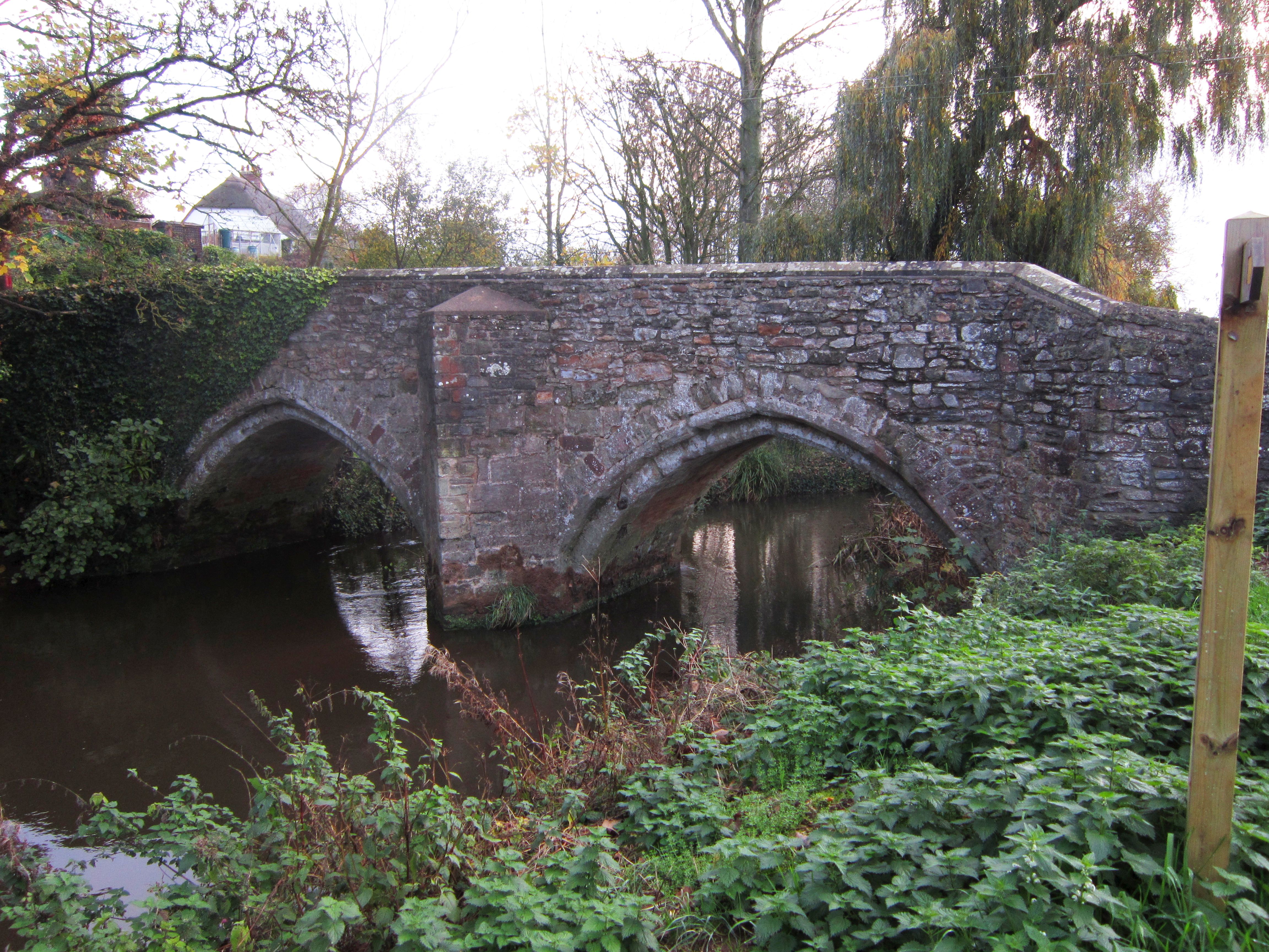
Bradford Bridge

Bradford Bridge in Bradford on Tone in the English county of Somerset carries a road over the River Tone. It was built at some point between the 13th and...

Taunton Deane (UK Parliament constituency)

Taunton Deane is a constituency in Somerset represented in the House of Commons of the UK Parliament by Rebecca Pow of the Conservative Party since 2015...

Lang's Farm

Lang's Farm (grid reference ST170241) is a 7.5 hectare (18.5 acre) biological Site of Special Scientific Interest between Oake and Bradford on Tone in...

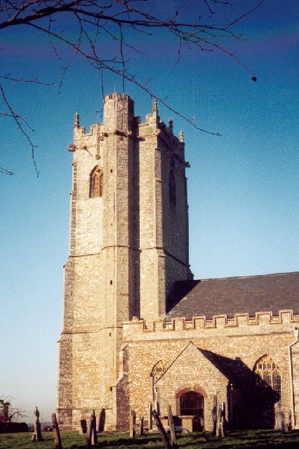
Church of the Holy Cross, Hillfarrance

The Church of the Holy Cross in Hillfarrance, Oake, Somerset, England was built in the 14th century. It is a Grade II* listed building. == History == The...

West Buckland

West Buckland is a village and civil parish in Somerset, England, situated 5 miles (8.0 km) south west of Taunton. The parish has a population of 1,189...

Church of St Bartholomew, Oake

The Church of St Bartholomew in Oake, Somerset, England was built in the 13th century. It is a Grade II* listed building. == History == The first part...

Comeytrowe

Comeytrowe is a south western suburb of Taunton and former civil parish, now in the parish of Taunton in the county of Somerset, England. In 2011 the parish...

Related Videos

EXPLORING SHEPPY’S CIDER FARM, SOMERSET

On our way to Cornwall we stopped to visit Sheppy's cider farm as we had heard good things about the 'House of Cider' farm shop ...

Bradford on Tone village and river walk | Somerset

Join me in the pretty village of Bradford on Tone in Somerset. I will show you around the village and church and then walk along ...

Sheppys Cider farm Somerset

Trip to Sheppys Cider farm near Taunton, Somerset.

Sheppy's Cider Farm Somerset Motorhome trip, we take a look at the famous apple orchards.

We have a look at this beautiful Somerset Cider Farm Shop, bar, orchards cider production and old school duck pond in the heart ...

Nearby Amenities

Located within 500m of 50.999209,-3.178928
Tone Green
Is In: Somerset, England, UK
Place: hamlet
Lat/Long: 51.0008786/-3.1837664
Bradford on Tone
Place: village
Wikidata: Q1811272
Wikipedia: en:Bradford-on-Tone
Lat/Long: 50.9996394/-3.1803167
Give Way
Lat/Long: 50.9972386/-3.1804894
Give Way
Lat/Long: 50.9997436/-3.1787734
Historic: memorial
Memorial: war_memorial
Lat/Long: 50.9997382/-3.1803833
Give Way
Lat/Long: 50.9996073/-3.1802995
Give Way
Lat/Long: 50.9998603/-3.1744365
Entrance: yes
Lat/Long: 51.0001378/-3.1799257
Power: pole
Lat/Long: 50.9989832/-3.1857204
Power: pole
Lat/Long: 50.9998025/-3.1847274
Power: pole
Lat/Long: 51.0007502/-3.1836052
Give Way
Lat/Long: 51.0009096/-3.1838069
Power: pole
Lat/Long: 51.001342/-3.1827092
Power: pole
Lat/Long: 51.0017705/-3.1820638
Power: pole
Lat/Long: 51.0023832/-3.1810991
Power: pole
Lat/Long: 51.0034321/-3.1800048
Post Box
Operator: Royal Mail
Operator Wikidata: Q638098
Post Box Type: lamp
Ref: TA4 283
Royal Cypher: EIIR
Royal Cypher Wikidata: Q33102113
Lat/Long: 50.9997318/-3.1801953
The data included in this document is from www.openstreetmap.org. The data is made available under ODbL.

Have you been to Bradford-on-Tone?

Leave your review of Bradford-on-Tone below (or comments, questions and feedback).